gi2014 ppt vohnout+team_erra prd east
TRANSCRIPT

Premysl VOHNOUT, Stepan KAFKA, Michal SREDL, Jan Bojko, Michal Kepka, CHARVAT, Tomas MILDORF, – CCSS
Radovan HILBERT – EPTISA
ERRA PRD EAST – Electronic Regional Risk Atlas Solution for Environmental Risk Management
in Eastern Partnership (including Armenia, Azerbaijan, Belarus, Georgia, Moldova and Ukraine)

Electronic Regional Risk Atlas (ERRA)
Atlas of Regional Risks
Capable geoportal solution for Civil Protection and Disaster Management
Key output from the PPRD East project
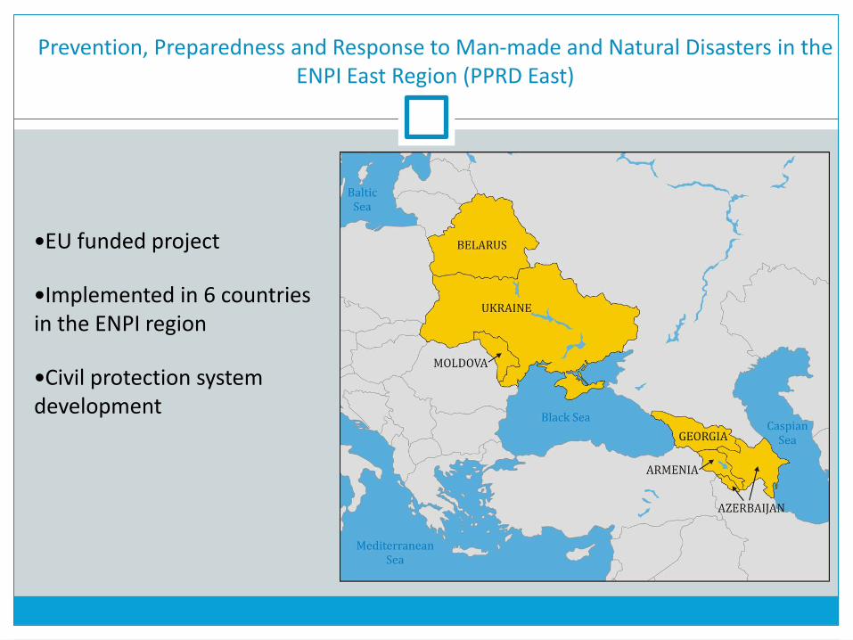
Prevention, Preparedness and Response to Man-made and Natural Disasters in the ENPI East Region (PPRD East)
EU funded project
Implemented in 6 countries in the ENPI region
Civil protection system development

PPRD East Objectives
To contribute to the development of the Partner Countries‘ civil protection capacities for disaster mitigation, preparedness and response;
To bring the Partner Countries progressively closer to the EU Civil Protection Mechanism and improve cooperation between them.

Electronic Regional Risk Atlas (ERRA)
Provides tools to search, view, analyse and download data related to civil protection
and disaster management The geoportal that serves as a skeleton of the whole system, where analytical tools can
be added
Multilingual solution
Multi-user, multi-organisation, cross-boundries solution with adequate security
requirements
Based on Open Source and Open Standards

Electronic Regional Risk Atlas (ERRA)
Access Control Requirements
Within one organisation:
Several users from several groups Access Control based on the group membership
User can be a member of several groups
Between various organisations:
Share the data/services that the organisation is willing to share
Secure the data/services that should be private

Electronic Regional Risk Atlas (ERRA)
General Architecture of ERRA

Electronic Regional Risk Atlas (ERRA)
Inside ERRA Node
Electronic Regional Risk Atlas (ERRA)
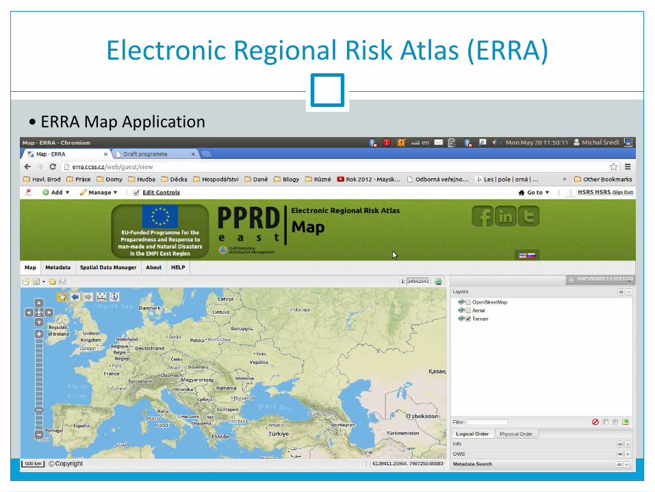
ERRA Map Application

ERRA - Metadata Catalogue Client
Search in Metadata of Data, Services, Compositions and Documents

ERRA - Metadata Catalogue Client
Serach results – Add to Map
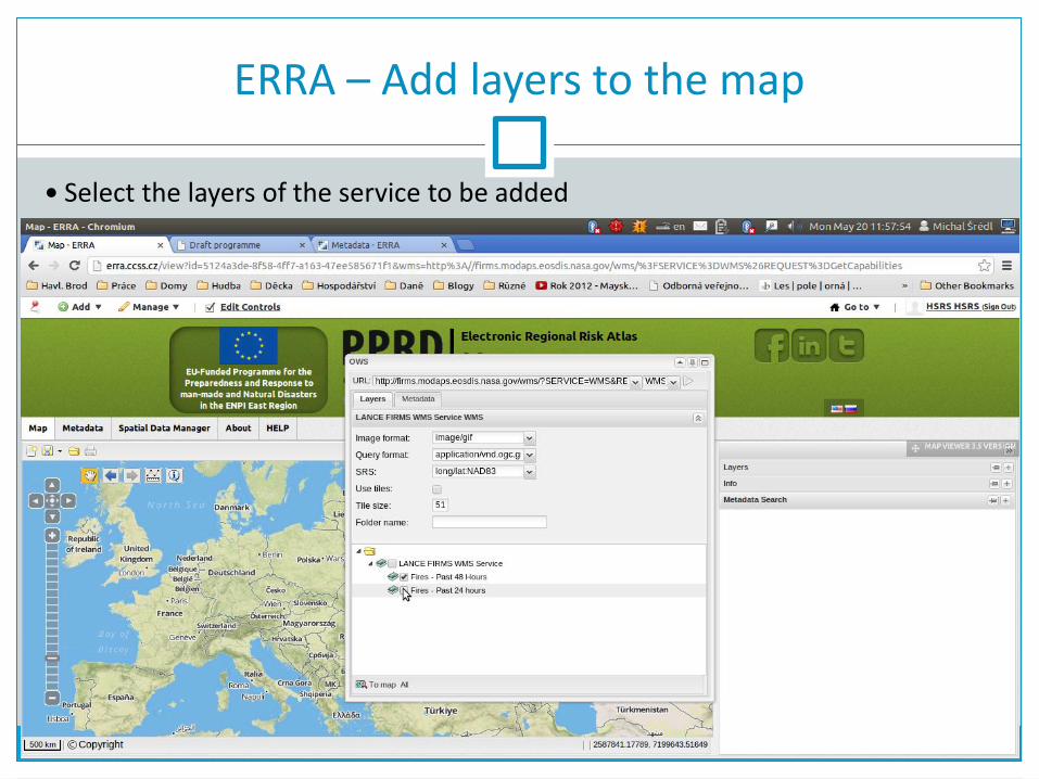
ERRA – Add layers to the map
Select the layers of the service to be added
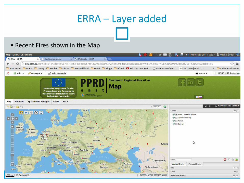
ERRA – Layer added
Recent Fires shown in the Map

ERRA – Add service from URL
Services of various types can be added from known URL

ERRA - Map Compositions
The whole state of the map (layers, opacity, pan, zoom...) we call the Composition
It can be: saved on the server downloaded on localhost
used to share the map for * viewing
* editing
searched for in the Metadata Catalogue

ERRA - Map Compositions
WMC – Web Map Context (OGC Standard)
WMS
WFS
Composition
(Just a JSON)
WMS
WFS
WCS
KML
GeoRSS
GML
GeoJSON
SOS
User-drawn objects directly included
Compositons and WMC
* Compositions can be exported to WMC (losely)

ERRA - Map Compositions
Save the Map Composition (set rights, select layers...)

ERRA - Map Compositions
Save the Map Composition - configure metadata

ERRA - Map Compositions
Save the Map Composition - Summary

ERRA - Map Compositions
Save the Map Composition - Summary

ERRA - Map Compositions
Composition saved

Electronic Regional Risk Atlas (ERRA)
Inside ERRA Node
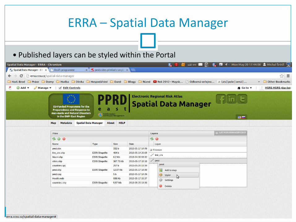
ERRA – Spatial Data Manager
Published layers can be styled within the Portal

ERRA – Query Map layers
Layers can be queried for detail info (e.g. the feature type details)

ERRA – Map layers actions
Various layer actions are available

ERRA – Map permalink
Map permalink saves the composition to the server and provides the link

ERRA – Embedding the Map
Map can be embedded into any HTML page

ERRA – Embedding the Map
Map can be embedded into any HTML page

ERRA – Mobile application
A mobile application is considered for data gathering:
