gis-alas: locating and analyzing crash locations within a gis environment national highway traffic...
TRANSCRIPT

GIS-ALAS: Locating and Analyzing Crash Locations
within a GIS Environment
National Highway Traffic Safety Administration
1999 Region Seven Data Conference
June 8-10, 1999
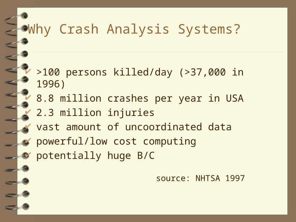
Why Crash Analysis Systems?
>100 persons killed/day (>37,000 in 1996) 8.8 million crashes per year in USA 2.3 million injuries vast amount of uncoordinated data powerful/low cost computing potentially huge B/C
source: NHTSA 1997
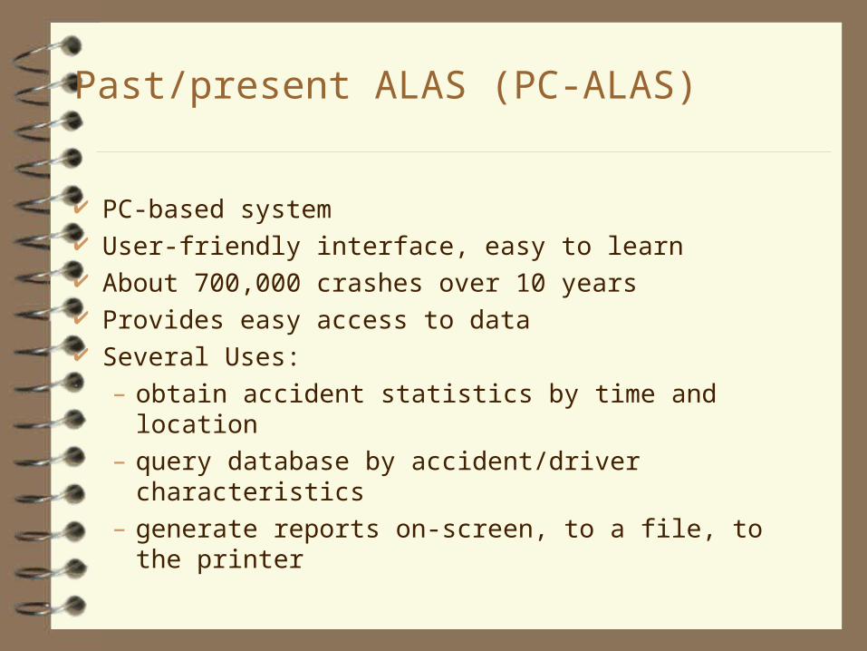
Past/present ALAS (PC-ALAS)
PC-based system User-friendly interface, easy to learn About 700,000 crashes over 10 years Provides easy access to data Several Uses:
– obtain accident statistics by time and location
– query database by accident/driver characteristics
– generate reports on-screen, to a file, to the printer
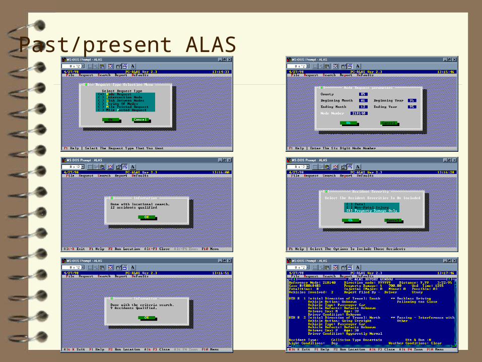
Past/present ALAS

CAD Node Maps

Current Difficulties
Node numbers must be identified from tables or paper maps
Difficult to analyze patterns Does not readily support integration of additional data Hard to identify crash “hot spots” and to analyze causes
and countermeasures

GIS-ALAS Project Goals
Develop geographic/map-based ALAS Use power of GIS Portable, accessible, windows based Free users from node maps Statewide coverage Supports highway safety analysis Facilitate integration with other data

Crash Locations
text
Text- node ID, x, y
MapBasic interpolation
program
MapInfo Crash Locations
CAD node file
MGE(unit conversion)
Text- node ID, lat, long
MapInfo Node Locations
Paper crash records
DB2- ID- from node- to node- distance- crash information
MIF
ArcView Crash Locations
x’
y’

Roadway and Crash Coverages

DB2- ID- location information- A (crash) records- B (driver 1) record- B (driver 2) record- …- C (1st 3 injuries) record- C (2nd 3 injuries) record- ...
Crash Information
Paper crash records
MapBasic defines 3 tables A, B and C
MapInfo
text
MIF
ArcView Crash Information (for ArcView-ALAS)
text
fortran
ABBBC
ArcView Crash Information (for Explorer-ALAS)

Background Data
IDMS Base Records (DOT)- ADT- pavement type- lane width- ...
CAD Roads (DOT)- State- County- Local
Text file- vertices- information
MapInfo/MapBasic aggregate to county level
MIF ArcView
CAD Hydrology (DOT)
DXFRail (BTS)
BTS preprocessor

Block Groups, Crashes, and Business Coverages

Alcohol-Related Crashes and Tavern Locations

Benefits of Customization
technology transfer - similar interface to PC-ALAS users don't need to know (much) GIS users don't need to be database experts
– variable names and labels (e.g., 3 = icy surface conditions) increased flexibility in interface (e.g., choosing crashes by selection
box, link/node (as in PC-ALAS), or city/county/region) enhanced display, e.g., standardized colors, defined zooms, "stacking"
of crash points standardized reports, e.g., for enforcement, engineering easier to do queries across counties, regions, years, tables works with relational data structure of crash files

Relational Data Structure of Crash Files

Avenue Scripts

Additionally...
Point location specifications– by node
– by crash location
– by link
Utilize GIS environment– logical queries
– spatial queries
– thematic maps
– buffering
– additional data sources
– more...

Logical Query
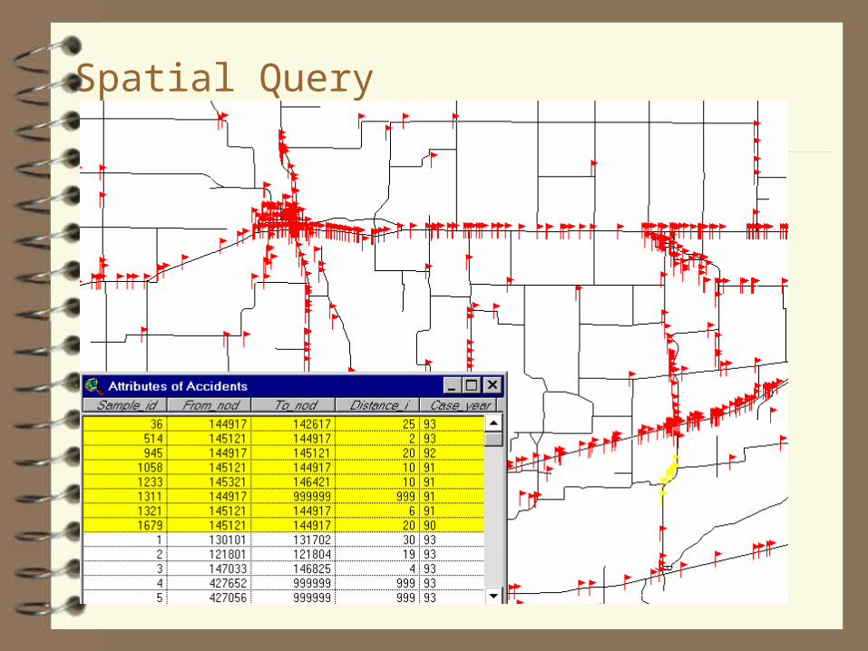
Spatial Query

Thematic Map - Crashes by Time of Day
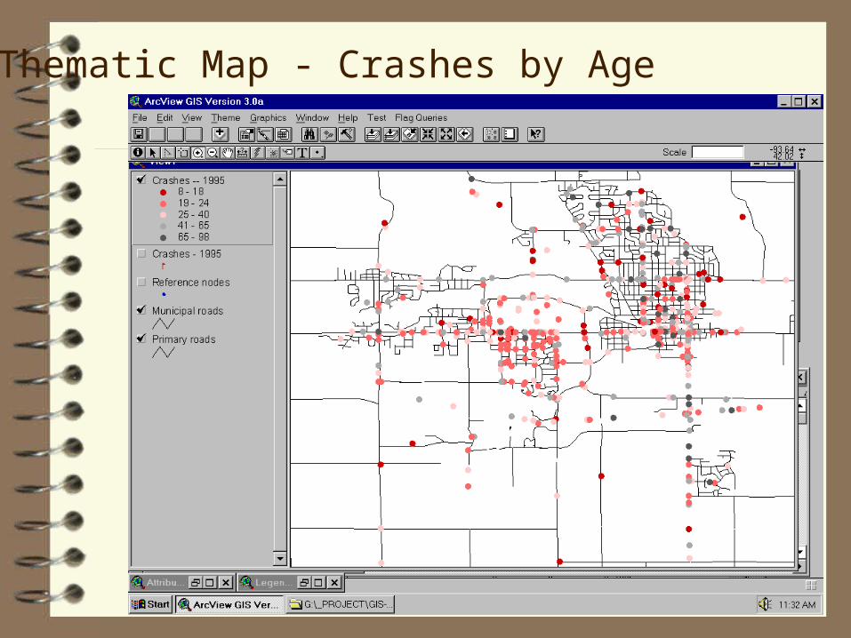
Thematic Map - Crashes by Age

Thematic Map - Crashes by Surface Conditions

Applications: Collision Diagram Software
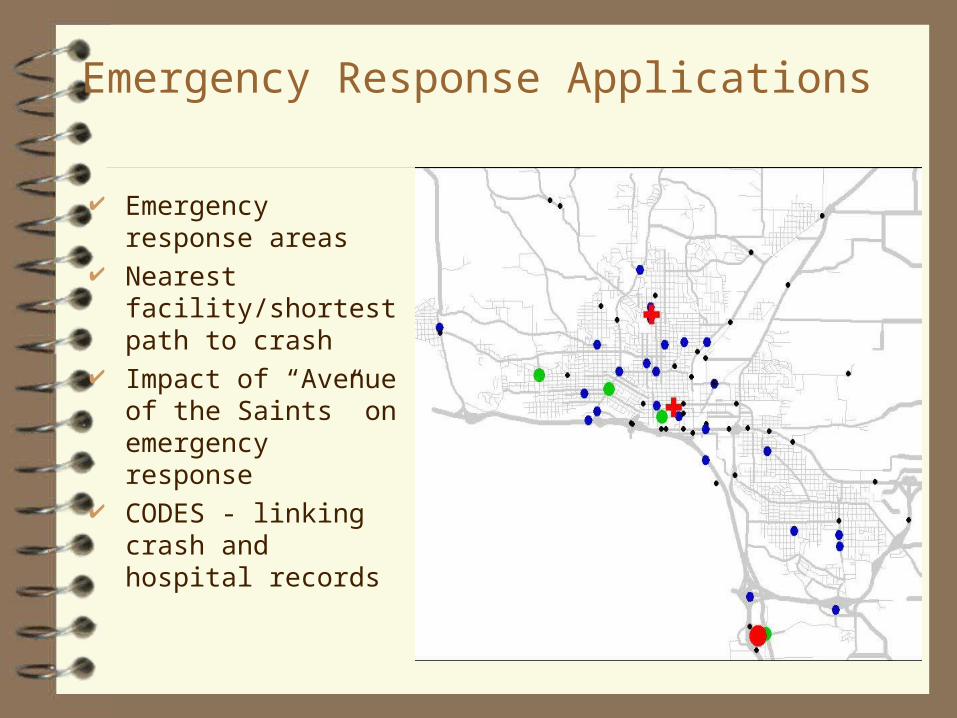
Emergency Response Applications
Emergency response areas
Nearest facility/shortest path to crash
Impact of “Avenue of the Saints” on emergency response
CODES - linking crash and hospital records

Emergency Response Times

Aerial photo integration


CTRE Crash Location Tool
Kansas City
June 1999
Outline
The National Model Current Iowa Location Procedure Advantage Safety Development and Demo

The National Model
Project Goal:• Shorten collection time
• Minimize traffic disruption
• Increase officer efficiency and safety
• Improve data quality
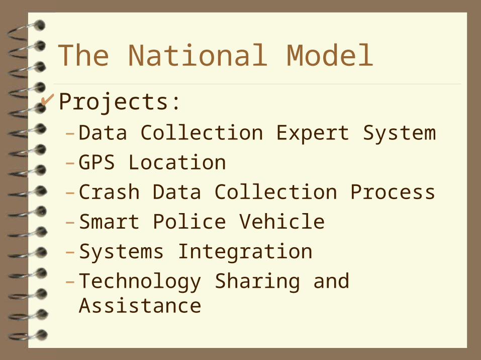
The National Model Projects:
– Data Collection Expert System
– GPS Location
– Crash Data Collection Process
– Smart Police Vehicle
– Systems Integration
– Technology Sharing and Assistance
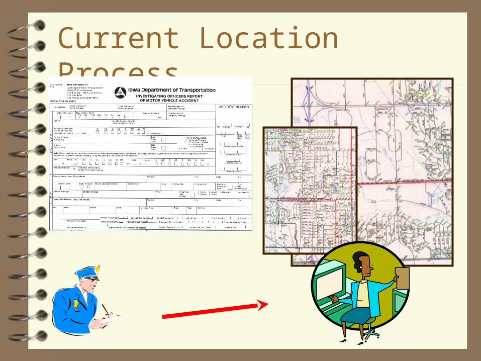
Current Location Process

Current Data-Flow Chart
Central Office Location
Processing of Literal Description
Paper Officer Report
Paper Driver Report
ALAS
PC-ALAS
Access ALAS
Link / Node to XY
GIS-ALAS
Bottleneck

Advantage Safety

Proposed Flow-Chart
Central Office Location
Advantage Safety w/LocTool
(Enterprise)
Paper Officer Report
Paper Driver Report
ALAS
PC-ALAS
Access ALAS
GIS-ALAS
Advantage Safety
w/LocTool
(Mobile)
Advantage Safety
w/LocTool (Office)
Local Data Analysis XY to
Link / Node
Translator

Crash Location Improvement Crash location performed on-site or at local
office Geographic coordinates of crash Roadway information confirms location Key fields identified for base record ID and
future cartographic upgrade

ESRI MapObjects Microsoft Visual Basic Arcview Shape Cartography Data from DOT Spatial Data Warehouse (Oracle) Distributed as a DLL
Software Selected

User Interface Menu
Main Map Window
Coordinate Information
Location Tool GUI

Crash Locate Tool
Pan Map
Zoom In/Out
Previous View
View Entire Map
User Interface Menu

Coordinate Milepost CountyCity Intersection
Location Finders

Milepost Marker
Corporate Limits
Crash Location
Demonstration
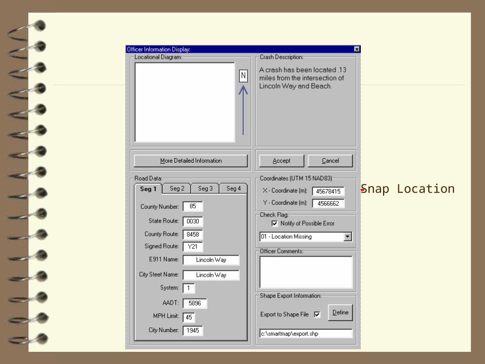
Snap Location
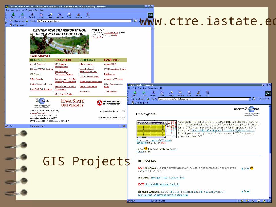
www.ctre.iastate.edu
GIS Projects

GIS-ALAS