glensheeglenofthefairies.co.uk/userfiles/file/glenshee-tourist-assoc-final... · you too! i commend...
TRANSCRIPT
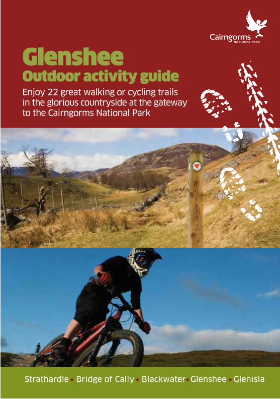
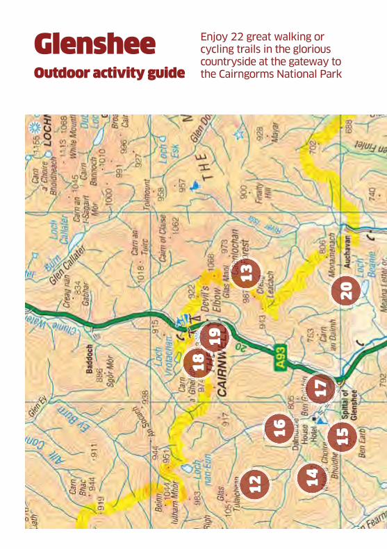
Enjoy 22 great walking or cycling trails in the glorious countryside at the gateway to the Cairngorms National Park
Glenshee Outdoor activity guide
Strathardle Bridge of Cally Blackwater Glenshee Glenisla
Glenshee Tourist Assoc.pdf 1Glenshee Tourist Assoc.pdf 1 23/03/2011 11:2023/03/2011 11:20
The walks and trails of Glenshee
deserve to be better known than
they are, particularly as so many
take the walker or mountain biker
to areas of outstanding beauty and
scenery which are rich in wildlife.
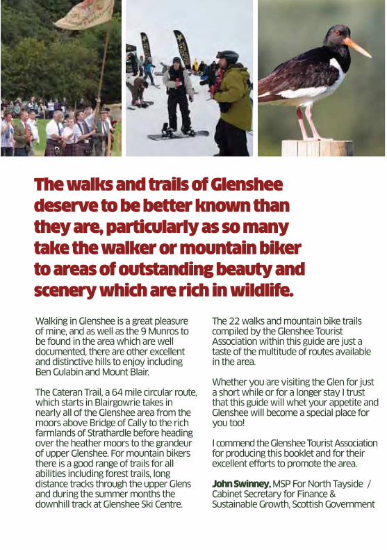
Walking in Glenshee is a great pleasure of mine, and as well as the 9 Munros to be found in the area which are well documented, there are other excellent and distinctive hills to enjoy including Ben Gulabin and Mount Blair.
The Cateran Trail, a 64 mile circular route, which starts in Blairgowrie takes in nearly all of the Glenshee area from the moors above Bridge of Cally to the rich farmlands of Strathardle before heading over the heather moors to the grandeur of upper Glenshee. For mountain bikers there is a good range of trails for all abilities including forest trails, long distance tracks through the upper Glens and during the summer months the downhill track at Glenshee Ski Centre.
The 22 walks and mountain bike trails compiled by the Glenshee Tourist Association within this guide are just a taste of the multitude of routes available in the area.
Whether you are visiting the Glen for just a short while or for a longer stay I trust that this guide will whet your appetite and Glenshee will become a special place for you too!
I commend the Glenshee Tourist Association for producing this booklet and for their excellent efforts to promote the area. John Swinney, MSP For North Tayside / Cabinet Secretary for Finance & Sustainable Growth, Scottish Government
Glenshee Tourist Assoc.pdf 2Glenshee Tourist Assoc.pdf 2 23/03/2011 11:2023/03/2011 11:20
Introduction 4-7
History 8
Wildlife 9
Access 10
Safety 11
The Glenshee Tourist Association acknowledges the support of Awards for All Scotland Produced by Glenshee Tourist Association c December 2010
Trails researched, photographed and written by Darren Morgan, Philip Smith, Simon & Alex Winton, Roger Clare, Scott Poole, Simon Calvin, Bob Ellis, Alan Stewart and Mike Purdie.
Additional photography by Mike Bell and Jennifer MacFarlane
Designed by Silverhunter, printed by Culross the Printers The Glenshee Association thanks local landowners for theirhelp and input to the guide.
DISCLAIMER
Whilst every care has been taken in compiling
the information in this guide, no responsibility
whatsoever can be accepted for any incorrect
information or any change which may subsequently
occur. Users of routes described in this
guidebook do so entirely at their own risk. Trail
routes marked on the map are not exact and for
guidance only.
Area Map 12-13
Cateran Trail 14-15
Routes for Walking/Cycling 16-57
Business Advertising 58-66
www.glenofthefairies.co.uk
Glenshee Tourist Assoc.pdf 3Glenshee Tourist Assoc.pdf 3 23/03/2011 11:2023/03/2011 11:20
04 Introduction
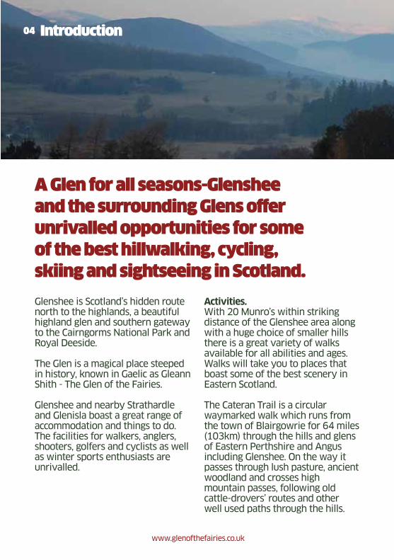
A Glen for all seasons-Glenshee
and the surrounding Glens offer
unrivalled opportunities for some
of the best hillwalking, cycling,
skiing and sightseeing in Scotland.
Glenshee is Scotland’s hidden route north to the highlands, a beautiful highland glen and southern gateway to the Cairngorms National Park and Royal Deeside.
The Glen is a magical place steeped in history, known in Gaelic as Gleann Shith - The Glen of the Fairies.
Glenshee and nearby Strathardle and Glenisla boast a great range of accommodation and things to do. The facilities for walkers, anglers, shooters, golfers and cyclists as well as winter sports enthusiasts are unrivalled.
Activities.With 20 Munro’s within striking distance of the Glenshee area along with a huge choice of smaller hills there is a great variety of walks available for all abilities and ages. Walks will take you to places that boast some of the best scenery in Eastern Scotland.
The Cateran Trail is a circular waymarked walk which runs from the town of Blairgowrie for 64 miles (103km) through the hills and glens of Eastern Perthshire and Angus including Glenshee. On the way it passes through lush pasture, ancient woodland and crosses high mountain passes, following old cattle-drovers’ routes and other well used paths through the hills.
www.glenofthefairies.co.uk
Glenshee Tourist Assoc.pdf 4Glenshee Tourist Assoc.pdf 4 23/03/2011 11:2023/03/2011 11:20
The spectacular natural environment and landscape of Glenshee is an adventure playground for Mountain Biking. There are many routes available that cater for the novice, families and experts alike. The easier trails will guide you through some stunning mountainous scenery and for the more experienced who can map read there are some challenging routes and descents along with the downhill mountain bike trail at Glenshee Ski Centre.
Glenshee Ski Centre is the largest Ski Resort in the UK, boasting 21 lifts and tows. Glenshee offers 36 runs
comprising 40kms of pisted snow and when conditions allow there are also snow making facilities if required. All abilities are catered for. At the Ski Centre and nearby in Glenshee there is a good selection of ski and board hire shops and ski school tuition.
Fishing and Fieldsports are a big feature of this area. There is a large river network coming from the hills and lochs for salmon and brown trout fishing, permits for which are available locally.
05Introduction
Glenshee
Forter Castle Cateran Trail
www.glenofthefairies.co.uk
Glenshee Tourist Assoc.pdf 5Glenshee Tourist Assoc.pdf 5 23/03/2011 11:2023/03/2011 11:20
06 Introduction
Glenshee has some excellent stalking for red, roe and fallow deer in some of the finest hills in Scotland with experienced and professional stalkers. The area is also very popular for grouse, pheasant and partridge shoots. Clay target shooting is also available.
Please be aware that when walking on the hills during the stalking season, care should be taken, any local estate notices should be adhered to and the Scottish Outdoor Access code should be followed.
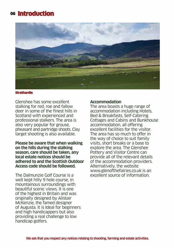
The Dalmunzie Golf Course is a well kept hilly 9 hole course, in mountainous surroundings with beautiful scenic views. It is one of the highest in Britain and was originally designed by Alistair McKenzie, the famed designer of Augusta. It is Ideal for beginners and high handicappers but also providing a real challenge to low handicap golfers.
AccommodationThe area boasts a huge range of accommodation including Hotels, Bed & Breakfasts, Self-Catering Cottages and Cabins and Bunkhouse accommodation, all offering excellent facilities for the visitor. The area has so much to offer in the way of choice to suit family visits, short breaks or a base to explore the area. The Glenshee Pottery and Visitor Centre can provide all of the relevant details of the accommodation providers. Alternatively, the website www.glenofthefairies.co.uk is an excellent source of information.
Strathardle
We ask that you respect any notices relating to shooting, farming and estate activities.
Glenshee Tourist Assoc.pdf 6Glenshee Tourist Assoc.pdf 6 23/03/2011 11:2023/03/2011 11:20
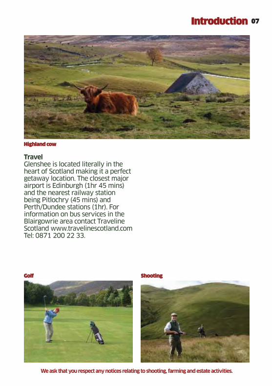
TravelGlenshee is located literally in the heart of Scotland making it a perfect getaway location. The closest major airport is Edinburgh (1hr 45 mins) and the nearest railway station being Pitlochry (45 mins) and Perth/Dundee stations (1hr). For information on bus services in the Blairgowrie area contact Traveline Scotland www.travelinescotland.com Tel: 0871 200 22 33.
07Introduction
Highland cow
Golf Shooting
We ask that you respect any notices relating to shooting, farming and estate activities.
Glenshee Tourist Assoc.pdf 7Glenshee Tourist Assoc.pdf 7 23/03/2011 11:2023/03/2011 11:20
08 History
Glenshee lies hidden in the North-East
corner of Perthshire, taking its name
from the Gaelic ‘Shith’ (Glen of the
Fairies or Peace) and its history
provides a virtual snapshot of the
story of Highland Scotland with the
mountains of the Cairngorms providing
magnificent scenery in all directions.
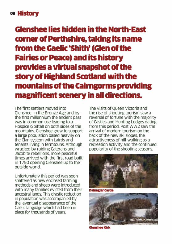
The first settlers moved into Glenshee in the Bronze Age and by the first millennium the ancient pass was in common use leading to a Hospice (Spittal) on both sides of the mountains. Glenshee grew to support a large population based heavily on the Clan system with Lairds and tenants living in fermtouns. Although wracked by raiding Caterans and Jacobite rebellions, more peaceful times arrived with the first road built in 1750 opening Glenshee up to the outside world. Unfortunately this period was soon shattered as new enclosed farming methods and sheep were introduced with many families evicted from their ancestral lands. This drastic reduction in population was accompanied by the eventual disappearance of the Gaelic language which had been in place for thousands of years.
The visits of Queen Victoria and the rise of shooting tourism saw a reversal of fortune with the majority of Castles and Hunting Lodges dating from this period. Post WW2 saw the arrival of modern tourism on the back of the new ski slopes, the attractiveness of hill-walking as a recreation activity and the continued popularity of the shooting seasons.
Glenshee Kirk
Dalnaglar Castle
Glenshee Tourist Assoc.pdf 8Glenshee Tourist Assoc.pdf 8 23/03/2011 11:2023/03/2011 11:20
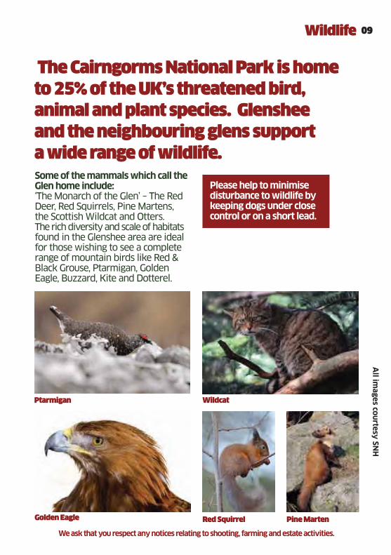
The Cairngorms National Park is home
to 25% of the UK’s threatened bird,
animal and plant species. Glenshee
and the neighbouring glens support
a wide range of wildlife.
09Wildlife
Ptarmigan Wildcat
Golden Eagle Red Squirrel Pine Marten
Some of the mammals which call the Glen home include:‘The Monarch of the Glen’ – The Red Deer, Red Squirrels, Pine Martens, the Scottish Wildcat and Otters. The rich diversity and scale of habitats found in the Glenshee area are ideal for those wishing to see a complete range of mountain birds like Red & Black Grouse, Ptarmigan, Golden Eagle, Buzzard, Kite and Dotterel.
Please help to minimise disturbance to wildlife by keeping dogs under close control or on a short lead.
All im
ages courtesy SN
H
We ask that you respect any notices relating to shooting, farming and estate activities.
Glenshee Tourist Assoc.pdf 9Glenshee Tourist Assoc.pdf 9 23/03/2011 11:2023/03/2011 11:20
10 Access
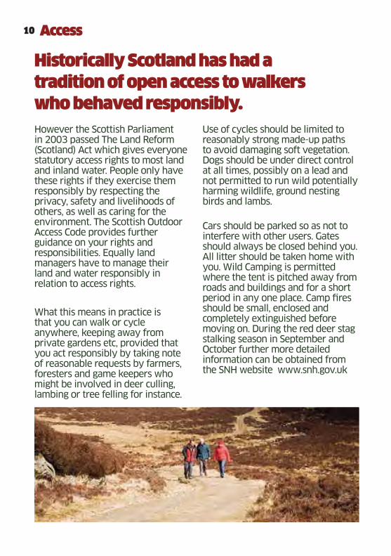
Historically Scotland has had a
tradition of open access to walkers
who behaved responsibly.
However the Scottish Parliament in 2003 passed The Land Reform (Scotland) Act which gives everyone statutory access rights to most land and inland water. People only have these rights if they exercise them responsibly by respecting the privacy, safety and livelihoods of others, as well as caring for the environment. The Scottish Outdoor Access Code provides further guidance on your rights and responsibilities. Equally land managers have to manage their land and water responsibly in relation to access rights.
What this means in practice is that you can walk or cycle anywhere, keeping away from private gardens etc, provided that you act responsibly by taking note of reasonable requests by farmers, foresters and game keepers who might be involved in deer culling, lambing or tree felling for instance.
Use of cycles should be limited to reasonably strong made-up paths to avoid damaging soft vegetation. Dogs should be under direct control at all times, possibly on a lead and not permitted to run wild potentially harming wildlife, ground nesting birds and lambs.
Cars should be parked so as not to interfere with other users. Gates should always be closed behind you. All litter should be taken home with you. Wild Camping is permitted where the tent is pitched away from roads and buildings and for a short period in any one place. Camp fires should be small, enclosed and completely extinguished before moving on. During the red deer stag stalking season in September and October further more detailed information can be obtained from the SNH website www.snh.gov.uk
Glenshee Tourist Assoc.pdf 10Glenshee Tourist Assoc.pdf 10 23/03/2011 11:2023/03/2011 11:20

11Safety
In order to enjoy your walk or
cycle to the full, it is best to take
a few sensible precautions.
• Obtain an accurate weather forecast.
• Wear appropriate clothing and footwear.
• Obtain and know how to use an appropriate map.
• Bear in mind that the weather can be very different from the forecast and can change very quickly, so be prepared to change
your plans if necessary.
• Please observe any access restrictions.
• Timings for the walks and cycle routes are approximate and may take longer than indicated.
Dial 999 ask for police and then mountain rescue,
giving the following information:
• Particularly for the higher hill walks, it is good practice to leave a note of your intended route and expected return time with a friend or family member.
• Cyclists are urged to wear an appropriate helmet & gloves.
• Be aware that on the higher walks snow and freezing temperatures can occur at virtually any time of the year, and that extra clothing, gloves and hat should be carried during anything but the summer months.
• In case of an incident occurring, it is a good idea to carry a mobile phone, bearing in mind a mobile signal cannot be guaranteed.
If there is an incident and you require assistance you should:
• Location – ideally with a six figure grid reference and description
• Nature of any injuries
• How many people are injured
• Be ready to give your mobile phone number
• Stay at the location given
• Bear in mind that, depending on your location, it can take some time for assistance to arrive. Take any steps you can to keep any casualty warm and from further harm.
We ask that you respect any notices relating to shooting, farming and estate activities.
Glenshee Tourist Assoc.pdf 11Glenshee Tourist Assoc.pdf 11 23/03/2011 11:2023/03/2011 11:20
Enjoy 22 great walking or cycling trails in the glorious countryside at the gateway to the Cairngorms National Park
Glenshee Outdoor activity guide
12
13
14
151
6
17
18
19
20
Glenshee Tourist Assoc.pdf 12Glenshee Tourist Assoc.pdf 12 23/03/2011 11:2023/03/2011 11:20

02
03
04
05
06
07
09
08
10
11
21
22
Glenshee Tourist Assoc.pdf 13Glenshee Tourist Assoc.pdf 13 23/03/2011 11:2023/03/2011 11:20
Lorem ipsum
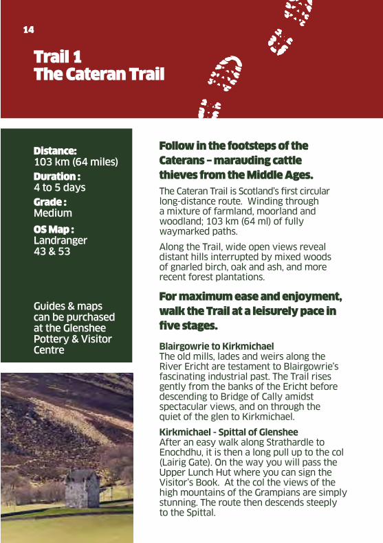
Distance: 103 km (64 miles)
Duration : 4 to 5 days
Grade : Medium
OS Map : Landranger 43 & 53 Guides & maps can be purchased at the Glenshee Pottery & Visitor Centre
14
Trail 1The Cateran Trail
Follow in the footsteps of the
Caterans – marauding cattle
thieves from the Middle Ages.
The Cateran Trail is Scotland’s first circular long-distance route. Winding through a mixture of farmland, moorland and woodland; 103 km (64 ml) of fully waymarked paths.
Along the Trail, wide open views reveal distant hills interrupted by mixed woods of gnarled birch, oak and ash, and more recent forest plantations.
For maximum ease and enjoyment,
walk the Trail at a leisurely pace in
five stages.
Blairgowrie to KirkmichaelThe old mills, lades and weirs along the River Ericht are testament to Blairgowrie’s fascinating industrial past. The Trail rises gently from the banks of the Ericht before descending to Bridge of Cally amidst spectacular views, and on through the quiet of the glen to Kirkmichael.
Kirkmichael - Spittal of Glenshee After an easy walk along Strathardle to Enochdhu, it is then a long pull up to the col (Lairig Gate). On the way you will pass the Upper Lunch Hut where you can sign the Visitor’s Book. At the col the views of the high mountains of the Grampians are simply stunning. The route then descends steeply to the Spittal.
Glenshee Tourist Assoc.pdf 14Glenshee Tourist Assoc.pdf 14 23/03/2011 11:2023/03/2011 11:20
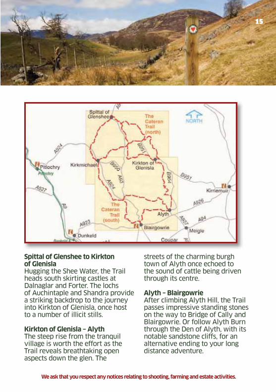
15
Spittal of Glenshee to Kirkton of GlenislaHugging the Shee Water, the Trail heads south skirting castles at Dalnaglar and Forter. The lochs of Auchintaple and Shandra provide a striking backdrop to the journey into Kirkton of Glenisla, once host to a number of illicit stills.
Kirkton of Glenisla – AlythThe steep rise from the tranquil village is worth the effort as the Trail reveals breathtaking open aspects down the glen. The
streets of the charming burgh town of Alyth once echoed to the sound of cattle being driven through its centre.
Alyth – BlairgowrieAfter climbing Alyth Hill, the Trail passes impressive standing stones on the way to Bridge of Cally and Blairgowrie. Or follow Alyth Burn through the Den of Alyth, with its notable sandstone cliffs, for an alternative ending to your long distance adventure.
We ask that you respect any notices relating to shooting, farming and estate activities.
Glenshee Tourist Assoc.pdf 15Glenshee Tourist Assoc.pdf 15 23/03/2011 11:2023/03/2011 11:20
Lorem ipsum
16
Distance: 9.7 km
Height Gain: 381 m
Duration : Walking 4-6 hoursCycling 2-3 hours
Grade : Walk: ModerateCycle: Technical
Start grid ref : NO 062628
OS Map : Landranger 43
Trail 2Enochdhu to Spittal
A majestic trail through open
countryside, with excellent views
from the highpoint of the route
overlooking the glens of Kirkmichael
and the Spittal of Glenshee
The first 3km of the route follows tracks under the shelter of woods; beyond this it is wild open mountainous terrain.
From the main Car Park at Enochdhu cross the road and follow the waymarked estate road passing estate houses and working farms. Dirnanean Gardens are open during the summer for a small admission charge. Look out for signs naming the woods and their planting dates.
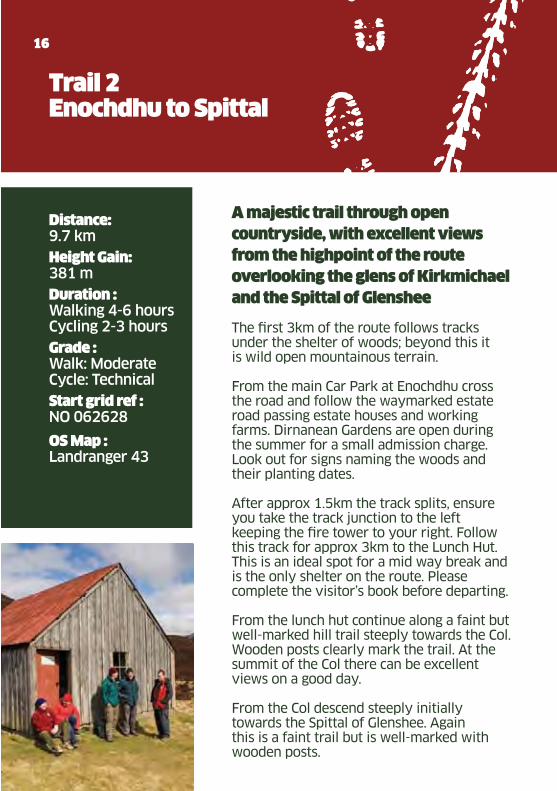
After approx 1.5km the track splits, ensure you take the track junction to the left keeping the fire tower to your right. Follow this track for approx 3km to the Lunch Hut. This is an ideal spot for a mid way break and is the only shelter on the route. Please complete the visitor’s book before departing.
From the lunch hut continue along a faint but well-marked hill trail steeply towards the Col. Wooden posts clearly mark the trail. At the summit of the Col there can be excellent views on a good day.
From the Col descend steeply initially towards the Spittal of Glenshee. Again this is a faint trail but is well-marked with wooden posts.
Glenshee Tourist Assoc.pdf 16Glenshee Tourist Assoc.pdf 16 23/03/2011 11:2023/03/2011 11:20

17
Reproduced by permission of Ordnance Survey on behalf of HMSO (copyright mark) Crown Copyright 2010.All rights reserved.Ordnance Survey Licence number GV -25062
We ask that you respect any notices relating to shooting, farming and estate activities.
Glenshee Tourist Assoc.pdf 17Glenshee Tourist Assoc.pdf 17 23/03/2011 11:2023/03/2011 11:20
Lorem ipsum
18
Distance: Up to 14km
Height Gain: Up to 290 m depending on route
Duration : Walking from 20 minutes to 4 hours
Grade : Walk: East to ModerateCycle: Easy to Moderate
Start grid ref : NO 141513
OS Map : OS Explorer 387Landranger 53
Trail 3Bridge of Cally River Walk & Blackcraig Forest
Blackcraig Forest is a commercial
forest managed by Forestry
Commission Scotland.
The best starting point for both mountain bikers and walkers is a small track which runs immediately behind the Bridge of Cally Hotel. (There is a small car parking area about ¼ mile along this track, additional car parking is available in the hotel car park nearby).
The forest extends northwards along Strathardle and there are over 8miles/14km of tracks to explore (only some of which are way marked). Mountain Bikers looking for a longer ride can also follow the Cateran Trail from Bridge of Cally to Kirkmichael before retracing their route, or else returning on the A924.
For walkers there is a shorter route lasting only 20 minutes, following the track behind the Bridge of Cally Hotel to just before the entrance gates into the Forest then follow the signed footpath along the riverbank back to the Hotel.
Wildlife watchers are likely to see red squirrels, roe deer and buzzards.
Refreshments are available all day at the Bridge of Cally Hotel; there is also a small post/office shop at Bridge of Cally which sells snacks and drinks.
Glenshee Tourist Assoc.pdf 18Glenshee Tourist Assoc.pdf 18 23/03/2011 11:2023/03/2011 11:20

19
Reproduced by permission of Ordnance Survey on behalf of HMSO (copyright mark) Crown Copyright 2010.All rights reserved.Ordnance Survey Licence number GV -25062
We ask that you respect any notices relating to shooting, farming and estate activities.
Glenshee Tourist Assoc.pdf 19Glenshee Tourist Assoc.pdf 19 23/03/2011 11:2023/03/2011 11:20

Lorem ipsum
Distance: 10.5 km
Duration : Walking 1-2 hours Cycling 30 mins - 1 hour
Grade : Moderate
Start grid ref : NO 138512
OS Map : Explorer 381, 387 and 379Landranger 53
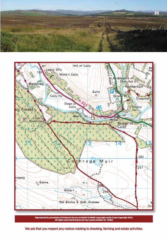
Trail 4Cochrage Muir
20
This is a nice circular ride mostly on
forestry and landrover tracks. The
reason it has a moderate grade is
because it starts with a 2 km climb
which isn’t everyones cup of tea, and
ends with a normally boggy ride
down a landrover track.
Park at the car park about 500m up the forestry road next to the Bridge of Cally hotel.Start at the gate at the car park and follow the road up for about 2km. Take the first road on the left and follow this for another 2km and look for where the forestry road turns right but a smaller land rover track goes straight on up the hill (then bears left through a gate).
Follow the land rover track (don’t turn off it to the larger loch on the left, keep going past another small Loch on the right) to where it meets the Cateran Trail.
Follow the Cateran Trail back towards Bridge of Cally. This part can be quite wet and boggy. Continue through four or five gates down towards the forest road. When you meet the forest road, you need to turn left back to the car park that you started at.
Glenshee Tourist Assoc.pdf 20Glenshee Tourist Assoc.pdf 20 23/03/2011 11:2023/03/2011 11:20
21
We ask that you respect any notices relating to shooting, farming and estate activities.
Reproduced by permission of Ordnance Survey on behalf of HMSO (copyright mark) Crown Copyright 2010.All rights reserved.Ordnance Survey Licence number GV -25062
Glenshee Tourist Assoc.pdf 21Glenshee Tourist Assoc.pdf 21 23/03/2011 11:2023/03/2011 11:20
Lorem ipsum
22
Distance: 6.5 km
Duration : Walking 2 hours Cycling 1 hour
Grade : Walking: Moderate Cycling: Moderate-Technical
Start grid ref : NO 136574
OS Map : Explorer 387Landranger 53
Trail 5Dalrulzion Woods and round Loch Mharaich
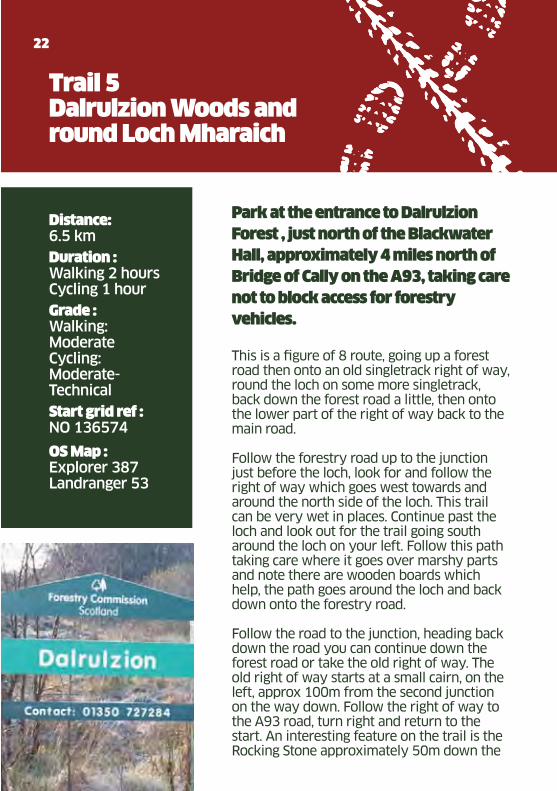
Park at the entrance to Dalrulzion
Forest , just north of the Blackwater
Hall, approximately 4 miles north of
Bridge of Cally on the A93, taking care
not to block access for forestry
vehicles.
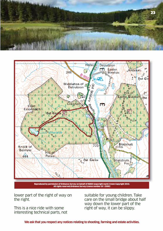
This is a figure of 8 route, going up a forest road then onto an old singletrack right of way, round the loch on some more singletrack, back down the forest road a little, then onto the lower part of the right of way back to the main road. Follow the forestry road up to the junction just before the loch, look for and follow the right of way which goes west towards and around the north side of the loch. This trail can be very wet in places. Continue past the loch and look out for the trail going south around the loch on your left. Follow this path taking care where it goes over marshy parts and note there are wooden boards which help, the path goes around the loch and back down onto the forestry road.
Follow the road to the junction, heading back down the road you can continue down the forest road or take the old right of way. The old right of way starts at a small cairn, on the left, approx 100m from the second junction on the way down. Follow the right of way to the A93 road, turn right and return to the start. An interesting feature on the trail is the Rocking Stone approximately 50m down the
Glenshee Tourist Assoc.pdf 22Glenshee Tourist Assoc.pdf 22 23/03/2011 11:2023/03/2011 11:20
23
lower part of the right of way on the right. This is a nice ride with some interesting technical parts, not
suitable for young children. Take care on the small bridge about half way down the lower part of the right of way, it can be slippy.
Reproduced by permission of Ordnance Survey on behalf of HMSO (copyright mark) Crown Copyright 2010.All rights reserved.Ordnance Survey Licence number GV -25062
We ask that you respect any notices relating to shooting, farming and estate activities.
Glenshee Tourist Assoc.pdf 23Glenshee Tourist Assoc.pdf 23 23/03/2011 11:2023/03/2011 11:20
Lorem ipsum
24
Distance: 11 km
Height Gain:
472 m
Duration : Walking 3-4 hoursCycling 1.5-2 hours
Grade : Cycle: Moderate to Strenuous. Walk: Moderate- Strenuous
Start grid ref : NO 149604
OS Map : Explorer 387 Landranger 43
Another alternative and popular route for Mount Blair is from the B951, where you can follow a distinct Landrover track (clearly marked on the OS Map) up the north slopes to the summit, return via the same route.
Trail 6Mount Blair
Mount Blair dominates the southern
entrance to Glenshee and is now
easily identifiable by the
communications mast on top. The
views from its summit are fantastic:
Glenshee and Glenisla to the North,
the North Sea to the East, Schiehallion
to the West and Strathmore and the
Sidlaws to the South.
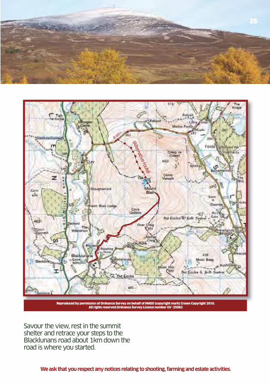
Park at the junction by the phone box on the Blacklunans & Drumore minor road linking the A93 with Glenisla. Head North up the road for 200m and take the first left by an old fank (shed/barn). The track winds its way up hill passing an old mill and the Borland farm before reaching the enormous and impressive lime kiln at the Coldrach. Continue on the track past the limekiln to the gate onto the hill.
Turn right and follow the track up the hill diagonally into Corie Goibhre.
When the track peters out head due east over rough ground for 200m until you reach the dry stane dyke, near an obvious dip in the ridge, The Glack of the Barnetts.
Cross the wall and follow a narrow path all the way to the summit crossing two stiles on the way up.
Glenshee Tourist Assoc.pdf 24Glenshee Tourist Assoc.pdf 24 23/03/2011 11:2023/03/2011 11:20
25
Savour the view, rest in the summit shelter and retrace your steps to the Blacklunans road about 1km down the road is where you started.
Reproduced by permission of Ordnance Survey on behalf of HMSO (copyright mark) Crown Copyright 2010.All rights reserved.Ordnance Survey Licence number GV -25062
We ask that you respect any notices relating to shooting, farming and estate activities.
(Alternative route)
Glenshee Tourist Assoc.pdf 25Glenshee Tourist Assoc.pdf 25 23/03/2011 11:2023/03/2011 11:20
Lorem ipsum
26
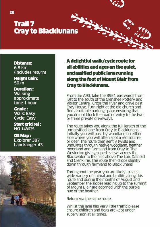
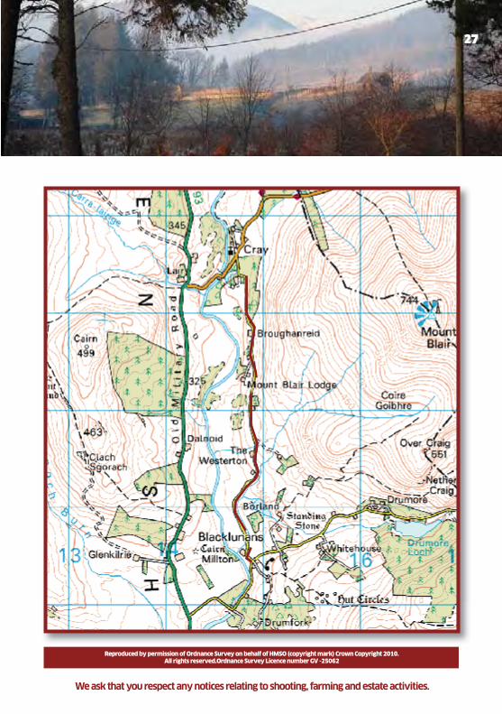
Trail 7Cray to Blacklunans
Distance: 6.8 km (includes return)
Height Gain: 50 m
Duration : Walking approximate time 1 hour
Grade : Walk: EasyCycle: Easy
Start grid ref : NO 148635
OS Map : Explorer 387Landranger 43
A delightful walk/cycle route for
all abilities and ages on the quiet,
unclassified public lane running
along the foot of Mount Blair from
Cray to Blacklunans.
From the A93, take the B951 eastwards from just to the south of the Glenshee Pottery and Visitor Centre. Cross the river and drive past Cray House. Turn right at the old church and find a suitable parking space ensuring that you do not block the road or entry to the two or three private driveways.
The route takes you along the full length of the unclassified lane from Cray to Blacklunans. Initially you will pass by woodland on either side where you will often spot a red squirrel or deer. The route then gently twists and undulates through native woodland, heather moorland and farmland from Cray to The Westerton giving superb views across the Blackwater to the hills above The Lair, Dalnoid and Glenkilrie. The route then drops slightly down through farmland to Blacklunans.
Throughout the year you are likely to see a wide variety of animal and birdlife along this route and during the months of August and September the slopes leading up to the summit of Mount Blair are adorned with the purple hue of the heather.
Return via the same route.
Whilst the lane has very little traffic please ensure children and dogs are kept under supervision at all times.
Glenshee Tourist Assoc.pdf 26Glenshee Tourist Assoc.pdf 26 23/03/2011 11:2023/03/2011 11:20
27
Reproduced by permission of Ordnance Survey on behalf of HMSO (copyright mark) Crown Copyright 2010.All rights reserved.Ordnance Survey Licence number GV -25062
We ask that you respect any notices relating to shooting, farming and estate activities.
Glenshee Tourist Assoc.pdf 27Glenshee Tourist Assoc.pdf 27 23/03/2011 11:2023/03/2011 11:20

Lorem ipsum
Distance: 12 km (circular route 40 km)
Duration : Walking 4 hours Cycling 2 hours(circular route 4.5-6 hours)
Grade : Technical and a bit of a challenge. (circular route very demanding, off road challenge)
Start grid ref : NO 142633
OS Map : Explorer 387Landranger 43
28
Trail 8The Lair to Kirkmichael
The route from the Lair (near Glenshee
Pottery) on the A93 to Kirkmichael is
a challenge. It is a right of way but is
usually very, very wet, finding the
path can be difficult (a map is a must)
and parts have to be walked. Not
advised for children by bike. As a walk
this is easier, navigation is still an issue
though and if the weather is misty we
would recommend you go elsewhere
as people do get lost in here. From the small road bridge across the burn at the Lair, the signposted right of way starts on the south side of the burn but on the west side of the road. Keep going up the hill and look out for the path which runs parallel to the burn and about 150 metres south of it. Look out for posts with yellow markers (these are not easy to spot and can be quite far apart).
The path is faint in places, but keep looking for the marker posts and refer to the map if in doubt. Beware that the route can be marshy in parts during wet weather. After passing Ashintully Castle, built in 1583, the route descends through agricultural fields to Kirkmichael.
Trail 8 can be extended into a longer circular route by joining Trail 2 at Kirkmichael and following the Cateran trail via Enochdhu, Spittal of Glenshee to Cray.
Glenshee Tourist Assoc.pdf 28Glenshee Tourist Assoc.pdf 28 23/03/2011 11:2023/03/2011 11:20
29
Reproduced by permission of Ordnance Survey on behalf of HMSO (copyright mark) Crown Copyright 2010.All rights reserved.Ordnance Survey Licence number GV -25062
We ask that you respect any notices relating to shooting, farming and estate activities.
Glenshee Tourist Assoc.pdf 29Glenshee Tourist Assoc.pdf 29 23/03/2011 11:2023/03/2011 11:20
Lorem ipsum
30
Distance: 15.5 km
Duration : Walking 3-4 hoursCycling 1hour 45 mins
Grade : Walk: ModerateCycle: Moderate
Start grid ref : NO 062626
OS Map : Explorer 387Landranger 43/53
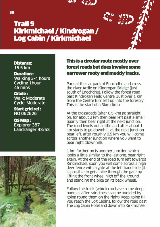
Trail 9Kirkmichael / Kindrogan / Log Cabin / Kirkmichael
This is a circular route mostly over
forest roads but does involve some
narrower rooty and muddy tracks,
Park at the car park at Enochdhu and cross the river Ardle on Kindrogan Bridge (just south of Enochdhu). Follow the forest road past Kindrogan Field Centre. Just over 1 km from the Centre turn left up into the forestry. This is the start of a 3km climb.
At the crossroads (after 0.5 km) go straight on, for about 2 km then bear left past a small quarry then bear right at the next junction. The road levels out a little and after about 1 km starts to go downhill, at the next junction bear left, after roughly 0.5 km you will come across another junction where you want to bear right (downhill).
1 km further on is another junction which looks a little similar to the last one, bear right again. At the end of the road turn left towards Kirkmichael, soon you will come across a high deer fence with a gate at the left hand side (it is possible to get a bike through the gate by lifting the front wheel high off the ground and standing the bike on its back wheel).
Follow the track (which can have some deep puddles after rain, these can be avoided by going round them on the right) Keep going till you reach the Log Cabins, follow the road past The Log Cabin Hotel and down into Kirkmichael.
Glenshee Tourist Assoc.pdf 30Glenshee Tourist Assoc.pdf 30 23/03/2011 11:2023/03/2011 11:20
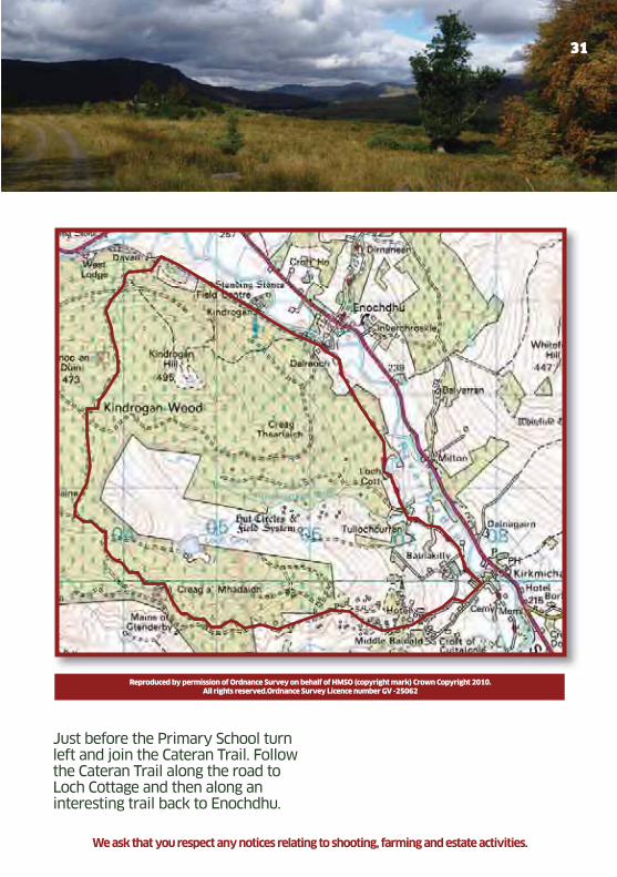
31
Just before the Primary School turn left and join the Cateran Trail. Follow the Cateran Trail along the road to Loch Cottage and then along an interesting trail back to Enochdhu.
Reproduced by permission of Ordnance Survey on behalf of HMSO (copyright mark) Crown Copyright 2010.All rights reserved.Ordnance Survey Licence number GV -25062
We ask that you respect any notices relating to shooting, farming and estate activities.
Glenshee Tourist Assoc.pdf 31Glenshee Tourist Assoc.pdf 31 23/03/2011 11:2023/03/2011 11:20

Lorem ipsum
Trail 10Kindrogan Drive
Distance: 3.5 km
Duration : Walking 1 1/2 hours Cycling 45 minutes
Grade : Easy
Start grid ref : NO 062626
OS Map : Landranger 43
32
A short and level linear trail on a
good landrover track through scenic
Strathardle. The trail takes you
alongside Kindrogan Wood where
you may see a wide range of wildlife
including birds, red squirrels and
roe deer.
Start at the east end of the route at the Car Park at Enochdhu, pass in front of the row of cottages and turn right over the bridge to cross the River Ardle.
On crossing the bridge turn right, keeping an eye out for the marker stone showing where Queen Victoria stopped for tea on her way from Balmoral to Dunkeld. The stone is on the river bank just below the trail.
Continue along the track passing by the Scottish Field Studies Council’s Kindrogan Centre and then on for a further 2 kilometres to West Lodge and the end of the Kindrogan Drive where it joins the main road. Return to the car park via the same route.
For the energetic walker, the walk can be extended by taking in Kindrogan Hill – look for the way markers before reaching the Cateran Trail signpost. This will add about 1½ hours to the walk with good views over Strathardle to the Grampian Mountains.
Note: The path to Kindrogan Hill is currently affected by windblown trees.
Glenshee Tourist Assoc.pdf 32Glenshee Tourist Assoc.pdf 32 23/03/2011 11:2023/03/2011 11:20
33
We ask that you respect any notices relating to shooting, farming and estate activities.
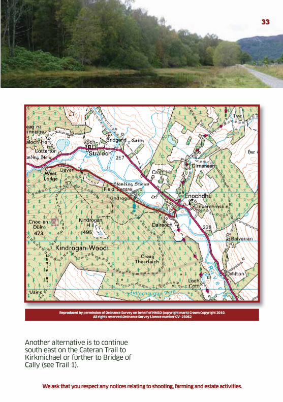
Another alternative is to continue south east on the Cateran Trail to Kirkmichael or further to Bridge of Cally (see Trail 1).
Reproduced by permission of Ordnance Survey on behalf of HMSO (copyright mark) Crown Copyright 2010.All rights reserved.Ordnance Survey Licence number GV -25062
Glenshee Tourist Assoc.pdf 33Glenshee Tourist Assoc.pdf 33 23/03/2011 11:2023/03/2011 11:20
Lorem ipsum
34
Distance: 7 km
Height Gain: 50 m
Duration : Walking 2 hoursCycling 1 hour
Grade : Walk: EasyCycle: Easy
Start grid ref : Car Park at Drimmie Woods NO 187490
OS Map : Explorer 381Landranger 53
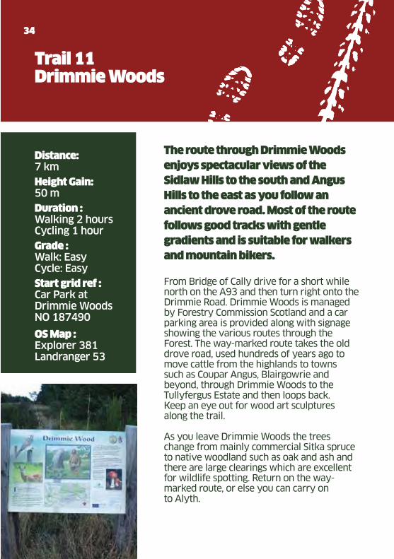
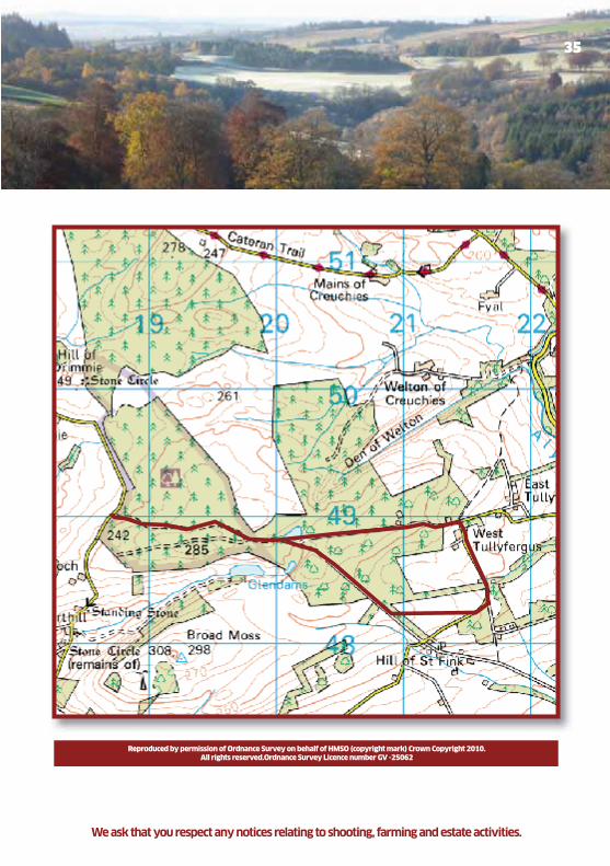
Trail 11Drimmie Woods
The route through Drimmie Woods
enjoys spectacular views of the
Sidlaw Hills to the south and Angus
Hills to the east as you follow an
ancient drove road. Most of the route
follows good tracks with gentle
gradients and is suitable for walkers
and mountain bikers.
From Bridge of Cally drive for a short while north on the A93 and then turn right onto the Drimmie Road. Drimmie Woods is managed by Forestry Commission Scotland and a car parking area is provided along with signage showing the various routes through the Forest. The way-marked route takes the old drove road, used hundreds of years ago to move cattle from the highlands to towns such as Coupar Angus, Blairgowrie and beyond, through Drimmie Woods to the Tullyfergus Estate and then loops back. Keep an eye out for wood art sculptures along the trail.
As you leave Drimmie Woods the trees change from mainly commercial Sitka spruce to native woodland such as oak and ash and there are large clearings which are excellent for wildlife spotting. Return on the way- marked route, or else you can carry on to Alyth.
Glenshee Tourist Assoc.pdf 34Glenshee Tourist Assoc.pdf 34 23/03/2011 11:2023/03/2011 11:20
35
We ask that you respect any notices relating to shooting, farming and estate activities.
Reproduced by permission of Ordnance Survey on behalf of HMSO (copyright mark) Crown Copyright 2010.All rights reserved.Ordnance Survey Licence number GV -25062
Glenshee Tourist Assoc.pdf 35Glenshee Tourist Assoc.pdf 35 23/03/2011 11:2023/03/2011 11:20

Lorem ipsum
36
This walk takes you up to the top of
one of Scotland’s 283 Munros with
spectacular views of the Cairngorms
and the Grampians.
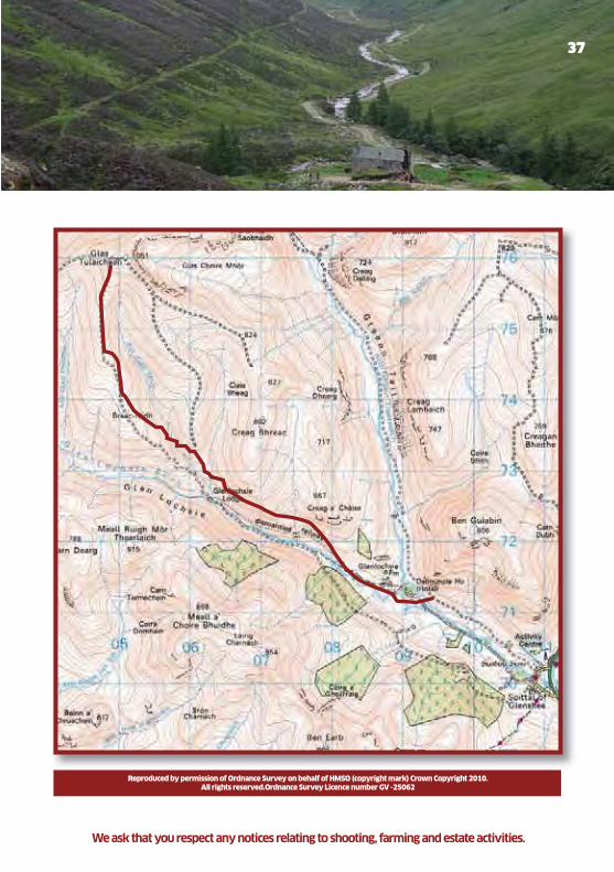
There is a vehicle track almost to the top but it must be remembered that in bad weather it is easy to get lost if you don’t stay on this track. Park at Dalmunzie Castle Hotel where there is a charge of £2. From car park walk up the estate driveway for 200m and follow signs to Glas Tulaichean. After approximately 1km, where the track crosses the river, follow the old railway line which is up to your right (150m up the hill). Continue along old railway line to the ruin of Glenlochsie Lodge, then follow hill track which takes you to within 300m of the top. The track levels off at grid reference 050759, turn east/right up hill 400m to the trig point at the top. When leaving the top please retrace your steps, do no leave the track in bad weather unless experienced.
This area is particularly sensitive during the stalking season, Monday to Friday, September, October and November. Please phone 01250 885226 for more information.
Distance: 15 km round trip
Height Gain: 600m
Duration : 4–6 hours
Grade : Strenuous
Start grid ref : NO 091712
OS Map : Landranger 43
Trail 12Glas Tulaichean from Dalmunzie Castle Hotel
Glenshee Tourist Assoc.pdf 36Glenshee Tourist Assoc.pdf 36 23/03/2011 11:2023/03/2011 11:20
37
Reproduced by permission of Ordnance Survey on behalf of HMSO (copyright mark) Crown Copyright 2010.All rights reserved.Ordnance Survey Licence number GV -25062
We ask that you respect any notices relating to shooting, farming and estate activities.
Glenshee Tourist Assoc.pdf 37Glenshee Tourist Assoc.pdf 37 23/03/2011 11:2023/03/2011 11:20

Lorem ipsum
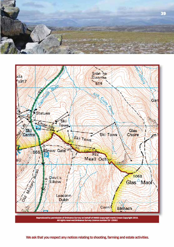
Trail 13Glas Maol
38
Distance: 6 km
Height gain: 420 m
Duration : 2½ - 3 hours
Grade : Strenuous
Start grid ref : NO 141775 (east side A93)
OS Map : Landranger 43 Explorer 387
A relatively short walk to the highest
Munro in Glenshee with a high start
point. Distant views to the east coast
and north west to the Cairngorms,
while closer by to the north are the
neighbouring Munros of Carn of
Cleise and Carn an’ Tuirc.
Park in the car park on the east side of A93 at the Aberdeenshire/Perth & Kinross boundary. Follow the landrover track heading east to a ski tow and Meall Odhar Café (only open during the ski season).
Continue following the track to the right of the ski tow to reach the summit of Meall Odhar (922 metres).
From here you will see the west face of Glas Maol with your route following to the right of the head of Coire Fionn. Following a short undulating section, the path now zig zags up the steepish west face, and on gaining the flat ground above follow the faint path and one or two old fence posts for ten minutes to the summit trig point and shelter at 1068 metres. To return to your car, retrace your outward route taking care down the steep section.
Glenshee Tourist Assoc.pdf 38Glenshee Tourist Assoc.pdf 38 23/03/2011 11:2023/03/2011 11:20
39
Reproduced by permission of Ordnance Survey on behalf of HMSO (copyright mark) Crown Copyright 2010.All rights reserved.Ordnance Survey Licence number GV -25062
We ask that you respect any notices relating to shooting, farming and estate activities.
Glenshee Tourist Assoc.pdf 39Glenshee Tourist Assoc.pdf 39 23/03/2011 11:2023/03/2011 11:20
Lorem ipsum
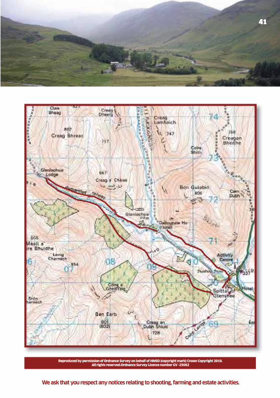
Trail 14Glenlochsie from Spittal of Glenshee
Distance: 11 km round trip
Height gain: 100 - 200m
Duration : 3 – 4 hours
Grade : Easy to Moderate
Start grid ref : NO 105701
OS Map : Landranger 43
40
This walk takes you along the
sides and up the beautiful Glen of
Glenlochsie. The views are stunning
and the paths are easy to follow.
Park 300m into Dalmunzie Estate at Spittal of Glenshee, in the big layby on the right of the driveway. Walk back out of the Estate, turn right and then first right up a hill track, where there are signs for Glenbeag Mountain Lodges.
Follow this track through the chalets and up the hill to a forestry gate. Go through the gate and continue following the track for 4½ km, through 2 forestry blocks, until you reach the river where you can see the ruin of Glenlochsie Lodge 200 metres ahead.
In low water you can cross the river and go to the Lodge returning home via the old railway line. South east of the lodge is a small bridge which takes you to the railway track, follow the track back to Dalmunzie Castle Hotel and then follow the Hotel driveway down to your car which is parked in the layby.
In high water return by the route you came.
Glenshee Tourist Assoc.pdf 40Glenshee Tourist Assoc.pdf 40 23/03/2011 11:2023/03/2011 11:20
41
Reproduced by permission of Ordnance Survey on behalf of HMSO (copyright mark) Crown Copyright 2010.All rights reserved.Ordnance Survey Licence number GV -25062
We ask that you respect any notices relating to shooting, farming and estate activities.
Glenshee Tourist Assoc.pdf 41Glenshee Tourist Assoc.pdf 41 23/03/2011 11:2023/03/2011 11:20
Lorem ipsum
Distance: 6.5 km round trip
Duration : Walking 2 hoursCycling 1 hour
Grade : Easy
Start grid ref : NO 109701
OS Map : Landranger 43
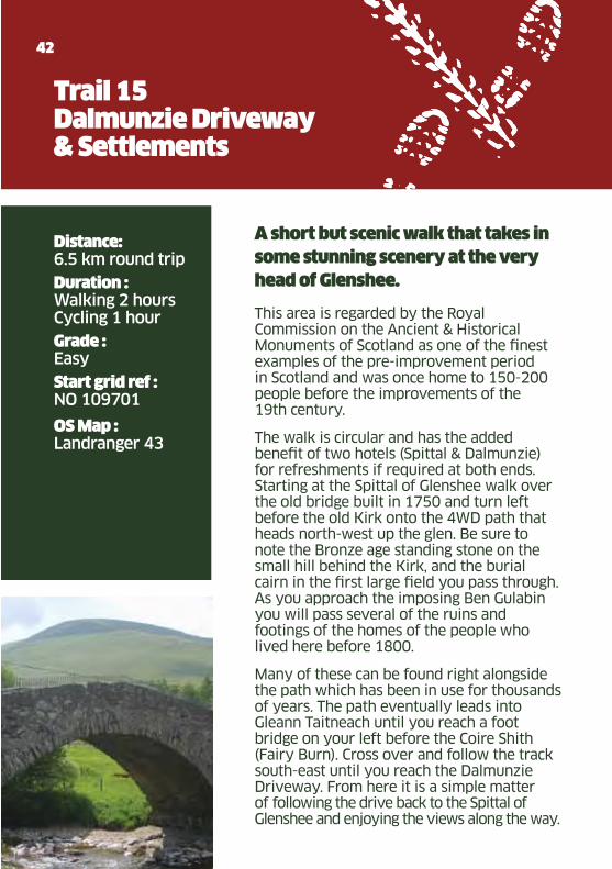
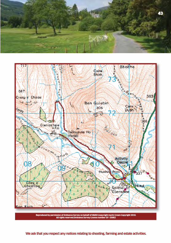
Trail 15Dalmunzie Driveway & Settlements
42
A short but scenic walk that takes in
some stunning scenery at the very
head of Glenshee.
This area is regarded by the Royal Commission on the Ancient & Historical Monuments of Scotland as one of the finest examples of the pre-improvement period in Scotland and was once home to 150-200 people before the improvements of the 19th century.
The walk is circular and has the added benefit of two hotels (Spittal & Dalmunzie) for refreshments if required at both ends. Starting at the Spittal of Glenshee walk over the old bridge built in 1750 and turn left before the old Kirk onto the 4WD path that heads north-west up the glen. Be sure to note the Bronze age standing stone on the small hill behind the Kirk, and the burial cairn in the first large field you pass through. As you approach the imposing Ben Gulabin you will pass several of the ruins and footings of the homes of the people who lived here before 1800.
Many of these can be found right alongside the path which has been in use for thousands of years. The path eventually leads into Gleann Taitneach until you reach a foot bridge on your left before the Coire Shith (Fairy Burn). Cross over and follow the track south-east until you reach the Dalmunzie Driveway. From here it is a simple matter of following the drive back to the Spittal of Glenshee and enjoying the views along the way.
Glenshee Tourist Assoc.pdf 42Glenshee Tourist Assoc.pdf 42 23/03/2011 11:2023/03/2011 11:20
43
Reproduced by permission of Ordnance Survey on behalf of HMSO (copyright mark) Crown Copyright 2010.All rights reserved.Ordnance Survey Licence number GV -25062
We ask that you respect any notices relating to shooting, farming and estate activities.
Glenshee Tourist Assoc.pdf 43Glenshee Tourist Assoc.pdf 43 23/03/2011 11:2023/03/2011 11:20
Lorem ipsum
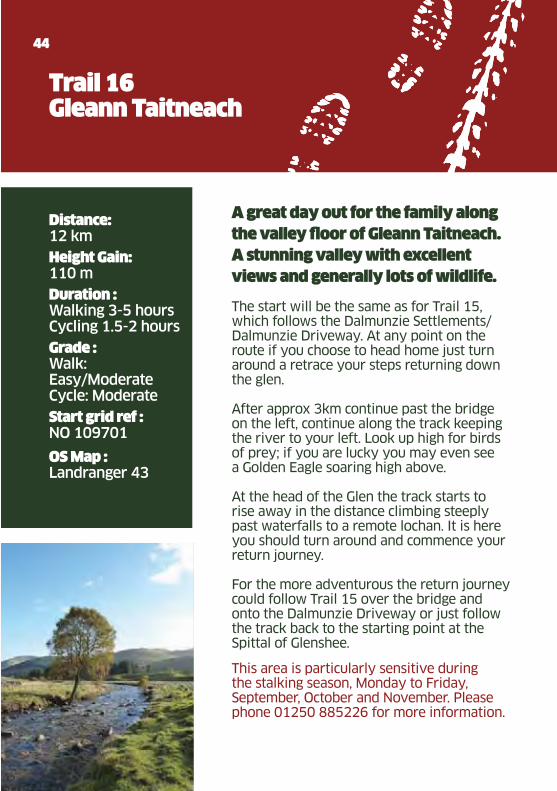
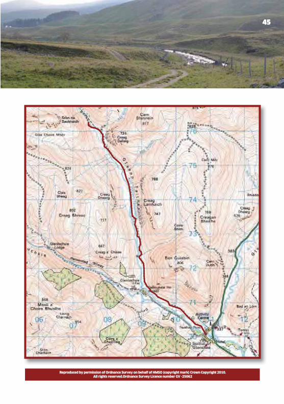
Distance: 12 km
Height Gain: 110 m
Duration : Walking 3-5 hoursCycling 1.5-2 hours
Grade : Walk: Easy/Moderate Cycle: Moderate
Start grid ref : NO 109701
OS Map : Landranger 43
Trail 16Gleann Taitneach
44
This area is particularly sensitive during the stalking season, Monday to Friday, September, October and November. Please phone 01250 885226 for more information.
A great day out for the family along
the valley floor of Gleann Taitneach.
A stunning valley with excellent
views and generally lots of wildlife. The start will be the same as for Trail 15, which follows the Dalmunzie Settlements/Dalmunzie Driveway. At any point on the route if you choose to head home just turn around a retrace your steps returning down the glen.
After approx 3km continue past the bridge on the left, continue along the track keeping the river to your left. Look up high for birds of prey; if you are lucky you may even see a Golden Eagle soaring high above.
At the head of the Glen the track starts to rise away in the distance climbing steeply past waterfalls to a remote lochan. It is here you should turn around and commence your return journey.
For the more adventurous the return journey could follow Trail 15 over the bridge and onto the Dalmunzie Driveway or just follow the track back to the starting point at the Spittal of Glenshee.
Glenshee Tourist Assoc.pdf 44Glenshee Tourist Assoc.pdf 44 23/03/2011 11:2023/03/2011 11:20
45
Reproduced by permission of Ordnance Survey on behalf of HMSO (copyright mark) Crown Copyright 2010.All rights reserved.Ordnance Survey Licence number GV -25062
Glenshee Tourist Assoc.pdf 45Glenshee Tourist Assoc.pdf 45 23/03/2011 11:2023/03/2011 11:20

Lorem ipsum
46
This area is particularly sensitive during the stalking season, Monday to Friday, September, October and November. Please phone 01250 885226 for more information as it is likely that walking will interfere with stalking activities.
Distance: 6 km
Height Gain: 456 m
Duration : 3-4 hours
Grade : Walk-Strenuous
Start grid ref : NO 114714
OS Map : Landranger 43
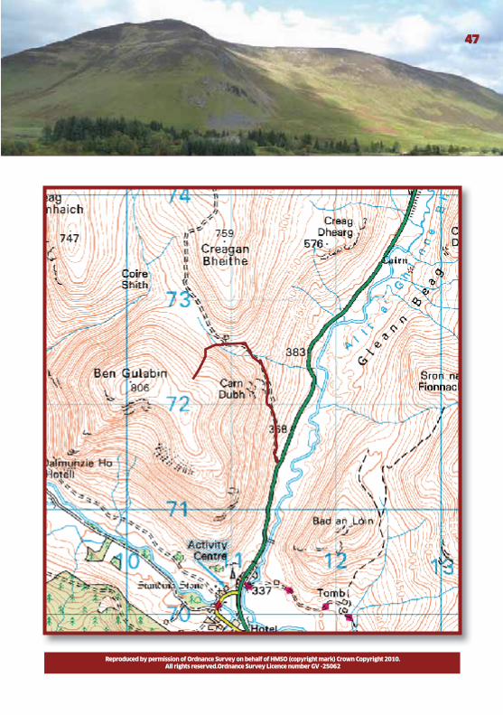
Trail 17Ben Gulabin
A magnificent walk which climbs
steeply to the summit of Ben Gulabin.
You will be rewarded with spectacular
views of the surrounding glens. From the Spittal of Glenshee head North along the A93 for approx 1km until a large gate on the left is seen with a track running behind. This being the start of the route.
Follow the 4x4 track steeply heading in a North Westerly direction. The route contours around Ben Gulabin gaining height quickly.
After passing the stream (approx 1km) look up right for the remains of the first ski tows that were installed at Glenshee. These were very popular until the ski area was developed further up the glen to the North, now known as The Glenshee Ski Centre.
As the track flattens out look for the obvious man-made track (not marked on maps) to the left. Follow this track steeply until its end point and head left across heather and a small rocky outcrop before arriving at the summit cairn. The views will be well worth it!Simply reverse the route for the descent but keep your eyes on the hillsides, as there is often wildlife to be seen.
Glenshee Tourist Assoc.pdf 46Glenshee Tourist Assoc.pdf 46 23/03/2011 11:2023/03/2011 11:20
47
Reproduced by permission of Ordnance Survey on behalf of HMSO (copyright mark) Crown Copyright 2010.All rights reserved.Ordnance Survey Licence number GV -25062
Glenshee Tourist Assoc.pdf 47Glenshee Tourist Assoc.pdf 47 23/03/2011 11:2023/03/2011 11:20
Lorem ipsum
48
Trail 18Cairnwell and Carn a’ Gheoidh
Distance: 10.5 km
Height gain: 500 m
Duration : 3½ - 4 hours
Grade : Fairly strenuous
Start grid ref : NO 138781
OS Map : Landranger 43Explorer 387
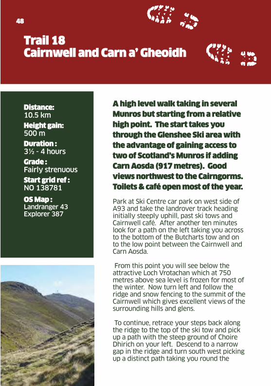
A high level walk taking in several
Munros but starting from a relative
high point. The start takes you
through the Glenshee Ski area with
the advantage of gaining access to
two of Scotland’s Munros if adding
Carn Aosda (917 metres). Good
views northwest to the Cairngorms.
Toilets & café open most of the year.
Park at Ski Centre car park on west side of A93 and take the landrover track heading initially steeply uphill, past ski tows and Cairnwell café. After another ten minutes look for a path on the left taking you across to the bottom of the Butcharts tow and on to the low point between the Cairnwell and Carn Aosda.
From this point you will see below the attractive Loch Vrotachan which at 750 metres above sea level is frozen for most of the winter. Now turn left and follow the ridge and snow fencing to the summit of the Cairnwell which gives excellent views of the surrounding hills and glens.
To continue, retrace your steps back along the ridge to the top of the ski tow and pick up a path with the steep ground of Choire Dhirich on your left. Descend to a narrow gap in the ridge and turn south west picking up a distinct path taking you round the
Glenshee Tourist Assoc.pdf 48Glenshee Tourist Assoc.pdf 48 23/03/2011 11:2023/03/2011 11:20
49
headwall of Choire Dhirich, past two small mountain lochans (a great place for bird watching in the spring).
The path from here bypasses the summit of Carn nan Sac and after some open ground – ‘the Coolah’ – climbs more steeply to the flat and rounded summit of Carn Gheoidh (975 metres). To return, retrace your steps to the narrow gap
(GR 126781) and from here avoiding the high ground to the right, traverse north to rejoin the flat area overlooking Loch Vrotachan and so down through the ski area to the car park.
Reproduced by permission of Ordnance Survey on behalf of HMSO (copyright mark) Crown Copyright 2010.All rights reserved.Ordnance Survey Licence number GV -25062
We ask that you respect any notices relating to shooting, farming and estate activities.
Glenshee Tourist Assoc.pdf 49Glenshee Tourist Assoc.pdf 49 23/03/2011 11:2023/03/2011 11:20
Lorem ipsum
50
Distance: 2.4 km
Height Gain: Access via Chairlift 300 m
Duration : 10-25 mins
Grade : Moderate
Start grid ref : NO 138782
OS Map : Landranger 43Explorer 387
Open:June-Sep
Trail 19Glenshee Ski Centre Mountain Bike Track
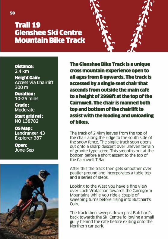
The Glenshee Bike Track is a unique
cross mountain experience open to
all ages from 8 upwards. The track is
accessed by a single seat chair that
ascends from outside the main café
to a height of 2998ft at the top of the
Cairnwell. The chair is manned both
top and bottom of the chairlift to
assist with the loading and unloading
of bikes.
The track of 2.4km leaves from the top of the chair along the ridge to the south side of the snow fence. The single track soon opens out onto a sharp descent over uneven terrain of granite type scree. This smooths out at the bottom before a short ascent to the top of the Cairnwell T’Bar.
After this the track then gets smoother over peatier ground and incorporates a table top and a series of steps.
Looking to the West you have a fine view over Loch Vrotachan towards the Cairngorm Mountains while you ride a couple of sweeping turns before rising into Butchart’s Coire.
The track then sweeps down past Butchart’s back towards the Ski Centre following a small gully behind the café before exiting onto the Northern car park.
Glenshee Tourist Assoc.pdf 50Glenshee Tourist Assoc.pdf 50 23/03/2011 11:2023/03/2011 11:20

51
Reproduced by permission of Ordnance Survey on behalf of HMSO (copyright mark) Crown Copyright 2010.All rights reserved.Ordnance Survey Licence number GV -25062
We ask that you respect any notices relating to shooting, farming and estate activities.
We advise you to contact Glenshee Ski Centre in advance of travelling to check the chairlift is operating Tel. (013397) 41320
Glenshee Tourist Assoc.pdf 51Glenshee Tourist Assoc.pdf 51 23/03/2011 11:2023/03/2011 11:20
Lorem ipsum
Distance: 6 km
Height gain: 110 m
Duration : 2 hours
Grade : Easy
Start grid ref : NO 133683
OS Map : Landranger 43
Trail 20Loch Beanie
52
A low level walk on a good track,
but also a muddy path, across
open moorland. A good location
to observe nesting birds in the
spring, and to see or hear red
deer in the autumn.
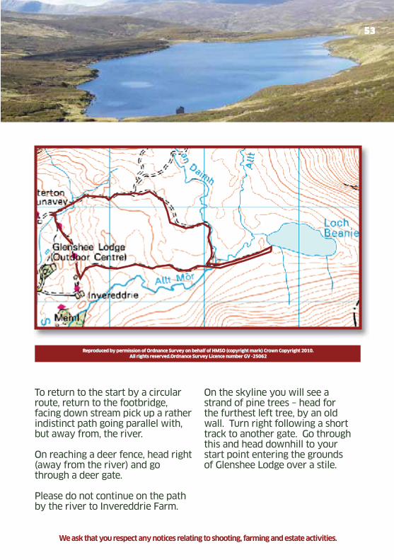
Car Parking can be arranged in advance by calling Glenshee Lodge (01250 885209). From Glenshee Lodge pick up a landrover track heading north past a small pond, through a gate and then uphill to join an older track.
Turn left onto this, passing through another gate through a wall and further on through a deer fence.
The track then takes you through open moorland and at a junction take the track to the right now heading southwest. Look out for a distant view of Loch Beanie opening up on the left before dropping down to a rather rickety footbridge!
In about ten minutes you arrive at the Loch by a small boat shed. To extend the walk, at the far (eastern) end of the loch there is a delightful sandy beach. It is also possible to continue the walk past the loch through Glen Beanie to Glen Isla.
Glenshee Lodge / Compass Christian Centre. For car parking please phone in advance 01250 885209
Glenshee Tourist Assoc.pdf 52Glenshee Tourist Assoc.pdf 52 23/03/2011 11:2023/03/2011 11:20
53
To return to the start by a circular route, return to the footbridge, facing down stream pick up a rather indistinct path going parallel with, but away from, the river.
On reaching a deer fence, head right (away from the river) and go through a deer gate.
Please do not continue on the path by the river to Invereddrie Farm.
Reproduced by permission of Ordnance Survey on behalf of HMSO (copyright mark) Crown Copyright 2010.All rights reserved.Ordnance Survey Licence number GV -25062
We ask that you respect any notices relating to shooting, farming and estate activities.
On the skyline you will see a strand of pine trees – head for the furthest left tree, by an old wall. Turn right following a short track to another gate. Go through this and head downhill to your start point entering the grounds of Glenshee Lodge over a stile.
Glenshee Tourist Assoc.pdf 53Glenshee Tourist Assoc.pdf 53 23/03/2011 11:2023/03/2011 11:20
Lorem ipsum
54
Distance: 6 km
Height gain 160 m
Duration : Walking 1–1.5 hoursCycling 30-45 mins
Grade : Moderate
Start grid ref : NO 187648
OS Map : Explorer 388Landranger 43/44
Trail 21Auchintaple Loch
This is a very scenic trail around
Auchintaple Loch in Glenisla.
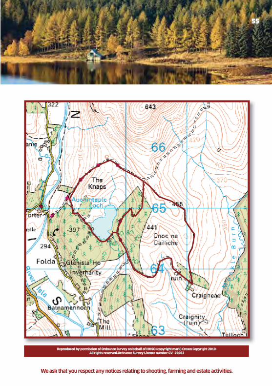
Park at the layby at the corner of the forest, just south of the bridge over the River Isla at Little Forter. Just north of the layby is a gate and a large stile, follow the Landrover track (and the Cateran Trail) up the hill north east for approximately 500m then bear right following the road up to the Loch.
Stay on the road passing the boathouse on your left, follow the track around the loch through some gates then it changes to a path going round the bottom end of the loch (watch the stones here!) Once over the man made dam cut up through the heather, using a faint path towards the road, then follow the road north through the trees to a gate and junction. Take the road going down to the north west and follow this back to the layby.
At the top end of this trail there is access to a large amount of paths and tracks that lie between Glenmarkie forest and the top half of Glenisla. A good look at the OS Map will reveal a selection of other interesting routes.
Glenshee Tourist Assoc.pdf 54Glenshee Tourist Assoc.pdf 54 23/03/2011 11:2023/03/2011 11:20
55
Reproduced by permission of Ordnance Survey on behalf of HMSO (copyright mark) Crown Copyright 2010.All rights reserved.Ordnance Survey Licence number GV -25062
We ask that you respect any notices relating to shooting, farming and estate activities.
Glenshee Tourist Assoc.pdf 55Glenshee Tourist Assoc.pdf 55 23/03/2011 11:2023/03/2011 11:20
Lorem ipsum
Distance: 3.5 km
Height gain: 30m
Duration : Walking 0.5-2 hoursCycling 30-40 mins
Grade : Easy
Start grid ref : NO 224608
OS Map : Explorer 381, 388Landranger 44
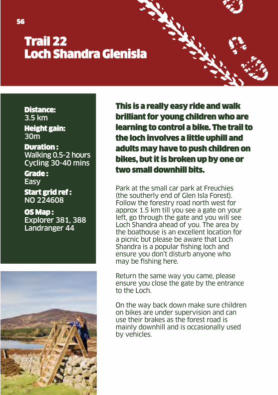
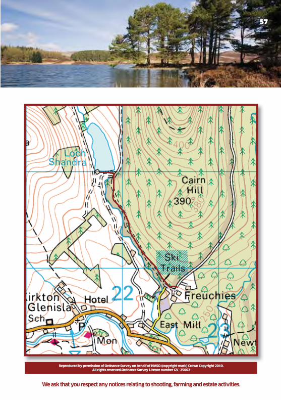
Trail 22Loch Shandra Glenisla
56
This is a really easy ride and walk
brilliant for young children who are
learning to control a bike. The trail to
the loch involves a little uphill and
adults may have to push children on
bikes, but it is broken up by one or
two small downhill bits.
Park at the small car park at Freuchies (the southerly end of Glen Isla Forest).Follow the forestry road north west for approx 1.5 km till you see a gate on your left, go through the gate and you will see Loch Shandra ahead of you. The area by the boathouse is an excellent location for a picnic but please be aware that Loch Shandra is a popular fishing loch and ensure you don’t disturb anyone who may be fishing here.
Return the same way you came, please ensure you close the gate by the entrance to the Loch.
On the way back down make sure children on bikes are under supervision and can use their brakes as the forest road is mainly downhill and is occasionally used by vehicles.
Glenshee Tourist Assoc.pdf 56Glenshee Tourist Assoc.pdf 56 23/03/2011 11:2023/03/2011 11:20
57
Reproduced by permission of Ordnance Survey on behalf of HMSO (copyright mark) Crown Copyright 2010.All rights reserved.Ordnance Survey Licence number GV -25062
We ask that you respect any notices relating to shooting, farming and estate activities.
Glenshee Tourist Assoc.pdf 57Glenshee Tourist Assoc.pdf 57 23/03/2011 11:2023/03/2011 11:20
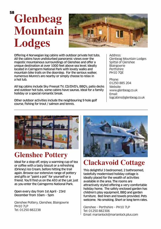
����������� ���������Offering 4 Norwegian log cabins with outdoor private hot tubs. All the cabins have undisturbed panoramic views over the majestic mountainous surroundings of Glenshee and offer a unique destination at over 1000 feet above sea level. Ideally located in Cairngorm National Park with lovely walks and mountain bike trails on the doorstep. For the serious walker, numerous Munro’s are nearby or simply choose to relax in a hot tub.
All log cabins include Sky Freesat TV, CD/DVD’s, BBQ’s, patio decks and outdoor hot tubs, some cabins have saunas. Ideal for a family holiday or a special romantic break.
Other outdoor activities include the neighbouring 9 hole golf course, fishing for trout / salmon and tennis.
Address: Glenbeag Mountain LodgesSpittal of GlensheeBlairgowriePerthshirePH10 7QE
Phone: 01250 885 204Website: www.glenbeag.co.ukEmail: [email protected]
���������� ���Ideal for a stop off, enjoy a warming cup of tea or coffee with a tasty biscuit or a refreshing (Orkney) Ice Cream, before hitting the trail again. Browse our extensive range of pottery and gifts or “paint a pot” for yourself or a friend. You’ll find us on the A93 at the Lair, just as you enter the Cairngorms National Park.
Open every day from 1st April - 23rd December from 10am – 5pm
Glenshee Pottery, Glenshee, BlairgowriePH10 7LPTel. 01250 882238
������������ ���This delightful 3 bedroomed, 2 bathroomed, tastefully modernised holiday cottage is ideally placed for the wealth of activities available in the area. The rooms are attractively styled offering a very comfortable holiday home. The safely enclosed garden has children’s play equipment, BBQ and garden furniture. Bed linen and towels provided. Pets welcome. No smoking. Short or long term rates.
Glenshee – Perthshire – PH10 7LP Tel: 01250 882306Email: [email protected]
58
Glenshee Tourist Assoc.pdf 58Glenshee Tourist Assoc.pdf 58 23/03/2011 11:2023/03/2011 11:20
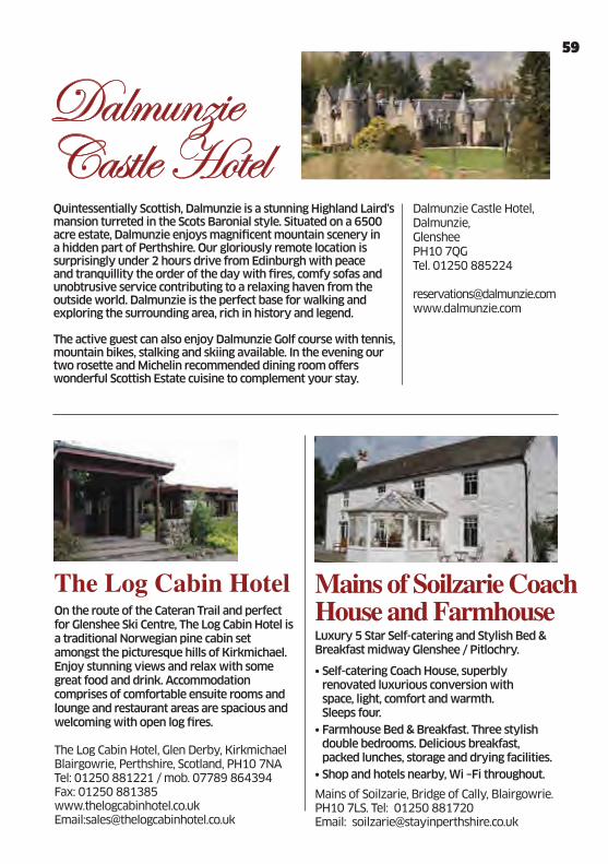
���������� ��������Quintessentially Scottish, Dalmunzie is a stunning Highland Laird’s mansion turreted in the Scots Baronial style. Situated on a 6500 acre estate, Dalmunzie enjoys magnificent mountain scenery in a hidden part of Perthshire. Our gloriously remote location is surprisingly under 2 hours drive from Edinburgh with peace and tranquillity the order of the day with fires, comfy sofas and unobtrusive service contributing to a relaxing haven from the outside world. Dalmunzie is the perfect base for walking and exploring the surrounding area, rich in history and legend. The active guest can also enjoy Dalmunzie Golf course with tennis, mountain bikes, stalking and skiing available. In the evening our two rosette and Michelin recommended dining room offers wonderful Scottish Estate cuisine to complement your stay.
Dalmunzie Castle Hotel, Dalmunzie, GlensheePH10 7QG Tel. 01250 885224
������������� ��On the route of the Cateran Trail and perfect for Glenshee Ski Centre, The Log Cabin Hotel is a traditional Norwegian pine cabin set amongst the picturesque hills of Kirkmichael. Enjoy stunning views and relax with some great food and drink. Accommodation comprises of comfortable ensuite rooms and lounge and restaurant areas are spacious and welcoming with open log fires. The Log Cabin Hotel, Glen Derby, KirkmichaelBlairgowrie, Perthshire, Scotland, PH10 7NATel: 01250 881221 / mob. 07789 864394Fax: 01250 881385www.thelogcabinhotel.co.ukEmail:[email protected]
������������������������������� �����Luxury 5 Star Self-catering and Stylish Bed & Breakfast midway Glenshee / Pitlochry.
• Self-catering Coach House, superbly renovated luxurious conversion with space, light, comfort and warmth. Sleeps four.
• Farmhouse Bed & Breakfast. Three stylish double bedrooms. Delicious breakfast, packed lunches, storage and drying facilities.
• Shop and hotels nearby, Wi –Fi throughout. Mains of Soilzarie, Bridge of Cally, Blairgowrie. PH10 7LS. Tel: 01250 881720 Email: [email protected]
59
Glenshee Tourist Assoc.pdf 59Glenshee Tourist Assoc.pdf 59 23/03/2011 11:2023/03/2011 11:20
Glenshee Tourist Assoc.pdf 60Glenshee Tourist Assoc.pdf 60 23/03/2011 11:2023/03/2011 11:20

�������������� ��22 Lifts & 38 Runs to suit all levels of skiers and boarders. FACILITES INLCUDE: Equipment Hire, Snowsports School, Shop & 3 Mountain Café’s. Opening times are 8.30 am – 5pm (7 days a week during season) Mountain Bike Track open June/SeptemberChairlift and café open during summer June/September
Cairnwell, Braemar, Aberdeenshire AB35 5XUTel No: 013397 41320 (dial 1 for snow report)Fax: 013397 41665E-mail – [email protected]: www.ski-glenshee.co.uk
������������A stone-built self catering cottage in beautiful Glenisla. The recently converted former threshing mill, originally built circa 1880, provides accommodation of the highest standard whilst retaining many original features. The accommodation includes three large bedrooms, a roomy farmhouse kitchen, a spacious sitting room and bright airy sun lounge. A bathroom and a shower room. Sleeps 6(+2).
(STB Graded 4 star)
Contact address: West Freuchies, Glenisla, Blairgowrie, Perthshire. PH11 8PG. Telephone 01575 582716. website: www.glenisla-westfreuchies.co.uk email: [email protected]
���!� ��The Bothy at the Spittal of Glenshee, offers a high standard of self-catering whilst still retaining that “home from home” feeling. Step out onto the way marked walks of the Cateran Trail or venture further on to one of the areas many Munros. Also nearby mountain biking, golf and adventure sports or simply relax and take in the spectacular scenery from the peaceful veranda. Enclosed garden. Pets welcome.
The Bothy, Spittal of Glenshee, Blairgowrie PH10 7QETel: 07903 831294Email: [email protected]: www.thebothyglenshee.co.uk
� ��������� ��������Glenshee is wild, romantic, unbelievably beautiful, steeped in history and legend.Surrounded by glens, rivers and mountains offering breathtaking views. Decked area for BBQs. Glenshee offers walking, golf, fishing, ski, extreme sports, castles, distilleries, inns etc or just relax and watch the amazing wildlife.
2 double bedrooms 1 bunk room no smoking, no pets
Mob: 07981845107Tel: 01472 501184
61
Glenshee Tourist Assoc.pdf 61Glenshee Tourist Assoc.pdf 61 23/03/2011 11:2023/03/2011 11:20
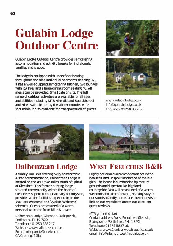
������������� � "��������������A family-run B&B offering very comfortable 4-star accommodation, Dalhenzean Lodge is located on the A93, two miles south of Spittal of Glenshee. This former hunting lodge, situated conveniently within the heart of Glenshee’s superb outdoor activity countryside, provides all the facilities expected from the ‘Walkers Welcome’ and ‘Cyclists Welcome’ schemes. Guests are assured of a warm personal welcome from Mike & Joyce.
Dalhenzean Lodge, Glenshee, Blairgowrie, Perthshire, PH10 7QDTelephone: 01250 885217Website: www.dalhenzean.co.ukEmail: [email protected] Grading: 4 Star
Highly acclaimed accommodation set in the beautiful and unspoilt landscape of the isla glen. The house is surrounded by mature grounds amid spectacular highland countryside. You will be assured of a warm welcome and a comfortable, relaxing stay in our scottish family home. Use the tripadvisor link on our website to access our excellent guest reviews.
(STB graded 4 star)Contact address: West Freuchies, Glenisla, Blairgowrie, Perthshire. PH11 8PG. Telephone 01575 582716. Website: www.Glenisla-westfreuchies.co.uk email: [email protected]
������������#� ������� ��Gulabin Lodge Outdoor Centre provides self catering accommodation and activity breaks for individuals, families and groups.
The lodge is equipped with underfloor heating throughout and nine individual bedrooms sleeping 37. It has a well-equipped self catering kitchen, two lounges with log fires and a large dining room seating 40. All meals can be provided. Small cafe on site. The full range of outdoor activities are available for all ages and abilities including MTB Hire. Ski and Board School and Hire available during the winter months. A 17 seat minibus also available for transportation of guests.
www.gulabinlodge.co.uk
Enquiries: 01250 885255
62
Glenshee Tourist Assoc.pdf 62Glenshee Tourist Assoc.pdf 62 23/03/2011 11:2023/03/2011 11:20
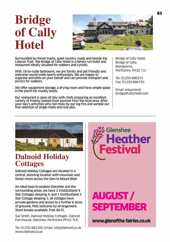
!�������������� ��Surrounded by forest tracks, quiet country roads and beside the Cateran Trail, the Bridge of Cally Hotel is a family run hotel and restaurant ideally situated for walkers and cyclists.
With 18 en-suite bedrooms, we are family and pet friendly and welcome countryside sports enthusiasts. We are happy to organise activities on your behalf and can provide transport and picnics for walkers.
We offer equipment storage, a drying room and have ample space in the porch for muddy boots.
Our restaurant is open all day with chefs preparing an excellent variety of freshly cooked food sourced from the local area. After your day’s activities why not relax by our log fire and sample our fine selection of single malts and real ales.
Bridge of Cally Hotel,Bridge of Cally, Blairgowrie, Perthshire. PH10 7JJ
Tel: 01250 886231 Fax: 01250 886793
Email: [email protected]
"��������������� ����Dalnoid Holiday Cottages are situated in a central, stunning location with mountain and forest views across the Glen to Mount Blair. An ideal base to explore Glenshee and the surrounding areas, we have 2 VisitScotland 4 Star Cottages sleeping 4, and 1 VisitScotland 3 Star Cottage sleeping 3, all cottages have private gardens and access to a further 6 acres of grounds. Pets welcome by arrangement. Short breaks available. Free Wi-Fi.
Sue Smith, Dalnoid Holiday Cottages, Dalnoid Farmhouse, Glenshee, Perthshire PH10 7LR Tel. 01250 882200, Email. [email protected]
www.glenofthe fairies.co.uk
Glenshee
AUGUST / SEPTEMBER
63
Glenshee Tourist Assoc.pdf 63Glenshee Tourist Assoc.pdf 63 23/03/2011 11:2023/03/2011 11:20
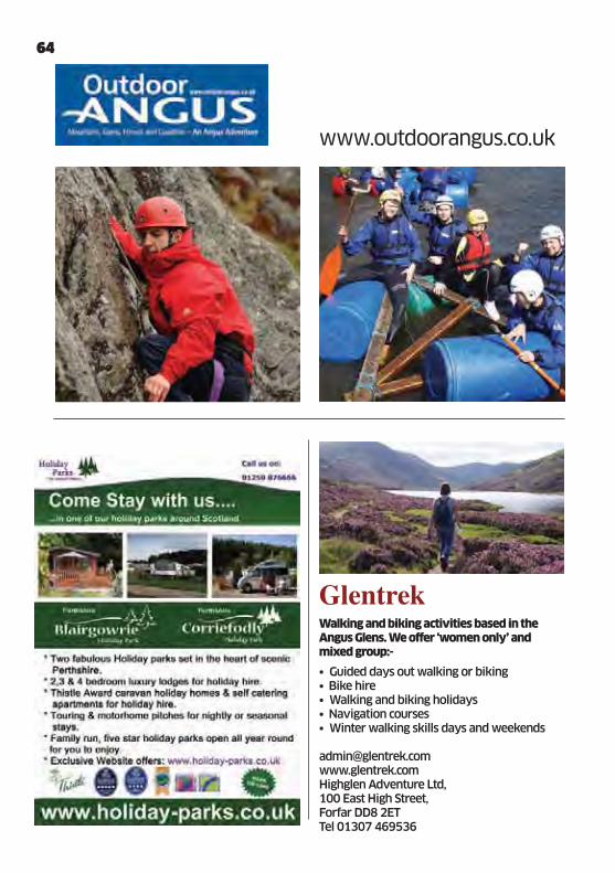
���� ���Walking and biking activities based in the Angus Glens. We offer ‘women only’ and mixed group:-
• Guided days out walking or biking• Bike hire• Walking and biking holidays• Navigation courses• Winter walking skills days and weekends
[email protected] www.glentrek.comHighglen Adventure Ltd, 100 East High Street, Forfar DD8 2ET Tel 01307 469536
64
www.outdoorangus.co.uk
Glenshee Tourist Assoc.pdf 64Glenshee Tourist Assoc.pdf 64 23/03/2011 11:2023/03/2011 11:20
��������� �����������
��������� ������������ ���������������������
�����������������������������
����������������� ����������
���� ���������������
������ !"��#��$��%
Long distance trails throughout Southern Cairngorms, Perthshire and Angus, including the Cateran Trail, Monega Path, Jock’s Road, Lairig Ghru. Hill Skill Training in summer and winter. National Navigation Awards.Wild Camping.
Email: [email protected]: www.nscdesign.com
Balmacron FarmhouseMeiglePerthshirePH12 8TD01828 640763
������������ �������������������������������������
����������� ��������� �����
����� ����� ������������ �������
������ �� �� ������ �
�������������������������������
������ �������������� ��
������������������
������������������������������ ������
������������ !�"�����������
!���������� �����������������������
��������
#$���������"�������"������
�������
������������ ���������������
��������
��������������������� ��������!����
��������������� ������!"
#���������$%��&&%$�'
"�������"���������"����������������� ����
65
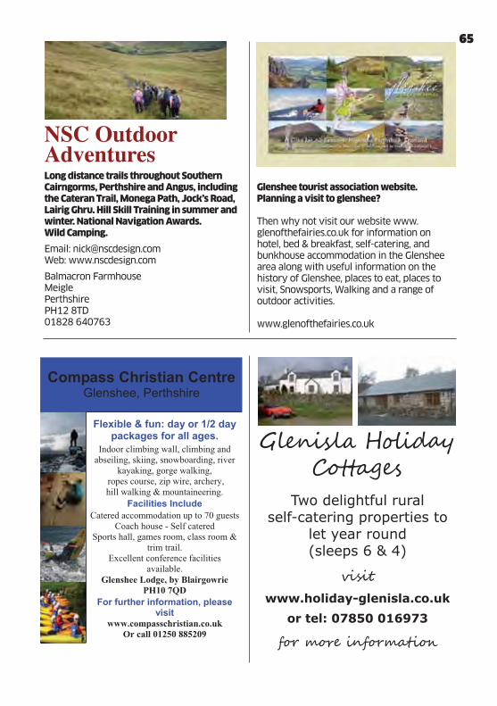
Glenshee tourist association website. Planning a visit to glenshee?
Then why not visit our website www.glenofthefairies.co.uk for information on hotel, bed & breakfast, self-catering, and bunkhouse accommodation in the Glenshee area along with useful information on the history of Glenshee, places to eat, places to visit, Snowsports, Walking and a range of outdoor activities.
www.glenofthefairies.co.uk
$��#� ����%���� ����
Glenshee Tourist Assoc.pdf 65Glenshee Tourist Assoc.pdf 65 23/03/2011 11:2023/03/2011 11:20

&'(������� ������ �)��� ������(��������&�� ��� ������
Tucked into the Highland hills, the Gateway to the Cairngorms, but only about 90 minutes’ drive from Edinburgh or Glasgow. For scenery like ours you might have thought you’d have to drive a lot further!
Make your base with us and you’re within easy reach of just about anything you’d want to do in Scotland, in countryside or town, in the mountains on the doorstep or even by the sea, as the unspoilt Angus coastline is less than an hour’s drive.
We like to think East Perthshire ticks a lot of boxes for the ideal Scottish break –
especially if it involves unwinding, recharging and enjoying the breeze on the heather and the panorama of soaring hill-slopes. But, if you want to get active, walk and climb, golf, fish or cycle, ski, visit historic places like Glamis Castle or the family attractions in Dundee, shop or discover the gourmet delights – there’s something for everyone.
Simply the ideal centre for a Scottish holiday.
Visit www.visiteastperthshire.co.uk for further details about what East Perthshire has to offer you.
66
Glenshee Tourist Assoc.pdf 66Glenshee Tourist Assoc.pdf 66 23/03/2011 11:2023/03/2011 11:20

GLENSHEE HEATHER FESTIVAL The Glenshee Heather Festival is an annual event which takes place throughout the Glenshee area during the last 2 weeks in August and into early September when the hills and the moors are ablaze with the purple flowering heather.
The Heather Festival covers a wide range of events and activities including Craft and Local Produce Markets, Highland Games, a Beer Festival, Ceilidhs, Guided Walks and Mountain Bike Rides, Activity Days, Heather Honey Cream Teas and a Classic Car Rally. Check out www.glenofthefairies.co.uk for the latest event programme.
Glenshee
GLENSHEE TOURIST ASSOCIATION WEBSITE Planning a visit to Glenshee? Then why not visit our website www.glenofthefairies.co.uk for information on hotel, bed & breakfast, self-catering, and bunkhouse accommodation in the Glenshee area along with useful information on the history of Glenshee, places to eat, places to visit, Snowsports, Walking and a range of outdoor activities.www.glenofthefairies.co.uk
Glenshee Tourist Assoc.pdf 67Glenshee Tourist Assoc.pdf 67 23/03/2011 11:2023/03/2011 11:20
Glenshee Pottery & Visitor Centre
WildlifeThe Cairngorms National Park is home to 25% of the UK’s threatened bird, animal and plant species. Glenshee and the neighbouring glens support a wide range of wildlife.
Myths & Legends of Glenshee & StrathardleMyths and Legends abound, originating in the mists of time, but kept alive through the generations and still remembered to this day!
History & HeritageGlenshee is unique ,it carries the highest of the passes to the North reaching 2,199 feet at the summit above Devil’s Elbow. The history and legends of the area is epitomised by the dramatic landscape – the raids by cattle thieves in the 16th century ,the building of military roads and the evolution of tourism in the early 20th century.
Once in Glenshee why not pay a visit to the Glenshee Pottery and Visitor Centre, on the A93 and the Gateway to the Cairngorms National Park. The centre is open from the 1st April until Christmas, 10am – 5pm daily. The visitor centre provides a range of information on the Glenshee area including myths and legends of the Glen, history and heritage, The Cateran Trail, walking and outdoor activities, wildlife and accommodation.
As well as a good selection of free visitor information, the visitor centre also retails useful local maps and guidebooks along with an internet terminal to catch up on emails!
The Glenshee Pottery has a wide range of local pottery, crafts and gifts as well as ‘paint a pot’ for youngsters and the young at heart!
Located at Glenshee Pottery, Glenshee, Blairgowrie PH10 7LP Tel. 01250 882238
Glenshee Tourist Assoc.pdf 68Glenshee Tourist Assoc.pdf 68 23/03/2011 11:2023/03/2011 11:20