historical landscape reconstruction and...
TRANSCRIPT
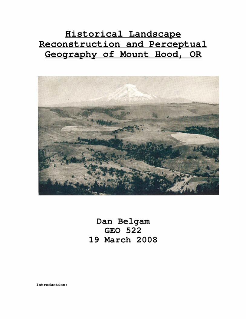
Historical Landscape Reconstruction and Perceptual Geography of Mount Hood, OR
Dan Belgam GEO 522
19 March 2008 Introduction:
2
People and their environments are inexorably linked to one
another. Human activity and land use is the result of external
environmental forcing and internal interpretation and application of
ideals and experience to create perceptions (Amadeo and Golledge 135-
36). Such perceptions dictate the activities and interactions occurring
at the interface between humans and environment, the landscape. Humans
are intensely complex and their actions are hard to predict and often
irrational; however, the study of perceptual geography can lend insight
into the reasoning behind choices of land use. Evidence for the pattern
of land use over time can be extracted from a landscape after employing
the concept of sequent occupancy, which involves analyzing the
successive occupation of an area by different peoples and cultures and
assessing this influence on the landscape (Holt-Jensen, 1999). Once a
timeline is established and sources of evidence secured, it is important
to delve into the cultural and societal perceptions of the landscape to
address the questions of why the landscape was manipulated or utilized
in a certain manner. The perceptions of a culture towards a landscape
provide proper context, specific insight, and act as a guide when
reconstructing the past landscapes of Mount Hood.
Methodology and Source Material:
The landscape surrounding Mount Hood was reconstructed and
analyzed based on a classification of prevailing perceptions to
determine how decisions of land use practices, influenced by
perceptions, have produced the landscape. Two methods were used in an
attempt to discern various perceptions of the landscape through time.
First, primary sources and commentary on these sources were used to gain
an understanding of general attitude, which could be verified through an
examination of land use at that time. Secondly, perceptions were
inferred through land use activities. Attempts were made to establish
the perceptions of the general population that were relevant to physical

3
use and alteration of the landscape occurring on Mount Hood. The
categorized perceptions sometimes overlap or occur concurrently, but are
all included and analyzed separately in the analysis, as they are each
major contributors in the shaping of the landscape. Over time, these
perceptions may also fade in intensity and pervasiveness, fluctuating
between popular beliefs of the masses to more restricted ideas of a
local population. The analysis of land use attempted to focus on the
introduction of each general perception and the landscape influence at
the height of popularity.
A variety of source material was used to approach the task of
reconstructing past landscapes, each with their respective advantages
and drawbacks. Period source material for pre-European influence Oregon
often takes the form of archaeologically recovered artifacts or
transcribed oral histories. These oral histories often incorporate both
myth and fact into their testimony as Balch observes in Bridge of the
Gods: “Among a superstitious race, every fact becomes mingled more or
less with fable; every occurrence, charged with fantastic meanings.”
When evaluating such sources, one is charged with the task of sifting
through the material and maintaining an open mind during interpretation,
analyzing all details closely in an attempt to draw out evidence of past
landscapes and the influence of human activity. Oral histories could be
influenced by cultural changes over time and it is important to attempt
to preserve the attitudes of the culture within the testimony to better
appreciate the symbolism of a landscape (Leffler and Brent, 1992 and
Meinig, 1979). Some of the material used in this analysis are second
hand sources, and have already gone through prior interpretation, which
must be considered and appreciated when conducting further analysis.
Records of this type can be biased by egocentric and ethno-ecological
ideas and so it is wise to compare material from a variety of sources to
uncover and provide a fair representation of the processes and parties
responsible for historical landscape change (Cronon, 1983). The written

4
record extending from the time of European contact may be considered
more reliable in terms of its authenticity and accuracy, but additional
measures should be referenced as an evaluation of bias. A vivid
reconstruction displaying transitions over time can also be established
by combining photographs with other sources of data. Analysis through
comprehensive acceptance and integration of various source materials is
necessary for a complete reconstruction of a landscape, since “all
evidence needs to be corroborated before it can be more than a
tantalizing suggestion of conditions in the past” (Russell, 1997).
Geographic setting
As the external agent influencing perceptions and defining land
use options and potential resources, it is necessary to provide a proper
description and background of the environmental features associated with
Mount Hood. This stratovolcano is located approximately 160 km from the
Pacific Ocean within the Cascade Range in northern Oregon, 45°22’24.3”
latitude and 121°42’49.6” longitude (Lillquist and Walker, 2006). The
local topography allows an unobstructed view of the mountain from all
directions, an unusual feature that accentuates the strength and majesty
cast by the mountain (Atkeson, 1977). The high visibility and solitary
setting create a visual illusion, exaggerating the mountain’s height,
which led to supposed overestimation in mountain elevation of several
thousand feet by early settlers (Atkenson, 1977). More accurate early
measurement techniques, such as barometer use, were applied in the late
19th century to obtain more accurate figures (Gannett, 1896).
The basal area at a 4000-foot elevation is approximately 80 miles
(American Guide Series, 1940). Mount Hood is situated on the border of
Oregon and Washington along the Columbia River Gorge, the major
transportation route of the area into the 20th century. The Pliocene
epoch was the major period of mountain building, while subsequent

5
outpourings of lava and erosion and weathering have continued to shape
the mountain (American Guide Series, 1940). The volcano is currently
considered dormant, though small-scale fumaroles and gas vent activity
occurred into the mid 19th century (Topinka, 2008). This activity can
also impact the landscape, for example, a portion of forest known as
Ghost Forest was reduced by such volcanic activity in the beginning of
the 19th century leaving behind deposits of ash (Lawrence, 1945). Tree
ring analysis was conducted to determine the year of the event
(Lawrence, 1945). In addition to volcanism, the landscape has been
shaped by glacial activity. Currently eleven glaciers cover the
mountain (Lillquist and Walker, 2006), while six rivers and two score
creeks divert melt water from the glacier (American Guide Series, 1940).
Reverence
Although heavily reliant upon oral tradition, some aspects of
Native American society were recorded to preserve the culture and belief
systems. Much of the initial literature focuses on myths and
creationist stories of the mountain and surrounding landscape. Various
local tribes in the area, such as Clackamas, Klickitat, Tygh, Mollala,
Wasco, and Paiute Indians, produced different myths as mechanisms to
provide meaning to the environment before them (Atkeson, 1977). Similar
details often arise in the analysis of these legends; a love story
involving the personification of multiple mountain peaks, with a great
warrior god, referred to as Wy’east, Sal-leks, or De-aubs, entombed
within Mount Hood after death (Atkeson, 1977). The volcanic nature of
the mountain is thus explained by the fierce warrior within. These myths
describe a land viewed with awe and reverence, with a spiritual and
sacred perception projected onto the mountains.
Land use on the mountain during the period of pre-European contact
was restricted to small-scale burnings to improve the productive
capabilities and secure food from the natural bounty. Mount Hood was

6
used as a landmark for gatherings and local populations established
trails along the foothills of the mountain during the treks of various
tribes to gathering sites along the Columbia River (Balch, 1940). The
Columbia Gorge offered transportation, ample supply of local goods, and
a central location for trade opportunities. Other direct influences on
the mountain were negligible, allowing natural disturbance cycles to
dominate the landscape. This respect and admiration for the mountain
continued into the period of initial European contact.
Respect
The first recorded European sighting of Mount Hood is attributed
to Lieutenant William Broughton of the Vancouver Expedition in 1792
(Grauer, 1975). An exploratory party lead by Broughton, referencing
maps of the inlet produced by Captain Robert Gray, proceeded up the
Columbia River with the goal of producing a more detailed description of
the inlet and surrounding landscape (Mockford, 2003). Landforms and
prominent features were named and general descriptions recorded.
Broughton named the mountain in honor of famed British naval officer
Lord Samuel Hood (1762-1814) (Mockford, 2003). Lewis and Clark noted in
1805 that the mountain had been referred to as Falls Mountain or Timm
Mountain, where Timm was a Native American name referring “to the falls
area in the river just above the site of the Dalles” (Grauer, 1975).
William Clark also noted that this feature was “the mountain was the
Mount Hood of Vancouver” (Grauer, 1975). The name quickly gained
acceptance and has subsequently been referred to as Mount Hood. The
mountain captivated early 19th century visitors to Fort Vancouver,
established by the Hudson’s Bay Company, who shared the admiration and
respect of the mountain attributed by Native Americans. These
sentiments are borne out of journal entries, such those by botanist
David Douglas in 1825, describing the mountain as “insurmountable” and
Captain Nathaniel J. Wyeth in 1832, referencing the “large, snowy

7
mountain…a more stupendous pile than any of the Rocky Mountains”
(Grauer, 1975).
Mount Hood continued to be dominated by natural factors, as direct
contact with the mountain under this perceptional classification was
quite limited. The mountain was observed from afar, since no monetary
value was ascribed to the mountain. Interest during this period was
focused on the Columbia River and its development, with Mount Hood
relatively ignored aside from its aesthetic appeal. The perception in
this era of appreciation for the spectacle of nature’s majesty was
transformed into an attitude in which the mountain was regarded as a
barrier to westward movement to an increasing population.
Obstacle
As manifest destiny gripped the nation, an ever-increasing number
of eager settlers sought new land and a new beginning in the untamed
wilderness. Routes of travel followed major river systems and where
navigable, the Columbia River became heavily utilized. Rapids in the
river required portaging and the rough terrain associated with the gorge
necessitated the development of alternative routes and networks for safe
travel. The prospect of a new route was further complicated by the
presence of the Cascade mountain range, which proved to be a substantial
obstacle to westward migration. The challenge of establishing a new
path was met by a convoy including the Barlow and Palmer parties. The
two families met at the Dalles in 1845 and quickly united under the
common need for a way across the Cascades (Grauer, 1975). While
exploring potential pathways, William Barlow recorded observations
potentially described a volcanically induced event where a “Torrent of
water carrying sand down from the mountain, the glacial area and the
cliffs near the summit of Mt. Hood. Very significantly he mentioned the

8
grove of dead trees in the bottom that had been killed by water-carried
sand being deposited around them”(Grauer, 1975). Sightings providing
evidence of the raw power and ability of the mountain to alter
landscapes, combined with a few near mishaps amid glacier fields,
generated a renewed sense of appreciation for the dangers produced by
the mountain (Grauer, 1975). The team decided to form a southern route
around Mount Hood, along what is presently Highway 26. Although another
trail, established by cattle drovers, led out of Hood River and followed
the Lolo Pass northwest of the mountain, the Barlow Road became popular
enough to be taken advantage of as a toll road (Grauer, 1975). The
exact route as well as the ownership and location of the gate have
changed over time, but the toll road remained in operation for
approximately 70 years (Grauer, 1975). A few small settlements
developed along the toll road, most notably Government Camp, whose name
arose from the remains of an overburdened wagon train left behind during
the passage under Lieutenant William Frost in 1849 (Rogers). The town
was also referred to as Pompeii, visible on Metzger’s Atlases into the
1950’s, however the name Government Camp gained favor and primary usage
when describing the town (Metzger’s Atlas Clackamas County 1937, 1951,
1966).
Over the decades following the establishment of the Barlow Toll Road,
the mountain had been summited by a few daring individuals, however, the
public perception of the mountain retained a wariness and awe of its raw
nature and towering presence. The transportation network may have
slightly reduced the intimidation factor of the mountain, granting a
slight feeling of control over the mountain. The consequence of
increased attention and population influx to the area was a larger human
influence on the natural landscape. Humans began clearing vegetation
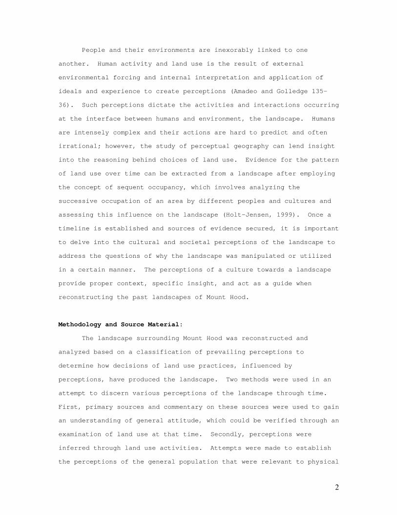
for trail and road construction, though on a much smaller scale than
subsequent development (Figure 1). The potential for invasive species
introduction was also increased as a result of rising populations.
9
Manipulating the landscape by humans was increased, yet the use of land
specific to the mountain was still limited in scale as few homesteaders
selected alpine plots.
Figure 1: Mount Hood Loop (Grauer, 1975)
Exploration
Mount Hood with constant vigilance over the now developing city of
Portland acted to arouse curiosity, attention, interest and a sense of
adventure within certain citizens to tread into unknown territory.
Groups of outdoor activists came together, surrounding their desire to
explore their stoic neighbor in greater depth. One of the initial
groups in this movement was the Oregon Alpine Club, which held its first
meeting in 1887 (Grauer, 1975). Group interest seemed to wane in 1891,
however, and the group soon dissolved. Three years later, some past
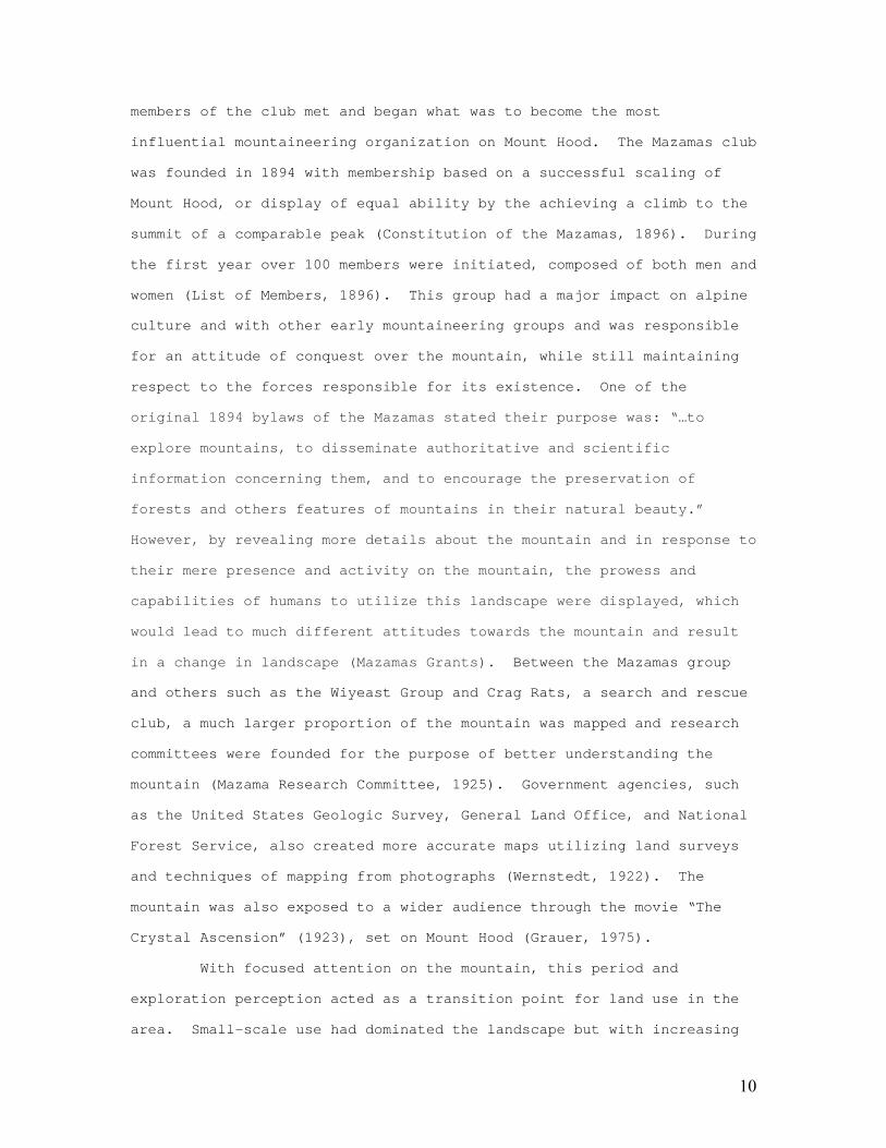
10
members of the club met and began what was to become the most
influential mountaineering organization on Mount Hood. The Mazamas club
was founded in 1894 with membership based on a successful scaling of
Mount Hood, or display of equal ability by the achieving a climb to the
summit of a comparable peak (Constitution of the Mazamas, 1896). During
the first year over 100 members were initiated, composed of both men and
women (List of Members, 1896). This group had a major impact on alpine
culture and with other early mountaineering groups and was responsible
for an attitude of conquest over the mountain, while still maintaining
respect to the forces responsible for its existence. One of the
original 1894 bylaws of the Mazamas stated their purpose was: “…to
explore mountains, to disseminate authoritative and scientific
information concerning them, and to encourage the preservation of
forests and others features of mountains in their natural beauty.”
However, by revealing more details about the mountain and in response to
their mere presence and activity on the mountain, the prowess and
capabilities of humans to utilize this landscape were displayed, which
would lead to much different attitudes towards the mountain and result
in a change in landscape (Mazamas Grants). Between the Mazamas group
and others such as the Wiyeast Group and Crag Rats, a search and rescue
club, a much larger proportion of the mountain was mapped and research
committees were founded for the purpose of better understanding the
mountain (Mazama Research Committee, 1925). Government agencies, such
as the United States Geologic Survey, General Land Office, and National
Forest Service, also created more accurate maps utilizing land surveys
and techniques of mapping from photographs (Wernstedt, 1922). The
mountain was also exposed to a wider audience through the movie “The
Crystal Ascension” (1923), set on Mount Hood (Grauer, 1975).
With focused attention on the mountain, this period and
exploration perception acted as a transition point for land use in the
area. Small-scale use had dominated the landscape but with increasing

11
access through trails and improved mapping, the mountain was in effect
demystified, leaving it vulnerable to more permanent settlement as well
as development and increased tourism. These new land uses would
influence the landscape to an extent not yet experienced, both in terms
of the intensity of change as well as the scale.
Livelihood
The first stage in the progression from an environmental
determinist perception to a possibilist ideology occurred as a result of
human needs dictating land use. In order to survive and thrive in an
environment under a capitalistic doctrine, a source of revenue is
required to secure food, shelter and other basic needs. One of the
first sources of income for this area was through grazing. Evidence of
this activity is recorded in journals and publications, where it is
mentioned that sheep were often encountered on various parts of the
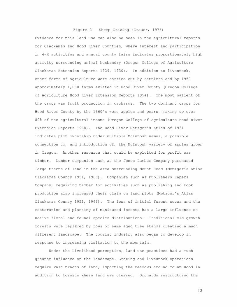
mountain by climbers (Lee, 1921).
12
Figure 2: Sheep Grazing (Grauer, 1975)
Evidence for this land use can also be seen in the agricultural reports
for Clackamas and Hood River Counties, where interest and participation
in 4-H activities and annual county fairs indicates proportionately high
activity surrounding animal husbandry (Oregon College of Agriculture
Clackamas Extension Reports 1929, 1930). In addition to livestock,
other forms of agriculture were carried out by settlers and by 1950
approximately 1,030 farms existed in Hood River County (Oregon College
of Agriculture Hood River Extension Reports 1954). The most salient of
the crops was fruit production in orchards. The two dominant crops for
Hood River County by the 1960’s were apples and pears, making up over
80% of the agricultural income (Oregon College of Agriculture Hood River
Extension Reports 1968). The Hood River Metzger’s Atlas of 1931
indicates plot ownership under multiple McIntosh names, a possible
connection to, and introduction of, the McIntosh variety of apples grown
in Oregon. Another resource that could be exploited for profit was
timber. Lumber companies such as the Jones Lumber Company purchased
large tracts of land in the area surrounding Mount Hood (Metzger’s Atlas
Clackamas County 1951, 1966). Companies such as Publishers Papers
Company, requiring timber for activities such as publishing and book
production also increased their claim on land plots (Metzger’s Atlas
Clackamas County 1951, 1966). The loss of initial forest cover and the
restoration and planting of manicured forests has a large influence on
native floral and faunal species distributions. Traditional old growth
forests were replaced by rows of same aged tree stands creating a much
different landscape. The tourist industry also began to develop in
response to increasing visitation to the mountain.
Under the Livelihood perception, land use practices had a much
greater influence on the landscape. Grazing and livestock operations
require vast tracts of land, impacting the meadows around Mount Hood in
addition to forests where land was cleared. Orchards restructured the

13
landscape as well, through forest clearing, soil agitation, and water
system alteration by irrigation. Attempts were soon made to optimize
profits from agriculture and other sources of livelihood discussed
above, once a sufficient baseline income was established. Agriculture
and lumber farms spread across the landscape and while these activities
had a much greater impact spatially surrounding the mountain, it was the
tourism industry, which would more intensely change the landscape of
Mount Hood itself. The tourist industry relied on the development of
towns and accommodations that would attract and provide ease of access
for tourists. Houses and lodges were constructed beginning with the
Cloud Cap Inn in 1889 (Grauer, 1975). In addition to accommodations,
roads were required and sight seeing opportunities and activities needed
to be developed.
Economic Development
The land use trends under the perception of livelihood continued
as the question of how humans could use what was provided by the
landscape for their needs was transformed into how humans could shape
the landscape to suit their wants. Along the transportation networks,
towns and villages began as stopovers for long trips or as final
destinations for weary pioneers. The development of an improved road
network surrounding Mount Hood connected early towns such as
Rhododendron, Government Camp, and Hood River to one another and
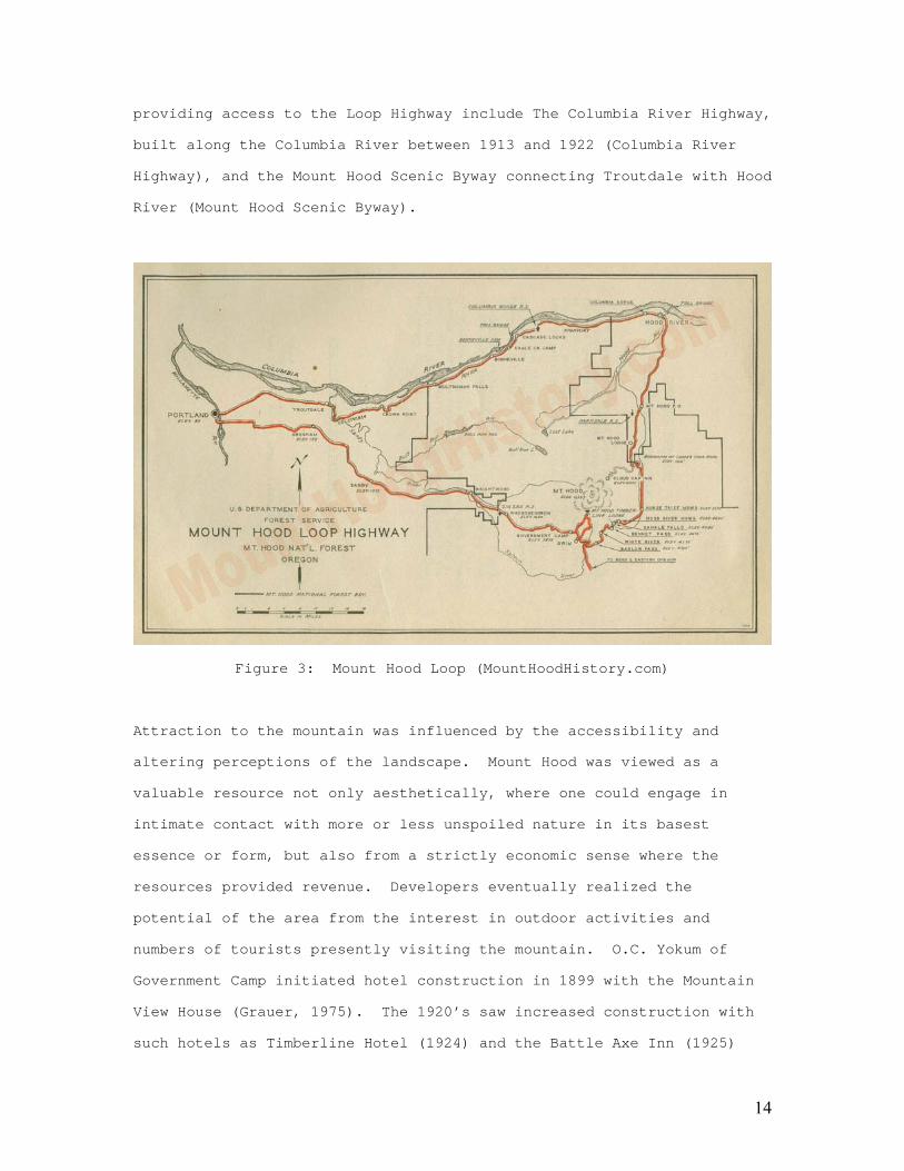
facilitated growth. This network included the Mount Hood Highway from
Portland to Hood River that opened in 1915, a paved road joining road
Government Camp to Portland completed in 1919, and a road from Hood
River over Bennett and Barlow Passes to Government Camp, which completed
the Loop Highway around the base of Mount Hood in 1925 (Figure 3)
(Atkeson, 1977). The Lolo Pass Route opened in 1954 among other
ancillary links in the network (Grauer, 1975). Other major roadways
14
providing access to the Loop Highway include The Columbia River Highway,
built along the Columbia River between 1913 and 1922 (Columbia River
Highway), and the Mount Hood Scenic Byway connecting Troutdale with Hood
River (Mount Hood Scenic Byway).
Figure 3: Mount Hood Loop (MountHoodHistory.com)
Attraction to the mountain was influenced by the accessibility and
altering perceptions of the landscape. Mount Hood was viewed as a
valuable resource not only aesthetically, where one could engage in
intimate contact with more or less unspoiled nature in its basest
essence or form, but also from a strictly economic sense where the
resources provided revenue. Developers eventually realized the
potential of the area from the interest in outdoor activities and
numbers of tourists presently visiting the mountain. O.C. Yokum of
Government Camp initiated hotel construction in 1899 with the Mountain
View House (Grauer, 1975). The 1920’s saw increased construction with
such hotels as Timberline Hotel (1924) and the Battle Axe Inn (1925)

15
(Grauer, 1975). Unfortunately, the Mountain View House and Battle Axe
Inn were destroyed by fires in the 1950’s (The Magic of Mount Hood).
Hood River also saw a chance for development as ski facilities arose
that continued into the 1970’s; discussed in the Hood River Agricultural
Report 1970:
The ski development at Mt. Hood Meadows and the improvement of Highway
35 has brought an influx of ski enthusiasts to the area. Hood River
County is expanding and improving county park facilities to
accommodate a greater number of tourists… Tourism is expected to be a
major contributor to the economy of the county in the years ahead.
Winter recreational activities, especially skiing, were major
draws to the region. The first ski facilities, including the still
operational Summit (1927), developed on Mount Hood with an interest in
ski jumping (Grauer, 1975). Ski jumping required few runs and had less
of an impact on the landscape when compared with modern ski hills.
Multorpor and Ski Bowl, now a single ski area, developed in the years
following the establishment of Summit, with continued interest in jump
hills. Ski clubs soon arose, such as Mount Hood Ski Club, Cascade Ski
Club, Viking Ski Club, and the Cascadians, who began holding
competitions (Grauer, 1975). The activity at the ski areas attracted
tourists, and the ski areas began adding ski runs and chairlifts along
with lodges to accommodate the influx. The potential for economic
development was not only locally acknowledged, but also at the national
scale. As part of the national economic relief programs established by
Franklin Delano Roosevelt during the Great Depression, the construction
of Timberline Lodge became a project for the Works Progress
Administration (WPA), as it was known at the time. The lodge,
constructed in a unique Cascadian Architectural Style, was dedicated by
Roosevelt on September 28, 1937 (Grauer, 1975). The construction of
Mount Hood Meadows on the eastern slope and Cooper Spur on the north

16
face of the mountain greatly opened up the mountain. The ski industry
on Mount Hood became very successful and continues to thrive today.
Under the economic development perception, road construction
vastly altered the native landscape, both in terms of its physical
construction and the influence it had of attracting additional
development. The construction of hotels, ski facilities, parking lots,
chair lifts, and manicured runs changed the face of the mountain leaving
indelible marks of human influence. The totality of exploitation,
however, was partially impeded by the creation of Mount Hood National
Forest.
Preservation
Although locally acknowledged by some, the movement utilizing the
perception of preservation towards natural landscape was imposed upon
the local landscape from a distant but powerful source, the National
Government. The first parcel of land divvied up and set aside for
preservation was the Bull Run Timberland Reserve in 1892 by President
Harrison, allocating a pristine water source for the growing city of
Portland, which fervently protected its water source (Grauer, 1975). In
1893 President Grover Cleveland established the Cascade Range Forest
Reserve, including most of the Cascade Range (Grauer, 1975). The
reserve was divided into north and south sections and operated under the
General Land Office. In 1907 the Cascade Range Forest Reserve name was
shortened to the Cascade Forest Reserve and in 1908 it was broken into
several national forests where Mount Hood was included into the Oregon
National Forest (Grauer, 1975). An executive order resulted in a
renaming of the forest to the Mount Hood National Forest. In 1940
regional forester Lyle F. Watts announced a change in designation from
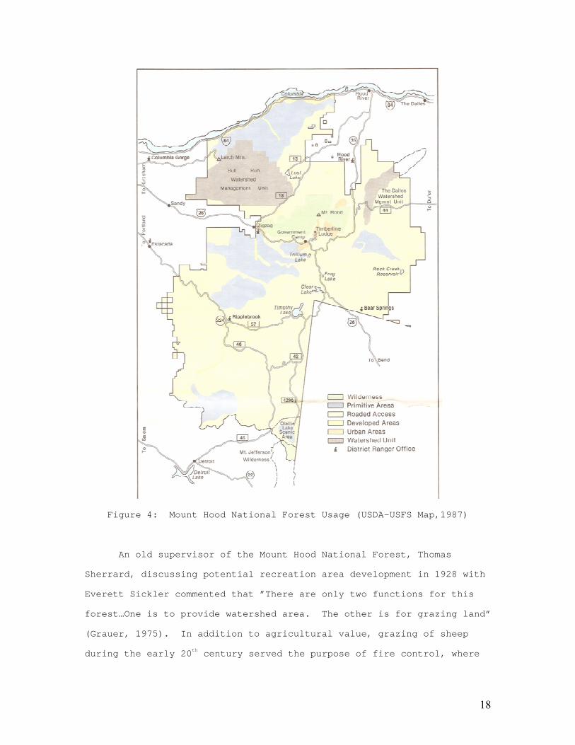
primitive area to a wild area for 14,800 acres around Mount Hood (Figure
4) (Grauer, 1975). In these areas no roads, timber cutting or business
was allowed, only recreation such as hunting, fishing, or skiing, with a

17
small area excluded for road to Cloud Cap Inn. In 1964 the wilderness
act was passed establishing the national wilderness preservation system
to manage wilderness areas, and defined the term wilderness in such a
manner: “A wilderness, in contrast with those areas where man and his
works dominate the landscape, is hereby recognized as an area where the
Earth and its community of life are untrammeled by man, where man
himself is a visitor who does not remain” (USDA Mount Hood Wilderness
Map, 1983).
18
Figure 4: Mount Hood National Forest Usage (USDA-USFS Map,1987)
An old supervisor of the Mount Hood National Forest, Thomas
Sherrard, discussing potential recreation area development in 1928 with
Everett Sickler commented that ”There are only two functions for this
forest…One is to provide watershed area. The other is for grazing land”
(Grauer, 1975). In addition to agricultural value, grazing of sheep
during the early 20th century served the purpose of fire control, where

19
it was believed that sheep would have the influence of keeping fires
from starting, keeping fires from spreading, and rendering fires less
destructive (Rachford, 1923). The preservation perception extended to
fire management as well. A fire lookout station was created in 1915 on
the summit as part of the firefinder system for fire observation and in
1916, Timberline Cabin was built for the U.S. Forest Service (Grauer,
1975).
The perception of preservation limited development and human
influence on the landscape of Mount Hood. Activities were only allowed
in specific areas giving the landscape a somewhat parceled appearance.
The wilderness area secured sections of forest that would be protected
and kept in as natural a state as possible. The system of fire
management altered natural processes and forest stand evolution,
producing a landscape managed and controlled by humans.
Research
A cultural transition towards education about environmental trends
and the influence of anthropogenic activities then occurred. The
discipline of glacial studies gained attention for the capacity of
glaciers to reflect climatic conditions. Mount Hood proved to be an
important site for such studies due to the long period of measurements,
initially begun by the Mazamas research group in 1925, and historical
photographs enabling measurements through rephotography (Mazamas
Research Committee, 1925 and Lillquist and Walker, 2006). Efforts to
determine the influence and relationship between climate and snow pack
have also been conducted on Mount Hood, while Mazama research has
compared data between weather stations in an attempt to produce better
spatial resolution for research (Heller 1963). Research on Mount Hood
extends well beyond cryosphere, reflecting interests to all landscape
components impacted by humans, such as meadow invasion by trees
(Franklin et. al 1971), impact of ski slopes of vegetation (Titus and
20
Tsuyuzaki, 1999), and forest management (Dane, Meador, and White, 1977).
The Mazamas organization has continued to make research a high priority,
offering scholarships to relevant studies in addition to their own
research.
The perception associated with research focused attention towards
the mountain. In addition to specialized publications, general trends
and results from research were sometimes conveyed in newspaper articles,
attempting to draw awareness to changing landscape in hopes for action
to stabilize and protect the landscape. The research methods themselves
had little impact on the landscape; however, the potential change in
land use resulting from the research may be very considerable in the
future.
Conclusion
Perceptions are a product of the belief systems and cultural
attitudes of a modern society and are therefore subject to change as
time progresses. A variety of source material can be used to reconstruct
historical landscapes and trace such land use evolution over time. The
general land use trends surrounding Mount Hood can be classified based
on the following perceptions: Reverence, Respect, Obstacle,
Exploration, Livelihood, Economic Development, Preservation, and
Research. Multiple perceptions and attitudes can occur during the same
time period or overlap in their transitions, impacting the landscape to
different degrees. Specific activities and their associated land use
practices are a direct result of the general perceptions of Mount Hood
and dictated how the landscape is viewed. The scale of human impact
depends not only on the land use practice but also on the popularity and
number of people ascribing to a perception. Popular movements, attitudes
of the time, wants, and needs will shape public perception and it is the
adoption or dismissal of these general public perceptions that in turn
influences the trends of land use. Local perception has a dramatic
21
influence and has been a dominant forcing mechanism, while outside
influence such as the National Government can mandate specific uses,
imposing a specific perception. The variations in perception of Mount
Hood have resulted in drastic changes to the landscape surrounding the
mountain over the period of recorded history, the impact of which can
only be fully appreciated after a complete reconstruction of the
historic landscape.
Bibliography Amadeo, Douglas M. and Golledge, Reginald G. “Environmental Perception
and Behavioral Geography.” Geography in America at the Dawn of the 21st Century.” Ed. Gaile, Gary L. and Willmott, Cort J. Oxford University Press. New York. p. 133-148. 2003.
American Guide Series. “Mount Hood: A Guide”. Compiled by Workers of the Writer’s Program of the Work Projects Administration in the State of Oregon. Oregon State Board control copyright 1940. Printed in US by J.J. Little and Ives Company, NY. 1940.

22
Balch, F.H. The Bridge of the Gods: A Romance of Indian Oregon.
Binfords & Mort Publishers. Portland, OR. Printed by Metropolitan Press. Copyright of A.C. McClurg & Co. 1940.
“Columbia River Highway”. Wikipedia. Last Updated 22 February 2008. Accessed 15 March 2008. http://en.wikipedia.org/wiki/Historic_Columbia_River_Highway “Constitution of the Mazamas.” Mazama. Vol. 1. No. 1. p. 127. 1896. Cronon, William. Changes in the Land: Indians, Colonists, and the Ecology of New England. Hill and Wang. New York. 1983. Dane, C.W., Meador, Nancy C., and White, John B. “Goal Programming in
Land-Use Planning.” Journal Forestry. Vol. 75. No. 6, p. 325- 329. 1 June 1977.
Franklin, Jerry F., Moir, William H., Douglas, George W., Wiberb, Curt.
“Invasion of Subalpine Meadows by Trees in the Cascade Range, Washington and Oregon.” Arctic and Alpine Research. Vol. 3., No. 3. p. 215-224. 1971.
Gannett, Henry. “The Measurement of Altitudes.” Mazama. Vol. 1.,
No. 1. p. 243-266. 1896. Grauer, Jack. Mount Hood: A Complete History. 1975. Heller, Roe. “Some Weather Records at Mt. Hood.” Mazama. Vol. 45.,
No. 13. p. 54. 1963. Holt-Jensen, Arlid. Geography History and Concepts: A Student’s Guide.
Third Edition. Sage Publications. London. 1999. Lawrence, Donald. “Mt. Hood’s Latest Eruption and Glacier Advances.”
Mazama. Vol. 30., No. 13. p. 22-29. 1948. Lee, John A. “Paradise Park and the West Side of Mount Hood.” Mazama.
Vol. 6, No. 2. p. 29-40. 1921. Leffler, Phyllis K. and Joseph Brent. Public History Readings. Malabar,
Florida: Krieger Publishing Company, 1992. Lillquist K., and Walker K. “Historical Glacier and Climate
Fluctuations at Mount Hood, Oregon”. Arctic, Antarctic, and Alpine Research. Vol. 38, No. 3, p. 399-412. 2006.
“List of Members.” Mazama. Vol. 1., No. 1. p. 130-133. 1896. Mazamas Grants. Accessed 16 March 2008.
http://www.mazamas.org/your/adventure/starts-here/C32/ Mazamas Research Committee. “First Annual Report of the Research
Committee.” Mazama. Vol. 7., No. 2 pp. 67-72. 1925. Meinig, D.W., ed. The Interpretation of Ordinary Landscapes:
Geographical Essays. Oxford University Press. New York. 1979 Metzger Maps. Metzger’s Atlas of Clackamas County. August 1937.
Tacoma, WA Seattle, WA and Portland, OR. Copyright Chas F.

23
Metzger. Metzger Maps. Metzger’s Atlas of Clackamas County. March 1951.
Tacoma, WA Seattle, WA and Portland, OR. Copyright Chas F. Metzger.
Metzger Maps. Metzger’s Atlas of Clackamas County. September 1966.
Tacoma, WA Seattle, WA Copyright Chas F. Metzger. Metzger Maps. Metzger’s Atlas of Clackamas County. 1931. Tacoma,
WA and Portland, OR. Copyright Chas F. Metzger. Mockford, Jim. “Before Lewis and Clark, Lt. Broughton’s River of
Names: The Columbia River Exploration of 1792.” Oregon Historical Quarterly. Vol. 106. Issue 4. Winter 2005.
“Mount Hood Scenic Byway”. Wikipedia. Last Updated 6 February 2008.
Accessed 15 March 2008. http://en.wikipedia.org/wiki/Mount_Hood_Scenic_Byway
Oregon College of Agriculture Extension Service. County Annual Reports. Clackamas County. 1929. Oregon College of Agriculture Extension Service. County Annual Reports. Clackamas County. 1930. Oregon College of Agriculture Extension Service. County Annual Reports. Hood River County. 1954. Oregon College of Agriculture Extension Service. County Annual Reports. Hood River County. 1968. Oregon College of Agriculture Extension Service. County Annual Reports. Hood River County. 1970. Rachford, C.E. “Eating up Forest Fires.” Mazama. Vol. 6., No. 4.
p. 66-68. Dec. 1923. Rogers, Sue and Ed. “Welcome to Huckleberry Inn in Government Camp,
Oregon on beautiful Mt. Hood”. Accessed 18 March 2008. http://www.huckleberry-inn.com/governmentcamphistory.html
Russell, Emily W.B. People and the Land through Time: Linking Ecology
and History. Yale University Press. New Haven. 1997. “The Magic of Mount Hood”. PdxHistory.com. Last Updated June 25 2006.
Accessed 16 March 2008 http://www.pdxhistory.com/html/mt_hood.html
Titus, Jonathan H., and Tsuyuzaki, Shiro. “Ski Slope Vegetation of
Mount Hood, Oregon, U.S.A.” Arctic, Antarctic, and Alpine Research. Vol. 31., No. 3. p. 283-292. 1999.
Topinka, Lyn. “Cascade Range Volcanoes •Historical Timeline: Early Historical Timeline: Early
Journals, Publications, Articles, and Newspaper Clippings”. USGS Cascade Volcano Observatory, Vancouver Washington. Last updated February 15 2008. Accessed 17 March 2008. http://vulcan.wr.usgs.gov/LivingWith/Historical/timeline.html
U.S. Department of Agriculture and National Forest Service. Mt. Hood
National Forest: Forest Visitor Map. ½” = 1 Mile. Regional

24
Office. Portland, OR, 1987. [map]. U.S. Department of Agriculture and National Forest Service. Mount Hood
Wilderness: 1:42,240. Regional Office. Portland, OR, 1983. [map].
Wang, Grace A., Anderson, Dorothy H., and Jakes, Pamela J. “Heritage
Management in the U.S. Forest Service: A Mount Hood National Forest Case Study.” Society and Natural Resources. Vol. 15 p. 359-369. 2002.
Wernstedt, Lage. “Map Making in the National Forests.” Mazama. Vol.
6., No. 3. p. 36-40. 1922. Source for Images: Title Page: Williams, John H. The Guardians of the Columbia: Mount Hood, Mount
Adams and Mount St. Helens. Tacoma, WA. 1912. Figure 1, 2: Grauer, Jack. Mount Hood: A Complete History. 1975. Figure 3: “Mount Hood History.com”. Accessed 15 March 2008.
http://www.mounthoodhistory.com/pics/loopmaplarge-01.jpg Figure 4: U.S. Department of Agriculture and National Forest Service. Mt. Hood
National Forest: Forest Visitor Map. ½” = 1 Mile. Regional Office. Portland, OR. 1987.