hlandata project: first results and synergies isabel goñi, tracasa
TRANSCRIPT

HLANDATA PROJECT:FIRST RESULTS AND SYNERGIES
Isabel Goñi , TRACASA

INSPIRE Conference Edinburgh, 27th June 2011CIP-ICT PSP-2009-3- GEO-250475
Overview
Introduction First results/Synergies Next steps Conclusions

INSPIRE Conference Edinburgh, 27th June 2011CIP-ICT PSP-2009-3- GEO-250475
PartnersIntroduction
Participant organisation name Country Role
Gobierno de Navarra – Departamento de Desarrollo Rural y Medio Ambiente
SpainContent provider End user for Pilot 1
Trabajos Catastrales S.A. Spain Technology provider
Instituto Geográfico Nacional – Centro Nacional de Información Geográfica
SpainContent providerEnd user for Pilot 1
UAB Aerogeodezijos Institutas - AGI LithuaniaContent providerEnd user for Pilot 2
GISAT Czech RepublicContent provider End user for Pilot 2
Technology Development Forum LatviaContent ProviderEnd user Pilot 1
Slovak Environmental Agency SlovakiaContent provider for Pilot 3End user for Pilot 3
CEIT ALANOVA AustriaTechnology providerEnd user for Pilots 1, 2 and 3.
ISOCARP The NetherlandsDissemination of project results, end user and validates Pilot 2

INSPIRE Conference Edinburgh, 27th June 2011CIP-ICT PSP-2009-3- GEO-250475
Main GoalIntroduction
To demonstrate the feasibility of harmonizing existing European Land Use and Land Cover Geographic Information considering data categorization and data models and also end users requirements through the development of user oriented value-added services

INSPIRE Conference Edinburgh, 27th June 2011CIP-ICT PSP-2009-3- GEO-250475
WorkpackagesIntroduction

INSPIRE Conference Edinburgh, 27th June 2011CIP-ICT PSP-2009-3- GEO-250475
To assess the relevant information related to the harmonization of the Land Use and Land Cover Datasets:
To make a proposal for the harmonization of the Land Use and Land Cover datasets
To develop and optimize of common data sharing infrastructure (based on web services) needed for the management of the harmonized Land Use and Land Cover datasets
To implement 3 pilot projects providing some value added service to a certain type of end users.
To make the assessment and disseminate the obtained pilot results within their respective fields of action.
To promote the creation of an experts’ network composed of producers and users of this information.
.
ObjectivesIntroduction

INSPIRE Conference Edinburgh, 27th June 2011CIP-ICT PSP-2009-3- GEO-250475
WP1-2-3 Introduction
TASK 2.1
TASK 2.2
12
3

INSPIRE Conference Edinburgh, 27th June 2011CIP-ICT PSP-2009-3- GEO-250475
HLANDATA harmonization methodologyFirst results
Identify source data model
Data Model? Create a simple
GeoData Structure
Fill Matching Table
Matcheable?
Perform Transformation
Document
HLANDATA Data Model
Any kind
Data M
odel
Without Data Model
NO
YE
S
Start Harmonisation Process
Finish Harmonisation Process
Choose Transformation Tool
and Document
Store Tranformation Rules
and Document
Step
1 S
tep 2
Step
4 S
tep 3
Create the Matching Table
DATA HARMONIZATION GUIDE
vv
vv
vv
vv
INSPIRE Conference Edinburgh, 27th June 2011CIP-ICT PSP-2009-3- GEO-250475
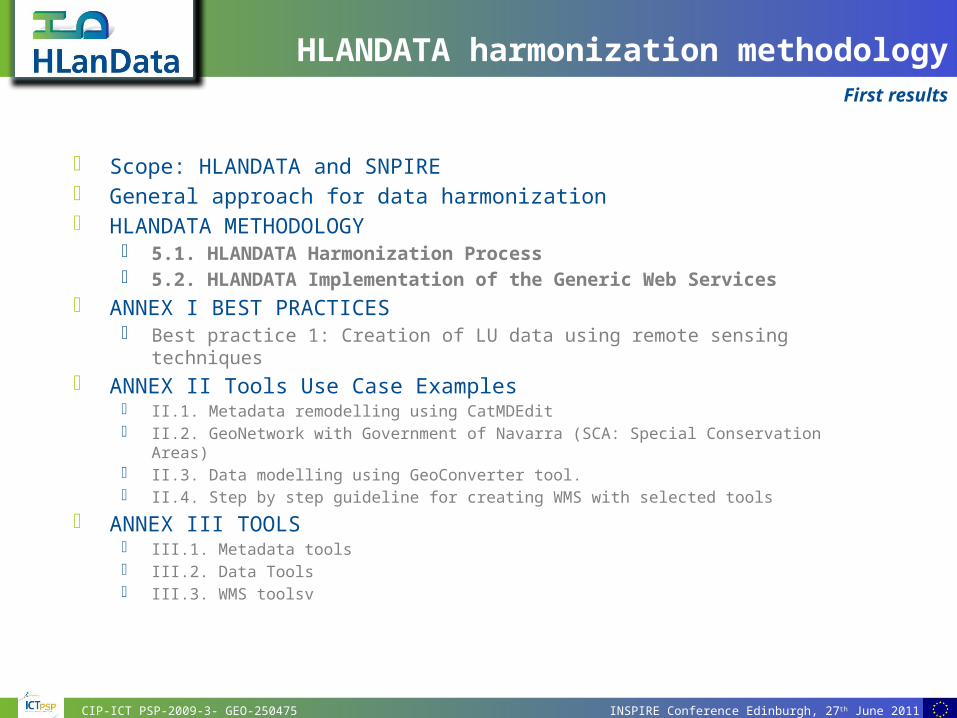
Scope: HLANDATA and SNPIRE General approach for data harmonization HLANDATA METHODOLOGY
5.1. HLANDATA Harmonization Process 5.2. HLANDATA Implementation of the Generic Web Services
ANNEX I BEST PRACTICES Best practice 1: Creation of LU data using remote sensing techniques
ANNEX II Tools Use Case Examples II.1. Metadata remodelling using CatMDEdit II.2. GeoNetwork with Government of Navarra (SCA: Special Conservation Areas) II.3. Data modelling using GeoConverter tool. II.4. Step by step guideline for creating WMS with selected tools
ANNEX III TOOLS III.1. Metadata tools III.2. Data Tools III.3. WMS toolsv
HLANDATA harmonization methodologyFirst results

INSPIRE Conference Edinburgh, 27th June 2011CIP-ICT PSP-2009-3- GEO-250475
HLANDATA harmonization proposal
TASK 2.1
12
3
First results: Synergies
?

INSPIRE Conference Edinburgh, 27th June 2011CIP-ICT PSP-2009-3- GEO-250475
?
First results: Synergies
HLANDATA harmonization proposal

INSPIRE Conference Edinburgh, 27th June 2011CIP-ICT PSP-2009-3- GEO-250475
HLANDATA harmonization proposalFirst results: Synergies

INSPIRE Conference Edinburgh, 27th June 2011CIP-ICT PSP-2009-3- GEO-250475
DS LU/LC v 2.0 Suggested profile model approach
Integrated Core model, Existing model & Planned model
Participation on the development of the nomenclature Adopt a common and feasible LU nomenclature designed for INSPIRE. And
permit in appropriate way rest of well-defined and contrasted nomenclatures as optional (LUCAS, SEEA, nationals…)
Metadata: INSPIRE + PLAN4all
TESTING!
HLANDATA harmonization proposalFirst results: Synergies

INSPIRE Conference Edinburgh, 27th June 2011CIP-ICT PSP-2009-3- GEO-250475
Towards harmonizationFirst results
TASK 2.2
12
3
TASK 2.1
12
3
D 2.3
D 2.4

INSPIRE Conference Edinburgh, 27th June 2011CIP-ICT PSP-2009-3- GEO-250475
WMS Detailed guide according to the software choice of every partner
Requirements, WMS version, format, Reference systems
Detailed guide for the implementation of CSW in the Geoportal Description of the functionality and arquitecture of the Geoportal-
spread WMServices- Harmonized Data
D 2.3 Preliminary design and specifications of the harmonized data sharing infrastructure to be implemented
First results

INSPIRE Conference Edinburgh, 27th June 2011CIP-ICT PSP-2009-3- GEO-250475
To be able to visualize on the HLANDATA Geoportal the harmonized LU/LC data through WMS created by each data provider.
Each data provider must create his own WMS for publishing harmonized LC/LU data
D 2.4 Validated harmonized data sharing infrastructure from all data providers partners
Next steps
COMMON DATA SHARING INFRASTRUCTURE:
Common webservices allowing to visualize, overlay information from different sources
PILOT 1: LU/LC data
Analysis system
(Spain, Latvia)
PILOT 2: National Land
systems
(Czech Rep, Lithuania)
PILOT 3: Waste dumps
stratification
(Slovakia)PILOT
2.1:
(Czech Rep)
PILOT 2.2:
(Lithuania)

INSPIRE Conference Edinburgh, 27th June 2011CIP-ICT PSP-2009-3- GEO-250475
Collaborating with INSPIRE Synergies: knowledge, resources Make possible user´s requirements
Conclusions

INSPIRE Conference Edinburgh, 27th June 2011CIP-ICT PSP-2009-3- GEO-250475
Thank you for your attention!