identify terrain features on a map 071-329-1001 071-329-1001
TRANSCRIPT

Identify Terrain Features on a MapIdentify Terrain Features on a Map 071-329-1001071-329-1001
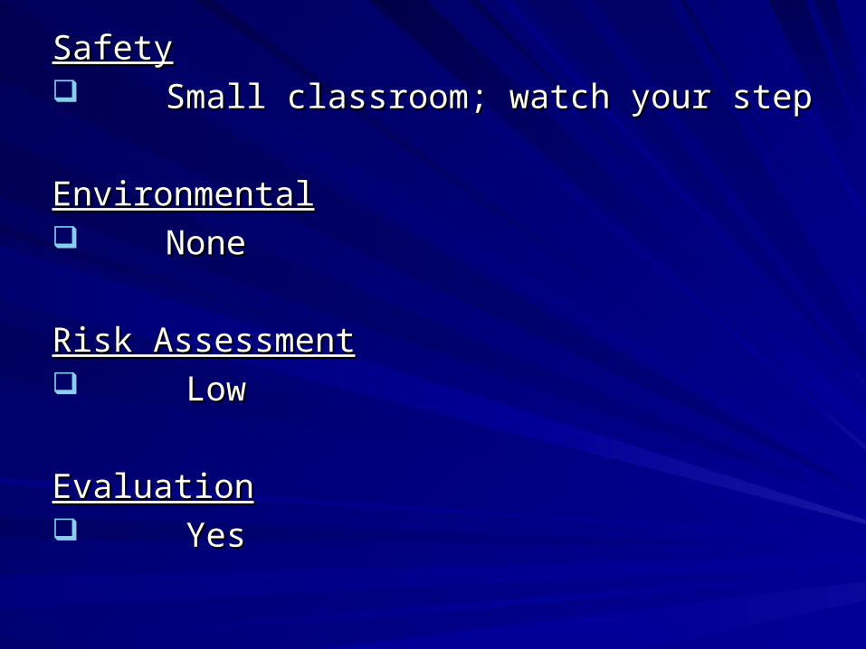
SafetySafety Small classroom; watch your stepSmall classroom; watch your step
EnvironmentalEnvironmental NoneNone
Risk AssessmentRisk Assessment LowLow
EvaluationEvaluation YesYes
ReferenceReference
Soldier’s Manual of Common Tasks Soldier’s Manual of Common Tasks Warrior Skills Task # 071-329-1001Warrior Skills Task # 071-329-1001
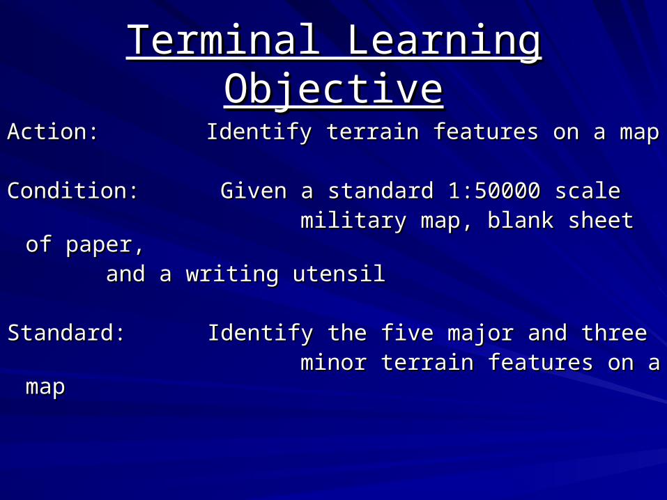
Terminal Learning ObjectiveTerminal Learning Objective
Action:Action: Identify terrain features on a map Identify terrain features on a map
Condition: Given a standard 1:50000 scaleCondition: Given a standard 1:50000 scale military map, blank sheet of paper,military map, blank sheet of paper,
and a writing utensiland a writing utensil
Standard: Identify the five major and threeStandard: Identify the five major and three minor terrain features on a mapminor terrain features on a map
Why do you need to know the Why do you need to know the terrain features on a map?terrain features on a map?
In order to locate a point on a mapIn order to locate a point on a map
In order to navigate from one point to the In order to navigate from one point to the nextnext

Types of Terrain FeaturesTypes of Terrain Features
Major-FiveMajor-Five
Minor-ThreeMinor-Three
Five Major Terrain FeaturesFive Major Terrain Features
HillHill
RidgeRidge
ValleyValley
SaddleSaddle
DepressionDepression
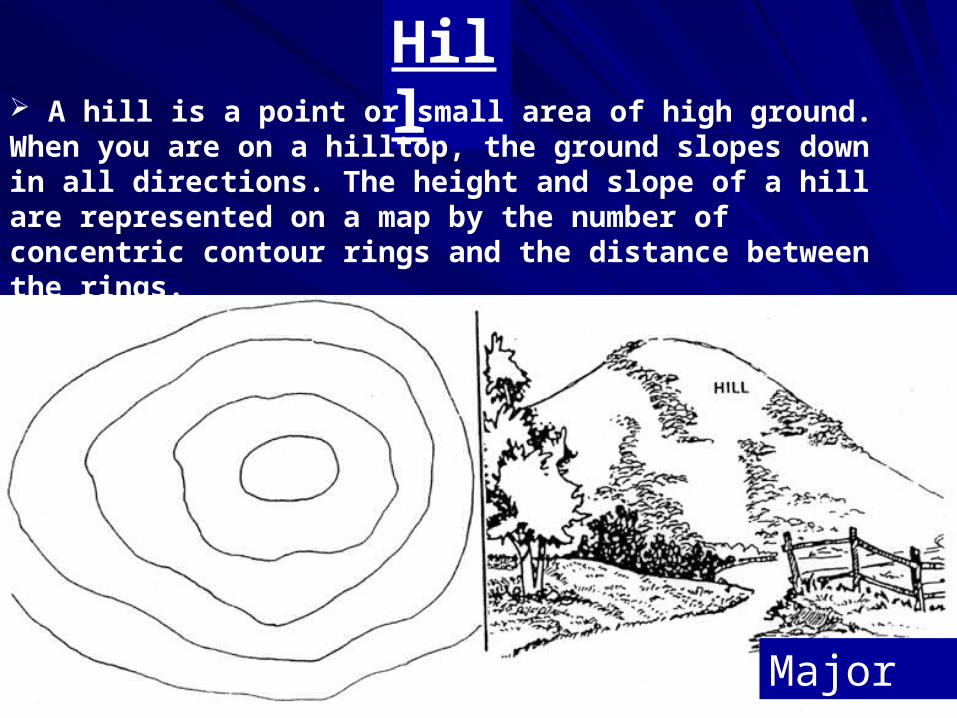
Hill A hill is a point or small area of high ground. When you are on a hilltop, the ground slopes down in all directions. The height and slope of a hill are represented on a map by the number of concentric contour rings and the distance between the rings.
Major
RidgeRidge
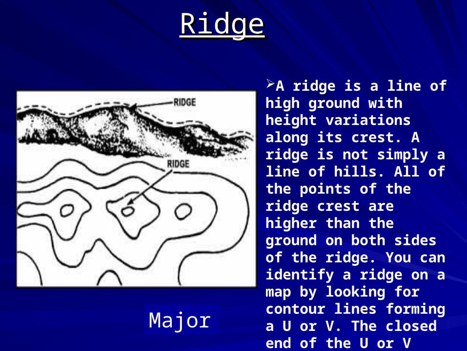
A ridge is a line of high ground with height variations along its crest. A ridge is not simply a line of hills. All of the points of the ridge crest are higher than the ground on both sides of the ridge. You can identify a ridge on a map by looking for contour lines forming a U or V. The closed end of the U or V points away from high ground.
Major
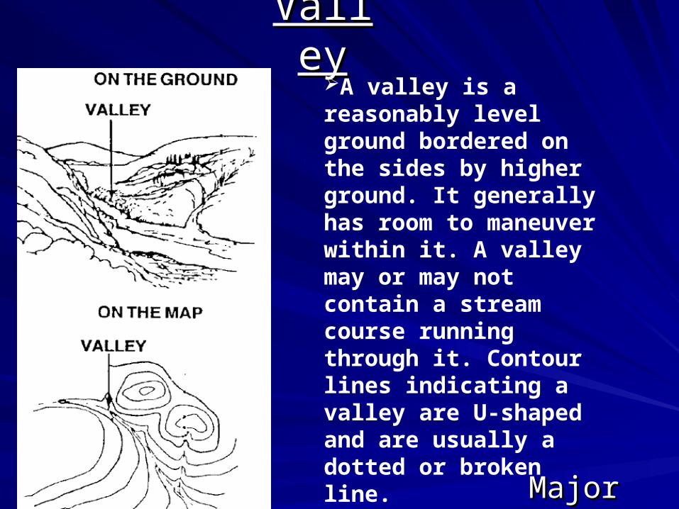
ValleyValleyA valley is a reasonably level ground bordered on the sides by higher ground. It generally has room to maneuver within it. A valley may or may not contain a stream course running through it. Contour lines indicating a valley are U-shaped and are usually a dotted or broken line.
MajorMajor
• What terrain feature is represented by contour lines that tend to parallel a stream before crossing and form a U?
VALLEYVALLEY
• What terrain feature is represented by contour What terrain feature is represented by contour lines forming concentric circles?lines forming concentric circles?
HILLHILL
• What terrain feature is a line of high ground with What terrain feature is a line of high ground with height variations along its crest?height variations along its crest?
RIDGERIDGE
SaddleSaddle
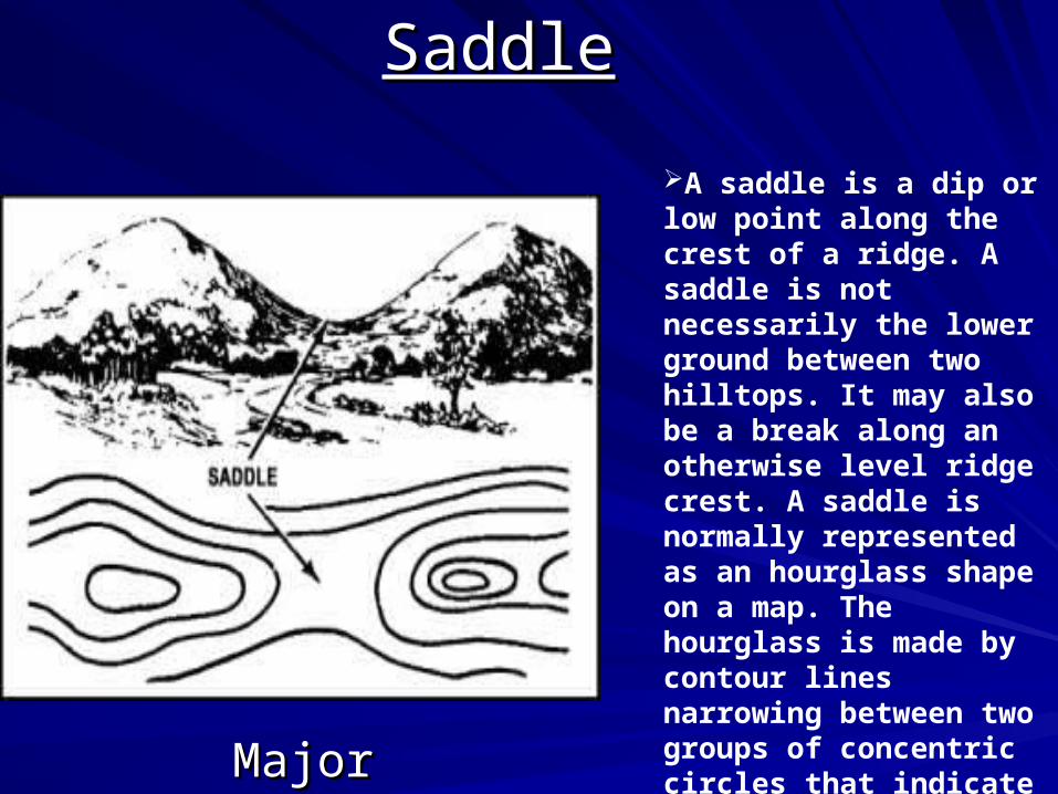
A saddle is a dip or low point along the crest of a ridge. A saddle is not necessarily the lower ground between two hilltops. It may also be a break along an otherwise level ridge crest. A saddle is normally represented as an hourglass shape on a map. The hourglass is made by contour lines narrowing between two groups of concentric circles that indicate hilltops or points of raised ground. MajorMajor
DepressionDepression
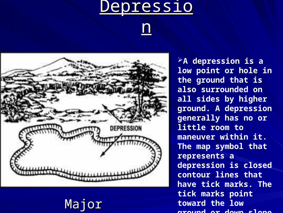
A depression is a low point or hole in the ground that is also surrounded on all sides by higher ground. A depression generally has no or little room to maneuver within it. The map symbol that represents a depression is closed contour lines that have tick marks. The tick marks point toward the low ground or down slope
MajorMajor
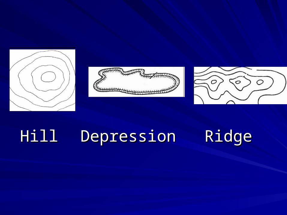
HillHill DepressionDepression RidgeRidge
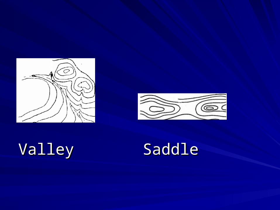
ValleyValley SaddleSaddle
Three Minor Terrain FeaturesThree Minor Terrain Features
DrawDraw
SpurSpur
CliffCliff
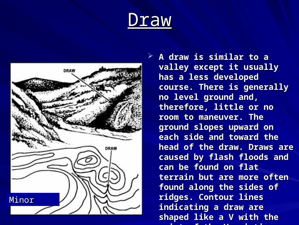
DrawDraw
A draw is similar to a valley except A draw is similar to a valley except it usually has a less developed it usually has a less developed course. There is generally no level course. There is generally no level ground and, therefore, little or no ground and, therefore, little or no room to maneuver. The ground room to maneuver. The ground slopes upward on each side and slopes upward on each side and toward the head of the draw. toward the head of the draw. Draws are caused by flash floods Draws are caused by flash floods and can be found on flat terrain and can be found on flat terrain but are more often found along but are more often found along the sides of ridges. Contour lines the sides of ridges. Contour lines indicating a draw are shaped like a indicating a draw are shaped like a V with the point of the V pointing V with the point of the V pointing toward the head of the draw. That toward the head of the draw. That means the point is pointing means the point is pointing toward the high ground.toward the high ground.
MinorMinor
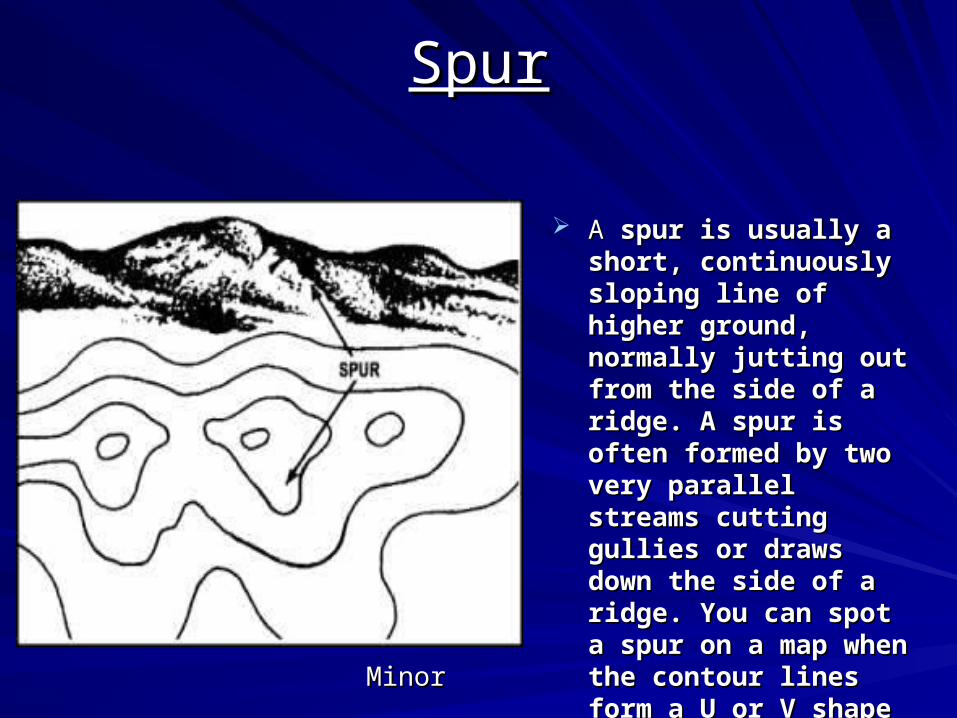
SpurSpur
A A spur is usually a short, spur is usually a short, continuously sloping line continuously sloping line of higher ground, of higher ground, normally jutting out from normally jutting out from the side of a ridge. A the side of a ridge. A spur is often formed by spur is often formed by two very parallel streams two very parallel streams cutting gullies or draws cutting gullies or draws down the side of a ridge. down the side of a ridge. You can spot a spur on a You can spot a spur on a map when the contour map when the contour lines form a U or V shape lines form a U or V shape that points away from that points away from the higher ground.the higher ground.
MinorMinor
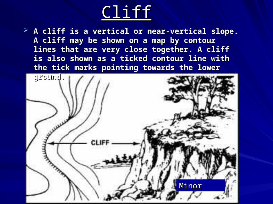
CliffCliff A cliff is a vertical or near-vertical slope. A cliff may be A cliff is a vertical or near-vertical slope. A cliff may be
shown on a map by contour lines that are very close shown on a map by contour lines that are very close together. A cliff is also shown as a ticked contour line together. A cliff is also shown as a ticked contour line with the tick marks pointing towards the lower ground.with the tick marks pointing towards the lower ground.
MinorMinor
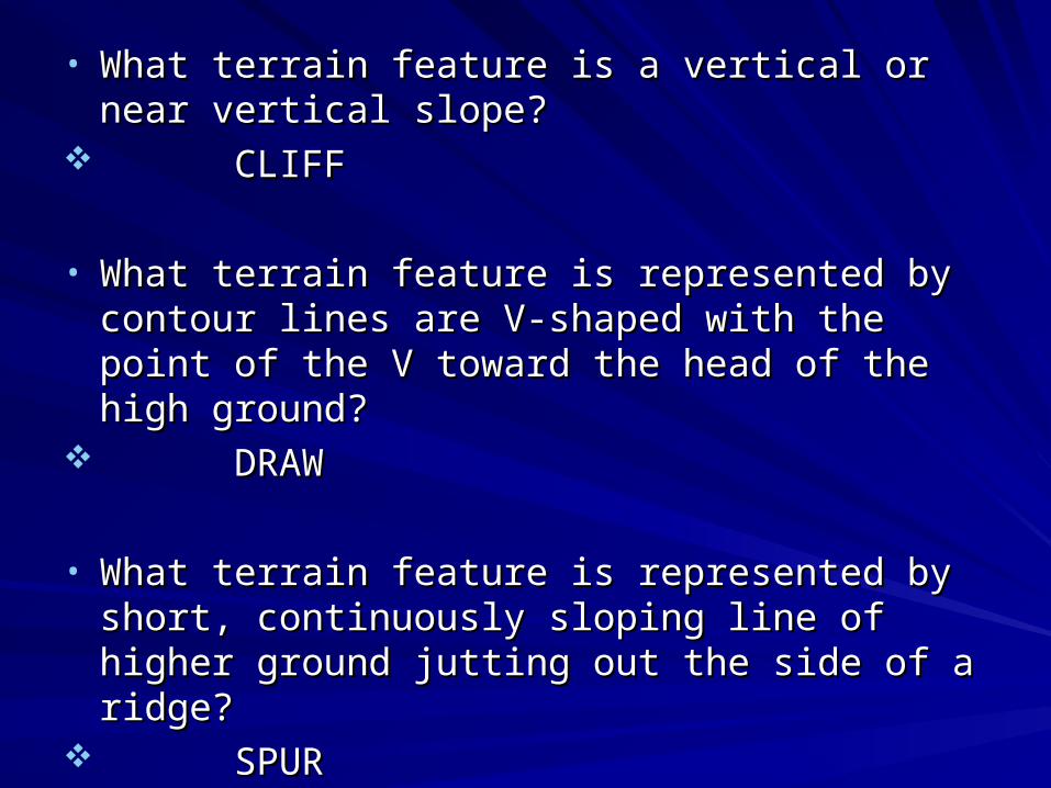
• What terrain feature is a vertical or near vertical What terrain feature is a vertical or near vertical slope?slope?
CLIFFCLIFF
• What terrain feature is represented by contour What terrain feature is represented by contour lines are V-shaped with the point of the V toward lines are V-shaped with the point of the V toward the head of the high ground?the head of the high ground?
DRAWDRAW
• What terrain feature is represented by short, What terrain feature is represented by short, continuously sloping line of higher ground jutting continuously sloping line of higher ground jutting out the side of a ridge?out the side of a ridge?
SPURSPUR
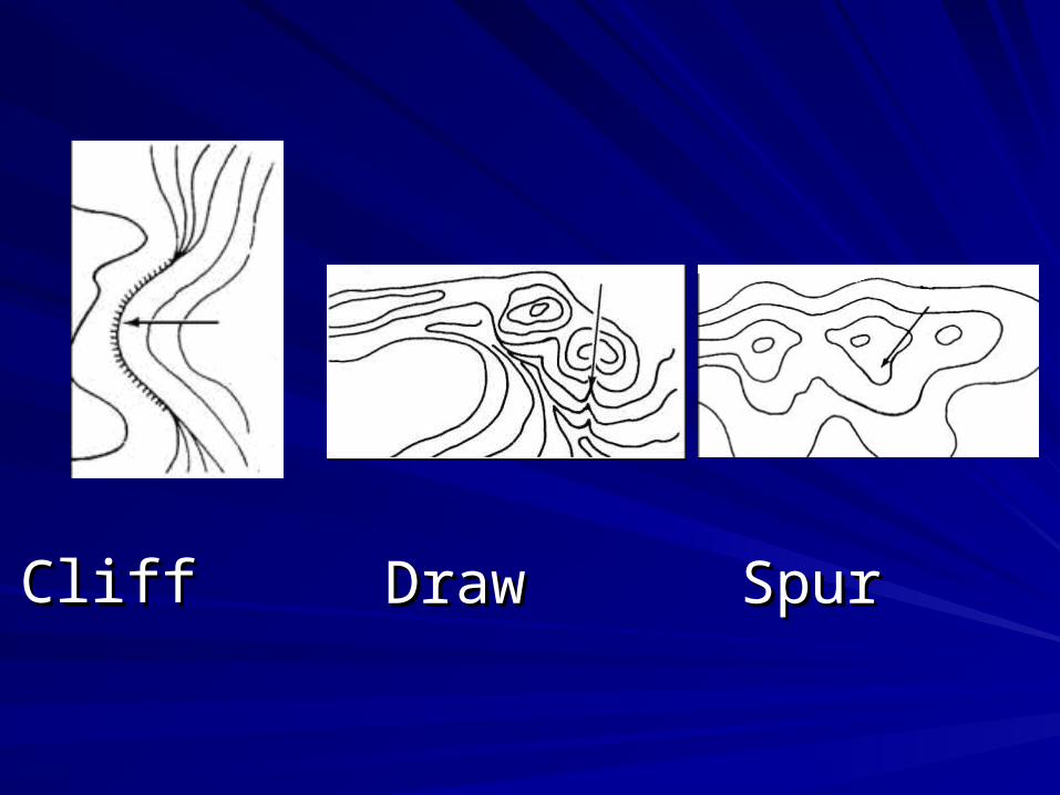
CliffCliff DrawDraw SpurSpur
Practical ExercisePractical Exercise
ReviewReview
Action:Action: Identify terrain features on a map Identify terrain features on a map
Condition: Given a standard 1:50000 scaleCondition: Given a standard 1:50000 scale military map, blank sheet of paper,military map, blank sheet of paper,
and a writing utensiland a writing utensil
Standard: Identify the five major and threeStandard: Identify the five major and three minor terrain features on a mapminor terrain features on a map
SummarySummaryFive major terrain featuresFive major terrain features• HillHill• RidgeRidge• ValleyValley• SaddleSaddle• DepressionDepression
Three minor terrain featuresThree minor terrain features• DrawDraw• SpurSpur• CliffCliff

Questions???Questions???