illicit discharge detection and elimination manual...
TRANSCRIPT

ILLICIT DISCHARGE DETECTION AND
ELIMINATION MANUAL
A Guidance Manual for Municipalities in the State of Ohio
The Cuyahoga County Board of Heath Watershed Protection
July 2006

IDDE: A Guidance Manual for Municipalities in the State of Ohio 2 July 2006
ILLICIT DISCHARGE DETECTION AND ELIMINATION MANUAL
A Guidance Manual for Municipalities in the State of Ohio
Prepared by the
Support for the IDDE Manual Project has been provided by Ohio Environmental Protection Agency, Office of Environmental Education
Cuyahoga County Board of Health 5550 Venture Drive Parma, Ohio 44130 216-201-2000 www.CCBH.net
Harry Stark, RS, MPA, Project Director [email protected]
Ohio EPA Environmental Education Fund Lazarus Government Center P.O. Box 1049 Columbus, Ohio 43214-1049 614-644-2873

IDDE: A Guidance Manual for Municipalities in the State of Ohio 3 July 2006
Acknowledgements This guidance manual was developed by the Cuyahoga County Board of Health (CCBH) as part of an Ohio EPA Environmental Education Fund Grant project. The Cuyahoga County District Board of Health has been serving the cities, villages and townships of Cuyahoga County since 1919. As Ohio's largest health district by population, and also one of the nation's largest, the Board of Health provides a broad range of quality driven public health programs and services. The CCBH’s Watershed Protection Unit was developed and designed to protect public health and our water quality resources from the impact of point source and non-point source pollution. The Watershed Protection Unit stresses the utilization of watershed based planning within the Cuyahoga County Board of Health as well as collaborative efforts with partnering agencies. This manual was written by Harry Stark, RS, MPA with assistance from Laura Travers, Pam Sawchyn, Jill Lis RS, and other CCBH staff. The CCBH would also like to thank the following people who contributed their time and expertise in the development of this manual. Cathy Becker, North Olmsted Assistant City Engineer Dan Bogoevsky, Ohio EPA Chris Courtney, the C.W. Courtney Company Ken Dombrowski, Wade Trim Kyle Dreyfuss-Wells, Executive Director for the Chagrin River Watershed Partners Jeff Duke, Northeast Ohio Regional Sewer District Jeff Filarski, Chagrin Valley Engineering LTD Tom Krezcko, Beachwood Staff Engineer Mary Maciejowski, Northeast Ohio Regional Sewer District Brian Mader, Steve Hovancsek and Associates Francine Toth, Lake County General Health District A special thanks to the Northeast Ohio Regional Sewer District (NEORSD) for providing the Illicit Discharge Detection and Elimination Manual Outfall Database and Users Manual for this project. The database is located within the CD-ROM. Along with these contributors, a number of reference documents were used in the development of this manual. These include:
• The Ohio EPA Phase II Storm Water Rules and Regulations (3745-39-03) • Illicit Discharge Detection and Elimination: A Guidance Manual for Program
Development and Technical Assessments by the Center of Watershed Protection and Robert Pitt, University of Alabama, 2004
• Illicit Discharge Detection and Elimination Manual: A Handbook for Municipalities by the New England Interstate Water Pollution Control Commission, 2003
• Guidelines and Standard Operating Procedures for Stormwater Phase II Communities in Maine
• US EPA Phase II Storm Water Rules and Regulations • US EPA Phase II Fact Sheets on Illicit Discharge Detection and Elimination Program

IDDE: A Guidance Manual for Municipalities in the State of Ohio 4 July 2006
Table of Contents Acknowledgements 3 Introduction 6 Chapter 1: Illicit Discharge Detection and Elimination 8 What is an Illicit Discharge 8 Types of Illicit Discharges 9 Mode of Entry 11 What are the Elements of an Effective IDDE Program? 12 Does This Measure Need to Address All Illicit Discharges? 12 Chapter 2: Mapping/Inventory 13 What is an MS4? 13 Review Available Information 14 Mapping the Storm Sewer System 15 Field Survey 16 Chapter 3: Inspection and Developing Priority Areas 22 Hot Spots 22 Detection/Inspections 23 Physical Indicators 24 Water Quality Sampling and Testing 25 Quality Assurance Management Plans and Project Plans (QAMP/QAPP) 29 Equipment for Water Sampling 29 Special Monitoring 29 Chapter 4: Tracing For the Source of an Illicit Discharge 31 Tracing Techniques 31 Chapter 5: Elimination of an Illicit Discharge 35 Preventing Illegal Dumping 37 Chapter 6: Evaluation of your IDDE Program 39 Evaluating the Program 39 Establish a Tracking and Reporting System 39 Chapter 7: Education to Public Employees, General Public, and Businesses 40 Public Employees 40 General Public 40 Businesses 41 References 42

IDDE: A Guidance Manual for Municipalities in the State of Ohio 5 July 2006
Table of Contents (continued) Appendix A: IDDE Outfall Database: Outfall Identification
and Stream Naming Convention 43 Appendix B: Inventory Form 59 Appendix C: Inspection Form 61 Appendix D: Example of a Quality Assurance Management Plan 63 Appendix E: Illicit Discharge Ordinance 98 Appendix F: IDDE Manual Outfall Database 106 Appendix G: IDDE Field Guide 109 List of Tables Table 1-1: Land uses, likely source locations, and activities that can produce transitory or intermittent illicit discharges 10 Table 1-2: Land uses, likely source locations, and activities that can produce continuous illicit discharges 11 Table 3-1: Water Quality Test Parameters and Uses 26 Table 3-2: Indicator Parameters Used to Detect Illicit Discharges 28 Table 5-1: Methods to Eliminate Discharges 36 List of Figures Figure 1: Designated MS4 outfall location 8 Figure 2: Storm sewer MS4 outfall 13 Figure 3: Ditch MS4 outfall 13 Figure 4: Map showing MS4 outfall locations 14 Figure 5: Field survey of outfall locations 16 Figure 6 and 7: Field surveys of outfall locations 17 Figure 8: Outfall mapping 18 Figure 9: Measuring size of outfall 19 Figures 10: Example of Outfall Materials 21 Figure 11: MS4 outfall location with illicit discharge 22 Figure 12: Dry weather field inspection 23 Figure 13: Taking a water sample at an MS4 outfall location during dry weather flow 25 Figure 14: Removing storm drain lid 31 Figure 15: Dye at outfall location 32
IDDE: A Guidance Manual for Municipalities in the State of Ohio 6 July 2006
Introduction This manual is intended to serve as a guidance manual for Phase II Storm Water designated communities in Ohio. The purpose of this manual is to assist these communities in developing their illicit discharge detection and elimination (IDDE) programs required by the EPA’s Phase II Storm Water program. This manual profiles the Illicit Discharge Detection and Elimination minimum control measure, which is one of six measures operators of a Phase II regulated small municipal separate storm sewer system (MS4) is required to include in its storm water management program to meet the conditions of its National Pollutant Discharge Elimination System (NPDES) permit. Background of Phase II Although the quality of the nation’s waters has improved greatly since the passage of the Clean Water Act in 1972, many water bodies are still impaired by pollution. According to the U.S. Environmental Protection Agency, the top causes of impairment include siltation, nutrients, bacteria, metals, and oxygen-depleting substances. Polluted storm water runoff, including runoff from urban/suburban areas and construction sites are leading sources of impairment. To address this problem, EPA has put into place a program that regulates certain storm water discharges. In 1990, the EPA promulgated Phase I of its storm water program under the National Pollutant Discharge Elimination System (NPDES) permit provisions of the Clean Water Act. Phase I addressed storm water runoff from “medium” and “large” municipal separate storm sewer systems (MS4s) generally serving populations of 100,000 or greater, construction activity that would disturb five or more acres of land, and 10 categories of industrial activity. To further reduce the adverse effects of storm water runoff, the EPA instituted its Storm Water Phase II Final Rule on December 8, 1999. The Phase II Storm Water program is part of EPA’s NPDES program. The Ohio EPA is the regulating authority responsible for the Phase II Storm Water regulations in Ohio. The Phase II program regulates discharges from small MS4s located in “urbanized areas” (as delineated by the Census Bureau in the most recent census) and from additional small MS4s designated by the permitting authority. The EPA’s Storm Water Phase II Final Rule states that this storm water management program must include the following six minimum control measures:
• Public education and outreach on storm water impacts • Public involvement and participation • Illicit discharge detection and elimination (IDDE) • Construction site storm water runoff control • Post-construction storm water management in new development and redevelopment • Pollution prevention and good housekeeping for municipal operations

IDDE: A Guidance Manual for Municipalities in the State of Ohio 7 July 2006
Why Are Illicit Discharge Detection and Elimination Efforts Necessary? Discharges from MS4s can often include wastes and wastewater from non-storm water sources, including illicit discharges, which can enter the system through various means. The result of this is untreated discharges that contribute to high levels of pollutants, including heavy metals, toxics, oil and grease, solvents, nutrients, viruses, and bacteria to receiving water bodies. Pollutant levels from these illicit discharges have been shown in EPA studies to be high enough to significantly degrade receiving water quality and threaten aquatic, wildlife, and human health. Now, more than ever, it is necessary to create an awareness of what illicit discharges are doing. This will allow operators and citizens to determine the types and sources of these discharges entering their water bodies. This manual can help establish the legal, technical, and educational means needed to prevent and eliminate these discharges. What Are Some Guidelines for Developing and Implementing This Measure? The objective of the illicit discharge detection and elimination minimum control measure is to have regulated, small MS4 operators gain a thorough awareness of their systems and position themselves to take necessary action on eliminating illicit discharges. This awareness will allow them to determine the types and sources of illicit discharges entering their system and establish the legal, technical, and educational means needed to eliminate these discharges. Finding, Fixing, and Preventing Illicit Discharges The purpose of an IDDE program is to find, fix and prevent illicit discharges, and develop a series of techniques to meet these objectives. This manual describes the major tools used to build a local IDDE program.

IDDE: A Guidance Manual for Municipalities in the State of Ohio 8 July 2006
Chapter 1: Illicit Discharge Detection and Elimination What is an Illicit Discharge?
Figure 1: Designated MS4 outfall location An illicit discharge is defined by the US EPA’s Phase II Storm Water Regulations as “any discharge to an MS4 (Municipal Separate Storm Sewer System) that is not composed entirely of storm water...” with some exceptions. These exceptions include discharges from NPDES-permitted industrial sources and discharges from fire-fighting activities. Illicit discharges are considered “illicit” because MS4s are not designed to accept, process, or discharge such non-storm water wastes. In most communities, the MS4 is directly connected to a waterbody and does not receive any type of treatment prior to its discharge to receiving water bodies of the United States. Because of this non-treatment, it is vital that only storm water be discharged from these MS4s. The general permit received by Phase II regulated communities requires that those communities develop an illicit discharge detection and elimination (IDDE) program. This program will assist communities in meeting their requirement set forth in their general NPDES permit. This guidance manual is designed to assist designated communities in establishing their IDDE program.

IDDE: A Guidance Manual for Municipalities in the State of Ohio 9 July 2006
Types of Illicit Discharges For any IDDE program to be successful, it is important to clearly understand the different types of illicit discharges so that individuals can take the necessary steps for elimination. This includes frequency of discharge and surrounding land use issues. Once an IDDE program is established and a community can investigate the frequency of discharge and land use issues associated with these discharges, then the possibility exists to trace the illicit discharge back to its source and eliminate it. Illicit discharges can be separated into three (3) categories based on frequency of discharge:
1. Transitory Illicit Discharge: These are typically a one-time event. They can result from spills, dumping, and line breaks. These types of discharges are often the most difficult to investigate and trace back to its source. Methods for reducing this type of discharge are to educate the public on storm water and illicit discharge, establishment of a “hotline” telephone number for the public to call if any discharges are observed, and education of the community’s investigative responses to sources of illicit discharge.
2. Intermittent Illicit Discharge: These are typically discharges that occur occasionally. They can occur several hours per day, week or over the course of a year. They can happen as the result of line breaks or cross connections. Again, the establishment of a “hotline” telephone number for the public to call if any discharges are observed is recommended.
3. Continuous Illicit Discharge: These direct connections into the MS4 can be from sanitary sewers, cross connections, infrastructure problems with a sanitary sewer system, or malfunctioning household sewage treatment systems (HSTS). This type of discharge is the easiest to find, investigate, trace and eliminate from the MS4. These types of discharges also have the greatest impact because of the constant pollutant loading into a water body.

IDDE: A Guidance Manual for Municipalities in the State of Ohio 10 July 2006
Table 1-1: LAND USES, LIKELY SOURCE LOCATIONS AND ACTIVITIES THAT CAN PRODUCE TRANSITORY OR INTERMITTENT ILLICIT DISCHARGES Land Use Likely Source Locations Condition/Activity that Produces Discharge
Residential · Apartments · Multi-family · Single Family Detached
· Car Washing · Driveway Cleaning · Dumping/Spills · Equipment Wash-downs · Lawn/Landscape Watering · Septic System Maintenance · Swimming Pool Discharges · Laundry Wastewater · Improper Plumbing (garage floor drains)
Commercial · Campgrounds/RV Parks · Car Dealers/Rental Car Co. · Car Washes · Commercial Laundry · Gas Stations/Auto Repair Shops · Marinas · Nurseries and Garden Centers · Oil Change Shops · Restaurants · Swimming Pools · Service Garages
· Building Maintenance (power washing) · Dumping/Spills · Landscaping/Grounds Care (irrigation) · Outdoor Fluid Storage · Parking Lot Maintenance (power washing) · Vehicle Fueling · Vehicle Maintenance/Repair · Vehicle Washing · Wash-down of Greasy Equipment & Grease Traps
Industrial · Auto Recyclers · Beverages and Brewing · Construction Vehicle Washouts · Distribution Centers · Food Processing · Garbage Truck Washouts · Marinas, Boat Building and repair · Metal Plating Operations · Paper and Wood Products · Petroleum Storage and Refining · Printing
· All Commercial Activities · Industrial Process Water or Rinse Water · Loading and Un-loading Area Wash-downs · Outdoor Material Storage (fluids)
Municipal · Airports · Landfills · Maintenance Depots · Municipal Fleet Storage Areas · Ports · Public Works Yards · Streets and Highways
· Building Maintenance (power washing) · Dumping/Spills · Landscaping/Grounds Care (irrigation) · Outdoor Fluid Storage · Parking Lot Maintenance (power washing) · Road Maintenance · Emergency Response · Vehicle Fueling · Vehicle Maintenance/Repair · Vehicle Washing
SOURCE: Modified from Illicit Discharge Detection and Elimination: A Guidance Manual for Program Development and Technical Assessments, Center for Watershed Protection, 2004, p. 12, Table 2.

IDDE: A Guidance Manual for Municipalities in the State of Ohio 11 July 2006
Table 1-2: LAND USES, LIKELY SOURCE LOCATIONS AND ACTIVITIES
THAT CAN PRODUCE CONTINUOUS ILLICIT DISCHARGES
Land Use Condition or Activity that Produces Discharge
Residential
· Failed sanitary sewer infiltrating into storm drain
· Sanitary sewer connection into storm drain
· Failed septic systems discharging to storm drain system
Commercial/Industrial
· Failed sanitary sewer infiltrating into storm drain
· Process water connections into storm drain
· Sanitary sewer connection into storm drain
Municipal · Failed sanitary sewer infiltrating into storm drain
· Sanitary sewer connection into storm drain Source: Table from Guidelines and Standard Operating Procedures for Stormwater Phase II Communities in Maine, Casco Bay Estuary Partnership. The tables outlined above examine the likely source locations that contribute illicit discharges to an MS4. Land use can predict the potential for these discharges. By understanding the possible discharges emanating from land use activities, it allows for the IDDE program manager to thoroughly utilize this knowledge in identifying illicit discharges and their potential sources. Industrial facilities are regulated by additional permits through the EPA. For industrial problems, please contact your local EPA office and refer to: www.epa.state.oh.us/dsw/storm/index.html. Mode of Entry Illicit discharges can also be classified based on how they enter the storm drain system. This entry can be direct or indirect. Direct entry means that the discharge is directly connected to the storm drain pipe system via a pipe. This type of entry will produce discharges that are either continuous or intermittent. Direct entry usually occurs when there are sewage cross-connections, or where there are industrial and commercial cross-connections. Indirect entry means that flows, which are generated outside the storm drain system, enter through storm drain inlets or by infiltrating through the joints of the pipe. Generally, indirect modes of entry produce intermittent or transitory discharges. This type of entry can include groundwater seepage into the storm drain pipe, spills, dumping, outdoor washing activities, and irrigation from landscaping or lawns that reaches the storm drain system.
IDDE: A Guidance Manual for Municipalities in the State of Ohio 12 July 2006
What are the Elements of an Effective IDDE Program? Ohio EPA states that the following must be incorporated in an IDDE Program:
Develop a storm sewer system map showing the location of all outfalls, and the names and location of all surface waters of the state that receive discharges from those outfalls, this also must include the location of all home sewage treatment systems (HSTS) that discharge directly into an MS4;
To the extent allowable under law, effectively prohibit, through ordinance or other regulatory mechanism, non-storm water discharges into your storm sewer system and implement appropriate enforcement procedures and actions;
Develop and implement a plan to detect and address non-storm water discharges, including illegal dumping, to your system, including a program for dry weather inspections;
Inform public employees, businesses, and the general public of hazards associated with illegal discharges;
Develop a list of occasional and incidental non-storm water discharges that will not be addressed as an illicit discharge. This can include charity car washes.
Does This Measure Need to Address All Illicit Discharges? No. The IDDE program does not need to address all illicit discharges unless you identify them as significant contributors of pollutants to your small MS4. Under the Ohio EPA rules for Phase II Storm Water, these include:
• water line flushing • landscape irrigation • diverted stream flows • rising ground waters • uncontaminated ground water infiltration • uncontaminated pumped ground water • discharges from potable water sources • foundation drains • air conditioning condensation • irrigation water • springs • water from crawl space pumps • footing drains • lawn watering • individual residential car washing • flows from riparian habitats and wetlands • dechlorinated swimming pool discharges • street wash water • Discharges or flows from fire fighting activities are excluded from the effective
prohibition against non-storm water and need only be addressed where they are identified as significant sources of pollutants to surface waters of the state.

IDDE: A Guidance Manual for Municipalities in the State of Ohio 13 July 2006
Chapter 2: Mapping / Inventory What is an MS4? According to the Ohio EPA, the definition of an MS4 does not solely refer to municipally-owned storm sewer systems, but rather, is a term of art with a much broader application that can include, in addition to local jurisdictions, State departments of transportation, universities, local sewer districts, hospitals, military bases, and prisons. An MS4 also is not always just a system of underground pipes – it can include roads with drainage systems, gutters and ditches. The regulatory definition of an MS4 is provided below: “municipal separate storm sewer means a conveyance or system of conveyances (including roads with drainage systems, municipal streets, catch basins, curbs, gutters, ditches, man-made channels, or storm drains): (i) Owned or operated by a State, city, township, county, district, association, or other public body (created by or pursuant to State law) including special districts under State law such as a sewer district, flood control district or drainage district, or similar entity, that discharges into waters of the state. (ii) Designed or used for collecting or conveying storm water; (iii) Which is not a combined sewer; and (iv) Which is not part of a Publicly Owned Treatment Works.” Basically, when the field crew is performing the inventory of MS4 outfalls, a good understanding is needed as to the community and the outfalls possibly located within a water body. Most people know that a storm sewer outfall is an MS4 outfall. However, you must remember that ditches and catch basins are considered MS4s as well.
Figure 2: Storm Sewer MS4 outfall Figure 3: Ditch MS4 outfall

IDDE: A Guidance Manual for Municipalities in the State of Ohio 14 July 2006
Mapping The Ohio EPA’s NPDES requirements for small MS4s state that one of the first mandatory elements of the IDDE program is to “develop, if not already completed, a storm sewer system map showing the location of all outfalls and the names and location of all surface waters of the state that receive discharges from those outfalls”. (OEPA NPDES requirements).
Figure 4: Map showing MS4 outfall locations. Review Available Information Many communities in Ohio have already developed detailed maps of their storm and sanitary sewer systems, while others have scattered information and still others have no information. In order to develop a map, communities need to collect any existing information on their storm sewer system. The following is a list of possible resources that communities should collect and review when developing a comprehensive database for their storm sewer system. Identifying outfall locations may help prioritize areas that may have high priority outfalls.
Review city records – city records can include a variety of maps as detailed below as well as information obtained regarding complaints filed with the community on possible illicit discharges emanating from a possible MS4 outfall.
Zoning maps Drainage maps Subdivision maps Department of transportation maps Storm drain maps Age of infrastructure and development – this information is important when determining
and prioritizing areas with possible illicit discharges. Older areas of infrastructure will have a higher priority.
Location of septic systems, both household and commercial – this information is important when prioritizing illicit discharge locations and should be given a high priority.

IDDE: A Guidance Manual for Municipalities in the State of Ohio 15 July 2006
Identify water bodies and watersheds within the community – this information will provide the community a sense of where they exist within a larger watershed as well as the water bodies that they contain.
Water quality information – this will assist the community in evaluating areas within their community that have impaired water bodies, as well as areas with high bacterial counts.
Review data from local health departments on locations of HSTS that discharge to an MS4. These systems must be included on the map along with the MS4 outfall locations.
Once the community has compiled this information, it is necessary to perform field activities to locate the MS4 outfall locations as well as verify the information compiled in the review of any documents the community used. Mapping the Storm Sewer System Once a community has compiled the available information on their storm sewer systems, then it is necessary to perform field activities. The field survey will be necessary to create a map or to verify and update an existing map. These field activities will serve a number of purposes. This includes:
Provide data to the community as to the location of their MS4 outfall locations. Provide data on possible areas of illicit discharges. Provides data as to the condition of the water bodies within the community. This can
include possible areas that can cause flooding problems (water bodies with excessive amounts of trees and debris obstructing the flow of water) during periods of high water flow.
It allows for the prioritization of areas in regards to possible illicit discharges by the observance of pollution in a specific area.
The field survey will include a number of steps. These basic steps will be expanded upon in the next section and include:
Contact regional partners to see if a numbering system already exists for the outfalls in your location. Include the Board of Health, Sewer District, County Engineer, Soil and Water Districts.
Survey of all water bodies located within a community on foot or by boat to look for all outfalls in a waterbody.
Note the locations of the outfalls on a map. Assign a number or code for each outfall that will be easy to understand and logical.
(reference to IDDE Outfall Database – Outfall Identification and Stream Naming Convention document in Appendix A)
Fill out a survey sheet for each outfall located. It is vital that when performing the field inventory that the public is made aware of the process. The public is very aware of what is happening in their community and it is important to keep them informed during this process. This can be done in a variety of ways: letters/postcards to homeowners, newsletters, and community webpage.

IDDE: A Guidance Manual for Municipalities in the State of Ohio 16 July 2006
Personnel safety is also extremely important during this process. Walking or boating water bodies can be potentially very hazardous and safety precautions must be utilized during this phase of your IDDE program. Wearing safety vests, carry a first aid kit, being careful while walking a water body due to algae growth (makes the rocks extremely slippery) and dark water (can contain unexpected deep holes and other items which could cut the surveyor’s leg). Safety in the field is vital. Typical surveys should always be done with two field staff (if available). All field staff should carry appropriate ID’s. Also, be aware of possible confined space locations when entering culvert pipes and follow confined space protocols for your location. Remember, like the mapping component, during the field investigations, there will be remote areas that the field staff will be inspecting. If injury occurs, the extra field staff is a necessity. Also be aware of the locations where field inspections will occur because specific locations may present specific sources of safety concerns. Inform storm water manager or appropriate personnel where field surveys will be conducted on any particular day for follow up if required. Field Survey
Figure 5: Field survey of outfall locations The field survey includes a number of processes to accurately provide the desired information that the community needs in order to effectively develop an IDDE program. Attached to this document in Appendix B is a field form that can be used during the field surveys and is also located within the attached database. The field survey begins by compiling all information that the community has obtained on their storm sewer systems as well as information as to the locations of their MS4 outfall locations. This information can be in the form of a map or in written comment. Once this information is obtained, it is vital to bring the information along during the field survey to verify the information or to locate the outfall locations. Equipment for successful field surveys includes:

IDDE: A Guidance Manual for Municipalities in the State of Ohio 17 July 2006
Existing paper maps – important to mark them in the field with the locations of the outfalls. It also allows the field crew the ability to know where they are in relation to specific areas within the community as they walk the water bodies.
Field / survey sheets (located in Appendix B and C) Digital camera GPS unit Clip boards and pens Tape measure Waders (either chest or hip) Water proof flash light First aid kit Cell phone or hand held radio Cones/safety vests
Field surveys are best conducted during low flows of the surface water ways to ensure that all MS4s are observable. During high water conditions, some MS4s may be covered and therefore missed during the inventory phase. During a field survey, the field crew must be aware of how to properly perform the field survey. The survey must be organized in a manner as to accurately obtain the information the community needs for their mapping component of their IDDE program. The first step is to utilize the field maps and plan a course of action as to effectively walk or boat the waterbodies within the community. The field surveys of these waterbodies can be done in a variety of ways, including:
Performing the survey in a section of the community (southeast, northeast, etc). Performing the surveys on one waterbody as it traverses through the community. This can
include just walking the main branch first and then follow-up with the tributaries at a later date, or to walk the main branch and walk the tributaries as you come upon them in the field.
Utilizing all of the above.
Figure 6 and 7: Field surveys of outfall locations.
IDDE: A Guidance Manual for Municipalities in the State of Ohio 18 July 2006
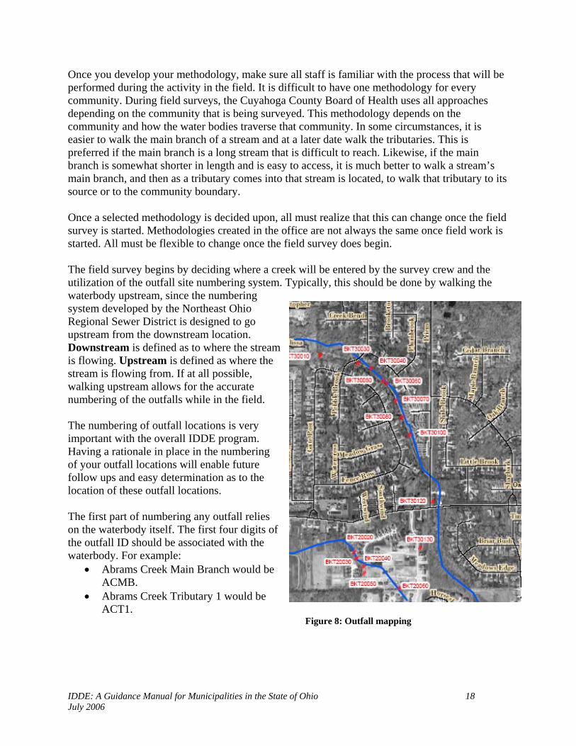
Once you develop your methodology, make sure all staff is familiar with the process that will be performed during the activity in the field. It is difficult to have one methodology for every community. During field surveys, the Cuyahoga County Board of Health uses all approaches depending on the community that is being surveyed. This methodology depends on the community and how the water bodies traverse that community. In some circumstances, it is easier to walk the main branch of a stream and at a later date walk the tributaries. This is preferred if the main branch is a long stream that is difficult to reach. Likewise, if the main branch is somewhat shorter in length and is easy to access, it is much better to walk a stream’s main branch, and then as a tributary comes into that stream is located, to walk that tributary to its source or to the community boundary. Once a selected methodology is decided upon, all must realize that this can change once the field survey is started. Methodologies created in the office are not always the same once field work is started. All must be flexible to change once the field survey does begin. The field survey begins by deciding where a creek will be entered by the survey crew and the utilization of the outfall site numbering system. Typically, this should be done by walking the waterbody upstream, since the numbering system developed by the Northeast Ohio Regional Sewer District is designed to go upstream from the downstream location. Downstream is defined as to where the stream is flowing. Upstream is defined as where the stream is flowing from. If at all possible, walking upstream allows for the accurate numbering of the outfalls while in the field. The numbering of outfall locations is very important with the overall IDDE program. Having a rationale in place in the numbering of your outfall locations will enable future follow ups and easy determination as to the location of these outfall locations. The first part of numbering any outfall relies on the waterbody itself. The first four digits of the outfall ID should be associated with the waterbody. For example:
• Abrams Creek Main Branch would be ACMB.
• Abrams Creek Tributary 1 would be ACT1.
Figure 8: Outfall mapping

IDDE: A Guidance Manual for Municipalities in the State of Ohio 19 July 2006
The next four components of the outfall ID consists of the number of that outfall. This, too, is a four digit number. Examples include:
A stream traverses Community A. This stream is the main branch and flows throughout the community, border to border. In this situation, the survey should be conducted from the downstream border of the stream and then walked upstream to the other border of the community.
The stream where it leaves the community will be numbered as either a 0000, 1000, 2000, 3000 etc, depending on how many communities that stream passes through before it either enters another major river or Lake Erie. If it only travels through one more community, then it would start at 1000.
Once the first outfall is located, either starting at 0000, 1000, 2000, etc, the next outfall number should go in sequences of 10’s. This allows for the addition of future outfall locations between existing ones. This can occur with new construction or if one outfall was missed during the initial field survey.
For additional examples, please refer to the IDDE Outfall Database – Outfall Identification and Stream Naming Convention document in Appendix A. Once in the waterbody, the survey crew will walk or boat until they come upon a MS4 outfall location. When the outfall is located, the survey crew will perform the following for the outfall location:
Take a photograph of the outfall and indicate the number of the photo on the survey form. Take GPS coordinates of the outfall – important in the mapping of the outfall locations.
The GPS coordinates can be exported to different mapping systems that can plot these points on a map of the community.
Fill out the necessary information on the field form (see Appendix B for example of field form), including
o Date o Observer o Community o Waterbody o Watershed / Subwatershed o Location (address if
possible, street name, etc) o Latitude and Longitude o Elevation o Side of stream the outfall is
located on (river left, river right – always face downstream when determining the side of the water body the outfall is on for consistency)
Figure 9: Measuring size of outfall

IDDE: A Guidance Manual for Municipalities in the State of Ohio 20 July 2006
o Shape of outfall Circular Elliptical Egg Rectangular Other
o Outfall Material RCP (Reinforced Concrete Pipe) CMP (Corrugated Metal Pipe) VCP (Vitrified Clay Pipe) PVC (Polyvinyl Chloride Pipe) Other
o Size of outfall o Condition of outfall
Good Fair Poor N/A
o Measurement of bottom of outfall to the top of the waterbody level, in feet o Type of outfall
MS4 Other Unknown Household septic discharge Commercial septic discharge
Observe any noticeable pollution condition or other observances that may indicate possible illicit discharges that may be emanating from this outfall.
Note: It is always desirable to perform dry weather inspections and sampling at the same time as the field survey. However, due to the weather conditions in Ohio and the number of days that we have dry weather (minimum 72 hours of no rainfall over 0.1 inches); it is necessary to perform the field surveys whenever possible and then to follow-up with dry weather inspections and sampling at a later date. Once the outfalls have been identified and mapped, it is easier to perform dry weather inspections and sampling because the locations are now mapped and easier to locate.

IDDE: A Guidance Manual for Municipalities in the State of Ohio 21 July 2006
Figures 10: Example of Outfall Materials
RCP (Reinforced Concrete Pipe) CMP (Corrugated Metal Pipe)
VCP (Vitrified Clay Pipe) PVC (Polyvinyl Chloride Pipe)
IDDE: A Guidance Manual for Municipalities in the State of Ohio 22 July 2006
Chapter 3: Inspection and Developing Priority Areas Another mandatory requirement of a Phase II IDDE program is to “develop and implement a plan to detect and address non-storm water discharges, including illegal dumping, to your system”. EPA recommends that this plan include the following components:
1. Locate priority areas within your community 2. Trace the source of an illicit discharge 3. Remove the source of the illicit discharge 4. Program evaluation and assessment
Locating priority areas within your community will be the focus of this chapter. The remaining components will be focused in the following chapters. Developing Priority Areas is vital to any community IDDE program. This process can be broken down into three fundamental steps:
1. Use all available information to identify the potential hot spots of the community 2. Conduct dry weather field screenings to locate non-storm water discharges 3. Conduct water quality sampling and analysis to determine what non-storm water
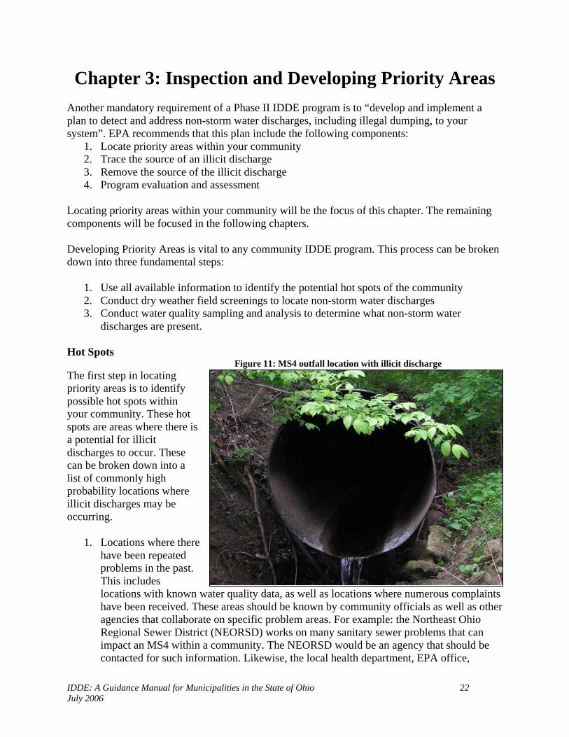
discharges are present. Hot Spots Figure 11: MS4 outfall location with illicit discharge The first step in locating priority areas is to identify possible hot spots within your community. These hot spots are areas where there is a potential for illicit discharges to occur. These can be broken down into a list of commonly high probability locations where illicit discharges may be occurring.
1. Locations where there have been repeated problems in the past. This includes locations with known water quality data, as well as locations where numerous complaints have been received. These areas should be known by community officials as well as other agencies that collaborate on specific problem areas. For example: the Northeast Ohio Regional Sewer District (NEORSD) works on many sanitary sewer problems that can impact an MS4 within a community. The NEORSD would be an agency that should be contacted for such information. Likewise, the local health department, EPA office,

IDDE: A Guidance Manual for Municipalities in the State of Ohio 23 July 2006
county engineer, municipal engineer or a variety of other agencies should be contacted when compiling this information.
2. Older areas of a community may indicate possible locations where there will be illicit discharges detected. These locations in a community may have a higher percentage of illegal connections and/or have deteriorating sewer lines leading to infiltration problems from the older infrastructure found in that area.
3. The commercial and/or industrial areas of the community will tend to have a higher percentage of illicit discharges as well. Historically, these locations have significant numbers of illegal connections and have discharges with a high potential to affect water quality (Tuomari, 1999 and Pitt et al., 1993).
Detection / Inspections Once the community has established their list of priority areas, then inspections must be conducted on all of the community’s known MS4 outfall locations. Dry weather inspections are the required inspection protocol that communities must perform on their MS4 outfall locations. Dry weather inspections are a visual inspection of the outfall location. Dry weather is defined as a minimum of 72 hours of no rainfall (0.1”) within an area. During this type of visual inspection, there are a number of recommendations required to perform an effective dry weather screening process.
Figure 12: Dry weather field inspection
• Always notify the public during any field component of your IDDE program. Examples include letters/postcards to residents, community webpage and community newsletters. As mentioned in the mapping chapter, it is important that the public is very aware of what is occurring in a community and keeping them informed of what is occurring will benefit the IDDE program. A better informed citizenry may assist in finding an illegal discharger, as well as helping with the educational component of the program.
• As mentioned in the previous chapter, safety in the field is vital. Typical surveys should
always be done with two field staff (if available). Remember, like the mapping component, during the field investigations there will be remote areas that the field staff will be inspecting. If injury occurs, the extra field staff is a necessity. Also be aware of the locations where field inspections will occur because specific locations may present specific sources for safety concerns.

IDDE: A Guidance Manual for Municipalities in the State of Ohio 24 July 2006
• Utilize the information that you obtained from your mapping component. Print out completed inventory forms, inspection forms and a map indicating where the outfalls are and have them numbered on this map. This will allow for ease of locating known MS4 outfall locations. The field form will have the photo of the outfall, location of the outfall, side of stream, etc. This information is imperative when in the field. When the field staff finds the outfall, it is important to know which outfall is being inspected.
• During this visual inspection, fill out the field inspection form. The following is a list of
observations needed for this component, and are listed on the field format: o Outfall number o Date o Time o Crew staff o Time of last rain o Pipe flow (none, <1/4 pipe, <1/2/ pipe, etc) o Comment section for:
Odor, color, turbidity, floatable matter The above information is for dry weather visual inspections only. The field form also encompasses a sampling section for water quality sampling work that is conducted on an outfall. Physical Indicators As mentioned above, during dry weather visual inspections, it is important to indicate the conditions observed at an outfall location. This includes: flow, odor, color, turbidity and if floatables are present at the location. The information that you obtain from the physical characteristics observed are indicators and cannot be fully relied upon by themselves. Floatables are the best physical indicator. Floatables can consist of sewage, suds, and oil sheens. These are the most common. The observation of sewage at an outfall location indicates that there is a severe problem with that MS4 and should be looked at as to where the source for the sewage is emanating from. Suds can indicate a variety of things. Some suds are naturally formed by the movement of the water. If the suds are located at a water drop off and break up quickly, this may only be water turbulence related. If the suds have a fragrant odor, this can indicate the presence of laundry water or wash water in the waterbody. Oil sheens need to be looked at to try and determine the source of the oil sheen. Some oil sheens are common and occur naturally by in-stream processes. This occurs when an iron bacteria forms a sheet-like film. This can be determined by looking at the sheen and seeing if it cracks when disturbed. Synthetic oil sheens, on the other hand, will swirl when disturbed. If this occurs, then the sheen is from an oil source. Remember, when dry weather flows are observed at an outfall, the flow is considered non-storm water related. This flow can be an illicit discharge, but it may also be a flow being generated from another action that is not considered illicit (refer to chapter 1). Likewise, if no flow is observed at an outfall, it does not mean that there is no problem at that specific outfall. In chapter 1, different types of illicit discharges (continuous, intermittent and transitory) were discussed. The continuous flows are the easiest to locate. The other two are not. That is why it is important to observe the area at each outfall’s location for any type of observable pollution problem that may be the result of a transitory or intermittent illicit discharge.

IDDE: A Guidance Manual for Municipalities in the State of Ohio 25 July 2006
It is extremely important for IDDE program managers to recognize that during field inspections, the outfall is observed as a snapshot in time. An effective IDDE program utilizes long term dry weather inspections. This involves regular inspections of outfalls in a community. These inspections will be consistent with the aforementioned protocol. The inspections can be done once a year but on a continuous basis over time. This will ensure that each outfall is being monitored routinely and that if changes occur at that location, action can then be implemented. Water Quality Sampling and Testing An effective IDDE program will utilize water quality sampling and testing as a tool. When dry-weather flows are observed, it will be difficult to determine if there is a problem with that flow. Obvious problems, such as strong sewage odor, or the presence of raw sewage or toilet paper, will indicate that there is a bacterial problem at that location emanating from sanitary sewers, cross connections or septic systems. However, in most circumstances, water that is observed during dry weather conditions will not have those visual clues. That is why water quality testing and sampling is a vital component for an IDDE program. Certain water quality parameters can serve as indicators of the likely presence or absence of a specific type of discharge. Some of these parameters can be measured in the field with specific instrumentation and field sample kits, while still others will need to be analyzed at a laboratory.
There are a large number of water quality parameters that can be measured in an IDDE program. The most commonly used and useful parameters are summarized in Table 3-1, which focuses on those parameters suggested in Pitt et al. (1993), the New England Interstate Water Pollution Control IDDE Manual and the EPA’s Phase II regulations.
Figure 13: Taking a water sample at an MS4 outfall location during dry weather flow.WATER Q UALITY TES T

IDDE: A Guidance Manual for Municipalities in the State of Ohio 26 July 2006
Table 3-1: Water Quality Test Parameters And Uses Water Quality Test
Use of Water Quality Test Comments
Conductivity Used as an indicator of dissolved solids
- Pitt et al. 1993 suggested parameter; EPA Phase II regulations recommended parameter - Typically measured in the field with a probe
Bacteria (fecal coliform, E. coli and/or enterococci)
Used to indicate the presence of sanitary wastewater
- Used by NHDES
Ammonia High levels can be an indicator of the presence of sanitary wastewater
- Pitt et al. 1993 suggested parameter; EPA Phase II regulations recommended parameter
Surfactants Indicate the presence of detergent (e.g., laundry, car washing)
- Pitt et al. 1993 suggested parameter; EPA Phase II regulations recommended parameter
pH Extreme pH values (low or high) may indicate commercial or industrial flows; not useful in determining the presence of sanitary wastewater (which, like uncontaminated base flows, tends to have a neutral pH, i.e., close to 7)
- Pitt et al. 1993 suggested parameter; EPA Phase II regulations recommended parameter - Typically measured in the field or lab with a probe
Temperature Sanitary wastewater and industrial cooling water can substantially influence outfall discharge temperatures. This measurement is most useful during cold weather.
- Pitt et al. 1993 suggested parameter - Measured in the field with a thermometer or probe
Hardness Used to distinguish between natural and treated waters
- Pitt et al. 1993 suggested parameter
Total Chlorine Used to indicate inflow from potable water sources; not a good indicator of sanitary wastewater because chlorine will not exist in a "free" state in water for long
- Pitt et al. 1993 suggested parameter
Fluoride Used to indicate potable water sources in areas where water supplies are fluoridated
- Pitt et al. 1993 suggested parameter
Potassium High levels may indicate the presence of sanitary wastewater
- Pitt et al. 1993 suggested parameter
Optical Brighteners (Fluorescence)
Used to indicate presence of laundry detergents (which often contain fabric whiteners, which cause substantial fluorescence)
-Pitt et al. 1993 suggested parameter -Used by City of Winooski, VT
Dissolved Oxygen Low DO can indicate sewage problem -Toth, Lake County Health
Phosphorus High phosphorus can indicate sewage and/or possible illegal gray water connections
-Toth, Lake County Health
Source: Table Modified from Illicit Discharge Detection and Elimination Manual: A Handbook for Municipalities, New England Interstate Water Pollution Control Commission
IDDE: A Guidance Manual for Municipalities in the State of Ohio 27 July 2006
The above table indicates that there are a number of water quality parameters that can be used to look for specific problems in communities. When deciding on what water quality parameters to use, the IDDE program manager must be aware of the community makeup and the possible sources of illicit discharges as well as how much money is available to complete water quality sampling. It is not necessary to do lab analysis on every sample. It is very possible to operate a successful IDDE program on a shoestring budget. That is why developing a priority list and hot spot locations are very important in determining the specific parameters to test for. When developing your IDDE program protocol for sampling, it is important to have a monitoring plan in place. This can be utilization of Standard Methods reference documents as well as a Quality Assurance Management Plan (QAMP). An example QAMP is included in the appendix. This was designed utilizing the US EPA QAMP model documents available at: http://www.epa.gov/quality/qmps.html. These plans will provide for proper quality assurance and quality control of proper sampling procedures. This will be important to validate your data. This will include proper calibration of field equipment and meters, how to properly take samples and keep them cold for the proper amount of time until delivered to the lab, and it will indicate how you will ensure the samples are valid (field blanks and replicate samples). Also, it is important to take into account the resources that a community has and what they can allow for the IDDE sampling portion of their program. During the sampling phase, utilizing a meter to obtain some of this information is a worthwhile endeavor. There are a series of meters that can be used for temperature, pH, and conductivity. The lab analysis of samples is where there can be a high cost for communities. When determining what you want to sample for, look at the community as a whole and what are the problems of that specific community. In many circumstances, the problems lay with infrastructure, where you have older sanitary and storm sewer lines and there are infiltration problems from the sanitary to the storm sewer. In most cases, the first sampling parameter should be for bacteria. Fecal coliform is an indicator organism found in the intestines of warm blooded mammals. When it is found in high quantities, this is an indicator of a bacterial problem. The dry weather inspections and the water quality testing will provide valuable information for an effective IDDE program. By establishing a consistent protocol in these inspection strategies, the community will acquire data that is necessary in order to have an effective IDDE program. By performing long term dry weather inspections, a long term protocol will be set in place to view MS4 outfalls and ensure they are not discharging pollutants into the surface waters of the state. Likewise, the sampling component will provide valuable data for communities’ IDDE programs. Sampling is a vital component and communities need to start addressing this component sooner rather than later. By starting a sampling protocol and continuing this protocol on a yearly basis, the community will develop baseline data as to their outfall discharges. It will allow the communities to efficiently work on problem areas by directing their resources wisely by utilizing the sampling data. It will also allow communities to look at their MS4s over a long period of time to observe improvements in problem areas.

IDDE: A Guidance Manual for Municipalities in the State of Ohio 28 July 2006
There is no single indicator parameter that is perfect. Table 3-2 summarizes the parameters that meet most of the indicator criteria, compares their ability to detect different flow types, and reviews some of the challenges that may be encountered when measuring them. “The Data in Table 3-2 are based on research by Pitt conducted in Alabama, and therefore, the percentages shown to distinguish “hits” for specific flow types should be viewed as representative and may shift for each community. Also, in some instances, indicator parameters were “downgraded” to account for regional variation or dilution effects. For example, both color and turbidity are excellent indicators of sewage based on discharge fingerprint data, but both can vary regionally depending on the composition of clean groundwater.” (Center for Watershed Protection and Pitt, 2004)
Table 3-2: Indicator Parameters Used to Detect Illicit Discharges Discharge Types It Can Detect
Parameter
Sewage
Wash water
Tap
Water
Industrial or Commercial
Liquid Wastes
Laboratory/Analytical Challenges
Ammonia # * x * Can change into other nitrogen forms as the flow travels to the outfall
Boron * * x N/A Chlorine x x x * High Chlorine demand in natural waters
limits utility to flows with very high chlorine concentrations
Color * * x * Conductivity * * x * Ineffective in saline waters Detergents- Surfactants
# # x
* Reagent is a hazardous waste
E. coli Enterococci Total Coliform
*
x
x
x
24-hour wait for results. Need to modify standard monitoring protocols to measure high bacteria concentrations
Fluoride1 x x # * Reagent is a hazardous waste exception for communities that do not fluoridate their tap water
Hardness * * * * pH x * x * Potassium * x x # May need to use two separate analytical
techniques, depending on the concentration Turbidity * * x * # Can almost always (>80% of samples) distinguish this discharge from clean flow types (e.g., tap water or natural water). For tap water can distinguish from natural water. * Can sometime (>50% of samples) distinguish this discharge from clean flow types depending on regional characteristics, or can be helpful in combination with another parameter x Poor indicator. Cannot reliably detect illicit discharges, or cannot detect tap water. N/A Data are not available to assess the utility of this parameter for this purpose. Data Source: Pitt (this study) 1 Fluoride is a poor indicator when used as a single parameter, but when combined with additional parameter (such as detergent, ammonia and potassium), it can almost always distinguish between sewage and wash water. SOURCE: Illicit Discharge Detection and Elimination: A Guidance Manual for Program Development and Technical Assessments, Center for Watershed Protection

IDDE: A Guidance Manual for Municipalities in the State of Ohio 29 July 2006
Quality Assurance Management Plans and Project Plans (QAMP/QAPP) Appendix D has information on the development of a QAMP or QAPP. These plans are extremely important in ensuring that when water samples are obtained, that there is a consistent and approved protocol used. This is to ensure that the data you collect is accurate. This should include where to collect samples, when to collect, how to collect, calibration of equipment (meters), storage of samples, chain of custody, and transportation of samples to lab. It is best to develop your QAMP/QAPP by utilizing organizations that have experience in this type of quality control processes. This can include EPA, local health departments, and sewer districts. It is also important to have all field staff properly trained for sample collecting. Equipment for Water Sampling When performing water quality sampling, it is important to have adequate equipment. This includes, but not limited to:
• Cooler • Ice • Bottles: These will depend on the parameter being sampled for. The lab that you utilize
for analysis may provide you the bottle that is required. Keep bottles in a safe environment to prevent cross contamination from occurring.
• Labels for bottles: In many circumstances, the lab will have the bottles pre-labeled. If not, get the labels that the lab recommends for labeling the bottles.
• Permanent marker for bottles • Field forms • Latex gloves • Meters: depends on what parameters and what type of meter purchased for use. • Test kits
Whenever a water sample is taken at an MS4 outfall location, fill out the inspection form from Appendix C and make sure the time of sample is indicated. This is important when delivering samples to the lab. It is not recommended to try and analyze the samples yourself, unless you have a lab available. It is better to use a lab that has a QA/QC policy in place and one that routinely performs this type of analysis for consistency purposes. Special Monitoring Some of the monitoring that will be required will involve different techniques. If an outfall location shows physical signs of a problem, but no flow is observed, then that illicit discharge is either an intermittent or transitory discharge. These do not flow continuously and may be difficult to observe. Once an outfall is determined to have a possible illicit discharge associated with it and no flow is observed, then an alternate inspection and sampling program must be used. This can include the following:

IDDE: A Guidance Manual for Municipalities in the State of Ohio 30 July 2006
Odd hours of monitoring: Perform inspections either later in the evening or early morning hours or on the weekends. Since many types of intermittent discharges probably occur when households are home, then the inspection needs to be performed during these times as well. Make sure that if samples will be collected during odd times, the lab needs to be notified to ensure they can accept and analyze the sample since there are specific holding times for each type of parameter. Sampling at the outfall plunge pool: A sample would be collected directly from the plunge pool below the outfall, if one is present. An upstream sample will also be taken to compare the results. This can be affected by dilution and time so it is not always that accurate and effective.

IDDE: A Guidance Manual for Municipalities in the State of Ohio 31 July 2006
Chapter 4: Tracing For the Source of an Illicit Discharge
Once an illicit discharge has been identified and detected, the next step is to locate the source of that discharge. The development of a plan to locate and address illicit discharges is required under the Phase II Storm Water Rules. “EPA recommends that the plan include the following five components:”
1. Locate the priority areas 2. Sample or screen the outfall 3. Trace the source of an illicit discharge 4. Remove the source of the illicit discharge 5. Program evaluation and assessment
The information that is received from the mapping and the inspection protocols established by a community will be valuable in this component (see previous chapters). During the inspection process, illicit discharges may be located and detected. Once these outfall locations are determined to have an illicit discharge, then the community must start its tracing protocol to determine where the source of the illicit discharge is emanating from. Once located, this discharge needs to be eliminated from the community’s MS4 system. Tracing Techniques There are a number of different techniques that can be utilized to trace for an illicit discharge. Each technique listed must be fully understood and their limitations must be understood as well. Visual Inspections/Manholes and Storm Drain Network Figure 14: Removing storm drain lid
Once a dry weather flow is observed and it has been determined to be an illicit discharge, a key tracing technique involves dry weather inspections along the specific MS4 conveyance system. Typically, if the conveyance system is an open ditch, this is an easier process then if it was within an enclosed storm drain network. The inspection process utilizing this method needs to start at the initial detection location (the MS4 outfall where the illicit discharge has been observed and noted). The next step is to work “upstream” from this location – that is moving up the storm drainage system to the first manhole. Check this manhole to see if there is evidence of flow. You may wish to sample each manhole, but looking for flow, since the flow has already been determined to have an illicit discharge, it is the more cost effective and faster method suggested. If flow is observed at

IDDE: A Guidance Manual for Municipalities in the State of Ohio 32 July 2006
this manhole, move to the next upstream manhole. Keep moving upstream until no flow or low flow is observed. Keep in mind that as you move upstream, there may be junction lines entering that main storm drainage system at other locations. Utilize the storm drainage maps for the community to determine if this is the case. In these circumstances, you will need to check these manholes as well. During this inspection process, key observations are necessary, including:
• Presence of flow • Odors • Colors/clarity • Stains or deposits on bottom of structure • Oil sheen, scum or foam on any standing water
During this process, sampling can be utilized to assist in this tracing process. Once areas are determined to have possible illicit source flows, sampling these individual locations and manholes can assist in directing where the source of the illicit discharge is located. Specific parameters can be used when looking for the illicit discharge. Refer to Chapter 3, Table 3-1 for sample parameters that can be used for specific sources of illicit discharges. Typically, you will use the same parameter that was used when the initial sample was taken to determine if an illicit discharge was present at that flow. Dye Testing Figure 15: Dye at outfall location Once the area has been determined where the potential illicit discharge source is located, the utilization of dye testing will assist in determining the exact location of the illicit discharge. Permission is required on private property prior to starting a dye test procedure. Access to the building is required. Once permission is granted, the dye testing will begin. Note: before any dye test is conducted, it is a good idea to notify the appropriate district office of the Ohio EPA Division of Emergency and Remedial Response that a dye test is being conducted as well as the local community fire department and other community personnel. The dye needs to be put into the suspect location. This is done by pouring the dye into sinks, toilets, etc and then flushed through the drainage system. The storm drains and sanitary sewers need to be monitored to observe where the dye discharges to. This procedure is effective in determining direct connections of sanitary lines to storm lines.

IDDE: A Guidance Manual for Municipalities in the State of Ohio 33 July 2006
Televising/Video Inspection Another method in determining where the illicit discharge source is located once an area has been determined to contain the discharge, is televising the storm line. Video cameras can be used by either pushing or using a mobile video unit. Both cameras will provide detailed information as to where the infiltration or connection is located within the MS4 system. Indicator Monitoring / Sampling When dry weather flow is observed at an outfall location, and the sample reveals that there is a problem with this flow, further monitoring can be done to assist in the location of the illicit discharge. As manholes are opened and dry weather flow is observed, samples can be taken and analyzed. During this process, we are looking for a pattern within the sample analysis, depending on the parameter sampled for. During this type of tracing, the monitoring will allow the field crew to determine if the dry weather flow observed is the source of the flow at the outfall location. There can be circumstances where dry weather flow occurs and it is not “illicit” due to its source (drinking water line break, fire hydrant flushing, etc: refer to Chapter 1: Does This Measure Need to Address All Illicit Discharges?). This flow can combine with an illicit source in the storm drainage system making it difficult to trace. By monitoring the water observed, it will assist in the tracing of the illicit source discharging into the storm drainage system. Automatic Samplers can also be used during the investigation of intermittent flows. These samplers can be placed at specific locations within the storm drainage system of a community. These samplers can be triggered by dry weather flows. This type of sampling and monitoring is not the best method for most communities due to the cost of the sampling equipment. This type of monitoring can be effective however, in areas with a large intermittent discharge problem and a very complex storm drainage system. These samplers will provide the date and time the sample was collected which will assist the community in locating the source of this discharge. Smoke Testing This method should be used during special circumstances when a good storm sewer map is not available for a location and there are known problems of connection issues. Smoke is introduced into the storm drainage system and will emerge at locations that are connected to that system. It is recommended that qualified personnel be used for this method to ensure accurate test results. “Notifying the public about the date and purpose of smoke testing before starting is critical. The smoke used is non-toxic, but can cause respiratory irritation, which can be a problem for some residents. Residents should be notified one week prior to testing, and should be provided the following information” (Hurco Technologies, Inc., 2003):
• Date testing will occur and reason for smoke testing • Precautions they can take to prevent smoke from entering their homes or businesses • What they need to do if smoke enters their home or business, and any health concerns
associated with the smoke • A number residents can call to relay any particular health concerns (e.g., chronic
respiratory problems)

IDDE: A Guidance Manual for Municipalities in the State of Ohio 34 July 2006
Optical Brightener Monitoring (OBM) Traps OBM traps can be used to assist in tracing intermittent flows that result from wash water with detergent. Detergents contain optical brighteners that can be detected at high concentrations. However, this method usually only picks up highly concentrated discharges. The OBM method may be used as a simple indicator for the presence or absence of intermittent flows or to detect the most concentrated flows. These traps usually contain unbleached cotton pads or a fabric swatch placed inside of a wire mesh trap. These traps are anchored inside of an outfall using wire that is secured to the pipe itself. Rocks can also be used to hold the trap in place. These traps will be retrieved after 24-48 hours of dry weather. They need to be removed prior to having contact with storm water. When placed under a fluorescent light, an OBM trap will indicate if it has been exposed to detergents. (Guidelines for SOP, 2-13).
IDDE: A Guidance Manual for Municipalities in the State of Ohio 35 July 2006
Chapter 5: Elimination of an Illicit Discharge Developing and implementing an effective IDDE program requires the successful removal of an illicit discharge once located. Under the Ohio EPA Phase II rules, you must “to the extent allowable under law, effectively prohibit, through ordinance or other regulatory mechanism, non-storm water discharges into your storm sewer system and implement appropriate enforcement procedures and actions”. There has been a model illicit discharge ordinance developed by a collaborative effort of the Chagrin River Watershed Partners, Inc., the Cuyahoga County Board of Health and the Lake County General Health District. This ordinance has been approved by the Ohio EPA and is located in Appendix E. This model ordinance allows for the regulatory mechanisms for communities to address these illicit discharges and comply with the Ohio EPA Phase II requirements. Once an illicit discharge has been identified, communities must then determine who is responsible for the removal of the discharge. Ultimately, it is the property owner or the municipality.
• Internal Plumbing Connection: Generally, it is the building owner. • Service Lateral: This is also generally the building owner. However, in some
circumstances, communities may fix the problem and share in the cost with the building owner depending on the policy and procedures communities have developed.
• Infrastructure Failure: This type of discharge is the community’s responsibility if within the dedicated right of way.
• Transitory Discharge: Again, the building owner is responsible to correct. • Educating residents on habits (illegal dumping, etc).
Typically, the timeframe established for the repair of these illicit discharges is established within the community’s enforcement procedures. During the enforcement of these illicit discharges the communities must provide clear guidance in both their ordinance and with their direction to the responsible party for what actions need to be taken to correct the problem. Once the removal of the illicit discharge has occurred, it must be confirmed to ensure the correction has been made. For example, this can be confirmed by dye testing internal plumbing fixtures if the source was from an internal or service lateral line source. There are various methods that can be used to remove an illicit discharge and to fix the problem. Table 5-1 gives an overview of the technique, when to use and the description.

IDDE: A Guidance Manual for Municipalities in the State of Ohio 36 July 2006
Table 5-1: Methods to Eliminate Discharges
Technique Application Description Estimated Cost Service Lateral Disconnection, Reconnection
Lateral is connected to the wrong line
Lateral is disconnected and reconnected to appropriate line
$2,500-$5,000
Cleaning
Line is blocked or capacity diminished
Flushing (sending a high pressure water jet through the line); pigging (dragging a large rubber plug through the lines); or rodding
$1/linear foot
Excavation and Replacement
Line is collapsed, severely blocked, significantly misaligned, or undersized
Existing pipe is removed, new pipe placed in same alignment; Existing pipe abandoned in place, replaced by new pipe in parallel alignment
For 12” line, $100-$150/linear foot
Manhole Repair
Decrease ponding; prevent flow of surface water into manhole; prevent groundwater infiltration
Raise frame and lid above grade; install lid inserts; grout, mortar or apply shortcrete inside the walls; install new precast manhole
Vary widely, from $250 to raise a frame and cover to ~ $4,000 to replace manhole
Corrosion Control Coating
Improve resistance to corrosion
Spray- or brush-on coating applied to interior of pipe.
< $10/linear foot
Grouting
Seal leaking joints and small cracks
Seals leaking joints and small cracks.
For a 12” line, ~ $36-$54/linear foot
Pipe Bursting
Line is collapsed, severely blocked, or undersized
Existing pipe used as guide for inserting expansion head; expansion head increases area available for new pipe by pushing existing pipe out radially until it cracks; bursting device pulls new pipeline behind it
For 8” pipe, $40- $80/linear foot
Slip Lining
Pipe has numerous cracks, leaking joints, but is continuous and not misaligned
Pulling of a new pipe through the old one.
For 12” pipe, $50- $75 /linear foot
Fold and Formed Pipe
Pipe has numerous cracks, leaking joints
Similar to slip lining but is easier to install, uses existing manholes for insertion; a folded thermoplastic pipe is pulled into place and rounded to conform to internal diameter of existing pipe
For 8-12” pipe, $60- $78/linear foot
Inversion Lining
Pipe has numerous cracks, leaking joints; can be used where there are misalignments
Similar to slip lining but is easier to install, uses existing manholes for insertion; a soft resin impregnated felt tube is inserted into the pipe, inverted by filling it with air or water at one end, and cured in place.
$75-$125/linear foot
SOURCE: Modified from Illicit Discharge Detection and Elimination: A Guidance Manual for Program Development and Technical Assessments, Center for Watershed Protection, 2004

IDDE: A Guidance Manual for Municipalities in the State of Ohio 37 July 2006
If the illicit discharge is emanating from outside of your community or jurisdiction, it is important that you notify the community where the discharge is coming from. This should be done in a letter format where you can document that it was sent. The letter should include where the illicit discharge was detected and where it was traced to by your community. Keep records of what your community did, and ask the neighboring community/jurisdiction to inform you when the correction has been made. Include all of your documentation with your annual Phase II Storm Water Report to the EPA. Preventing Illegal Dumping One source of illicit discharge to a community’s MS4 system is illegal dumping. This is often difficult to identify and locate. Because of the potential problem that this type of discharge presents, it is important to develop an Illegal Dumping Prevention Program as part of your IDDE Program. The US EPA has developed an Illegal Dumping Prevention Guidebook that provides key information and procedures in addressing this type of illicit discharge. The guidebook can be located at: http://www.epa.gov/region5/illegaldumping/. Strategies for preventing illegal dumping include:
• Site maintenance and controls: This includes cleaning up areas where illegal dumping has occurred and to utilize specific controls to prevent further dumping. These controls can include signage or restriction of the area.
• Targeted Enforcement: Utilization of an ordinance that prohibits illegal dumping.
• Education and Involvement: As with components I and II of the Phase II program,
community outreach and involvement is vital to any successful IDDE program. This includes a variety of programs that can assist the community in meeting their requirements under this component of Phase II.
o Educate general public, municipal employees and businesses about water quality
issues and how illegal dumping has a direct impact on these water quality issues. o Provide for effective ways to dispose of waste
o Provide a way for citizens to get involved in reporting and preventing illegal
dumping, such as storm drain marking that indicates:
No dumping – drains directly to lake, creek, or other water body
o Develop materials/brochures for the public and businesses. This should include businesses that handle hazardous materials as well as restaurants, auto repair shops and others that may have an impact on possible sources of an illicit discharge.

IDDE: A Guidance Manual for Municipalities in the State of Ohio 38 July 2006
o Develop an anonymous mechanism that can be used by the public, businesses and
municipal employees to report illicit discharges.
o Create a service department self-inspection program to detect possible sources of illicit discharges and illegal connections.

IDDE: A Guidance Manual for Municipalities in the State of Ohio 39 July 2006
Chapter 6: Evaluation of your IDDE Program A successful IDDE Program involves a program evaluation and assessment. EPA recommends that the IDDE Program have procedures for program evaluation and assessments. IDDE programs should be evaluated at the end of each year to assess if it has been effective and most of all, efficient. Evaluating the Program To effectively evaluate your program, a number of questions need to be asked and analyzed.
1. Evaluate priority areas within your community: a. Were these areas identified initially? b. Are these areas still appropriate to be a priority area? c. Have illicit discharges been located in these areas?
2. Detection Program a. Is the program effective? Need to reassess the program by determining what has
been achieved. Look at number of outfalls inventoried, the number visually inspected, the number that had dry weather flows and look at the overall percentages of these flows as part of your overall storm sewer system for your community.
b. Cost effectiveness: What aspects of the program had the highest quality of effectiveness in relationship to cost?
c. Number of illicit discharges detected utilizing each detection method (will assist to see what method is more effective).
3. Tracing Program
a. What techniques were used? b. Were these methods successful? c. What techniques that were not used would be beneficial for next year? d. How many illicit sources were identified and eliminated?
4. Other a. If using water quality sampling, resample areas within community to determine
effectiveness of the removal of illicit discharges. b. Determine how much time was spent by employees and expenses to determine
overall cost for achieving a given result. Establish a Tracking and Reporting System It is important that a tracking system be developed. This system is to track, report and respond to illicit discharge problems. This tracking system enables the community to measure the IDDE program effectiveness and assists with the evaluation of the overall IDDE program.

IDDE: A Guidance Manual for Municipalities in the State of Ohio 40 July 2006
Chapter 7: Education to Public Employees, General Public and Businesses
The Ohio EPA requires that communities must inform public employees, businesses and the general public of hazards associated with illegal discharges and improper disposal of waste. This chapter provides some suggestions as to how to provide this information to the targeted audience. Public Employees The Phase II Storm Water rules require that municipal employees be trained on pollution prevention techniques. This is located under minimum control measure number 6: “Pollution Prevention/Good Housekeeping for Municipal Operations”. Part of this training can include the prevention of non-storm water discharges from entering the storm sewer system from municipal operations. Public employees can play an important role as partners in the detection and/or prevention of illicit discharges. Service department employees can look for signs of illegal dumping in catch basins and other locations. Building inspectors can ensure that illegal connections to the storm sewer system do not take place during construction projects. Staff whose jobs keep them outside and mobile can help spot illegal dumpers. Fire and police department personnel who respond to hazardous material spills can help keep these spills out of the storm sewer system and adjacent water bodies. General Public The general public must be made aware and educated on environmental and water quality issues. During this outreach stage, it is important to get the public engaged and involved in the process. Some examples of what can be done by the general public include:
Print and distribute outreach materials. This should include information on water pollution, storm water problems, what is an illicit discharge, and what the community is doing about illicit discharges.
Develop a program to encourage the public to report illicit discharges/dumping when they are observed. This can include a dedicated “hotline” for the public to call when they observed situations that are impacting the community’s MS4 system.
Develop citizen volunteers to conduct storm drain stenciling projects at storm drains. It is important that citizens be trained. Many local Soil and Water Conservation Districts can perform this training and assist the community in public involvement activities. All volunteers should sign a liability form.
The community should develop a household hazardous waste disposal/recycling program. This can be done in conjunction with other communities or coordinated through the County Solid Waste Management District.

IDDE: A Guidance Manual for Municipalities in the State of Ohio 41 July 2006
8 Businesses It is also important to educate local businesses to show how they can have an impact on water pollution. Here are some steps you can take to reach out to businesses.
Develop a brochure and/or presentations to inform businesses about water pollution, storm water and illicit discharges. It is important to have partners assist on this project including the local Chamber of Commerce.
Provide contractors and developers information on illegal connections.

IDDE: A Guidance Manual for Municipalities in the State of Ohio 42 July 2006
References Casco Bat Estuary Partnership, Aquarion Engineering Services, and Edelstein Associates.
Guidelines and Standard Operating Procedures for Stormwater Phase II Communities in Maine.
Center for Watershed Protection and Robert Pitt. 2004. Illicit Discharge Detection and
Elimination: A Guidance Manual for Program Development and Technical Assessments. Cuyahoga County Board of Health, 2005. Quality Assurance Management Plan. Cuyahoga County Board of Health, 2003. Illicit Discharge Detection and Elimination Field
Requirements. New England Interstate Water Pollution Control Commission, 2003. Illicit Discharge Detection
and Elimination Manual: A Handbook for Municipalities. Northeast Ohio Regional Sewer District, 2003. Stormwater Outfall Database. Ohio EPA, 2004. 3745-39-03, Ohio EPA NPDES requirements for small MS4s.

IDDE: A Guidance Manual for Municipalities in the State of Ohio 43 July 2006
Appendix A
IDDE Outfall Database - Outfall Identification and Stream
Naming Convention

IDDE: A Guidance Manual for Municipalities in the State of Ohio 44 July 2006
IDDE Outfall Database - Outfall Identification and Stream
Naming Convention Background The naming system used for identifying outfalls in the NEORSD historical outfall dataset was used as the basis for the IDDE Outfall Database. This system was developed over the course of several years and several different projects. The resulting naming conventions only addressed the streams within a particular study area and did not give consideration to a more globally applicable stream naming system. As these data sets were incorporated into a comprehensive set, considerations were taken in developing a scheme to make the outfall identification numbers more consistent. It became apparent, however, that as users continued to survey more streams and tributaries, it would be necessary to develop a more flexible naming convention, with the ability to handle multiple unnamed tributaries and duplicate names. As the number of users of the database in Northeast Ohio continues to grow, additional difficulties with the current outfall numbering system will continue to emerge. Already we have encountered instances of common stream names which are used in more than one drainage area and rural drainage systems in which fourth and even fifth order tributaries are not uncommon. So far, this outfall identification system has been able to accommodate these special cases, but such a system is inherently limited. Future expansion of the database may require a more standardized naming system, something along the lines of the stream segment numbering system used by Ohio EPA. Stream Codes: 1) Main Branches Technically only first order streams, that is streams and rivers draining directly into Lake Erie, should be designated as Main Branches. In Northeast Ohio, this includes the Rocky River, Cuyahoga River, Chagrin River, and so forth. However, due to the amount of data collected for many second and third order streams, and the significant number of their tributaries, a number of these were included as Main Branches as well. Examples of Northeast Ohio tributaries designated as Main Branches in the database are Blodgett Creek (tributary of Rocky River), Chippewa Creek (tributary of Cuyahoga River), and Chevy Branch (tributary of Big Creek, itself a tributary of the Cuyahoga River).

IDDE: A Guidance Manual for Municipalities in the State of Ohio 45 July 2006
The first two characters of the outfall identification number designate the Main Branch to which an outfall is tributary. A list of these two-character codes developed for Northeast Ohio communities and thus far assigned can be found in the Stream Designation Spreadsheet. Letters of the alphabet were used to logically approximate stream names, however, in cases where large numbers of streams have names consisting of similar letters (for example, stream names beginning with B and consisting of A's, K's, L's; see Black, Baker, Blodgett, etc.), referring to the codes in the spreadsheet is strongly advised. The second two characters of the outfall identification number indicate whether the stream described by the first two characters is a Main Branch or a Tributary. If the stream is a Main Branch, that is, if the outfall in question is actually located on the stream designated by the first two characters, the second two characters will be designated as MB. 2) Tributary Streams In the outfall identification system described in this document, a tributary stream is any stream designated by the second two characters of the four-character stream code, with the exception of MB, and tributary to the stream designated by the first two characters of the code. This includes secondary and tertiary tributaries as well, and is not limited only to streams that flow directly into the primarily designated stream. For example, if Cook Run is designated as a Main Branch or primary stream (Code = COMB) and a tributary flowing directly into Cook Run is designated Tributary 1 (Code = COT1), another tributary flowing into Tributary 1 may be designated Tributary 2 and coded in a similar way to Tributary 1 (Code = COT2), (Figure 1).
Cook Run Main Branch (COMB)
Tributary
1 (C
OT1)
Tributar
y 2 ( C
OT2
)

IDDE: A Guidance Manual for Municipalities in the State of Ohio 46 July 2006
Figure 1 – Any tributary can be designated by the second two characters of the outfall identification number, including secondary and tertiary tributaries. Some examples (Figure 2) of how tributaries can be coded:
• Commonly-used names (Riley Ditch, tributary to the previously used example of Cook Run, would be CORD);
• Generic tributary numbers (Tributary 1, Tributary 2, etc., tributary to Cook Run would be
COT1, COT2, etc.);
• Other logical designations (North Tributary, Upper Tributary, etc., would be CONT, COUT, etc.).
Cook Run Main Branch (COMB)
Tributar
y 1 (C
OT1)
Tributary 2 (
COT2
)
Riley
D
itch (C
OR
D)
Uppe
r Tri
buta
ry (C
OU
T)
Figure 2 – Examples of how secondary and tertiary tributaries can be named, numbered and coded. 3) Special Cases a) Multiple Main Branch Streams with Identical Names Numerous situations have already been encountered where a stream name has been found to be used in more than one geographical area. As expected, many stream names are not unique and can be encountered repeatedly even within a relatively small area. So far, within the northeast Ohio area we have seen two cases of streams named Wolf Creek and three cases of streams named Plum Creek. In cases where the multiple names are tributaries of different Main

IDDE: A Guidance Manual for Municipalities in the State of Ohio 47 July 2006
Branches, there is no need for different codes, since the outfall identification number will indicate both the tributary name and the main branch name, resulting in a unique combination. In the case where duplicate-name streams are designated as Main Branches, however, it is important to differentiate them with a unique stream code for each. As an example, each of the three Plum Creeks have been given a different stream code (P1, P2 and P3). b) Streams Passing Through Multiple Communities Streams that flow through multiple communities are each assigned a reserved range of numbers for outfall identification. These ranges are further discussed below in the section on Numbering. c) Streams Forming Community Boundaries Streams that form a boundary between communities along all or part of their length create a special challenge in devising a logical outfall identification system. Because each community is required to assign numbers to outfalls along one side of the stream with no knowledge of the numbers being used on the other side, the outfall numbers would inevitably be out of order and/or duplicated for the subject stream. To eliminate potential problems, sections of streams that form community boundaries have been assigned dual designations, either North/South or East/West depending on the general orientation of the stream segment. For example, the segment of Doan Brook Main Branch that forms the boundary between Cleveland and Cleveland Heights, and farther upstream, Shaker Heights and Cleveland Heights, has been designated Doan Brook North Shore (DBNS) and Doan Brook South Shore (DBSS). The segments of Doan Brook which are entirely within Cleveland and entirely within Shaker Heights are designated Doan Brook Main Branch (DBMB), (Figure 3).

IDDE: A Guidance Manual for Municipalities in the State of Ohio 48 July 2006
Doan B
rook Main Bran
ch (DBMB)
Doan Brook South Shore (DBSS)
Doan Brook Mai n Branc
Doan Brook North Shore (DBNS)
Begin Doan Brook North Shore
Resume Doan Brook Main Branch
Begin Doan Brook South Shore
Cleveland
Shaker Heights
ClevelandHeights
Figure 3 – Example of stream segment designations for streams that form community boundaries. Numbering: 1) General In addition to the four-character stream designation, each outfall identification number also consists of a four-digit numerical code beginning with 0000 at the confluence of the stream and initially proceeding by increments of 10 while moving upstream. Using increments of 10 allows for the later addition of outfalls which may have escaped observation in earlier surveys or outfalls from new construction and development, while maintaining order of numbering. 2) Culverted Outfalls Occasionally, in sections where a stream is culverted, a ninth character (c) is added to the end of the outfall identification number to denote that the outfall is in a culvert. For example, KRMB0280c is an outfall in the culverted section of the Kingsbury Run Main Branch. Sometimes such an identification number is assigned to a culverted stream section where individual outfalls cannot be surveyed, due to the inability to meet confined space entry requirements. Later, individual outfalls can be assigned numbers within the range of the culverted section.

IDDE: A Guidance Manual for Municipalities in the State of Ohio 49 July 2006
For example, a culverted portion of Nine Mile Creek Main Branch could temporarily be assigned the identification number NMMB1650c. Later, after a confined entry inspection is performed and three outfalls are found within the section, the identification numbers NMMB1650c, NMMB1653c and NMMB1656c could be reassigned to the specific outfalls. The final character (c) should continue to be used for these individual outfalls to indicate that they are located within a culverted stream section. 3) Reserved Number Ranges for Streams Passing Through Multiple Communities When a stream consecutively flows through two or more communities, a problem arises in coordinating the numbers assigned to outfalls, especially when a survey is begun in a community before a downstream community's surveying is completed. For this reason, specific number ranges have been assigned to each community through which a stream flows, beginning at the confluence. Generally, outfall number ranges are reserved in blocks of 1000. Although a stream may only flow through a community for a very short distance, and the total number of outfalls in this segment may be small, say three, numbers in the next upstream community should begin with a new block of 1000 in order to maintain consistency and avoid duplicate outfall identification numbers. For example, Such’n’Such Creek begins in Community X, then flows into Community Y and finally flows into the Cuyahoga River in Community Z. Therefore, Community Z will number it's outfalls along Such’n’Such Creek beginning with SSMB0000 and end with an outfall identification number no greater than SSMB0999. Community Y will use outfall identification numbers in the range SSMB1000 to SSMB1999 and, Community X, SSMB2000 to SSMB2999. If Community Y only has two outfalls, they will be numbered SSMN1000 and SSMB 1010, and Community X will begin numbering their outfalls with SSMB2000. Using this system, a user quickly scanning a merged regional database of all outfall data will be able to move upstream in an orderly manner and also determine the relative length of stream segment in each consecutive community. 4) Reserved Number Ranges for Streams Forming Community Boundaries In cases where a different number of communities are situated along each shore or bank of a stream, and the stream forms a community boundary, communities on each side of the stream should use the system of reserved numbering blocks described under 1) General. In most cases the point at which each community will start and stop a numbering block will have no relation to the number series being using directly across the stream by another community (Figure 4). In other words, although there will be numerical continuity along each shore or bank, there will likely be no numerical logic for the entire stream. The system does, however, prevent duplication of outfall identification numbers.

IDDE: A Guidance Manual for Municipalities in the State of Ohio 50 July 2006
Begin PCWS0000
Begin PCWS1000
Begin PCWS2000
Begin PCWS3000
Begin PCES0000
Begin PCES1000
Olmsted Falls
OlmstedTwp
Berea
OlmstedTwp
Berea
Plum
Cre
ek Blodgett Creek
Bake
rs C
reek
Figure 4 – Example of reserved numbering ranges for Plum Creek West Shore (PCWS) and Plum Creek East Shore (PCES). Conclusions The outfall identification scheme presented here is unlikely to describe every situation which may arise when assigning identification numbers while performing an outfall inventory. The attempt was made to cover some of the more common predicaments that arise during such an exercise. The key to developing additional naming schemes for use in cases not foreseen and covered in this guide is consistency. Also, it is important to document the method used for naming streams and numbering outfalls, including procedures for naming newly discovered, newly constructed, and newly acquired streams and outfalls. As an example of a documentation tool, the following table is a partial summary of stream naming designations used by some communities in Northeast Ohio:

IDDE: A Guidance Manual for Municipalities in the State of Ohio 51 July 2006
Table 1 – Partial List of Northeast Ohio Stream Designations Stream Name
Outfall Designation Stream (XX)
Outfall Designation Tributary (YY)
Abram Creek - Main Branch AC MB Abram Creek Tributary AC T1 Abram Creek Tributary AC T2 Abram Creek Tributary AC T3 Abram Creek Tributary AC T4 Abram Creek Tributary AC T5 Albers Creek - Main Branch AL MB Bakers Creek – Main Branch BK MB Bakers Creek Tributary BK T1 Bakers Creek Tributary BK T2 Bakers Creek Tributary BK T3 Bakers Creek Tributary BK T4 Bakers Creek Tributary BK T5 Baldwin Creek – Main Branch BC MB Baldwin Creek Tributary BC T1 Baldwin Creek Tributary BC T2 Baldwin Creek Tributary BC T3 Baldwin Creek Tributary BC T4 Baldwin Creek Tributary BC T5 Baldwin Creek Tributary BC T6 Baldwin Creek Tributary BC T7 Barberton Creek – Main Branch BA MB Bear Creek – Main Branch BE MB Bear Creek Tributary BE T1 Bear Creek Tributary BE T2 Bear Creek Tributary BE T3 Bear Creek Tributary BE T4 Bear Creek Tributary BE T5 Bear Creek Tributary BE T6 Bear Creek Tributary BE T7 Bear Creek Tributary BE T8 Beaver Meadows Creek - Main BV MB Beechers Brook – Main Branch BH MB

IDDE: A Guidance Manual for Municipalities in the State of Ohio 52 July 2006
Stream Name
Outfall Designation Stream (XX)
Outfall Designation Tributary (YY)
Big Creek - Main Branch BG MB Big Creek - Chevy Branch BG CH Big Creek - East Branch BG EB Big Creek - East Branch Tributary BG E1 Big Creek - East Branch Tributary BG E2 Big Creek - East Branch Tributary BG E3 Big Creek - East Branch Tributary BG E4 Big Creek - East Branch Tributary BG E5 Big Creek - East Branch Tributary BG E6 Big Creek - East Branch Tributary BG E7 Big Creek - East Branch Tributary BG E8 Big Creek - West Branch BG WB Big Creek - West Branch Tributary BG W1 Big Creek - West Branch Tributary BG W2 Big Creek - West Branch Tributary BG W3 Big Creek - Main Branch BG MB Big Creek - Chevy Branch BG CH Big Creek - East Branch BG EB Blodgett Creek - Main Branch BL MB Blodgett Creek Tributary BL T1 Blodgett Creek Tributary BL T2 Brandywine Creek - Main Branch BR MB Brandywine Creek Tributary BR T1 Brandywine Creek Tributary BR T2 Brandywine Creek Tributary BR T3 Brandywine Creek Tributary BR T4 Brandywine Creek Tributary BR T5 Brandywine Creek Tributary BR T6 Brandywine Creek Tributary BR T7 Brandywine Creek Tributary BR T8 Brandywine Creek Tributary BR T9 Brandywine Creek Tributary BR 10 Burke Brook - Main Branch BB MB Busby Ditch - Main Branch BD MB Cahoon Creek - Main Branch CA MB Chagrin River - Main Branch CH MB Chagrin River - Upper Forty Tributary CH UF

IDDE: A Guidance Manual for Municipalities in the State of Ohio 53 July 2006
Stream Name
Outfall Designation Stream (XX)
Outfall Designation Tributary (YY)
Chagrin River - Highland Heights Tributaries CR HT Chagrin River - Orange Tributaries CR OT Chippewa Creek - Main Branch CC MB Chippewa Creek Tributary CC T1 Chippewa Creek Tributary CC T2 Chippewa Creek Tributary CC T3 Chippewa Creek Tributary CC T4 Chippewa Creek Tributary CC T5 Chippewa Creek Tributary CC T6 Chippewa Creek Tributary CC T7 Chippewa Creek Tributary CC T8 Chippewa Creek Tributary CC T9 Chippewa Creek Tributary CC 10 Chippewa Creek Tributary CC 11 Chippewa Creek Tributary CC 12 Chippewa Creek Tributary CC 13 Chippewa Creek Tributary CC 14 Coe Creek - Main Branch CO MB Copley Creek - Main Branch CP MB Cuyahoga River - East CR ES Cuyahoga River - West CR WS Doan Brook - Main Branch DB MB Doan Brook - North Shoreline DB NS Doan Brook - South Shoreline DB SS Dugway Brook - Main Branch DU MB Dugway Brook - East Branch DU EA Dugway Brook - East Branch Tributary DU E1 Dugway Brook - East Branch Tributary DU E2 Dugway Brook - West Branch DU WE Euclid Creek - Main Branch EC MB Euclid Creek - East Branch EC EB Euclid Creek - East Branch Tributary EC E1

IDDE: A Guidance Manual for Municipalities in the State of Ohio 54 July 2006
Stream Name
Outfall Designation Stream (XX)
Outfall Designation Tributary (YY)
Euclid Creek - East Branch Tributary EC E2 Euclid Creek - East Branch Tributary EC E3 Euclid Creek - East Branch Tributary EC E4 Euclid Creek - West Branch EC WB Euclid Creek - West Branch Tributary EC W2 Euclid Creek - West Branch Tributary EC W3 Euclid Creek - West Branch Tributary EC W4 Euclid Creek - West Branch Tributary EC W5 French Creek - Main Branch FC MB French Creek - Lower Tributary FC LT French Creek - Old French Tributary FC OF Furnace Run - Main Branch FR MB Furnace Run Tributary FR T1 Furnace Run Tributary FR T2 Furnace Run Tributary FR T3 Furnace Run Tributary FR T4 Furnace Run Tributary FR T5 Furnace Run Tributary FR T6 Furnace Run Tributary FR T7 Furnace Run Tributary FR T8 Green Creek - Main Branch GC MB Hawthorne Creek - Main Branch HT MB Hemlock Creek - Main Branch HE MB Hemlock Creek Tributary HE T1 Hemlock Creek Tributary HE T2 Hemlock Creek Tributary HE T3 Hemlock Creek Tributary HE T4 Hemlock Creek Tributary HE T5 Hudson Run - Main Branch HU MB

IDDE: A Guidance Manual for Municipalities in the State of Ohio 55 July 2006
Stream Name
Outfall Designation Stream (XX)
Outfall Designation Tributary (YY)
Hudson Run Tributary HU T1 Hudson Run Tributary HU T2 Hudson Run Tributary HU T3 Hudson Run Tributary HU T4 Hudson Run Tributary HU T5 Hudson Run Tributary HU T6 Hudson Run - Lake Dorothy HU LD Indian Creek - Main Branch IT MB Kingsbury Run - Main Branch KR MB Lake Erie - East Shoreline LE ES Lake Erie - West Shoreline LE WS Little Cuyahoga River - Main Branch LC MB Mill Creek - Main Branch MC MB Mill Creek Orange Tributaries MC OT Mill Creek Tributary MC T1 Mill Creek Tributary MC T2 Mill Creek Tributary MC T3 Mill Creek Tributary MC T4 Mill Creek Tributary MC T5 Mill Creek Tributary MC T6 Mill Creek Tributary MC T7 Mill Creek Tributary MC T8 Mill Creek Tributary MC T9 Mill Creek Tributary MC 10 Mill Creek Tributary MC 11 Mill Creek Tributary MC 12 Mill Creek Tributary MC 13 Mill Creek Tributary MC 14 Mill Creek Tributary MC 15 Mill Creek Tributary MC 16 Mill Creek Tributary MC 17 Mill Creek Tributary MC 18 Mill Creek Tributary MC 19 Mill Creek Tributary MC 20 Mill Creek Tributary MC 21 Mill Creek Tributary MC 22

IDDE: A Guidance Manual for Municipalities in the State of Ohio 56 July 2006
Stream Name
Outfall Designation Stream (XX)
Outfall Designation Tributary (YY)
Mill Creek Tributary MC 23 Mohler Creek - Main Branch MO MB Mohler Creek Tributary MO T1 Mohler Creek Tributary MO T2 Morgana Run - Main Branch MR MB Mud Brook - Main Branch MU MB Nimisila Creek - Main Branch NC MB Nine Mile Creek - Main Branch NM MB Pancake Creek - Main Branch PA MB Pancake Creek Tributary PA T1 Pancake Creek Tributary PA T2 Pepper Creek - Main Branch PC MB Pigeon Creek - Main Branch PG MB Plum Creek - Main Branch (1) P1 MB Plum Creek Tributary P1 T1 Plum Creek Tributary P1 T2 Plum Creek Tributary P1 T3 Plum Creek Tributary P1 T4 Plum Creek - Main Branch (2) P2 MB Plum Creek - Main Branch (3) P3 MB Porter Creek - Main Branch PO MB Rocky River - Main Branch RR MB Rocky River - East Shoreline RR ES Rocky River - West Shoreline RR WS Rocky River - East Branch RR EB Rocky River - West Branch RR WB Rocky River West Branch in North Olmsted RR WB Rocky River - West Branch Tributary RW MB
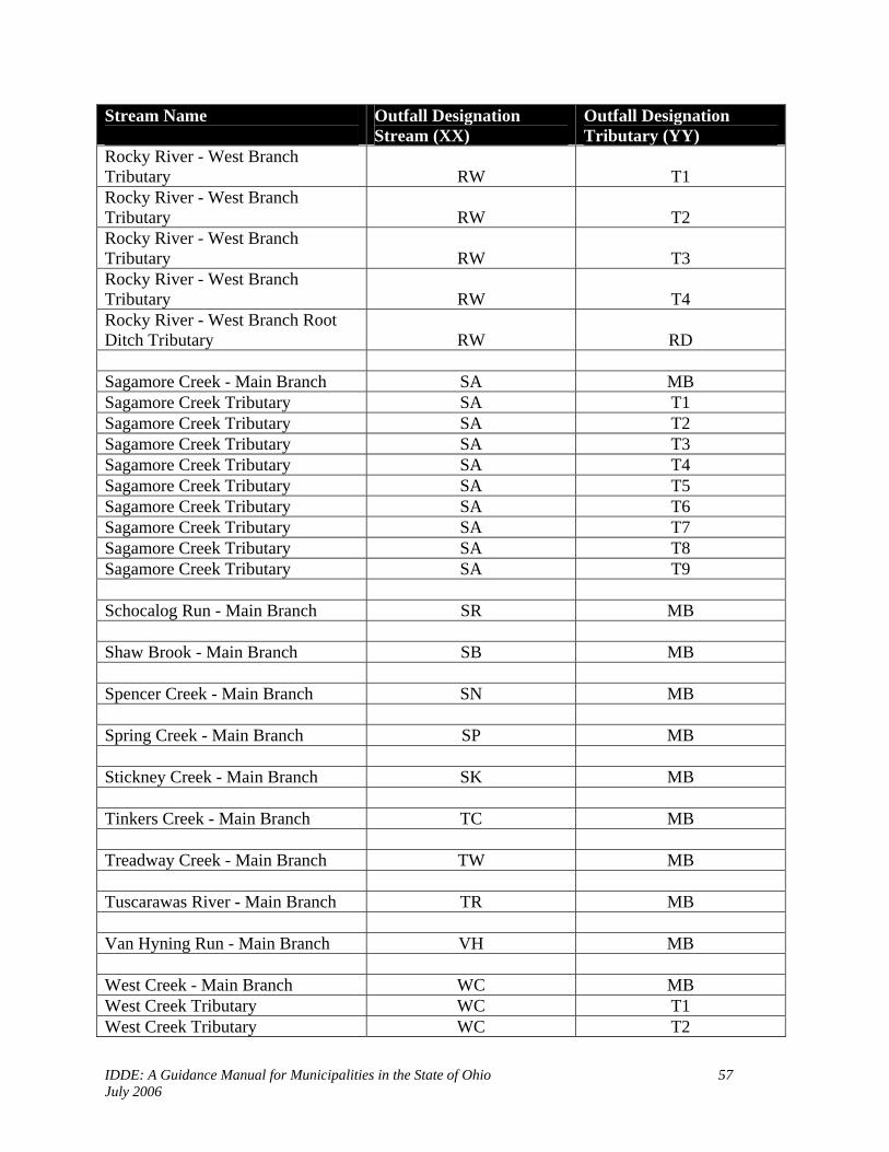
IDDE: A Guidance Manual for Municipalities in the State of Ohio 57 July 2006
Stream Name
Outfall Designation Stream (XX)
Outfall Designation Tributary (YY)
Rocky River - West Branch Tributary RW T1 Rocky River - West Branch Tributary RW T2 Rocky River - West Branch Tributary RW T3 Rocky River - West Branch Tributary RW T4 Rocky River - West Branch Root Ditch Tributary RW RD Sagamore Creek - Main Branch SA MB Sagamore Creek Tributary SA T1 Sagamore Creek Tributary SA T2 Sagamore Creek Tributary SA T3 Sagamore Creek Tributary SA T4 Sagamore Creek Tributary SA T5 Sagamore Creek Tributary SA T6 Sagamore Creek Tributary SA T7 Sagamore Creek Tributary SA T8 Sagamore Creek Tributary SA T9 Schocalog Run - Main Branch SR MB Shaw Brook - Main Branch SB MB Spencer Creek - Main Branch SN MB Spring Creek - Main Branch SP MB Stickney Creek - Main Branch SK MB Tinkers Creek - Main Branch TC MB Treadway Creek - Main Branch TW MB Tuscarawas River - Main Branch TR MB Van Hyning Run - Main Branch VH MB West Creek - Main Branch WC MB West Creek Tributary WC T1 West Creek Tributary WC T2

IDDE: A Guidance Manual for Municipalities in the State of Ohio 58 July 2006
Stream Name
Outfall Designation Stream (XX)
Outfall Designation Tributary (YY)
West Creek Tributary WC T3 West Creek Tributary WC T4 West Creek Tributary WC T5 West Creek Tributary WC T6 West Creek Tributary WC T7 West Creek Tributary WC T8 West Creek Tributary WC T9 West Creek Tributary WC 10 West Creek Tributary WC 11 West Creek Tributary WC 12 West Creek Tributary WC 13 West Creek Tributary WC 14 West Creek Headwater WC H1 West Creek Headwater WC H2 West Creek Headwater WC H3 West Creek Headwater WC H4 West Creek Headwater WC H5 Wiley Creek - Main Branch WI MB Wiley Creek WI OT Wolf Creek - Main Branch (1) W1 MB Wolf Creek Tributary W1 T1 Wolf Creek Tributary W1 T2 Wolf Creek Tributary W1 T3 Wolf Creek - Main Branch (2) W2 MB Wood Creek - Main Branch WD MB Wood Creek Tributary WD T2 Wood Creek Tributary WD T3 Wood Creek Tributary WD T4 Wood Creek Tributary WD T5 Wood Creek Tributary WD T6 Wood Creek Tributary WD T7 Wood Creek Tributary WD T8 Wood Creek Tributary WD T9 Yellow Creek - Main Branch YC MB

IDDE: A Guidance Manual for Municipalities in the State of Ohio 59 July 2006
Appendix B
Inventory Form

IDDE: A Guidance Manual for Municipalities in the State of Ohio 60 July 2006
IDDE: A Guidance Manual for Municipalities in the State of Ohio 61 July 2006
Appendix C
Inspection Form

IDDE: A Guidance Manual for Municipalities in the State of Ohio 62 July 2006

IDDE: A Guidance Manual for Municipalities in the State of Ohio 63 July 2006
Appendix D
Example of a Quality Assurance Management Plan

IDDE: A Guidance Manual for Municipalities in the State of Ohio 64 July 2006
Cuyahoga County Board of Health
Quality Assurance Management Plan

IDDE: A Guidance Manual for Municipalities in the State of Ohio 65 July 2006
Table of Contents Table of Contents 65 Program Organization 67 Management, Organization and Responsibilities 67 Water Quality Program 68 Permanent Sampling Program 72 Storm Water Program 72 Macroinvertebrate Assessment 73 Equipment Maintenance and Calibration 74 SECTION A - Chemical Parameters Introduction Chapter 1 – Program Management A.1.1 Project Description 77 A.1.1.a Chemical Safety 78 A.1.2 Accuracy 79 A.1.3 Training Requirements 79 A.1.4 Documentation and Records 79
Chapter 2 – Measurement / Data Acquisition A.2.1 Sampling Process Design 80 A.2.2 Sampling Methods Requirements 80 A.2.2.a Fecal coliform 80 A.2.2.b. E. coli 81 A.2.2.c. BOD-5 82 A.2.2.d Suspended Solids 82 A.2.2.e Total Phosphorus 82 A.2.2.f Ammonia 82 A.2.3. Sample Custody Procedures 83 A.2.4 Quality Control Requirements 83 A.2.5 Instrument/Equipment Inspection, Calibration and Maintenance 84 A.2.6 Inspection / Acceptance Requirements 85 A.2.7 Data Management 85
Chapter 3 – Assessment and Oversight A.3.1. Assessment and Response Actions 86 A.3.2. Reports to Management 86
Chapter 4 – Data Validation and Usability A.4.1. Data Review, Verification, and Validation 86 A.4.2. Validation and Verification Methods 87 A.4.3. Reconciliation with User Requirements 87

IDDE: A Guidance Manual for Municipalities in the State of Ohio 66 July 2006
SECTION B – Biological and Physical Parameters Chapter 1 – Program Management B.1.1. Project Description 87 B.1.2. Quality Objectives and Criteria 89 B.1.3. Training Requirements / Certification 90 B.1.4. Documentation and Records 91
Chapter 2 – Measurement / Data Acquisition B.2.1. Sampling Process Design 91 B.2.2. Sampling Methods Requirements 91 B.2.3. Quality Control Requirements 94 B.2.4. Instrument/Equipment Inspection, Calibration and Maintenance 95 B.2.5. Data Management 96
Chapter 3 – Assessment and Oversight B.3.1. Assessment and Response Actions 96 B.3.2. Reports to Management 97
Chapter 4 – Data Validation and Usability B.4.1. Data Review, Verification, and Validation 97 B.4.2. Validation and Verification Methods 97
IDDE: A Guidance Manual for Municipalities in the State of Ohio 67 July 2006
Program Organization The CCBH mission is to assure optimal health and environment for every citizen in its district by administering all provisions of the public laws of the state and of the Health Department, and further to do all things reasonably necessary to protect and improve the health of its residents of the communities it serves by actively working towards:
a. Prevention and control of communicable disease b. Promotion of health education c. Improvement of sanitary conditions in the environment d. Improvement of the health of its residents by supporting or in some cases providing
medical, nursing and supportive services for the early diagnoses, prevention, and preventative treatment of disease and disability.
To carry out this mission, the CCBH relies on environmental data from a variety of sources to make decisions to protect the health of the public and the environment. To ensure that the basis for these decisions is sound, CCBH requires that programs have appropriate quality systems in place. These systems are intended to provide reasonable assurance that all environmental data generated and processed will be scientifically valid, of known precision and accuracy, complete, representative, comparable, and where appropriate legally defensible.
Management, Organization and Responsibilities The Environmental Health Director is responsible for the Department’s Environmental Health Programs and to ensure that the policies of the Department are maintained. The Deputy Director is responsible for the Environmental Health’s district programs (including Water Quality) oversees the completion of the overall district programs and to ensure that the policies and procedures of the Cuyahoga County Board of Health are maintained during the completion of these activities. The CCBH Supervisor over the water quality program and Phase II storm water program is responsible for the overall function of those programs which includes budget and job activities that are performed. The CCBH Program Manager over the Surface Water Quality and Storm Water Programs is responsible for the program management of these programs. This includes budget details and the day to day management of the programs. This program manager is also responsible for the quality assurance management plan for these programs, which includes the monitoring and educational outreach efforts. The authority of the Program Manager in regards to the QA program includes the management of the quality assurance plan. This will include the management of the records generated from the QA plan (calibration charts, lab checklists, sample blanks and duplicates, equipment checklists), and a detailed summary report annually on each specific program with regards to the QA plan requirements. This manager will be accessible to the staff in regards to questions concerning any QA Plan policies. Likewise, the quality assurance management plan will be

IDDE: A Guidance Manual for Municipalities in the State of Ohio 68 July 2006
made available to all staff. This plan will provide the basic information on all QA affected programs and should provide the necessary information to answer any questions that may arise. The sanitarians that perform activities in the storm water and water quality programs are responsible for the completion of tasks for the monitoring, sampling and outreach efforts of these programs. They are also responsible in following the quality assurance plans for the required components of the program they are working in. All of these sanitarians will receive a Quality Assurance Manual that will also include all the technical information on equipment that will be used for the water quality programs. All sanitarians will sign off that they have received and read this manual. The interns who work in these programs are responsible for the completion of required tasks and the writing of reports on the tasks that were performed. These reports are due by the completion date of their internship. They are also responsible in following the quality assurance plans for the programs in which they work. They will also receive the Quality Assurance Manual. The program manager of the water quality programs and QA program will provide training to all staff that will be affected by the QA Plan. This training will be done annually and will include all aspects of this plan including equipment information, sampling protocols and report generation.
Water Quality Program The Cuyahoga County Board of Health conducts an extensive water quality program. The focus of this program is an overall watershed based approach when dealing with water quality issues. This program consists of the following responsibilities:
Identifying and eliminating public health nuisances and hazards in the surface waters within the Health District
Surveying the various watersheds within the Health District Supporting the Household Sewage, Storm Water, Semi-public Sewage, Bathing Beach and
Parks & Recreation Programs Educating the public on Non-Point Source Pollution issues Participating in local watershed protection groups and meetings
The Water Quality Program Manager administers the department’s surface water quality programs. These programs are responsible for monitoring the surface waters of the state in the CCBH’s jurisdiction. This monitoring includes chemical, physical and biological sampling. The surface water chemical sampling includes (bacteriological testing as well as several chemical parameters requiring laboratory analysis or the use of a meter). The biological and physical sampling includes macroinvertebrate sampling (using Ohio Department of Natural Resources methods, and habitat evaluations methods developed by Ohio EPA.)
Personnel Qualifications and Training Employees hired by the CCBH are all Registered Sanitarians except the college interns who are required to be at least a sophomore with several courses in biology/ chemistry and have some lab experience. The educational background of these personnel must include a four-year degree in a

IDDE: A Guidance Manual for Municipalities in the State of Ohio 69 July 2006
natural science and be eligible to be a Registered Sanitarian through the Sanitarian Registration Board for the State of Ohio. Each year, all Registered Sanitarians must receive a minimum of 18 continuing education units in environmental and public health courses. These hours are submitted annually to the State Board of Sanitarian Registration and once evaluated, the renewal RS license is issued to each sanitarian. The CCBH will provide educational programs to the staff whenever changes are made to programs. This includes the QA Plan. All staff members who perform water quality activities will be trained in how to properly monitor and sample as is required under the QA Plan. The Program Manager is responsible for training the staff in the specific programs when changes or new technology is relevant. The Program Manager submits the information for the training session to the State Board of Sanitarian Registration. This includes an outline of the training session, the number of hours the session will be and who will be presenting the training seminars including their knowledge and educational background. The Office Manager is responsible to ensure that each sanitarian renews their registration on an annual basis. It is up to each sanitarian to ensure they have the appropriate number of continuing education units for any given year.
Quality Assurance System Responsibility for oversight of environmental data quality for the CCBH has historically been distributed among a number of programs in the Environmental Health Division (EHD). In an effort to coordinate quality assurance oversight of water quality data, the CCBH EHD has emphasized those QA components into this QA Plan. The Quality Assurance components can be generally characterized as planning, implementation or assessment. The EHD’s quality assurance system consists of the following:
Planning The Water Quality Program Manager is ultimately responsible for ensuring that data generated by the department within the water quality programs is appropriate for their intended use. This responsibility includes scientific study design, appropriate QA planning, development of DQO’s, preparation of QA planning documents where appropriate and the coordination of technical and data quality issues among field, laboratory and data assessment staff involved in this activity. DQOs are qualitative and quantitative statements of a study’s technical and quality objectives that define the appropriate type of data and specify tolerable levels of potential decision errors. DQOs will be established and documented prior to data collection and/or assessment activities. At the beginning of any investigation or data collection activity, the program manager is responsible for initiating DQO development. During the early planning phase of the investigation or project, the program manager must clearly establish the intended use of the data, the time and resource constraints and the required data quality required. This process requires effective communication among the program manager, field and laboratory staff.

IDDE: A Guidance Manual for Municipalities in the State of Ohio 70 July 2006
Implementation Standard Operating Procedures (SOP) are documents that describe the officially approved procedures for performing certain routine tasks. SOPs are useful when it is necessary to ensure comparability among activities performed on different occasions or by different individuals. The CCBH will utilize SOPs whenever appropriate in the water quality programs. These SOPs have been developed and published within this document under Standard Operating Procedures for Water Quality Programs.
Information Management The program manager for the water quality programs will be responsible for the managing of information on the water quality programs.
Assessment and Response Assessments of activities are used to verify that measurement systems are operating appropriately and that the data generated by these systems are appropriate for their intended use. Assessments will be performed on the water quality equipment to ensure equipment is operating as designed. Assessments will also be performed on the staff performing water quality monitoring activities by the observance of water quality monitoring techniques while in the field by the program manager of the water quality program, and other peer reviewers. All assessments will be performed annually to ensure the QA Plan is being followed as desired. Possible types of assessments will include a quality systems audit by the program manager, peer reviews, performance evaluations, data quality assessments and surveillance.
Documents and Records The information generated from the water quality monitoring activities will be provided as data documents and records. These records and documents will consist of: • water quality lab analysis results on a form supplied by the Cuyahoga County Sanitary
Engineers Water Quality Control Lab (CCSWQCL); • biological assessments on a form supplied by the Department of Natural Resources for
macroinvertebrate studies; • QHEI and HHEI information on a form supplied by the Ohio EPA; • computer database for all water quality chemical sampling results; • Log books for equipment supplied by the CCBH. The program manager of the water quality programs will be responsible for assessing the completed forms filled out by the field staff once the work is completed to ensure that the documents accurately reflect the completed work. All paper documents will be kept in appropriate water quality files in the water quality program manager’s office. Staff will have access to these files at all times. When appropriate the information from these forms will be entered into the CCBH’s water quality database. The water quality results on these forms will be published annually in a water quality program summary for the work performed that calendar year.

IDDE: A Guidance Manual for Municipalities in the State of Ohio 71 July 2006
The computer database is an Access database that the CCBH staff has the ability to access at all times. This database has the ability to generate reports and to provide all pertinent information on a given monitoring location (lab analysis results, location, GPS coordinates, photos, maps, investigation information, correspondence information, city and watershed). This database was developed by the Northeast Ohio Regional Sewer District (NEORSD). All staff that will be utilizing this database will be appropriately trained. The program manager and one office support staff will have administration access to making changes to the database. This will allow for the integrity of the information to remain viable. Both the program manager and the office support staff personnel will be trained by the NEORSD.
Procurement of Services Contractual services involving the acquisition or analysis of environmental data shall be planned and controlled to ensure that these services meet applicable technical and QA requirements. 1. College interns shall be hired in accordance with applicable hiring practices of the CCBH.
The intern shall be at least a sophomore in college with several courses in biology/chemistry and have lab experience, as well as have proficiency in computer skills.
2. Laboratory Services for water quality data shall be obtained through the Cuyahoga County
Sanitary Engineer’s Water Quality Lab, unless deemed necessary by an Environmental Health Supervisor, to obtain services from another approved water quality lab.
3. A Memorandum of Understanding must be obtained with any community who desires to
contract with the CCBH for Phase II Storm Water Activities to be conducted on behalf of that community.
Procurement of Equipment and Supplies The procurement of equipment and supplies for water quality monitoring operations shall be planned and controlled to ensure that the quality of obtained goods is documented and meets the technical requirements of the Ohio EPA and the CCBH, Division of Environmental Health. Procurement of goods shall in all instances abide by the policies of the CCBH. Quality assurance specifications shall be clearly indicated in purchase orders or related procurement documents. 1. Purchase of equipment and supplies shall be initiated by a Program Manager, in accordance with the CCBH policy on purchase orders, and approved by an Environmental Health Supervisor. Any purchase in excess of $300.00 must be accompanied by a purchase order. Purchases totaling $1,000.00 or more require three written quotations to be attached with the purchase requisition. For purchases from $300.00 to $1000.00, three quotations must be obtained, but it is the discretion of the division to have supporting justification to ensure that accountability and best prices are obtained.

IDDE: A Guidance Manual for Municipalities in the State of Ohio 72 July 2006
PERMANENT SAMPLING PROJECT SAMPLING PROCESS DESIGNS Currently, 53 permanent sampling sites are chosen to assess water quality in the three major watersheds in Cuyahoga County: the Rocky River, Cuyahoga River, & Chagrin River. Sites are chosen to measure the effect on water quality beginning at the county line and continuing downstream as different tributaries enter the stream or land use changes emerge. Special emphasis is placed on areas using household sewage treatment systems. Each site is sampled three times from May through October during dry weather conditions for the following parameters: E. coli, fecal coliform, dissolved oxygen, specific conductance, temperature, pH, total suspended solids, total phosphorous, ammonia, and flow rate. CCBH defines dry weather as at least 72 hours with less than 0.1 inch of precipitation. Precipitation is measured using the NOAA website. The permanent sampling locations are broken down into three sections: East, Central and West. Two principal technicians are responsible for performing the permanent sampling requirements for their section. Each section will receive an equipment manual, quality assurance manual and calibration log book. The equipment manual will contain manuals of all the equipment that their section will use. The quality assurance manual will contain this policy along with all attachments, and the locations of all the permanent sampling locations throughout the county including photographs of the site and a map. The calibration log will consist of a field notebook that must be filled out every time a piece of equipment is calibrated. Also, any problems or other identifiable information must be put into this log that may affect any of the sampling data that is obtained.
Storm Water Program Outfall Survey and Documentation of Locations. The CCBH Storm Water Program provides for the survey of Municipal Separate Storm Sewer Systems (MS4s). The CCBH Water Quality Program Manager is responsible for the consistent application of MS4 documentation within those communities who contract for this service. The CCBH will identify all possible MS4 outfall locations within the community by:
Utilizing a city storm sewer map for outfall locations and field assess them for accuracy; Walk the open creeks and streams of the city to identify all possible MS4 outfall locations; Walk all open ditches and identify areas where they connect with surface waters of the state.
During this survey, the CCBH will perform the following activities:
Number the MS4 outfall with a city unique numbering system (set up by database); Digital photograph MS4 outfall; Utilize a dry erase board: number location on board and include in picture for identification
purposes; Utilize a GPS unit to get coordinates of MS4 outfall location; Mark hard copy of city storm sewer map for approximate location of outfall;
Once completed, all information will be entered into water quality database and shared with the community.

IDDE: A Guidance Manual for Municipalities in the State of Ohio 73 July 2006
Visual Observations of MS4 Outfalls During Dry Weather Visual screening of outfalls during dry weather periods will identify if there is a possible illicit discharge within that MS4 system. Dry weather is defined as less than .1” of rain in past 72 hours. If the visual observation indicates that the outfall is flowing at this time, then a sample will need to be obtained. The outfall is not considered to be flowing if there is only a very small amount of water observed in this area. The subjective nature of this observation warrants a follow up screening at a later time when questions arise as to the amount of water observed at that outfall at any one point in time. Dry Weather Sampling The majority of all MS4 outfall sample analysis will be for fecal coliform. The data collected from this monitoring will allow communities the ability to prioritize the MS4s in which illicit discharge source identification is required.
Sample bottles will be obtained from the CCSWQCL, 6100 Canal Road, Valley View, Ohio. Bottles are 100-milliliter autoclaved Nalgene plastic, preserved with sodium thiosulfate.
Grab samples are collected only during dry weather. Sample technicians shall wear disposable gloves.
Bottles are labeled with the sample location, time, and date. They are placed in a cooler filled with ice water (four degrees Celsius), and transported to the CCSWQCL for analysis no later than six hours after collection.
Technicians fill out a laboratory manifest supplied by the CCSWQCL, indicating the location of each sample, the time it was collected, what tests will be run (in this case, fecal coliform), the sampler’s name and company, and the time the samples reached the laboratory.
Each technician collects duplicates and a blank sample once per month for quality control. Laboratory analyzes samples using fecal coliform membrane filter procedure as described in
Method 9222 D of Standards Methods for the Examination of Water and Wastewater (18th Edition).
Macroinvertebrate Assessment
Biological monitoring is an effective means for identifying water quality problems. Aquatic biological communities reflect overall ecological integrity (i.e., chemical, physical and biological integrity). These communities change in response to a wide variety of pollutants and to the cumulative impacts of those pollutants. Biological monitoring is utilized for detecting the health of aquatic environments and assessing the relative severity of the pollution impacts.
Use Ohio Department of Natural Resources’ (ODNR) Stream Quality Assessment Form and training (obtained through ODNR and from the Isaac Walton League of America) to assess water quality through the health of the macroinvertebrate community.
Stream quality assessment forms, macroinvertebrate identification guide, and assessment
equipment (seines, macroinvertebrate pan, oilcloth, and tweezers) are available at the Cuyahoga County Board of Health office.
The Quality assessment forms and ODNR manual are included in this manual for easy field
access.

IDDE: A Guidance Manual for Municipalities in the State of Ohio 74 July 2006
Protocol for use of the Hester- Dendy Samplers This device is an artificial substrate sampler. It is designed to be placed in the stream for four weeks for colonization of benthic macroinvertebrate organisms to attach themselves to the masonite plates. It is important to establish the location of where the sampler is placed, either through GPS or other means. The sampler is made up of 9 masonite plates on an eye bolt with spacers in between each plate. It has 0.10 mm of sampling area. The 9 plates are 76 by 76 mm (3 by 3 in.) each. It is to be attached to either a concrete block or a large boulder and submerged in the stream, in a run area. Retrieval of the samplers is accomplished by removing from attachment to the concrete block. Care needs to be taken not to dislodge organisms while removing from the stream. Place sampler in a quart container or other sealed plastic container with stream water and transported to the CCSWQCL for counting. Counting and identification of organisms should be done in a white enamel container using forceps and a hand held magnifier if needed. Counting must be done in the same day otherwise a 10% formalin preservative must be added to the container. Results are to be entered on the ODNR Macro Invertebrate evaluation form for each site.
EQUIPMENT MAINTENANCE AND CALIBRATION
SEASONAL RESPONSIBILITIES All equipment manuals are available in the CCBH laboratory, or in the program manager’s office. The program manager will ensure all equipment is functioning properly as follows: YSI MODEL 85 METER
Replace the dissolved oxygen membrane cap at the beginning of the season as described in Section 3.1 of the Operations Manual. Afterward, replace the cap if dissolved oxygen readings become erratic, or every two to eight weeks.
Check the expiration dates of the conductivity buffer solution. Calibrate the meter for conductivity prior to use each season as described in Section 5.2 of
the Operations Manual. Perform additional calibration only as needed (i.e. if readings become erratic, or conductivity reading in dry air varies significantly from 0.0).
At the end of the sampling season, clean the conductivity cell with Dow Chemical Bathroom Cleaner as described in Section 9.1 of the Operations manual, and remove the batteries for winter.
YSI 556 MPS
Replace the dissolved oxygen membrane prior to first yearly use, and every two to eight weeks thereafter, or if D.O. readings become erratic. Instructions for this procedure are described in section 6.2.3 of the operations manual.
Calibrate for conductivity prior to use each season as described in section 6.2.2 in the operations manual. Perform additional calibration for conductivity only if readings become erratic.
Calibrate for pH prior to use each sampling session as described in section 6.2.4 in the operations manual.
Calibrate the barometer as specified in section 10.10 in the operations manual Remove batteries at the end of the season.

IDDE: A Guidance Manual for Municipalities in the State of Ohio 75 July 2006
GLOBAL FLOW PROBE FP101
Change batteries as needed. Ensure that the propeller is moving freely. Ensure that the meter is operating in feet per second (fps).
OAKTON pH METER
Check expiration dates on all pH buffer solutions. Condition the meter before use each season. Calibrate the meter before use each season with 7.0, 10.0, and 4.01 buffer solutions. Remove batteries at the end of the season.
FIELD RESPONSIBILITIES The program manager of the water quality programs will inspect all equipment and verify all necessary parts are present each time equipment is returned to the CCBH offices. Field sanitarians will be required to sign out equipment on sheets in the CCBH program manager’s office prior to taking equipment into the field. All replacement parts are located in the Cuyahoga County Board of Health laboratory or the Program Manager’s office. Contact the Program Manager when a question arises as to maintenance or equipment locations. Each field sanitarian shall inspect all equipment prior to use in the field each day as follows:
YSI 556 MPS Inspect DO membrane for wrinkles, damage, looseness, and air bubbles Ensure that probe was stored wet Check for build up on silver anode Check for build up on gold anode Inspect pH/ORP sensors for debris Inspect temperature and conductivity probes for cleanliness Check Battery Strength Calibrate the pH probe with 7.0 and 10.0 buffer solutions before the day’s use as described in
Section 6.2.4 of the Operations Manual. Calibrate for dissolved oxygen in % saturation prior to each day’s use as described in Section
6.2.3 of the Operations Manual.
YSI Model 85 Meter Ensure that the probe compartment is moist. Inspect dissolved oxygen membrane for wear Check for debris in probe Check battery strength Calibrate for dissolved oxygen before use, and whenever the elevation changes significantly
(more than 100 feet). Calibration instructions for dissolved oxygen are described in Section 5.1 of the Operations Manual, and are also taped inside each meter’s carrying case.
Global Flow Probe FP101 Check Batteries Ensure propeller is unobstructed and moves freely

IDDE: A Guidance Manual for Municipalities in the State of Ohio 76 July 2006
Oakton pH Meter Check batteries Check probes for debris Calibrate with 7.0 and 10.0 buffer solutions before each day’s use.
Sediment Stick Check for cracks
Thermometer Ensure thermometer is operational
Macroinvertebrate nets Inspect seine for tears Ensure seine is free of debris from previous sampling
Macroinvertebrate kit (properly stocked as follows):
Sampling container Shower curtain or oil cloth Thermometer Two sets of tweezers Two magnified specimen holders Laminated macroinvertebrate identification sheets (Group 1, 2, and 3 Taxa)
Inspection / Acceptance Requirements for Supplies and Consumables All supplies will be received from approved sources and inspected prior to use by the Program Manager. The following list of supplies will be available at the CCBH laboratory.
Nalgene plastic sample bottles: supplied by CCSWQCL De-ionized Water: Supplied by CCSWQCL Potable Water: Cleveland Water Instruction manuals for YSI meters and flow meters DO Membranes DO Membrane solution (KCl Solution) pH Reagents Latex Rubber Gloves Conductivity Reagents
Data Acquisition Requirements (Non – Direct Measurements)
Sediment readings will be obtained utilizing conversion tables provided by the Ohio Department of Natural Resources, Division of Natural Areas and Preserves Scenic Rivers Section. Copies of this document are available at CCBH.
The Ohio Department of Natural Resources, Division of Natural Areas and Preserves Scenic Rivers Section Macro invertebrate Identification Guide is used to identify macro invertebrates in the field. Copies of this document are available at CCBH.

IDDE: A Guidance Manual for Municipalities in the State of Ohio 77 July 2006
The Ohio EPA QHEI and HHEI indexes will be utilized. Copies of these documents are available at CCBH.
Rainfall data is obtained from rain gauges at wastewater treatment plants in the appropriate watershed. CCBH defines dry weather as at least 72 hours with less than 0.1 inch of precipitation. Precipitation is measured using the NOAA website. (www.srh.noaa.gov/data/obhistory/KCLE.html).
Data Management:
Sanitarians and field staff complete field data sheets and flow calculations. The Program Manager receives all reports on sampling from CCWQL. Data entered into the Access Water Quality Database at CCBH will be performed by the
Program Manager as well as designated office support staff personnel. Field sheets are stored in files at CCBH in the Program Managers office
SECTION A CHEMICAL PARAMETERS
Chapter 1 Program Management A.1.1. Project Description The CCBH will perform chemical monitoring in areas throughout the county to serve a variety of purposes. Different projects will vary according to the purpose of the data. Criteria for determining a project’s design will include the following:
• Tributaries receiving effluent from HSTSs • Previous studies conducted nuisance complaints • Stream corridors previously not monitored or assessed • Storm sewer outfall studies • Grant objectives
Monitoring activities will take place during the recreational season from May through October. The information generated from these projects will be provided to the appropriate agency as well as local community officials. Problem areas will be identified and forwarded to those agencies for the proper follow-up investigations and remediation. Monitoring Overview

IDDE: A Guidance Manual for Municipalities in the State of Ohio 78 July 2006
Table 1.1 summarizes possible monitoring designs, including the parameters tested, the methods used, precipitation, frequency of monitoring, and quality control requirements. Table A.1.1 PROJECT SCOPE Parameter Method Precipitation Monitoring
Frequency Quality Control
Temperature
Turbidity
Dissolved Oxygen
pH
Fecal Coliform
E. coli
Specific Conductance
Flow
Ammonia
Phosphorous
BOD
Suspended solids
Table 1.2 identifies the schedule of major activities associated with a given project. Table A.1.2 PROJECT SCHEDULE Activity Date
Training (including quality control)
Check equipment
Initiate Monitoring
Initiate data entry
Review data with technical advisors
A.1.1.a. CHEMICAL SAFETY The chemical sampling that will be occurring with a project will consist of sample analysis by the CCSWQCL. They will supply the CCBH and CSWCD staff with the sample bottles required for each parameter. All bottles will be properly prepared by laboratory personnel prior to pickup by the employees who are collecting the samples. Bottle preparation varies for different parameters, and is described in Section A.2.2.

IDDE: A Guidance Manual for Municipalities in the State of Ohio 79 July 2006
The pH will be monitored utilizing a pH meter. The pH calibration solutions of 4.0, 7.0 and 10.0 will be the only chemicals these samplers will be using while in the field. It is very important when working with these chemicals to know the proper handling techniques and possible hazards. Even though the chemicals are used in very small amounts and are, for the most part, considered non-hazardous, they still can be potentially harmful to you and/or the environment. Following the guidelines below will ensure your safety and well-being.
Know your equipment, sampling instructions, and procedures before going out into the field. Enclosed in each pH kit are Material Safety Data Sheets (MSDS) for each of the chemicals. These sheets are provided by the chemical company and contain very specific information on the chemical and the proper first aid if someone ingests the chemical, or if it comes in contact with someone’s eyes or skin.
Read the MSDS sheet for each chemical that you will be handling to familiarize yourself with the potential hazards. Know where your MSDS sheets are located when monitoring in the field.
Keep all equipment and chemicals away from small children. Avoid contact between chemical reagents and skin, eye, nose, and mouth. Wash hands directly after using the chemical tests and before eating. Wear goggles and rubber gloves when handling chemicals. Know chemical cleanup and disposal procedures. Wipe up all spills when they occur. Close all containers tightly after use. Do not switch caps. Do not expose chemicals or equipment to temperature extremes or long-term direct sunshine
and store in a climate-controlled environment (inside house or office). A.1.2 Accuracy Accuracy describes how close the measurement is to its true value. Accuracy is the measurement of a sample of known concentration and comparing the known value against the measured one. The accuracy of chemical measurements will be checked by performing quality assurance checks on the samples taken. This will include duplicate samples as well as blanks during field monitoring events. See quality assurance section. A.1.3 Training Requirements To qualify as a sample collector, training must be completed. Training will teach the monitor how to accurately select a sampling site, collect and record data. The methodology outlined for the parameters included in this QAPP must be followed completely. One training session will need to be conducted. The training for chemical data collection will entail review of parameters to be collected, safety, how to follow the sample collection methodology, how to properly record the data and proper sample handling. A.1.4 Documentation and Records All data that is recorded as part of the chemical sampling of a project will be provided on the appropriate forms provided by the CCBH. There will be one form per sample location. After each sample site is sampled, the collector will document all information and sample results on the form, sign, date and time before next location is sampled.

IDDE: A Guidance Manual for Municipalities in the State of Ohio 80 July 2006
Chapter 2 Measurement / Data Acquisition A.2.1 Sampling Process Design The project manager and field staff will all be included in choosing the sample site locations. The following criteria will be used in site selection:
• Safe access • Permission to cross private property, where applicable • Sample is representative of the part of the water body of interest • Location compliments or supplements historical data • When more then one site is chosen, the sites will be well distributed • Headwaters, confluences, upstream and downstream effluents, main stems of streams,
and lake feeder streams will all be considered when choosing sampling sites. Each site will be located using a Global Positioning Unit (GPS) to record the latitude and longitude. Where possible, river mile of the site will be included in the sample site description along with the name of the map that was used. The full sample site description should always be used; example: Clear Creek site #1, River Mile 1.7 at County Road 34 bridge, latitude 000000 longitude 0000000, Cleveland East, Ohio (1975) Quadrangle. Also, record the county and watershed. A.2.2. Sampling Methods Requirements A.2.2.a Fecal coliform • 100-milliliter Nalgene plastic sample bottles are prepared at Cuyahoga County Sanitary
Engineers Water Quality Laboratory (CCSEWQL) as follows: Bottles are washed in Liqui-nox cleaning solution and water, then rinsed with de-ionized water and set to air dry. The dried bottles are then autoclaved at 121 degrees for 30 minutes, capped and labeled for use. All autoclaved bottles are sealed and stamped with the date they were autoclaved. Sample bottles are preserved with 0.008% sodium thiosulfate in the laboratory prior to autoclaving.
• The CCBH employee picks up the bottles and CCSEWQL manifest sheet at the laboratory (6100 W. Canal Rd.; Valley View, OH), and transports them in their vehicle to the selected sample sites.
• The employee shall wear disposable gloves to prevent contamination of the sample, and collect grab samples by opening the bottle and filling it with the sample source. The employee shall stand downstream from the collection point so as not to contaminate the sample. The employee shall change gloves after each sample.
• The employee shall label the bottle with the location, time of day, and date of collection, and place it in a cooler filled with ice water (four degrees Celsius) inside their vehicle.
• The employee shall transport the sample to CCSEWQL for analysis no later than six hours after collection of the first sample.

IDDE: A Guidance Manual for Municipalities in the State of Ohio 81 July 2006
• Upon reaching CCSEWQL, the employee will complete the laboratory manifest, indicating their name, company (CCBH), date and the time they delivered the samples to the laboratory. Also, for each sample, the employee will fill in information regarding the location, site (i.e. storm sewer outfall, creek, etc.), time of collection, and what tests will be run (in this case, fecal coliform). The employee will keep the pink copy of the manifest, and leave the other copies at the laboratory.
• The CCBH employee will place all samples inside the refrigerator at the laboratory. • CCSEWQL personnel analyze the samples using the fecal coliform membrane filter
procedure as described in Method 9222 D of Standard Methods for the Examination of Water and Wastewater (18th Edition)
CHECKLIST -100 milliliter autoclaved Nalgene sample bottles preserved with sodium thiosulfate -Disposable gloves -Cooler -Ice water A.2.2.b Escherichia coliform (E. coli)
• The sample collection method for E. coli is identical to that described for fecal coliform above, except that a different sampling bottle is used.
• Sample bottles are washed, dried, autoclaved, and labeled at CCWQL as described above. However, bottles used for E. coli do NOT contain a preservative.
A.2.2.c BOD-5; A.2.2.d Suspended Solids; A.2.2.e Total Phosphorous; A.2.2.f Ammonia Nitrogen • 500-milliliter and 1000- milliliter Nalgene plastic bottles are washed in Liqui-nox cleaning
solution and water at CCSEWQL, rinsed with deionized water, and set to air dry. Bottles are then capped, labeled and put on a shelf for use. Either size bottle can be used for the tests listed above, but the larger bottle may be needed for unpolluted sample sites, because a larger sample volume is needed to run the lab tests.
• The CCBH employee picks up the bottles needed and a CCSEWQL manifest sheet at the laboratory, and transports them in their vehicle to the selected sample sites.
• The employee shall wear disposable gloves to prevent contamination of the sample, and collect a grab sample by opening the bottle and filling it with the sample source. The employee shall stand downstream from the collection point so as not to contaminate the sample. The employee shall change gloves after each sample.
• The employee shall label the bottle with the location, time of day, date of collection, and the parameters to be tested. If a sample will be tested for BOD-5 or suspended solids, it must be placed in a cooler filled with ice water (4 degrees Celsius) inside the employee’s vehicle. Samples tested only for total phosphorous or ammonia do not need to be refrigerated, but must be preserved with sulfuric acid to a pH of less than 2 by laboratory personnel upon arrival at CCSEWQL.
• The maximum holding time for samples to be tested for the above parameters varies from 24 hours for BOD-5 to 28 days for total phosphorous. However, it is CCBH’s policy to transport all samples to CCSEWQL on the same day that they were collected.

IDDE: A Guidance Manual for Municipalities in the State of Ohio 82 July 2006
• Upon reaching CCSEWQL, the employee will complete the laboratory manifest, indicating their name, company (CCBH), the date, and the time that they delivered the samples to the laboratory. Also, for each sample, the employee will fill in information regarding the location, site (i.e. storm sewer outfall, creek, etc.), time of sample collection, and what parameters will be tested. The employee will keep the pink copy of the manifest, and leave the other copies at the laboratory.
• The CCBH employee will place all samples inside the refrigerator at the laboratory. • CCSEWQL laboratory personnel then analyze the samples for the appropriate parameters
using the methods listed below.
A.2.2.c BOD-5 • CCSEWQL personnel analyze the sample using Method 5210 B described in Standard
Methods for the Examination of Water and Wastewater (18th Edition) Checklist -500 or 1000 milliliter Nalgene plastic bottles -Disposable gloves -Cooler -Ice water A.2.2.d Suspended Solids • CCSEWQL personnel analyze the sample using Method 2540 D described in Standard
Methods for the Examination of Water and Wastewater (18th Edition) Checklist -500 or 1000 milliliter Nalgene plastic bottles -Disposable gloves -Cooler -Ice water
A.2.2. e Total Phosphorous • CCSEWQL personnel analyze the sample using the method described in the Hach DR/4000
Spectrophotometer Procedures Manual 8190 Checklist -500 or 1000 milliliter Nalgene plastic bottles -Disposable gloves
A2.2.f Ammonia Nitrogen • CCSEWQL personnel analyze the sample using the procedures described in Method 4500
NH3 F in Standard Methods for the Examination of Water and Wastewater (18th Edition) Checklist -500 or 1000 milliliter Nalgene plastic bottles -Disposable gloves

IDDE: A Guidance Manual for Municipalities in the State of Ohio 83 July 2006
A2.2.g Dissolved Oxygen, Specific Conductance, Temperature, and pH These parameters are measured in the field using either a YSI Model 85 meter and a pH
meter (Oakton pHTestr 3), or a YSI Model 556 MPS (multi-probe system) meter. Technician places the probe directly into the stream until it stabilizes.
Technician may scroll through probe menu for appropriate parameter and record data on site,
or else save the information for later retrieval.
YSI Model 85 meter is calibrated for dissolved oxygen each day before use by the field technician, and recalibrated if there is a significant change in elevation of more than 100 feet. Calibration instructions are inside the meter’s carrying case, and in Section 5.1 of the Operations Manual.
Oakton pH meter is calibrated each day before use by the field technician using 7.0 and 10.0
buffer solutions.
Technicians have access to the Operations Manuals for all equipment located at the Cuyahoga County Board of Health laboratory.
A.2.3. Sample Custody Procedures Many water quality monitoring tests do not require specific custody procedures since they are conducted at the sampling site by the sampler. These include those parameters measured by equipment; including pH, dissolved oxygen, temperature, specific conductance, flow. These parameters are recorded on the monitoring form which is completed and signed by the sample collector. When the samples are analyzed by the CCSWQCL, a manifest form provided by CCSWQCL must be used. The form will be filled out with sample bottle identification, sample site description, time of collection, and what parameters must be analyzed. Both the sample collector and a representative from the CCSWQCL will sign the form when the samples are delivered to the laboratory. A.2.4. Quality Control Requirements Quality control samples will be taken to ensure valid data is collected. Depending on the parameter, quality control samples will consist of blanks, replicates, and split samples. In addition, quality control sessions (calibration exercises) will be held twice a year to verify the proper working order of equipment, and determine whether the data quality objectives are being met. A.2.4.a Blanks, Replicates, Split Samples and Standardization Blanks, replicates, and split samples are used to ensure that samples are free of cross contamination and that the sample collector is following proper procedures. The specific type and frequency of quality control samples will vary according to the design of the specific project. Table A.1.1 in Section A.1.1 (Project Description) can be used to pinpoint these specifics.

IDDE: A Guidance Manual for Municipalities in the State of Ohio 84 July 2006
The lab blank will consist of distilled water or tap water that will be taken into the field by the collector. The collector will pour distilled water or run tap water into the sample bottle (100-milliliter autoclaved Nalgene plastic) and will then place it into the cooler filled with ice water. The lab blank will be marked as such on the bottle. The field blank will also consist of distilled water. A bottle of distilled water will be taken into field and after a number of samples designated in the project description, the collector will pour 100 ml of distilled water into the 100 ml autoclaved Nalgene plastic bottle and place in the ice water cooler. The collector will mark on the bottle that it is the field blank. Split Samples: After a project designated number of samples, the collector will take the split sample by collecting the sample in a bottle supplied by the CCSEWQL and then pouring the sample into the appropriate sized sample bottle. The split sample will be marked on the sample bottle with the sample site id followed by SS. Replicate Samples: After a project designated number of samples, the sample collector will fill two separate bottles for each parameter tested with water from the same site. The second bottle will be marked with the sample site id followed by RS. A.2.5 Instrument / Equipment Inspection, Calibration and Maintenance The project manager or designated CCBH staff personnel will inspect all equipment and verify all necessary parts is present each time equipment is returned to the CCBH laboratory. Field sanitarians will be required to sign out equipment on sheets in the CCBH stock room prior to taking equipment into the field. All replacement parts are located in the Cuyahoga County Board of Health laboratory. Each field sanitarian shall inspect all equipment prior to use in the field each day as follows:
YSI 556 MPS Inspect DO membrane for wrinkles, damage, looseness, and air bubbles Ensure that probe was stored wet Check for build up on silver anode Check for build up on gold anode Inspect pH/ORP sensors for debris Inspect temperature and conductivity probes for cleanliness Check Battery Strength Calibrate the pH probe with 7.0 and 10.0 buffer solutions before the day’s use. Calibrate for dissolved oxygen in % saturation prior to each day’s use as described in Section
6.2.3 of the Operations Manual.
YSI Model 85 Meter Ensure that the probe compartment is moist. Inspect dissolved oxygen membrane for wear Check for debris in probe

IDDE: A Guidance Manual for Municipalities in the State of Ohio 85 July 2006
Check battery strength Calibrate for dissolved oxygen before use, and whenever the elevation changes more than
100 feet. Calibration instructions for dissolved oxygen are described in Section 5.1 of the Operations Manual, and are also taped inside each meter’s carrying case.
Oakton pH Meter Check batteries Check probes for debris Calibrate with 7.0 and 10.0 buffer solutions before each day’s use.
Thermometer Ensure thermometer is operational
A.2.5.b Data Acquisition Requirements (Non – Direct Measurements)
• Sediment readings will be obtained utilizing conversion tables provided by the Ohio Department of Natural Resources, Division of Natural Areas and Preserves Scenic Rivers Section. Copies of this document are available at CCBH.
• The Ohio Department of Natural Resources, Division of Natural Areas and Preserves Scenic Rivers Section Macro invertebrate Identification Guide is used to identify macro invertebrates in the field. Copies of this document are available at CCBH.
• The Ohio EPA QHEI and HHEI indexes will be utilized. • Rain fall data is obtained from rain gauges at waste water treatment plants in the
appropriate watershed. A.2.5.c Data Management:
• Sanitarians and field staff complete field data sheets and flow calculations • The program manager receives reports on sampling from CCWQL • Data entered into Access Water Quality Database at CCBH by the program manager • Field sheets are stored in files at CCBH in the program managers office
A.2.6 Inspection / Acceptance Requirements Upon receipt, buffer solutions, standards and reagents used in the field will be inspected by the program manager or designated field staff for leaks, broken seals, and expiration dates. All other sampling equipment will be inspected for broken or missing parts, and will be examined to ensure proper operation. A.2.7 Data Management The field sample collector is responsible for collecting and recording the data accurately on the data sheet. Field data sheets will be checked and signed in the field by the sample collector. The sample collector will be responsible for verification of data and for having copies of the data sheets for reference. These copies can then be stored in a folder or three ring binder. The original data sheets will be given to the Program Manager of the project the next time the collector is in the CCBH’s office. All data sheets will be stored in the CCBH’s files for water quality data and designated by year and project.
IDDE: A Guidance Manual for Municipalities in the State of Ohio 86 July 2006
The project’s program manager will identify any results where holding times have been exceeded, sample identification information is incorrect, samples were inappropriately handled, or calibration information is missing or inadequate. Such data will be marked as unacceptable and will not be entered into the computer database. Data entry begins within a week after the collector turns in the data sheets to the project’s program manager. As the data is entered into the computer database, the data sheets will be checked and examined for accuracy. If a problem exists, the data collector will be contacted. The data will be entered into the CCBH’s database. This is an Access 2000 database under the windows operating system. Once all data is entered, the project manager then files the data sheets. Chapter 3 Assessment and Oversight A.3.1 Assessment and Response Actions After the approval of the QAMP, it will be circulated to all employees of the CCBH who will be performing water quality activities as part of the project. The project manager will conduct a field performance and systems audit of employees through verification of complete data sheets and field shadowing to ensure that methods are being followed. The manager is responsible for equipment and will have equipment repaired and/or replaced when necessary. A.3.2 Reports to Management An annual project status report will be produced by the project manager and will be given to the CCBH chain of command located on the approval page of this document. This report will include:
• Number of employees trained in a given year • Number of retrained employees in a given year, • Problems with data collection and documentation, • Corrective actions needed or taken, • Significant quality assurance problems and recommendations.
Chapter 4 Data Validation and Usability A.4.1 Data Review, Verification and Validation The project manager will validate the data from this project. Data recorded on approved data sheets are the acceptable data. Data sheets that do not contain sample site location, date and time of collection and signature of collector will not be accepted. These are the minimum requirements that are needed to accurately analyze the data. Data will be compared to previous year’s data to identify any problems that may be recorded in the data.
IDDE: A Guidance Manual for Municipalities in the State of Ohio 87 July 2006
A.4.2 Validation and Verification Methods As data is entered into the database, the project manager will place a check mark or date of entry and initials on each data sheet to verify data entry has occurred. Data entered into the database will be printed out and placed in the projects file at the CCBH office. A.4.3 Reconciliation with User Requirements The project manager and the quality assurance manager will evaluate the actual data with the user requirements on a monthly basis. After the project manager and the quality assurance manager validate the data, they will review the quality objectives and criteria outlined in this quality assurance plan, to ensure that the data complies with the defined program criteria. This review of data will be conducted in November of each year. If a dataset does not comply with the quality objectives and criteria, then that dataset will be discarded. The accepted data are considered to be the final dataset. Once the final dataset is confirmed by the project manager, the annual reports will be produced.
Section B Biological and Physical Parameters
Chapter One Program Management B.1.1 Project Description The CCBH will perform physical and biological monitoring in areas throughout the county to serve a variety of purposes. Different projects will vary according to the purpose of the data. Criteria for determining a project’s design will include the following:
• Tributaries receiving effluent from HSTS • Previous studies conducted • Nuisance complaints • Stream corridors previously not monitored or assessed • Grant objectives • Environmental education
Monitoring activities will take place primarily during the recreational season from May through October, and will be conducted by CCBH registered sanitarians or college interns. The information generated from these projects may be provided to the appropriate agencies as well as local community officials. Problem areas will be identified and forwarded to those agencies for the proper follow-up investigations and remediation.
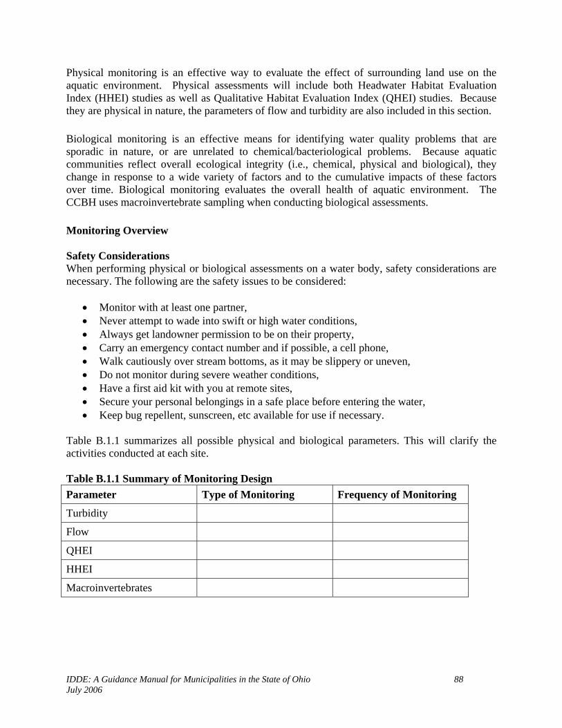
IDDE: A Guidance Manual for Municipalities in the State of Ohio 88 July 2006
Physical monitoring is an effective way to evaluate the effect of surrounding land use on the aquatic environment. Physical assessments will include both Headwater Habitat Evaluation Index (HHEI) studies as well as Qualitative Habitat Evaluation Index (QHEI) studies. Because they are physical in nature, the parameters of flow and turbidity are also included in this section. Biological monitoring is an effective means for identifying water quality problems that are sporadic in nature, or are unrelated to chemical/bacteriological problems. Because aquatic communities reflect overall ecological integrity (i.e., chemical, physical and biological), they change in response to a wide variety of factors and to the cumulative impacts of these factors over time. Biological monitoring evaluates the overall health of aquatic environment. The CCBH uses macroinvertebrate sampling when conducting biological assessments. Monitoring Overview Safety Considerations When performing physical or biological assessments on a water body, safety considerations are necessary. The following are the safety issues to be considered:
• Monitor with at least one partner, • Never attempt to wade into swift or high water conditions, • Always get landowner permission to be on their property, • Carry an emergency contact number and if possible, a cell phone, • Walk cautiously over stream bottoms, as it may be slippery or uneven, • Do not monitor during severe weather conditions, • Have a first aid kit with you at remote sites, • Secure your personal belongings in a safe place before entering the water, • Keep bug repellent, sunscreen, etc available for use if necessary.
Table B.1.1 summarizes all possible physical and biological parameters. This will clarify the activities conducted at each site. Table B.1.1 Summary of Monitoring Design Parameter Type of Monitoring Frequency of Monitoring
Turbidity
Flow
QHEI
HHEI
Macroinvertebrates

IDDE: A Guidance Manual for Municipalities in the State of Ohio 89 July 2006
Table B.1.2 identifies the schedule of activities associated with a given project. Table 1.2 Project Schedule
Activity Date
Training
Calibration and quality control sessions
Check equipment
Initiate Monitoring
Initiate data entry
Review data with technical advisors
B.1.2 Quality Objectives and Criteria Whenever possible, the methods with the greatest sensitivity and lowest detection limit will be employed as the primary assessment methods. Methods with lesser sensitivity and higher detection limits will be used for field confirmations or as back-up methods in the case that the primary methods are not available or functioning properly for a particular sampling event. By combining physical and biological stream assessments, researchers can gain a well-rounded perspective of a particular stream’s health. This comprehensive assessment is critical for evaluating the effect of disturbances and land use practices on aquatic communities. B.1.2.a Macroinvertebrate Sampling When conducting macroinvertebrate assessments, the ODNR’s macroinvertebrate monitoring method and assessment form are used. Sampling procedures will be standardized as far as site, equipment and sampling technique. This means that the sampling equipment, technique and location remain constant. The data that is generated from these assessments will be compared with ODNR or Cleveland Metroparks historical data, where available. B.1.2.b and B.1.2.c QHEI and HHEI When conducting QHEI or HHEI assessments, Ohio EPA methods and scoring sheets are used. All interns working on these assessments are overseen by a CCBH employee who has received training from Ohio EPA personnel. It is not possible to quantitatively express the accuracy and precision of these indexes. The data that is generated from these studies will be compared with the Ohio EPA historical data, where available.
B.1.2d Turbidity (Ohio Sediment Stick) The Ohio Sediment Stick has been calibrated to Ohio EPA total suspended solids, TSS. This tube can be purchased from the Lake County Soil and Water Conservation District.
• Turbidity is measured in inches of clarity, to the nearest ½ inch • Range in inches of clarity is 0.5 – 36.0

IDDE: A Guidance Manual for Municipalities in the State of Ohio 90 July 2006
• The Accuracy of the Ohio Sediment Stick to predict Total Suspended Solids (TSS) is 90% (Ohio EPA)
• A reading must be taken twice at the exact location and an average must be calculated for your final reading. (R1 + R2) / 2 = inches of clarity.
• The chart calibrated by Ohio EPA must be used to convert inches of clarity to TSS. • Estimate the stream load of sediment in pounds per day, use the following calculation: • _______TSS x 5.39 x _______cfs = ________ lbs/day • Comparability – May compare with turbidimeter from water treatment plant or a Water
Quality partner (EPA). B.1.2.e Flow Flow measurements are taken at the narrowest stream cross section possible by two technicians working as a team. Technicians will use a Global Water FP 101 probe to obtain stream velocity and stream depth, and a tape measure to measure stream cross section. Flow measurements are calculated in cubic feet per second, (using an Excel spreadsheet entitled “flow calculation” available in the public file).
B.1.3 Training Requirements To qualify to perform physical assessments of water bodies as part of this project, training must be completed. Training will teach the employee how to accurately select sampling sites, collect and record data. The methodology outlined for the parameters included in this QAPP must be followed completely. There will be one training session per type of physical assessment being performed (QHEI or HHEI). B.1.3.a Qualitative Habitat Evaluation Index (QHEI) Employees must complete training to be qualified to complete a QHEI assessment. This course must go over the information that is compiled in the Ohio EPA QHEI Training Course Materials 1999. Part of the training will be in the classroom. The QHEI form will also be reviewed and the field staff familiarized with all required metrics on the form. The rest of the class will be completed outdoors in a stream that has been chosen by the trainer. The trainer must thoroughly review the site to ensure that many of the characteristics on the data sheet are present. When in the field, both the field staff and trainer will evaluate the stream habitat by completing a QHEI form individually. When finished completing their QHEI, the trainer will go over the completed form and answer any questions that may arise. B.1.3.b Headwater Habitat Evaluation Index (HHEI) Employees must complete training to be qualified to complete a HHEI. This course must go over the information that is compiled in the Ohio EPA HHEI Training Course Materials 1999. Part of the training will be in the classroom. Definition will be reviewed and identified. The HHEI form will also be reviewed and the field staff familiarized with all required metrics on the form. The rest of the class will be completed outdoors in a stream that has been chosen by the trainer. The trainer must thoroughly review the site to ensure that many of the characteristics on the data

IDDE: A Guidance Manual for Municipalities in the State of Ohio 91 July 2006
sheet are present. When in the field both the field staff and trainer will evaluate the stream habitat by completing a HHEI form individually. When finished completing their HHEI, the trainer will go over the completed form and answer any questions that may arise.
B.1.4 Documentation and Records All data that is recorded as part of QHEI or HHEI studies will be provided on the appropriate forms from the Ohio EPA.
Chapter 2 Measurement / Data Acquisition B.2.1 Sampling Process Design Each field staff is encouraged to take multiple readings at each sample site that they wish to monitor. The project manager and field staff will all be included in choosing the sample site locations. A map will be used to identify where data has previously been collected, if applicable, and where new sites should be located. You must be able to obtain landowner permission to use private property as a sampling site prior to sampling that location. Each sampling site must be representative of that stream or headwater. When more than one sampling site is chosen, the sites should be well distributed. Headwaters, confluences, upstream and downstream from effluents, main stems of streams, and Lake Feeder streams should all be considered. Each site will be located using a Global Positioning Unit (GPS) to record the latitude and longitude. Where possible, river mile of the site will be included in the sample site description along with the name of the map that was used. The full sample site description should always be used; example: Clear Creek site #1, River Mile 1.7 at County Road 34 bridge, latitude 000000 longitudes 0000000, Cleveland East, Ohio (1975) Quadrangle. Also, record the county and watershed.
B.2.2 Sampling Methods Requirements B.2.2.a Qualitative Habitat Evaluation Index (QHEI) The qualitative habitat evaluation index (QHEI) assesses the physical characteristics of a stream. QHEI represents a measure of instream geography. There are six variables which comprise this index (represented in the following table).
Substrate Instream Cover
Channel Morphology
Riparian Zone Pool Quality Riffle Quality
Map Gradient

IDDE: A Guidance Manual for Municipalities in the State of Ohio 92 July 2006
A QHEI assessment will be conducted as per the requirements of the Ohio EPA. These methods are described in the Ohio EPA documents The Qualitative Habitat Evaluation Index (QHEI): Rationale, Methods and Application (Nov. 6, 1989). B.2.2.b Headwater Habitat Evaluation Index (HHEI) Primary headwater streams are the very smallest swales and streams that are the origin of larger water bodies in the state. The chemical, physical, and biological quality of larger streams and lakes is closely connected to the overall health of headwater streams and their watersheds. Primary headwater streams provide important economic and ecological functions through the retention of sediment, water, and organic matter, nutrient reduction, and by providing corridors for wildlife dispersal. The Three Types of Primary Headwater Streams in Ohio: (1) Class III-PHWH Stream (cool-cold water adapted native fauna) (2) Class II-PHWH Stream (warm water adapted native fauna) (3) Class I- PHWH Stream (ephemeral stream, normally dry channel) A HHEI assessment will be conducted as per the requirements of the Ohio EPA. These methods are described in “Field Evaluation Manual for Ohio’s Primary Headwater Habitat Streams” (April 2001). B.2.2.c Turbidity Turbidity is measured with the Ohio Sediment Stick, acquired form the Lake County Soil and Water Conservation District (125 East Erie Street, Painesville, Ohio 44077, 440-350-2730). The Ohio Sediment Stick is 36 inches long with a 1 inch diameter. The Ohio EPA has calibrated it to estimate Total Suspended Solids, TSS, with 90% accuracy (Anderson and Davic 2003). Walk to a point in the stream where regular flow is identified, upstream from where you have entered the stream and/or walked through it. While holding the stick firmly, place it in the center of the water column, pointing the open end of the stick upstream. Keep the stick in this position until the tube fills with water. Hold the stick perpendicular to the ground while looking straight down into the tube to identify the 0.4 inch black dot at the bottom of the tube. Pour water out slowly until the black dot becomes visible. Be sure to rock the tube continually to ensure that sediment remains suspended while reading the sample. Once you can see the black dot at the bottom of the tube, read the height of the water line on the side of the tube to the nearest ½ inch. B.2.2.d Flow
Flow is measured by two technicians working as a team.
Flow measurement is taken at the narrowest cross section and highest velocity possible. When possible, technicians use the smallest channel through which the entire flow travels.

IDDE: A Guidance Manual for Municipalities in the State of Ohio 93 July 2006
Flow is determined by multiplying the stream cross section by the average depth and the average velocity to obtain the flow in cubic feet per second.
Cross section is measured in feet using a tape measure.
For larger streams, a tape measure is strung across the cross section and depth readings and
average velocity readings are taken at each 3-foot interval. For smaller streams, depth and average velocity readings are taken without using the tape measure. (Tape measure is still needed in small streams to determine the cross section.)
Depths are obtained by standing the Global Flow Probe FP101 in the stream bottom and
measuring the height of the water column.
Average velocity is obtained by using a Global Flow Probe FP101. Technician places the propeller directly into the flow with the arrow on the bottom pointing downstream. The average velocity (“av”) setting in feet per second is used. Technicians have access to the flow probe instruction manual at the Cuyahoga County Board of Health laboratory.
Technicians record all readings, and calculate flow in cubic feet per second.
B.2.2.e Macroinvertebrate Sampling Benthic macroinvertebrates are organisms without a backbone such as arthropods, mollusks, and worms that live in the substrate on the stream bottom. These organisms are collected in the riffle areas of the stream where the water contains enough oxygen for them to survive. For sampling purposes, the organisms are divided into three groups based on their sensitivity to oxygen depletion. Group One taxa, which are the most sensitive, receive three points. Organisms in this group include water penny larvae, mayfly nymphs, stonefly nymphs, dobsonfly larvae, caddisfly larvae, riffle beetle adults, and gilled snails. Group Two Taxa are worth two points. These organisms include damselfly nymphs, dragonfly nymphs, cranefly larvae, beetle larvae, crayfish, scuds, clams, and sowbugs. The pollution tolerant Group Three Taxa receive only one point, and include blackfly larvae, aquatic worms, midge larvae, pouch snails, and leeches. Therefore, higher scores indicate healthier aquatic communities. The Ohio Department of Natural Resources (ODNR) score sheet and sampling protocol is used, and requires two participants. Both participants shall wear waders and take care not to disturb any areas upstream to the sampling area. One person positions the macroinvertebrate seine downstream of a riffle area, holding the net upright with the bottom edge sitting in the stream bottom. The samplers may need to reposition some rocks and use them to anchor down the bottom of the net. The net holder should slightly lean the pole handles towards the downstream side so that they are not positioned perpendicular to the water’s surface, and make sure that no water is overflowing the top edge of the net. While standing beside, not within, the sampling area, the second person visually measures out a 3 feet by 3 feet area in front of the net which will be the sampling area. The second sampler uses their hands to rub all large rocks within the sampling area so that everything living on them flows into the net. These rocks are then placed outside the sampling area, and the sampler kicks

IDDE: A Guidance Manual for Municipalities in the State of Ohio 94 July 2006
up the stream bottom in the sampling area with their feet to collect the organisms living in the smaller substrates. If the substrate allows, the sampler should work the toes of their boot 3-5 inches below the stream bottom to account for burrowing organisms. The current will carry any dislodged organisms into the net. Substrate disturbances should last 60 seconds each time performed. Once kick seining has been completed, both participants wait a few seconds for any organisms remaining in the water column to settle onto the net. The sampler who performed the kick seining grasps the bottom left and right edges of the net using both hands, and carefully removes the net from the water with a forward scooping motion. The sampler holding the pole handles should lean the pole handles downward if necessary to adjust for the lift so that water does not run directly off the face of the net.
Both participants lay the net down over a white shower curtain or oil cloth placed on a dry stream bank where they collect the macroinvertebrates with tweezers and place them in a plastic container of water. Once they have collected the organisms on the net, the samplers remove the net and observe the white plastic sheet underneath for additional organisms. When all of the organisms have been collected, they are identified and tallied on the ODNR score sheet according to taxonomical group. (Magnified hand lenses and field identification sheets are provided to each sampling team.) Final scores indicate the quality of the macroinvertebrate population as follows: 23 or higher = Excellent; 22 – 17 = Good; 11 – 16 = Fair; 10 or less = Poor.
B.2.3 Quality Control Requirements The project manager will be primarily responsible for quality control over monitors. The following will be implemented to ensure QC:
• Training: Monitors must attend one training session that will train individuals on how to use the sampling equipment, how to collect samples and to identify macroinvertebrates.
• Data Review: The project manager will review all Assessment Forms that are submitted by monitors. Forms will be reviewed and checked for completeness.
• QC Problems: If any QC problems exist upon reviewing the assessment forms, the monitor will be contacted to discuss the problem(s) found. The data is either thrown out or qualified based on the project manager’s decision. If the data is found unacceptable, the project manager will resample the site and the monitor will require retraining.
Monitors must attend a quality control workshop once per year. These workshops will include reviewing methods and observations of the staff collecting data. The project manager and designated staff will conduct the training sessions. The project manager and/or designated staff will conduct on-site inspections at random during the course of a project sampling event. The inspection will entail the project manager shadowing the field staff while data is collected and recorded. This will allow the field staff to have any questions answered and the project manager to observe their performance. The field staff must follow the specified methods and completely

IDDE: A Guidance Manual for Municipalities in the State of Ohio 95 July 2006
fill out the data forms. Any flaws in the monitor’s procedure will be noted and corrected. The project manager and his designees will attend training exercises that requires them to review the sampling methodology and sampling techniques once per two years.
B.2.4 Instrument / Equipment Inspection, and Maintenance B.2.4.a Macroinvertebrate equipment Seine Net The seine net should be examined before going to the stream site for sampling. Sampling teams should make sure that the net is tied to the pole handles securely and that no holes or major abrasions on the net surface exist. Macroinvertebrate kit Each sampling team will take a kit into the field along with the net. They should check that the kit is properly stocked as follows:
• Sampling container • Shower curtain or oil cloth • Thermometer • Two sets of tweezers • Two magnified specimen holders • Laminated macroinvertebrate identification sheets (Group 1, 2, and 3 Taxa)
If any problems are noticed prior to sampling, please contact the project manager for equipment repair and/or replacement before sampling begins. Store clean nets in a well ventilated area so that they can dry properly after usage. When drying the nets, keep them opened whenever possible. B.2.4.b Ohio Sediment Stick The tube should be kept clean at all times. Inspection must occur before and after each sample is processed. When inspecting, look for any possible cracks in tubing and any soil that may be obstructing the view of turbidity. If any sediment remains in the tube after sample is taken, rinse out thoroughly to prevent contamination of the next sample. If a crack is found in the tubing or the scale on the side of the tube is peeling, tearing, yellowing or fading, contact the project manager. B.2.4.c Flow Ensure that the measuring tape does not tear, stretch or fade. Inspect the Global Flow Probe FP101 to make sure the battery is operating and the propeller is spinning freely.

IDDE: A Guidance Manual for Municipalities in the State of Ohio 96 July 2006
B.2.5 Data Management The field sample collector is responsible for collecting and recording the data accurately on the data sheet. Field data sheets will be checked and signed in the field by the sample collector. The sample collector will be responsible for verification of data and for keeping reference copies of the data sheets. These copies can then be stored in a folder or three ring binders. The original data sheets will be given to the Program Manager of the project the next time the collector is in the CCBH’s office. All data sheets will be stored in the CCBH’s files for water quality data and designated by year and project. The project’s program manager will identify any results where holding times have been exceeded, sample identification information is incorrect, samples were inappropriately handled, or calibration information is missing or inadequate. Such data will be marked as unacceptable and will not be entered into the computer database. Data entry begins within a week after the collector turns in the data sheets to the project’s program manager. As the data is entered into the computer database, the data sheets will be checked and examined for accuracy. If a problem exists, the data collector will be contacted. The data will be entered into the CCBH’s database. This is an Access 2000 database under the windows operating system. Once all data is entered, the project manager then files the data sheets. NOTE: MOST PHYSICAL AND BIOLOGICAL DATA ARE NOT ENTERED INTO THE DATABASE, AND ARE NOT SUBJECT TO HOLDING TIMES AND CALIBRATION (EXCEPTIONS ARE TURBIDITY AND FLOW)
Chapter 3 Assessment and Oversight B.3.1 Assessment and Response Actions After the approval of the QAPP, it will be circulated to all employees of the CCBH who will be performing water quality activities as part of this project. It will also be circulated to those CCBH employees located on page four of this document who have signed the approval page. The project manager will conduct a field performance and systems audit of employees through verification of complete data sheets and field shadowing to ensure that methods are being followed. The manager is responsible for equipment and will have equipment repaired and/or replaced when necessary.
IDDE: A Guidance Manual for Municipalities in the State of Ohio 97 July 2006
B.3.2 Reports to Management An annual project status report will be produced by the project manager and will be given to the CCBH chain of command located on the approval page of this document. This report will include:
• Number of employees trained in a given year • Number of retrained employees in a given year, • Problems with data collection and documentation, • Corrective actions needed or taken, • Significant quality assurance problems and recommendations
Chapter 4 Data Validation and Usability B.4.1 Data Review, Verification and Validation The project manager will validate the data from this project. Data recorded on approved data sheets are the acceptable data. Data sheets that do not contain sample site location, date and time of collection and signature of collector will not be accepted. These are the minimum requirements that are needed to accurately analyze the data. Data will be compared to previous year’s data to identify any problems that may be recorded in the data. B.4.2 Validation and Verification Methods As data is entered into the database, the project manager will place a check mark or date of entry and initials on each data sheet to verify data entry has occurred. Data entered into the database will be printed out and placed in the projects file at the CCBH office.

IDDE: A Guidance Manual for Municipalities in the State of Ohio 98 July 2006
Appendix E
Illicit Discharge Ordinance

IDDE: A Guidance Manual for Municipalities in the State of Ohio 99 July 2006
MODEL ORDINANCE FOR ILLICIT DISCHARGE & ILLEGAL CONNECTION CONTROL
WHEREAS, illicit discharges to the [community] separate storm sewer system create water quality
risks to public health, safety, and general welfare; and, WHEREAS, illicit discharges may necessitate repair of storm sewers and ditches; damage to
public and private property; and may damage water resources by reducing water quality; and,
WHEREAS, there are watershed-wide efforts to reduce illicit discharges to the [rivers to which community drains] and to protect and enhance the unique water resources of the [rivers to which community drains] watershed(s); and,
WHEREAS, the [community] is a member of the [insert names of watershed organizations or utilities in which the community is participating] and recognizes its obligation as a part of these watersheds/organizations to control illicit discharges and to protect water quality within its borders; and,
WHEREAS, 40 C.F.R. Parts 9, 122, 123, and 124, and Ohio Administrative Code 3745-39 require designated communities, including the [community], to develop a Storm Water Management Program that, among other components, requires the [community] to prohibit illicit discharges to their storm water system and to implement appropriate enforcement procedures and actions to detect and eliminate such illicit discharges; and,
WHEREAS, Article XVIII, Section 3 of the Ohio Constitution grants municipalities the legal
authority to exercise all powers of local self-government and to adopt and enforce within their limits such local police, sanitary, and other similar regulations, as are not in conflict with general laws. NOW, THEREFORE BE IT ORDAINED by the Council of [community], county of [county], State of Ohio, that:
PLEASE NOTE This model was developed to assist communities in implementing a storm water management program to control and eliminate illicit discharges. This model was reviewed by the Ohio EPA and complies with Ohio EPA’s Phase II Storm Water Management requirements to prohibit illicit discharges to storm water systems and to implement appropriate enforcement procedures and actions to detect and eliminate such illicit discharges. Ohio EPA’s Phase II Program requires Phase II designated entities to develop and implement a program to detect and eliminate illicit discharges. This includes the adoption of regulations to provide the Phase II designated entity the necessary authority to carry out this program. This model ordinance is intended to provide communities with a template for that regulation. All areas highlighted in bold/italics must be adjusted for your community. This model is a collaborative effort of the Chagrin River Watershed Partners, Inc., Chagrin Valley Engineering, Ltd. representing several CRWP member communities, the Cuyahoga County Board of Health, and the Lake County General Health District.

IDDE: A Guidance Manual for Municipalities in the State of Ohio 100 July 2006
SECTION 1: Codified Ordinance Chapter XXXX Illicit Discharge and Illegal Connection Control is hereby adopted to read in total as follows:
CHAPTER XXXX Illicit Discharge and Illegal Connection Control
XXXX.01 PURPOSE AND SCOPE The purpose of this regulation is to provide for the health, safety, and general welfare of the citizens of the [community] through the regulation of illicit discharges to the municipal separate storm sewer system (MS4). This regulation establishes methods for controlling the introduction of pollutants into the MS4 in order to comply with requirements of the National Pollutant Discharge Elimination System (NPDES) permit process as required by the Ohio Environmental Protection Agency (Ohio EPA). The objectives of this regulation are: A. To prohibit illicit discharges and illegal connections to the MS4. B. To establish legal authority to carry out inspections, monitoring procedures, and enforcement actions
necessary to ensure compliance with this regulation. XXXX.02 APPLICABILITY This regulation shall apply to all residential, commercial, industrial, or institutional facilities responsible for discharges to the MS4 and on any lands in the [community], except for those discharges generated by the activities detailed in Section XXXX.07 (A)(1) to (A)(3) of this regulation. XXXX.03 DEFINITIONS The words and terms used in this regulation, unless otherwise expressly stated, shall have the following meaning: A. Best Management Practices (BMPs): means schedules of activities, prohibitions of practices, general
good house keeping practices, pollution prevention and educational practices, maintenance procedures, and other management practices to prevent or reduce the discharge of pollutants to storm water. BMPs also include treatment practices, operating procedures, and practices to control site runoff, spillage or leaks, sludge or water disposal, or drainage from raw materials storage.
B. Community: means the [community], its designated representatives, boards, or commissions. C. Environmental Protection Agency or United States Environmental Protection Agency (USEPA):
means the United States Environmental Protection Agency, including but not limited to the Ohio Environmental Protection Agency (Ohio EPA), or any duly authorized official of said agency.
D. Floatable Material: in general this term means any foreign matter that may float or remain suspended
in the water column, and includes but is not limited to, plastic, aluminum cans, wood products, bottles, and paper products.
E. Hazardous Material: means any material including any substance, waste, or combination thereof,
which because of its quantity, concentration, or physical, chemical, or infectious characteristics may cause, or significantly contribute to, a substantial present or potential hazard to human health, safety, property, or the environment when improperly treated, stored, transported, disposed of, or otherwise managed.

IDDE: A Guidance Manual for Municipalities in the State of Ohio 101 July 2006
F. Illicit Discharge: as defined at 40 C.F.R. 122.26 (b)(2) means any discharge to an MS4 that is not
composed entirely of storm water, except for those discharges to an MS4 pursuant to a NPDES permit or noted in Section XXXX.07 of this regulation.
G. Illegal Connection: means any drain or conveyance, whether on the surface or subsurface, that allows
an illicit discharge to enter the MS4. H. Municipal Separate Storm Sewer System (MS4): as defined at 40 C.F.R. 122.26 (b)(8), municipal
separate storm sewer system means a conveyance or system of conveyances (including roads with drainage systems, municipal streets, catch basins, curbs, gutters, ditches, man-made channels, or storm drains): 1. Owned or operated by a State, city, town, borough, county, parish, district, municipality,
township, county, district, association, or other public body (created by or pursuant to State law) having jurisdiction over sewage, industrial wastes, including special districts under State law such as a sewer district, or similar entity, or an Indian tribe or an authorized Indian tribal organization, or a designated and approved management agency under section 208 of the Clean Water Act that discharges to waters of the United States;
2. Designed or used for collecting or conveying storm water;
3. Which is not a combined sewer; and
4. Which is not part of a Publicly Owned Treatment Works (POTW) as defined at 40 C.F.R. 122.2.
I. National Pollutant Discharge Elimination System (NPDES) Storm Water Discharge Permit: means a
permit issued by the EPA (or by a State under authority delegated pursuant to 33 USC § 1342(b)) that authorizes the discharge of pollutants to waters of the United States, whether the permit is applicable on an individual, group, or general area-wide basis.
J. Off-Lot Discharging Home Sewage Treatment System: means a system designed to treat home
sewage on-site and discharges treated wastewater effluent off the property into a storm water or surface water conveyance or system.
K. Owner/Operator: means any individual, association, organization, partnership, firm, corporation or
other entity recognized by law and acting as either the owner or on the owner's behalf. L. Pollutant: means anything that causes or contributes to pollution. Pollutants may include, but are not
limited to, paints, varnishes, solvents, oil and other automotive fluids, non-hazardous liquid and solid wastes, yard wastes, refuse, rubbish, garbage, litter or other discarded or abandoned objects, floatable materials, pesticides, herbicides, fertilizers, hazardous materials, wastes, sewage, dissolved and particulate metals, animal wastes, residues that result from constructing a structure, and noxious or offensive matter of any kind.
M. Storm Water: any surface flow, runoff, and drainage consisting entirely of water from any form of
natural precipitation, and resulting from such precipitation. N. Wastewater: The spent water of a community. From the standpoint of a source, it may be a
combination of the liquid and water-carried wastes from residences, commercial buildings, industrial plants, and institutions.

IDDE: A Guidance Manual for Municipalities in the State of Ohio 102 July 2006
XXXX.04 DISCLAIMER OF LIABILITY Compliance with the provisions of this regulation shall not relieve any person from responsibility for damage to any person otherwise imposed by law. The provisions of this regulation are promulgated to promote the health, safety, and welfare of the public and are not designed for the benefit of any individual or for the benefit of any particular parcel of property. XXXX.05 CONFLICTS, SEVERABILITY, NUISANCES & RESPONSIBILITY A. Where this regulation is in conflict with other provisions of law or ordinance, the most restrictive
provisions, as determined by the [community], shall prevail. B. If any clause, section, or provision of this regulation is declared invalid or unconstitutional by a court
of competent jurisdiction, the validity of the remainder shall not be affected thereby. C. This regulation shall not be construed as authorizing any person to maintain a nuisance on their
property, and compliance with the provisions of this regulation shall not be a defense in any action to abate such a nuisance.
D. Failure of the [community] to observe or recognize hazardous or unsightly conditions or to
recommend corrective measures shall not relieve the site owner from the responsibility for the condition or damage resulting therefrom, and shall not result in the [community], its officers, employees, or agents being responsible for any condition or damage resulting therefrom.
XXXX.06 RESPONSIBILITY FOR ADMINISTRATION The [community] shall administer, implement, and enforce the provisions of this regulation. The [community] may contract with the [county] Board of Health to conduct inspections and monitoring and to assist with enforcement actions. XXXX.07 DISCHARGE AND CONNECTION PROHIBITIONS A. Prohibition of Illicit Discharges. No person shall discharge, or cause to be discharged, an illicit
discharge into the MS4. The commencement, conduct, or continuance of any illicit discharge to the MS4 is prohibited except as described below:
1. Water line flushing; landscape irrigation; diverted stream flows; rising ground waters;
uncontaminated ground water infiltration; uncontaminated pumped ground water; discharges from potable water sources; foundation drains; air conditioning condensate; irrigation water; springs; water from crawl space pumps; footing drains; lawn watering; individual residential car washing; flows from riparian habitats and wetlands; dechlorinated swimming pool discharges; street wash water; and discharges or flows from fire fighting activities. These discharges are exempt until such time as they are determined by the [community] to be significant contributors of pollutants to the MS4.
2. Discharges specified in writing by the [community] as being necessary to protect public health
and safety. 3. Discharges from off-lot household sewage treatment systems permitted by the [County] Board of
Health for the purpose of discharging treated sewage effluent in accordance with Ohio Administrative Code 3701-29-02(6) until such time as the Ohio Environmental Protection

IDDE: A Guidance Manual for Municipalities in the State of Ohio 103 July 2006
Agency issues a NPDES permitting mechanism for residential 1, 2, or 3 family dwellings. These discharges are exempt unless such discharges are deemed to be creating a public health nuisance by the [County] Board of Health.
In compliance with the [community] Storm Water Management Program, discharges from all off-lot household sewage treatment systems must either be eliminated or have coverage under an appropriate NPDES permit issued and approved by the Ohio Environmental Protection Agency. When such permit coverage is available, discharges from off-lot discharging household sewage treatment systems will no longer be exempt from the requirements of this regulation.
B. Prohibition of Illegal Connections. The construction, use, maintenance, or continued existence of
illegal connections to the MS4 is prohibited.
1. This prohibition expressly includes, without limitation, illegal connections made in the past, regardless of whether the connection was permissible under law or practices applicable or prevailing at the time of connection.
2. A person is considered to be in violation of this regulation if the person connects a line conveying
illicit discharges to the MS4, or allows such a connection to continue. XXXX.08 MONITORING OF ILLICIT DISCHARGES AND ILLEGAL CONNECTIONS A. Establishment of an Illicit Discharge and Illegal Connection Monitoring Program: The [community]
shall establish a program to detect and eliminate illicit discharges and illegal connections to the MS4. This program shall include the mapping of the MS4, including MS4 outfalls and home sewage treatment systems; the routine inspection of storm water outfalls to the MS4, and the systematic investigation of potential residential, commercial, industrial, and institutional facilities for the sources of any dry weather flows found as the result of these inspections.
B. Inspection of Residential, Commercial, Industrial, or Institutional Facilities.
1. The [community] shall be permitted to enter and inspect facilities subject to this regulation as often as may be necessary to determine compliance with this regulation.
2. The [community] shall have the right to set up at facilities subject to this regulation such devices
as are necessary to conduct monitoring and/or sampling of the facility's storm water discharge, as determined by the [community].
3. The [community] shall have the right to require the facility owner/operator to install monitoring
equipment as necessary. This sampling and monitoring equipment shall be maintained at all times in safe and proper operating condition by the facility owner/operator at the owner/operator’s expense. All devices used to measure storm water flow and quality shall be calibrated by the [community] to ensure their accuracy.
4. Any temporary or permanent obstruction to safe and reasonable access to the facility to be
inspected and/or sampled shall be promptly removed by the facility’s owner/operator at the written or oral request of the [community] and shall not be replaced. The costs of clearing such access shall be borne by the facility owner/operator.
5. Unreasonable delays in allowing the [community] access to a facility subject to this regulation for
the purposes of illicit discharge inspection is a violation of this regulation.

IDDE: A Guidance Manual for Municipalities in the State of Ohio 104 July 2006
6. If the [community] is refused access to any part of the facility from which storm water is
discharged, and the [community] demonstrates probable cause to believe that there may be a violation of this regulation, or that there is a need to inspect and/or sample as part of an inspection and sampling program designed to verify compliance with this regulation or any order issued hereunder, or to protect the public health, safety, and welfare, the [community] may seek issuance of a search warrant, civil remedies including but not limited to injunctive relief, and/or criminal remedies from any court of appropriate jurisdiction.
7. Any costs associated with these inspections shall be assessed to the facility owner/operator.
XXXX.09 ENFORCEMENT A. Notice of Violation. When the [community] finds that a person has violated a prohibition or failed to
meet a requirement of this regulation, the [community] may order compliance by written Notice of Violation. Such notice must specify the violation and shall be hand delivered, and/or sent by registered mail, to the owner/operator of the facility. Such notice may require the following actions:
1. The performance of monitoring, analyses, and reporting; 2. The elimination of illicit discharges or illegal connections; 3. That violating discharges, practices, or operations cease and desist; 4. The abatement or remediation of storm water pollution or contamination hazards and the
restoration of any affected property; or 5. The implementation of source control or treatment BMPs.
B. If abatement of a violation and/or restoration of affected property is required, the Notice of Violation
shall set forth a deadline within which such remediation or restoration must be completed. Said Notice shall further advise that, should the facility owner/operator fail to remediate or restore within the established deadline, a legal action for enforcement may be initiated.
C. Any person receiving a Notice of Violation must meet compliance standards within the time
established in the Notice of Violation. D. Administrative Hearing: If the violation has not been corrected pursuant to the requirements set forth
in the Notice of Violation, the [community] shall schedule an administrative hearing to determine reasons for non-compliance and to determine the next enforcement activity. Notice of the administrative hearing shall be hand delivered and/or sent registered mail.
Note: Communities need to determine appropriate body to hear this, such as Board of Zoning Appeals, Planning Commission, or other legislative body. E. Injunctive Relief: It shall be unlawful for any owner/operator to violate any provision or fail to
comply with any of the requirements of this regulation pursuant to O.R.C. 3709.211. If a owner/operator has violated or continues to violate the provisions of this regulation, the [community] may petition for a preliminary or permanent injunction restraining the owner/operator from activities that would create further violations or compelling the owner/operator to perform abatement or remediation of the violation.
IDDE: A Guidance Manual for Municipalities in the State of Ohio 105 July 2006
XXXX.10 REMEDIES NOT EXCLUSIVE The remedies listed in this regulation are not exclusive of any other remedies available under any applicable federal, state or local law and it is in the discretion of the [community] to seek cumulative remedies.
IDDE: A Guidance Manual for Municipalities in the State of Ohio 106 July 2006
Appendix F
IDDE Manual Outfall Database (Included on the attached CD-ROM)

IDDE: A Guidance Manual for Municipalities in the State of Ohio 107 July 2006
Overview This Outfall Database was originally developed for internal use only by the Northeast Ohio Regional Sewer District. It was adapted to share with northeast Ohio communities in 2003 to support NPDES Phase II Permit requirements and further adapted to share as part of the IDDE Manual. The Outfall Database was developed as a desktop-based application for use with Microsoft Access V. 2000 or later. To start – please copy the entire contents of the CD to a desktop or server. The file, IDDE_OutfallDatabaseV1.mdb will start the application. Please note, after copying from the CD to a desktop or server; please ensure to remove the Read-Only property from all of the files. Directory Structure: This CD contains several files and directories that are needed by certain functions within the Outfall Database. The Outfall Database CD is organized as follows: • \IDDEManual_OutfallDB\ - This is the root directory. Within this directory is the Outfall
Database file – IDDE_OutfallDatabaseV1.mdb. The user could change the name of the file as necessary after initial use.
• \IDDEManual_OutfallDB\Documentation\ - This subdirectory can be used to store Outfall
Database Documentation-related files. Any .PDF format files stored in this directory will be automatically linked to the Storm Sewer Map function in the Outfall Database Main Menu. Users can add additional subdirectories as necessary for file storage. There are several support documentations included in this subdirectory, such as blank inspection forms, a comprehensive Outfall Database user guide and a stream naming convention guide.
• \IDDEManual_OutfallDB\Extra – This subdirectory contains files that are needed to
properly run the Outfall Database. Do not erase this subdirectory or any of the files in this subdirectory.
• \IDDEManual_OutfallDB\Images - This subdirectory is currently empty, but is used
assorted Images related to the outfalls. See the Users Guide for more info regarding this subdirectory. Users do not have to create any subdirectories as the Outfall Database will create outfall-specific subdirectories as necessary.
• \IDDEManual_OutfallDB\Storm Sewer Maps\ - This subdirectory can be used to store
Storm Sewer Map-related files. Any .PDF format files stored in this directory will be automatically linked to the Storm Sewer Map function in the Outfall Database Main Menu. Users can add additional subdirectories as necessary for file storage.
• \IDDEManual_OutfallDB\Watershed Maps\ - This subdirectory can be used to store
Watershed Map-related files. Any .PDF format files stored in this directory will be automatically linked to the Storm Sewer Map function in the Outfall Database Main Menu. Users can add additional subdirectories as necessary for file storage.
IDDE: A Guidance Manual for Municipalities in the State of Ohio 108 July 2006
Disclaimer: This database was adapted to share with communities to support NPDES Phase II Permit requirements as part of the IDDE Manual. The District makes no warranties, expressed or implied, with respect to the use of this outfall database to support NPDES Phase II Permit requirements or for any other specific purpose. The District and its employees expressly disclaim any liability that may result from the use of this database. For More Information regarding the Outfall Database - Contact: Mary Maciejowski or Jeffrey Duke ([email protected] or [email protected]) Northeast Ohio Regional Sewer District 3900 Euclid Avenue Cleveland, Ohio 44115-2506 (216) 881-6600

IDDE: A Guidance Manual for Municipalities in the State of Ohio 109 July 2006
Appendix G
IDDE Field Guide