intro to remote sensing - university of texas at san … is remote sensing remote sensing: remote...
TRANSCRIPT
Intro to Remote Sensing
Lecture 1August 24, 2006
What is remote sensing
Remote Sensing: remote sensing is science of acquiring,processing, andinterpreting
images and related data that are obtained from ground-based, air-or space-borne instruments that record the interaction between matter (target) and electromagnetic radiation.
Remote Sensing: using electromagnetic spectrum to image the land, ocean, and atmosphere.
In this class, we will mostly focus on the the principles and techniques for data collection and the interaction of electromagnetic energy with the Earth's surface (2/3 of the time)some application examples (1/3 of the time)also you will get familiar with ENVI, an image processing software.
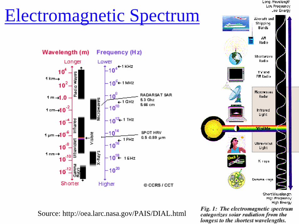
Electromagnetic Spectrum
Source: http://oea.larc.nasa.gov/PAIS/DIAL.html
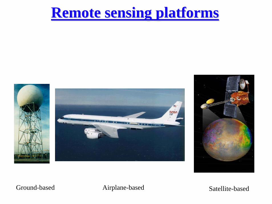
Remote sensing platforms Remote sensing platforms
Ground-based Airplane-based Satellite-based
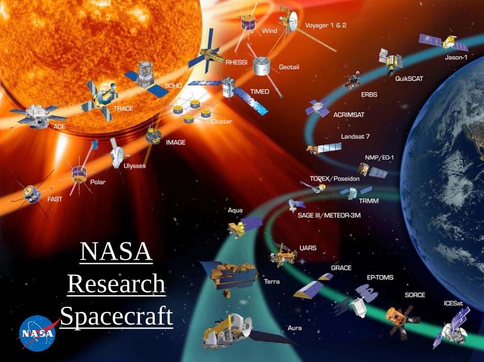
NASA Research
Spacecraft
Busy Traffic Data acquisition
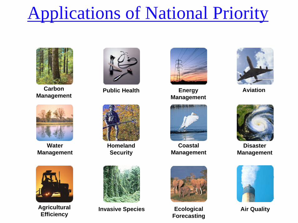
AgriculturalEfficiency
Air Quality
WaterManagement
Disaster Management
CarbonManagement
Aviation
Ecological Forecasting
Invasive Species
Coastal Management
Homeland Security
Energy Management
Public Health
Applications of National Priority
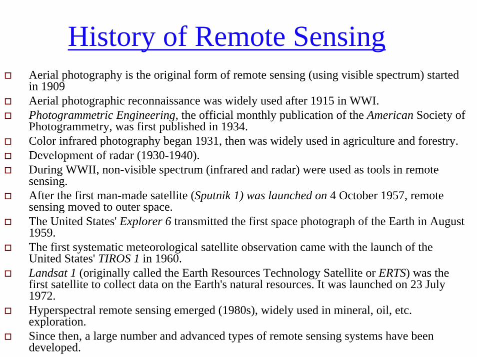
History of Remote SensingAerial photography is the original form of remote sensing (using visible spectrum) started in 1909Aerial photographic reconnaissance was widely used after 1915 in WWI.Photogrammetric Engineering, the official monthly publication of the American Society of Photogrammetry, was first published in 1934.Color infrared photography began 1931, then was widely used in agriculture and forestry.Development of radar (1930-1940).During WWII, non-visible spectrum (infrared and radar) were used as tools in remote sensing.After the first man-made satellite (Sputnik 1) was launched on 4 October 1957, remote sensing moved to outer space. The United States' Explorer 6 transmitted the first space photograph of the Earth in August 1959.The first systematic meteorological satellite observation came with the launch of the United States' TIROS 1 in 1960.Landsat 1 (originally called the Earth Resources Technology Satellite or ERTS) was the first satellite to collect data on the Earth's natural resources. It was launched on 23 July 1972.Hyperspectral remote sensing emerged (1980s), widely used in mineral, oil, etc. exploration.Since then, a large number and advanced types of remote sensing systems have been developed.
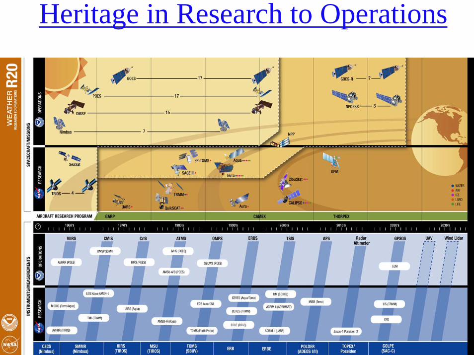
Heritage in Research to Operations
NASA & NOAA jointly funding NRC studies on improving transition
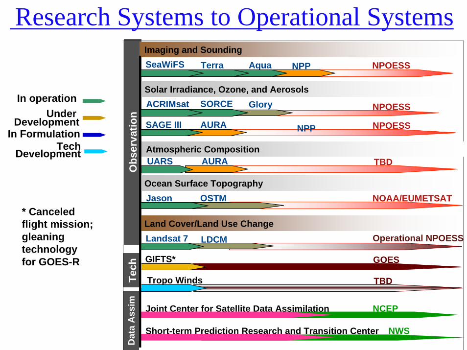
NPP NPOESSSeaWiFS Terra Aqua
Joint Center for Satellite Data Assimilation NCEP
Short-term Prediction Research and Transition Center NWS
Obs
erva
tion
Dat
a A
ssim
ACRIMsat SORCE Glory NPOESS
SAGE III AURA NPOESS
Jason OSTM NOAA/EUMETSAT
Landsat 7 LDCM Operational NPOESS
GIFTS* GOES
Tropo Winds TBD
Imaging and Sounding
Solar Irradiance, Ozone, and Aerosols
Ocean Surface Topography
Land Cover/Land Use Change
Tech
In Formulation
In operationUnder
Development
Atmospheric CompositionUARS AURA TBD
* Canceled flight mission; gleaning technology for GOES-R
TechDevelopment
NPP
Research Systems to Operational Systems
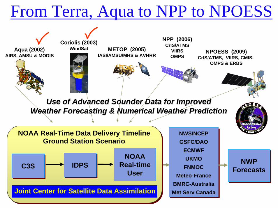
From Terra, Aqua to NPP to NPOESSNPP (2006)
CrIS/ATMSVIIRSOMPS
Aqua (2002)AIRS, AMSU & MODIS
METOP (2005)IASI/AMSU/MHS & AVHRR
NPOESS (2009)CrIS/ATMS, VIIRS, CMIS,
OMPS & ERBS
Coriolis (2003)WindSat
NWS/NCEPGSFC/DAO
ECMWFUKMO
FNMOCMeteo-France
BMRC-AustraliaMet Serv Canada
NWS/NCEPGSFC/DAO
ECMWFUKMO
FNMOCMeteo-France
BMRC-AustraliaMet Serv Canada
NWPForecasts
NWPForecasts
NOAA Real-Time Data Delivery TimelineGround Station Scenario
NOAAReal-time
UserC3SC3S IDPSIDPS
Joint Center for Satellite Data Assimilation
Use of Advanced Sounder Data for ImprovedUse of Advanced Sounder Data for ImprovedWeather Forecasting & Numerical Weather PredictionWeather Forecasting & Numerical Weather Prediction
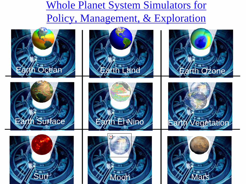
Whole Planet System Simulators for Policy, Management, & Exploration
MarsMoonSun
Earth VegetationEarth El NinoEarth Surface
Earth OzoneEarth LandEarth Ocean
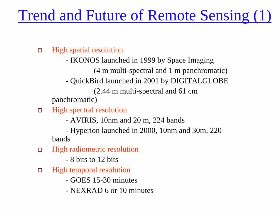
Trend and Future of Remote Sensing (1)
High spatial resolution- IKONOS launched in 1999 by Space Imaging
(4 m multi-spectral and 1 m panchromatic)- QuickBird launched in 2001 by DIGITALGLOBE
(2.44 m multi-spectral and 61 cm panchromatic)High spectral resolution
- AVIRIS, 10nm and 20 m, 224 bands- Hyperion launched in 2000, 10nm and 30m, 220
bandsHigh radiometric resolution
- 8 bits to 12 bitsHigh temporal resolution
- GOES 15-30 minutes- NEXRAD 6 or 10 minutes
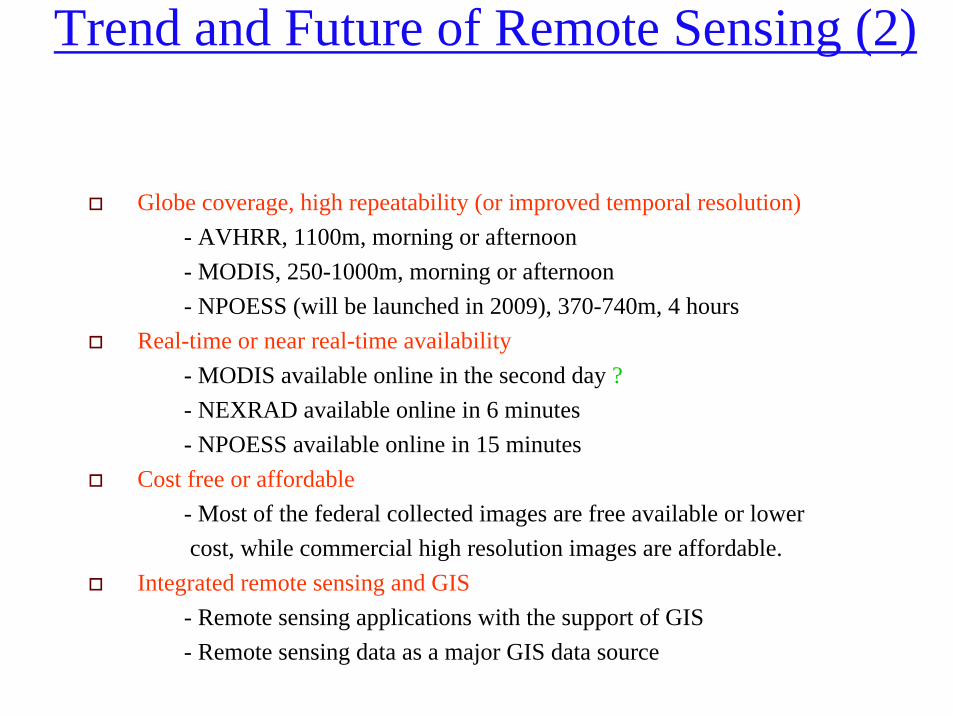
Trend and Future of Remote Sensing (2)
Globe coverage, high repeatability (or improved temporal resolution)- AVHRR, 1100m, morning or afternoon- MODIS, 250-1000m, morning or afternoon- NPOESS (will be launched in 2009), 370-740m, 4 hours
Real-time or near real-time availability- MODIS available online in the second day ?- NEXRAD available online in 6 minutes- NPOESS available online in 15 minutes
Cost free or affordable - Most of the federal collected images are free available or lowercost, while commercial high resolution images are affordable.
Integrated remote sensing and GIS - Remote sensing applications with the support of GIS- Remote sensing data as a major GIS data source
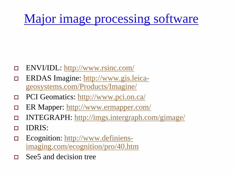
Major image processing software
ENVI/IDL: http://www.rsinc.com/ERDAS Imagine: http://www.gis.leica-geosystems.com/Products/Imagine/PCI Geomatics: http://www.pci.on.ca/ER Mapper: http://www.ermapper.com/INTEGRAPH: http://imgs.intergraph.com/gimage/IDRIS: Ecognition: http://www.definiens-imaging.com/ecognition/pro/40.htmSee5 and decision tree