introduction to remote sensingintroduction to remote sensingdrm.cenn.org/trainings/remote...
TRANSCRIPT
9/12/2011
1
Training CourseRemote Sensing – Basic Theory & Image Processing Methods19 – 23 September 2011
Introduction to Remote SensingIntroduction to Remote SensingIntroduction to Remote SensingIntroduction to Remote SensingMichiel Damen Michiel Damen (September 2011)(September 2011)

9/12/2011
2
Course: Remote Sensing – Basic Theory & Image Processing Methods - 19 - 23 September 2011
OverviewOverview
Some definitions
R t i hi t Remote sensing history
Examples of remote sensing images
Remote sensing sensors – passive & activeg p
Electro magnetic spectrum
Remote sensing platforms
Spatial data acquisition
Questions
Michiel Damen, ITC
9/12/2011
3
Course: Remote Sensing – Basic Theory & Image Processing Methods - 19 - 23 September 2011
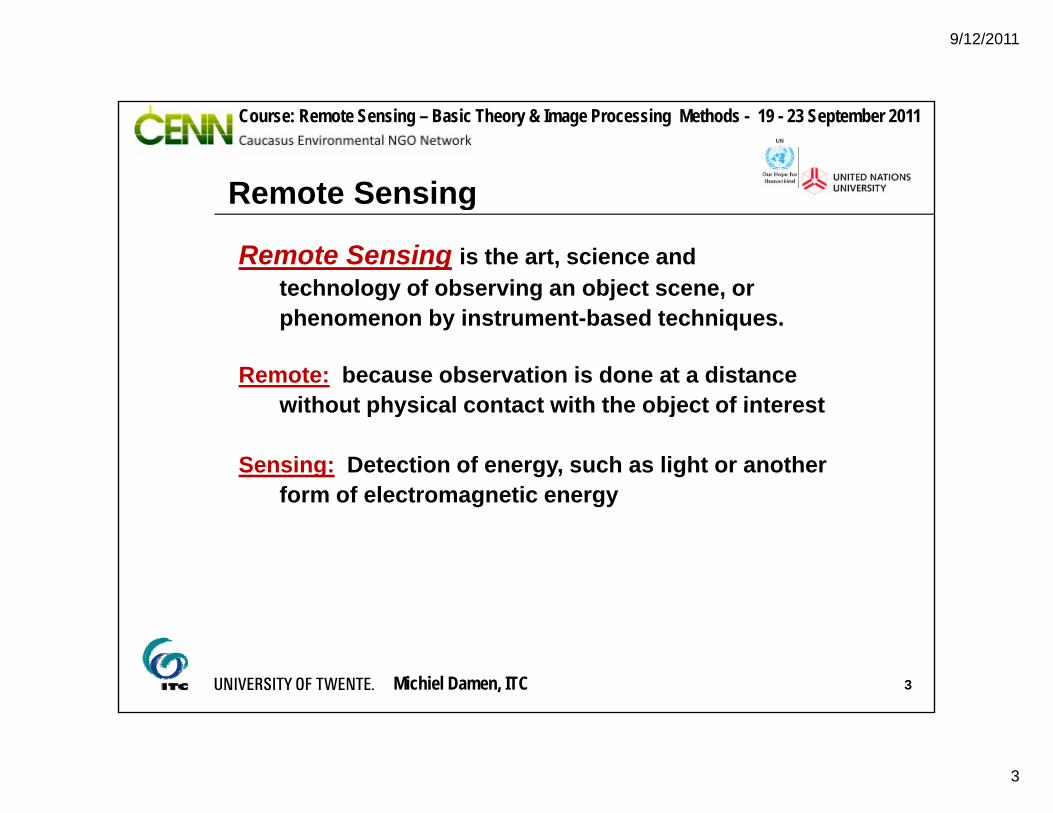
Remote Sensing
Remote Sensing is the art, science and technology of observing an object scene, or
Remote Sensing
phenomenon by instrument-based techniques.
Remote: because observation is done at a distance without physical contact with the object of interestwithout physical contact with the object of interest
Sensing: Detection of energy, such as light or another form of electromagnetic energy
Michiel Damen, ITC 3
9/12/2011
4
Course: Remote Sensing – Basic Theory & Image Processing Methods - 19 - 23 September 2011
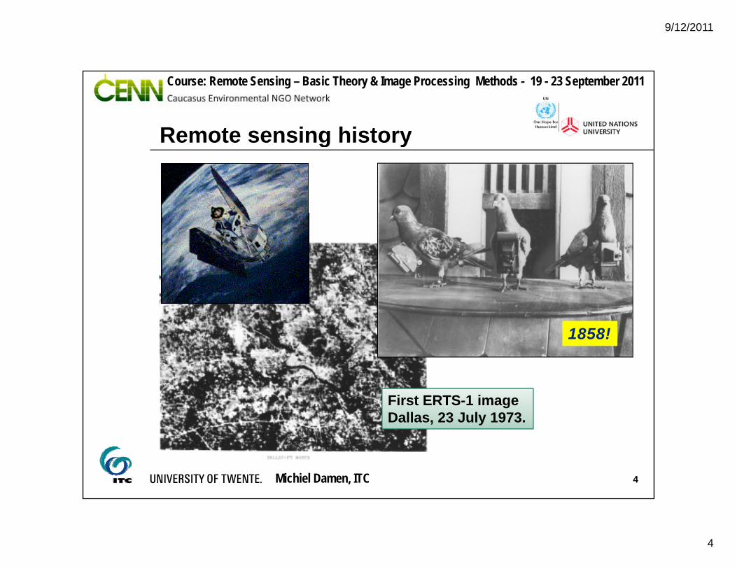
Remote sensing historyRemote sensing history
1858!
First ERTS-1 imageDallas, 23 July 1973.
Michiel Damen, ITC 4
9/12/2011
5
Course: Remote Sensing – Basic Theory & Image Processing Methods - 19 - 23 September 2011
Remote sensing data
Geospatial data acquisition (GDA): Collection, processing and analysis of data for various
Remote sensing data
, p g ypurposes:
- Water management- Land management- Resource management, etc.
Data :representations that can be manipulated by a computer
Information :interpreted data “GEO”: geodetically
defined coordinate system
Michiel Damen, ITC 5
system

9/12/2011
6
Course: Remote Sensing – Basic Theory & Image Processing Methods - 19 - 23 September 2011
Remote sensing imageg
Bandung, Indonesia
Michiel Damen, ITC 6
Bandung, IndonesiaASTER R G B : 3N 2 1
9/12/2011
7
Course: Remote Sensing – Basic Theory & Image Processing Methods - 19 - 23 September 2011
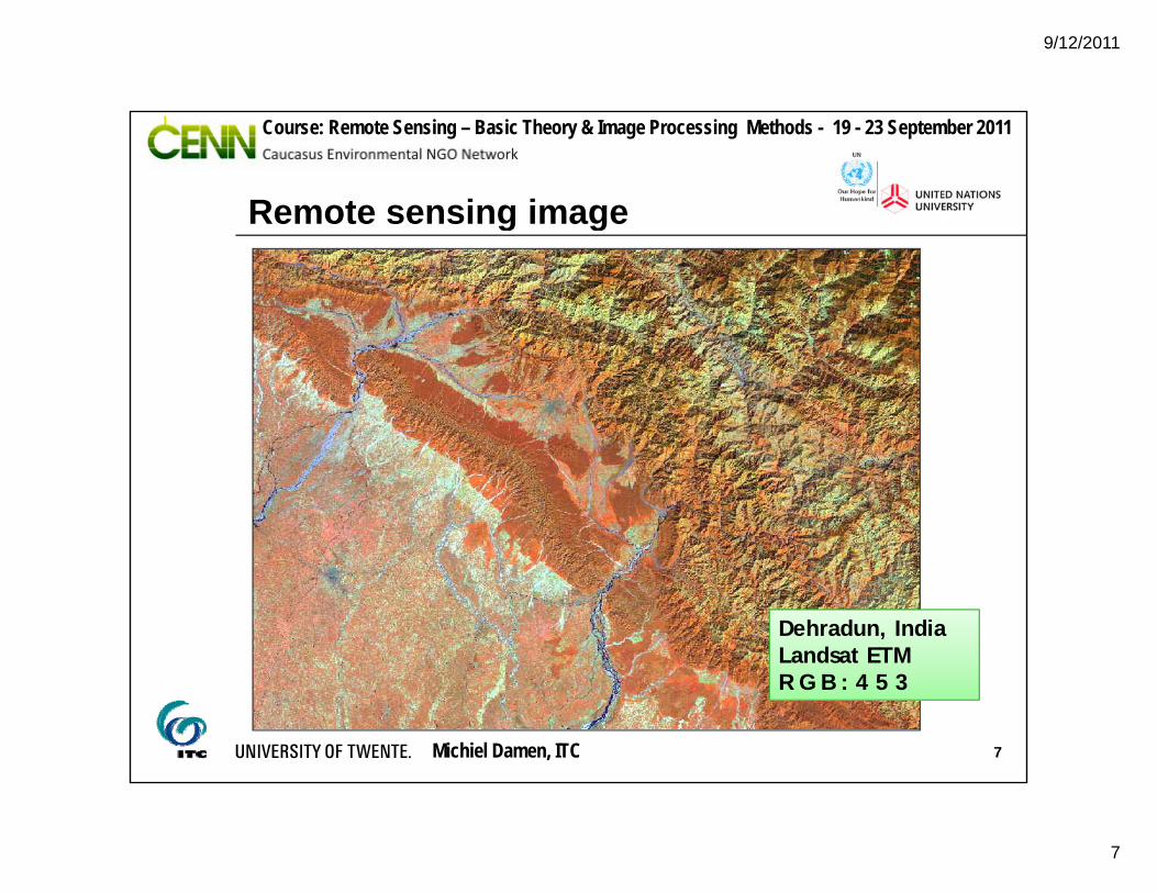
Remote sensing imageRemote sensing image
Dehradun, IndiaLandsat ETM
Michiel Damen, ITC 7
R G B : 4 5 3
9/12/2011
8
Course: Remote Sensing – Basic Theory & Image Processing Methods - 19 - 23 September 2011
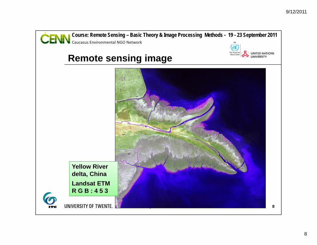
Remote sensing imageRemote sensing image
Yellow River delta, ChinaLandsat ETM
Michiel Damen, ITC 8
Landsat ETM R G B : 4 5 3
9/12/2011
9
Course: Remote Sensing – Basic Theory & Image Processing Methods - 19 - 23 September 2011
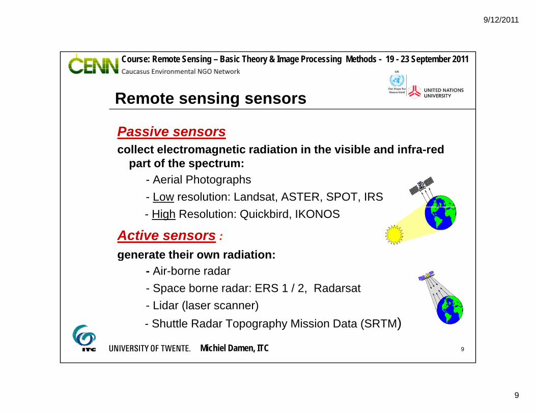
Remote sensing sensors
Passive sensorscollect electromagnetic radiation in the visible and infra-red
Remote sensing sensors
gpart of the spectrum:
- Aerial Photographs - Low resolution: Landsat, ASTER, SPOT, IRS - High Resolution: Quickbird, IKONOS
Active sensors :generate their own radiation:g
- Air-borne radar- Space borne radar: ERS 1 / 2, Radarsat- Lidar (laser scanner)
Michiel Damen, ITC 9
( )- Shuttle Radar Topography Mission Data (SRTM)
9/12/2011
10
Course: Remote Sensing – Basic Theory & Image Processing Methods - 19 - 23 September 2011
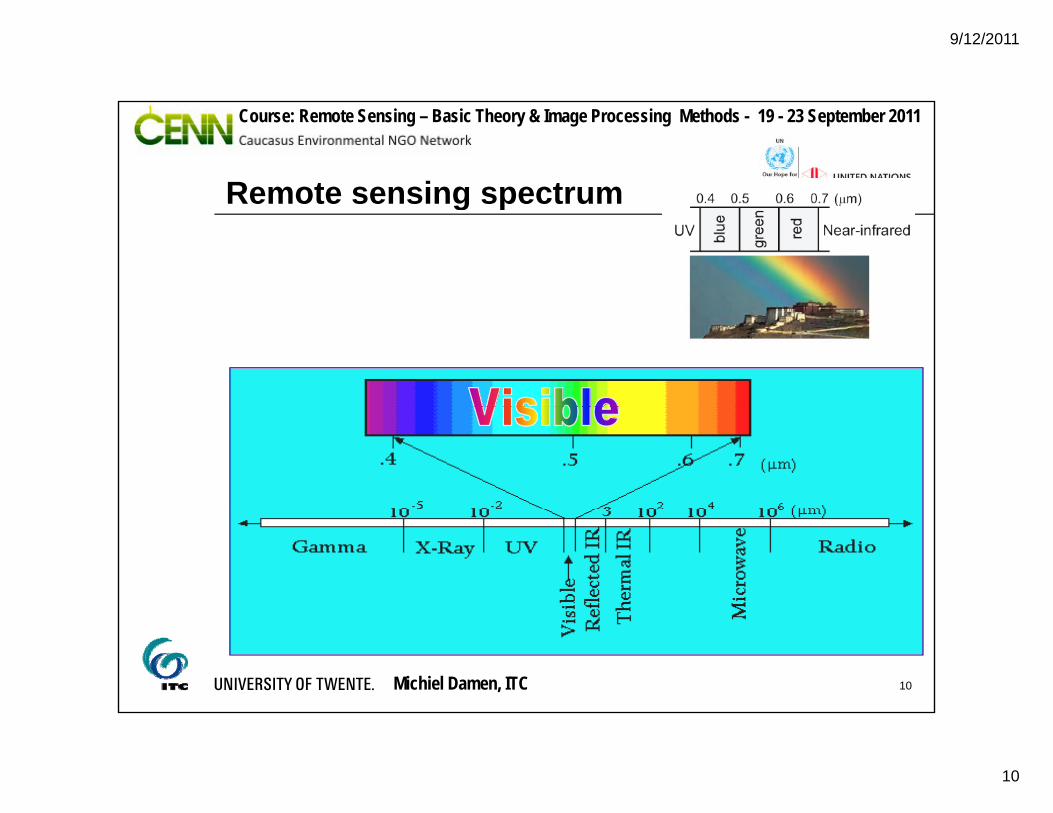
Remote sensing spectrumRemote sensing spectrum
Michiel Damen, ITC 10
9/12/2011
11
Course: Remote Sensing – Basic Theory & Image Processing Methods - 19 - 23 September 2011
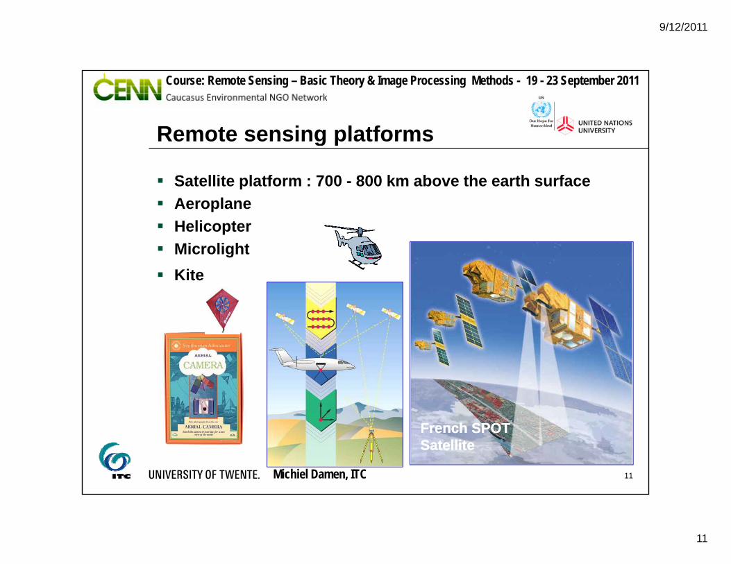
Remote sensing platforms
Satellite platform : 700 - 800 km above the earth surface Aeroplane
Remote sensing platforms
p Helicopter Microlight Kite
F h SPOTF h SPOT
Michiel Damen, ITC 11
French SPOT French SPOT SatelliteSatellite

9/12/2011
12
Course: Remote Sensing – Basic Theory & Image Processing Methods - 19 - 23 September 2011
Remote sensing data steamsEnergy Source SatComSensor
Remote sensing data steams
Application
Target
Michiel Damen, ITC 12
Processing Station Analysis
9/12/2011
13
Course: Remote Sensing – Basic Theory & Image Processing Methods - 19 - 23 September 2011
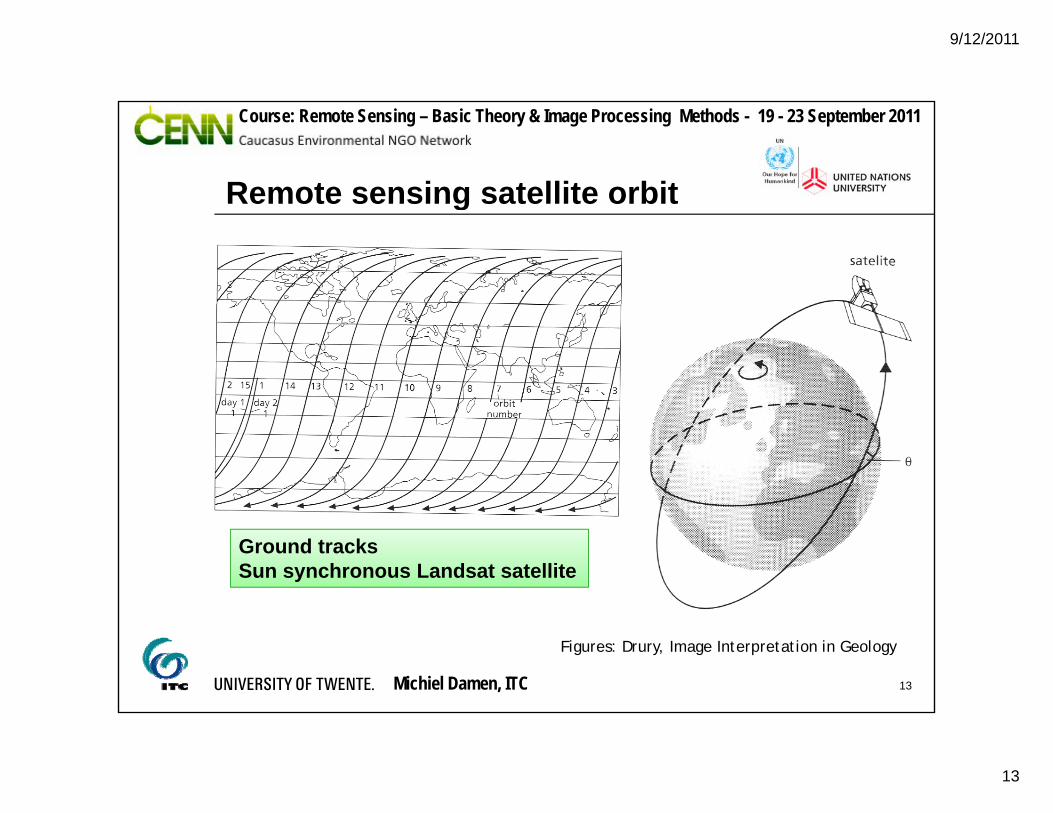
Remote sensing satellite orbitRemote sensing satellite orbit
Ground tracksSun synchronous Landsat satellite
Michiel Damen, ITC 13
Figures: Drury, Image Interpretation in Geology
9/12/2011
14
Course: Remote Sensing – Basic Theory & Image Processing Methods - 19 - 23 September 2011
Spatial data acquisitionSpatial data acquisition
Ground based methodsMaking field observations, taking in-situ measurements.g , g
Remote sensingMethods are based on the use of image data acquired g qby a sensor, such as aerial camera’s scanners or radar.
Michiel Damen, ITC 14

9/12/2011
15
Course: Remote Sensing – Basic Theory & Image Processing Methods - 19 - 23 September 2011
Spatial data acquisition
Ground based methodsMaking field observations, taking in-situ measurements.
Spatial data acquisition
g , g
Michiel Damen, ITC 15
9/12/2011
16
Course: Remote Sensing – Basic Theory & Image Processing Methods - 19 - 23 September 2011
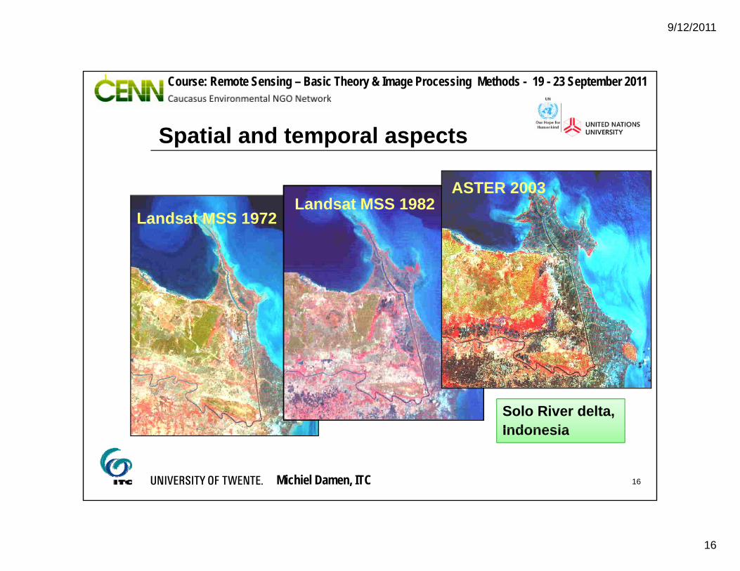
Spatial and temporal aspectsSpatial and temporal aspects
L d t MSS 1972Landsat MSS 1982
ASTER 2003
Landsat MSS 1972Landsat MSS 1982
ASTER 2003Landsat MSS 1972
Solo River delta, Indonesia
Michiel Damen, ITC 16
Indonesia
9/12/2011
17
Course: Remote Sensing – Basic Theory & Image Processing Methods - 19 - 23 September 2011
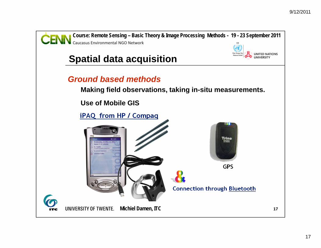
Spatial data acquisitionSpatial data acquisition
Ground based methodsMaking field observations, taking in-situ measurements.g , g
Use of Mobile GIS
Michiel Damen, ITC 17

9/12/2011
18
Course: Remote Sensing – Basic Theory & Image Processing Methods - 19 - 23 September 2011
Spatial data acquisition
Remote Sensing methods are based on the use of image data acquired by a sensor, such as aerial
Spatial data acquisition
g q y ,cameras, scanners or a radar.
observation andreal world sensor image data spatial database
observation andmeasurement
remote sensing based approach
Michiel Damen, ITC 18
9/12/2011
19
Course: Remote Sensing – Basic Theory & Image Processing Methods - 19 - 23 September 2011
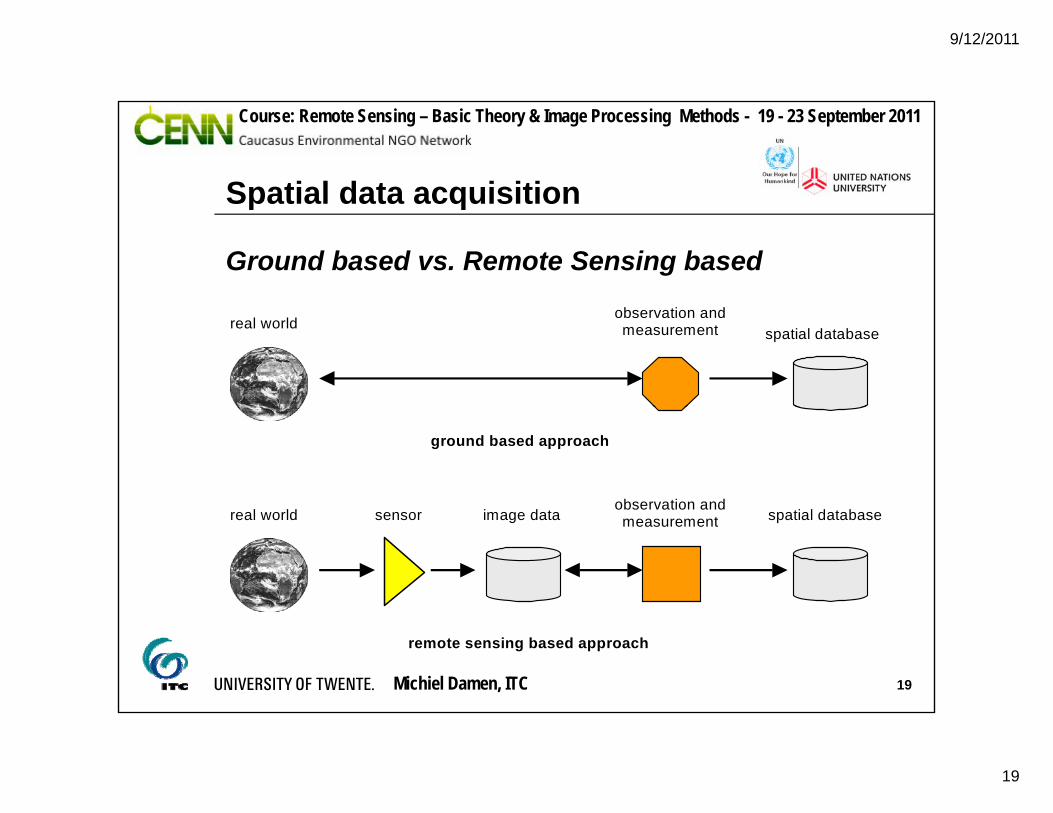
Spatial data acquisition
Ground based vs. Remote Sensing based
Spatial data acquisition
spatial databaseobservation andmeasurementreal world
observation and
ground based approach
real world sensor image data spatial databaseobservation andmeasurement
Michiel Damen, ITC 19
remote sensing based approach
9/12/2011
20
Course: Remote Sensing – Basic Theory & Image Processing Methods - 19 - 23 September 2011
Spatial data acquisition
RS sensors can be divided into passive and activesensors
Spatial data acquisition
sensors
Passive sensors detect EM radiation in the visible and IR part of the spectrum
Active sensors (radar) generate their own radiation
There exist different RS platforms: space-borne, air-borne (plane, helicopter, micro-light)borne (plane, helicopter, micro light)
For analysis of the RS images is also ground checking needed
Michiel Damen, ITC 20
9/12/2011
21
Course: Remote Sensing – Basic Theory & Image Processing Methods - 19 - 23 September 2011
Applications of remote sensing
Question :
H i t i d i
Applications of remote sensing
How is remote sensing used in your organization?
Kind of RS data (sensors etc.)
Software used
Created output
G I S
Michiel Damen, ITC 21