isprs sc newslettersc.isprs.org/files/sc/newsletter/isprs_sc_vol4_no2.pdf · became a focal point...
TRANSCRIPT

ISPRS SC NewsLetterEditor-in-Chief:G r e g o r S T A V B A R
Technical Editor:G r e g o r S T A V B A RU r š a K A N J I R
Editorial Board: Dr. E m m a n u e l B A L T S A V I A SDr. M o j c a K O S M A T I N F R A SDr. A n k a L I S E CK r z y s z t o f S T E R E Ń C Z A KC e m a l Ö z g ü r K I V I L C I M
Proof-Reading:Dr. E m m a n u e l B A L T S A V I A S
Contributors:A l e š L A Z A RK a j a K A N D A R EA r t u r J o s é F r e i r e G I L
This PDF version of SC Newsletter is licensed under a Creative Commons Licence.
For more information about the licence visit:http://creativecommons.org/licenses/by-nd/3.0/
SC Newsletter (ISSN Y506-5879) is published every three months by ISPRS Student Consortium.
To join our members area visitwww.isprs-studentconsortium.org
Would you like to join SC Newsletter team? Do you want to make a difference? Want to learn new skills?SC Newsletter is at a stage where getting broader and better demands more people to be involved in the process of it’s formation. That’s why SC Newsletter team is looking for the following volunteers: - More people who would be willing to prepare articles for existing or new rubrics, - Designers of Newsletter, - English native speakers for proof reading.If you can help us with any of the above, please let us know!
And also...If you would like to publish your research work in the SC Newsletter send us your abstract on email written above. We will soon contact you for further information.
Frontpage designed by Ayda Aktaş
The printing of this hardcopy version of the SC Newsletter was made possible by
Frontpage source: http://photoblog.mohamedsomji.com/index.php?showimage=185
Dear Friends,
In the year of 1909, on the day of July 4th, a passionate scientist Profe-sor Dolezar founded the ISPRS, the first umbrella organization within its fields. Since that day, the society en-larged its mission of scientific activi-ties for the benefit of man and nature,
adapted itself to the new scientific and technological de-velopments and needs. In the year of 2004, the youngest part of the society, Student Consortium was established to introduce ISPRS to the new generations and integrate them to the society in the beginning of their career. SC became a focal point with several technical and social activities dedicated to youth within the last years. Since 2008 it became a global network with almost 400 mem-bers from 69 countries. This year in June, SC presented its midterm report of 2008-2012 during the ISPRS TC VI Symposium in Enschede, the Netherlands. The current progress was evaluated with outlines of future issues and perspective as well as a podium discussion of par-ticipants for a sustainable structure. There is a lot of volunteer work and sacrifice behind SC. We produce more and more together. In the next years, SC will enlarge its structure; however it is also necessar-ily important to keep the quality and high numbers of activities with a dream of next generations to celebrate the next milestone of ISPRS achievements. From SC per-spective with well established network there is the fu-ture imagery of ISPRS
On Behalf of Student Consortium,Cemal Özgür KIVILCIMISPRS SC Chair
Table of Contents
2 SPOTLIGHTS Interview with Prof. Dr. Emmanuel Baltsavias3 Seeking a New Generation of Geomatic Engi neers to Meet the Challenges of the Future
4 ANNOUNCEMENTS Karl Kraus Award
5 ISPRS Congress 2012
A COORDINATOR’S EYE Monitoring an Active Volcano in Costa Rica
6 MAP KIBERA
7 MONUMENT AND BUILDING DOCUMENTATION Photogrammetry or Laser Scanning?
9 PAST EVENTS REPORTS Annual Student Meeting RSPSoc 2010 Student Consortium Activity in ISPRS TC VI Symposium
10 FUTURE ISPRS RELATED EVENTS STUDIES AND PRACTICAL WORK11 IT NEWS INTERESTING LINKS
2
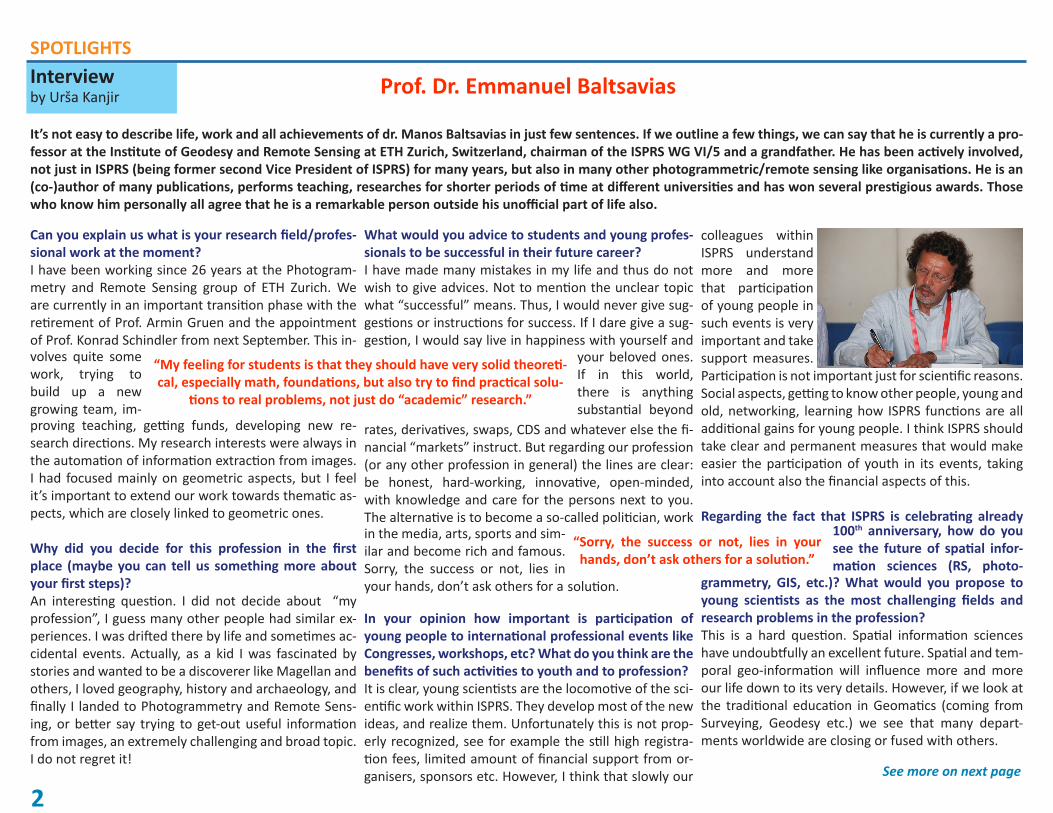
Interviewby Urša Kanjir
SPOTLIGHTS
Prof. Dr. Emmanuel Baltsavias
It’s not easy to describe life, work and all achievements of dr. Manos Baltsavias in just few sentences. If we outline a few things, we can say that he is currently a pro-fessor at the Institute of Geodesy and Remote Sensing at ETH Zurich, Switzerland, chairman of the ISPRS WG VI/5 and a grandfather. He has been actively involved, not just in ISPRS (being former second Vice President of ISPRS) for many years, but also in many other photogrammetric/remote sensing like organisations. He is an (co-)author of many publications, performs teaching, researches for shorter periods of time at different universities and has won several prestigious awards. Those who know him personally all agree that he is a remarkable person outside his unofficial part of life also.
Can you explain us what is your research field/profes-sional work at the moment?I have been working since 26 years at the Photogram-metry and Remote Sensing group of ETH Zurich. We are currently in an important transition phase with the retirement of Prof. Armin Gruen and the appointment of Prof. Konrad Schindler from next September. This in-
“Sorry, the success or not, lies in your hands, don’t ask others for a solution.”
volves quite some work, trying to build up a new growing team, im-proving teaching, getting funds, developing new re-search directions. My research interests were always in the automation of information extraction from images. I had focused mainly on geometric aspects, but I feel it’s important to extend our work towards thematic as-pects, which are closely linked to geometric ones.
Why did you decide for this profession in the first place (maybe you can tell us something more about your first steps)? An interesting question. I did not decide about “my profession”, I guess many other people had similar ex-periences. I was drifted there by life and sometimes ac-cidental events. Actually, as a kid I was fascinated by stories and wanted to be a discoverer like Magellan and others, I loved geography, history and archaeology, and finally I landed to Photogrammetry and Remote Sens-ing, or better say trying to get-out useful information from images, an extremely challenging and broad topic. I do not regret it!
What would you advice to students and young profes-sionals to be successful in their future career?I have made many mistakes in my life and thus do not wish to give advices. Not to mention the unclear topic what “successful” means. Thus, I would never give sug-gestions or instructions for success. If I dare give a sug-gestion, I would say live in happiness with yourself and
your beloved ones. If in this world, there is anything substantial beyond
rates, derivatives, swaps, CDS and whatever else the fi-nancial “markets” instruct. But regarding our profession (or any other profession in general) the lines are clear: be honest, hard-working, innovative, open-minded, with knowledge and care for the persons next to you. The alternative is to become a so-called politician, work
“My feeling for students is that they should have very solid theoreti-cal, especially math, foundations, but also try to find practical solu-
tions to real problems, not just do “academic” research.”
in the media, arts, sports and sim-ilar and become rich and famous. Sorry, the success or not, lies in your hands, don’t ask others for a
In your opinion how important is participation of young people to international professional events like Congresses, workshops, etc? What do you think are the benefits of such activities to youth and to profession?It is clear, young scientists are the locomotive of the sci-entific work within ISPRS. They develop most of the new ideas, and realize them. Unfortunately this is not prop-erly recognized, see for example the still high registra-tion fees, limited amount of financial support from or-ganisers, sponsors etc. However, I think that slowly our
colleagues within ISPRS understand more and more that participation of young people in such events is very important and take support measures. Participation is not important just for scientific reasons. Social aspects, getting to know other people, young and old, networking, learning how ISPRS functions are all additional gains for young people. I think ISPRS should take clear and permanent measures that would make easier the participation of youth in its events, taking into account also the financial aspects of this.
Regarding the fact that ISPRS is celebrating already 100th anniversary, how do you see the future of spatial infor-mation sciences (RS, photo-
grammetry, GIS, etc.)? What would you propose to young scientists as the most challenging fields and research problems in the profession?This is a hard question. Spatial information sciences have undoubtfully an excellent future. Spatial and tem-poral geo-information will influence more and more our life down to its very details. However, if we look at the traditional education in Geomatics (coming from Surveying, Geodesy etc.) we see that many depart-ments worldwide are closing or fused with others.
solution.
See more on next page
3
SPOTLIGHTS
Often the number of students drops, while other disciplines get involved in our tra-ditional work, and often with success. This can be alarming, and may change soon the face of our profession. I believe we should increase a lot our PR towards the society in general, and especially the high school students, making clear what our contribution in the society is. Challeng-ing fields and research problems exist in abundance, e.g. extracting in automated
fashion information from images, can keep us busy at least for decades. My feeling for students is that they should have very solid theoretical, especially math, founda-tions, but also try to find practical solutions to real problems, not just do “academic” research. Another important aspect is the combination, integration, fusion of the continuously increasing amount of data and information. Which can’t be done with-out the proper quality characterization and uncertainty propagation.
Seeking a new generation of geomatic engineers to meet the challenges of the future.
Ian Dowman, Emeritus professor of Photogrammetry and Remote Sensing,University College LondonFirst Vice President of ISPRS
I have written already in GIS Development on my perspective on 40 years in photo-grammetry, half of that active in ISPRS. I have also given an interview to GIM Inter-national and discussed the technical developments in photogrammetry and remote sensing over that period. My message in both of these articles has been that the most important challenge for the profession, and for ISPRS, is to ensure the future of the profession by training young people in the use of imagery and by educating a wide spectrum of professionals and decision makers in the importance of using geospatial data for the benefit of society at large. Orhan Altan, current President of ISPRS, was very perceptive in initiating student activities at the ISPRS Congress in Istanbul. He has been shown to be right by the speed at which the Student Consor-tium has become established with dynamic leaders. This augurs well for the future, but the challenges must not be underestimated. Our profession is very dependent on the global market. The production and generation of geospatial data is not uni-versally recognized by governments and funding agencies as being a priority, so we must be creative in linking with scientists in other disciplines, and with decision makers, and by showing them how geospatial data can benefit their activities.
The shift from analogue photogrammetry to digital photogrammetry, which includes the development of satellite data, and the development of new software, has pro-vided tools which allow the rapid exploitation of imagery for mapping and monitor-ing; and the internet has made imagery widely accessible. And here we can make a really important input in promoting the use of imagery and geospatial data and at the same time stress the importance of understanding the accuracy of information and the limitations on its use.
The new technology has generated exciting research topics to attract young people into the profession, but the new challenge is to make sure that the results of this research are understood and used in the wider scientific and commercial communi-ties. The areas of computer science, medical physics and archeology have a particu-lar interest in three dimensional data and in visualization. The use of mobile map-ping systems and airborne lidar generating dense point clouds, offer a real potential for generating models which could be of very wide application. It is my experience that students from different disciplines mix more than academics at a later stage in their development, so there is a real opportunity for students to establish links with other disciplines early on and to maintain these throughout their career.
One driver of promoting the relevance of photogrammetry and remote sensing, now being embraced by governments and international agencies, is that science and technology should benefit society. This is very much promoted by the Group on Earth Observations (GEO). The United Nations Millennium Development Goals are set up as targets for governments; of particular interest to ISPRS are the goals to combat diseases and to ensure environmental sustainability. Although health may not immediately be seen as relevant to the use of geospatial data, the way in which disease spreads and the environmental factors which influence the development of disease, depend on spatial analysis and several studies on air pollution and epide-miology, for example, have demonstrated this. These applications are most relevant in developing countries and I hope that the Student Consortium will soon be able to expand its activities to Africa and Latin America, where the requirement to support education is very important.
Photogrammetry and remote sensing is at a critical stage of development. We have solved many of the problems of handling digital data, and of realizing its enormous potential; now is the time to maintain momentum by applying the data and the processing techniques to real problems and to engage with the world outside of this discipline. I look forward to seeing these challenges being met and to see a new generation of outward looking professionals emerge.

4
ANNOUNCEMENTS
Sign up and receive the magazine for free: www.gim-international.com/trial
GIM International, the global magazine for geomatics, focuses on reporting the
latest news and communicating new developments and applications in geomatics.
WE’VE GOT IT COVERED
NO MATTER THE LOCATION...
KARL KRAUS AWARD
The ISPRS “Karl Kraus Medal” is a prize to honour the authorship of excellent textbooks in the scientific fields of Photogrammetry, Remote Sensing, and Spa-tial Information Sciences. The prize is dedicated to the memory of Professor Karl Kraus, a passionate teacher and author of a number of textbooks.
In order to present the ideas of the students for the best book, Student Consor-tium Chair was also appointed as one of the jury members of the jury formed of distinguished academicians. The chairman of the jury reported that “…. the 7 nominated and reviewed books- with an impressive overall volume of some 4500 pages - were all of very high quality and made the decision of the Jury no simple task.” The winner of the award for 2010 is ‘Close Range Photogrammetry: Principles,Techniques and Applications’ by Professor Thomas Luhmann, (Insti-tute of Applied Photogrammetry and Geoinformatics, University for Applied Sciences,Oldenburg, Germany), Professor Stuart Robson, (University College London), Dr. Stephen Kyle, (Consultant; Hon. Research Fellow, University Col-lege London),and Professor Ian Harley, (Emeritus Professor, University College London).Published by Whittles Publishing, Dunbeath, Scotland. The award will be presented at the ISPRS Centenary Celebration in Vienna on 4th July 2010. The winner of the Karl Kraus award will be presented in the centenary celebrations of ISPRS.
5
ANNOUNCEMENTS
Monitoring an Active Volcano in Costa Ricaby Carlomagno Soto Organization for Tropical Studies,La Selva Biological Station GIS Lab.
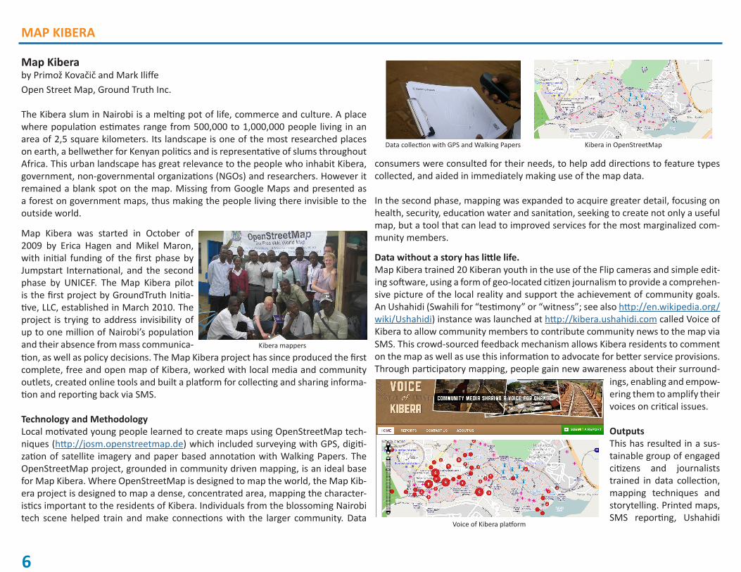
As part of the “Pacific Ring of Fire”, Costa Rica is characterized by intense volcanic activity, which is affecting human productive activities. One of the volcanoes that this year has increased its activity is the Turrialba, located in the area of the same name, where the main activities are cattle ranching and agriculture.
Turrialba Volcano
Save the Date! Great Opportunities for ISPRS Congress 2012
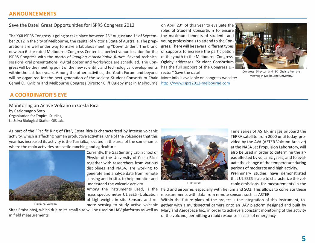
The XXII ISPRS Congress is going to take place between 25th August and 1st of Septem-ber 2012 in the city of Melbourne, the capital of Victoria State of Australia. The prep-arations are well under way to make a fabulous meeting “Down Under”. The brand new eco 6-star rated Melbourne Congress Center is a perfect venue location for the ISPRS Congress with the motto of imaging a sustainable future. Several technical sessions oral presentations, digital poster and workshops are scheduled. The Con-gress will be the meeting point of the new scientific and technological developments within the last four years. Among the other activities, the Youth Forum and beyond will be organized for the next generation of the society. Student Consortium Chair Cemal Ö. Kıvılcım and Melbourne Congress Director Cliff Ogleby met in Melbourne
Congress Director and SC Chair after the meeting in Melbourne University.
on April 23rd of this year to evaluate the roles of Student Consortium to ensure the maximum benefits of students and young professionals to attend to the Con-gress. There will be several different types of supports to increase the participation of the youth to the Melbourne Congress. Ogleby addresses “Student Consortium has the full support of the Congress Di-rector.” Save the date! More info is available on congress website:http://www.isprs2012-melbourne.com
A COORDINATOR’S EYE
Currently, the Gas Sensing Lab, School of Physics of the University of Costa Rica, together with researchers from various disciplines and NASA, are working to generate and analyze data from remote sensing and in-situ, to help monitor and understand the volcanic activity. Among the instruments used, is the mass spectrometer ULISSES (Utilization of Lightweight in situ Sensors and re-mote sensing to study active volcanic
Sites Emissions), which due to its small size will be used on UAV platforms as well as in field measurements.
Time series of ASTER images onboard the TERRA satellite from 2000 until today, pro-vided by the AVA (ASTER Volcano Archive) at the NASA Jet Propulsion Laboratory, will also be used in order to determine the ar-eas affected by volcanic gases, and to eval-uate the change of the temperature during periods of moderate and high activity. Preliminary studies have demonstrated that ULISSES is able to characterize the vol-canic emissions, for measurements in the Field work
field and airborne, especially with helium and SO2. This allows to correlate these measurements with data from remote sensors such as ASTER. Within the future plans of the project is the integration of this instrument, to-gether with a multispectral camera onto an UAV platform designed and built by Maryland Aerospace Inc., in order to achieve a constant monitoring of the activity of the volcano, permitting a rapid response in case of emergency.
MAP KIBERA
6
Map Kiberaby Primož Kovačič and Mark IliffeOpen Street Map, Ground Truth Inc.
The Kibera slum in Nairobi is a melting pot of life, commerce and culture. A place where population estimates range from 500,000 to 1,000,000 people living in an area of 2,5 square kilometers. Its landscape is one of the most researched places on earth, a bellwether for Kenyan politics and is representative of slums throughout Africa. This urban landscape has great relevance to the people who inhabit Kibera, government, non-governmental organizations (NGOs) and researchers. However it remained a blank spot on the map. Missing from Google Maps and presented as a forest on government maps, thus making the people living there invisible to the outside world.
Kibera mappers
Map Kibera was started in October of 2009 by Erica Hagen and Mikel Maron, with initial funding of the first phase by Jumpstart International, and the second phase by UNICEF. The Map Kibera pilot is the first project by GroundTruth Initia-tive, LLC, established in March 2010. The project is trying to address invisibility of up to one million of Nairobi’s population and their absence from mass communica-tion, as well as policy decisions. The Map Kibera project has since produced the first complete, free and open map of Kibera, worked with local media and community outlets, created online tools and built a platform for collecting and sharing informa-tion and reporting back via SMS. Technology and Methodology Local motivated young people learned to create maps using OpenStreetMap tech-niques (http://josm.openstreetmap.de) which included surveying with GPS, digiti-zation of satellite imagery and paper based annotation with Walking Papers. The OpenStreetMap project, grounded in community driven mapping, is an ideal base for Map Kibera. Where OpenStreetMap is designed to map the world, the Map Kib-era project is designed to map a dense, concentrated area, mapping the character-istics important to the residents of Kibera. Individuals from the blossoming Nairobi tech scene helped train and make connections with the larger community. Data
consumers were consulted for their needs, to help add directions to feature types collected, and aided in immediately making use of the map data. In the second phase, mapping was expanded to acquire greater detail, focusing on health, security, education water and sanitation, seeking to create not only a useful map, but a tool that can lead to improved services for the most marginalized com-munity members.
Data without a story has little life. Map Kibera trained 20 Kiberan youth in the use of the Flip cameras and simple edit-ing software, using a form of geo-located citizen journalism to provide a comprehen-sive picture of the local reality and support the achievement of community goals. An Ushahidi (Swahili for “testimony” or “witness”; see also http://en.wikipedia.org/wiki/Ushahidi) instance was launched at http://kibera.ushahidi.com called Voice of Kibera to allow community members to contribute community news to the map via SMS. This crowd-sourced feedback mechanism allows Kibera residents to comment on the map as well as use this information to advocate for better service provisions. Through participatory mapping, people gain new awareness about their surround-
Voice of Kibera platform
ings, enabling and empow-ering them to amplify their voices on critical issues.
Outputs This has resulted in a sus-tainable group of engaged citizens and journalists trained in data collection, mapping techniques and storytelling. Printed maps, SMS reporting, Ushahidi
Kibera in OpenStreetMapData collection with GPS and Walking Papers

MAP KIBERA
7
Photogrammetry or Laser Scanning?by Thanasis Moysiadis, University of Thessaly
and citizen driven media all contribute to a methodology that can be put to use throughout Kenya and the world. Outputs of the project will be used to identify locations of service provisions and service providers, areas of psychological risk or vulnerability and patterns of risk perception. Further, the information will be publicly owned and available, helping to keep grassroots advocates and policy planners more accountable to people espe-cially young people in the community.
00
0
0
00
"0"0
"0
"0
"0
"0
"0 "0"0
"0
"0"0
"0
"0
"0
"0
"0
"0
"0
"0
"0
"0
"0
"0
"0
"0
"0"0
"0
"0
"0"0
"0
"0
"0
"0
"0
"0
"0"0 "0"0
"0
"0"0
"0
"0
"0
"0
"0
"0
"0
"0"0"0
"0
"0
"0
"0 "0
"0
"0
"0
"0
"0
"0"0"0
"0
"0
"0
"0
"0
"0
"0
"0"0
"0
"0"0
"0
"0
"0
"0
"0
"0
"0"0"0
"0
"0
"0"0
"0
"0
"0
"0"0
"0
"0"0
!
ú
!
ú
!
ú
!
ú
!
ú
!
ú
!
ú
!
ú
!
ú
!
ú
!
ú
!
ú
!
ú
!
ú
!
ú
!
ú
!
ú
!
ú
!
ú
!
ú
!
ú
!
ú
!
ú
!
ú
!
ú
!
ú
!
ú
!
ú
!
ú
!
ú !
ú
!
ú
!
ú
!
ú
!
ú
!
ú
!
ú
!
ú
!
ú
!
ú
!
ú
!
ú
!
ú!
ú
!
ú
!
ú
!
ú
!
ú!
ú
!
ú
!
ú
!
ú
!
ú
!
ú
!
ú
!
ú
!
ú
!
ú
!
ú
!
ú
!
ú
!
ú
!
ú!
ú
!
ú
ú
ú
ú
ú
ú
ú
ú
ú
ú
úú ú
úú
ú ú ú
ú
ú
úú
ú
ú
6666666666
6666666666
66666
6666666666
66666
66666
66666
66666
66666
P
x
P
x
P
x
P
x
P
x
P
x
P
x
P
x
P
x
P
x
P
x
P
x
P
x
P
x
P
x
P
x
P
x
P
x
P
x
P
x
P
x
P
x
P
x
P
x
P
x
P
x
P
x
P
x
P
x
P
x
P
x
P
x
P
x
P
x
P
x
P
x
P
x
P
x
P
x
%c
%c%c
%c
E
E E
E
EE
E
E
E
E
E
E
E
E
EE
E
E
E E
E
E
E
E
E
E
E
E
E
Sa
×Y
×Y
×Y
×A
×A
×C
×C
¾kGBV
¾kGBV
¾kGBV
¾GBVk
¾GBVk
¾GBVk
¾GBVk
¾GBVk
¾GBVk
¾GBVk
¾GBVk
¾GBVk
¾GBVk
!O
!O!O!O
!O
!O!O
!O
!O
!O !O
!O
!O!O
!O!O
!O
!O
!O
!O
The railway line is dark and secluded, so girls try and avoid this area.
±Credits, Copyrights & Information
Data:Vector data: OpenStreetMap, ILRI GIS ServicesGPS data: OpenStreetMap
Information & Contacts: www.mapkibera.org
Created: 17 th June 2010
Print dimensions: 1:10.000, ISO A3 (297 × 420 mm)
0 125 250 375 50062,5m
Ayany
Kianda
Olympic
Raila
SowetoWest
Gatwekera
Karanja
Makina
KisumuNdogo
KambiMuru
Mashimoni
Laini Saba
Lindi
Silanga
SowetoEast
Legend!O Safe Space
¾kGBV GBV Support
×C Chief's Camp
×A Administration
×Y Youth Support
Sa Police
E Black Spot
%c Hatari Spot
"0 Bar
P
x
Adopt A Light Non-Operational
P
x
Adopt A Light Operational
66666 Street Light Not-Installed
ú Street Light Non-Operational
!
ú Street Light Operational
Roads
Kibera Drive
Dangerous Paths
Paths
Dangerous Area - Forest
Dangerous Area - Dam
Village Boundary
The high reeds in the Nairobi Dam area make it a convenient area for robbers andsexual predators. Despite this, many children play near the football grounds here.
Ngong Forest is known to be a place where rape and defilementtake place. Girls avoid this areaeven during the day.
Bus stops in Makina and Karanja, two of the formal villages, are known for robberies since the many business ownershere often carry large sums of money.
Gatwekera and Raila have almost no lights.
Carjackings are frequent at the Ayany Bridge.
Kambi Muru has only one safe space but many girls report that the area is dangerous.
KENYA
NAIROBI
Nairobi
Kibera
Example of an output: Security situation in Kibera
ReferencesErica, H., 2010. The story of Map Kibera. Workspaces: The changing environment of infome-diaries/Map Kibera.http://wiki.ikmemergent.net/index.php/Workspaces:The_changing_environment_of_info-mediaries/Map_Kibera (accessed 17.6.2010)
Map Kibera, 2010.http://mapkibera.org/ & http://mapkibera.org/wiki (accessed 17.6.2010)
MONUMENT AND BUILDING DOCUMENTATION
The last part of the report outlines the combination of Photogrammetry and Laser Scanning in cultural heritage applications. Modelling a monument is not an easy task. There are many factors related to the methodology implemented, already mentioned in the two previous report parts, which have to be taken into consider-ation and influence the accuracy and precision of the final product.
On one hand, Laser Scanning offers many advantages due to rapid data acquisition and simple use of the instrument. Laser scanning instruments capture significant detail so they provide a dense and accurate 3D model of a monument. However, parts with complex surfaces are more difficult to model which is largely affected by the instrument specifications and calibration, the scan positions, the surface re-flectivity, the algorithm used for the scan registration and the ability to handle large amount of data. Even if laser scanning is a very convenient solution in terms of time and data acquisition, the need of data editing due to occlusions is unavoidable. Therefore, significant manual and partly automatic editing is needed which is time consuming and limits the accuracy of these parts of the surface.
Figure 1: Data occlusion in the 3D laser scanning model (left) and after semi-automatic editing (right).© Moysiadis, University College London
The use of targets on the monument surface before the scanning process provides control both for the Laser Scanning and the Photogrammetric model. Therefore, there is direct georeferencing between the two datasets.
On the other hand, Close-Range Photogrammetry provides correct geometric and texture information. More specifically, geometric patterns and edges appear in greater detail for those parts, where the laser scanner data has limitations. How-ever, there is a good correlation in terms of geometry between Laser Scanning and
8
MONUMENT AND BUILDING DOCUMENTATION
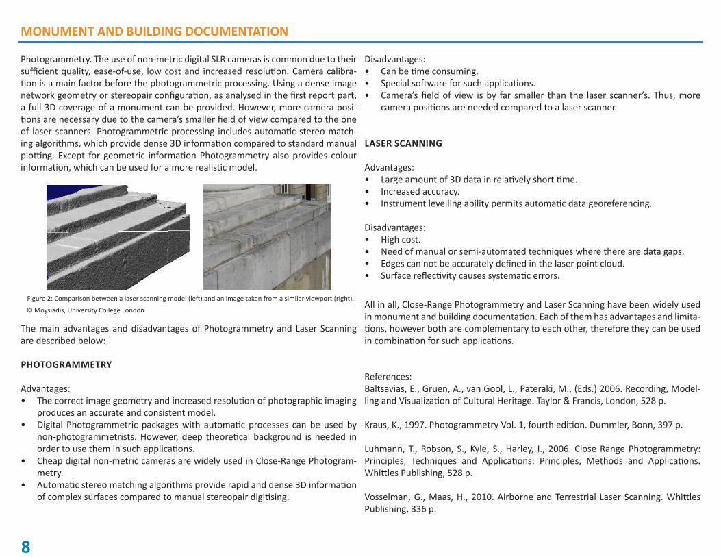
Photogrammetry. The use of non-metric digital SLR cameras is common due to their sufficient quality, ease-of-use, low cost and increased resolution. Camera calibra-tion is a main factor before the photogrammetric processing. Using a dense image network geometry or stereopair configuration, as analysed in the first report part, a full 3D coverage of a monument can be provided. However, more camera posi-tions are necessary due to the camera’s smaller field of view compared to the one of laser scanners. Photogrammetric processing includes automatic stereo match-ing algorithms, which provide dense 3D information compared to standard manual plotting. Except for geometric information Photogrammetry also provides colour information, which can be used for a more realistic model.
Figure 2: Comparison between a laser scanning model (left) and an image taken from a similar viewport (right).
© Moysiadis, University College London
The main advantages and disadvantages of Photogrammetry and Laser Scanning are described below:
PHOTOGRAMMETRY
Advantages:The correct image geometry and increased resolution of photographic imaging • produces an accurate and consistent model.Digital Photogrammetric packages with automatic processes can be used by • non-photogrammetrists. However, deep theoretical background is needed in order to use them in such applications.Cheap digital non-metric cameras are widely used in Close-Range Photogram-• metry.Automatic stereo matching algorithms provide rapid and dense 3D information • of complex surfaces compared to manual stereopair digitising.
Disadvantages:Can be time consuming.• Special software for such applications.• Camera’s field of view is by far smaller than the laser scanner’s. Thus, more • camera positions are needed compared to a laser scanner.
LASER SCANNING
Advantages:Large amount of 3D data in relatively short time.• Increased accuracy. • Instrument levelling ability permits automatic data georeferencing.•
Disadvantages:High cost.• Need of manual or semi-automated techniques where there are data gaps.• Edges can not be accurately defined in the laser point cloud. • Surface reflectivity causes systematic errors.•
All in all, Close-Range Photogrammetry and Laser Scanning have been widely used in monument and building documentation. Each of them has advantages and limita-tions, however both are complementary to each other, therefore they can be used in combination for such applications.
References:Baltsavias, E., Gruen, A., van Gool, L., Pateraki, M., (Eds.) 2006. Recording, Model-ling and Visualization of Cultural Heritage. Taylor & Francis, London, 528 p.
Kraus, K., 1997. Photogrammetry Vol. 1, fourth edition. Dummler, Bonn, 397 p.
Luhmann, T., Robson, S., Kyle, S., Harley, I., 2006. Close Range Photogrammetry: Principles, Techniques and Applications: Principles, Methods and Applications. Whittles Publishing, 528 p.
Vosselman, G., Maas, H., 2010. Airborne and Terrestrial Laser Scanning. Whittles Publishing, 336 p.
9
PAST EVENTS REPORTS
Annual Student Meeting RSPSoc 2010by Matthias KunzISPRS SC, UK Representative
This year’s RSPSoc (Remote Sensing and Photogrammetry Society) Annual Student Meeting was held from 15.3. to 17.3.2010 in the Mount Batten Centre in Plymouth, UK. Over 30 students from across the UK came together in the sunny south of England to present their current work on posters and in oral presentations. Ranging from master level to final year PhD students the conference was held in a nice and relaxed atmosphere. It gave students a great opportunity to discuss their work with peers and for networking. A wide range of interesting research has been presented including mobile mapping systems, airborne and terrestrial lidar, radar applications and the use of modern earth observation satellites. Each day of the conference also included a keynote talk. Furthermore, an introduction to the ISPRS Student Consortium and the UK Polar Network has been given to get more students involved in national and in-ternational student driven organisations. The very enjoyable social events included water sports, a visit of the National Aquarium and a Pub Quiz with some really tricky questions.
Student Consortium Activity in ISPRS TC VI Symposium
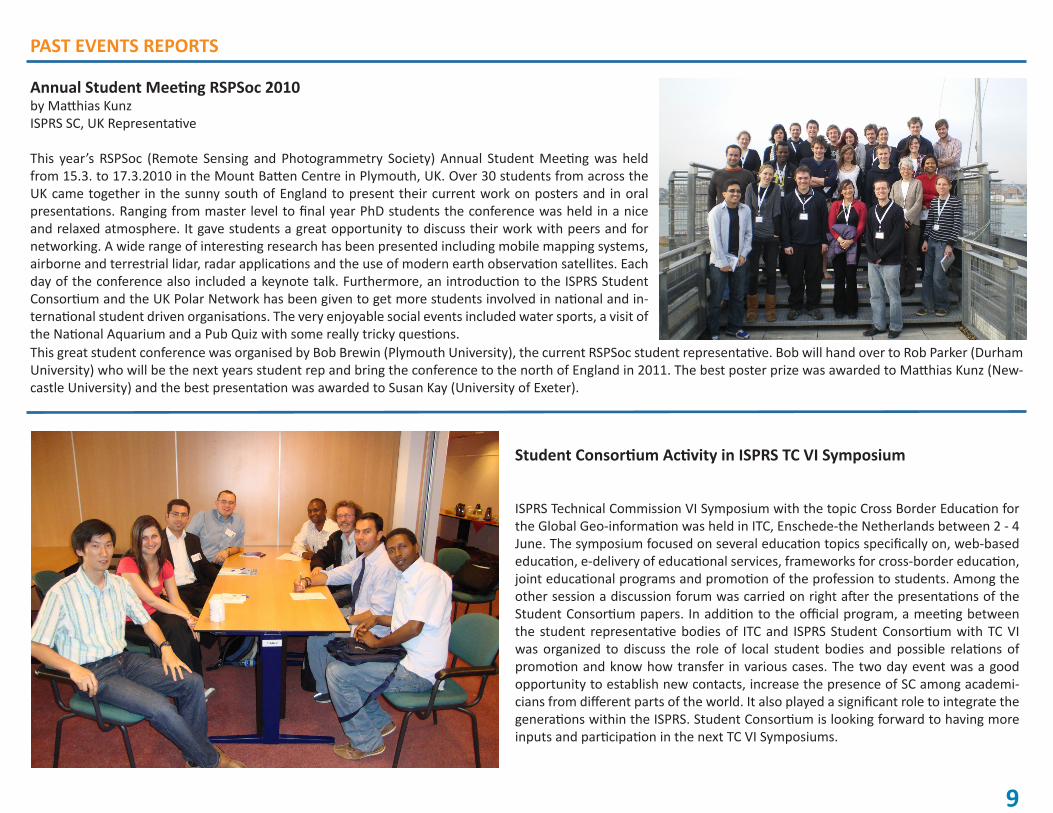
ISPRS Technical Commission VI Symposium with the topic Cross Border Education for the Global Geo-information was held in ITC, Enschede-the Netherlands between 2 - 4 June. The symposium focused on several education topics specifically on, web-based education, e-delivery of educational services, frameworks for cross-border education, joint educational programs and promotion of the profession to students. Among the other session a discussion forum was carried on right after the presentations of the Student Consortium papers. In addition to the official program, a meeting between the student representative bodies of ITC and ISPRS Student Consortium with TC VI was organized to discuss the role of local student bodies and possible relations of promotion and know how transfer in various cases. The two day event was a good opportunity to establish new contacts, increase the presence of SC among academi-cians from different parts of the world. It also played a significant role to integrate the generations within the ISPRS. Student Consortium is looking forward to having more inputs and participation in the next TC VI Symposiums.
This great student conference was organised by Bob Brewin (Plymouth University), the current RSPSoc student representative. Bob will hand over to Rob Parker (Durham University) who will be the next years student rep and bring the conference to the north of England in 2011. The best poster prize was awarded to Matthias Kunz (New-castle University) and the best presentation was awarded to Susan Kay (University of Exeter).

10
The International Masters Program (Master of Science, M.Sc.) in Geospatial Tech-nologies is a cooperation of the University of Münster (Germany), University Jaume I (Spain) and New University of Lisbon (Portugal). It has been selected within the Eras-mus Mundus Program of the European Commission (2007-0064/001 FRAME MUNB123). Regarding the 2010/2011 edition, for students not applying for an Erasmus Mundus grant but for regular admission to the Masters program, the deadine for application will be July 31st, 2010. Read full announcement at: http://geotech.uni-muenster.de/index.php?option=com_content&view=article&id=29:call-for-applications-application-system-open&catid=1:news
The Joint Research Centre (JRC) in Ispra, Italy invite application on different positions (Jobs, PostDoc positions, Traineeship, etc.). The mission of the JRC is to provide cus-tomer-driven scientific and technical support for the conception, development, imple-mentation and monitoring of European Union policies. They provide scientific and tech-nical assistance in a wide range of fields, including those relating to the environment, consumer protection, energy, nuclear safety and security, agriculture and external re-lations. For more info visit http://ec.europa.eu/dgs/jrc/index.cfm?id=3720
A full-time position is available from 1st September 2010 at the Photogrammetry and Remote Sensing group (Prof. Dr. Konrad Schindler) of the Institute of Geodesy and Pho-togrammetry, ETH Zurich. The main task will be the participation in current research projects and teaching duties of the group within the curriculum Geomatic Engineering and Planning. The successful candidate will undertake independent high-level scientific research in photogrammetry, remote sensing and computer vision aiming at a Ph.D. the-sis within approximately 4 years. The teaching duties include support and supervision of students in lectures, exercises and labs, seminar projects as well as Master- and Bache-lor-Theses, and exams. Candidates should hold a university degree (Master/Diploma in Engineering or equivalent degree) in Geomatic Engineering or related disciplines (e.g. Computer Science, Electrical or Electronic Engineering, Mathematics, Physics). Further requirements are a high degree of initiative, good mathematics and programming skills, and proficiency in English (written and spoken). Knowledge of German is an additional advantage. For additional information about the position and the tasks, please contact Prof. Konrad Schindler, +49-6151-163413, [email protected]. Full announcement at http://internet5.refline.ch/845721/1041/++publications++/1/index.html
FUTURE ISPRS RELATED EVENTS STUDIES AND PRACTICAL WORK
The ESA is organising POLinSAR 2011, the 5th International Workshop on Science and Applications of SAR Polarimetry and Polarimetric Interferom-etry, which will be hosted in ESRIN, Frascati, Italy on 24-28 January 2011For more info visit: http://www.polinsar2011.com/
9th International NCCR Climate Summer School Grindelwald, Switzerland, 29 August – 3 September 2010For more info visit: http://www.nccr-climate.unibe.ch/summer_school/2010/
ISARA 9th International Symposium on Spatial Accuracy Assessment in Nat-ural Resources & Environmental SciencesLeicester, UK, 20-23 July 2010For more info visit: http://www.le.ac.uk/geography/accuracy/
5th ESA/ENVISAT Earth Observation Summer School on Earth System Moni-toring & Modelling Frascati, Italy, 2-13 August 2010For more info visit: http://envisat.esa.int/envschool/
GIslands 2010 - International Summer School 2010 Ponta Delgada, Azores Islands, Portugal, 7-12 August 2010For more info visit: http://www.gislands.org/
GeoWeb 2010Vancouver, Canada, 28-30 July 2010For more info visit: http://geowebconference.org/
ISPRS Commission VIII Symposium ″Remote Sensing Applications & Poli-cies″ Kyoto, Japan, 9-12 August 2010For more info visit: http://www.isprscom8.org/
ISPRS Commission III Symposium ″Photogrammetric Computer Vision & Image Analysis″Paris, France, 1-3 September 2010For more info visit: http://pcv2010.ign.fr/
This column serves as a guide for the students who are thinking or are willing to go studying or doing practical work abroad. We have searched for new op-portunities in different faculties, schools and other learning programs all over the world in order to encourage as many students as possible to take new steps towards new horizons.
IT NEWS
INTERESTING LINKS
ArcGIS.com Portalhttp://www.arcgis.com/home/
OpenAerialMap Projecthttp://openaerialmap.org/ Geospatial Revolution Projecthttp://www.geospatialrevolution.psu.edu/
RESOURCESAnnotated GIS Bibliographieshttp://dusk.geo.orst.edu/gis/bibs.html
FREE SOFTWARE BEAM is an open-source toolbox and devel-opment platform for viewing, analysing and processing of remote sensing raster data.http://www.brockmann-consult.de/cms/web/beam/welcome
JOBS, CAREER OPPORTUNITIESGetGISJobshttp://www.getgisjobs.com/
GeoSearchhttp://www.geosearch.com/
JOURNALSEarth Magazinehttp://www.earthmagazine.org/
RELATED ORGANIZATIONS, ASSOCIATIONSOnline Access to Research in the Environ-ment (OARE)http://www.oaresciences.org/
SuperGIS Desktop 3, the desktop geographic information system of SuperGIS 3 series products, has plentiful GIS tools to offer GIS experts a GIS professional platform for
SuperGIS Desktop 3
geoprocessing and displaying, editing, managing, querying and analyzing geographic data. SuperGIS Desktop 3 greatly enhances the performance in editing, displaying and geopro-cessing and strengthens the data interoperability with various databases and supports of OGC standards.
Source:http://www.supergeotek.com/store_SuperGIS_3.aspx
Geomagic 12Geomagic Studio transforms 3D scan data and polygon meshes into accurate 3D digital models for reverse engineering, product design, rapid prototyping and analysis. A fast way to convert 3D scan data into parametric models, Geomagic Studio directly integrates with lead-ing mechanical CAD packages. Geomagic Studio offers parametric modeling capabilities as well as features for capturing exact geometry, giving you the power and flexibility to choose the modeling method.Geomagic Qualify enables fast, accurate, graphical comparisons between digital reference models and as-built parts for first-article inspection, pro-duction inspection and supplier quality management. Delivering best-in-class reporting capabilities, Geomagic Qualify’s powerful yet simple report designer allows you to design and customize inspection reports to meet the requirements of your organization.
Source: http://www.geomagic.com/
STUDIES AND PRACTICAL WORKThe Norwegian Centre for International Cooperation in Higher Education (SIU) is a knowledge- and service organisation with the mission of promoting and facilitating cooperation, standardisation, mobility, and the overcoming of cultural barriers to communication and exchange within the realm of higher education on an international level. The goal of the Quota Scheme is to give students from developing countries in the South, Central- and East-Europe and Central-Asia, relevant education that would also benefit their home countries when they return after graduation. The Norwegian government provides scholarships for students from developing countries in the South and countries of Central- and East-Europe and Central-Asia under the Quota Scheme. The deadline for appling is December 1st each year.For all the application procedures, Institutions that are under the Quota Scheme and all other info please visit:http://siu.no/en/Programme-overview/Quota-Scheme
11

Please visit our SC web page www.isprs-studentconsortium.org where you will find more information about Stu-dent Consortium, our previous Newsletter issues, SC activities, photo galleries from previous Summer Schools, interesting links etc. You can also register to our website. Just click on members area and recive ISPRS SC Newsletters, information about special student offers and grants, information on practical training, academic exchange and etc. within the related fields of ISPRS. Of course, by registering you can decide if you want to participate actively or not. In any case you are more than welcome to join SC community!
Our previous Newsletter issues
Invitation to Join ISPRS SC Society