melbourne convention and exhibition centre | melbourne ...€¦ · melbourne convention and...
TRANSCRIPT

The XXII Congress of the International Society for
Photogrammetry and Remote Sensing
25 August – 1 September 2012
Final Program
www.isprs2012.org
Host Organisations
The 16th ARSPC is being held in conjunction with the ISPRS Congress
Melbourne Convention and Exhibition Centre | Melbourne, Australia
Silver Sponsor Congress Sponsor
Platinum Sponsor

ContentsCommittee 2
Sponsors 2
Welcome Messages 3-4
Plenary Speakers 5
Congress Scientific Program 6-91
Sunday 26 August 6-15
Monday 27 August 16-31
Tuesday 28 August 32-47
Wednesday 29 August 48-61
Thursday 30 August 62-75
Friday 31 August 76-87
Saturday 1 September 88-91
Business Meetings 92-93
Congress Social Program 94
Registration Desk Hours 94
Presentation Information 95
Exhibition Information 96-97
Exhibitor Profiles 98-115
Accommodation and Venue Location 116
Venue Information 117
General Information 118-119
Program Overview 122
Notes 120-121
www.isprs2012.org
Sponsors
Platinum Sponsor
ISPRS 2012 Final Program
Silver Sponsor
Congress Sponsor
16ARSPC Sponsors
CommitteeCliff Ogleby Congress Director
Mark Shortis Technical Program Director
Chris Bellman Treasurer
Simon Jones Workshop & Tutorials
Robyn McCutcheon SSSI Liaison
John Trinder 16ARSPC Convenor
Joanne Poon Technical Tours
Nathan Quadros Volunteers
Carly Lambert Social Media
Media Partners
Technology Sponsor
Intelligent Exhibitions
Spatial Scientific
University of Southern Queensland
University of Melbourne
Electronic Proceedings Sponsor
Satchel Insert Sponsors
Pens Sponsor
Earthmine, Inc
Notepad Sponsor
University of Melbourne
RMIT University
IEEE Geoscience and Remote Sensing Society Symposium IGARSS Melbourne 2013
2
www.isprs2012.org
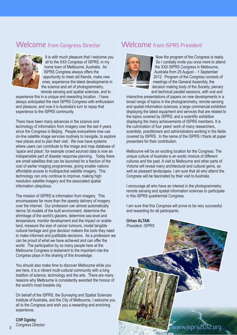
Welcome from Congress Director
It is with much pleasure that I welcome you all to the XXII Congress of ISPRS, in my home town of Melbourne, Australia. An ISPRS Congress always offers the opportunity to meet old friends, make new ones, experience the latest developments in the science and art of photogrammetry, remote sensing and spatial sciences, and to
experience this in a unique and rewarding location. I have always anticipated the next ISPRS Congress with enthusiasm and pleasure, and now it is Australia's turn to repay that experience to the ISPRS community.
There have been many advances in the science and technology of information from imagery over the last 4 years since the Congress in Beijing. People everywhere now use on-line satellite image services routinely to navigate, to explore new places and to plan their visit. We now have systems where users can contribute to the image and map database of 'space and place'; for example crowd sourced data is now an indispensible part of disaster response planning. Today there are small satellites that can be launched for a fraction of the cost of earlier imaging programmes, giving smaller nations affordable access to multispectral satellite imagery. This technology can only continue to improve, making high resolution satellite imagery and the associated spatial information ubiquitous.
The mission of ISPRS is information from imagery. This encompasses far more than the speedy delivery of imagery over the internet. Our profession can almost automatically derive 3d models of the built environment, determine the shrinkage of the world's glaciers, determine sea level and temperature, monitor development and the impact on arable land, measure the size of cancer tumours, model tangible cultural heritage and give decision makers the tools they need to make informed and justifiable decisions. As a profession we can be proud of what we have achieved and can offer the world. The participation by so many people here at the Melbourne Congress is testament to the important role the Congress plays in the sharing of this knowledge.
You should also make time to discover Melbourne while you are here, it is a vibrant multi-cultural community with a long tradition of science, technology and the arts. There are many reasons why Melbourne is consistently awarded the honour of the world's most liveable city.
On behalf of the ISPRS, the Surveying and Spatial Sciences Institute of Australia, and the City of Melbourne, I welcome you all to the Congress and wish you a rewarding and enriching experience.
Cliff OglebyCongress Director
Now the program of the Congress is ready. So I cordially invite you once more to attend the XXII ISPRS Congress in Melbourne, Australia from 25 August – 1 September 2012. Program of the Congress consists of meetings of the General Assembly, the decision making body of the Society; plenary and technical parallel sessions, with oral and
interactive presentations of papers on new developments in a broad range of topics in the photogrammetry, remote sensing and spatial information sciences; a large commercial exhibition displaying the latest equipment and services that are related to the topics covered by ISPRS; and a scientific exhibition displaying the many achievements of ISPRS members. It is the culmination of four years' work of many researchers, scientists, practitioners and administrators working in the fields covered by ISPRS. In the name of the ISPRS I thank all paper presenters for their contribution.
Melbourne will be an exciting location for the Congress. The unique culture of Australia is an exotic mixture of different cultures and the past. A visit to Melbourne and other parts of Victoria will reveal many architectural and cultural gems, as well as pleasant landscapes. I am sure that all who attend the Congress will be fascinated by their visit to Australia.
I encourage all who have an interest in the photogrammetry, remote sensing and spatial information sciences to participate in this ISPRS quadrennial Congress.
I am sure that this Congress will prove to be very successful and rewarding for all participants.
Orhan ALTANPresident, ISPRS
Welcome from ISPRS President
3

Welcome from the State of Victoria
www.isprs2012.org
ISPRS 2012 Final Program
4

www.isprs2012.org
Plenary Speakers
Konrad Schindler
ETH Zurich, Switzerland
Madhu Chandra
Technische Universitaet Chemnitz, Germany
Stewart Walker
BAE Systems, San Diego, USA
Sandau Rainer
International Academy of Astronautics, Germany
Piero Boccardo
Politecnico di Torino, Italy
Ranganath Navalgund
Director, Space Applications Centre, ISRO,
Ahmedabad, India
Peng Gong
Tsinghua University, Beijing and University of
California, Berkeley, USA
Stuart Lane
University of Lausanne, Switzerland
Gordon McBean
President Elect of the International Council for Science
Gilberto Câmara
Director of INPE, Brazil
Juergen Dold
Hexagon, Switzerland
Lawrie Jordan
ESRI, USA
5

www.isprs2012.org
ISPRS 2012 Congress Scientific Program
Sunday, 26 August 2012
Time Location Session Code Sunday August 26
9:00-10:30 Plenary 2 Plenary 1
11:00-12:30
Plenary 2 TS714 VII/4: Methods for Land Cover Classification-1
208 SS901 CIPA, ICOMOS and WG V/2: Advances in Digital Documentation-1
210 TS801 VIII/1: Earthquakes and Damage Assessment
211 TS701 VII/1: Physical Modelling and Signatures in Remote Sensing-1
212 TS501 V/1: Vision Metrology - Best Practice, Systems and Applications-1
213 TS401 IV/1: Geospatial Data Infrastructure-1
216 SS911 ISPRS and GSDI: Spatially Enabled Society
217 TS601 VI/1: Web Based Education and VI/2: E-Delivery of Education Services-1
218 TS101 I/1: Standardization of Airborne Platform Interface
219 TS301 III/4: Building Reconstruction
220 TS201 II/1: Cognition and Modeling of Space and Time-1
2:00-3:30
Plenary 2 TS715 VII/4: Methods for Land Cover Classification-2
208 SS902 CIPA, ICOMOS and WG V/2: Advances in Digital Documentation-2
209 TS805 VIII/2: Environment and Health-1
210 TS802 VIII/1: Mass Movements
212 TS502 V/1: Vision Metrology - Best Practice, Systems and Applications-2
213 TS402 IV/1: Geospatial Data Infrastructure-2
216 SS914 URSI and ISPRS: Disaster Management
217 TS602 VI/1: Web Based Education and VI/2: E-Delivery of Education Services-2
218 TS102 I/2: LIDAR, SAR and Optical Sensors for Airborne and Spaceborne Platforms-1
219 TS302 III/4: ISPRS Benchmark-1
220 TS202 II/1: Cognition and Modeling of Space and Time-2
5.2.03-4 ALCM Consortium Meeting
4:00-5:30
Plenary 2 TS716 VII/4: Methods for Land Cover Classification-3
208 SS904 EuroSDR and WG IV/2: Automatic Updates of National Core Geospatial databases
209 SS908 ICA and WG IV/7: Exploring the Moon!
210 TS806 VIII/2: Environment and Health-2
211 TS703 VII/1: Physical Modelling and Signatures in Remote Sensing-2
212 TS503 V/2: Cultural Heritage Data Acquisition and Processing-1
213 TS403 IV/1: Geospatial Data Infrastructure-3
216 TS311 ICWG III/VII: Feature Analysis for Image Classification
217 TS604 VI/5: Promotion of the Profession to Young People
218 TS103 I/2: LIDAR, SAR and Optical Sensors for Airborne and Spaceborne Platforms-2
219 TS303 III/4: ISPRS Benchmark-2
220 TS203 II/2: Urban / City Generalization
5.2.03-4 ALCM Consortium Meeting
6

www.isprs2012.org
09:00-10:30� MCEC Plenary 2Plenary 1Co-Chair: Orhan Altan, Istanbul Technical University, TurkeyIan Dowman, University College London, UK
09:00� Seeing the Future through Better Knowledge of the Present 1001Gordon McBean, President-elect International Council for Science, Western University, London, Ontario, Canada
09:30� Small Satellites Status, Opportunities and Challenges 1002Rainer Sandau, International Academy of Astronautics (IAA), German Aerospace Center, Germany
10:00� Whither Radar Remote Sensing? 1003Madhu Chandra, Chemnitz University of Technology, Chemnitz, Germany
11:00-12:30� MCEC208CIPA, ICOMOS and WG V/2: Advances in Digital Documentation-1 Chair: Paul Bryan, English Heritage, United Kingdom
11:00� Advancing Documentation of Buried Archaeological Landscapes 1004Michael Doneus, University of Vienna, Austria
11:22� Artefact Mobile Data Model to Support Cultural Heritage Data Collection and Interpretation 1005Zaffar Sadiq Mohamed Ghouse, Sinclair Knight Merz, Australia
11:44� Archaeological Site Monitoring: UAV Photogrammetry can be an Answer1006Fulvio Rinaudo, Politecnico di Torino, Italy
12:06� An Approach to Find Localization of Non-Existent Historical Buildings by Terrestrial Photogrammetry 1007Ugur Acar, Yildiz Technical University, Turkey
11:00-12:30� MCEC216ISPRS and GSDI: Spatially Enabled Society Chair: Abbas Rajabifard, The University of Melbourne, Australia
11:00� An Imperative of e-planning in Integrating Land Administration Functions for Housing Production 1008Abbas Rajabifard, The University of Melbourne, Australia
11:00-12:30� MCEC218I/1: Standardization of Airborne Platform Interface Chairs: Andrew C Roberts, Northrop Grumman, United States and Guo Huadong, CEODE, China
11:00� The Results from the International Forum which Promotes Airborne Science Platform Capabilities Sponsored by the ISPRS 1009Andrew C Roberts, Northrop Grumman Information Systems, United States
11:22� Request Analysis of DGPS/IMU on the Air-borne InSAR System 1010Sheng Liang Lou, Xi'an Research Institute of Surveying and Mapping, China
11:44� Direct Georeferencing: A New Standard in Photogrammetry for High Accuracy Mapping 1011Aldino Rizaldy, Bakosurtanal, Indonesia
12:06� Accuracy Verification of Gps-Ins Method in Indonesia 1012Kohei Uesugi, PASCO Corporation, Indonesia
11:00-12:30� MCEC220II/1: Cognition and Modeling of Space and Time-1 Chair: Xinming Tang, State Bureau of Surveying and Mapping, China
11:00� Mapping Coral and Algal Patches at Heron Reef, Australia using Object-based Analysis and Pan-sharpened WordView-2 Images 1013Chris M Roelfsema, The University of Queensland, Australia
11:22� Refined Topological Relations Computation Model between Spatial Objects with ‘Euler-number’ and ‘Degree of Point’ 1014Xiaoguang Zhou, Central South University, China
11:44� A Qualitative Representation of Spatio-temporal Change 1015Xinming Tang, Satellite Surveying and Mapping Application Center, China
7

www.isprs2012.org
Sunday, 26 August 201211:00-12:30� MCEC219III/4: Building Reconstruction Chair: Franz Rottensteiner, Leibniz University Hannover, Germany
11:00� The ISPRS Benchmark on Urban Object Classification and 3D Building Reconstruction 1016Franz Rottensteiner, Leibniz University Hannover, Germany
11:30� Sub-Surface Growing and Boundary Generalization for 3D Building Reconstruction 1017Martin Kada, University of Osnabrück, Germany
12:00� Automatic Reconstruction of Building Roofs through Effective Integration of LIDAR and Multispectral Imagery 1018Mohammad Awrangjeb, The University of Melbourne, Australia
11:00-12:30� MCEC213IV/1: Geospatial Data Infrastructure-1 Chair: Jie Jiang, National Geomatics Center of China, China
11:00� A New Multi-resolution Algorithm to Store and Transmit Compressed DTM 1019Ludovico Biagi, Politecnico di Milano, Italy
11:22� Concepts, Models and Implementation of the Marine Spatial Data Infrastructure in Germany (MDI-DE) 1020Ralf Bill, University Rostock, Germany
11:44� Geometrical Adjustment toward the Alignment of Vector Databases 1021Sagi Dalyot, Institut für Kartographie und Geoinformatik (IKG), Germany
12:06� Interpolating Terrain Points for TIN based on Local Relief 1022Lin Li, Wuhan University, China
11:00-12:30� MCEC212V/1: Vision Metrology - Best Practice, Systems and Applications-1 Chair: Stuart Robson, University College London, United Kingdom
11:00� Implementation of Zoom-Dependent Camera Calibration in Close-Range Photogrammetry 1023Clive S Fraser, CRC for Spatial Information, Australia
11:37� Monte-Carlo-Simulation for Accuracy Assessment of a Single Camera Navigation System 1024Thomas Luhmann, Jade University of Applied Sciences, Germany
11:54� Automatic Calibration of Stereo-cameras using Ordinary Chess-board Patterns 1025Anthony Prokos, National Technical University of Athens, Greece
12:11� Development of a Wind Observation System using Photogrammetry 1026Hideaki Kawasaki, Tokyo Metropolitan Government, Japan
11:00-12:30� MCEC217VI/1: Web Based Education and VI/2: E-Delivery of Education Services-1 Chair: Martien Molenaar, ITC, The Netherlands
11:00� E-Learning - Best Practice in Photogrammetry, Remote Sensing and GIS: Status and Challenges 1027Gerhard König, Technische Universität Berlin, Germany
11:22� Web-based Education- Issues and Challenges 1028Anjana Narendra Vyas, CEPT University, India
11:44� Evaluation and Development of e-Learning Tools and Methods in Digital Photogrammetry and Remote Sensing for Non Experts from Academia and Industry 1029Eberhard Gülch, Stuttgart University of Applied Sciences, Germany
12:06� Development and Evaluation of Technology Education using Earth Observation Technique 1030Yosuke Ito, Naruto University of Education, Japan
8

www.isprs2012.org
11:00-12:30� MCEC211VII/1: Physical Modelling and Signatures in Remote Sensing-1 Chair: Shunlin Liang, University of Maryland, United States
11:00� Reflectance Calibration Scheme for Airborne Frame Camera Images 1031Ulrich Beisl, Leica Geosystems, Switzerland
11:37� Quantitative Benthos and Bathymetry Assessment: In Situ, Airborne and Spaceborne Requirements 1032Arnold G Dekker, CSIRO Land and Water, Australia
11:54� Measuring the Particulate Backscattering in Inland Waters: A Comparison of Techniques 1033Glenn Campbell, University of Southern Queensland, Australia
12:11� Retrieving Forest Structure Variables from Very High Resolution Satellite Images using an Automatic Method 1034Benoît Beguet, University of Bordeaux, France
11:00-12:30� MCEC Plenary 2VII/4: Methods for Land Cover Classification-1 Chair: Peijun Li, Peking University, China
11:00� Analysis of Multitemporal and Multisensor Remote Sensing Data for Crop Rotation Mapping 1035Guido Waldhoff, University of Cologne, Germany
11:37� Automatic Refinement of Training Data for Classification of Satellite Imagery 1036Torsten Büschenfeld, Institut für Informationsverbeitung, Germany
11:54� Modeling Spatial Distribution of a Rare and Endangered Plant Species - Brainea Insignis 1037Wen Chiao Wang, Chung-Hsing University, Taiwan
12:11� Optimization of Decision-Making for Spatial Sampling in the North China Plain, Based on Remote-Sensing a Priori Knowledge 1038Jianzhong Feng, Institute of Agriculture Information of Chinese Academy of Agricultural Sciences, China
11:00-12:30� MCEC210VIII/1: Earthquakes and Damage Assessment Chair: Piero Boccardo, Politecnico di Torino, Italy
11:00� Rapid Disaster Damage Estimation 1039Tuong Thuy Vu, University of Nottingham, Malaysia
11:22� Fusion of Multi Precursors Earthquake Parameters to Estimate the Date, Magnitude and Affected Area of the Forthcoming Powerful Earthquakes 1040Mehdi Akhoondzadeh, University of Tehran, Iran
11:44� KAL-Haïti: A Research Database for Risks Management and Sustainable Reconstruction in Haïti 1041Alain Giros, CNES, France
12:06� Hydrologic Modelling of Katsina-Ala River Basin: An Emerging Scenario from Lake Nyos Threat 1042Joseph O Akinyede, African Regional Centre for Space Science and Technology Education in English (ARCSSTE-E), Nigeria
14:00-15:30� MCEC208CIPA, ICOMOS and WG V/2: Advances in Digital Documentation-2 Chair: Bharat Lohani, IIT Kanpur, India
14:00� Recording Approach of Heritage Sites based on Merging Point Clouds from High Resolution Photogrammetry and Terrestrial Laser Scanning 1043Pierre Grussenmeyer, INSA, LSIIT-TRIO Strasbourg, France
14:22� Hydrologic and Feature-based Surface Analysis for Tool Mark Investigation on Archaeological Finds 1044Kristof Kovacs, University of Innsbruck, Austria
14:44� Costless Platform for High Resolution Stereoscopic Images of a High Gothic Façade 1045Sébastien Giordano, IGN, France
15:06� 3D Imaging for Museum Artefacts: A Portable Test Object for Heritage and Museum Documentation of Small Objects 1046Mona Hess, University College London, United Kingdom
9

www.isprs2012.org
Sunday, 26 August 201214:00-15:30� MCEC216URSI and ISPRS: Disaster Management Chair: Tullio Tanzi, Telecom-Paris Tech, France
14:00� Haiti Earthquake Damage Assessment: Review of the Remote Sensing Role 1047Piero Boccardo, Politecnico di Torino, Italy
14:22� Event-Driven Observations and Comprehensive Evaluation for Natural Disaster Assessment in China 1048Zhi Wang, Northeastern University, China
14:44� Flash Flood Forecasting and Early Warning in Small Catchments with a Quasi-Distributed Hydrological Model using WRF Precipitation Dataset 1049Romeji Singh Ngangbam, India
14:00-15:30� MCEC218I/2: LIDAR, SAR and Optical Sensors for Airborne and Spaceborne Platforms-1Chairs: Boris Jutzi, Karlsruhe Institute of Technology, Germany and Huadong Guo, Center for Earth Observation and Digital Earth, China
14:00� An Airborne InSAR Mapping System 1050Huadong Guo, Center for Earth Observation and Digital Earth, China
14:37� Surface Complexity Component of LiDAR Point Cloud Error Characterization 1051Charles Toth, The Ohio State University, United States
14:54� High Resolution Airborne Shallow Water Mapping 1052Frank Steinbacher, University of Innsbruck, Austria
15:11� A New Effective Way for Vegetation Monitoring: Using Multi-wavelength Canopy Lidar 1053Bo Zhu, Wuhan University, ChinaWei Gong, Wuhan University, ChinaShuo Shi, Wuhan University, China
14:00-15:30� MCEC220II/1: Cognition and Modeling of Space and Time-2Chair: Stephan Winter, The University of Melbourne, Australia
14:00� Accuracy Analysis of a Low-Cost Platform for Positioning and Navigation 1054Sabine Hofmann, Leibniz Universitaet Hannover, Germany
14:22� Wavelet-based Identification of Topographic Descriptors for the Registration of Digital Terrain Models 1055Ophir Almog, Technion - Israel Institute of Technology, Israel
14:44� Working with the Spatiotemporal Data Type 1056Ale Raza, Esri, United States
15:06� A Maximum Entropy Model of the Bearded Capuchin Monkey Habitat Incorporating Topography and Spectral Unmixing Analysis 1057Allison Howard, University of Georgia, United States
14:00-15:30� MCEC219III/4: ISPRS Benchmark-1Chair: Gunho Sohn, York University, Canada
14:00� Conditional Random Fields for LiDAR Point Cloud Classification in Complex Urban Areas 1058Joachim Niemeyer, Leibniz University Hannover, Germany
14:30� Urban Object Extraction from Digital Surface Model and Digital Aerial Images 1059Dejan Grigillo, University of Ljubljana, SloveniaUrsa Kanjir, Institute of Anthropological and Spatial Studies, ZRC SAZU, Slovenia
15:00� Context-based Urban Terrain Reconstruction from Images and Videos 1060Dimitri Bulatov, Fraunhofer Institute of Optronics, Germany
10

www.isprs2012.org
14:00-15:30� MCEC213IV/1: Geospatial Data Infrastructure-2Chair: Pattabhi Rama Rao, Indian National Centre for Ocean Information Services, India
14:00� Coastal Ocean Observing Network – Open Source Architecture for Data Management and Web-based Data Services 1061Pattabhi Rama Rao, Indian National Centre for Ocean Information Services, India
14:22� Understanding Irrigated Agricultural Land use Change through the Integration of Satellite-based Land Cover Measurements, Spatial Information Systems and Market Segmentation Models 1062Andrew McAllister, Department of Primary Industries, Victoria, Australia
14:44� Collaborative Web GIS Platform for Systematic Exploration of Lake Geneva 1063Yosef Akhtman, École Polytechnique Fédérale de Lausanne, Switzerland
15:06� Representation of Physical Building Model in 3D Cadastre 1064Minghui Hao, Chinese Academy Surveying and Mapping, China
14:00-15:30� MCEC212V/1: Vision Metrology - Best Practice, Systems and Applications-2Chair: Thomas Luhmann, Jade University of Applied Sciences, Germany
14:00� Real Time Data Processing for Optical Remote Sensing Payloads 1065Jürgen Wohlfeil, German Aerospace Center (DLR), Germany
14:22� Determination of the Degree of Gravel Aggregate-Bitumen-Coverage by Multi-Directional Reflectance Measurements 1066Christian Mulsow, Technical University of Dresden, Germany
14:44� Construction of a System for Defining Areas which are not Obtained Data from Stereo Images 1067Hideharu Yanagi, Japan Association of Surveyors, JapanHirofumi Chikatsu, Tokyo Denki University, Japan
15:06� IPS - A System for Real-time Navigation and 3D Modelling 1068Jürgen Wohlfeil, German Aerospace Center (DLR), Germany
14:00-15:30� MCEC217VI/1: Web Based Education and VI/2: E-Delivery of Education Services-2Chair: Gerhard König, Technische Universität Berlin, Germany
14:00� Building Interactivity in Higher Education to Support Student Engagement in Spatial Problem Solving and Programming 1069Elizabeth-Kate S Gulland, Curtin University, Australia
14:22� E-Learning Applications for Urban Modelling and OGC Standards Using HTML5 Capabilities 1070Robert Kaden, Technische Universität Berlin, Germany
14:44� The Earth Observation Technology Cluster 1071Paul Aplin, University of Nottingham, United Kingdom
15:06� Issues and Challenges in Geomatics Education in Haryana State, India 1072Bhagwan Singh Chaudhary, Kurukshetra University, India
14:00-15:30� MCEC Plenary 2VII/4: Methods for Land Cover Classification-2Chair: Peijun Li, Peking University, China
14:00� Classification of Polarimetric SAR Images using Joint Hierarchical Classification and Parametric Multidimensional Analysis 1073Ying Bao Yang, Hohai University, ChinaYan Wen Li, Hohai University, China
14:22� Orientation Based Building Outline Extraction in Aerial Images 1074Andrea Kovacs, Hungarian Academy of Sciences, Hungary
14:44� The Low Backscattering Targets Classification in Urban Areas 1075Lei Shi, ChinaPingXiang Li, Wuhan University, China
15:06� Assessing the Feature Sensitivity to Segmentation Errors in Object-oriented Classification using High Resolution Imagery 1076Tiantian Feng, Tongji University, China
11

www.isprs2012.org
Sunday, 26 August 201214:00-15:30� MCEC210VIII/1: Mass MovementsChair: T Srinivasa Kumar, National Centre for Ocean Information Services, India
14:00� LiDAR and SAR Data Application for Landslide Study in Carpathians Region (Southern Poland) 1077Andrzej Borkowski, Wroclaw University of Environmental and Life Sciences, Poland
14:22� MUNOLD: A Spatial Sensor Network for Landslide Monitoring 1078Ping Lu, Tongji University, China
14:44� Capability of ASCAT and ASAR, C-band Active Microwave Sensors, for Monitoring of Extreme Flood and Drought Events in Lower Mekong Countries 1079Vahid Naeimi, German Aerospace Center (DLR), Germany
14:00-15:30� MCEC209VIII/2: Environment and Health-1Chairs: Amelia Budge, Earth Data Analysis Center, USA and Stanley Morain, University of New Mexico, USA
14:00� Remote Sensing in a Changing Climate and Environment: The Rift Valley Fever Case 1080Yves M Tourre, Columbia University, United States
14:22� Mapping the Risks of Malaria, Dengue and Influenza using Satellite Data 1081Stanley Morain, University of New Mexico, United States
14:44� Risk Zone Modelling and Early Warning System for Visceral Leishmaniasis (Kala-azar) Disease in Bihar, India using Remote Sensing and GIS 1082Jeyaram Alagarsamy, Indian Space Research Organisation, India
15:06� Night-time Lights and Levels of Development: A Study using DMSP-OLS Night Time Images at the Sub-national Level 1083Koel Roychowdhury, RMIT University, Australia
16:00-17:30� MCEC208EuroSDR and WG IV/2: Automatic Updates of National Core Geospatial DatabasesChair: Dieter Fritsch, University of Stuttgart, Germany
16:00� Mono-temporal GIS Update Assistance System based on Unsupervised Coherence Analysis and Evolutionary Optimization 1084Christian Becker, Leibniz Universität Hannover, Germany
16:22� Service Oriented Architecture for Wireless Sensor Networks in Agriculture 1085S A Sawant, Indian Institute of Technology Bombay, India
16:44� The Challenge of Automated Change Detection: Developing a Method for the Updating of Land Parcels 1086Leena Matikainen, Finnish Geodetic Institute, Finland
17:06� Sensor Web Services for Early Flood Warnings Based on Soil Moisture Profiles 1087Thomas Brinkhoff, Jade University Oldenburg, Germany
16:00-17:30� MCEC209ICA and WG IV/7: Exploring the Moon!Chair: Jürgen Oberst, German Aerospace Center (DLR), Germany
16:00� Exploring the Moon with the Lunar Reconnaissance Orbiter Camera 1088Emerson J Speyerer, Arizona State University, United States
16:17� LandSAfe: Landing Site Risk Analysis Software Framework 1089Ralph Schmidt, Leibniz Universität Hannover, Germany
16:34� Lunar Cartography: Progress in the 2000’s and Prospects for the 2010’s 1090Randolph L Kirk, U.S. Geological Survey, United States
16:51� Digital Elevation Models and Derived Products from LROC NAC Stereo Observations 1091Kyle N Burns, Arizona State University, United States
17:08� In-Flight Geometric Calibration of the Lunar Reconnaissance Orbiter Camera 1092Emerson J Speyerer, Arizona State University, United States
12

www.isprs2012.org
16:00-17:30 � MCEC218I/2: LIDAR, SAR and Optical Sensors for Airborne and Spaceborne Platforms-2Chair: Franz Meyer, University of Alaska Fairbanks, USA
16:00� Fusing Passive and Active Sensed Images to Gain Infrared-textured 3D Models 1093Stefan Hinz, Karlsruhe Institute of Technology, Germany
16:22� EnMAP Detector Calibration and Verification 1094Ralf Reulke, Humboldt-Universität zu Berlin, Germany
16:44� Automated Data Production for a Novel Airborne Multiangle SpectroPolarimetric Imager (AirMSPI) 1095Veljko M Jovanovic, NASA, United States
17:06� Using Relative Orientation Constraints to Produce Virtual Images from Oblique Frames 1096Antonio MG Tommaselli, UNESP, Brazil
16:00-17:30 � MCEC220II/2: Urban / City GeneralizationChair: Monika Sester, Leibniz University of Hannover, Germany
16:00� Pattern Classification Approaches to Matching Building Polygons at Multiple Scales 1097Martien Molenaar, ITC, The Netherlands
16:29� Multi-Level Building Reconstruction for Automatic Enhancement of High Resolution DSM 1098Hossein Arefi, German Aerospace Center (DLR), Germany
16:49� Multiscale and Multitemporal Urban Remote Sensing 1099Victor Mesev, Florida State University, United States
16:00-17:30 � MCEC219III/4: ISPRS Benchmark-2Chair: Markus Gerke, ITC, The Netherlands
16:00� An Implicit Regularization for 3D Building Rooftop Modeling using Airborne LIDAR Data 1100Gunho Sohn, York University, Canada
16:30� A Line-based 3D Roof Model Reconstruction Algorithm: TIN-Merging and Reshaping (TMR) 1101Jiann-Yeou Rau, National Cheng Kung University, Taiwan
17:00� Automatic Roof Outlines Reconstruction from Photogrammetric DSM 1102Francesco Nex, FBK - Bruno Kessler Foundation, Italy
16:00-17:30 � MCEC216ICWG III/VII: Feature Analysis for Image ClassificationChair: Wolfgang Förstner, Bonn University, Germany
16:00� Semi-supervised Marginal Fisher Analysis for Hyperspectral Image Classification 1103Hong Huang, Chongqing University, ChinaYinsong Pan, Chongqing University, China
16:30� A Modified Stochastic Neighbor Embedding for Combining Multiple Features for Remote Sensing Image Classification 1104Lefei Zhang, Wuhan University, China
17:00� An Evaluation of Feature Learning Methods for High Resolution Image Classification 1105Piotr Tokarczyk, ETH Zurich, Switzerland
16:00-17:30 � MCEC213IV/1: Geospatial Data Infrastructure-3Chair: Michael P Finn, U.S. Geological Survey, United States
16:00� Developing and Testing a 3D Cadastral Data Model- A Case Study in Australia 1106Ali Aien, The University of Melbourne, Australia
16:17� Data Updating Methods for Spatial Data Infrastructure that Maintain Infrastructure Quality and Enable its Sustainable Operation 1107Saya Murakami, Kokusai Kogyo Co., Ltd., Japan
13

www.isprs2012.org
Sunday, 26 August 201216:34� Development of a Metadata Management System for an Interdisciplinary Research Project 1108Constanze Curdt, University of Cologne, Germany
16:51� A Study of Urban Land Intensity Evaluating System 1109Jirong Gu, Sichuan Normal University, China
17:08� Seamless Navigation Using Various Sensors: An Overview of the Seamless Navigation Campaign 1110Masafumi Nakagawa, Shibaura Institute of Technology, Japan
16:00-17:30 � MCEC212V/2: Cultural Heritage Data Acquisition and Processing-1Chair: Paul Bryan, English Heritage, United Kingdom
16:00� High Resolution Surface Reconstruction from Imagery for Close Range Cultural Heritage Applications 1111Konrad Wenzel, University of Stuttgart, Germany
16:22� Conservation Monitoring of a Heritage Ceiling by Photometric Stereo 1112Stuart Robson, University College London, United Kingdom
16:44� High Precision Texture Reconstruction for 3D Sculpture Model 1113Fan Zhang, Wuhan University, China
17:06� Increase of Readability and Accuracy of 3D Models using Fusion of Close Range Photogrammetry and Laser Scanning 1114Mateo Gasparovic, University of Zagreb, CroatiaIva Malaric, Geofoto d.o.o., Croatia
16:00-17:30 � MCEC217VI/5: Promotion of the Profession to Young PeopleChair: Manos Baltsavias, ETH Zurich, Switzerland
16:00� ISPRS Student Consortium: The Network of Youth in Geoinformation Society 1115Cemal Özgür Kivilcim, Istanbul Technical University, TurkeyKrzysztof Sterenczak, Warsaw University of Life Sciences, PolandUrsa Kanjir, University of Ljubljana, SloveniaAhmet Sengül, Istanbul Technical University, TurkeyElena Lobo, Smithsonian Tropical Research Institute, Panama
16:30� Activities of Asian Students and Young Scientists on Photogrammetry and Remote Sensing 1116Hiroyuki Miyazaki, The University of Tokyo, Japan
16:50� Higher Education in Balkan Region and its Contribution to the Earth Observation 1117Anka Lisec, University of Ljubljana, Slovenia
17:10� Applied Geospatial Education: Acquisition and Processing of High Resolution Airborne Lidar and Orthoimages for the Great Smoky Mountains National Park, Southeastern United States 1118Thomas R Jordan, University of Georgia, United States
16:00-17:30 � MCEC211VII/1: Physical Modelling and Signatures in Remote Sensing-2Chair: Mitsunori Yoshimura, Remote Sensing Technology Center of Japan
16:00� Characterising Vegetated Surfaces Using MODIS Multi-angular Satellite Data 1119Geoffrey W McCamley, RMIT University, Australia
16:17� The Model of Wheat Yield Forecast Based on MODIS NDVI - A Case Study in Xinxiang 1120Hong-wei Zhang, Xinxiang Meteorological Service, China
16:34� Geostatistical Analysis of Surface Temperature and Soil Moisture for Improved LST Time Series from MODIS 1121Mammatt Sohrabinia, University of Canterbury, New Zealand
16:51� Development of a Model to Correct Multi-view Angle Above Water Measurements for the Analysis of the Bidirectional Reflectance of Coral and Other Reef Substrates 1122Bruce C Forster, The University of New South Wales, Australia
17:08� Sensitivity Analysis in the Retrieval of Turbid Coastal Water Bathymetry Using WorldView-2 Satellite Data 1123Chew Wai Chang, National University of Singapore, Singapore
14

www.isprs2012.org
16:00-17:30 � MCEC Plenary 2VII/4: Methods for Land Cover Classification-3Chair: Julian Smit, University of Cape Town, South Africa
16:00� Context Models for CRF-Based Classification of Multitemporal Remote Sensing Data 1124Christian Heipke, Leibniz Universitaet Hannover, Germany
16:22� Fast Mean-Shift Based Classification of Very High Resolution Images: Application to Forest Cover Mapping 1125Samia Boukir, University of Bordeaux, France
16:44� Support Vector Machine Classification of Object-based Data for Crop Mapping, using Multi-temporal Landsat Imagery 1126Rakhesh Devadas, Department of Environment and Resource Management, Queensland, Australia
17:06� Land Cover Classification of Multi-sensor Images by Decision Fusion using Weights of Evidence Model 1127Peijun Li, Peking University, China
16:00-17:30 � MCEC210VIII/2: Environment and Health-2 Chair: Stanley Morain, University of New Mexico, United States
16:00� Modernized Method for Estimating Time-Weighted Urban Population Distributions 1128Jeffrey M Young, LizardTech, United States
16:22� Spatial Analysis Based Health And Safety Risk Assessment For Linear Construction Projects 1129Gonul Toz, Istanbul Technical University, Turkey
16:44� A New Approach to Estimate Ground-Level Fine Particles for Health Impact Analysis 1130Fazlay S Faruque, The University of Mississippi Medical Center, United StatesDavid J Lary, University of Texas, United States
17:06� Monitoring Environment with GIS for Part of Thiruvallur Town using Cartosat 1 Stereo, PAN & Resourcesat Liss 4 MSS Merged Data 1131Ghouse Shaik Mohamed, Anna University, India
15

www.isprs2012.org
ISPRS 2012 Congress Scientific Program
Monday, 27 August 2012
Time Location Session Code Monday August 27
9:00-10:30
Plenary 2 GA II
208 TS728 VII/6: Remote Sensing Data Fusion-1
209 TS807 VIII/3: Cloud and Atmospheric Data Analyses
210 TS804 VIII/1: Projects and Systems
211 TS704 VII/2: Deformation Monitoring
212 TS504 V/2: Cultural Heritage Data Acquisition and Processing-2
213 TS404 IV/2: Automatic Geospatial Data Acquisition and Image-Based Databases-1
216 1001 16ARSPC/1: Plenary Session - Sustaining Earth Observation for Australia
217 TS605 Youth Forum-1
218 TS104 I/2: LIDAR, SAR and Optical Sensors for Airborne and Spaceborne Platforms-3
219 TS304 III/4: Database Updating and Diagnostic
220 TS204 II/2: Terrain Generalization
5.2.01-2 SS907 ICA and WG IV/5: Crowdsourcing and Volunteered Geographic Information
5.2.03-4 TS606 Youth Forum-2
11:00-12:30
Plenary 2 GA II
208 TS729 VII/6: Remote Sensing Data Fusion-2
209 TS808 VIII/3: Climate Change and Temperature Estimation
210 TS813 VIII/6: Crop Assessment
211 TS705 VII/2: Interferometric Image Analysis and Object Extraction
212 TS505 V/3: Laser Scanning I: Point Cloud Registration
213 TS405 IV/2: Automatic Geospatial Data Acquisition and Image-Based Databases-2
216 1002 16ARSPC/2: Land Cover Mapping 1
217 TS607 Youth Forum-3
218 TS105 I/3:Multi-Platform Multi-Sensor Inter-Calibration-1
219 TS320 III/4: Dense Matching for Surface Reconstruction
220 TS205 II/3: Spatio-Temporal Pattern Analysis
5.2.01-2 TS608 Youth Forum-4
5.2.03-4 TS409 IV/4: Virtual Globes and Context-Aware Visualisation-1
16

www.isprs2012.org
Time Location Session Code Monday August 27
2:00-3:30
210 PS801 VIII/1: Disaster Management; VIII/3: Atmosphere, Climate and Weather
211 PS701VII/1: Physical Modelling and Signatures in Remote Sensing; VII/2: SAR Interferometry; VII/3, VII/6, III/2, V/3: Integration of hyperspectral and lidar data
213 PS401ICWG IV/VIII: Updating and Maintenance of Core Spatial Databases; IV/2, IV/4: Point Cloud Processing, Management and Visualization; IV/2, IV/II: GeoSensor Networks and Sensor Web; IV/2: Automatic Geospatial Data Acquisition and Image-Based Databases
216 1003 16ARSPC
217 TS610 Youth Forum - Panel of Invited Speakers
218 PS406IV/8: 3D Spatial Data Integration for Disaster Management & Env. Monitoring; IV/II, IV/8, IV/1: Volunteered Geospatial Information; IV/7: Planetary Mapping and Databases
219 PS301 ICWG III/VII: Pattern Recognition in Remote Sensing
220 PS201ICWG II/IV: Semantic Interoperability and Ontology for Geospatial Information; II/1: Cognition and Modeling of Space and Time; II/5: Multidimensional and Mobile Data Models
5.2.01-2 VS101 Hexagon Vendor Session 1
5.2.03-4 VS101 Hexagon Photogrammetry and Geospatial Solutions
4:00-5:30
Plenary 2 TS717 VII/4: Methods for Land Cover Classification-4
209 TS410 IV/4: Virtual Globes and Context-Aware Visualisation-2
210 TS809 VIII/4: Coastal Regions and Wetlands
211 TS706 VII/2: Monitoring of Deformation and Motion
212 SS903 CIPA, TC IV: 3D Dynamic Landscape Visions for Cultural Heritage/Archaeology
213 TS406 IV/3: Mapping from High Resolution Data-1
216 1004 16ARSPC/4: Applications of Earth Observation Data and Terminology
217 TS611 Youth Forum - General Assembly
218 TS106 I/3:Multi-Platform Multi-Sensor Inter-Calibration-2
219 TS321 III/4: Surface Reconstruction
220 ThS324 TCs III and V: Medical Imaging and Human Motion
17

www.isprs2012.org
ISPRS 2012 Congress Scientific Program
Monday, 27 August 201209:00-10:30� MCEC21616ARSPC/1: Plenary Session 1 - Remote Sensing Policy Chair: Peter Woodgate, CRC for Spatial Information, Australia
09:00� Australia's Remote Sensing Science Capabilities - Building and Sustaining a Critical Resource Stuart R Phinn, University of Queensland, Australia
09:30� Linking Science to Management: State Agencies Perspectives Richard Hicks, NSW Department of Premier and Cabinet, Australia
10:00� Trust Me, I’m a Doctor: The Critical Need for Transparency, Provenance and Auditability in the Environmental Sciences 2003Stuart Minchin, Geoscience Australia, Australia
09:00-10:30� MEC5.2.01-02ICA and WG IV/5: Crowdsourcing and Volunteered Geographic Information Chair: Bert G Veenendaal, Curtin University, Australia
09:00� openemotionmap.org - Emotional Response to Space as an Additional Concept in Cartography 2004Georg Gartner, Vienna University of Technology, Austria
09:22� Google Maps for Crowdsourced Emergency Routing 2005Sisi Zlatanova, TU Delft, The Netherlands
09:44� The Development of an Online Social Network and Crowd-sourcing-based Geospatial Cyberinfrastructure Platform2006Steve Liang, University of Calgary, Canada
10:06� Development of an Urban Management Platform based on SOA using Volunteered Geographic Information 2007Jian Li, Wuhan University, China
09:00-10:30� MCEC218I/2: LIDAR, SAR and Optical Sensors for Airborne and Spaceborne Platforms-3Chair: Charles Toth, The Ohio State University, United States
09:00� Image Quality and Image Resolution 2008Ralf Reulke, Humboldt-Universität zu Berlin, Germany
09:22� Property of the Large Format Digital Aerial Camera DMC II 2009Karsten Jacobsen, Leibniz University Hannover, Germany
09:44� UltraCam Eagle, Details and Insight 2010Michael Gruber, Microsoft, Austria
10:06� The UltraCam Story 2011Franz Leberl, Technical University Graz, Austria
09:00-10:30� MCEC220II/2: Terrain GeneralizationChair: Lars Harrie, Lund University, Sweden
09:00� Generalisation of Terrain Features on a Contour Map 2012Eric Guilbert, Hong Kong Polytechnic University, Hong Kong
09:29� A Study of Variables Characterizing Drainage Patterns in River Networks 2013Ling Zhang, Hong Kong Polytechnic University, Hong Kong
09:49� Study on Evaluation Index System of Contour Simplification Algorithms 2014Jingsong Ma, Nanjing University, China
10:09� Delaunay Triangulation Parallel Construction Method and its Application in Map Generalization 2015Jie Shen, Nanjing Normal University, China
18

www.isprs2012.org
09:00-10:30� MCEC219III/4: Database Updating and DiagnosticChair: Franz Rottensteiner, Leibniz University Hannover, Germany
09:00� Verification of 3D Building Models using Mutual Information in Airborne Oblique Images 2016Adam P Nyaruhuma, University of Twente, The Netherlands
09:30� Multiple Model Based Verification of Road Data 2017Uwe Breitkopf, Leibniz University Hannover, Germany
10:00� Network Snakes for Adapting GIS Roads to Height Data of Different Data Sources – Performance Analysis using ALS Data and Stereo Images 2018Jens Göpfert, Leibniz University of Hanover, Germany, Germany
09:00-10:30� MCEC213IV/2: Automatic Geospatial Data Acquisition and Image-Based Databases-1 Chair: Petra Helmholz, Leibniz University of Hannover, Germany
09:00� A Structure-Based Approach for Matching Road Junctions with Different Coordinate Systems 2019Xuechen Luan, Wuhan University, China
09:17� Automated 3D Road Sign Mapping with Stereovision-based Mobile Mapping Exploiting Disparity Information from Dense Stereo Matching 2020Stefan Cavegn, University of Applied Sciences Northwestern Switzerland, Switzerland
09:34� HouseDiff: A Map-Based Building Change Detection from High Resolution Satellite Imagery Using Geometric Optimization Method2021Nobuhiro Ishimaru, Hitachi, Ltd., Japan
09:51� Automated Modeling of 3D Building Roofs using Image and LIDAR Data 2022Emmanuel Baltsavias, ETH Zurich, Switzerland
10:08� The Digital Camera as GPS Compass: Location Matching using Point Clouds2023Masafumi Nakagawa, Shibaura Institute of Technology, Japan
09:00-10:30� MCEC212V/2: Cultural Heritage Data Acquisition and Processing-2Chair: Fulvio Rinaudo, Politecnico di Torino, Italy
09:00� A Method of 3D Measurement and Reconstruction for Cultural Relics in Museums 2024Shunyi Zheng, Wuhan University, China
09:22� High Resolution 3D Modeling of the Behaim Globe 2025Fabio Menna, Foundation Bruno Kessler, Italy
09:44� From Point Cloud to 3D Model, Modelling Methods based on Architectural Knowledge Applied to Fortress of Chatel-sur-moselle (France) 2026Emmanuel Alby, INSA Strasbourg, France
10:06� Protecting UNESCO World Heritage Properties's Integrity: The Role of Recording and Documentation in Risk Management 2027Mario e Santana Quintero, Carleton University, CanadaOna Vileikis, University of Leuven, Belgium
09:00-10:30� MCEC217Youth Forum-1Chair: Cemal Ozgur Kivilcim, Istanbul Metropolitan Municipality, Turkey
09:00� Determination of the UAV Position by Automatic Processing of Thermal Images 2028Wilfried Hartmann, ETH Zurich, Switzerland
09:22� A Study on Automatic UAV Image Mosaic Method for Paroxysmal Disaster 2029Ming Li, Wuhan University, China�09:44� Activities of the Student Forum of the Geoinformation Forum Japan 2030Akihiro Oba, Keio University, Japan
10:06� An Assessment of Shadow Enhanced Urban Remote Sensing Imagery of a Complex City - Hong Kong 2031Cheuk-Yan Wan, Hong Kong Polytechnic University, Hong Kong
19

www.isprs2012.org
Monday, 27 August 201209:00-10:30� MEC5.2.03-04Youth Forum-2Chair: Ursa Kanjir, Institute of Anthropological and Spatial Studies, ZRC SAZU, Slovenia
09:00� Hierarchical Matching of Uncertain Building Models with Oblique View Airborne IR Image Sequences 2032Dorota Iwaszczuk, Technische Universitaet Muenchen, Germany
09:22� Feature Analysis for Multi-window Matching 2033Wen-Chi Chang, Department of Civil Engineering, National Central University, Taiwan
09:44� Automated Multi-Source Remote Sensing Image Registration Based on Phase Congruency 2034Jie Shan, Wuhan University, United States
10:06� A New Aproach for the Semi-automatic Texture Generation of the Buildings Facades, from Terrestrial Laser Scanner Data 2035Ersilia V Oniga, Romanian Society of Photogrammetry and Remote Sensing, Romania
09:00-10:30� MCEC211VII/2: Deformation MonitoringChair: Uwe Soergel, Leibniz Universität Hannover, Germany
09:00� High Resolution Deformation Time Series Estimation for Distributed Scatterers using TerraSAR-X Data 2036Kanika Goel, German Aerospace Center (DLR), Germany
09:22� Detecting Land Subsidence Using RPC Model with High-resolution SAR Data 2037Hongbo Pan, Wuhan University, China
09:44� Ultrashort-baseline Persistent Scatterer Radar Interferometry for Subsidence Detection 2038Guoxiang Liu, Southwest Jiaotong University, China
09:00-10:30� MCEC208VII/6: Remote Sensing Data Fusion-1Chair: Jixian Zhang, Chinese Academy of Surveying and Mapping, China
09:00� Fusion of Active and Passive Microwave Observations to Create an Essential Climate Variable Data Record on Soil Moisture 2039Wolfgang Wagner, Vienna University of Technology, Austria
09:37� AdaBoost-based Feature Relevance Assessment in Fusing Airborne LiDAR and Image Data for Classification of Trees and Vehicles in Urban Scenes 2040Uwe Stilla, Technische Universitaet Muenchen, Germany
09:54� Monitoring of Glacial Change in the Head of the Yangtze River from 1997 to 2007 Using InSAR Technique 2041Hong'an Wu, Chinese Academy of Surveying and Mapping, China
10:11� Fast Occlusion and Shadow Detection for High Resolution Remote Sensing Image Combined with Lidar Point Cloud 2042XiangYun Hu, Wuhan University, ChinaXiaokai Li, Wuhan University, China
09:00-10:30� MCEC210VIII/1: Projects and SystemsChair: Piero Boccardo, Politecnico di Torino, Italy
09:00� Global Burned Area Mapping From European Satellites: The ESA Fire_cci Project 2043Emilio Chuvieco, Universidad de Alcalá, Spain
09:22� Multi-Modal, Multi-Touch Interaction with Maps in Disaster Management Applications 2044Volker Paelke, Institut de Geomatica, Spain
09:44� Low-cost Optical Camera Systems for Disaster Monitoring 2045Franz Kurz, German Aerospace Center (DLR), Germany
10:06� Burn Severity Mapping in Australia 2009 2046Randy A McKinley, U.S. Geological Survey, United States
20

www.isprs2012.org
09:00-10:30� MCEC209VIII/3: Cloud and Atmospheric Data AnalysesChair: Tatsuya Yokota, NIES, Japan
09:00� Stereo Derived Cloud Top Height Climatology Over Greenland from 20 Years of the Along Track Scanning Radiometer (ATSR) Instruments 2047Daniel N Fisher, University College London, United Kingdom
09:22� Ground-Based Cloud Observation for Satellite-Based Cloud Discrimination and its Validation 2048Megumi Yamashita, Survey College of Kinki, Japan
09:44� Atmospheric LIDAR Noise Reduction Based on Ensemble Empirical Mode Decomposition 2049Jun Li, Wuhan University, China
10:06� Total Column Methane Retrievals Using the Tropospheric Infrared Mapping Spectrometer Over Sunglint Waters 2050North F Larsen, Lockheed Martin, United States
11:00-12:30� MCEC21616ARSPC/2: Land Cover Mapping 1Chair: Simon Jones, RMIT University, Australia
11:00� Integrating Landsat, IceSAT and ALOS PALSAR for Regional Scale Vegetation Structure Assessment2051Peter Scarth, The University of Queensland, Australia
11:18� A National Framework for Calibration and Validation2052Simon Jones, RMIT University, Melbourne, Australia
11:36� Unlocking the Landsat Archive 2053Matthew Purss, Geoscience Australia, Australia
11:54� The Effect of Observer Experience Levels on the Variability of Fractional Ground Cover Reference Data 2054Rebecca Trevithick, Queensland Department of Environment and Resource Management, Australia
12:12� Object-based Classification of Rehabilitated Vegetation in a Mine Closure Site Nisha Bao, China University of Geosciences, China
11:00-12:30� MCEC218I/3:Multi-Platform Multi-Sensor Inter-Calibration-1Chair: Ayman F Habib, University of Calgary, Canada
11:00� Rigorous Image Formation from Airborne and Spaceborne Digital Array Scanners 2056Henry J Theiss, National Geospatial-Intelligence Agency, United States
11:22� A Geometric Calibration Method Based On Finite Elements Model With Distortion Smooth Constraint 2057Guo Zhang, Wuhan, China, China
11:44� New Method for the Calibration of Multi-Camera Mobile Mapping Systems2058Ayman F Habib, University of Calgary, Canada
12:06� A Rigorous and Flexible Calibration Method for Digital Airborne Camera Systems 2059Rongfu Tang, University of Stuttgart, Germany
11:00-12:30� MCEC220II/3: Spatio-Temp Pattern AnalysisChairs: Yaolin Liu, Wuhan University, China and Tao Cheng, University College London, United Kingdom
11:00� Space-Time Analysis of Crime Patterns in Central London 2060Tao Cheng, University College London, United Kingdom
11:17� Brazilian Amazonia Deforestation Detection using Spatio-temp Scan Statistics 2061Carlos A O Vieira, Federal University of Santa Catarina, Brazil
11:34� A Fast Matching Approach of Polygon Features 2062Qingxiang Meng, Wuhan University, ChinaZhongliang Fu, Wuhan University, China
11:51� A VoMR-tree Based Parallel Space-range Query Method of Distributed Spatial Database 2063Siyuan Liu, Wuhan University, China
12:08� Relationship Between Intra-Urban Vegetation Change and Social-Economic Data 2064Leila MG Fonseca, National Institute for Space Research, Brazil
21

www.isprs2012.org
Monday, 27 August 201211:00-12:30� MCEC219III/4: Dense Matching for Surface ReconstructionChair: Gunho Sohn, York University, Canada
11:00� Globally Optimal Multi View Dense Matching for Aerial Images 2065Arnold Irschara, Graz University of Technology, Austria
11:30� 3D Modeling from Gnomonic Projections 2066Mattia Previtali, Politecnico di Milano, Italy
11:00-12:30� MCEC213IV/2: Automatic Geospatial Data Acquisition and Image-Based Databases-2Chair: Jens Göpfert, Leibniz University of Hanover, Germany, Germany
11:00� In-Database Raster Analytics: Map Algebra and Parallel Processing in Oracle Spatial GeoRaster 2067Qingyun (Jeffrey) Xie, Oracle Corporation, United States
11:17� ArcGIS Data Models for Managing and Using Imagery 2068Hong Xu, Esri, United States
11:34� The Microsoft Global Ortho Program 2069Wolfgang Walcher, Microsoft, United States
11:51� Fusion of Airborne and Terrestrial Image-based 3D Modelling for Road Infrastructure Management – Vision and First Experiments 2070Stephan Nebiker, University of Applied Sciences Northwestern Switzerland, Switzerland
12:08� Entities and Features for Classification of Airborne Laser Scanning Data in Urban Area 2071George Vosselman, University of Twente, The Netherlands
11:00-12:30� MEC5.2.03-04IV/4: Virtual Globes and Context-Aware Visualisation-1Chair: Jianya Gong, Wuhan University, China
11:00� Verification of Image Based Augmented Reality for Urban Visualization 2072Takashi Fuse, University of Tokyo, Japan
11:17� OpenWebGlobe – An Open Source SDK for Creating Large-Scale Virtual Globes on a WebGL Basis 2073Benjamin Loesch, University of Applied Sciences Northwestern Switzerland, Switzerland
11:34� GeoGlobe-based Application: User Case Analysis 2074Jing Geng, Wuhan University, China
11:51� Information Management Systems for Monitoring and Documenting World Heritage - the Silk Roads CHRIS 2075Ona Vileikis, KULeuven, Belgium
12:08� The Direct Registration of LiDAR Point Clouds and High Resolution Image Based on Linear Feature by Introducing an Unknown Parameter 2076Chun Jing Yao, Wuhan University, China
11:00-12:30� MCEC212V/3: Laser Scanning I: Point Cloud RegistrationChair: Derek D Lichti, University of Calgary, Canada
11:00� Towards Transparent Quality Measures in Surface based Registration Brocesses: Effects of Deformation onto Commercial and Scientific Implementations 2077Daniel Wujanz, Technical University of Berlin, Germany
11:22� Rigorous Point-to-Plane Registration of Terrestrial Laser Scans 2078Darion S Grant, Purdue University, United States
11:44� Co-Registration of 3D Point Clouds by Using an Errors-in-Variables Model 2079Umut Aydar, Istanbul Technical University, TurkeyDevrim Akca, Isik University, Turkey
12:06� Automated Feature based TLS Data Registration for 3D Building Modeling2080Kazuo Kitamura, Topcon Corporation, Japan
22

www.isprs2012.org
11:00-12:30� MCEC217Youth Forum-3Chair: Krzysztof Jan Sterenczak, Warsaw University of Life Sciences, Poland
11:00� Reconstructing Three-dimensional Specific Curve Building Models From A Single Perspective View Image 2081Huan Chang, National Central University, Taiwan
11:22� LiDAR and VHRS Data for Assessing Living Quality in Cities - An Approach based on 3D Spatial Indices 2082Piotr Tompalski, University of Agriculture in Krakow, Poland
11:44� Knowledge Discovery from a Spatialized Literature Database of Land Cover Mapping Activities in the World 3157Le Yu, Tsinghua University, China
11:00-12:30� MEC5.2.01-02Youth Forum-4Chair: Anka Lisec, University of Ljubljana, Slovenia
11:00� Comparative Study on Methods for 3D Modelling of Urban Areas 2085Ersilia V Oniga, Romanian Society of Photogrammetry and Remote Sensing, Romania
11:22� An Improved Algorithm Used in Automatic Matching for Low-altitude Aerial Image 2086Xue Wan, Wuhan University, China
11:44� Assessment of Coastal Vulnerability to Sea Level Rise of Bolinao, Pangasinan Using Remote Sensing and Geographic Information Systems 2087Sheryl Rose C Reyes, University of the Philippines, Philippines
12:06� Modeling of the “Plan da Mattun” Archaeological Site using a Combination of Different Sensors 2088Piotr Tokarczyk, ETH Zurich, Switzerland
11:00-12:30� MCEC211VII/2: Interferometric Image Analysis and Object Extraction Chair: Uwe Soergel, Leibniz Universität Hannover, Germany
11:00� Airborne X-HH Incidence Angle Impact on Canopy Height Retrieval: Implications for Spaceborne X-HH Tandem-X Global Canopy Height Models 2090M Lorraine Tighe, Intermap Technologies, United States
11:22� Automatic Calculation of Oil Slick Area from Multiple SAR Acquisitions for Deepwater Horizon Oil Spill 2091Filiz Sunar, Istanbul Technical University, Turkey
11:44� InSAR of Aquatic Bodies 2152Parviz Tarikhi, Iranian Space Agency, Iran
12:06� A Block Adjustment Calibration Method for Airborne InSAR System 2158Guoman Huang, Chinese Academic of Surveying and Mapping, China
11:00-12:30� MCEC208VII/6: Remote Sensing Data Fusion-2Chair: Zhong Lu, U. S. Geological Survey Center for EROS, United States
11:00� Pansharpening of Hyperspectral Images in Urban Areas2092Chembe Chisense, Stuttgart University of Applied Sciences, Germany
11:22� Comparison of the Spectral Properties of Pan-sharpen Images Generated from AVNIR-2 and PRISM Onboard ALOS 2093Masayuki Matsuoka, Kochi University, Japan
11:44� A Parallel Implementation Framework for Remotely Sensed Image Fusion 2094Jinghui Yang, Chinese Academy of Surveying and Mapping, China
12:06� Research on Image Translation between SAR and Optical Imagery 2095 Zhongliang Fu, Wuhan University, China
23

www.isprs2012.org
Monday, 27 August 201211:00-12:30� MCEC209VIII/3: Climate Change and Temperature EstimationChair: Tatsuya Yokota, NIES, Japan
11:00� Multi-scale Remote Sensing for Resolving Urban Heating and Cooling 2096Stuart R Phinn, University of Queensland, Australia
11:22� An Investigation of Local Effects on Surface Warming with Geographically Weighted Regression (GWR) 2097Yucai Xue, National Administration of Surveying, Mapping and Geoinformation, China
11:44� Surface Temperature Estimation of Gangotri Glacier Using Thermal Remote Sensing2098Kamal Jain, Indian Institute of Technology Roorkee, India
11:00-12:30� MCEC210VIII/6: Crop AssessmenChair: Ranganath R Navalgund, Indian Space Research Organisation, India
11:00� MODIS-based Evapotranspiration for Crop Performance Monitoring and Drought Early Warning Applications2099Gabriel B Senay, U.S. Geological Survey, United States
11:22� Temporal Indices Data for Specific Crop Discrimination using Fuzzy Based Noise Classifier 2100Vijaya Musande, Jawaharlal Nehru Engineering College, India
11:44� Evaluation of Wheat Growth Monitoring Methods based on Hyperspectral Data of Later Grain Filling and Heading Stages in Western Australia2101Taira Nakanishi, Kokusai Kogyo Co., Ltd., Japan
12:06� Establishing Crop Productivity Using RADARSAT-2 2102Heather McNairn, Agriculture and Agri-Food Canada, Canada
14:00-15:30� MCEC217Youth Forum: Panel of Invited SpeakersChair: Martien Molenaar, ITC, The Netherlands
14:00-15:30� MEC5.2.01-04Hexagon Photogrammetry and Geospatial Solutions
14:00� Hexagon Photogrammetry and Geospatial Solutions William LaRocque, Intergraph, Madison, AL, United States
14:30� Hexagon Photogrammetry and Geospatial SolutionsRuedi J Wagner, Hexagon Geosystems, Switzerland
15:00� Hexagon Photogrammetry and Geospatial SolutionsRon Roth, Leica Geosystems, United States
14:00-15:30� MCEC216Short+Interactive16ARSPCChair: Craig Smith, Geoscience Australia
14:00� Analysis of Relationship between Land Surface Temperature and Green Cover in Sydney Metropolitan Area using Time-series Satellite Images 2103Xihua Yang, NSW Department of Premier and Cabinet, Australia
14:03� High Resolution Remote Sensing of Farm Dams in New South Wales, Australia 2104Mustak Shaikh, NSW Department of Primary Industries, Australia
14:06� Spatial Resolution Requirements for Vegetation Parameters Estimation 2105Lola Suarez, EMMAH, France
14:09� Object-based Classification of Vegetation Community Type using Supervised Classification and a Species Distribution Model 2106Adam Roff, New South Wales Office of Environment and Heritage, Australia
14:12� Efficient Photogrammetric Reconstruction of Highwalls in Open Pit Coal Mines 2107Klaus Thoeni, The University of Newcastle, Australia
14:15� Estimation of Coarse Woody Debris using Airborne LiDAR 2108Naoko Miura, The University of Tokyo, Japan
24

www.isprs2012.org
14:18� Multi-temp Classification of Woody Vegetation using Pan-Sharpened SPOT-5 Data 2109Michael Day, New South Wales Office of Environment and Heritage, Australia
14:21� Modelling Surface Water Dynamic As A Function Of Climate Using Remote Sensing Imagery And Spatially Explicit Climate Data 2110Mirela Tulbure, University of New South Wales, Australia
14:24� Image Enhancement from a Stabilised Video Sequence 2111Gabriel Scarmana, University of Southern Queensland, Australia
14:27� Land Use Mapping in Queensland: Past, Present and Future 2112James Taylor, Queensland Land Use Mapping Program, Australia
14:00-15:30� MCEC220Short+InteractiveICWG II/IV: Semantic Interoperability and Ontology for Geospatial Information; II/1: Cognition and Modeling of Space and Time; II/5: Multidimensional and Mobile Data ModelsChair: Alias Abdul Rahman, University of Technology Malaysia
14:00� Geo-ontology-based Object-oriented Spatiotemp Data Modeling 2113Jingwen Li, Guilin University of Technology, China
14:03� Simplified 3D City Models from LIDAR 2114Jochem Lesparre, Delft University of Technology, The Netherlands
14:06� Classification of Multitemp Imagery using Decision Trees 2115Thales S Korting, INPE, Brazil
14:09� A Novel Dynamic Unified Data Model of Geo-interaction for Aircraft Navigation in Terminal Area 2116Deren Li, Wuhan University, China
14:12� Implementation of a Forest Stand Map Services on Android Platform 2117In-Kyu Jeong, Kookmin University, Korea
14:15� Correction of Faulty Lines in Muscle, to be used in 3D Building Network Construction 2118Ismail R Karas, Karabuk University, Turkey
14:18� Digital Archiving of People Flow by Recycling Large-scale Social Survey Data of Developing Cities 2119Yoshihide Sekimoto, University of Tokyo, Japan
14:00-15:30� MCEC219Short+InteractiveICWG III/VII: Pattern Recognition in Remote SensingChair: Wolfgang Förstner, Bonn University, Germany
14:00� Multi-temp and Multi-sensor Image Matching Based on Local Frequency Information 2120Xiaohu Zhang, National University of Defense Technology, China
14:03� The Use of High Spatial and Medium Spectral Resolution Satellite Imagery for the Mapping of Urban Trees2121David A Bruce, University of South Australia, Australia
14:06� Spectral Regression Discriminant Analysis for Hyperspectral Image Classification 2122Yinsong Pan, Chongqing University, China
14:09� 3D Classification of Crossroads from Multiple Aerial Images using Markov Random Fields 2123Sergey G Kosov, Institute of Photogrammetry and GeoInformation, Germany
14:12� Research on the Improved Image Dodging Algorithm Based on Mask Technique 2124Han Hu, Wuhan University, China
14:15� Removing Shadows from High-resolution Urban Aerial Images Based on Color Constancy 2125Qin Ye, Tongji University, China
14:18� On Land Slide Detection using TerraSAR-X over Earthen Levees 2126Nicolas H Younan, Mississippi State University, United States
14:21� Feature Evaluation for Building Facade Images: An Empirical Study 2127Michael Ying Yang, University of Bonn, Germany
25
www.isprs2012.org
Monday, 27 August 201214:24� Morphological Hit-or-Miss Transform Based Approach for Building Damage Estimation from VHR Airborne Imagery in 2011 Pacific Coast of Tohoku Earthquake and Tsunami 2128Chandana Dinesh Kumara Parape, Kyoto University, Japan
14:27� Fast Power Line Detection and Localization using Steerable Filter for Active UAV Guidance 2129Yuee Liu, Australian Research Centre for Aerospace Automation, Australia
14:30� Feature Modelling of High Resolution Remote Sensing Images Considering Spatial Autocorrelation 2130Kun Qin, Wuhan University, China
14:33� An Algorithm for Coastline Detection Using SAR Images 2131Fusun Balik Sanli, Yildiz Technical University, Turkey
14:00-15:30� MCEC213Short+InteractiveICWG IV/VIII: Updating/Maintenance of Core Spatial Databases; IV/2, IV/4: Point Cloud Processing, Management & Visualization; IV/2, IV/II: GeoSensor Networks & Sensor Web; IV/2: Automatic Geospatial Data Acquisition & Image-Based DatabasesChair: Costas Armenakis, York University, Canada
14:00� Precise Mapping a Solar Energy Resource of Korea Peninsula Using 5m-DEMs 2132You-Kyung Seo, Kookmin University, Korea
14:03� Automatic Airborne LiDAR Mounting Bias Calibration 2133Wanshou Jiang, Wuhan University, China
14:06� An Integrated Spatial Indexing of Huge Point Image Model 2134Yanmin Wang, Beijing University of Civil Engineering and Architecture, China
14:09� A Corroding Method for Building Boundary Extraction and 3D Reconstruction from LIDAR Data 2135Hui-ying Li, Jilin University, China
14:12� Research on the Prototype of Rail Clearance Measurement System 2136Slawomir Mikrut, AGH University of Science and Technology, Poland
14:15� Variometry Tests for Accelerometers Sensors 2137Maria Grazia MG D'Urso, University of Cassino, Italy
14:18� Multitemp Quality Assessment of Grassland and Cropland Objects of a Topographic Dataset 2138Petra Helmholz, Leibniz University of Hannover, Germany
14:21� Gap Filling in Road Extraction using Radon Transformation 2139Hosein Pourali, RMIT University, Australia
14:24� Multi-temp Analysis of Landscapes and Urban Areas2140Fabio Menna, FBK - Bruno Kessler Foundation, Italy
14:00-15:30� MCEC218Short+InteractiveIV/8: 3D Spatial Data Integration for Disaster Management & Env. Monitoring; IV/II, IV/8, IV/1: Volunteered Geospatial Information; IV/7: Planetary Mapping and DatabasesChair: Zhizhong Kang, China University of Geosciences, China
14:00� The Visualization Method of the 3D Concentration Distribution of Asian Dust in the Google Earth 2141Takashi Kusaka, Kanazawa Institute of Technology, Japan
14:03� Study of Influence of Effluent on Ground Water using Remote Sensing, GIS and Modeling Techniques 2142Suparn Pathak, Department of Space, India
14:06� Ortho-Rectification of HJ-1A/1B Multi-Spectral Image based on the GCP Image Database 2143Guoyuan Li, Satellite Surveying and Mapping Application Center of National Administration of Surveying, Mapping and Geoinformation, China
14:09� A Cellular Automata Model to Simulate Forest Fire Spread in Northeast China considering Combustible Instance Index and Real-time Weather Forecast 2144Kaiming Xu, Heilongjiang Geomatics Center, China
14:12� Application Possibility of Smartphone as Payload for Photogrammetric UAV System 2145MyungHyun Yun, Pukyong National University, Korea
26

www.isprs2012.org
14:15� A Bottom-up Geospatial Data Update Mechanism for Spatial Data Infrastructure Updating 2146Wenwen Tian, Wuhan University, China
14:18� Improved Phobos Atlas from Mars Express HRSC/SRC Image Data 2147Konrad Willner, Technical University of Berlin, Germany
14:21� Stereo-photogrammetric Analysis of MESSENGER Mercury Images 2148Frank Preusker, German Aerospace Center (DLR), Germany
14:24� Shape of Asteroid (4) Vesta 2149Frank Preusker, German Aerospace Center (DLR), Germany
14:00-15:30� MCEC211Short+InteractiveVII/1: Physical Modelling and Signatures in Remote Sensing; VII/2: SAR Interferometry; VII/3, VII/6, III/2, V/3: Integration of Hyperspectral and Lidar DataChair: Uwe Sörgel, Leibniz Universität Hannover, Germany
14:00� SAR Doppler Paramters Estimation Based on POS Data 2150Yushan Sun, Chinese Academy of Surveying and Mapping, China
14:03� Atmospheric Correction Comparison of SPOT-5 Image Based on Model FLAASH and Model QUAC 2151Yunkai Guo, Changsha University of Science & Technology, China
14:06� Sar Polarimetric Signatures For Urban Targets - Polarimetric Signature Calculation and Visualization 2153Anjana Narendra Vyas, CEPT University, India
14:09� Sources of Artefacts in Synthetic Aperture Radar Interferometry Data Sets 2154Kazimierz Becek, Universiti Brunei Darussalam, Brunei Darussalam
14:12� A Novel Approach of Representing Persistent Scatterer Interferometry (PSI) Point Targets using Hue and Saturation Scale 2155Ping Lu, University of Firenze, Italy
14:15� The Extraction of Low Coherent Area and Interferometric Phase Reconstruction 2156Chunsen Chen, Chinese Academy of Surveying and Mapping, China
14:18� Multi-Baseline Airborne InSAR for DEM Measuring 2157Fenfen Hua, Chinese Academy of Surveying and Mapping, China
14:21� The Accuracy Analysis of the SRTM-X Elevation Model on the Area of Poland 2159Artur Karol Karwel, Institute of Geodesy and Cartography, Poland
14:24� InSAR Atmospheric Delay Migitigation by GPS; Case Study Izmit Eartquake Interferograms 2160Mehmet Ugur Altin, Istanbul Technical University, Turkey
14:27� Testing the Generalization Efficiency of Oil Slick Classification Algorithm using Multiple SAR Data for Deepwater Horizon Oil Spill 2161Filiz Sunar, Istanbul Technical University, Turkey
14:30� Fusion of Optical Data and SAR Data for the Estimation of Nitrogen Concentration in Pearl River Estuary Hong Kong Seas, China 2162Xiangnan Liu, China University of Geosciences, China
14:33� The Benefits of Terrestrial Laser Scanning and Hyperspectral Data Fusion Products 2163 Simon J Buckley, University of Bergen, Norway
14:36� Edge Feature Registration of Remote Sensing Images via the Parameters Decomposition of Affine Transformation Model 2164Tianze Chen, National University of Defense Technology, China
14:00-15:30� MCEC210Short+InteractiveVIII/1: Disaster Management; VIII/3: Atmosphere, Climate and WeatherChair: Tatsuya Yokota, NIES, Japan
14:00� Soft Computing Approach for Liquefaction Identification using Landsat-7 Temp-indices Data 2165Anil Kumar, Indian Institute of Remote Sensing, India
27

www.isprs2012.org
Monday, 27 August 201214:03� Methodology for Landslide Monitoring in a Road Cut by Means of Terrestrial Laser-Scanning Techniques 2166M Angeles Hernandez, University of Jaen, Spain
14:06� Spectroscopy of Brachiaria Brizantha Plants Contaminated by Liquid Hydrocarbons as Indicator of Small Leakages in Pipelines 2167Giuliana C Mercuri Quiterio, UNICAMP, Brazil
14:09� Geometric Integration of Multi-source High-resolution Remotely Sensed Imagery with Applications to Natural Hazard Mitigation 2168Xiaohua Tong, Tongji University, China
14:12� Bushfires in the Krachi District: The Socio-Economic and Environmental Implications 2169John M Kusimi, University of Ghana, Ghana
14:15� Geographical Information Analysis of Tsunami Flooded Area by the Great East Japan Earthquake using Mobile Mapping System 2170Mamoru Koarai, Geospatial Information Authority of Japan, Japan
14:18� Direct Detection of Soils Contaminated with Liquid Hydrocarbons using Hyperspectral Data 2171Lucíola A Magalhães, State University of Campinas, Brazil
14:21� Using Full Spectrum MODIS and VIIRS Reflectance Observations for Australian Surface, Biosphere and Atmospheric Science Products 2172Mark A Gray, Curtin University, Australia
14:24� Quantification of Aerosol Signal in MTSAT Visible Imagery over China2173Linyan Bai, Centre For Earth Observation and Digital Earth, China
14:27� Image Interpretation of Coastal Areas 2174Maria A Lazaridou, Aristotle University of Thessaloniki, Greece
16:00-17:30� MCEC21616ARSPC/4: Applications of Earth Observation Data and TerminologyChair: Shona Chisholm, Geoimage Pty Ltd, Australia
16:00� Preliminary Design of a Small Satellite Constellation for Monitoring Bushfires in Australia 2175Manuel F Dionizio, Australia
16:17� Comparing Landsat TM and Rapideye Imagery for Mapping Woody Vegetation Damage Following Cyclone Yasi 2176Michelle Newstead, University of Southern Queensland, Australia
16:34� In Situ Observations of Vegetation Response to Fire 2177Vaibhav Gupta, RMIT University, Australia
16:51� International Photogrammetric Terminology - A New Edition2178Paul R T Newby, Remote Sensing and Photogrammetry Society, United Kingdom
17:08� The Queensland Ground Cover Monitoring Program 2179Michael Schmidt, Queensland Department of Environment and Resource Management, Australia
16:00-17:30� MCEC212CIPA, TC IV: 3D Dynamic Landscape Visions for Cultural Heritage/ArchaeologyChair: Minna Lonnqvist, University of Oulu, Finland
16:00� Satellite Perspectives on Highland - Lowland Human Interaction in Ancient Syria 2180Minna Lönnqvist, University of Oulu, Finland
16:22� Improved Understanding of Historical Sites with 3D Geovisualization: Reconstructing Visions of Wormsloe State Historic Site, Georgia, USA 2181Marguerite Madden, University of Georgia, United States
16:44� The New Three-dimensional Visualization Method of Heritage Sites by LiDAR Data 2182Noritsuna Fujii, Asia Air Survey Co.,Ltd., Japan
17:06� Combination of Virtual Tours, 3D Model and Digital Data in a 3D Archaeological Knowledge and Information System 2183Mathieu Koehl, INSA Strasbourg, France
28

www.isprs2012.org
16:00-17:30� MCEC220TCs III and V: Medical Imaging and Human MotionChair: Harvey Mitchell, University of Newcastle, Australia
16:00� Detection and Evaluation of Skin Disorders by One of Photogrammetric Image Analysis Methods2184Merve Gucin, Istanbul Technical University,, Turkey
16:22� Accuracy Test of Microsoft Kinect for Human Morphologic Measurements 2185Bence Molnár, BUTE Department Photogrammetry and Geoinformatics, Hungary
16:44� Natural User Interface Sensors for Human Body Measurement 2186Jan Boehm, University College London, United Kingdom
17:06� Image Based 3D Reconstruction and Analysis for Orthodontia 2187Vladimir A Knyaz, State Research Institute of Aviation System, Russia
16:00-17:30� MCEC218I/3:Multi-Platform Multi-Sensor Inter-Calibration-2 Chair: Cheng Wang, Xiamen University, China
16:00� Simultaneous Orientation and Calibration of Images and Laser Point Clouds with Straight Segments 2188Eduard Angelats Company, Institute of Geomatics, Spain
16:22� Calibration of Low Cost Digital Camera Using Data from Simultaneous Lidar and Photogrammetric Surveys 2189Edson A Mitishita, Federal University of Parana, Brazil
16:44� Orientation Strategies for Aerial Oblique Images 2191Albert Wiedemann, BSF Swissphoto, Germany
16:00-17:30� MCEC219III/4: Surface ReconstructionChair: Markus Gerke, ITC, The Netherlands
16:00� Image-based Topography Reconstruction by Minimizing the Reprojection-Error over a Surface 2192Sagi Filin, Technion - Israel Institute of Technology, Israel
16:30� Automatic Fusion of Partial Reconstructions 2193Franz Leberl, Graz University of Technology, Austria
17:00� Comparison of Laser Scanning, Photogrammetry and SFM-MVS Pipeline Applied in Structures and Artificial Surfaces 2194Dimitrios P Skarlatos, Cyprus University of Technology, Cyprus
16:00-17:30� MCEC213IV/3: Mapping from High Resolution Data-1Chair: Pradeep K Srivastava, Indian Space Research Organisation, India
16:00� Morphological Building Index (MBI) and Morphological Shadow Index (MSI) for Automatic Building Extraction from High-resolution Remotely Sensed Imagery 2195Xin Huang, Wuhan University, China
16:17� Automating the Photogrammetric Workflow in a National Mapping Agency 2196David A Holland, Ordnance Survey, United Kingdom
16:34� Information Content of Very High Resolution Optical Space Imagery 2197Mehmet Alkan, Zonguldak Karaelmas University, Turkey
16:51� Object-oriented True Ortho-image Rectification Method Based on Multi-view Images 2198Qing Zhu, Wuhan University, China
17:08� Mapping and Geospatial Analysis of Seagrass Coverage in Bolinao, Pangasinan using Remote Sensing and Geographic Information System 2199Ayin M Tamondong, University of the Philippines, Philippines
29

Monday, 27 August 201216:00-17:30� MCEC209IV/4: Virtual Globes and Context-Aware Visualisation-2Chair: Huayi Wu, Wuhan University, China
16:00� Development of a New Geospatial Data Sharing/Overlay System for Land Environmental Studies – CEReS Gaia 2200Ryutaro Tateishi, Chiba University, Japan
16:17� An Innovation Approach for Developing a 3D Model by Registering a Mono Image on a DTM 2201Amir Saeed Homainejad, Independent Research Group on Geospatial, Iran
16:34� Establishing Web3D Virtual Campus Using Open Source Software 2202Fan En Kung, National Chengchi University, Taiwan
16:51� Towards a Reactive Virtual Environment. Simulation of Smart 3D Objects 2203Falak R Sheth, Department of Primary Industries, Australia
17:08� True 3D Images and Their Applications 2204Zheng Wang, HuaZheng Duowei Software Company, United States
16:00-17:30� MCEC217Youth Forum: General AssemblyChair: Manos Baltsavias, ETH Zurich, Switzerland
16:00-17:30� MCEC211VII/2: Monitoring of Deformation and Motion Chair: Uwe Sörgel, Leibniz Universität Hannover, Germany
16:00� TerraSAR-X InSAR Processing in Northern Bohemian Coal Basin using Corner Reflector (Preliminary Results) 2205Lena Halounova, CTU in Prague, Czech Republic
16:22� Matching Persistent Scatterers to Buildings 2206 Alexander Schunert, Leibniz Universität Hannover, Germany
16:44� A New Persistent Scatter Network Construction Algorithm for PS-InSAR and its Application to the Detection of Urban Subsidence 2207Xiao-jun Luo, SouthWest JiaoTong University, ChinaGuo-xiang Liu, SouthWest JiaoTong University, China
17:06� Glacier Surface Monitoring by Maximizing Mutual Information 2208Esra Erten, ETH Zurich, Switzerland
16:00-17:30� MCEC Plenary 2VII/4: Methods for Land Cover Classification-4Chair: Julian Smit, University of Cape Town, South Africa
16:00� Combination of Genetic Algorithm and Dempster-Shafer Theory of Evidence for Land Cover Classification using Integration of SAR and Optical Satellite Imagery 2209Hai Tung Chu, The University of New South Wales, Australia
16:22� Adaptive Multi-objective Sub-pixel Mapping Framework based on Memetic Algorithm for Hyperspectral Remote Sensing Imagery 2210Yanfei Zhong, Wuhan University, China
16:44� Using LiDAR Data for Extracting Land Cover Information 2211Ahmed Shaker AbdElrahman, Ryerson University, Canada
17:06� Seasonal Differences in Spatial Scales of Chlorophyll-A Concentration in Lake Taihu, China 2212Ying Bao, Nanjing University,China, China
16:00-17:30� MCEC210VIII/4: Coastal Regions and WetlandsChair: Ricky J Van Dongen, Department of Environment and Conservation, Australia
16:00� Coastal Currents Monitoring Using Radar Satellites Based on Wave Tracking Approach 2213Abbas Abedini, University of Tehran, Iran
16:22� Hydroperiod Classification of Cervantes Coolimba Coastal Wetlands using Landsat Time Series Imagery 2214Ricky J Van Dongen, Department of Environment and Conservation, Australia
16:44� Monitoring Temp Dynamics of Wetland Vegetation in the Great Artesian Basin in Australia using MODIS Normalized Difference Vegetation Index (NDVI) 2215Megan Lewis, The University of Adelaide, Australia
17:06� Remote Sensing of Water Quality in Optically Complex Lakes 2216Tiit Kutser, University of Tartu, Estonia
30

www.isprs2012.org
Notes
31

www.isprs2012.org
ISPRS 2012 Congress Scientific Program
Tuesday, 28 August 2012
Time Location Session Code Tuesday August 28
9:00-10:30
208 SS905-1 IAA and ISPRS: Earth Observation Forum-1
209 TS810 VIII/4: Hydrological Estimations, Sediment and Geomorphology
210 TS815 VIII/6: Vegetation and Ecosystems-1
211 TS707 VII/2: DEM Extraction and Validation
212 TS506 V/3: Laser Scanning II: Mobile Mapping and Deformation Measurement
213 TS407 IV/3: Mapping from High Resolution Data-2
216 1005 16ARSPC/5: Plenary 2
217 TS730 VII/6: Remote Sensing Data Fusion-3
218 TS107 I/3:Multi-Platform Multi-Sensor Inter-Calibration-3
219 TS322 III/4: Performance Analysis
220 TS207 II/3: Spatial Data Mining - 1
5.2.01-2 SS908 ICA and WG IV/7: Exploring the Moon!
11:00-12:30
208 SS905-2 IAA and ISPRS: Earth Observation Forum-2
209 TS736 Highlights of TC VII
210 TS816 VIII/6: Vegetation and Ecosystems-2
211 TS708 VII/3: Information Extraction from Hyperspectral Data-1
212 TS507 V/3: Laser Scanning III: Multi-sensor Integration
213 TS408 IV/3: Mapping from High Resolution Data-3
216 1006 16ARSPC/6: Advanced image processing
217 SS910 ICA, FIG, IEEE, EuroSDR, TCVI: CrossBorder Education for the Global GI-Community
218 TS108 I/4: Performance of Very High Resolution Optical Sensors - Geometry and DEM
219 TS312 ICWG III/VII: Image Classification
220 TS208 II/3: Spatial Data Mining - 2
5.2.03-4 ThS425 IV/5, IV/1, II/IV, IV/8, IV/3: Free and Open Source Web Mapping and Processing
32

www.isprs2012.org
Time Location Session Code Tuesday August 28
2:00-3:30
208 SS905-3 IAA and ISPRS: Earth Observation Forum-3
210 PS802 VIII/4: Water
211 PS702 VII/3: Information Extraction from Hyperspectral Data; VII/4: Methods for Land Cover Classification
213 PS402IV/1: Geospatial Data Infrastructure; IV/1,4,5, II/2,6,8: Data Modeling for Online Geographic Infomation Services
216 PS306 III/4: Complex Scene Analysis and 3D Reconstruction
218 PS101I/2: LIDAR, SAR and Optical Sensors for Airborne and Spaceborne Platforms; I/3: Multi-Platform Multi-Sensor Inter-Calibration
219 PS302ICWG III/VII: Pattern Recognition in Remote Sensing; III/1: Pose Estimation and Surface Reconstruction from Image and/or Range Data
5.2.01-2 VS102 Hexagon Vendor Session 2
5.2.03-4 VS102 New Solutions from Hexagon Geosystems and Intergraph
4:00-5:30
208 SS905-4 IAA and ISPRS: Earth Observation Forum-4
209 TS731 VII/7: Theory and Experiments in Radar and Lidar-1
210 TS817 VIII/6: Vegetation Dynamics
211 TS709 VII/3: Information Extraction from Hyperspectral Data-2
212 TS508 V/3: Laser Scanning IV: Other Ranging Sensors and Point Cloud Modelling
213 TS428 IV/3: Mapping from High Resolution Data-4
216 1008 16ARSPC/8: Land Cover Mapping 2
217 TS812 VIII/5: Energy and Solid Earth
218 TS109 I/4: Large Scale Adjustment of Space Borne Stereo Image Data
219 TS305 III/2: Tree Detection and Characterization
220 TS209 II/4: Quality of DEMs and Related Spatial Models
5.2.01-2 SS906 IAG and TC I: New Trends in Direct Geo-referencing Technologies
33

www.isprs2012.org
ISPRS 2012 Congress Scientific Program
Tuesday, 28 August 2012
09:44� Performance Analysis of Fast AT for Corridor Aerial Mapping 3011Marta Blázquez, Institute of Geomatics, Spain
10:06� One-step and Two-step Calibration of a Portable Panoramic Image Mapping System 3012Yi-Hsing Tseng, National Cheng-Kung University, Taiwan
09:00-10:30� MCEC220II/3: Spatial Data Mining - 1Chair: Abdulvahit Torun, General Command of Mapping, Turkey
09:00� Analysis of Light Intensity Data by the DMSP/OLS Satellite Image using Existing Spatial Data for Monitoring Human Activity in Japan 3013Yuki Akiyama, The University of Tokyo, Japan
09:22� Prediction of Individual’s Movement based on Interesting Places 3014Udo Feuerhake, Leibniz University of Hannover, Germany
09:44� Verification and Risk Assessment for Landslides in the Shimen Reservoir Watershed of Taiwan Using Spatial Analysis and Data Mining 3015Jhe-Syuan Lai, National Central University, TaiwanFuan Tsai, National Central University, Taiwan
10:06� Monitoring Urban Development of Small Chinese Cities using Innovative Aerial Surveying Technologies 3016Li Hongbo, Big Map Air Photo Technology & Service Co. Ltd., China
09:00-10:30� MCEC219III/4: Performance AnalysisChair: Franz Rottensteiner, Leibniz University Hannover, Germany
09:00� Diagnostic-robust Statistical Analysis for Local Surface Fitting in 3D Point Cloud Data 3017Abdul Awal Md Nurunnabi, Curtin University, Australia
09:30� Deformation Detection in Piping Installations using Profiling Techniques 3018George Sithole, University of Cape Town, South Africa
09:00-10:30� MCEC21616ARSPC/5: Plenary 2: Space PolicyChair: Stuart Minchin, Geoscience Australia, Australia
09:00� National Support for Science and Management - The Role of GA Adam Lewis, Geoscience Australia, Australia
09:30� National Support for Science and Management - Role of Bureau of MeteorologyAnthony Rea, Bureau of Meteorology, Australia
10:00� The Role of the Space Policy Unit in Defining Space Policy for AustraliaAnthony Wicht, Space Policy Unit, Australia
09:00-10:30� MCEC208IAA and ISPRS: Earth Observation Forum-1: The Role of International and National AgenciesChairs: Jim Weber, ICRSE and Guo Huadong, CEODE
09:00� NASA Earth Science & ApplicationsLawrence Friedl, NASA, United States
09:15� China's Earth Observing Satellites for Digital EarthGuo Huadong, CEODE, China
09:30� Earth Observation Data Continuity and Dependencies in Australia's R&D SectorAlex Held, CSIRO, Australia
09:45� JAXA's Earth Observation ProgrammeToru Fukuda, JAXA, Japan
09:00-10:30� MCEC218I/3:Multi-Platform Multi-Sensor Inter-Calibration-3Chair: Mostafa Madani, Sanborn, United States
09:00� Accuracy Potential and Applications of MIDAS Aerial Oblique Camera System 3009Mostafa Madani, Sanborn, United States
09:22� Bubble Cam: A Commercial-Grade Spherical Camera 3010Michael A Chapman, Ryerson University, Canada
34

www.isprs2012.org
10:00� Optimal Camera Network Design for 3D Reconstruction of Cultural Heritage 3019Bashar Saleem Alsadik, Twente University - ITC, The Netherlands
09:00-10:30� MCEC213IV/3: Mapping from High Resolution Data-2Chair: David A Holland, Ordnance Survey, United Kingdom
09:00� Graph-based Urban Land Use Mapping from High Resolution Satellite Images 3020Irene Walde, Friedrich-Schiller University Jena, Germany
09:22� Analysis of the Effects of the Image Quality on Digital Map Generation from Satellite Images 3021Hye-Yeon Kim, Inha University, Korea
09:44� High Performance Photogrammetric Processing on Computer Clusters 3022Victor N Adrov, Racurs, Russia
10:06� A Comparison of Accuracies of the RPC Models: Homo- and Hetero-type Stereo Pairs of GeoEye and WorldView Images 3023Sun Yong Choi, Agency for Defense Development, Korea
09:00-10:30� MCEC212V/3: Laser Scanning II: Mobile Mapping and Deformation Measurement Chair: Marco Scaioni, Politecnico di Milano, Italy
09:00� Automatic Processing of Mobile Laser Scanner Point Clouds for Building Façade Detection 3024Nalani Hetti Arachchige, Institute of Photogrammetry and Remote Sensing, Sri Lanka
09:22� Curb-based Street Floor Extraction from Mobile Terrestrial LIDAR Point Cloud 3025Sherif M Ibrahim, University of Calgary, Canada
09:44� Continuously Deformation Monitoring of Subway Tunnel based on Terrestrial Point Clouds 3026Zhizhong Kang, China University of Geosciences, China
10:06� Deformation Monitoring of Motorway Underpasses using Laser Scanning Data 3027Iván Puente, Spain
09:00-10:30� MCEC211VII/2: DEM Extraction and ValidationChair: Uwe Sörgel, Leibniz Universität Hannover, Germany
09:00� The Global TanDEM-X DEM: Production Status and First Validation Results 3028Martin Huber, German Aerospace Center (DLR), Germany
09:22� Validation of DEMs Derived from High Resolution SAR Data: A Case Study on Barcelona 3029Uwe Sörgel, Leibniz Universität Hannover, Germany
09:44� Radargrammetric Digital Surface Models Generation from TerraSAR-X Imagery: Case Studies, Problems and Potentialities 3030Mattia Crespi, Università di Roma, Italy
10:06� Towards an Urban DEM Generation with Satellite SAR Interferometry 3031Cristian Rossi, German Aerospace Center (DLR), Germany
09:00-10:30� MCEC217VII/6: Remote Sensing Data Fusion-3Chair: J L van Genderen, ITC, The Netherlands
09:00� Automatic Registration of Multi-source Data using Mutual Information 3032Ebadat Ghanbari Parmehr, Cooperative Research Centre for Spatial Information, Australia
09:17� A Proposed Framework to Unmix Scattering Mechanisms of Polarimetric Radar Images using Very High Resolution Optical Images 3033Sébastien Giordano, Ecole Nationale des Sciences Géographiques (ENSG), France
09:34� Integrated Fusion Method for Multiple Temp-Spatial-Spectral Images 3034Huanfeng Shen, Wuhan University, China
09:51� Radar Backscatter and Optical Textural Indices Fusion for Pine Plantation Structure Mapping 3035Ali Shamsoddini, University of New South Wales, Australia
10:08� The Influence of Spectral Wavelength on the Quality of Pan Sharpened Image Simulated using Hyperspectral Data 3036Masayuki Matsuoka, Kochi University, Japan
35

www.isprs2012.org
Tuesday, 28 August 201209:00-10:30� MCEC209VIII/4: Hydrological Estimations, Sediment and GeomorphologyChair: Duong Dinh Nguyen, Vietnam Academy of Science and Technology, Vietnam
09:00� Water Body Extraction from Multi Spectral Image by Spectral Pattern Analysis 3038Duong Dinh Nguyen, Vietnam Academy of Science and Technology, Vietnam
09:22� Shallow-water Bathymetry Over Variable Bottom Types using Multispectral Worldview-2 Image 3039Georgia Doxani, Aristotle University of Thessaloniki, Greece
09:44� Exploring Climate Change Effects on Watershed Sediment Yield and Land Cover-Based Mitigation Measures using SWAT Model, RS and GIS: Case of Cagayan River Basin, Philippines 3040Jeark A Principe, University of the Philippines Diliman, Philippines
09:00-10:30� MCEC210VIII/6: Vegetation and Ecosystems-1Chairs: Yoshiaki Honda, Chiba University, Japan and Ferdaous Chaabane, Ecole Supérieure des Communications de Tunis, Tunisia
09:00� Status and Distribution of Mangrove Forests of the World using Earth Observation Satellite Data 3041Chandra P Giri, U.S. Geological Survey, United States
09:22� The Role of Remote Sensing for Sustainable Elephant Management in South Africa. Four Medium Sized Game Reserves as Case Studies 3042Maarten Jordaan, University of South Africa, South Africa
09:44� Mapping Thermal Habitat of Ectotherms Based on Behavi Thermoregulation in a Controlled Thermal Environment 3043Teng Fei, Wuhan University, China
10:06� Does the Improved Spectral Resolution of Worldview-2 Multispectral Imagery Improve Discrimination of Invasive Tussock, Buffel Grass (Cenchrus Ciliaris)?3044Victoria M Marshall, The University of Adelaide, Australia
11:00-12:30� MCEC21616ARSPC/6: Advanced Image ProcessingChair: Tim Whiteside, Department of Sustainability, Environment, Water, Population & Communities, NT, Australia
11:00� Long Term Land Cover and Seagrass Mapping using Landsat and Object Based Image Analysis from 1972 – 2010 3045Mitchell B Lyons, University of Queensland, Australia
11:17� Discrimination and Classification of Australian Native Forest Species at the Leaf, Canopy and Community Levels Using Hyperspectral Remote Sensing Data and Machine-learning Algorithms 3046Xiao Shang, University of Wollongong, Australia
11:34� Forest Classification using Random Forests with Multisource Remote Sensing and Ancillary GIS Data 3047 Andrew Mellor, Victorian Department of Sustainability and Environment, Australia
11:51� Combining Multiple Satellite Sensors to Map Inflow Dependent Ecosystems in Australia 3048Joanne Poon, Sinclair Knight Merz, Australia
12:08� Broadscale Monitoring of Riparian Vegetation in the Great Barrier Reef Catchments using GIS and Landsat Satellite Imagery 3049Andrew J Clark, Queensland Department of Environment and Resource Management, Australia
11:00-12:30� MCEC208IAA and ISPRS: Earth Observation Forum-2: The Business PerspectiveChairs: Naser El-Sheimy, University of Calgary, Canada and Charles Toth, The Ohio State University, USA
11:00� The ESA Approach to Sustainable Earth Observation Stephen Ward, ESA/CEOS
11:20� Commercial EO Industry: A Media Perspective on the Way ForwardBhanu Rheka, Geospatial Media, India
11:40� The DMC International Collaboration and Serving Public Entities with Commercial DataGary Holmes, DMC International Imaging, United Kingdom
12:00� Collaborative Thoughts in a Competitive WorldJohn Ahlrichs, RapidEye AG, Germany
36

www.isprs2012.org
11:00-12:30� MCEC217ICA, FIG, IEEE, EuroSDR, TCVI: CrossBorder Education for the Global GI-CommunityChair: Martien Molenaar, ITC, The Netherlands
11:00� EduServ – The Education Service of EuroSDR - Sharing Experience for Capacity Building 3052Dieter Fritsch, Stuttgart University, Germany
11:15� Outreach Programmes for Education and Training: Contributions from the International Cartographic Association 3053William Cartwright, RMIT University, Australia
11:30� FIG Educational Activities 3054Kate Fairlie, Chair, FIG Young Surveyors Network, Australia
11:45� Activities of the ISPRS Student Consortium on Education, Promotion of Profession and International Cooperation 3055Emmanuel Baltsavias, ETH Zurich, Switzerland
11:00-12:30� MEC5.2.03-04IV/5, IV/1, II/IV, IV/8, IV/3: Free and Open Source Web Mapping and ProcessingChair: Songnian Li, Ryerson University, Canada
11:00� Valorisation of Como Historical Cadastral Maps through Modern Web Geoservices 3056Maria A Brovelli, Politecnico di Milano, Italy
11:22� Design of Livestock Management Tool for Climate Change Risk in Mongolia 3057Akihiro Oba, Keio University, Japan
11:44� User Friendly Open GIS Tool for Large Scale Data Assimilation – A Case Study of Hydrological Modelling 3058Prasun Kumar Gupta, Indian Institute of Remote Sensing (ISRO), India
12:06� National Land Cover and Resource Statistics 3059Anne Nilsen, Norwegian Forest and Landscape Institute, Norway
11:00-12:30� MCEC218I/4: Performance of Very High Resolution Optical Sensors - Geometry and DEMChair: Peter Reinartz, German Aerospace Center (DLR), Germany
11:00� DEM Generation with Worldview-2 Images 3060Gurcan Buyuksalih, BIMTAS, Turkey
11:17� Testfield Trento - Geometric Evaluation of Very High Resolution Satellite Imagery 3061Giorgio Agugiaro, Foundation Bruno Kessler, Italy
11:34� 3D Photogrammetric Processing of Worldview-2 Data without GCP 3062Peter Reinartz, German Aerospace Center (DLR), Germany
11:51� Temporal Correlation of Metadata Errors for Commercial Satellite Images: Representation and Effects on Stereo Extraction Accuracy 3063John T Dolloff, National Geospatial-Intelligence Agency, United States
12:08� Performance Analysis of 3D Least Square Matching for Automatic DEM Extraction from High Resolution Satellite Images 3064Sooahm Rhee, Inha University, Korea
11:00-12:30� MCEC220II/3: Spatial Data Mining - 2Chair: Yaolin Liu, Wuhan University, China
11:00� Urban Land Surface Characterization of City of Monash, Melbourne using LiDAR Data 3065Sultana Nasrin Nury, Monash University, Australia
11:22� Evaluating the Novel Methods on Species Distribution Modeling in Complex Forest 3066Chun-Hao Tu, National Chung-Hsing University, Taiwan
11:44� Fusion of the Remote Sensing and Modeling Techniques in Assessing the Spatiotemp Variations of Chlorophyll-a in the Lake Paldang System of Korea 3067Kon Joon Bhang, Kumoh National Institute of Technology, Korea
37

www.isprs2012.org
Tuesday, 28 August 201211:00-12:30� MCEC219ICWG III/VII: Image ClassificationChair: Wolfgang Förstner, Bonn University, Germany
11:00� Extraction of Vineyards out of Aerial Ortho-image using Texture Information 3068Arnaud Le Bris, IGN - Laboratoire MATIS, France
11:30� Geometrical Correlation and Matching of 2D Image Shapes 3069Sergey Yu Zheltov, State Research Institute of Aviation Systems, Russia
12:00� Combine Markov Random Fields and Marked Point Processes to Extract Building from Remotely Sensed Images 3070Dengfeng Chai, Zhejiang University, China
11:00-12:30� MCEC213IV/3: Mapping from High Resolution Data-3Chair: Zhanguo He, Aerophotogrammetry and Remote Sensing of China Coal
11:00� Rapid Change Detection Algorithm for Disaster Management 3071Ulrich Michel, University of Education Heidelberg, Germany
11:22� Seamline Network Optimized Method based on Segmentation for Orthoimage Mosaicking 3072Jun Pan, Wuhan University, China
11:44� Contribution of the New WorldView-2 Spectral Bands for Urban Mapping in Coastal Areas: Case Study São Luis (Maranhão State, Brazil) 3073Ulisses Denache Souza, INPE - National Institute for Space Research, Brazil
12:06� Object-Based Image Analysis of WorldView-2 Satellite Data for the Classification of Mangrove Areas in the city of São Luis, Maranhão State, Brazil 3074Hermann J H Kux, INPE - National Institute for Space Research, Brazil
11:00-12:30� MCEC212V/3: Laser Scanning III: Multi-sensor IntegrationChair: Hans-Gerd Maas, Technische Universität Dresden, Germany
11:00� A Method for the Registration of Hemispherical Photographs and TLS Intensity Images 3075Anja Schmidt, Technische Universität Dresden, GermanyHans-Gerd Maas, Technische Universität Dresden, Germany
11:22� Automatic Procedure for the Registration of Thermographic Images with Point Clouds 3076Julia Armesto, University of Vigo, Spain
11:44� An Automatic Procedure for Combining Digital Images and Laser Scanner Data 3077Wassim Moussa, University of Stuttgart, Germany
12:06� Multi-source Registration of 3D Models from Close-range Sensors 3078Marco Scaioni, Politecnico di Milano, Italy
11:00-12:30� MCEC211VII/3: Information Extraction from Hyperspectral Data-1Chair: Eyal Ben Dor, Tel Aviv University, Israel
11:00� Extracting Bathymetric Information of Shallow Water from Hyperspectral Imageries 3079Enjie Jing, Defence Science and Technology Organisation, Australia
11:37� Road Classification and Condition Determination using Hyperspectral Imagery 3080Maryam Mohammadi, University of Applied Sciences Stuttgart, Germany
11:54� Extracting Temp and Spatial Distributions Information about Algal Blooms Based on Multitemp MODIS 3081Chunguang Lv, Nanjing University, China
12:11� Hyperspectral Image Denoising With Cubic Total Variation Model 3082Hongyan Zhang, Wuhan University, China
38

www.isprs2012.org
11:00-12:30� MCEC209Highlights of TC VIIChair: Wolfgang Wagner, Vienna University of Technology, Austria
11:00� Sea Surface Altimetry Based on Airborne GNSS Signal Measurements 3083Kegen Yu, University of New South Wales, Australia
11:22� An Investigation of Automatic Change Detection for Topographic Map Updating 3084Patricia Duncan, Department of Rural Development and Land Reform, South Africa
11:44� Change Detection on Land use and Land Cover Dynamics at a Regional Scale from MODIS Time-series Imagery 3085Yudi Setiawan, University of Tsukuba, Japan
12:06� Evaluation of Terrestrial Laser Scanning for Rice Growth Monitoring 3086Nora Tilly, University of Cologne, Germany
11:00-12:30� MCEC210VIII/6: Vegetation and Ecosystems-2Chair: Heather McNairn, Agriculture and Agri-Food Canada
11:00� Riparian Vegetation Status and Rates of Water Use from Satellite Data 3088Kathryn Sheffield, Department of Primary Industries, Australia
11:22� Identification of Potential Habitat Patches using Multi-Criteria Evaluation for Connectivity in Andhra Pradesh, India 3090Shanthala Devi B S, ISRO, India
11:44� Two-way Spatial Extrapolation and Validation on Ecological Patterns of Elaeocarpus Japonicus between Main Watersheds in Huisun of Central Taiwan 4149Sheng-Yang Su, National Chung Hsing University, Taiwan
12:06� Plant Species Monitoring in the Canary Islands using WorldView-2 Imagery 4150Laia Nunez-Casillas, University of La Laguna, Spain
14:00-15:30� MCEC208IAA and ISPRS: Earth Observation Forum-3: Non Commercial and Legal IssuesChair: Gunter Schreier, German Remote Sensing Data Centre, Germany
14:00� A Steppingstone for Global Space Cooperation 3091Rainer Sandau, International Academy of Astronautics (IAA), German Aerospace Center, Germany
14:15� Advances in the Use of Remote Sensing and Geoinformation Technologies in Nuclear Non-proliferation and Arms Control Verification Regimes 3092Irmgard Niemeyer, Nuclear Waste Management and Reactor Safety, Germany
14:30� Establishing a Network of Space Agencies, Space Universities and Space Private Sector for the Well-being of the Natural and Cultural Heritage of the World Mario Hernandez, UNESCO, France
14:45� Australian Government use of Commercial EO Capabilities Adam Lewis, Geoscience Australia, Australia
15:00� Earth Observation for Science and Public Use: Rules, Experiences and PlansGunter Schreier, German Remote Sensing Data Centre, Germany
14:00-15:30� MEC5.2.01-04New Solutions from Hexagon Geosystems and Intergraph
14:00� New Solutions from Hexagon Geosystems and IntergraphJuergen Dold, Hexagon, Switzerland
14:30� New Solutions from Hexagon Geosystems and IntergraphKaushik Chakraborty, Intergraph, India
15:00� New Solutions from Hexagon Geosystems and IntergraphRuedi J Wagner, Hexagon Geosystems, Switzerland
39
www.isprs2012.org
Tuesday, 28 August 201214:00-15:30� MCEC218Short+InteractiveI/2: LIDAR, SAR and Optical Sensors for Airborne and Spaceborne Platforms; I/3: Multi-Platform Multi-Sensor Inter-CalibrationChair: Boris Jutzi, Karlsruhe Institute of Technology, Germany
14:00� High-Precision DEM Production for Spaceborne Stereo SAR Imagery Based on SIFT Matching and Region-based Least Squares Matching 3096Xiaotian Shi, Wuhan University, ChinaGuo Zhang, Wuhan University, China
14:03� Classification of Land Cover Using Fused Images of Polarimetric SAR and SPOT5 Based on SVM Method 3097Chunhong Bao, Chinese Academy of Surveying and Mapping, China
14:06� Synthetic Aperture Radar Interferometry for Digital Elevation Model of Kuwait Desert - Analysis of Errors 3098Rao S Kota, Kuwait University, Kuwait
14:09� A Preliminary Study on the Mechanism of LAI Inversion Saturation 3099Jing Zhao, Chinese Academy of Sciences, China
14:12� Real Time Power Line Detection from Online Generated Point Clouds 3100Bo Guo, Wuhan University, China
14:15� Planialtimetric Accuracy Evaluation of Digital Surface Model (DSM) and Digital Terrain Model (DTM) Obtained from Aerial Survey with LIDAR 3101Carla Bernadete Madureira Cruz, Universidade Federal do Rio de Janeiro (UFRJ), Brazil
14:18� The Leica RCD30 Medium Format Camera – A Revolutionary Tool for (Airborne) Imaging Applications 3102Ruedi J Wagner, Hexagon Geosystems, Switzerland
14:21� Estimation of Radiometric Calibration Coefficients of Egyptsat-1 Sensor 3103Ayman Hamed Nasr, National Authority for Remote Sensing and Space Sciences, Cairo, Egypt
14:24� A Survey of LANDNET Sites Focusing on Tuz Golu Salt Lake, Turkey 3104Hilal Özen, TUBITAK Space Technologies Research Institute, Turkey
14:27� Preliminary Results of the Comparison of Satellite Imagers using Tuz Gölü as a Reference Standard 3105Hilal Özen, TUBITAK Space Technologies Research Institute, Turkey
14:30� Image-based Deformation Monitoring of Statically and Dynamically Loaded Beams 3106Ivan D Detchev, University of Calgary, Canada
14:33� Cross-calibration of the RapidEye Multispectral Imager Payloads using Pseudo-Invariant Test Sites 3107Michael Thiele, RapidEye AG, Germany
14:36� Sensor Calibration of Three-Line CCD Scanners on ZY-3 3108ShengHui Fang, Wuhan University, China
14:39� Calibration Procedures in Mid Format Camera Setups 3109Gerhard Kemper, GGS, Germany
14:42� Optical-to-SAR Image Registration Based on Gaussian Mixture Model 2190Hanyun Wang, National University of Defense Technology, China
14:00-15:30� MCEC219Short+InteractiveICWG III/VII: Pattern Recognition in Remote Sensing; III/1: Pose Estimation and Surface Reconstruction from Image and/or Range DataChair: Wolfgang Förstner, Bonn University, Germany
14:00� Texture Analysis for Classification of RISAT-II Images 3110Debasish Chakraborty, Indian Space Research Organization, India
14:03� Feature-Based Digital Watermarking for Remote Sensing Images 3111Pai-Hui Hsu, National Taiwan University, Taiwan
40

www.isprs2012.org
14:06� On Object Extraction using Airborne Laser Scanner Data and Digital Images for 3D Modelling 3112Kazuya Nakano, Aero Asahi Corporation, Japan
14:09� Dense and Reliable Image Matching Based on Self-Adaptive Triangulations 3113Bo Wu, The Hong Kong Polytechnic University, Hong Kong
14:12� Photogrammetric Model based Method of Automatic Orientation of Space Cargo Ship Relative to International Space Station 3114Yury B Blokhinov, State Research Institute of Aviation Systems, Russia
14:15� An Experience of High-accuracy DEMs for Forested and Snow Covered Territories Creation basing on GeoEye-1 Satellite Stereo Space Imagery 3115Alexander V Orlovsky, GeoInnovation Agency Innoter, Russia
14:18� Obtaining Approximate Values of Exterior Orientation Elements of Multi-intersection Images Using Particle Swarm Optimization 3116 Xin Li, Wuhan University, China
14:21� Image-based Navigation of Forest Harvesters 3117Marc Schulze, Dresden University of Technology, Germany
14:24� Using Stereo Vision to Support the Automated Analysis of Surveillance Videos 3118Moritz Menze, Leibniz Universität Hannover, Germany
14:27� Image to Point Cloud Method of 3D-modeling 3119Alexander G Chibunichev, Moscow State University of Geodesy and Cartography, Russia
14:30� Iterative Determination of Camera Pose from Line Features 3120Xiaohu Zhang, National University of Defense Technology, China
14:33� A Refining Method for Building Object Aggregation and Footprint Modeling using Multi-source Data 3121Yan Li, International Institute for Earth System Science, Nanjing University, ChinaLin Zhu, PASCO Corporation, JapanKikuo Tachibana, PASCO Corporation, Japan
14:36� Line-based Multi-image Matching for Façade Reconstruction 3122Tee-Ann Teo, National Chiao Tung University, Taiwan
14:39� Fully Automated Generation of Accurate Digital Surface Models with Sub-meter Resolution from Satellite Imagery 3123Jürgen Wohlfeil, German Aerospace Center (DLR), Germany
14:42� Evaluation of Penalty Functions for Semi-Global Matching Cost Aggregation 3124Christian Banz, Leibniz Universität Hannover, Germany
14:45� A Hybrid Method of Stereo Cameras and Laser Structured Light for Insulator Geometric Parameters Measurement 3125Zheng Ji, Wuhan University, China
14:00-15:30� MCEC216Short+InteractiveIII/4: Complex Scene Analysis and 3D ReconstructionChair: Franz Rottensteiner, Leibniz University Hannover, Germany
14:00� Performance Assessment of Fully Automatic Three-Dimensional City Model Reconstruction Methods 3126Thomas Krauss, German Aerospace Center (DLR), Germany
14:03� From Image Contours to Pixels 3127Gabriel Scarmana, University of Southern Queensland, Australia, Australia
14:06� Road Detection by Neural and Genetic Algorithm in Urban Environment 3128Arpad Barsi, Budapest University of Technology and Economics, Hungary
14:09� Edge-based Registration for Airborne Imagery and LIDAR Data 3129Liang-Chien Chen, National Central University, Taiwan
14:12� Reconstruction of Sky Illumination Domes from Ground-Based Panoramas 3130Mathieu Brédif, Institut Géographique National, France
41

www.isprs2012.org
Tuesday, 28 August 201214:15� LEGION Segmentation for Building Extraction from LiDAR based DSM Data 3131Chun Liu, Tongji University, China
14:18� Manhole Cover Detection using Vehicle-based Multi-Sensor Data 3132Shunping Ji, Wuhan University, China
14:21� The Research of Line Matching Algorithm under the Improved Homograph Matrix Constraint Condition 3133Weixi Wang, Land and Resources Research Centre, China
14:24� Toward Automated Façade Texture Generation for 3D Photo-Realistic City Modeling with Smartphones or Tablet PCs 3134Sendo Wang, National Taiwan Normal University, Taiwan
14:27� Automatic 3D Building Model Generation from LiDAR and Image Data Using Sequential Minimum Bounding Rectangle (MBR) 3135Eunju Kwak, University of Calgary, Canada
14:30� A Multi-View Image Matching Method for Feature Points Based on The Moving Z-Plane Constraint 3136Jingxue Wang, Liaoning Technical University, China
14:33� Primitive-based 3D Building Reconstruction Method Tested by Reference Airborne Data 3137Wuming Zhang, Beijing Normal University, China
14:36� Automatic Extraction of Building Roofs from Pictometry’s Orthogonal and Oblique Images 3138Yandong Wang, Pictometry International Corporation, United States
14:39� Ground Object Recognition using High Resolution Airborne Images and DSM 3139Qingming Zhan, Wuhan University, China
14:42� Extracting Semantic Building Models from Aerial Images and Conversion to CityGML 3140Ahmet Sengül, Istanbul Technical University, Turkey
14:45� Mono Space Imagery 3D Feature Extraction 3141Vladimir M Laritchkin, Center for Applied Geoinformatics Terra Space, Russia
14:00-15:30� MCEC213Short+InteractiveIV/1: Geospatial Data Infrastructure; IV/1,4,5, II/2,6,8: Data Modeling for Online Geographic Information ServicesChair: Jiang Jie, National Geomatic Center of China
14:00� Web-based Delivery System for Disaster Prevention Information using a new JMA DPI XML Format and AMeDAS Data 3142Masahiro Nishio, Kinki University, JapanMasatoshi Mori, Kinki University, Japan
14:03� Development of Spatial Information Consulting Method for Merged Local Governments 3143Naoya Oku, Kokusai Kogyo Co.,Ltd., Japan
14:06� Global Mapping Project – Applications and Development of Version 2 Dataset 3144Taro Ubukawa, Geospatial Information Authority of Japan, Japan
14:09� Datum Transformation of Spatial Data and Application in Cadastre 3145Lutfi Ekin, General Directorate of Land Registry and Cadastre, Turkey
14:12� The Method to Obtain Position using GNSS and RFID for Realization of Indoor and Outdoor Seamless Positioning 3146Masaaki Shikada, Kanazawa Institute of Technology, Japan
14:15� Revisiting the Procedures for the Vector Data Quality Assurance in Practice 3147Mustafa Erdogan, General Command of Mapping, Turkey
14:18� Building Road Centerline Database from Massive Smartphone GPS Data 3148Songnian Li, Ryerson University, Canada
14:21� Integrating GIS into our Daily Lives in a Developed Economy 3149Joseph O Akinyede, ARCSSTE-E, Nigeria
14:24� Design and Realization of Online Retrieval System for Grassland Biomass Based on MODIS Data 3151Minyan Duan, Chinese Academy of Surveying and Mapping, China
42

www.isprs2012.org
14:27� Usage of Stereo Orthoimage in GIS: Old Concept, Modern Solution 3152Krystian Pyka, AGH University of Science and Technology Krakow, Poland
14:30� Planialtimetric Evaluation of a Cartosat-1 Stereo Pair – Case Study on São Sebastião, SP, Brazil 5109Rafael S Barros, Universidade Federal do Rio de Janeiro, Brazil
14:00-15:30� MCEC211Short+InteractiveVII/3: Information Extraction from Hyperspectral Data; VII/4: Methods for Land Cover ClassificationChair: Eyal Ben-Dor, Tel Aviv University, Israel
14:00� Capabilities of Remote Sensing Hyperspectral Images for the Detection of Lead Contamination 3158Ali A Al Maliki, University of South Australia, AustraliaDavid Bruce, University of South Australia, Australia
14:03� Soil Spectral Imaging: Moving from Proximal Sensing to Spatial Quantitative Domain 3159Eyal Ben Dor, Tel Aviv University, Israel
14:06� Analysis of Concrete Reflectance Characteristics Using Spectroradiometer and VNIR Hyperspectral Sensor 3160Jin-Duk Lee, Kumoh National Institute of Technology, Korea
14:09� Spectral Analysis of Different Vegetation Cover using the Hyperion Sensor - A Case Study in the State of Rio de Janeiro – Brazil 3161Elizabeth Rocha de Souza, UFRJ, Brazil
14:12� Assessing the Significance of Hyperion Spectral Bands in Forest Classification 3163Glenn J Newnham, CSIRO Division of Land and Water, Australia
14:15� Anomaly Detection and Comparative Analysis of Hydrothermal Alteration Materials through Hyperspectral Multisensor Data in the Turrialba Volcano 3164Juan G Rejas, National Institute for Aerospace Technology (INTA), Spain
14:18� Identifying and Assessing Mineralization Processes using Hyperspectral Data 3166Trude V. King, U.S. Geological Survey, United States
14:21� Optimizing Object-based Classification in Urban Environments using Very High Resolution GeoEye-1 Imagery 3167Manuel A Aguilar, Almería University, Spain
14:00-15:30� MCEC210Short+InteractiveVIII/4: Water; VI/5: Promotion of the Profession to Young People; Youth ForumChair: Martien Molenaar, ITC, The Netherlands
14:00� Assessment of Ground Water Potential Exploration Using Remote Sensing and Geographic Information System (Case Study: Sele-Bon Watershed) 3168Aliakbar Damavandi, Agriculture-Natural Resource Department, Iran
14:03� Yangon River Geomorphology Identification and its Environmental Impacts Analysis by Optical and Radar Sensing Techniques 3169Aung Lwin, Mandalay Technological University, Myanmar
14:06� Runoff Simulation using Distributed Hydrological Modeling Approach, Remote Sensing and GIS Techniques: A Case Study from Indian Agricultural Watershed 3170Chowdary M Vemuri, Indian Space Research Organization, India
14:09� Geomorphic and Hydrologic Analysis for River Restoration using Optical & SAR Imagery 3171Romeji Singh Ngangbam, India
14:12� Bathymetric Extraction using WorldView-2 High Resolution Images 3172Monica Deidda, University of Cagliari, Italy
14:15� Photogrammetry - Remote Sensing and Geoinformation 3153Maria A Lazaridou, Aristotle University of Thessaloniki, Greece
43

www.isprs2012.org
Tuesday, 28 August 201214:18� International Summer Student Seminar (3S), from Idea to Realization 3154Igor A Musikhin, Siberian State Academy of Geodesy, Russia
14:21� Visual Tour Based on Panaromic Images for Indoor Places in Campus 3155Tolga Bakirman, Yildiz Technical University, Turkey
14:24� Performing Improved Two-step Camera Calibration with Weighted Total Least-squares 3156Jue Lu, Tongji University, China, China
16:00-17:30� MCEC21616ARSPC/8: Land Cover Mapping 2Chair: David Byrne, AEROmetrex P/L, Australia
16:00� Estimation of Foliage Projective Cover, Leaf Area Index and Crown Cover from Airborne LIDAR across Multiple Bioregions in Eastern Australia 3173Peter Scarth, University of Queensland, Australia
16:17� Validating MODIS Soil Fractional Cover for Arid Regions, using the Albedo from Very High-resolution Satellite Imagery 3174Erika Lawley, The University of Adelaide, Australia
16:34� Deriving RUSLE Cover Factor from Time-series Satellite Data for Dynamic Soil Erosion Assessment in New South Wales 3175Xihua Yang, NSW Department of Premier and Cabinet, Australia
16:51� A Rule-based Approach to Segment and Classify Floodplain Vegetation from WorldView-2 Imagery 3176Tim Whiteside, Department of Sustainability, Environment, Water, Population and Communities, NT, Australia
17:08� Patterns of Forest Cover Loss Along the Indonesia-Malaysia Border on Borneo 3177Mark Broich, University of New South Wales, Australia
16:00-17:30� MCEC208IAA and ISPRS: Earth Observation Forum-4: Panel Discussion Involving all SectorsCo-Chair: Lawrence Friedl, NASA, United States and Ian Dowman, ISPRS
Panel Members:
Gunter Schreier, DLR and Chair Elect of ISPRS IPACMario Hernandez, UNESCO and ISPRS Regional Representative for Latin AmericaAlex Held, CSIRO Guo Huadong, CEODERainer Sandau, DLR and Chair ISPRS IPAC
16:00-17:30� MEC5.2.01-02IAG and TC I: New Trends in Direct Geo-referencing Technologies Chairs: Allison Kealy, The University of Melbourne, Australia and Kai-Wei Chiang, National Cheng Kung University, Taiwan
16:00� The Performance Analysis of a 3D Map Embedded INS/GPS Fusion Algorithm for Seamless Vehicular Navigation in Elevated Highway Environments 3178Yi-Hsuan Lee, National Cheng Kung University (NCKU), Taiwan
16:17� Vibrations on a Gyrocopter - An Analysis Using Synchronized IMUs3179Alvand Miraliakbari, Stuttgart University of Applied Sciences (HFT), Germany
16:34� The Performance of a Tight INS/GNSS/Photogrammetric Integration Scheme for Land Based MMS Applications in GNSS Denied Environments3180Chien-Hsun Chu, National Cheng Kung University, Taiwan
16:51� Mapping Crop Status from an Unmanned Aerial Vehicle for Precision Agriculture Applications 3181Tao Guo, Hitachi, Ltd., Japan
17:08� A Location-Tracking Testbed using Vision-Assisted Scheme for Wireless Sensor Networks 3182Fuan Tsai, National Central University, Taiwan
44

www.isprs2012.org
16:00-17:30� MCEC218I/4: Large Scale Adjustment of Space Borne Stereo Image Data Chair: Karsten Jacobsen, Leibniz University Hannover, Germany
16:00� Toward a Global Bundle Adjustment of SPOT 5 – HRS Images 3183Stéphane Massera, IGN, France
16:22� Generation of the Australian Geographic Reference Image through Long-Strip ALOS PRISM Orientation 3184Clive Fraser, The University of Melbourne, Australia
16:44� Minimizing Ground Control Requirements for Large Cartosat-1 Stereo Blocks 3185Pablo d'Angelo, German Aerospace Center (DLR), Germany
17:06� Research on Geometric and Radiometric Correction Order and Its Impact for Remote Sensing Image 3186Jiahui Xu, Nanjing University, China
16:00-17:30� MCEC220II/4: Quality of DEMs and Related Spatial ModelsChair: Alfred Stein, University of Twente - ITC, The Netherlands
16:00� Visual and Statistical Analysis of Digital Elevation Models Generated Using IDW Interpolator with Varying Powers 3187Fahmy F Asal, University of Tabuk, Saudi Arabia
16:17� Evaluation of Elevation, Slope and Stream Network Quality of Spot DEMs 3188Laurent Polidori, Laboratoire de Géodésie et Géomatique (L2G), ESGT, France
16:34� GIS Comparison of Digital Elevation Models used to Create Waterways and Catchments over Large Areas 3189Bruce R Harris, BTM WBM, Australia
16:51� Assessment of Three-dimensional Models Derived from LIDAR and TLS Data 3190Tania Landes, INSA de Strasbourg, France
17:08� Spatial Uncertainty in Line-Surface Intersections with Applications to Photogrammetry 3191John D Marshall, National Geospatial-Intelligence Agency, United States
16:00-17:30� MCEC219III/2: Tree Detection and Characterization Chair: George Vosselman, ITC, The Netherlands
16:00� A Comparitive Study using Geometric and Vertical Profile Features Derived from Airborne LiDAR for Classification Tree Genera 3192Gunho Sohn, York University, Canada
16:30� Tree Detection in Mobile Laser Scans of Urban Scenes based on Accumulations of Geometric Descriptors 3193Bruno Vallet, IGN, France
16:00-17:30� MCEC213IV/3: Mapping from High Resolution Data-4Chair: Zhanguo He, Aerophotogrammetry and Remote Sensing of China Coal
16:00� Extraction of Spatial Parameters from Classified LiDAR Data and Aerial Photograph for Sound Modelling3194Bharat Lohani, IIT Kanpur, India
16:22� Evaluation of Cartosat 1 PAN Stereo and Resourcesat LISS 4 MSS Merged Data with Morphometric Analysis for Delineation of Drainage Basins and Codification in Tamil Nadu India and Australia 3195Ghouse Shaik Mohamed, Anna University, India
16:44� Application of Thermal Imaging in Melbourne Local Council Areas 3196Shobhit Chandra, Sinclair Knight Merz, Australia
17:06� Medium-format Cameras and Their Use in Topographic Mapping 3197Joachim Höhle, Aalborg University, Denmark
45

www.isprs2012.org
Tuesday, 28 August 201216:00-17:30� MCEC212V/3: Laser Scanning IV: Other Ranging Sensors and Point Cloud Modelling Chair: Pedro Arias Sanchez, University of Vigo, Spain
16:00� Performance Analysis of a Low-cost Triangulation-based 3D Camera: Microsoft Kinect System 3198Jacky CK Chow, University of Calgary, Canada
16:22� Robust Real-time and Rotation-invariant American Sign Language Alphabet Recognition using Range Camera 3199Hervé Lahamy, University of Calgary, Canada
16:44� Analysis of Mobile Laser Scanning Data and Multi-view Image Reconstruction 3200Christian Briese, LBI for Archaeological Prospection and Virtual Archaeology and Vienna University of Technology, Austria
17:06� Dynamic Concrete Beam Deformation Measurement with 3D Range Cameras 3201Xiaojuan Qi, University of Calgary, Canada
16:00-17:30� MCEC211VII/3: Information Extraction from Hyperspectral Data-2 Chair: Eyal Ben Dor, Tel Aviv University, Israel
16:00� Mapping the Wetland Vegetation Communities of the Australian Great Artesian Basin Springs using SAM, MTMF and Spectrally Segmented PCA Hyperspectral Analyses 3202Davina C White, The University of Adelaide, Australia
16:22� Hyperspectral Analysis of Rice Phenological Stages in Northeast China 3203Martin Leon Gnyp, University of Cologne, Germany
16:44� Assessing Hyperspectral Vegetation Indices for Estimating Leaf Chlorophyll Concentration of Summer Barley 3204Kang Yu, University of Cologne, Germany
17:06� Evaluation the Potential of Meta-Heuristic Optimization Algorithms in Determination of Optimum SVMs Classifiers for Hyperspectral Imagery 3205Hadiseh Hasani, University of Tehran, Iran
16:00-17:30� MCEC209VII/7: Theory and Experiments in Radar and Lidar - 1Chair: Yifang Ban, Royal Institute of Technology - KTH, Sweden
16:00� Radiometric Calibration of Multi-wavelength Airborne Laser Scanning Data 3206Christian Briese, Vienna University of Technology and LBI for Archaeological Prospection and Virtual Archaeology, Austria
16:22� Full Waveform Active Hyperspectral Lidar3207Teemu Hakala, Finnish Geodetic Institute, Finland
16:44� Signal Noise Reduction based on Wavelet Transform in Two-wavelength Lidar System 3208Shuo Shi, Wuhan University, ChinaWei Gong, Wuhan University, ChinaBo Zhu, Wuhan University, China
16:00-17:30� MCEC217VIII/5: Energy and Solid EarthChairs: Carlos de Souza Filho, University of Campinas, Brazil and Yoshiki Ninomiya, Geological Survey of Japan
16:00� Continental Scale ASTER Products and Geoscience Applications in Australia 3209Matilda Thomas, Geoscience Australia, Australia
16:22� Integrated Interpretation of Various Remotely Sensed Datasets in Areas of Limited Geological Outcrop 3210Tsehaie Woldai, University of Twente - ITC, The Netherlands
16:44� Identification of Geomorphic Signatures of Neotectonic Activity using DEM in the Precambrian Terrain of Western Ghats, India 3211Jayappa Siddappa Kathihally, Mangalore University, India
17:06� Shadow Effect on Photovoltaic Potentiality Analysis using 3D City Models 3212Md Nazmul Alam, University of Applied Sciences, Stuttgart, Germany
46

www.isprs2012.org
16:00-17:30� MCEC210VIII/6: Vegetation DynamicsChair: Haruhisa Shimoda, Tokai University Research and Information Center, Japan
16:00� Shifts in ANPP and Rainfall Use Efficiency Across Australian Savannas using MODIS and TRMM Data 3213Alfredo R Huete, University of Technology Sydney, Australia
16:22� MODIS Time Series for Land use Change Detection in Fields of the Amazon Soy Moratorium 3214Joel Risso, National Institute for Space Research (INPE), Brazil
16:44� Analysing and Quantifying Vegetation Responses to Rainfall with High Resolution Spatio-temp Time Series Data for Different Ecosystems and Ecotones in Queensland 3215Michael Schmidt, Department of Environment and Ressource Management, Australia
17:06� Vegetation Responses to Climatic Variability in the Southeast United States: An Analysis of Changes in Greenness and Primary Productivity during the First Decade of the 21st Century 3216Sergio Bernardes, The University of Georgia, United States
47

www.isprs2012.org
ISPRS 2012 Congress Scientific ProgramWednesday, 29 August 2012Time Location Session Code Wednesday August 29
9:00-10:30 Plenary 2 Plenary 2
11:00-12:30
Plenary 2 TS718 VII/4: Methods for Land Cover Classification-5
208 SS915 GEO, CEOS and ISPRS: Global DEMs for the 21st century
209 TS826 VIII/8: Landscape Biophysical Characterization
210 TS818 VIII/6: Biophysical Parameter Retrieval
211 TS710 VII/3: Information Extraction from Hyperspectral Data-3
212 TS509 V/4: Image-Based and Range-Based 3D Modelling-1
213 TS411 IV/5: Distributed and Web-Based Geoinformation Services and Applications-1
216 TS419 IV/8: 3D Spatial Data Integration for Disaster Management & Env. Monitoring-1
217 TS115 ICWG I/V: 3D Extraction using Unmanned Systems
218 TS110 I/4: New and Future Satellite Mission: Modelling and Performance
219 TS306 III/1: Image Processing
220 TS210 II/4: Applied Spatial Uncertainty and Quality Control
5.2.03-4 TS211 II/5: Multidimensional and Mobile Data Models
2:00-3:30
Plenary 2 GA III
208 PS901 Special Sessions
210 PS803 VIII/6: Agriculture, Ecosystems and Bio-Diversity
211 PS703VII/4: Methods for Land Cover Classification; VII/5: Methods for Change Detection and Process Modelling
212 PS501V/1: Vision Metrology-Best Practice, Systems and Applications; V/2: Cultural Heritage Data Acquisition and Processing; V/4: Image-Based and Range-Based 3D Modelling
213 PS403 IV/3: Mapping from High Resolution Data
216 PS307 III/4: Complex Scene Analysis and 3D Reconstruction; III/5: Image Sequence Analysis
218 PS102 I/4: Geometric and Radiometric Modeling of Optical Spaceborne Sensors
219 PS303III/1: Pose Estimation and Surface Reconstruction from Image and/or Range Data; III/2: 3D Point Cloud Processing
220 PS202 II/3: Spatial Analysis and Data Mining
5.2.01-2 VS103 ESRI Vendor Session 1
5.2.03-4 VS103 A Comprehensive Imagery System
4:00-5:30
Plenary 2 GA III
208 TS824 VIII/7: Biomass Estimation with Active Sensors
209 TS711 VII/3: Information Extraction from Hyperspectral Data-4
210 TS819 VIII/6: Agricultural Management
211 TS721 VII/5: Methods for Change Detection and Process Modelling-1
212 TS510 V/4: Image-Based and Range-Based 3D Modelling-2
213 TS412 IV/5: Distributed and Web-Based Geoinformation Services and Applications-2
216 TS313 III/5: UAVs
217 TS116 ICWG I/V: Remote Sensing in Remote Areas using Unmanned Systems
218 TS111 I/4: Radiometric and Geometric Modelling and Adjustment
219 TS307 III/1: Mobile Mapping Systems
220 TS212 II/6: Geo-Visualization and Virtual Reality-1
5.2.01-2 SS909 ICA and WG IV/8: Maps, Imagery and Crowd Sourcing for Disaster Management
5.2.03-4 ThS421 IV/2, IV/II: GeoSensor Networks and Sensor Web
48

www.isprs2012.org
11:00-12:30� MCEC218I/4: New and Future Satellite Mission: Modelling and PerformanceChair: Daniela Poli, AVT, Austria
11:00� The Future Spaceborne Hyperspectral Imager EnMAP: Its In-Flight Radiometric and Geometric Calibration Concept 4008Mathias Schneider, German Aerospace Center (DLR), Germany
11:22� Development of Camera Model and Geometric Calibration/Validation of XSAT IRIS Imagery 4009Xiaojing Huang, National University of Singapore, Singapore
11:44� Sentinel-2 Level 1 Products and Image Processing Performances 4010Simon J Baillarin, Centre National d'Etudes Spatiales, France
12:06� Introducing ZY-3: China’s First Civilian High-Res Stereo Mapping Satellite 4011Chengzhi Sun, Satellite Surveying and Mapping Application Center, China
11:00-12:30� MCEC217ICWG I/V: 3D Extraction using Unmanned SystemsChair: Armin Gruen, ETH Zurich, Switzerland
11:00� Dense Multiple Stereo Matching of Highly Overlapping UAV Imagery 4012Norbert Haala, University of Stuttgart, Germany
11:37� Processing of UAV based Range Imaging Data to Generate Detailed Elevation Models of Complex Natural Structures 4013Tobias K Kohoutek, ETH Zurich, Switzerland
11:54� Aerial Images from an UAV System: 3D Modeling and Tree Species Classification in a Park Area 4014Rossana Gini, Politecnico di Milano, Italy
12:11� Automatic Texture Mapping with an Omnidirectional Camera Mounted on a Vehicle Towards Large Scale 3D City Models 4015Fei Deng, Wuhan University, China
09:00-10:30� MCEC Plenary 2Plenary 2Co-Chair: Chen Jun, National Geomatics Center of China, ChinaAmmatzia Peled, University of Haifa, Israel
09:00� Towards Dynamic GISJuergen Dold, Hexagon, Switzerland
09:30� Global Land Cover Mapping at Fine Resolutions 4002Peng Gong, Institute for Global Change Studies, Tsinghua University, China
10:00� Geomatics and Disaster Management: State-of-the-art and New Perspectives 4003Piero Boccardo, ITHACA-Politecnico di Torino, Italy
11:00-12:30� MCEC208GEO, CEOS and ISPRS: Global DEMs for the 21st Century Chair: Jan-Peter Muller, University College London, United Kingdom
11:00� TanDEM-X: Mission Status and Science Activities Steffen Wollstadt, German Aerospace Centre (DLR), Germany
11:30� ASTER Global DEM: The Kaizen approach 4005David J Meyer, U.S. Geological Survey, United States
11:49� GMTED2010: Source Evaluations between the ASTER GDEM Version 2 and Comparable Higher Resolution Data Sources 4006Dean B Gesch, U.S. Geological Survey, United States
12:08� NASADEM: A New NASA Digital Topographic Data Set 4007Michael Kobrick, NASA Jet Propulsion Laboratory, United States
49
ISPRS 2012 Congress Scientific Program
Wednesday, 29 August 201211:00-12:30� MCEC220II/4: Applied Spatial Uncertainty and Quality ControlChair: Mahmoud R Delavar, University of Tehran, Iran
11:00� The use of Random Sets to Model Uncertainties in Spatial Studies 4016Alfred Stein, Twente University - ITC, The Netherlands
11:17� Quality Checking and Evaluation of Digital Line Graph Based on Rule Database and Fuzzy Comprehensive Evaluation Method 4017Xiaoming Gao, National Administration of Surveying, Mapping and Geoinformation, China
11:34� Quality Evaluation of Generalized Building Groundplans 4018Yevgeniya Filippovska, University of Stuttgart, Germany
11:51� Integration of Genetic Algorithms and Fuzzy Logic for Urban Growth Modeling 4019Mahmoud Reza Delavar, University of Tehran, Iran
12:08� Consistency Matching in the Integration of Contour and River Data by Spatial Knowledge 4020Ming Yang, Wuhan University, China
11:00-12:30� MEC5.2.03-04II/5: Multidimensional and Mobile Data ModelsChair: Abdul A Rahman, Universiti Teknologi Malaysia (UTM), Malaysia
11:00� Integrated Management of Heterogeneous Geodata with a Hybrid 3D Geographic Information System 4021Susanne Becker, Stuttgart University, Germany
11:22� Data Oriented Algorithm for Route Choice Set Generation in a Metropolitan Area using Mobile Phone GPS Data 4022Toshikazu Nakamura, University of Tokyo, Japan
11:44� Kinetic Algorithms for Harbour Management 4023Christopher M Gold, Universiti Teknologi Malaysia (UTM), Malaysia
12:06� CAD Construction Method of 3D Building Models for GIS Analysis 4024Pawel Boguslawski, Universiti Teknologi Malaysia (UTM), Malaysia
11:00-12:30� MCEC219III/1: Image ProcessingChair: Helmut Mayer, Bundeswehr University Munich, Germany
11:00� Evaluation of Correction Methods of Chromatic Aberration in Digital Camera Images 4025Ryuji Matsuoka, Kokusai Kogyo Co., Ltd., Japan
11:30� Detecting and Correcting Motion Blur from Images Shot with Channel-dependent Exposure Time 4026Mathieu Brédif, Institut Géopgraphique National - Laboratoire MATIS, France
11:00-12:30� MCEC213IV/5: Distributed and Web-Based Geoinformation Services and Applications-1Chair: Maria A Brovelli, Politecnico di Milano, Italy
11:00� Building an Integrated Web-based Environment for Exploratory Spatiotemp Data Analysis 4027Bing She, Wuhan University, China
11:22� Field Ground Truthing Data Collector - A Mobile Toolkit for Image Analysis and Processing 4028Xiaoliang Meng, Wuhan University, China
11:44� Extending Cyberinfrastructure to Share More Than Data: Geospatial Service Web 4029Huayi Wu, Wuhan University, China
12:06� A Robust Parallel Framework for Massive Spatial Data Processing on High Performance Clusters 4030Xuefeng Guan, Wuhan University, China
11:00-12:30� MCEC216IV/8: 3D Spatial Data Integration for Disaster Management & Env. Monitoring-1Chair: Sisi Zlatanova, Delft University of Technology, The Netherlands
11:00� Augmenting 3D City Model Components by Geodata Joints to Facilitate Ad-hoc Geometric-Topologically Sound Integration 4031Robert Kaden, Technische Universität Berlin, Germany
50

11:22� Flood Hazard Assessment by the Integration of 3D-GIS and Flood Simulation 4032Yulin Ding, Wuhan University, China
11:44� Three-dimensional Visualization of Spatial Data for Yangtze River Flood Prevention and Control Operation 4033Fuling Bian, Wuhan University, China
12:06� A Pedestrian Accessible Position Extraction Method of Existing 3D Files for Large Building Evacuations 4034Lei Niu, Henan University of Urban Construction, China
11:00-12:30� MCEC212V/4: Image-Based and Range-Based 3D Modelling-1Chair: Fabio Remondino, FBK - Bruno Kessler Foundation, Italy
11:00� Automatic Texture Mapping of Architectural and Archaeological 3D Models 4035Thomas Kersten, HafenCity University Hamburg, Germany
11:22� 3D Modeling of Architecture by Edge-Matching and Integrating the Point Clouds of Laser Scanner and those of Digital Camera 4036Nobuo Kochi, Topcon Corporation, Japan
11:44� From Geometry to Diagnosis: Experiences of Geomatics in Structural Engineering 4037Pedro Arias Sanchez, University of Vigo, Spain
12:06� A Novel Image Acquisition and Processing Procedure for Fast Tunnel DSM Production 4038Riccardo Roncella, Università degli Studi di Parma, Italy
11:00-12:30� MCEC211VII/3: Information Extraction from Hyperspectral Data-3Chair: Arnold G Dekker, CSIRO Land and Water, Australia
11:00� Hyperspectral Data Classification using Factor Graphs 4039Rupert Mueller, German Aerospace Center (DLR), Germany
11:22� A Classification Algorithm for Hyperspectral Data based on Synergetics Theory 4040Daniele Cerra, German Aerospace Center (DLR), Germany
11:44� Super-Resolution of Hyper Spectral Images using Compressive Sensing based Approach 4041Rakesh C Patel, Dhirubhai Ambani Institute of Information and Communication Technology, India
12:06� A Hybrid Segmentation-based Approach for Exploiting Spectral and Spatial Information Facilitating Hyperspectral Classification 3165Huan Xie, Tongji Univerity, China
11:00-12:30� MCEC Plenary 2VII/4: Methods for Land Cover Classification-5Chair: Julian Smit, University of Cape Town, South Africa
11:00� Mapping and Monitoring Invasive Saltcedar with Landsat TM imagery and Landscape Metrics 4042Le Wang, The State University of New York at Buffalo, United States
11:22� Identification of Land Cover in the Past using Infrared Images at Present 4043Vaclav Safar, GEODIS BRNO, Czech Republic
11:44� Comparative Performance Analysis of a Hyper-temp NDVI Analysis Approach and a Landscape-ecological Mapping Approach 4044Amjad Ali, University of Twente - ITC, The Netherlands
12:06� A Novel Approach to Super Resolution Mapping of Multispectral Imagery Based on Pixel Swapping Technique 4045Milad Niroumand Jadidi, K.N. Toosi University of Technology, Iran
11:00-12:30� MCEC210VIII/6: Biophysical Parameter RetrievalChairs: Alfredo R Huete, University of Technology Sydney, Australia and N R Patel, IIRS, India
11:00� Remote Sensing Canopy Conductance for Combined Water and Carbon Studies 4047Marta Yebra, CSIRO, Australia
11:22� Estimation of Vegetation Height through Satellite Image Texture Analysis4048Zisis Petrou, Imperial College London AND Centre for Research and Technology Hellas, Greece
51

www.isprs2012.org
Wednesday, 29 August 201211:44� Remote-Sensing-Based Biophysical Models for Estimating LAI of Irrigated Crops in Murry Darling Basin 4049Indira Wittamperuma, Charles Sturt University, Australia
12:06� Monitoring Spatial Patterns of Vegetation Phenology in an Australian Tropical Transect using MODIS EVI 4050Xuanlong Ma, University of Technology Sydney, Australia
11:00-12:30� MCEC209VIII/8: Landscape Biophysical CharacterizationChair: Laurie A Chisholm, University of Wollongong, Australia
11:00� Validation of Landsat based Time-Series of Persistent Green-Vegetation Fraction for Australia 4051Kasper Johansen, The University of Queensland, Australia
11:17� Operational Observation of Australian Bioregions With Bands 8-19 of MODIS 4052Brendon K McAtee, Landgate Satellite Remote Sensing Services, Australia
11:34� Developments in Monitoring Rangelands using Remotely-sensed Cross-fence Comparisons 4053Adam D Kilpatrick, The University of Adelaide, Australia
11:51� Application of High Dynamic Range Imaging for Ground-Based Monitoring of Vegetation and Photosynthetically Active Radiation 4054Dennis G Dye, U.S. Geological Survey, United States
12:08� High Temp Frequency Biophysical and Structural Vegetation Information from Multiple Remote Sensing Sensors can Support Modelling of Event based Hillslope Erosion in Queensland 4055Birte Schoettker, University of Queensland, Australia
14:00-15:30� MEC5.2.01-04Esri Presentation - A Comprehensive Imagery System
14:00� A Comprehensive Imagery System 4056Peter Becker, Environment System Research Institute, United StatesMelanie Harlow, Environment System Research Institute, United States
14:00-15:30� MCEC218Short+InteractiveI/4: Geometric and Radiometric Modeling of Optical Spaceborne SensorsChair: Peter Reinartz, German Aerospace Center (DLR), Germany
14:00� The Geometric Correction Model based on Areal Features for Multisource Images Rectification 4057Weili Jiao, Chinese Academy of Sciences, China
14:03� The Transformation from Tilted Image to Horizontal Image based on the Rational Function Model 4058Danchao Gong, Xi'an Institute of Surveying and Mapping, China
14:06� Accuracy Analysis of HRSI-based Geopositioning using Least Squares Collocation 4059Gang Qiao, Tongji University, China
14:09� SENSOR++: Simulation of Remote Sensing Systems from Visible to Thermal Infrared 4060Carsten Paproth, German Aerospace Center (DLR), Germany
14:12� Self Calibration of Small and Medium Format Digital Cameras 4061Jon Christopherson, SGT, United States
14:15� Comparison of Particle Swarm Optimization and Genetic Algorithm in Rational Function Model Optimization 4062Somayeh Yavari, K. N. Toosi University of Technology, Iran
14:18� Image Registration using Terrain Relief Correction based on the Rigorous Sensor Models 4063 Hyunsuk Kim, Satrec Initiative, Korea
14:21� Triple Linear-array Imaging Geometry Model of the ZiYuan-3 Surveying Satellite and Its Validation 4064 Xinming Tang, Satellite Surveying And Mapping Application Center, China
52

www.isprs2012.org
14:00-15:30� MCEC220Short+InteractiveII/3: Spatial Analysis and Data MiningChair: Tao Cheng, University College London, UK
14:00� Forest Disturbance Leads to the Rapid Spread of the Invasive Leucaena Leucocephala in Taiwan 4065ChaurTzuhn Chen, National Pingtung University of Science and Technology, Taiwan
14:03� Cost Analysis of Spatial Data Production as a Part of Business Intelligence within the Mapping Department 4066Sinan Colak, General Directrate of Land Registry and Cadastre, Turkey
14:06� GIS-Based Spatial Statistical Analysis of College Graduates Employment 4067Ruidai Tang, Wuhan University, China
14:09� Automatic Map Retrieval and Map Interpretation in the Internet 4068Volker Walter, University of Stuttgart, Germany
14:12� An Efficient Algorithm for the Convex Hull of Planar Scattered Point Set 4069Zhongliang Fu, Wuhan University, ChinaYuefeng Lu, Wuhan University, China
14:15� A Research on Spatial Topological Association Rules Mining 4070Jiangping Chen, Wuhan University, China
14:18� A Study on the Comprehensive Simulation of Nonpoint Source Pollution for Er-hai Lake’s Watershed in Dali of China 4071Kun Yang, GIS Technology Research Center of Resource and Environment in Western China, China
14:21� Properties of the Q-Tree Representation of a Scalar Field 4072Kazimierz Becek, Universiti Brunei Darussalam, Brunei Darussalam
14:00-15:30� MCEC219Short+InteractiveIII/1: Pose Estimation and Surface Reconstruction from Image and/or Range Data; III/2: 3D Point Cloud ProcessingChair: Christoph Strecha, EPFL, Switzerland
14:00� A New Approach of Digital Bridge Surface Model Generation4073Charles Toth, The Ohio State University, United States
14:03� SIFT for Dense Point Cloud Matching and Aero Triangulation 4074Jaan-Rong Tsay, National Cheng Kung University, Taiwan
14:06� An Accuracy Assessment of Automated Photogrammetric Techniques for 3D Modeling of Complex Interiors 4075Athanasios Georgantas, IGN, France
14:09� A Multi-Sensor Approach to Semi-Global Matching 4076William LaRocque, Intergraph, United States
14:12� RANSAC Algorithm for Automatic Extraction of the Ground Surface from LiDAR Data 4077Norbert Pfeifer, Vienna University of Technology, Austria
14:15� L1 Estimation with Different Adjustment Models 4078Jim Bethel, Purdue University, United States
14:18� Classification by Using Multispectral Point Cloud Data 4079Chen-Ting Liao, National Chengchi University, Taiwan
14:21� UltraMap: The all in one Photogrammetric Solution 4080Alexander Wiechert, Microsoft Vexcel Imaging GmbH, Austria
14:24� Advances of Flash LiDAR Development Onboard UAV 4081Guoqing Zhou, Guilin University of Technology, China
14:27� Finding Cuboid-Based Building Models in Point Clouds 4082William Nguatem, Bundeswehr University Munich, Germany
14:30� Structure Line Detection from Lidar Point Clouds using Topological Elevation Analysis 4083Chao-Yuan Lo, National Central University, Taiwan
53

www.isprs2012.org
Wednesday, 29 August 201214:33� General Mathematical Model of Least Squares 3D Surface Matching and its Application of Strip Adjustment 4084Zhiquan Zuo, Chinese Academy of Surveying and Mapping, China
14:36� Algorithm for DEM Generation from Full-Waveform LIDAR Data of Forest Areas 4085Yungang Cao, Southwest Jiaotong University, China
14:39� Classification of Airborne Laser Scanning Data in Wadden Sea Areas using Conditional Random Fields 4086Alena Schmidt, Leibniz Universität Hannover, Germany
14:42� Automated Reconstruction of Walls from Airborne LIDAR Data for Complete 3D Building Modelling 4087Yuxiang He, Cooperative Research Centre for Spatial Information, Australia
14:45� Alternative Methodologies for the Estimation of Local Point Density Index: Moving Towards Adaptive LIDAR Data Processing 4088Zahra Lari, University of Calgary, Canada
14:00-15:30� MCEC216Short+InteractiveIII/4: Complex Scene Analysis and 3D Reconstruction; III/5: Image Sequence AnalysisChair: Gunho Sohn, York University, Canada
14:00� A New Object Based Method for Automated Extraction of Urban Objects from Airborne Sensors Data 4089Naser El-Sheimy, University of Calgary, Canada
14:03� Kinect-based Real-time RGB-D Image Fusion Method 4090Tangwu Du, Wuhan University, China
14:06� Complex Building Model Reconstruction from Point Clouds by Smart Components 4091Xianfeng Huang, Wuhan University and Microsoft Research Asia, China
14:09� Plane Matching with Object-Space Searching using Independently Rectified Images 4092Hiroshi Takeda, Kokusai Kogyo Co.,Ltd, Japan
14:12� Gestalt Grouping on Façade Textures from IR Image Sequences: Comparing Different Production Systems 4093Dorota Iwaszczuk, TU Munich, Germany
14:15� LIBRJMCMC: An Open-source Generic C++ Library for Stochastic Optimization 4094Mathieu Brédif, IGN, France
14:18� Accuracy Assessment of Building Models Created from Laser Scanning Data 4095Grzegorz Jozkow, Wroclaw University of Environmental and Life Sciences, Poland
14:21� Development of 3D Building Creation Software using Vertical and Oblique Aerial Images 4096Sunghoon Lee, Geontech, Korea
14:24� 3D Building Reconstruction Based on Synergistic Combination of LiDAR Data and Digital Aerial Imagery 4097Hossein Arefi, German Aerospace Center (DLR), Germany
14:27� Quality Analysis on RANSAC-based Roof Facets Extraction from Airborne LIDAR Data 4098Jixing Yan, Wuhan University, China
14:30� Intensity and Range Image based Features for Object Recognition in Mobile Mapping Data 4099Geoff Alec West, Curtin University, Australia
14:33� Optimisation of Fuzzy based Soft Classifiers for Remote Sensing Data 4100S K Ghosh, Indian Institute of Technology, India
14:36� Real Time Speed Estimation From Monocular Video 4101Sitki Külür, Istanbul Technical University, Turkey
14:39� Persistent Object Tracking with Randomized Forests 4102Tobias Klinger, Leibniz Universität Hannover, Germany
14:42� Spectrum-based Object Detection and Tracking Technique for Digital Video Surveillance 4103Yury V Vizilter, GosNIIAS, Russia
54

www.isprs2012.org
14:45� Image Acquisition Constraints for Panoramic Frame Camera Imaging 4104Heikki J Kauhanen, Aalto University, Finland
14:48� A Novel Object of Interest Extraction Method for Mobile Mapping Systems 4190Peng Li, National University of Defense Technology, China
14:00-15:30� MCEC213Short+InteractiveIV/3: Mapping from High Resolution Data Chair: David Holland, Ordnance Survey, UK
14:00� Road Extraction from High Resolution Satellite Images 4105Meral Özkaya, Bilisim Ltd., Turkey
14:03� Reliable and Pratical City Map Generation at 1:1000 or 1:500 Scale based on "Five Control Points" Rectification of Digitized Images 4106Wei Ruan, Tong Ji University, China
14:06� Power Line Detection from SAR Imagery using Coherence of Co- and Cross-polarisation Estimated in the Hough Domain 4107Shaoping Deng, Wuhan University, China
14:09� Accuracy Improvement of DEM for Generating Orthophoto by Reverse Projection Method 4108Fuminori Sugiyama, Aeroasahi Co., JapanHirofumi Chikatsu, Tokyo Denki University, Japan
14:12� Research of Image Matching Algorithm Based on Rotation Vector Field 4109YanSong Duan, Wuhan University, China
14:15� VHRS Stereo Images for 3D Modelling of Buildings 4110Aleksandra Bujakiewicz, Warsaw University of Technology, Poland
14:18� Satellite "Canopus-V" Images Processing Technology Development for Cartography Purposes based on Prelaunch Simulation 4111Victor V Nekrasov, VNIIEM, Russia
14:21� A Method for True Orthophoto Generation based on Projection and Iteration Strategy 4112Xiao Wang, Chinese Academy of Sciences, China
14:24� A Class of Regression-cum-ratio Estimators in Two-phase Sampling for Utilizing Information from High Resolution Satellite Data 4113Bijoy Krishna Handique, Department of Space, India
14:27� Extraction of Forest Stands Parameters from ASTER Data in Open Forest 4114Hamid Reza Riyahi Bakhtyari, University of Shiraz, Iran
14:30� Orthorectification by Using GPGPU Method 4115Hakan Sahin, General Command of Mapping, Turkey
14:33� Dense Corresoponding Pixel Matching using a Fixed Window with RGB Independent Information 4116Teng Hu, Wuhan University, ChinaHuayi Wu, Wuhan University, ChinaJianya Gong, Wuhan University, China
14:00-15:30� MCEC212Short+InteractiveV/1: Vision Metrology-Best Practice, Systems and Applications; V/2: Cultural Heritage Data Acquisition and Processing; V/4: Image-Based and Range-Based 3D Modelling Chair: Bharat Lohani, IIT Kanpur, India
14:00� Efficient Extraction Method of the Change of Buildings for Fixed Property Investigation 4117Yasuhiro Tanauchi, Aero Asahi Corporation, Japan
14:03� Using Vision Metrology System for Quality Control in Automotive Industries 4118Nikrouz Mostofi, Islamic Azad University, Iran
14:06� Determining the Technical Standards of Ping Pong Table by Using Close Range Photogrammetry 4119Ugur Acar, Yildiz Technical University, Turkey
14:09� Building 3D Model of Stairs Structure Using Close Range Photogrammetry 4120Seyed Mohammad Ayazi, National Cartography Center (NCC), Iran
14:12� Determining Pull-out Deformations of Bonded Metal Anchors Embedded in Concrete by Means of Photogrammetry 4121Ozgur Avsar, Istanbul Technical University, Turkey
55

www.isprs2012.org
Wednesday, 29 August 201214:15� Imaging a Sustainable Future in 3D 4122Walter Schuhr, University of Applied Sciences Magdeburg, GermanyJin-Duk Lee, Kumoh National Institute of Technology, Korea
14:18� Stereometric Modelling 4123Pietro Grimaldi, Politecnico di Bari, Italy
14:21� Deformation Monitoring of the “Passetto di Borgo” in Rome using Geomatics Integrated Techniques 4124Benedetto Villa, University of Palermo, Italy
14:24� High Resolution Survey of Festòs Palace (Crete) by TLS and Terrestrial Photogrammetry 4125Vladimiro Achilli, University of Padova, Italy
14:27� Simple Room Shape Modeling with Sparse 3D Point Information using Photogrammetry and Application Software 4126Shun Hirose, TOPCON Corporation, Japan
14:00-15:30� MCEC211Short+InteractiveVII/4: Methods for Land Cover Classification; VII/5: Methods for Change Detection and Process ModellingChair: Julian Smit, University of Cape Town, South Africa
14:00� Classification of Active Microwave and Passive Optical Data Based on Bayesian Theory and MRF 4127Fan Yu, Chinese Academy of Surveying and Mapping, China
14:03� Spatial Interpolation as a Tool for Spectral Unmixing of Remotely Sensed Images 4128Xi Li, Wuhan University, China
14:06� Application of MODIS Data to Assess the Latest Forest Cover Changes of Sri Lanka 4129Kithsiri Perera, University of Southern Queensland, Australia
14:09� Accuracy Evaluation of Two Global Land Cover Data Sets Over China Wetlands 4131Zhenguo Niu, Chinese Academy of Sciences, China
14:12� Evaluation of ASTER Images for Characterization and Mapping of Ametist Mining Residues 4132Paulo Roberto Markoski, UFRGS, Brazil
14:15� Random Forests-Based Feature Selection for Land-Use Classification using LIDAR Data and Orthoimagery 4133Jun Yu, Xiamen University, China
14:18� Post-classification Approach Based on Geostatistics to Remote Sensing Images: Spectral and Spatial Information Fusion 4134Jingxiong Zhang, Wuhan University, China
14:21� Impact of Different Topographic Corrections on Prediction Accuracy of Foliage Projective Cover (FPC) in a Topographically Complex Terrain 4135Sisira Ediriweera, Southern Cross University, Australia
14:24� Land use Mapping in Khuzestan Province by using the Satellite Imagery 4136Maisam Toosi, Mamaghan Islamic Azad University, Iran
14:27� Defining Densities for Urban Residential Texture, through Land use Classification, from Landsat 7etm+ Imagery: Case Study of Spanish Mediterranean Coast 4137Nicola Colaninno, Universitat Politècnica de Catalunya, Spain
14:30� Comparison of Various Techniques of Glacial Lake Mapping in Teesta River Basin, India 4138Rahul Dev Garg, Indian Institute of Technology, India
14:33� Albedo Pattern Recognition and Time-series Analyses in Malaysia 4139Siti Aekbal Salleh, Universiti Teknologi MARA, Malaysia
14:36� Quantitative Analysis of Urban Expansion in Central China 4140Yongnian Zeng, Central South University, China
14:37� Combining Local Features and Progressive Support Vector Machine for Urban Change Detection of VHR Images 4141Chunlei Huo, Chinese Academy of Sciences, China
14:42� Identifying Building Change Using High Resolution Point Clouds - An Object-based Approach 4142Steve du Plessis, Intergraph, United States
56

www.isprs2012.org
14:00-15:30� MCEC210Short+InteractiveVIII/6: Agriculture, Ecosystems and Bio-DiversityChair: Heather McNairn, Agriculture and Agri-Food Canada, Canada
14:00� NDVI from Active Optical Sensors as a Measure of Canopy Cover and Biomass 4143Elizabeth M Morse-McNabb, Department of Primary Industries, Australia
14:03� Estimating Biochemical Parameters of Tea (Camellia sinensis (L.)) using Hyperspectral Techniques 4144Meng Bian, Wuhan University, China
14:06� Evaluation Model for Rice under Heavy Metal Cd Stress using Hyperspectral Data 4145Ping Wang, Northeast Normal University, ChinaXiangnan Liu, China University of Geosciences, China
14:09� Subdivision of Pantanal Quaternary Wetlands: MODIS NDVI Time-series in the Indirect Detection of Sediments Granulometry 4146Natasha Costa Penatti, University of São Paulo, Brazil
14:12� Estimation of the Area under Sugarcane Cultivation using Multi-scene SLC-off ETM+ Images 4147Hamed Fahimnejad, Sepehr Geomatics Engineering Co., Iran
14:15� Participatory Geographic Information System for Soil Conservation in Phewa Watershed of Nepal 4148Krishna Prasad Bhandari, Tribhuvan University, Nepal
14:18� Implementation of an Agricultural Environmental Information System (AEIS) for SanJiang Plain, NE-China 4151Quanying Zhao, University of Cologne, Germany
14:21� Impact Assessment of Watershed in Desert Region 4152Vasala Madhava Rao, National Institute of Rural Development, India
14:00-15:30� MCEC208Short+InteractiveSpecial SessionsChair: Mark Shortis, RMIT University, Australia
14:00� Photogrammetric and LIDAR Documentation of the Royal Chapel (Cathedral-Mosque of Cordoba, Spain) 4153Javier Cardenal, University of Jaén, Spain
14:03� Comparison of Low Altitude Photogrammetric Methods for Obtaining DEMs and Orthoimages of Archaeological Sites 4154Antonio T Mozas-Calvache, University of Jaén, Spain
14:06� Surveying and Monitoring the Rialto Bridge in Venice by Integrated Methodologies 4155Giuseppe Artese, University of Calabria, Italy
14:09� Laser Scanner Survey to a Cultural Heritage Conservation and Restoration 4156Giuseppina Vacca, University of Cagliari, Italy
14:12� Indian Remote Sensing Satellite, Resourcesat 2 for Australian Land, Water, Ecological and Environment Monitoring and Management 4157Murthy Remilla Rln, Antrix Department of Space, India
14:15� Revised Coordinates for Apollo Lunar Modules and ALSEPs 4158Robert V Wagner, Arizona State University, United States
14:18� Parallel and Adaptive Uniform-Distributed Registration Method for Chang’e-1 Lunar Remote Sensed Imagery 4159Xiaogang Ning, Chinese Academy Surveying and Mapping, China
14:21� Precise Locations of Landed US and Soviet Lunar Spacecraft 4160Mark S Robinson, Arizona State University, United States
14:24� On the National Geographical Condition Monitoring Several Strategic Issues 4161Dezhu Gui, State Bureau of Surveying Mapping and Geoinformation, China
14:27� Pleiades-HR Image Quality commissioning 4162Laurent Lebegue, CNES, France
57

www.isprs2012.org
Wednesday, 29 August 201214:30� PLEIADES Absolute Calibration: Inflight Calibration Sites and Methodology 4163Sophie Lacherade, CNES, France
14:33� Restoration Technique for Pleiades-HR Panchromatic Images 4164Christophe Latry, CNES, France
14:36� Attitude Assessment using PléiadesHR Capabilities 4165Jean-Marc Delvit, CNES, France
14:39� Automatic and Generic Mosaicing of Multisensor Images: An Application to Pleiades HR 4166Simon Baillarin, CNES, France
14:42� Pleiades HR in Flight Geometrical Calibration: Location and Mapping of the Focal Plane 4167Françoise de Lussy, CNES Centre Spatial de Toulouse, France
14:45� Automatic Damaged Building Detection Using Fast Fourier Transform from Close Range Optical Imagery in Case of Natural Hazards 4168Chandana Dinesh Kumara Parape, Kyoto University, Japan
16:00-17:30� MEC5.2.01-02ICA and WG IV/8: Maps, Imagery and Crowd Sourcing for Disaster ManagementChair: Milan Konecny, Masaryk University, Czech Republic
16:00� Three-Dimensional Maps for Disaster Management 4169Milan Konecny, Masaryk University, Czech Republic
16:22� The Use of Lidar and Volunteered Geographic Information to Map Flood Extents and Inundation 4170Kevin McDougall, University of Southern Queensland, Australia
16:44� The Important of Toponym in the Middle of Maps and Imagery for Disaster Management 4171Aji Putra Perdana, Bakosurtanal, Indonesia
17:06� From Orthophoto to Info Clouds – Automated Image Processing for Emergency Response 4172Ruedi J Wagner, Hexagon Geosystems, Switzerland
16:00-17:30� MEC5.2.03-04IV/2, IV/II: GeoSensor Networks and Sensor WebChair: Anthony Stefanidis, George Mason University, USA
16:00� A Hybrid Pull-Push System for Near Real-Time Notifications on Sensor Web 4173Chih-Yuan Huang, University of Calgary, Canada
16:22� Qtrajectories: Improving the Quality of Object Tracking using Self-organizing Camera Networks 4174Uwe Jaenen, Leibniz University of Hannover, Germany
16:44� Integrated Remote and In-Situ Sensing Data Processing for a Real-time Landslide Monitoring Sensor Network System 4175Tiantian Feng, Tongji University, China
17:06� Deployable Non-linear Geomovies and 3D Augmented Reality Space-time Visualizations as New Forms of Situated Public Environmental Information Tools 4176Nick Hedley, Simon Fraser University, Canada
16:00-17:30� MCEC218I/4: Radiometric and Geometric Modelling and AdjustmentChair: Gurcan Buyuksalih, BIMTAS, Turkey
16:00� Bundle Block Adjustment with Self-Calibration of Long Orbit CBERS-02B Imagery 4177Maoteng Zheng, Wuhan University, China
16:22� Interior Orientation Error Modelling and Correction for Precise Georeferencing of Satellite Imagery4178Chunsun Zhang, The University of Melbourne, Australia
16:44� Study on the Influence of Spacecraft Jitter on RFM Precision and Methods for Jitter Elimination 4179Bin Liu, Chinese Academy of Sciences, China
17:06� An Attribute and Orbit Parameter Fitting Method for Chinese Satellite Based on Hidden Markov Model 4180Xiuxiao Yuan, Wuhan University, China
58

www.isprs2012.org
16:00-17:30� MCEC217ICWG I/V: Remote Sensing in Remote Areas using Unmanned SystemsChair: Norbert Haala, University of Stuttgart, Germany
16:00� UAV Photogrammetry in Remote Areas – 3D Modeling of Drapham Dzong, Bhutan 4181Armin Gruen, ETH Zurich, Switzerland
16:37� Searching Lost People with UAVs: The System and Results of the CLOSE-SEARCH Project 4182Pere Molina, Institute of Geomatics, Spain
16:54� Using a Micro-UAV for Ultra-high Resolution Multi-sensor Observations of Antarctic Moss Beds 4183Arko Lucieer, University of Tasmania, Australia
17:11� Photogrammetric Measurements in Fixed Wing UAV Imagery 4184Eberhard Gülch, Stuttgart University of Applied Sciences, Germany
16:00-17:30� MCEC220II/6: Geo-Visualization and Virtual Reality-1Chair: Chris Pettit, Department of Primary Industries, Australia
16:00� 3D Geovisualization - Definition and Structures for the Assessment of Usefulness 4185Susanne Bleisch, University of Applied Sciences Northwestern Switzerland, Switzerland
16:22� A Framework of Online Spatial-temp Data Visualization based on HTML5 4186Bo Mao, Royal Institute of Technology, Sweden
16:44� Landscape Visualisation on the Internet 4187Mark P Imhof, Department of Primary Industries, Australia
17:06� Simultaneous Visualization of Different Utility Networks for Disaster Management 4188Thomas H Kolbe, Technische Universität Berlin, Germany
16:00-17:30� MCEC219III/2: Mobile Mapping SystemsChair: Christoph Strecha, EPFL, Switzerland
16:00� Off-line Vs. On-line Calibration of a Panoramic-Based Mobile Mapping System 4189Bertrand Cannelle, Institut Géographique National, France
16:30� Trajectory-based Registration of 3D LIDAR Point Clouds Acquired with a Mobile Mapping Systems 4191Adrien Gressin, Institut Géographique National, France
16:00-17:30� MCEC216III/5: UAVsChair: Uwe Stilla, Technische Universitaet Muenchen, Germany
16:00� Complex Event Detection in Pedestrian Groups from UAVs 4192Florian Burkert, Technische Universität München, Germany
16:30� Developing Species Specific Vegetation Maps using Multi-spectral Hyperspatial Imagery from Unmanned Aerial Vehicles 4193Christoph Strecha, EPFL, Switzerland
17:00� 3D Modelling and Monitoring of Granite Quarry using Unmanned Aerial Vehicle 4194Diego Gonzalez-Aguilera, University of Salamanca, Spain
59

www.isprs2012.org
Wednesday, 29 August 201216:00-17:30� MCEC213IV/5: Distributed and Web-Based Geoinformation Services and Applications-2Chair: Bert G Veenendaal, Curtin University, Australia
16:00� A Geospatial Web Services Composition Framework Supporting Real-Time Status Monitoring 4195Lan You, Wuhan University, China
16:22� Distributed Infrastructure Enabling Effective Integration of Earth Observation Information Resources for Collective Solution of Archiving, Searching, Processing and EO Data Analyzing Tasks 4196Victor P Savorskiy, Kotelnikov's Institute of Radioengineering and Electronics of RAS, Russia
16:44� The Application of Digital Line Graphs and Map in the Network Environment 4197Xincheng Guo, Chang'an University, China
17:06� An Automated End-to-End Multi-Agent QoS Based Architecture for Selection of Geospatial Web Services 4198Yogesh Verma, ISRO, India
16:00-17:30� MCEC212V/4: Image-Based and Range-Based 3D Modelling-2 Chair: Jan Boehm, University College London, United Kingdom
16:00� Detailed Primitive-based 3D Modelling of Architectural Elements 4199Fabio Remondino, FBK Bruno Kessler Foundation, Italy
16:22� Fully Automated Image Orientation in the Absence of Targets 4200Christos Stamatopoulos, CRC for Spatial Information, Australia
16:44� Implementing an Adaptive Approach for Dense Stereo-matching 4201Christos Stentoumis, National Technical University of Athens, Greece
17:06� Estimation of Tree Stem Attributes using Terrestrial Photogrammetry 4202Mona Forsman, Swedish University of Agricultural Sciences, SwedenNiclas Börlin, Umeå University, Sweden
16:00-17:30� MCEC209VII/3: Information Extraction from Hyperspectral Data-4Chair: Arnold G Dekker, CSIRO Land and Water, Australia
16:00� Towards Standards for the Exchange of Spectral Datasets 4203Tim J Malthus, CSIRO Land and Water, Australia
16:22� A Graph and Simplex Regularized Nonnegative Matrix Factorization for Hyperspectral Unmixing 4204Yuancheng Huang, Xi'an Institute of Optics and Precision Mechanics, China
16:44� Comparison of Wavelet-Based and HHT-Based Feature Extraction Methods for Hyperspectral Image Classification 4205Xiu-Man Huang, National Taiwan University, Taiwan
17:06� Study on Oil-gas Information Detecting Methods using Hyperspectral Remote Sensing 3162Qingjiu Tian, Nanjing University, China
16:00-17:30� MCEC211VII/5: Methods for Change Detection and Process Modelling-1 Chair: Qiming Zhou, Hong Kong Baptist University, Hong Kong
16:00� Seasonal Trends in Tibetan Lake Level Changes as Observed by ICESat Laser Altimetry 4206Vu H Phan, Delft University of Technology, The Netherlands
16:37� Analysis of Thickness Changes on Amery Ice Shelf and its Surroundings, East Antarctica, using ICESat Crossovers 4207Hongchao Fan, Tongji University, China
16:54� On the use of Dual-co-polarized TerraSAR-X Data for Wetland Monitoring 4208Andreas Schmitt, German Aerospace Center (DLR), Germany
17:11� Feasibility to Detect Signs of Potential CO2 Leakage with Multi-temp SPOT Satellite VEGETATION Imagery in Otway, Victoria 4209Paula Rattanasuda Cholathat, The University of New South Wales, AustraliaLinlin Ge, The University of New South Wales, Australia
60

www.isprs2012.org
16:00-17:30� MCEC210VIII/6: Agricultural ManagementChair: Shibendu S Ray, Indian Space Research Organisation, India
16:00� Exploiting the DMC Satellite Constellation for Applications in Agriculture, Forest Monitoring and Disaster Response 4210Gary Holmes, DMC International Imaging, United Kingdom
16:17� Satellite-based Measurements for Benchmarking Regional Irrigation Performance in Goulburn-Murray Catchment 4211Mohammad Abuzar, Department of Primary Industries, Australia
16:34� Global Monitoring for Food Security and Sustainable Land Management – Recent Advances of Remote Sensing Applications to African and Siberian Show Cases 4212Klaus U Komp, EFTAS, Germany 16:51� Regionalization of Agricultural Management by using the Multidata Approach (MDA) 4213Georg Bareth, University of Cologne, Germany
17:08� Monitoring of Agricultural Landscape in Norway 4214Hanne Gro Wallin, Norwegian Forest and Landscape Institute, Norway
16:00-17:30� MCEC208VIII/7: Biomass Estimation with Active SensorsChair: Erwan Renaudin, University of Calgary, Canada
16:00� Improved Interpretation of ALOS PALSAR Backscattering Coefficients for Estimation of Forest Stem Volume at Mountainous Stand Level 4215Min-Gee Hong, Kookmin University, Korea
16:22� Voxel-based Approach for Estimating Urban Tree Volume From Terrestrial Laser Scanning Data 4216Thomas Voegtle, Karlsruhe Institute of Technology, Germany
16:44� Biomass Estimation using Vertical Forest Structure from SAR Tomograghy: A Case Study in Canadian Boreal Forest 4217 Erwan Renaudin, University of Calgary, Canada
61

ISPRS 2012 Congress Scientific ProgramThursday, 30 August 2012Time Location Session Code Thursday August 30
9:00-10:30
208 CATCON-1 CATCON-1: Presentations
209 TS712 VII/3: Information Extraction from Hyperspectral Data-5
210 TS820 VIII/6: Wetland Ecosystems
211 TS722 VII/5: Methods for Change Detection and Process Modelling- Session 2
212 TS511 V/5: Sensor Calibration-1
213 TS413 IV/5: Distributed and Web-Based Geoinformation Services and Applications-3
216 TS420 IV/8: 3D Spatial Data Integration for Disaster Management & Env. Monitoring-2
217 TS314 III/5: Image Sequence Analysis
218 TS117 ICWG I/V: Instruments and Methods for Unmanned Systems Based Remote Sensing
219 TS308 III/2: Façades
220 TS213 II/6: Geo-Visualization and Virtual Reality-2
2:00-3:30
210 PS804 VIII/7: Forestry; VIII/10: Cryosphere
211 PS704 VII/5: Methods for Change Detection and Process Modelling; VII/6: Remote Sensing Data Fusion
212 PS502V/3: Terrestrial Laser Scanning and 3D Imaging; V/6: Close Range Morphological Measurement for the Earth Sciences
213 PS404 IV/3: Mapping from High Resolution Data
216 PS308 III/5: Image Sequence Analysis; TCs III and V: Medical Imaging and Human Motion
219 PS304 III/2: 3D Point Cloud Processing
5.2.01-2 VS104 ESRI Vendor Session 2
5.2.03-4 VS104 Easily Manage and Make Large Collections of Imagery and Remote Sensing Data Accessible
11:00-12:30
208 CATCON-2 CATCON-2: User Evaluations
209 TS829 VIII/8: Drought, Moisture and Stress Detection
210 TS821 VIII/7: Forest Change Detection
211 TS723 VII/5: Methods for Change Detection and Process Modelling- Session 3
212 TS512 V/5: Sensor Calibration-2
213 TS414 IV/6: Global DEM Interoperability-1
216 TS422 ICWG IV/VIII: Updating and Maintenance of Core Spatial Databases-1
217 TS603 VI/4: Cross-Border Education - Joint Educational Programs
218 TS118 ICWG I/V: Unmanned Systems for Mapping
219 TS309 III/4: Building Outlining
220 TS214 II/6: Geo-Visualization and Virtual Reality-3
4:00-5:30
208 TS830 VIII/9: Ocean Temperature, Salinity and Carbon
209 ThS733 VII/7, III/2, V/1, V/3, ICWG V/I: Low-cost UAVs (UVSs) and Mobile Mapping Systems-1
210 TS822 VIII/7: Classification and Lidar
211 TS724 VII/5: Methods for Change Detection and Process Modelling-4
212 TS513 V/6: Close Range Morphological Measurement for the Earth Sciences
213 TS415 IV/6: Global DEM Interoperability-2
216 TS316 III/1: Image Orientation
217 SS913 ISPRS and OGC: Open Geospatial Consortium Forum
218 TS112 I/5: Integrated Systems for Sensor Georeferencing and Navigation-1
219 TS310 III/2: Efficient Algorithm Implementation and Data Management
220 TS215 II/7: Spatial Decision Support and Location-Based Services-1
www.isprs2012.org62

www.isprs2012.org
09:00-10:30� MCEC208CATCON-1: Presentations
09:00-10:30� MCEC218ICWG I/V: Instruments and Methods for Unmanned Systems Based Remote SensingChair: Eberhard Gulch, Stuttgart University of Applied Sciences, Germany
09:00� Development of Four Vision Camera System for a Micro-UAV 5001Görres J Grenzdörffer, Rostock University, Germany
09:22� Measurement of Large-Scale Solar Power Plant by Using Images Acquired by Non-Metric Digital Camera on board UAV 5002Ryuji Matsuoka, Kokusai Kogyo Co., Ltd., Japan
09:44� Comparison and Analysis of Nonlinear Least Squares Methods for Vision Based Navigation (VBN) Algorithms5003Bassem I Sheta, University of Calgary, Canada
10:06� The Performance Analysis of a UAV based Mobile Mapping System 5004Meng-Lun Tsai, National Cheng Kung University, Taiwan
09:00-10:30� MCEC220II/6: Geo-Visualization and Virtual Reality-2 Chair: Bo Wu, The Hong Kong Polytechnic University, Hong Kong
09:00� Visualisation Support for Exploring Urban Space and Place 5005Christopher J Pettit, The University of Melbourne, Australia
09:22� An Open Source Geovisual Analytics Toolbox for Multivariate Spatio-temp Data for Environmental Change Modeling 5006Arzu Coltekin, University of Zurich, Switzerland
09:44� A Geo-Visual Analytics Approach to Biological Shepherding: Modelling Animal Movements and Impacts 5007Jean-Philippe Aurambout, Department of Primary Industries, Australia
10:06� Spatio-Temp Clustering of Movement Data: An Application to Trajectories Generated by Human-Computer Interaction5008Gavin McArdle, National University of Ireland Maynooth, Ireland
09:00-10:30� MCEC219III/2: FaçadesChair: Qingming Zhan, Wuhan University, China
09:00� Streamed Vertical Rectangle Detection in Terrestrial Laser Scans for Facade Database Production 5009Jerome Demantke, IGN, France
09:30� Learning a Compositional Representation for Facade Object Categorization 5010Susanne Wenzel, University of Bonn, Germany
10:00� Building Facade Separation in Vertical Aerial Images 5011Philipp Meixner, Graz University of Technology, Austria
09:00-10:30� MCEC217III/5: Image Sequence AnalysisChair: Stefan Hinz, University of Karlsruhe, Germany
09:00� Integration of Video Images and CAD Wireframes for 3D Object Localization 5012Costas Armenakis, York University, CanadaGunho Sohn,York University, Canada
09:30� Optical Flow for Glacier Motion Estimation 5013Christoph Vogel, ETH Zurich, Switzerland
10:00� Real-time Camera Guidance for 3D Scene Reconstruction 5014Wolfgang Förstner, University of Bonn, Germany
63
www.isprs2012.org
ISPRS 2012 Congress Scientific Program
Thursday, 30 August 201209:00-10:30� MCEC213IV/5: Distributed and Web-Based Geoinformation Services and Applications-3 Chair: Songnian Li, Ryerson University, Canada
09:00� Hierarchical Optimization Model on GeoNetwork 5015Jie Jang, National Geomatics Center of China, China
09:22� Results of an Evaluation of the Orchestration Capabilities of the ZOO Framework and the 52° North Platform for an Intelligent Geoportal 5016Victoria Rautenbach, University of Pretoria, South Africa
09:44� Virtual Cultural Landscape Laboratory based on Internet GIS Technology 5017Frank Niemeyer, Rostock University, Germany
10:06� Incorporating Load Balancing Spatial Analysis into XML-based WebGIS 5018Haosheng Huang, Vienna University of Technology, Austria
09:00-10:30� MCEC216IV/8: 3D Spatial Data Integration for Disaster Management & Env. Monitoring-2 Chair: Zhizhong Kang, China University of Geosciences, China
09:00� Aerial Images and Lidar Data Fusion for Disaster Change Detection 5019John C Trinder, University of New South Wales, Australia
09:22� Strategic Multiple sensor Data Fusion for Time-critical Natural Disaster Response 5020Seongsam Kim, National Disaster Management Institute, Korea
09:44� Role Assessment of GIS Analysis and its Reliability while Ranking Urban Sustainability using Scenarios Specific to Regional Climate, Community and Culture 5021Huda Al Salmi, Abu Dhabi City Municipality, United Arab Emirates
10:06� The Use of Satellite Imagery to Guide Field Plot Sampling Scheme for Biomass Estimation in Ghanaian Forest 5022Bhuwneshwar P Sah, PASCO Corporation, Japan
09:00-10:30� MCEC212V/5: Sensor Calibration-1Chair: Ralf Reulke, Humboldt University of Berlin, Germany
09:00� Comparison of Methods for Geometric Camera Calibration 5023Jan Hieronymus, Humboldt University of Berlin, Germany
09:22� Accuracy Evaluation of Stereo Camera Systems with Generic Camera Models 5024Dominik Rueß, German Aerospace Center (DLR), Germany
09:44� Assessing the Photogrammetric Potential of Cameras in Portable Devices 5025Martin J Smith, The University of Nottingham, United Kingdom
10:06� “Kanopus-V” Perspective Satellite. “Kanopus-V” Satellite Images Processing Technology in the “Photomod” Digital Photogrammetric System 5026Elena V Kravtsova, GeoInnovation Agency “Innoter”, RussiaVictor V Lavrov, GeoInnovation Agency “Innoter”, Russia
09:00-10:30� MCEC209VII/3: Information Extraction from Hyperspectral Data-5Chair: Megan Lewis, The University of Adelaide, Australia
09:00� Spectral Information Retrieval for Sub-Pixel Building Edge Detection 5027Janja Avbelj, German Aerospace Center (DLR) and Technical University Munich, Germany
09:22� Classification of Roof Materials using Hyperspectral Data 5028Chembe Chisense, Stuttgart University of Applied Sciences, Germany
09:44� Robust Metric Based Anomaly Detection in Kernel Feature Space5029Bo Du, Wuhan University, ChinaLiangpei Zhang, Wuhan University, China
64

www.isprs2012.org
09:00-10:30� MCEC211VII/5: Methods for Change Detection and Process Modelling-2Chair: Qiming Zhou, Hong Kong Baptist University, Hong Kong
09:00� Evaluating the Consistency of Remote Sensing based Snow Depth Products in Arid Zone of Western China 5030Bo Sun, Hong Kong Baptist University, Hong Kong
09:22� An Improved Method of Tracking Large-Area Mangrove Deforestation with Time Series of High-Fidelity MODIS Imagery 5031Abdullah Faiz Rahman, Indiana University, United States
09:44� Automatic Moving Vehicle’s Information Extraction from One-Pass WorldView-2 Satellite Imagery 5032Rakesh Kumar Mishra, University of New Brunswick, Canada
10:06� Soybean Crop Area Estimation and Mapping in Mato Grosso State, Brazil 5033Anibal Gusso, Federal University of Rio Grande do Sul, Brazil
09:00-10:30� MCEC210VIII/6: Wetland EcosystemsChair: Ross Lunetta, U.S. Environmental Protection Agency, USA
09:00� Multi-sensor Synergies Provide New Understanding of Great Artesian Basin Wetlands 5034Megan M Lewis, The University of Adelaide, Australia
09:22� Spectral Characteristics of Selected Hermatypic Cs from Gulf of Kachchh, India 5035Nandini Ray Chaudhury, ISRO, India
09:44� Low-cost, Ultra-high Spatial and Temp Resolution Mapping of Intertidal Rock Platforms 5036Mitch Bryson, The University of Sydney, Australia
10:06� Impact of The Atatürk Dam Lake on Agro-Meteorological Aspects of the Southeastern Anatolia Region Using Remote Sensing and GIS Analysis 5037Orkan Ozcan, Istanbul Technical University, Turkey
11:00-12:30� MCEC208CATCON-2: User Evaluations
11:00-12:30� MCEC218ICWG I/V: Unmanned Systems for Mapping Chair: Armin Gruen, ETH Zurich, Switzerland
11:00� Evaluation of the Navigational Performance of Micro UAVs for Swarm Applications 5038Dietmar J Backes, University College London, United Kingdom
11:22� Determination of Exterior Orientation Parameters through Direct Geo-referencing in a Real time Aerial Monitoring System 5039Hojun Kim, The University of Seoul, Korea
11:44� Land Survey from Unmanned Aerial Vehicle 5040Vid Peterman, Modri Planet, Slovenia
12:06� Introducing a Low-cost Mini-UAV for Thermal- and Multispectral-Imaging 5041Juliane V Bendig, University of Cologne, Germany
11:00-12:30� MCEC220II/6: Geo-Visualization and Virtual Reality-3Chair: Arzu Coltekin, University of Zurich, Switzerland
11:00� Visualization and Analysis of Light Pollution: A Case Study in Hong Kong 5042B Wu, The Hong Kong Polytechnic University, Hong Kong
11:22� An Interactive Tool for Analysis and Optimization of Texture Parameters in Photorealistic Virtual 3D Models 5043Aleksandra Anna Sima, Centre for Integrated Petroleum Research, Norway
11:44� A Cache Design Method for Spatial Information Visualization in 3D Real-time Rendering Engine 5044Hanjiang Xiong, Wuhan University, China
12:06� Experimental Evaluation of LiDAR Data Visualization Schemes 5045Bharat Lohani, IIT Kanpur, India
65

www.isprs2012.org
Thursday, 30 August 201211:00-12:30� MCEC219III/4: Building OutliningChair: Franz Rottensteiner, Leibniz University Hannover, Germany
11:00� Building Edge Detection Using Small-footprint Airborne Full-waveform Lidar Data 5046Clement Mallet, IGN, France
11:30� Automatic Building Outlining from Multi-view Oblique Images5047Jing Xiao, University of Twente - ITC, The Netherlands
12:00� An Automated Method for 3D Roof Outline Generation and Regularization in Airborne Laser Scanner Data 5048Sanka Nirodha Perera, Technische Universität Dresden, Germany
11:00-12:30� MCEC213IV/6: Global DEM Interoperability-1Chair: Jan-Peter Muller, University College London, United Kingdom
11:00� Extracting Precise and Affordable DEMs Despite of Clouds. Ajax: The Joining of Radar and Optical Strengths 5049Marc Bernard, Astrium Services GEO Information, France
11:22� Global DEM Resolution and Accuracy Enhancements 5050Robert E Crippen, NASA Jet Propulsion Laboratory, United States
11:44� DEM Registration based on Mutual Information 5051Mehdi Ravanbakhsh, The University of Melbourne, AustraliaClive Fraser, The University of Melbourne, Australia
12:06� Validation Study on ALOS PRISM DSM Mosaic and ASTER GDEM 2 5052Takeo Tadono, Japan Aerospace Exploration Agency, Japan
11:00-12:30� MCEC216ICWG IV/VIII: Updating and Maintenance of Core Spatial Databases-1 Chairs: Ammatzia Peled, University of Haifa, Israel and Zhao Renliang, National Geomatics Center of China
11:00� Maintenance of Core Geospatial Databases in India: Search for an Appropriate Legal and Policy Framework 5053Pramod K Singh, Institute of Rural Management Anand, India
11:22� Upgrading to PostGIS 2.0 in the Brazilian Federal Police forensics GIS 5054Daniel A Miranda, Brazilian Federal Police, Brazil
11:44� Conflation of National Bridge Inventory Database with TIGER-Based Road Vectors 5055Bryan Mercer, University of Calgary, Canada
12:06� Towards Automated GIS Feature Verification for Terrestrial Mobile Mapping Systems 5056Cheng Wang, Xiamen University, China
11:00-12:30� MCEC212V/5: Sensor Calibration-2Chair: Martin J Smith, The University of Nottingham, United Kingdom
11:00� Accuracy Aspects of Utilizing RAW Imagery in Photogrammetric Measurement 5057Christos Stamatopoulos, The University of Melbourne, Australia
11:22� Geometric Properties of a Mechanical Forward Motion Compensation System Controlled by a Piezoelectric Drive 5058Julien Losseau, Optech Incorporated, Belgium
11:44� Study on Shadow Effects of Various Features on Close Range Thermal Images 5059Chia-Ling Liao, National Chengchi University, Taipei, Taiwan
12:06� New Airborne Sensors and Platforms for Solving Specific Tasks in Remote Sensing 5060Gerhard Kemper, GGS GmbH, Germany
ISPRS 2012 Congress Scientific Program
66

www.isprs2012.org
11:00-12:30� MCEC217VI/4: Cross-Border Education - Joint Educational ProgramsChair: P S Roy, Indian Institute of Remote Sensing, India
11:00� The African Geospatial Sciences Institute (AGSI) - A New Approach to Geospatial Training in North Africa 5061Stefan Oeldenberger, German GeoConsultants Group, Tunisia
11:30� Satellite Based Education and Training in Remote Sensing and Geo-Information: An E-Learning Approach to Meet the Growing Demands in India 5062Penumetcha Lakshmi Narasa Raju, Indian Institute of Remote Sensing, India
11:50� The Status of Geospatial Information Capacity in Africa and the Way Forward 5063Olajide Kufoniyi, Obafemi Awolowo University, Nigeria
12:10� Transfer of Technology for Cadstral Mapping in Tajikistan using High Resolution Satellite Data 5064Romuald Kaczynski, Military University of Technology, Poland
11:00-12:30� MCEC211VII/5: Methods for Change Detection and Process Modelling-3Chair: Jean-Francois Cretaux
11:00� Determining Cropping Patterns and Intensities through the use of Multi-temp MODIS Imagery for the Murray-Darling Basin, Queensland Australia 5065 Andries B Potgieter, The University of Queensland, Australia
11:22� Multi-temp SAR Change Detection and Monitoring 5066Ferdaous Chaabane, Ecole Supérieure des Communications de Tunis, Tunisia
11:44� Multitemp Spaceborne SAR Data for Urban Change Detection: A Case Study in Beijing 5067 Yifang Ban, Royal Institute of Technology , Sweden
12:06� Determining Landsat’s Potential as a Rapid Response Compliance Tool 5068Jeremy R Anderson, Queensland Department of Environment and Resource Management, Australia
11:00-12:30� MCEC210VIII/7: Forest Change DetectionChair: Noam Levin, The Hebrew University of Jerusalem, Israel
11:00� Wildfire Regime in Israel in the 2000s – A National Analysis using Satellite Images 5069Noam Levin, The Hebrew University of Jerusalem, Israel
11:22� Application of Spatial Modeling Approaches, Sampling Strategies and 3S Technology within an Ecological Framework 5070Hou-Chang Chen, Chung-Hsing University, Taiwan
11:44� Species-specific Forest Variable Estimation using Non-parametric Modeling of Multi-spectral Photogrammetric Point Cloud Data 5071Jonas Bohlin, Swedish University of Agricultural Sciences, Sweden
12:06� Impact of Climate Variability on Forest Fire Vulnerability in Chhattisgarh India 5072Bijan Debnath, National Remote Sensing Centre, India
11:00-12:30� MCEC209VIII/8: Drought, Moisture and Stress DetectionChairs: Laurie Chisholm, University of Wollongong, Australia and Alfredo Huete, University of Technology Sydney, Australia
11:00� Gullies, Google Earth and the Great Barrier Reef: A Remote Sensing Methodology for Mapping Gullies over Extensive Areas 5073Uri Gilad, Queensland Department of Environment and Resource Management, Australia
11:22� Improvement of Thermal Estimation at Land Cover Boundary by Using Quantile 5074Tsukasa Hosomura, Tokyo Denki University, Japan
11:44� Sediment Yield Estimation and Prioritization of Watershed using Remote Sensing and GIS 5075Sreenivasulu Vemu, Jawaharlal Nehru Technical University, India
12:06� Remote Sensing Techniques as a Tool for Environmental Monitoring 5076Kamil Faisal, Ryerson University, Canada
67

www.isprs2012.org
Thursday, 30 August 201214:00-15:30� MEC5.2.01-04Esri Workshop - Easily Manage and Make Large Collections of Imagery and Remote Sensing Data Accessible
14:00� Easily Manage and Make Large Collections of Imagery and Remote Sensing Data Accessible 5077Peter Becker, Environment Systems Research Institute, United StatesMark Romero, Environment Systems Research Institute, United States
14:00-15:30� MCEC219Short+InteractiveIII/2: 3D Point Cloud ProcessingChair: George Vosselman, ITC, The Netherlands
14:00� Eigenvalues Analysis for Range Image Segmentation 5078Jorge AS Centeno, Federal University of Paraná, Brazil
14:03� Reconstruction of Building Outlines in Dense Urban Areas based on LiDAR Data and Address Points 5079Malgorzata Jarzabek-Rychard, Wroclaw University of Environmental and Life Sciences, Poland
14:06� Hierarchical Algorithm in DTM Generation and Automatic Extraction of Road from LiDAR Data 5080Hui-ying Li, Jilin University, China
14:09� 3D Modeling of Architectural Elements with a Complex Structure using the Convex-hull Method 5081Przemyslaw Tymkow, Wroclaw University of Environmental and Life Sciences, Poland
14:12� Classification of Mobile Laser Scanning Data with Fast Point Feature Histograms 5082Tingting Cui, Wuhan University, China
14:15� A Recognition Method for Airplane Targets Using 3D Point Clouds Data 5083Mei Zhou, Chinese Academy of Sciences, China
14:18� Terrestrial Laser Scanning Data Classification Using Expectation Maximization Algorithm 5084Chao Luo, York University, Canada
14:21� A Novel Approach for Segmentation of Airborne Laser Scanning Point Cloud Located on Roof Structure 5085Hongchao Fan, The University of Heidelberg, Germany
14:24� Knowledge-based Object Detection in Laser Scanning Point Clouds 5086Frank Boochs, University of Applied Sciences Mainz, Germany
14:27� Evaluation Model for Pavement Surface Distress on 3D Point Clouds from Mobile Mapping System 5087Kazuya Aoki, PASCO Corporation, Japan
14:30� A Least Squares Collocation based Elevation Error Correction Method for Laser-point Cloud 5088Liang Zhang, Wuhan University, China
14:33� Progressive Densification and Region Growing Methods for LiDAR Data Classification 5089Jose Luis Pérez-García, Universidad de Jaén, Spain
14:36� Quality Monitoring of Large-Scale Steel Buildings Using Terrestrial LIDAR Technology 5090Yanmin Wang, Beijing University of Civil Engineering and Architecture, China
14:39� Combined Geometric/Radiometric Point Cloud Matching for Shear Analysis 5091Stephan Gehrke, North West Geomatics, Canada
14:00-15:30� MCEC216Short+InteractiveIII/5: Image Sequence Analysis; TCs III and V: Medical Imaging and Human MotionChair: Uwe Stilla, Technische Universitaet Muenchen, Germany
14:00� Location Determination in Urban Environment from Image Sequences 5092Qingming Zhan, Wuhan University, China
14:03� Quality Analysis of Vehicle-based Sequence Images Relative Orientation based on Computer Vision 5093Zhenliang Xu, Wuhan University, China
ISPRS 2012 Congress Scientific Program
68

www.isprs2012.org
14:06� Multiple Human Tracking in Complex Situation by Data Assimilation with Pedestrian Behavior Model 5094Wataru Nakanishi, The University of Tokyo, Japan
14:09� Co-registration between Multisource Remote-sensing Images 5095Joz Wu, National Central University, Taiwan
14:12� Mapping Major Cropping Patterns in Southeast Asia from MODIS Data using Wavelet Transform and Artificial Neural Networks 5096Nguyen-Thanh Son, National Central University, Taiwan
14:15� Retrieving Surface Soil Moisture from MODIS and AMSR-E Data: A Case Study in Taiwan 5097Chi-Farn Chen, National Central University, Taiwan
14:18� Quality Assessment of Mapping Building Textures from Infrared Image Sequences 5098Ludwig Hoegner, Technische Universität München, Germany
14:21� A Step Towards Dynamic Scene Analysis with Active Multi-view Range Imaging Systems 5099Boris Jutzi, Karlsruhe Institute of Technology, Germany
14:24� An Investigation on the Use of the Independent Component Analysis (ICA) Techniques for Elimination of the Changes of the Unwanted Lighting Conditions from Video Images 5100Sedat Dogan, Ondokuz Mayis University, Turkey
14:27� Investigating the Dynamics of Wandoo Crown Decline with Time Series Landsat Imagery 5101Katherine Zdunic, Department of Environment and Conservation Western Australia, Australia
14:30� Photogrammetric Network for Evaluation of Human Faces for Face Reconstruction Purpose 5102Peter Schrott, Budapest University of Technology and Economics, Hungary
14:33� 3D Geometric Accuracy Analysis of CT devices 5103Karoly Fekete, Budapest University of Technology and Economics, Hungary
14:00-15:30� MCEC213Short+InteractiveIV/3: Mapping from High Resolution DataChair: Zhanguo He, Aerophotogrammetry and Remote Sensing of China Coal
14:00� Object-oriented Information Extraction of High Resolution Imagery Based on Multi-Classifier Fuzzy Integration 5104Yu Zeng, Chinese Academy of Surveying and Mapping, China
14:03� Characterising Upland Swamps using Object-based Classification Methods and Hyper-spatial Resolution Imagery Derived from an Unmanned Aerial Vehicle 5105Alex M Lechner, The University of Queensland, Australia
14:06� Ultra-high Resolution Aerial Photography – Bridging the Gap between Ecology and Spatial Sciences 5106Bertram Ostendorf, The University of Adelaide, Australia
14:09� UltraMap V3 – A Revolution in Aerial Photogrammetry 5107Bernhard Reitinger, Microsoft, Austria
14:12� True Ortho Generation from Multi Angular World-View Imagery 5108Masoome Shariat, University of Tehran, Iran
14:15� Impact of Terrain Slope on Vegetation Canopy Height Extraction from X-HH InSAR 5110M Lorraine Tighe, Intermap Technologies, United States
14:18� Precise Close Range UAV Mapping in Difficult Field Conditions 5111Jakub Mirijovsky, Palacky University in Olomouc, Czech Republic
69

Thursday, 30 August 201214:00-15:30� MCEC212Short+InteractiveV/3: Terrestrial Laser Scanning and 3D Imaging; V/6: Close Range Morphological Measurement for the Earth SciencesChair: Simon Buckley, University of Bergen, Norway
14:00� Cylinder-based Self-calibration of a Panoramic Terrestrial Laser Scanner 5112Ting On Chan, University of Calgary, Canada
14:03� A New Approach for Subway Tunnel Deformation Monitoring: High-Resolution Terrestrial Laser Scanning 5114Jian Li, Wuhan University, China
14:06� Acquiring Underwater DSM Using Green-wavelength Terrestrial Laser Scanner 5115Pu-Hsin Hsu, National Cheng-Kung University, TaiwanChi-Kuei Wang, National Cheng-Kung University, Taiwan
14:09 Integration of Photogrammetric and Laser Scanning Data Based on Selected Examples 5116Slawomir W Mikrut, AGH University of Science and Technology, Poland
14:12� Photogrammetry and Laser Scanning for the Earth Sciences- Working Group V6 5117Rene Wackrow, Loughborough University, United Kingdom
14:15� Kilimanjaro Ice Cliff Monitoring with Close Range Photogrammetry 5118Klaus Hanke, University of Innsbruck, Austria
14:18� Dem Assessment Derived from Close Range Photogrammetry: A Case Study from Kadavur Area, Karur District, Tamil Nadu, India5119Anbarasan S Anbarasan, Oxford Engineering College Tiruchirappalli, India
14:21� Close-range Photogrammetry for Deformation Measurement of Small-scale Object in Geotechnical Application by Using Consumer-grade Digital Camera 5120Gang Qiao, Tongji University, China
14:00-15:30� MCEC211Short+InteractiveVII/5: Methods for Change Detection and Process Modelling; VII/6: Remote Sensing Data FusionChair: Qiming Zhou, Hong Kong Baptist University
14:00� Object-based Changed Detection Using High-Resolution Remotely Sensed Data and GIS 5121Manfred Ehlers, University of Osnabrueck, Germany
14:03� Object-oriented Change Detection using Discriminant Function 5122Brian R Kloer, Intergraph, United States
14:06� A Method to Analyze Neighborhood Spatial Scale Effects in Cellular Automata Simulation of Land Use 5123Hao Wu, Wuhan University of Technology, China
14:09� Environmental Changes Analysis in Bucharest City Using CORONA, SPOT HRV and IKONOS Images 5124 Ioan I Noaje, Technical University of Civil Engineering Bucharest, Romania
14:12� A Multi-band Remote Sensing Image Change Detection Algorithm based on the MRF 5125Liangpei Zhang, Wuhan University, ChinaPingxiang Li, Wuhan University, China
14:15� Forest Resources Study in Mongolia using Advanced Spatial Technologies 5126Damdinsuren Amarsaikhan, Mongolian Academy of Sciences, Mongolia
14:18� Semi-automated Cloud/Shadow Removal and Land Cover Change Detection using Satellite Imagery 5127Nami Kubo, PASCO Corporation, Japan
14:21� Object-level Change Detection Based on High-resolution Remote-sensing Images and Its Application in Japanese Earthquake on March 11, 2011 5128Kaimin Sun, Wuhan University, China
14:24� Methods for Multitemp Analysis of Satellite Data Aimed at Environmental Risk Monotoring 5129Mauro Caprioli, Politecnico di Bari, Italy
ISPRS 2012 Congress Scientific Program
70

www.isprs2012.org
14:27� Ice-sheet Mass Change Analysis in Antarctic Area based on Multiple Geodetic Measurements from 2003 to 2010 5130Jian Zhao, Tongji University, China
14:30� Determination of Magnitude and Direction of Land Use/ Land Cover Changes in Terkos Water Basin, Istanbul 5131Cigdem Goksel, Istanbul Technical University, Turkey
14:33� Geospatial Modelling for Urban Sprawl using IRS-1C and P-6 Signatures of Remote Sensing: A Case Study of Gurgaon City, NCR Region, India 5132Madan Mohan, Jamia Millia Islamia (Central University), India
14:36� Texture Analysis Based Fusion Experiments Using High-Resolution SAR and Optical Imagery 5133Shuhe Zhao, Nanjing University, China
14:39� Large Area Land Cover Classification with LANDSAT ETM+ Images Based on Decision Tree 5134Liang Zhai, Chinese Academy of Surveying and Mapping, China
14:42� Construction of Disaster Prevention Map based on Digital Imagery 5135Hee Cheon Yun, Chungnam National University, Korea
14:00-15:30� MCEC210Short+InteractiveVIII/7: Forestry; VIII/8: Land; VIII/9: Oceans; VIII/10: CryosphereChair: Kohei Cho, Tokai University, Japan
14:00� Estimating Mixed Broadleaves Forest Stand Volume using DSM Extracted from Digital Aerial Images 5136Hormoz Sohrabi, Tarbiat Modares University, Iran
14:03� Developing a 3D Waveform LiDAR Simulator for Forest 5137Takahiro Endo, The University of Tokyo, Japan
14:06� Investigating the Capability of IRS-P6-LISS IV Satellite Image for Pistachio Forests Density Mapping (Case study: Northeast of Iran) 5138Ali Asghar Darvishsefat, University of Tehran, Iran
14:09� A Case Study of a Forest Carbon Stock Monitoring System for REDD+ in Lao PDR 5139Mitsuru Nasu, Asia Air Survey Co., Ltd., Japan
14:12� Extreme Airborne LiDAR - Validating Aerial Surveys Over Antarctic Pack Ice 5140Adam D Steer, University of Tasmania, Australia
14:15� Monitoring Glacier Variations in the Southern Patagonia Icefield Utilizing Images Landsat 7 ETM+ 5141Luís Felipe Ferreira, Universidade Federal do Rio Grande do Sul, Brazil
14:18� 3D Volumetric Modeling on Trunk Volumes Using Ground-Based Lidar 5186Shou-Tsung Wu, Shih Chien University, Taiwan
14:21� Cloud Detection based on Decision Tree Over Tibetan Plateau with MODIS Data 6124Lina Xu, Wuhan University, China
14:24� Detecting Slums from Quick Bird Data in Pune using an Object Oriented Approach 6125Sulochana Shekhar, Central University of Karnataka Gulbarga, India
14:27� Trajectory Analysis of Forest Changes in Northern Area of Changbai Mountains, China from Landsat TM Image 6126Fang Huang, Northeast Normal University, China
14:30� Automated Construction of Coverage Catalogues of ASTER Satellite Image for Urban Areas of the World 6127Hiroyuki Miyazaki, The University of Tokyo, Japan
14:33� A Glimpse into the Past: Using Historical Aerial Photography to Map Seagrass Distribution Dynamics in Port Phillip Bay, Victoria, Australia 6128Mariela Soto-Berelov, RMIT University, Australia
71

Thursday, 30 August 201216:00-17:30� MCEC217ISPRS and OGC: Open Geospatial Consortium ForumChair: Ian Dowman, University College London, UK
16:00� A Partnership for Geospatial Information - OGC Activities Relevant to ISPRS 5142George S Percivall, Open Geospatial Consortium (OGC), United States
16:22� Web Mapping Services in a Crowdsource Environment for Disaster Management: State-of-the-art and Further Development 5143Paolo Pasquali, ITHACA, Italy
16:44� Assessment of the Homogeneity/Evolution of Volunteered Geographic Information in South Africa 5144Lindy-Anne Siebritz, National Geospatial Information, South Africa
17:06� Photogrammetry and Remote Sensing: New German Standards (DIN) Setting Quality Requirements of Products Generated by Digital Airborne Cameras, Pan Sharpening and Classification 5145Ralf Reulke, Humboldt-Universität zu Berlin, Germany
16:00-17:30� MCEC209VII/7, III/2, V/1, V/3, ICWG V/I: Low-cost UAVs (UVSs) and Mobile Mapping Systems-1Chair: Harri Kaartinen, Finnish Geodetic Institute, Finland
16:00� An Accuracy Assessment of Georeferenced Point Clouds Produced Via Multi-view Stereo Techniques Applied to Imagery Acquired Via Unmanned Aerial Vehicle 5146Steve J Harwin, University or Tasmania, Australia
16:37� Hyperspectral Reflectance Signatures and Point Clouds for Precision Agriculture by Light Weight UAV Imaging System 5147Lauri Markelin, Finnish Geodetic Institute, Finland
16:54� Aerial Terrain Mapping Using Unmanned Aerial Vehicle Approach5148Khairul Nizam Tahar, Universiti Teknologi MARA, Malaysia
17:11� Assessing the Feasibility of UAV-based LiDAR for High Resolution Forest Change Detection 5149Luke O Wallace, University of Tasmania, Australia
16:00-17:30� MCEC218I/5: Integrated Systems for Sensor Georeferencing and Navigation-1Chair: Ismael Colomina, Institute of Geomatics, Spain
16:00� Integrated Georeferencing of Stereo Image Sequences Captured with a Stereovision Mobile Mapping System – Approaches and Practical Results 5150Hannes Eugster, University of Applied Sciences Northwestern Switzerland, Switzerland
16:22� Automated Blur Detection and Removal in Airborne Imaging Systems using IMU data 5151Chintan A Shah, United States
16:44� A Lunar Astronaut Spatial and Orientation Information System 5152Rongxing Li, The Ohio State University, United States
17:06� The Need and Keys for a New Generation Network Adjustment Software 5153Ismael Colomina, Institute of Geomatics, Spain
16:00-17:30� MCEC220II/7: Spatial Decision Support and Location-Based Services-1Chair: Alireza Sharifi, Tehran University, Iran
16:00� Evaluation of Photogrammetric Approach of Image-based Positioning 5154Xun Li, University of New South Wales, Australia
16:22� Solar Radiation Estimation on Building Roofs and Web-based Solar Cadastre 5155Giorgio Agugiaro, FBK - Bruno Kessler Foundation, Italy
16:44� Building Analysis for Urban Energy Planning using Key Indicators on Virtual 3D City Models - The Energy Atlas of Berlin 5156Andreas Krüger, Technische Universität Berlin, Germany
17:06� Tracking Vehicles in GSM Network to Support Intelligent Transportation Systems 5157Zoltan Koppanyi, Budapest University of Technology and Economics, Hungary
ISPRS 2012 Congress Scientific Program
72

www.isprs2012.org
16:00-17:30� MCEC219III/2: Efficient Algorithm Implementation and Data ManagementChair: George Vosselman, ITC, The Netherlands
16:00� Memory Efficient Semi-Global Matching 5158Maximilian Buder, German Aerospace Center (DLR), Germany
16:30� The OPALS Data Manager - Efficient Data Management for Processing Airborne Laser Scanning Projects 5159Johannes Otepka, Vienna University of Technology, Austria
17:00� Octree-Based SIMD Strategy for ICP Registration and Alignment of 3D Point Clouds 5160Daniel Eggert, Leibniz Universitaet Hannover, Germany
16:00-17:30� MCEC216III/1: Image OrientationChair: Yongjun Zhang, Wuhan University, China
16:00� Bundle Adjustment for Multi-camera Systems with Points at Infinity 5161Johannes Schneider, University of Bonn, Germany
16:30� Relative Pose Estimation from Airborne Image Sequences 5162Tanja Reize, German Aerospace Center (DLR), Germany
17:00� Detection and Correction of Changes in Exterior and Interior Orientations while Estimating 3-D Object Deformations from Multiple Images with Weak or Strong Imaging Geometry 5163Henrik Haggrén, Aalto University, Finland
16:00-17:30� MCEC213IV/6: Global DEM Interoperability-2Chair: Takeo Tadono, JAXA Earth Observation Research Center, Japan
16:00� Data Acquisition Strategies for ASTER Global DEM Generation 5164Minoru Urai, Geological Survey of Japan, Japan
16:22� Summary of the Validation of the Second Version of the ASTER GDEM 5165David Meyer, U.S. Geological Survey, United States
16:44� Removal of Tree Offsets from SRTM and Other Digital Surface Models 5166Arthur M Read, CSIRO Land and Water, Australia
17:06� The Use of Existing Global Elevation Dataset for Absolute Orientation of High Resolution Image without GCPs 5167Jaehoon Jeong, Inha University, Korea
16:00-17:30� MCEC212V/6: Close Range Morphological Measurement for the Earth SciencesChair: Jim H Chandler, Loughborough University, United Kingdom
16:00� Multidimensional Roughness Characterization for Microwave Remote Sensing Applications using a Simple Photogrammetric Acquisition System 5168Philip Marzahn, Ludwig-Maximilians-University of Munich, Germany
16:17� Studying Glacial Melt Processes using Sub-centimeter DEM Extraction and Digital Close-range Photogrammetry 5169Jim H Chandler, Loughborough University, United Kingdom
16:34� Laboratory Flume Experiment with a Coded Structured Light System 5170Devrim Akca, Isik University, Turkey
16:51� In Situ Measurement of Bedrock Erosion 5171 Dirk H Rieke-Zapp, University of Bern, Switzerland
17:08� Close Range Hyperspectral Imaging Integrated with Terrestrial Lidar Scanning Applied to Rock Characterisation at Centimetre Scale 5172Tobias H Kurz, University of Bergen, Norway
73

www.isprs2012.org
Thursday, 30 August 201216:00-17:30� MCEC211VII/5: Methods for Change Detection and Process Modelling-4Chair: Jean-Francois Crétaux, Laboratoire d´Etudes en Géophysique et Océanographie Spatiales, France
16:00� CEST Analysis: Automated Change Detection from Very-High-Resolution Remote Sensing Images 5173Manfred Ehlers, University of Osnabrueck, GermanyUlrich Michel, University of Education Heidelberg, Germany
16:22� Kernel-Composition for Change Detection in Medium Resolution Remote Sensing Data 5174Uwe Weidner, Karlsruhe Institute of Technology, Germany
16:44� Absolute Relative Spectral Mixture Analysis: A New Remote Sensing Tool for Quantifying Changes in Fractional Ground Cover 5175Ken D Clarke, University of Adelaide, Australia
17:06� A Shape Similarity Based Change Detection Approach of Multi-resolution Remote Sensing Images 5176Penglin Zhang, Wuhan University, China
16:00-17:30� MCEC210VIII/7: Classification and LidarChair: William L Woodgate, RMIT University, Australia
16:00� A Proposed New Vegetation Index, the Total Ratio Vegetation Index (TRVI), for Arid and Semi-arid Regions 5177Hadi Fadaei, Japan Agency for Marine-Earth Science and Technology, Japan
16:17� Change Analysis of the Spectral Characteristics of Rubber Trees at Canopy and Leaf Scales during the Brazilian Autumn 5178Cibele Hummel do Amaral, University of São Paulo, Brazil
16:34� Time-series Analysis of Coastal Erosion in the Sundarbans Mangrove5179Mahmudur Rahman, Bangladesh Space Research and Remote Sensing Organization, Bangladesh
16:51� A Comparison of Different Point Density for Detecting tree position of a Subtropical Forest from Airborne Lidar Data 5180Chung-Cheng Lee, National Cheng Kung University, TaiwanChi-Kuei Wang, National Cheng Kung University, Taiwan
17:08� An Intercomparison of Passive Terrestrial Remote Sensing Technologies to Derive LAI and Canopy Cover Metrics 5181William L Woodgate, RMIT University, Australia
16:00-17:30� MCEC208VIII/9: Ocean Temperature, Salinity and CarbonChairs: Samantha Lavender, RSPSoc, United Kingdom and Timothy Liu, Jet Propulsion Laboratory, United States
16:00� Using Satellite Sea Surface Temperature Data to Measure Diurnal Warming in the Tropical Warm Pool Region 5182Helen M Beggs, Bureau of Meteorology, Australia
16:22� Satellite Sea Surface Temperature Products for the Australian Region from IMOS 5183Leon Majewski, Bureau of Meteorology, Australia 16:44� Spacebased Observation of Ocean-atmosphere Carbon Dioxide Exchange 5184W Timothy Liu, Jet Propulsion Laboratory, United States
17:06� SAC-D Aquarius a Satellite for Ocean, Climate and Environment. One Year of Data 5185Sandra Torrusio, CONAE (Argentine Space Agency), Argentina
ISPRS 2012 Congress Scientific Program
74

www.isprs2012.org
Notes
ISPRS 2012 Final Program
75

www.isprs2012.org
ISPRS 2012 Congress Scientific Program
Friday, 31 August 2012
Time Location Session Code Friday August 31
9:00-10:30 Plenary 2 Plenary 3
11:00-12:30
Plenary 2 TS719 VII/4: Methods for Land Cover Classification-6
208 SS917 NASMG and WG II/1: ZY-3 Satellite Data Processing and Application
209 TS831 VIII/9: Ecology
210 TS823 VIII/7: Biomass
211 TS725 VII/5: Methods for Change Detection and Process Modelling-5
212 ThS514 V/6, IV/8: Morphological Change Detection
213 TS416 IV/6: Global DEM Interoperability-3
216 TS423 ICWG IV/VIII: Updating and Maintenance of Core Spatial Databases-2
217 ThS325 WGs from TCs III and I: Pléïades System Applications
218 ThS735 VII/7, III/2, V/3: Waveform Lidar for Remote Sensing
219 TS315 III/2: Object Detection in 3D Point Clouds
220 TS216 II/7: Spatial Decision Support and Location-Based Services-2
2:00-3:30
Plenary 2 GA IV
211 PS705VII/6: Remote Sensing Data Fusion; VII/7, III/2, V/1, V/3, ICWG V/I:Low-cost UAVs (UVSs) and mobile mapping systems; VII/7, III/2, V/3: Waveform lidar for remote sensing; VII/7: Theory and Experiments in Radar and Lidar
212 PS503 V/5: Image Sensor Technology; ICWG V/I: Land-Based Mobile Mapping Systems
213 PS405IV/5: Distributed and Web-Based Geoinformation Services and Applications; IV/6: Global DEM Interoperability
218 PS104 I/5: Integrated Systems for Sensor Georeferencing and Navigation; ICWG I/V: Unmanned Vehicle Systems (UVS) for Mapping and Monitoring Applications
219 PS305 III/2: 3D Point Cloud Processing; III/3: Image Analysis for Indexation and Image Retrieval
220 PS203II/4: Uncertainty Modeling and Quality Control for Spatial Data; II/6: Geo-Visualization and Virtual Reality; II/7: Spatial Decision Support and Location-Based Services
5.2.01-2 VS105 ESRI Vendor Session 3
5.2.03-4 VS105 Working with Lidar in a GIS Environment
4:00-5:30
Plenary 2 GA IV
208 TS832 VIII/10: Cryosphere: Sea Ice
209 TS732 VII/7: Theory and Experiments in Radar and Lidar-2
210 TS827 VIII/8: Land Cover Dynamics
211 TS726 VII/5: Methods for Change Detection and Process Modelling-6
212 TS515 ICWG V/I: Land-Based Mobile Mapping Systems-1
213 TS417 IV/7: Planetary Mapping and Databases - Moon
216 TS318 III/1: Registration-2
217 SS912 ISPRS and IAA: Pléïades Inflight Calibration and Performance Assessment
218 TS114 I/5: Integrated Systems for Sensor Georeferencing and Navigation-2
219 TS317 III/2: Registration-1
220 ThS734 VII/7, III/2, V/1, V/3, ICWG V/I: Low-cost UAVs (UVSs) and Mobile Mapping Systems-2
5.2.01-2 TS217 ICWG II/IV: Semantic Interoperability
5.2.03-4 ThS426 IV/5,4,1,8, II/6, VI/1,2: Web-based Virtual and Shared Geospatial Environments
76

www.isprs2012.org
09:00-10:30� MCEC Plenary 2Plenary 3Co-Chair: Cliff Ogleby, University of Melbourne, AustraliaMike Renslow, Renslow Mapping Services, USA
09:00� Earth Observation for Early Warning Systems 6001Ranganath R Navalgund, Indian Space Research Organization, India
09:30� Developments in Photogrammetry Stewart Walker, BAE System, United States
10:00� Developments in Computer VisionKonrad Schindler, ETH Zurich, Institute of Geodesy and Photogrammetry, Switzerland
11:00-12:30� MCEC208NASMG and WG II/1: ZY-3 Satellite Data Processing and ApplicationChair: Wolfgang Kainz, University of Vienna, Austria
11:00� An Introduction of ZY-3 Satellite 6004Xinming Tang, State Bureau of Surveying and Mapping, China
11:25� Calibration and Data Processing of ZY-3 Satellite 6005Guo Zhang, Wuhan University, China
11:42� Exploring the Environmental Monitoring Potentials of ZY-3 Satellite 6006Xiaoliang Wu, CSIRO, Australia
11:59� An Introduction of ZY-3 Satellite Data Products and Distribution Service 6007Guoyuan Li, Satellite Surveying and Mapping Application Center of National Administration of Surveying, Mapping and Geoinformation, China
11:00-12:30� MCEC217WGs from TCs III and I: Pléïades System ApplicationsChair: Nicolas Paparoditis, IGN, France
11:00� 3D Capabilities of Pleiades Satellite 6008Marc Bernard, Astrium Services GEO Information, France
11:22� ORFEO, the PLEIADES Accompaniment Program and its In-flight Thematic Commissioning 6009Alain Giros, CNES, France
11:44� Pléiades: Responsiveness, Flexibility, Reactivity 6010Robert Lees, Astrium Geoinformation Services, Australia
12:06� Automatic Cloud Detection from Multi-temp Satellite Images: Towards the use of Pléiades Time Series 6011Nicolas Champion, IGN-F, France
11:00-12:30� MCEC212V/6, IV/8: Morphological Change DetectionChair: Dirk Rieke-Zapp, Universität Berne, Switzerland
11:00� Pilot Studies with a Photogrammetric Glacier Lake Outburst Flood Early Warning System 6012Hans-Gerd Maas, Technische Universität Dresden, Germany
11:22� Geospatial Data Integration for Assessing Landslide Hazard on Engineered Slopes 6013Pauline E Miller, Newcastle University, United Kingdom
11:44� Terrestrial Laser Scanning for Coastal Geomorphologic Research in Western Greece 6014Dirk Hoffmeister, University of Cologne, Germany
12:06� Detection and Quantification of Rock Glacier Creep using Image Data of Virtual Globes 6015Viktor Kaufmann, Graz University of Technology, Austria
77

www.isprs2012.org
ISPRS 2012 Congress Scientific Program
Friday, 31 August 201211:00-12:30� MCEC218VII/7, III/2, V/3: Waveform Lidar for Remote SensingChair: Wolfgang Wagner, Vienna University of Technology, Austria
11:00� Full Waveform LiDAR Exploitation Technique and its Evaluation in the Mixed Forest Hilly Region6016Subas Chhatkuli, PASCO Corporartion, Japan
11:22� Identifying Standing Dead Trees in Forest Areas Based on 3D Single Tree Detection from Full Waveform LIDAR Data6017Wei Yao, Munich University of Applied Sciences, Germany
11:44� Comparison of Discrete Return and Waveform Terrestrial Laser Scanning for Dense Vegetation Filtering 6018Alberto Guarnieri, University of Padova, Italy
12:06� Exploring Weak and Overlapped Returns of a LiDAR Waveform with a Wavelet-based Echo Detector 6019Cheng-Kai Wang, National Cheng-Kung University, Taiwan
11:00-12:30� MCEC220II/7: Spatial Decision Support and Location-Based Services-2Chair: Shattri Mansor, Universiti Putra Malaysia, Malaysia
11:00� Optimization of Land use Suitability for Agriculture using Integrated Geospatial Model and Genetic Algorithms 6020Shattri B Mansor, Universiti Putra Malaysia, Malaysia
11:22� A New Model for Emergency Evacuation under the Disaster Condition 6021Luliang Tang, Wuhan University, China
11:44� Modelling Vague Knowledge for Decision Support in Planning Archaeological Prospections 6022Hartmut Mueller, Mainz University of Applied Sciences, Germany
12:06� Multi-Criteria Path Finding 6023Ehsan Mohammadi, University of Calgary, Canada
11:00-12:30� MCEC219III/2: Object Detection in 3D Point CloudsChair: Qingming Zhan, Wuhan University, China
11:00� Implicit Shape Models for Object Detection in 3D Point Clouds 6024Alexander Velizhev, 1) Lomonosov Moscow State University 2) Moscow State University of Geodesy and Cartography, Russia
11:30� A Marked Point Process Model for Vehicle Detection in Aerial LIDAR Point Clouds 6025Csaba Benedek, MTA SZTAKI, Hungary
12:00� Reconstruction of Rectangular Windows in Multi-looking Oblique View ALS Data 6026Sebastian Tuttas, Technische Universität München, Germany
11:00-12:30� MCEC213IV/6: Global DEM Interoperability-3Chair: Dean Gesch, U.S. Geological Survey, United States
11:00� Validation of the ASTER Global Digital Elevation Model Version 2 over the Conterminous United States 6027Dean Gesch, U.S. Geological Survey, United States
11:22� Evaluation of ASTER GDEM v. 2 using GPS Checkpoints, OSGB DEM Values and Photogammetrically Derived DEMs 6029Jane Drummond, University of Glasgow, United Kingdom
11:44� Evaluation of ASTER GDEM ver2 Using GPS Benchmarks and SRTM ver4.1 in China 6030Jan-Peter Muller, University College London, United KingdomJane Drummond, University of Glasgow, United Kingdom
78

www.isprs2012.org
11:00-12:30� MCEC216ICWG IV/VIII: Updating and Maintenance of Core Spatial Databases-2Chairs: Costas Armenakis, York University, Canada and Ammatzia Peled, University of Haifa, Israel
11:00� Understanding the Past, Managing the Future 6031Orhan Altan, Istanbul Technical University, Turkey
11:37� An Updating Production Line System for National Topographical Database at 1:50k of China based on Digital Map Generalization 6032Renliang Zhao, National Geomatics Center of China, China
11:54� Object-Based Building Extraction from High Resolution Satellite Imagery 6033Reza Attarzadeh, Islamic Azad University, Iran
12:11� An Iterative Terrain Recovery Approach to Automated DTM Generation from Airborne LiDAR Point Clouds 6034Ming Cheng, Xiamen University, China
11:00-12:30� MCEC Plenary 2VII/4: Methods for Land Cover Classification-6Chair: Peijun Li, Peking University, China
11:00� Improving Markov Random Field based Super Resolution Mapping Through FUZZY Parameter Integration 6035Duminda R Welikanna, Kyoto University, Japan
11:22� Empirical Distribution Analysis (EDA)- based Object Classification 6036Brian R Kloer, Intergraph, United States
11:44� A New Integrated Pixel- and Object Based Techniques for Efficient Urban Classification using WorldView-2 Data 6037Ahmed S Elsharkawy, University of Calgary, Canada
12:06� Hierarchical Classification of Polarimetric SAR Image Based on Statistical Region Merging 6038Fengkai Lang, Wuhan University, China
11:00-12:30� MCEC211VII/5: Methods for Change Detection and Process Modelling-5Chair: Jean-Francois Crétaux, Laboratoire d´Etudes en Géophysique et Océanographie Spatiales, France
11:00� Detection and Quantification of Morphological Changes using Multi-resolution Terrestrial Laser Scans 6039Reuma Arav, Technion - Israel Institute of Technology, Israel
11:22� Super-pixel Unsupervised Change Detection using Multi-dimensional Change Vector Analysis and SVM-based Classification 6040Zhaocong Wu, Wuhan University, China
11:44� Accuracy Improvement of Change Detection Based on Color Analysis 6041Jing Wang, NEC System Technologies, Ltd., Japan
12:06� A Semiautomatic Anomalous Change Detection Method for Monitoring Aims 6042Giuseppe Artese, University of Calabria, Italy
11:00-12:30� MCEC210VIII/7: BiomassChair: Mitsunori Yoshimura, PASCO Corporation, Japan
11:00� Development of Photogrammetry System for Grasping Forest Resources Information 6043Yoichi Uramoto, PASCO Corporation, Japan
11:22� Forest Resource Management System by Standing Tree Volume Estimation using Aerial Stereo Photos 6044Hirokazu Koizumi, NEC System Technologies, Ltd., Japan
11:44� Crown Delineation Influence on Standing Volume Calculations in Protected Area 6045Krzysztof Jan Sterenczak, Warsaw University of Life Sciences, Poland
12:06� Fusion of LiDAR Data with High Resolution Optical Image for Biomass and Carbon Estimation in Bois Noir Forests in the French Alps 6046Yousif Ali Hussin, University of Twente - ITC, The Netherlands
79

www.isprs2012.org
ISPRS 2012 Congress Scientific Program
Friday, 31 August 201211:00-12:30� MCEC209VIII/9: EcologyChairs: Samantha Lavender, RSPSoc, UK and Joji Ishizaka, University of Nagasaki, Japan
11:00� The use of MODIS Data to Define Natural Boundaries and Regions in the Marine Water Column 6047Joseph H Leach, University of Melbourne, Australia
11:17� Satellite Ocean Color in Yangtze Estuarine and Coastal Waters 6048Yunxuan Zhou, East China Normal University, China
11:34� Extraction of Benthic Cover Information From Video Tows and Photographs Using Object-based Image Analysis 6049Mari Trix L Estomata, University of Philippines Diliman, PhilippinesAriel Blanco, University of Philippines Diliman, Philippines
11:51� Fluorescent Analysis of Photosynthetic Microbes and Polycyclic Aromatic Hydrocarbons Linked to Optical Remote Sensing 6050Daoxi Zhang, Univerisity College London, United Kingdom
12:08� Improved Capability for Marine Oil Spill Detection using New Generation of SAR Imaging Satellites 6051Jonathan Li, University of Waterloo, Canada
14:00-15:30� MEC5.2.01-04Esri Presentation - Working with Lidar in a GIS Environment
14:00� Working with Lidar in a GIS Environment 6052Lindsay Weitz, ESRI, United StatesMelanie Harlow, ESRI, United States
14:00-15:30� MCEC218Short+InteractiveI/5: Integrated Systems for Sensor Georeferencing and Navigation; ICWG I/V: Unmanned Vehicle Systems (UVS) for Mapping and Monitoring ApplicationsChair: Ismael Colomina, Institute of Geomatics, Spain
14:00� An Autonomous Star Identification Algorithm Based on the Directed Circularity pattern 6053Junfeng Xie, State Bureau of Surveying and Mapping, China
14:03� Misalignment Calibration of Ultracam D and XP 6054Shirin Malihi, NCC, Iran
14:06� A Route Backtracking Method Based on Video and Road Network 6055Tao Hu, Wuhan University of China
14:09� Preliminary Estimation on Pointing Accuracy of Japanese Quasi-Zenith Satellite-1 (Michibiki) L1-SAIF 6056Mitsuharu Tokunaga, Kanazawa Institute of Technology, Japan
14:12� Application of Mobile Lidar Mapping for Damage Survey after Great East Japan Earthquake 6057Megumi Koizumi, Asia Air Survey Co., Ltd, JapanEmiko Ariyasu, Asia Air Survey Co., Ltd, Japan
14:15� Study on Construction of 3D Building Based on UAV Images 6058Feifei Xie, Wuhan University; Chinese Academy of Surveying and Mapping, China
14:18� Application of UAV System for Low Altitude Photogrammetry in Shanxi 6059Zongjian Lin, Chinese Academy of Surveying and Mapping, China
14:21� Sensor Correction and Radiometric Calibration of a 6-Band Multispectral Imaging Sensor for UAV Remote Sensing 6060Joshua M Kelcey, University of Tasmania, Australia
14:24� UAVRS Application in Linear Engineering 6061Jinkuan Yin, National Engineering Research Center of Surverying and Mapping, China
80

www.isprs2012.org
14:27� Visual UAV Trajectory Plan System based on Network Map 6062Zongjian Lin, Chinese Academy of Surveying and Mapping, ChinaGuozhong Su, Chinese Academy of Surveying and Mapping, China
14:30� Method for Stereo Mapping Based on ObjectARX and Pipeline Technology 6063Fengzhu Liu, Shandong University of Science and Technology, China
14:33� 1:500 Aerial Triangulation Accuracy Test for Unmanned Airship 6064Ying Yang, Chinese Academy of Surveying and Mapping, China
14:36� Relative Orientation in Low Altitude Photogrammetry Survey 6065Jin Wang, Wuhan University, China
14:39� The Features of the Geodetic Reference of the Satellite Images6066Magsad Huseyn Gojamanov, Baku State University, Azerbaijan
14:42� 3D Building Modeling based on Low Altitude Mapping System 6067Yuan Zhou, Chinese Academy of Surveying and Mapping, China
14:45� Today and Future of Mobile Mapping via Low-cost UAV Systems 6068Mehmet Zeki Coskun, Istanbul Technical University, Turkey
14:00-15:30� MCEC220Short+InteractiveII/4: Uncertainty Modeling and Quality Control for Spatial Data; II/6: Geo-Visualization and Virtual Reality; II/7: Spatial Decision Support and Location-Based ServicesChair: Bo Wu, The Hong Kong Polytechnic University, Hong Kong
14:00� Designing a Spatial Model of Residential Energy Consumption to Assess Urban Environment Sustainability 6069Maryam Saydi, The University of Melbourne, Australia
14:03� Trusting Geospatial Data and Modeling: A Recent Progress 6070Xiaohua Tong, Tongji University, China
14:06� 3D Visualization System for Cadastres 6071Davood Shojaei, The University of Melbourne, Australia
14:09� Information Systems for Architecture: An Application for Prisons of the Inquisition in Palermo, Italy 6072Andrea Scianna, Institute for Data Processing and High Performance Networks, Italy
14:12� Controlling Virtual Clouds and Making it Rain Particle Systems in Real Spaces using Situated Augmented Simulation and Portable Virtual Environments6073Nick Hedley, Simon Fraser University, Canada
14:15� Using Situated Citizen Sampling, Augmented Geographic Spaces and Geospatial Game Design to Improve Resilience in Real Communities at Risk from Tsunami Hazards 6074Nick Hedley, Simon Fraser University, Canada
14:18� Land Transactions in Peri-Urban Ghana – A Dynamic Approach in a GIS Environment: A Case Study of Juaben Ekyiniso 6075Agnes Addai, Building and Road Research Institute, Ghana
14:21� Spatial Comparison Between Densely Built-up Districts from the Viewpoint of Vulnerability to Road Blockades with Respect to Evacuation Behaviour 6076Kiichiro Kumagai, Setsunan University, Japan
14:24� The Evaluation of Potential Slope Failure of Forest Roads Using Artificial Neural Network and GIS 6077Zahra Azizi, Tarbiat Modares University, Iran
14:27� A GIS Based Multi-criteria Evaluation System for Selection of Landfill Sites: A Case Study frin Abu Dhabi, United Arab Emirates 6078Salem Mohammad Issa, United Arab Emirates University, United Arab Emirates
81

ISPRS 2012 Congress Scientific Program
Friday, 31 August 201214:00-15:30� MCEC219Short+InteractiveIII/2: 3D Point Cloud Processing; III/3: Image Analysis for Indexation and Image RetrievalChair: Qingming Zhan, Wuhan University, China
14:00� Min-cut based Segmentation of Airborne LiDAR Point Clouds 6079Serkan Ural, Purdue University, United States
14:03� Planar Projection of Mobile Laser Scanning Data in Tunnels6080Jose A Gonçalves, University of Porto, Portugal
14:06� Research on the Three Angular Resolution of Terretrial Laser Scanning6081Ronghua Yang, Chongqing University, China
14:09� A Comparison of Two Different Approaches of Point Cloud Classification Based on Full-waveform LiDAR Data 6082Jinhu Wang, Academy of Opto-Electronics, China
14:12� Multi Times Image Fusion based on Wavelet Theory 6083 Mahmoud Reza Delavar, University of Tehran, Iran
14:15� Study on the Necessity of Introduction NIR into Ground Close-range Building RGB Images for Automatic Removal and Repair Vegetation Occlusion 6084Yawen Liu, Wuhan University, China
14:18� Indexing of Satellite Images of Different Spatial Resolutions using Multi Features 6085Bin Luo, Wuhan University, China
14:21� Image Fusion Applied to Satellite Imagery for the Improved Mapping and Monitoring of C Reefs: A Proposal 6086Mahdi M Gholoum, University of South Australia, Kuwait
14:24� A Joint Pixel and Region Based Multiscale Markov Random Field for Image Classification 6087Tiancan Mei, Wuhan University, China
14:27� Analysis on the Utility of Satellite Imagery for Detection of Agricultural Facility 6088Joon Mook Kang, Chungnam National University, Korea
14:30� Evaluating Tasselled Cap Transform Coefficients for KOMPSAT-2 IMAGES of Korea Peninsula 6089Choen Kim, Kookmin University, Korea
14:00-15:30� MCEC213Short+InteractiveIV/5: Distributed and Web-Based Geoinformation Services and Applications; IV/6: Global DEM InteroperabilityChair: Ludovico Biagi, Politecnico di Milano, Italy
14:00� Database Organisation in a Web-enabled Free and Open-source Software (FOSS) Environment for Spatio-temp Landslide Modelling 6090Iswar Das, Indian Institute of Remote Sensing, India
14:03� Using Imagery Information Easily with Online GIS 6091Renee Brandt, Esri, United States
14:06� A KML-based Approach for Distributed Collaborative Interpretation of Remote Sensing Images in the Geo-browser 6092Liang Huang, Wuhan University, China
14:09� Towards Thematic Web Services for Generic Data Visualization and Analysis 6093Teerayut Horanont, The University of Tokyo, Japan
14:12� Automating Mapping Production for the Enterprise: From Contract to Delivery 6094Belai T Beshah, North West Geomatics Ltd, United States
14:15� Online Maps and Cloud-Supported Location-Based Services Across a Manifold of Devices 6095Daniel Buchmueller, Microsoft Corporation, United States
14:18� Implementation of the Distributed Parallel Program for Geoid Heights Computation using MPI and OpenMP 6096Seongkyu Lee, Pukyong National University, Korea
14:21� TANDEM-X: A New Era of Global Digital Elevation Data 6097Thomas Schrage, Astrium Services, Germany
14:24� DTM Cross Validation and Merging: Problems and Solutions for a Case Study within the HELI-DEM Project 6098Laura Carcano, Politecnico di Milano, Italy
14:27� Estimation of Accuracy of EuroDEM on the Area of the Poland 6099Ireneusz Ewiak, Institute of Geodesy and Cartography, Poland
82

www.isprs2012.org
14:00-15:30� MCEC212Short+InteractiveV/5: Image Sensor Technology; ICWG V/I: Land-Based Mobile Mapping SystemsChair: Pauline Miller, Newcastle University, United Kingdom
14:00� Robust Person Tracking with Multiple Non-Overlapping Cameras in an Outdoor Environment 6100Sebastian Hellwig, Humboldt-Universität zu Berlin, Germany
14:03� The Scanning Photogrammetry 6101Tao Ke, Wuhan University, China
14:06� Investigations on a Combined RGB / Time-of-Flight Approach for Dynamic Close Range Applications 6102Heidi Hastedt, Jade University Oldenburg, Germany
14:09� Simulation of Images MUX(Camera Multispectral) from CBERS-3 (Brazil-China Satellite Earth Resources) 6103Giovanni A Boggione, National Institute for Space Research, Brazil
14:12� Assisted Control Point Measurement for Close Range Photogrammetry 6104Emilio Mata, University of Jaen, Spain
14:15� Calibration and Epipolar Geometry of Generic Heterogeneous Camera Systems 6105Andreas Luber, German Aerospace Center, Germany
14:18� The Range and Intensity Calibration of the Mobile Laser Scanner using Portable Calibration Targets 6106Eero Ahokas, Finnish Geodetic Institute, Finland
14:21� Applications of Mobile GIS in Forestry South Australia 6107Peter Mackenzie, Forestry South Australia, Australia
14:24� Error Distribution Evaluation of the Third Vanishing Point Based on Random Statistical Simulation 6108Chang Li, Central China Normal University, China
14:27� Object-space Multi-image Matching of Mobile-Mapping-System Image Sequences 6109Yung-Chuan Chen, De-Lin Institute of Technology., Taiwan
14:30� The Rail Mapper – A Dedicated Mobile Lidar Mapping System for Railway Networks 6110Jens Kremer, IGI mbH, Germany
14:33� Terrestrial Mobile Laser Scanning for 3D Urban Infrastructure Mapping 6111Jun Li, Xiamen University, China
14:00-15:30� MCEC211Short+InteractiveVII/6: Remote Sensing Data Fusion; VII/7, III/2, V/1, V/3, ICWG V/I:Low-cost UAVs (UVSs) and mobile mapping systems; VII/7, III/2, V/3: Waveform lidar for remote sensing; VII/7: Theory and Experiments in Radar and LidarChair: Yifang Ban, Royal Institute of Technology, Sweden
14:00� Urban Detection, Delimitation and Morphology: Comparative Analysis of Selective “Megacities” 6112Blanca Ramos Arellano, Technical University of Catalonia, Spain
14:03� Planning Tripoli Metro Network by the Use of Remote Sensing Imagery 6113Othman Alhusain, Budapest University of Technology and Economics, Hungary
14:06� An Improved High Frequency Modulating Fusion Method Based on Modulation Transfer Function Filters 6114Yonghong Jia, Wuhan University, China
14:09� A Transformation Method for Texture Feature Description under Different Imagine Conditions 6115Zequn Guan, Tongji University, China
14:12� Synthetic Aperture Radar (SAR) and Optical Imagery Data Fusion: Crop Yield Analysis in Southeast Asia 6116Susan M Parks, Exelis Visual Information Solutions, United States
14:15� The Performance Analysis of an AKF Based Tightly Coupled INS/GPS Integrated Positioning and Orientation Scheme with Odometer and Non-holonomic Constraints 6117Cheng-An Lin, National Cheng Kung University, Taiwan
83

www.isprs2012.org
ISPRS 2012 Congress Scientific Program
Friday, 31 August 201214:18� Reconstruction of 3D Landscapes from UAV Images and Flight-Control Data 6118Zhi Wang, Northeastern University, China
14:21� Waveform Analysis for the Extraction of Post-fire Vegetation Characteristics 6119Francesco Pirotti, CIRGEO - Interdepartmental Research Center in Geomatics, Italy
14:24� Canopy Profiling for Vegetation Mapping in South-western Australian Forested Ecosystems 6120Antonius GT Schut, Curtin University, Australia
14:27� LIDAR Waveform Simulation over Complex Targets 6121Seongjoon Kim, The University of Seoul, Korea
14:30� PolInSAR Experiments of Multi-mode X-Band Data Over South Area of China 6122Lijun Lu, Chinese Academy of Surveying and Mapping, China
14:33� Tensor-based Quality Prediction for Building Model Reconstruction from LiDAR Data and Topographic Map 6123Bo-Cheng Lin, National Cheng Kung University, Taiwan
16:00-17:30� MCEC217ISPRS and IAA: Pléïades Inflight Calibration and Performance AssessmentChair: Nicolas Paparoditis, Institut Géographique National, France
16:00� PLEIADES System Architecture and Main Performances 6129Alain Gleyzes, CNES, France
16:17� PLEIADES-HR System Products Performance after In-orbit Commissioning Phase 6130Chantal Panem, CNES, France
16:34� Pleiades-HR Innovative Techniques for Radiometric Image Quality Commissioning 6131Gwendoline Blanchet, CNES, France
16:51� Pleiades-HR Innovative Techniques for Geometric Image Quality Commissioning 6132Daniel Greslou, CNES, France
17:08� Star-Based Methods for Pleiades HR Commissioning 6133Sebastien Fourest, CNES, France
16:00-17:30� MEC5.2.03-04IV/5,4,1,8, II/6, VI/1,2: Web-based Virtual and Shared Geospatial EnvironmentsChair: Maria A Brovelli, Politecnico di Milano, Italy
16:00� Feature Positioning on Google Street View Panoramas 6134Victor J D Tsai, National Chung Hsing University, Taiwan
16:22� 3D Town Project: Augmented Urban Spaces 6135Gunho Sohn, York University, Canada
16:44� pRasterBlaster: High-Performance Small-Scale Raster Map Projection Transformation Using the Extreme Science and Engineering Discovery Environment 6136Michael P Finn, U.S. Geological Survey, United States
17:06� An Integrated Web-Based 3D Modeling and Visualization Platform to Support Sustainable Cities 6137Sam Amirebrahimi, Centre for SDIs and Land Administration, Australia
16:00-17:30� MCEC220VII/7, III/2, V/1, V/3, ICWG V/I: Low-cost UAVs (UVSs) and Mobile Mapping Systems-2Chair: Antero Kukko, Finnish Geodetic Institute, Finland
16:00� Automatic Exterior Orientation Procedure for Low-cost UAV Photogrammetry using Video Image Tracking Technique and GPS Information6138Tetsuji Anai, TOPCON Corporation, Japan
16:22� Direct Georeferencing with Onboard Navigation Components of Light Weight UAV Platforms 6140Norbert Pfeifer, Vienna University of Technology, Austria
84

www.isprs2012.org
16:00-17:30� MCEC218I/5: Integrated Systems for Sensor Georeferencing and Navigation-2 Chair: Ismael Colomina, Institute of Geomatics, Spain
16:00� Pose Estimation of Unmanned Aerial Vehicles Based on Multisensor Data Fusion 6141Ghasem Abdi, University of Tehran, Iran
16:22� Photogrammetry for Mapping Underground Utility Lines with Ground Penetrating Radar in Urban Areas 6142Diana Pagliari, Politecnico di Milano, Italy
16:44� UAV Borne Low Altitude Photogrammetry System 6143Zongjian Lin, Chinese Academy of Surveying and Mapping, China
17:06� Update on the DMC Constellation and Next Generation Satellites 6144Gary Holmes, DMC International Imaging, United Kingdom
16:00-17:30� MEC5.2.01-02ICWG II/IV: Semantic InteroperabilityChair: Ryosuke Shibasaki, The University of Tokyo, Japan
16:00� Toward Real Time Semantic Interoperability in AD HOC Networks of Geospatial Data Sources: Challenges, Achievements and Perspectives 6145Mir Abolfazl Mostafavi, Laval University, Canada
16:17� A Comparison of Semantic Similarity Models in Evaluating Concept Similarity 6146Qianxiang Xu, The Hong Kong Polytechnic University, China
16:34� Critical Metadata Protocols in Hyperspectral Field Campaigns for Building Robust Hyperspectral Datasets 6147Barbara Rasaiah, RMIT University, Australia
16:51� Facilitating Integrated Spatio-temp Visualization and Analysis of Heterogeneous Archaeological and Palaeoenvironmental Research Data 6148Christian Willmes, University of Cologne, Germany
17:08� Non-spatial and Geospatial Semantic Query of Health Information 6149François Anton, DTU Informatics, Denmark
16:00-17:30� MCEC219III/2: Registration-1George Vosselman, ITC, The Netherlands
16:00� Improving 3D LiDAR Point Cloud Registration using Optimal Neighborhood Knowledge 6150Adrien Gressin, Institut Géographique National, France
16:30� Probabilistic Feature Matching Applied to Primitive based Registration of TLS Data 6151Jean-Francois Hullo, INSA, France
17:00� 3D Feature-Based Matching by RSTG Approach 6152Tzu-Yi Chuang, National Taiwan University, Taiwan
16:00-17:30� MCEC216III/2: Registration-2Chair: Christoph Strecha, EPFL, Switzerland
16:00� Registration of Laser Scanning Point Clouds and Aerial Images using Either Artificial or Natural Tie Features 6153Petri N Rönnholm, Aalto University, Finland
16:30� Automated Registration of Terrestrial Laser Scanner Point Clouds using Natural Planar Surfaces 6154Pascal Theiler, ETH Zurich, Switzerland
17:00� Semi-Automatic Co-Registration of Photogrammetric and Lidar Data using Buildings 6155Costas Armenakis, York University, Canada
16:00-17:30� MCEC213IV/7: Planetary Mapping and Databases – Moon Chairs: Randolph L Kirk, U.S. Geological Survey, United States and Konrad Willner, Technische Universität Berlin, Germany
16:00� Rigorous Photogrammetric Processing Of Chang'E-1 And Chang'E-2 Stereo Imagery for Lunar Topographic Mapping 6156Kaichang Di, Chinese Academy of Sciences, China
85

www.isprs2012.org
ISPRS 2012 Congress Scientific Program
Friday, 31 August 201216:17� Comparison of Lunar Topographic Models Derived from Multiple Sources Based on Least Squares Matching 6157Jian Guo, The Hong Kong Polytechnic University, Hong KongBo Wu, The Hong Kong Polytechnic University, Hong Kong
16:34� Lunar Topographic Mapping using OSU OrbiterMapper and LROC NAC Stereo Images 6158Rongxing Li, The Ohio State University, United States
16:51� Topographic Modeling of Wide- and Narrow-angle Stereo Images Obtained by the LRO Camera – and Applications in Lunar Geodesy and Geology6159Jürgen Oberst, German Aerospace Center (DLR), Germany
17:08� Jigsaw: The ISIS3 Bundle Adjustment for Extraterrestrial Photogrammetry 6160Kenneth L Edmundson, U.S. Geological Survey, United States
16:00-17:30� MCEC212ICWG V/I: Land-Based Mobile Mapping Systems-1Chair: Jonathan Li, Waterloo Laboratory for GeoSpatial Technology and Remote Sensing, Canada
16:00� Panoramic Epipolar Image Generation for Mobile Mapping System 6161Tianen Chen, PASCO Corporation, Japan
16:22� Stereovision Mobile Mapping: System Design and Performance Evaluation 6162Joel Burkhard, University of Applied Sciences Northwestern Switzerland, Switzerland
16:44� Benchmarking Mobile Laser Scanning Systems using a Permanent Test Field 6163Harri Kaartinen, Finnish Geodetic Institute, Finland
17:06� Implementation and Evaluation of a Mobile Mapping System based on Integrated Range and Intensity Images for Traffic Signs Localization 6164Mozhdeh Shahbazi, University of Tehran, Iran
16:00-17:30� MCEC211VII/5: Methods for Change Detection and Process Modelling-6Chair: Georg Bareth, University of Cologne, Germany
16:00� Processing Australia’s AVHRR HRPT Archive to a Long-term Record of Australian Land Surface Dynamics 6165Ian F Grant, Australian Bureau of Meteorology, Australia
16:22� 3D Building Change Detection using High Resolution Stereo Images and a GIS Database 6166Gholam Reza Dini, Leibniz University Hannover, Germany
16:44� Updating Building Maps Based on Object Extraction and Building Height Estimation 6167Lin Zhu, PASCO Corporation, Japan
16:00-17:30� MCEC209VII/7: Theory and Experiments in Radar and Lidar-2Chair: Wolfgang Wagner, Vienna University of Technology, Austria
16:00� Automatic Extraction of Water in High-resolution SAR Images based on Multi-scale Level Set Method and OTSU Algorithm 6168Haigang Sui, Wuhan University, ChinaChuan Xu, Wuhan University, China
16:22� Evaluation of Filters for ENVISAT ASAR Speckle Suppression in Pasture Area 6169Linlin Ge, The University of New South Wales, Australia
16:44� Research on DEM Extraction with StereoSAR in Difficult Mapping Area 6170Shucheng Yang, Chinese Academy of Surveying and Mapping, China
17:06� Spaceborne SAR Imagery Stereo Positioning Based on Range-Coplanarity Equation 6171Chunquan Cheng, Chinese Academy of Surveying and Mapping, China
86

www.isprs2012.org
16:00-17:30� MCEC210VIII/8: Land Cover DynamicsChair: Laurie Chisholm, University of Wollongong, Australia
16:00� Quantifying Land Use/cover Change and Landscape Fragmentation in Danang City, Vietnam: 1979-2009 6172Linh Hoang Khanh Nguyen, Goettingen University, Germany
16:17� Global Land Cover Classification Using MODIS Surface Reflectance Products 6173Haruhisa Shimoda, Tokai University, Japan
16:34� Dynamics of the Yellow River Delta 6174Igor Klein, German Remote Sensing Data Center, Germany
16:51� Observed Changes and Vulnerability of Philippine Forestry and Agriculture 6175Gay Jane P Perez, University of the Philippines/NASA Goddard Space Flight Center, Philippines
17:08� Spectral Unmixing of Blended Reflectance for Denser Time-series Mapping of Wetlands 6176Ryo Michishita, University of Utah, Japan
16:00-17:30� MCEC208VIII/10: Cryosphere: Sea IceChair: Josefino C Comiso, NASA Goddard Space Flight Center, United States
16:00� Rapid Changes in Sea Ice Cover and Productivity in the Arctic 6177Josefino C Comiso, NASA Goddard Space Flight Center, United States
16:37� A Study on Extracting Thin Sea Ice Area from Space 6178Kohei Cho, Tokai University, Japan
16:54� Interannual Variability in Antarctic Sea-ice Motion Derived from (A)SAR Imagery 6179Petra Heil, AAD and ACE CRC, Australia
17:11� Assessment of Sea Ice Freeboard and Thickness in McMurdo Sound, Antarctica, Derived by Ground Validated Satellite Altimeter Data 6180Daniel DF Price, University of Canterbury, New Zealand
87

www.isprs2012.org
ISPRS 2012 Congress Scientific Program
Saturday, 1 September 2012
Time Location Session Code Saturday September 1
9:00-10:30 208 TS833 VIII/10: Cryosphere: Glaciers and Ice Sheets
209 SS916 GEO, GOFC-GOLD and ISPRS: Global Land Cover Mapping at Fine Resolutions
212 TS516 ICWG V/I: Land-Based Mobile Mapping Systems-2
213 TS418 IV/7: Planetary Mapping and Databases - Mars
216 ThS427 IV/II, IV/8, IV/1: Volunteered Geospatial Information
217 TS319 III/1: Image Orientation and Reconstruction
218 TS119 I/6 and IAA: Small Satellites for Earth Observation
219 TS323 III/2: 3D Point Cloud Classification
220 TS218 ICWG II/IV: Ontologies for Geospatial Applications
11:00-12:30 Plenary 2 Plenary 4
2:00-3:30 Plenary 2 Closing Ceremony
09:00-10:30� MCEC209GEO, GOFC-GOLD and ISPRS: Global Land Cover Mapping at Fine ResolutionsChair: Peng Gong, Tsinghua University, China
09:00� US GEO Global 30 m Land Cover Initiative: Progress and Plans Chandra P Giri, U.S. Geological Survey, United States
09:17� Preliminary Results on 250m Global Land Cover Map of 2010 from MODIS Time Series DataPeng Gong, Tsinghua University, China
09:34� Preliminary Study on Global Land Cover Mapping Based on Hierarchical Classification StrategyLijun Chen, National Geomatics Center of China, China
09:51� Land Cover Change Knowledge Representation using Temp Logic and Operation Relations7004Chen Jun, National Geomatics Center of China, China
10:08� GEO Global Land Cover task and its critical role to the development of the Global Earth Observation System of Systems (GEOSS)Georgios Sarantakos, GEO, Switzerland
09:00-10:30� MCEC216IV/II, IV/8, IV/1: Volunteered Geospatial InformationChair: Anthony Stefanidis, George Mason University, USA
09:00� Exploring The Application of Volunteered Geographic Information to Catchment Management: A Survey Approach 7005Dev Raj Paudyal, University of Southern Queensland, Australia
09:22� Automated Matching Crowdsourcing Road Networks using Probabilistic Relaxation 7006Yunfei Zhang, Wuhan University, China
09:44� Comprehensive Evaluation and Analysis of China’s Mainstream Online Map Service Websites 7007Qian Wang, National Geomatics Center of China, China
10:06� Visual-Aided Context-Aware Framework for Personal Navigation Services 7008Sara Saeedi, University of Calgary, Canada
88

www.isprs2012.org
09:00-10:30� MCEC218I/6 and IAA: Small Satellites for Earth ObservationChair: Xiaoliang Wu, CSIRO, Australia
09:00� Hypxim, an Advanced Hyperspectral Satellite for Environment, Security and Defence 7009Marie-José Lefevre-Fonollosa, Centre National d'Etudes Spatiales, France
09:22� An Optimal Imaging-scheduling Algorithm for the Multi-strip Imaging-mode of the High-resolution Agile Satellites Based on Certain Step-size Search7010Mi Wang, Wuhan University, China
09:00-10:30� MCEC220ICWG II/IV: Ontologies for Geospatial ApplicationsChair: Mir Abolfazl Mostafavi, Laval University, Canada
09:00� Integration of Spatial Planning and Environmental Data using Ontologies 7011Adam Iwaniak, Wroclaw University of Environmental and Life Sciences, Poland
09:17� Ontological Standardization for Historical Map Collections: Studying the Greek Borderlines of 1881 7012Eleni Gkadolou, Harokopio University of Athens, Greece
09:34� The Development of Cadastral Domain Model Oriented at Unified Real Estate Registration of China based on Ontology 7013Ming Li, Wuhan University, China
09:51� Cardinal Direction Relations Query Modeling Based on Geo-ontology 7014Xinyan Zhu, Wuhan University, ChinaDi Chen, Wuhan University, China
10:08� Earth Observation Data Interoperability Arrangement with Ontology Registry 7015Ryosuke Shibasaki, University of Tokyo, Japan
09:00-10:30� MCEC217III/1: Image Orientation and ReconstructionChair: Helmut Mayer, Bundeswehr University Munich, Germany
09:00� Orientation and Dense Reconstruction of Unordered Terrestrial and Aerial Wide Baseline Image Sets 7016Jan Bartelsen, Bundeswehr University Munich, Germany
09:30� Efficient Reconstruction of Large Unordered Image Datasets for High Accuracy Photogrammetric Applications 7017Dieter Fritsch, University of Stuttgart, Germany
10:00� Combined Multi-View Matching Algorithm with Multiple Long-Strip Satellite Images from Different Orbits 7018Yong-jun Zhang, Wuhan University, China
09:00-10:30� MCEC219III/2: 3D Point Cloud ClassificationChair: Qingming Zhan, Wuhan University, China
09:00� Moving Window Segmentation Framework for Point Clouds 7019George Sithole, University of Cape Town, South Africa
09:30� Automatic Powerline Scene Classification and Reconstruction using Airborne LIDAR Data 7020Heungsik Brian Kim, York University, Canada
10:00� Object-based Classification of Urban Airborne Lidar Point Clouds with Multiple Echoes using SVM 7021Jixian Zhang, Chinese Academy of Surveying and Mapping, China
89

www.isprs2012.org
Saturday, 1 September 201209:00-10:30� MCEC213IV/7: Planetary Mapping and Databases - MarsChairs: Kaichang Di, Chinese Academy of Sciences, China and Jürgen Oberst, German Aerospace Center (DLR), Germany
09:00� Automatic Registration of Multi Sensor Remotely Sensed Images from the Mars 7022Bin Luo, Wuhan University, China
09:17� Evaluation of Area-based Image Matching Applied to DTM Generation with Hirise Images 7023Cristina Re, Università di Padova, Italy
09:34� Improved Phobos Shape and Gravity Working Models 7024Konrad Willner, Technische Universität Berlin, Germany
09:51� A Generalized Matching Concept for Area-based Reconstruction of Planetary 7025Jürgen Oberst, German Aerospace Center (DLR), Germany
10:08� Systematic Bundle Adjustment of HRSC Image Data 7026Jonas Bostelmann, Leibniz Universität Hannover, Germany
09:00-10:30� MCEC212ICWG V/I: Land-Based Mobile Mapping Systems-2Chair: Antonio MG Tommaselli, UNESP, Brazil
09:00� Generation of High Resolution and High Precision Orthorectified Road Imagery from Mobile Mapping System 7027Mitsuteru Sakamoto, PASCO Corporation, Japan
09:22� Multiplatform Approach to Mobile Laser Scanning 7028Antero Kukko, Finnish Geodetic Institute, Finland
09:44� Empirical Accuracy Assessment of MMS Laser Point Clouds 7029Koji Mano, PASCO Corporation, Japan
09:00-10:30� MCEC208VIII/10: Cryosphere: Glaciers and Ice SheetsChair: Josefino C Comiso, NASA Goddard Space Flight Center, United States
09:00� The ICESat-2 Mission: Concept, Applications and Pre-launch Performance Assessments for Monitoring Cryoshperic Changes 7030Beata Csatho, University at Buffalo, United States
09:37� Comparison of Microwave Backscatter Anisotropy Parameterisations Over the Antarctic Ice Sheet 7031Alexander D Fraser, Antarctic Climate and Ecosystems Cooperative Research Centre, Australia
09:54� Application of Surface Matching for Improved Measurements of Historic Glacier Volume Change in the Antarctic Peninsula 7032Jon P Mills, Newcastle University, United Kingdom
10:11� A Novel Approach for Change Detection from Laser Altimetry Data7033Tony Schenk, University at Buffalo, United States
11:00-12:30� MCEC Plenary 2Plenary 4Co-Chair: Armin Gruen, ETH Zurich, Switzerland and Rainer Sandau, International Academy of Astronautics (IAA), German Aerospace Center (DLR), Germany
11:00� Climate Change Futures, Earth Surface Processes and Landscapes Across-scales: The Critical Role of Terrain Measurement 7034Stuart Lane, Université de Lausanne, Switzerland
11:30� Geoinformation in BrazilGilberto Camara, INPE, Brazil
12:00� The Future Belongs to The Simple & The Quick - A New Era in Remote Sensing and GIS 7036Lawrie Jordan, ESRI, United States
ISPRS 2012 Congress Scientific Program
90

www.isprs2012.org
Notes
ISPRS 2012 Final Program
91

www.isprs2012.org
ISPRS 2012 Congress Scientific Program
Saturday 25 August
09:30 - 15:00 MCEC Plenary 2 General Assembly I
16:00 - 17:30 MCEC Plenary 2 Opening Ceremony of the Congress
18:00 - 20:00 MCEC Foyer Welcome Reception
Sunday 26 August 10:00 - 11:00 MCEC 207 Accompanying Persons Reception
13:00 - 14:00 MCEC 218 Open Meeting Technical Commission I
13:00 - 14:00 MCEC 220 Open Meeting Technical Commission II
13:00 - 14:00 MCEC 219 Open Meeting Technical Commission III
13:00 - 14:00 MCEC 210 Open Meeting Technical Commission VIII
13:00 - 18:00 MCEC 207 Joint Board of Geospatial Information Societies
14:00 - 17:30 MEC 5.2.03-04 ALCM Consortium
17:30 - 18:30 Crown Metropol Brock Award Reception
Business Meetings
Monday 27 August 09:00 - 12:30 MCEC Plenary 2 General Assembly II
12:30 - 13:30 MCEC 207 ASIERA Meeting
12:45 - 13:45 MEC 5.2.01-04 Hexagon UGM
13:00 - 14:00 MCEC 213 Open Meeting Technical Commission IV
13:00 - 14:00 MCEC 212 Open Meeting Technical Commission V
13:00 - 14:00 MCEC 217 Open Meeting Technical Commission VI
13:00 - 14:00 MCEC 211 Open Meeting Technical Commission VII
13:30 - 14:30 MEC Exhibit Area Opening of Technical Exhibition
13:30 - 15:30 MEC 5.1.02 IJIDF Journal Editorial Board
14:00 - 15:30 MCEC 207 Meeting Incoming - Outgoing TCPs and Council
16:00 - 17:30 MCEC 207 Foundation Board Meeting
18:30 - 20:30 MEC Exhibit Area Exhibitors Reception
92

www.isprs2012.org
Thursday 30 August
07:30 - 08:30 Hilton Hotel Breakfast Meeting Incoming - Outgoing Council
09:00 - 10:30 MEC 5.2.01-02 Visit of the Exhibitors
10:00 - 11:30 MEC 5.1.02 Business Meeting: Intergraph Board Meeting
12:00 - 18:00 MEC 5.1.02 Business Meeting: ICSM
Friday 31 August
14:00 - 17:30 MCEC Plenary 2 General Assembly IV
19:00 - 23:00 Flemington Racecourse Conference Gala Dinner
Saturday 1 September
13:30 - 15:00 MCEC Plenary 2 Closing Ceremony
16:00 - 17:00 MCEC 207 Meeting of the Incoming TCPs with Regional Chairs and Sister Societies
18:30 - 22:30 MCG Football Ground Australian Rules Football Game Essendon v Collingwood
Tuesday 28 August 10:30 - 12:30 MCEC 207 White Elephant Meeting
12:45 - 13:45 MCEC 216 SSSI RS&P Commission Meeting
13:00 - 14:00 MCEC 220 Incoming/Outgoing TCP II Candidate WG Chairs
13:00 - 14:00 MCEC 219 Incoming/Outgoing TCP III Candidate WG Chairs
13:00 - 14:00 MCEC 213 Incoming/Outgoing TCP IV Candidate WG Chairs
13:00 - 14:00 MCEC 210 Incoming/Outgoing TCP VIII Candidate WG Chairs
13:30 - 17:30 Albert Park Indoor Sports Centre Indoor Football Competition
14:00 - 15:00 MCEC 207 Sustaining Members Meeting
14:00 - 17:00 MEC 5.1.02 GSIS Journal Editorial Board
17:30 - 18:30 Clarendon RoomEarth Observation Forum Reception
Wednesday 29 August
11:00 - 12:30 MCEC 207 EuroSDR + New TCPs
13:00 - 14:00 MCEC 218 Incoming/Outgoing TCP I Candidate WG Chairs
13:00 - 14:00 MCEC 212 Incoming/Outgoing TCP V Candidate WG Chairs
13:00 - 14:00 MCEC 217 Incoming/Outgoing TCP VI Candidate WG Chairs
13:00 - 14:00 MCEC 211 Incoming/Outgoing TCP VII Candidate WG Chairs
14:00 - 17:30 MCEC Plenary 2 General Assembly III
19:00 - 22:00 The Meat MarketFoundation Dinner
19:30 - 22:30 Regent Theatre VSEA Dinner
93

www.isprs2012.org
ISPRS 2012 Final Program
Congress Social Program
Welcome Reception
Date: Saturday, 25 August 2012
Time: 18:00 – 20:00
Venue: Melbourne Convention and
Exhibition Centre
Exhibitors' Reception
Date: Monday, 27 August 2012
Time: 18:30 – 20:30
Venue: Exhibition Hall, Melbourne Convention and Exhibition Centre
Foundation Function
Date: Wednesday, 29 August 2012
Time: 19:00 – 22:00
Venue: The Meat Market
Congress Dinner
Date: Friday, 31 August 2012
Time: 19:00 – 23:00
Venue: Flemington Racecourse
The Inaugural ISPRS
International Indoor
Soccer Cup
Date: Tuesday, 28 August 2012
Time: 13:30 – 17:30
Venue: Albert Park
Website: www.apisc.com.au/indoor-soccer-locations.htm
Registration Desk Hours
Friday 24 August 0800 – 1730
Saturday 25 August 0800 – 1900
Sunday 26 August 0800 – 1730
Monday 27 August 0830 – 1730
Tuesday 28 August 0830 – 1730
Wednesday 29 August 0830 – 1730
Thursday 30 August 0830 – 1730
Friday 31 August 0830 – 1730
Saturday 1 September 0830 – 1400
94

Presentation Information
Session Chairs Please ensure that you are available in your presentation room at least ten minutes prior to the start of the session.
Oral PresentationsIt is important that all speakers upload their presentation in the Speakers' Preparation Room at least two hours prior to the commencement of their allocated session. Speakers who are presenting at an early morning session should check-in their presentation the day before their presentation. An audio visual technician will be available in the Speakers' Preparation Room to assist with this process.
Short + Interactive PresentationsePosters will be available for viewing from Sunday 26 August through to Friday 31 August. ePoster presenters must upload their presentation at the Speakers' Preparation Room.
Speakers are requested to register at the registration desk at least two hours prior to the scheduled presentation.
Speakers' Preparation RoomThe Speaker’s Preparation Room is located adjacent to the registration desk.
Friday 24 August 0800 – 1730
Saturday 25 August 0800 – 1900
Sunday 26 August 0800 – 1730
Monday 27 August 0830 – 1730
Tuesday 28 August 0830 – 1730
Wednesday 29 August 0830 – 1730
Thursday 30 August 0830 – 1730
Friday 31 August 0830 – 1730
Saturday 1 September 0830 – 1000
95

www.isprs2012.org
ISPRS 2012 Final Program
Exhibition Information
MEC 5.1.01-02 MEC 5.2.01-04ENTRY/EXIT
Door 8
LOADING 8 LOADING 9
12
1
2
3
4
10
14
23
2430
36
INTERNET
1
INTERNET
2
404144
59
CATERING
AREA 1
CATERING
CATERING
AREA 4
P2 P3
Poster Display
Poster Pods
15
25
26
31
32
28D28E
28C28B
28A 20
21
22
1118
1927A27C
5460
55
64
65
66
71
73
5669
70
6276
77
79
80
81
78
46/3872
27B
13
61
33
16 7
9
5051
29D
29E
29F 29C
29B
29A39D47D
39E47E
39F47F 39C47C
39B47B
39A47A
63
5
6
67
68
74
75
82
85
57A 57D
CATERING
AREA 3
P2 P3P3P3
P3P3
AREA 2
83
84
17 8
57E
57F
57B
57C
Exhibition Plan current as of 20 August 2012
96

www.isprs2012.org
GPSat Systems Australia Pty Ltd 28B
Hexagon 38;46
Hi-Target Surveying Instrument Co., Ltd 39F
HyVista Corporation 78
IGI mbH 3
Intergraph 38;46
ISPRS Student Consortium 1
ISPRS WGI-1 Airborne Platform Interface 2
ITRES Research Limited 44
KLT Associates Inc 10
KQ GEO Technologies 39D
Maptek 12
National Administration of Surveying, Mapping
and Geoinformation of China 39E
National Geomatics Centre of China 29D
NZ Aerial Mapping Ltd 57C
Optech Incorporated 20
PASCO Corporation 5;6
PCI Geomatics 11
Phase One A/S 61
Photomapping Services Pty Ltd 82
PRAGUE 2016 – ISPRS CANDIDACY
Racurs 54;60
RapidEye AG 24
RIEGL Laser Measurement Systems GmbH 40;41
Satellite Surveying And Mapping Application Centre, NASG 29A
SFPT – Paris 2016 Candidate City 50
Shaanxi Tirain Science & Technology Co Lyd 47E
Silver Data Spatial-GIS Co. Ltd (Xiamen) 81
Simactive Inc 80
South Surveying & Mapping Instrument Co Ltd 39A;39B
Spatial Scientific Pty Ltd 68
Supresoft Inc. 30
Taylor & Francis 85
Trimble Germany GmbH 62;69
Ultimate Positioning 63
USQ Engineering and Surveying 27C
Vekta Pty Ltd 15
Vexcel Imaging GMBH 64,65,71
VisionMap 21;22
Wuda Geoinformatics Co Ltd 56
Wuhan HuaZheng Duowei Software Company 67
Wuhan Visiontek Inc. 47A
Xi'an ARSC Information Industry Co. Ltd 29E;29F
Exhibition HoursThe Exhibition is located in Main Foyer of the Melbourne Convention Centre and will be open during the following hours:
Sunday 26 August 1000 - 1730
Monday 27 August 1000 - 2030
Tuesday 28 August 1000 - 1730
Wednesday 29 August 1000 - 1730
Thursday 30 August 1000 - 1730
Friday 31 August 1000 - 1600
Exhibitors
3D Laser Mapping / Terrasolid 57F
AAM 66
Adam Technology 31
Adept Turnkey Pty Ltd 23
Aerodata Australia Pty Ltd 5&6
AEROmetrex Pty Ltd 57B
American Society for Photogrammetry & Remote Sensing 25
Antrix Corporation Ltd 72
APPLANIX 79
ASD Inc. 36
Asia Air Survey Co Ltd 16
Astrium Services 74;75
Auletris, SRO 18
BAE Systems 57A;57D
Beijing Ceke Spacial Info-Tech Co Ltd 47F
Beijing Geo-Vision Technology Company Limited 39C
Beijing GEOWAY Software Co. Ltd 47D
Blue Marble Geographics 27B
Chinese Academy of Surveying and Mapping 47B;47C
DAT/EM Systems International 26;32
DMCii Ltd 70
Earthmine, Inc 76
Eastdawn Corporation 29B;29C
Elsevier BV 7
Environmental Systems Research Institute, Inc 28D
Esri 28C;28D
Euclideon 51
Exelis Visual Information Solutions 28E
Fugro Spatial Solutions 27A
GAIA3D, Inc 77
GeoCue Corporation / QCoherent Software 19
GeoFly GmbH 13
GGS – Geotechnik, Geoinformatik & Service GmbH 55
GoeInnovation Agency "Innoter" 73
97

www.isprs2012.org
ISPRS 2012 Final Program
Booth 57F
3D Laser Mapping Ltd & Terrasolid Ltd
Contact Iain Bramwell
Address Level 3, 267 St Georges Terrace,
Perth, WA, 6000
Telephone +61 8 9261 7703
Email [email protected]
Website www.3dlasermapping.com / www.terrasolid.com
3D Laser Mapping is a world-leading integrator of laser scanning technology for the mining, mapping and modelling industries.
Our technology draws on many years of developing highly effective solutions to multinational companies around the world.
Terrasolid Ltd is the world leader in airborne and mobile laser scanning software solutions.
Booth 66
AAM Pty Ltd
Address 2 / 33 Waterloo Road,
Macquarie Park, 2113 NSW
Telephone +61 2 8879 1600
Facsimile +61 2 8879 1633
Email [email protected]
Website www.aamgroup.com
AAM’s proven technology leadership includes a range of advanced systems for the collection, analysis and presentation of geospatial information. Comprising a multi- disciplinary team of more than 350 geospatial professionals, AAM operates from an extensive office network throughout Australia, New Zealand, Malaysia and South Africa. AAM has a long- standing reputation for adopting the latest technologies and tailoring innovative, customised solutions to meet client needs.
Booth 23
Adept Turnkey Pty Ltd
Contact Marc Fimeri
Address Level 1, 15 Drake Street,
Osborne Park, WA, 6017
Telephone +61 8 9242 5411
Facsimile +61 8 9201 9991
Email [email protected]
Website www.specim.fi
Adept Turnkey specialises in supplying Vision and imaging technology to the Aust/NZ markets. Adept Turnkey represents Specim, a world-leading manufacturer of hyperspectral imaging instrumentation. We provide solutions for the most demanding applications in laboratory, field and remote sensing. AISA airborne hyperspectral sensors are the market leader in remote sensing with more than 80 systems successfully being deployed.
Booth 31
Adam Technology
Contact Kevin Ha
Address Suite 3, 41 Belmont Ave, Belmont,
WA 6104, Australia
Telephone +61 8 9479 5575
Facsimile +61 8 9479 5585
Email [email protected]
Website www.adamtech.com.au
ADAM Technology is a Western Australian company that has been developing innovative photogrammetric solutions since 1986. 3DM Analyst Mine Mapping Suite, the current flagship product, is used worldwide for numerous aerial, terrestrial, underground, and underwater surveying, mapping, and modelling applications by mining companies, service providers, researchers, and many government departments.
Exhibitor Profiles
98

Booth 57B
Aerodata Australia Pty Ltd
Contact Luc Van Hoorick
Address Level 19, AMP Place, 10 Eagle Street,
Brisbane, QLD 4000, Australia
Telephone +61 7 3303 0888
Facsimile +61 7 3303 8445
Email [email protected]
Website www.aerodata-australia.com
Aerodata Australia has been established in mid 2010 to respond to the growing demand for updated aerial imagery and geospatial data over large areas in the Australian and Pacific region. The branch benefits of the experience and resources of one of the largest aerial survey group in the world, Aerodata International Surveys part of the PASCO group of companies.
The company operates 8 aircraft equipped with state-of-the art aerial survey digital mapping cameras Microsoft Vexcel UC Xp and WA, VisionMap A3 as well as LiDAR, Hyperspectral and Thermography systems. We provide a range of services and products from high resolution vertical and 3d aerial imagery to digital terrain models and mapping via photogrammetric data capture and LiDAR. Booth 72
Antrix Corporation Ltd
Contact Manish Parmar
Address ISRO HQ, New BEL Road,
Bangalore, India. 560231
Telephone +91 80 2217 8331
Facsimile +91 80 2217 8341
Email [email protected]
Website www.antrix.gov.in
Antrix Corporation Limited is the commercial wing of Indian Space Research Organisation (ISRO) for promotion and commercial exploitation of space products and services to international customers worldwide. With fully equipped state-of-the-art facilities, Antrix provides solutions for satellite manufacturing, launch services, earth observation data & services, transponders lease, mission support services.
Booth 25
American Society for Photogrammetry and Remote Sensing
Contact Kim Tilley
Address 5410 Grosvenor Lane, Suite 210,
Bethesda, MD 20814, USA
Telephone +1 301 493 0290
Facsimile +1 301 493 0208
Email [email protected]
Website www.asprs.org
American Society for Photogrammetry and Remote Sensing (ASPRS) is an international professional organization of geospatial professionals. ASPRS is devoted to advancing knowledge and improving understanding of the mapping sciences to promote responsible application of photogrammetry, remote sensing, geographic information systems and supporting technologies. For information, visit www.asprs.org.
www.isprs2012.org
Booth 57B
AEROmetrex Pty Ltd
Contact David Byrne
Address 59 King William Street, Kent Town SA 5067
Telephone +61 8 8362 9911
Facsimile +61 8 8363 2777
Email [email protected]
Website www.aerometrex.com.au
AEROmetrex provides accurate digital image mapping and geospatial engineering solutions by exploiting both existing and emerging air and ground imaging technologies.
We specialize in digital orthophoto and seamless mosaic production, survey accurate terrain and feature capture.
Our various markets and industries include: Environment, Infrastructure & Transport, Urban Planning, Energy & Mining and all tiers of Governments.
99

www.isprs2012.org
ISPRS 2012 Final Program
Booth 74 & 75
Astrium Services
Address 5 rue des Satellites, BP 14 359, F-31030
Toulouse cedex 4, France
Telephone +33 5 62 19 40 40
Facsimile +33 5 62 19 40 11
Email [email protected]
Website www.astrium-geo.com
Astrium GEO-Information Services (former Spot Image and Infoterra), one of the leaders in the geo-spatial information market, provides decision-makers with complete solutions for security, agriculture, oil, gas and mining, natural resources and environment monitoring and also has exclusive access to data from the SPOT, TerraSAR-X, TanDEM-X and Pléiades satellites.
Booth 36
ASD Inc.
Contact David Hatchell
Address 2555 55th Street, Suite 100,
Boulder, Colorado 80301 (U.S.A.)
Telephone +1 303 444 6522
Facsimile +1 303 444 6825
Email [email protected]
Website www.asdi.com
ASD Inc. is a recognized world leader in reflectance spectroscopy for remote sensing. Researchers across the globe trust our instruments because they are portable, rugged and easy to use - providing research critical measurements in the field. ASD FieldSpec® instruments and accessories can be adapted for unique field research needs.
Booth 16
Asia Air Survey Co Ltd
Contact Saeko Kamiyama
Address 1-2-2 Manpukuji, Asao-ku, Kawasaki,
Kanaga wa, 215 0004, Japan
Telephone +81 44 967 6305
Facsimile +81 44 954 8165
Email [email protected]
Website www.ajiko.co.jp
Asia Air Survey is an aerial surveying and geomatics company excelling in surveying, soft technology development and consulting solutions. Since 1947, AAS has been providing solutions for our clients in a wide range of fields such as disaster, environment and land management using our innovative geomatics.
Booth 79
APPLANIX
Contact John Sacke
Address 85 Leek Crescent, Richmond Hill,
Ontario, L4B 3B3, Canada
Telephone +1 905 709 4600
Facsimile +1 905 709 6027
Email [email protected]
Website www.applanix.com
Applanix has a simple mission - to be the industry leader in the development, manufacture, sales, and support of Mobile Mapping products and solutions. Our technology is specifically designed for commercial applications, including aerial survey and remote sensing, land-based mobile mapping, and marine survey operations – markets we helped pioneer.
100

Booth 39C
Beijing Geo-Vision Technology Co Ltd
Contact Weiping Jia
Address 16 Beitaiping Road, Beijing, 100038 China
Telephone +86 10 8827 9961
Facsimile +86 10 8827 9780
Email [email protected]
Booth 47F
Beijing Ceke Spacial Info-Tech Co Ltd
Contact Lin Zongjian
Address 16 Bei tai Ping Road, Beijing 100039, China
Telephone +86 10 6818 7752
Facsimile +86 10 6816 8748
Email [email protected]
Booth 47D
Beijing GEOWAY Software Co Ltd
Contact Xiuxiu Hou
Address F16, Wanshang Plaza, 22 Shijingshan Road,
100043 Beijing, China
Telephone +86 10 6863 8580
Facsimile +86 10 6863 8766
Email [email protected]
Website www.geoway.cn
Beijing GEOWAY is the leading provider of geomatic solutions in China, and is competitive in imagery processing and database-based mapping worldwide. GEOWAY is engaged in research and development of geoinformation processing system, image processing system and digital photogrammetric system, while carrying out stereo mapping, image processing, electronic map production, 3D modelling and other spatial data processing business.
Booth 57A & 57D
BAE Systems
Contact Anand Santhanam
Address Level 2, 14 Childers Street, Canberra City,
Australia 2601
Telephone +61 2 6195 2700
Facsimile +61 2 6160 4001
Email [email protected]
Website www.baesystems.com/gxp
BAE Systems’ software SOCET GXP v4.0 offers rigorous photogrammetry, including 3-D site and city modeling, automatic feature extraction, and advanced terrain editing (TIN and Grid, including LiDAR point clouds). In addition, our newest product offering, GXP Xplorer, introduces a revolutionary way to access, catalog, and share data. www.baesystems.com/gxp
Booth 27B
Blue Marble Geographics
Contact Patrick Cunningham
Address 397 Water Street, Suite 100,
Gardiner, ME 04345, United States
Telephone +1 207 582 6747
Facsimile +1 207 582 7001
Email [email protected]
Website www.bluemarblegeo.com
Blue Marble Geographics of Gardiner, ME is a leading developer and provider of software products and services for highly accurate geospatial data conversion solutions. Blue Marble is known for the Blue Marble Desktop, Geographic Calculator, GeoCalc SDK, and as of November 2011, Global Mapper Desktop and SDK.
www.isprs2012.org101

www.isprs2012.org
ISPRS 2012 Final Program
Booth 47C
Chinese Academy of Surveying and Mapping
Contact Wzang Ying
Address 28 Lianhuachixi Road, Beijing, 100830 China
Telephone +86 010 6388 0812
Facsimile +86 010 6388 0822
Email [email protected]
Booth 70
DMCii Ltd
Contact Gary Holmes
Address Tycho House, 20 Stephenson Road, Surrey
Research Park, Guildford, Surrey GU2 7YE UK
Telephone +44 1483 803925
Facsimile +44 1483 803804
Email [email protected] | [email protected]
Website www.dmcii.com
DMC International Imaging Ltd (DMCii) supplies imagery from the DMC satellite constellation. Each satellite carries a wide (650km) swath multispectral sensor with 22m-32m spatial resolution - ideal for monitoring large land areas on a regular basis for applications such as land cover mapping, forest monitoring, agricultural monitoring and disaster response.
Booth 26 & 32
DAT/EM Systems International
Contact Jeffrey Yates
Address 8240 Sandlewood Place #101, Anchorage AK,
United States
Telephone +1 907 522 3681
Facsimile +1 907 522 3688
Email [email protected]
Website Datem.com
DAT/EM Systems International is a leader in the development of software for digital mapping and photogrammetric applications. DAT/EM Systems serves over 500 photogrammetric firms, engineering firms, and government agencies in more than 70 countries worldwide. We take pride in a reputation for delivering quality systems and superior customer service at a fair price.
Booth 76
Earthmine, Inc
Contact Anthony Fassero
Address 2390A 4th Street, Berkley CA, 94710,
United States
Telephone +1 510 768 7001
Facsimile +1 510 295 2871
Email [email protected]
Website www.earthmine.com
Earthmine is a world leader in 3D street-level imagery delivering a full end-to-end solution including collection hardware, software and cloud-based hosting.
102

Booth 29B & 29C
Eastdawn Corporation
Contact Daniella Li
Address 10th Floor, Sinosteel Plaza, Haidian District,
Beijing 100080 China
Telephone +86 106 268 6799
Facsimile +86 106 268 6790
Email [email protected]
Booth 28D
Environmental Systems Research Institute, Inc
Contact Tim Flewelling
Address 380 New York Street Redlands CA 92373 USA
Telephone +1 909 793 2853
Facsimile +1 909 307 3102
Email [email protected]
Booth 7
Elsevier BV
Contact Anita Olfers
Address Radarweg 29, 1043 NX Amsterdam
The Netherlands
Telephone +31 20 485 3003
Facsimile +31 20 485 3228
Email [email protected]
Website www.elsevier.com
Elsevier is the leading publisher in remote sensing and photogrammetry, renowned for its high quality and high impact factor journals, offering a variety of open access solutions. Elsevier partners with experts worldwide to drive innovation. Elsevier publishes the ISPRS Journal of Photogrammetry and Remote Sensing.
Booth 28C & 28D
Esri
Address 380 New York St. Redlands, CA 92373
Telephone +1 909 793 2853
Email [email protected]
Website www.esri.com
Esri® develops geographic information systems solutions used by more than a million people on any given day and over 350,000 organizations worldwide. Our main product, ArcGIS, is a comprehensive imagery system for managing, visualizing, analyzing and disseminating all forms of geospatial data.
Booth 51
Euclideon
Contact Tamaryn Osborne
Address 3/8 Miller Street, Murrarie QLD 4216
Email [email protected]
Website www.euclidoen.com
Booth 28E
Exelis Visual Information Solutions
Contact Eduardo Iturrate
Address 4990 Pearl East Circle, Boulder,
CO 80301, USA
Telephone +1 303 786 9900
Facsimile +1 303 786 9909
Email [email protected]
Website www.exelisvis.com
Exelis VIS offers software solutions that help geographers, GIS specialists, and scientists make important discoveries using remotely sensed imagery. Regardless of the kinds of data you use, from airborne and spaceborne imagery to complex numerical and LiDAR data, Exelis products allow you to access and analyze data and disseminate results.
www.isprs2012.org103

www.isprs2012.org
ISPRS 2012 Final Program
Booth 77
GAIA3D, Inc
Contact Seo-in Kim
Address #702, SJ Techno Ville Seol 153-769
South Korea
Telephone +82 23 399 3475
Facsimile +82 23 397 3478
Email [email protected]
Website www.qaia3d.com
Booth 27A
Fugro Spatial Solutions
Contact Michael de Lacy
Address PO Box 10, Sunnybank Qld, 4109
Telephone +61 7 3841 3433
Facsimile +61 7 3841 3466
Email [email protected]
Website www.fugrospatial.com.au
Fugro Spatial Solutions is a leading provider of geospatial products and services, utilising LiDAR, Aerial and Satellite Imaging, GeoSAR, Land Survey and Geospatial solutions. Through Fugro’s international network, we can deliver local expertise, specialist disciplines, pioneering technologies and world-class resources that combine to provide unified support for your projects worldwide.
Booth 13
GeoFly GmbH
Contact Aicke Damrau
Address Ottersleber Chaussee 91, 39120 Magdeburg,
GERMANY
Telephone +49 391 50 95 95 80
Facsimile +49 391 50 95 95 899
Email [email protected]
Website www.geofly.eu
GeoFly is one of the leading German companies for aerial data acquisition. Digital aerial photo¬flights are the base of a photogrammetric project. Scope of work is providing 3-D data set for True-Ortho-Maps and 3D-City-Models. GeoFly is also providing Thermography and Airborne Laser Scan.
Booth 19
GeoCue Corporation / QCoherent Software
Contact Ashley Love
Address 9668 Madison Blvd., Suite 202 Madison,
AL 35758 USA
Telephone +1 256 461 8289
Facsimile +1 256 461 8249
Email [email protected] | [email protected]
Website www.GeoCue.com | www.QCoherent.com
GeoCue Corporation is a software development and consulting services company specializing in geospatial production management solutions. We will be demonstrating our GeoCue product family of integrated solutions at booth #208. These products provide an integrated end-to-end processing framework that, when combined with industry leading production tools, significantly reduces production time from data acquisition to finished product.
Qcoherent is an innovative provider of high-capacity LIDAR software. Our extensive knowledge of LIDAR and geospatial software has been applied to LP360 for ArcGIS desktop solutions and LIDAR Server for point cloud visualization and distribution via the web. With unparalleled performance in point cloud processing, classification, extraction, and operating environment options, QCoherent is the provider of choice for LIDAR software.
104

Booth 55
GGS – Geotechnik, Geoinformatik & Service GmbH
Contact Gerhard Kemper
Address Kammererstr 14 Speyer 67346 Germany
Telephone +49 6232 629 271
Facsimile +49 6232 629 274
Email [email protected]
Website www.aerotopol.com
We provide innovative solutions for aerial survey work
AeroTopoL: Mission Planning and Flightmanagement SystemAeroStab 3: Small Camera StabilizerAeroStab Twin: Stabilizer for Dual Midformat CamerasAeroDiDOS: Direct Referencing SystemAeroCam: Midformat Metric Aerial CamerasAeroScan: Laserscanner
We provide integration of your existing equipment and consulting in aerial survey.
Booth 73
GoeInnovation Agency "Innoter"
Contact Victor Lavrov
Address Office 304 Moscow 117208 Russia
Telephone +7 495 319 8180
Facsimile +7 495 319 8179
Email [email protected]
Website wwwinnoter.com
Booth 28B
Contact Graeme Hooper
Address Suite 1/22 Aberdeen Road Macleod Vic 3085
Telephone +61 3 9455 0041
Facsimile +61 3 9455 0042
Email [email protected]
Website www.gpsatsys.com.au
GPSat Systems delivers innovative satellite navigation equipment, system solutions and technical services to Australian markets. As the distributor for both NovAtel and Spirent equipment, our dedicated team of engineers with broad multidisciplinary skills in electronics, software, geomatics and communication engineering, maintain elite technical expertise with the world’s leading GNSS components and test equipment.
GPSat Systems Australia Pty Ltd
Contact Katy Greer
Address 5051 Peachtree Corners Circle, Suite 100
Norcross, GA 30092
Telephone +1 770 776 3497
Email [email protected]
Website www.hexagon.com
Intergraph®/ERDAS, Leica Geosystems and Z/I Imaging are part of Hexagon, Platinum Sponsor of ISPRS2012.Hexagon (Nordic exchange: HEXA B) is a leading global provider of design, measurement and visualisation technologies. Our customers design, measure and position objects, and process and present data, to stay one step ahead of a changing world.Hexagon's technologies increase productivity, enhance quality and allow for faster, better operational decisions, saving time, money and resources.Hexagon has over 13 000 employees in more than 40 countries and net sales of about 2 200 MEUR. Our products are used in a broad range of industries including surveying, power and energy, aerospace and defence, safety and security, construction and manufacturing. Learn more at www.hexagon.com.
Booth 38 & 46
Hexagon (Platinum Sponsor)
www.isprs2012.org105

www.isprs2012.org
ISPRS 2012 Final Program
Contact Daisy Lei
Address 10th Floor, ChuangXin Building,
Tian'An Technology Zone, No.555,North of
Panyu Road, Panyu District, Guangzhou,
China, 511400
Telephone +86 20 2288 3916
Facsimile +86 20 2288 3900
Email [email protected]
Website www.hi-target.com.cn
Hi-Target Surveying Instrument Co., Ltd is a leading company specializing in R&D, manufacturing and sales of Landing Surveying Instrument, GIS, Marine Products and CORS system development for more than 12 years. It owns more than 1000 staff and has established a nationwide sales and service centers. Now Hi-Target is the No.1 Chinese GNSS brand.
Booth 39F
Hi-Target Surveying Instrument Co., Ltd
Contact Dr. Michael Hussey
Address 11/10 Gladstone Rd., Castle Hill, NSW 2154
Telephone +61 2 8850 0262
Facsimile +61 2 9899 9366
Email [email protected]
Website www.hyvista.com
HyVista specialises in the world-wide supply of airborne hyperspectral remote sensing imagery and information products for applications including geological mapping, mineral exploration, and environmental monitoring. Providing a significant advantage over conventional satellite-imaging, HyMap sensors produce unprecedented maps of the Earth’s surface, revealing complex mineralogy and chemistry and simplifying mapping.
Booth 78
HyVista Corporation
Booth 38 & 46
Intergraph
Contact Andrew Bashfield
Address Level 3, 420 St Kilda Road,
Melbourne Victoria 3004
Telephone +61 3 9292 9600
Facsimile +61 3 9292 9601
Email [email protected]
Website www.intergraph.com
Intergraph Security, Government & Infrastructure (SG&I) provides geospatially powered solutions to the public safety and security, defence and intelligence, government, transportation, photogrammetry, utilities and communications industries. Now part of Intergraph, ERDAS provides integrated products for remote sensing, photogrammetry, and geospatial data management and delivery. Intergraph Government Solutions (IGS) is an independent subsidiary for SG&I’s U.S. federal business. Intergraph SG&I is one of two divisions of Intergraph Corporation, a wholly owned subsidiary of Hexagon AB.
Contact Cathy Brett
Address 3404 E. Harmony Rd, Fort Collins,
Colorado, USA
Telephone +1 970 898 0016
Email [email protected]
Website www.hp.com
Accelerate your geospatial applications with HP Workstations.When you perform spatial and spectral analysis, carry out photogrammetric processes, or produce maps and visual representations, you have a distinct set of workstation needs.You need high performance I/O sub-systems, large memory capacities, robust processing and 3D visualization capabilities, and highly reliable systems. You’ll find all of this and more in the HP portfolio of desktop and mobile workstations. HP Workstations deliver the I/O, memory, processing, and visualization performance you need to accelerate your work with large data sets. Better still, they give you the assurance that comes with rigorous system testing with key software applications and a full three-year warranty.
Hewlett-Packard Company
106

Booth 2
ISPRS WGI-1 Airborne Platform Interface
Contact Jim Weber
Address 5376 Mad River Lane Columbia MD 21044 USA
Telephone +1 410 730 0845
Facsimile +1 410 730 0845
Email [email protected]
Website www.comcast.net
Booth 1
ISPRS Student Consortium
Contact Cemal Özgür KIVILCIM
Address Istanbul, Turkey
Website www.isprs-studentconsortium.org
The ISPRS Student Consortium(SC) is an important connection between young generation and ISPRS. It provides a platform for exchange of information and organise student-specific events either independently (e.g. international summer schools) or within larger ISPRS events. SC also cooperate with other international and regional student organisations. Advanced Diploma, Master, PhD students and young professionals in ISPRS fields can become a SC member. SC reached 800 members from 87 countries by 2012.
Booth 44
ITRES Research Limited
Contact Steve Mah, Andrew House
Address 110 3553-31st. Street Nw Calgary,
Alberta, Canada
Telephone +1 403 250 9944
Facsimile +1 403 260 9916
Email [email protected] | [email protected]
Website www.itres.com
ITRES (1979) manufactures airborne hyperspectral electro-optical imagers for high resolution remote sensing applications (coastlines, water quality, minerals, heat loss, fire mapping, search and rescue target detection). Custom imager design services are offered in the VNIR, SWIR, MWIR, and LWIR infrared spectral regions. Worldwide hyperspectral mapping and derived product generation services also offered.
Booth 10
KLT Associates Inc
Address 100 Corporate Place, Peabody, MA 01960-3809
Telephone +1 978 536 9100
Facsimile +1 978 536 9110
Email [email protected]
Website www.kltassoc.com
KLT ASSOCIATES, ATLAS provides the latest tools for all photogrammetric software applications processes. Today using the same data structure that was developed 25 years ago, a user can take an archived MAPPS 300 file, MAP/CE file, and many other formats and use the file with the latest Windows version of ATLAS, KLT's feature based vector data collection software(ATLAS), integrated into a user friendly digital stereo plotter (ATLAS/DSP). This philosophy, of data migration continues today with each KLT product. The benefits of this philosophy is a user can prepare a job, compile the data, TIN the data (ATLAS/TIN), produce an ortho mosaic (ATLAS/ORTHO) and deliver a product without changing neither environments nor moving or translating data. All data is maintained in an easy to use and easy to understand ASCII format for manipulation and modification. Driven by our customers and technologies, KLT Associates continues to develop and enhance the KLT products, be it digital aerial cameras, Aerial Triangulation (KLT/AT), LIDAR, close range, or simply stream lining a process, minimizing time factors by using batch processes, KLT Associates is always listening to our customers. We pride ourselves in customer support and response; we provide toll free numbers to our customers with support at no additional cost available through out the world. Look us up at ISPRS, email or call us, we will be happy to discuss your needs and requirements and show you how KLT Associates can address your specific photogrammetric needs.
www.isprs2012.org
Booth 3
IGI mbH
Contact Philipp Grimm
Address Langenauer Str. 46, 57223 Kreuztal, Germany
Telephone +49 2732 5525 0
Facsimile +49 2732 5525 25
Email [email protected]
Website www.igi-systems.com
IGI mbH was founded in 1978. The primary goal of the company was to manage airborne sensor systems for flight guidance, sensor control using GNSS (Global Navigation Satellite System) and INS (Inertial Navigation Systems). Today the portfolio includes customised sensor systems using LiDAR, digital camera systems and thermal camera systems.
107

www.isprs2012.org
ISPRS 2012 Final Program
Booth 39D
KQ GEO Technologies
Contact Maggie Wang
Address Room 1915-1922, Jianda Building,
Dongtucheng Road, Chaoyang District,
Beijing, China
Telephone +86 10 8527 1488 ext 830
Facsimile +86 10 8527 1489
Email [email protected]
Website www.kqgeo.com www.kanq.com.en
Founded in May, 2001, KQ GEO TECHNOLOGIES CO., LTD. is one of the few A level surveying and mapping service providers qualified by the State Bureau of Surveying and Mapping in China. With over 200% annual sales growth rates, the sales exceeded $30 million in 2009, of which software sales were up to more than $15 million. With over 800 employees, 25 regional offices in China, KQ GEO TECHNOLOGIES CO., LTD. has become one of the leading suppliers of GIS platforms, GNSS technologies & equipments, spatial data service, and GPS technologies. The company is dedicated to providing superior and comprehensive solutions for customers. It founded two research centers in Beijing and Wuhan, and one research lab in the University of Nottingham, providing powerful technical support for various applications. KQ GEO TECHNOLOGIES CO., LTD. delivers many well-proven products which have lots of successful applications in industries such as land, conservation, forestry, water, transportation, communication, electric power, municipal facility, real estate, navigation and so on. The company has complete solutions for land resource management, 3D urban scenery, real estate management, comprehensive municipal management, road administration, management of underground pipelines and GIS-based e-government. All the solutions have been widely used.
Booth 12
Maptek
Contact Jason Richards
Address 31 Flemington Street, Glenside SA 5065
Telephone +61 8 8338 9222
Facsimile +61 8 8338 9229
Email [email protected]
Website www.maptek.com
Maptek I-Site™ systems combine accurate 3D laser scanners with advanced point cloud processing software for survey, civil, mining and forensic applications. Products include the I-Site 8800 and I-Site 8400 laser scanners, I-Site Studio intuitive point cloud software and I-Site Forensic software.
Booth 29D
National Geomatics Centre of China
Contact PENG Shu
Address 28 Lianhuachi West Road, Haidian District,
Beijing, 100830, P.R. China
Telephone +86 10 6388 1906
Facsimile +86 10 6388 1905
Email [email protected]
Website www.ngcc.cn
National Geomatics Center of China (NGCC) is a governmental agency, subordinating to National Administration of Surveying, Mapping and Geoinformaton of China (NASG). The responsibilities for NGCC are construction, management, distribution, archiving and application of national fundamental geoinformation data; planning, designing and execution of national major surveying and mapping projects etc.
108

Booth 57C
NZ Aerial Mapping Ltd
Contact David Napier
Address PO Box 6, Hastings, New Zealand
Telephone +64 6 873 7550
Facsimile +64 6 878 1290
Email [email protected]
Website www.nzam.com
NZAM provide aerial photography and LiDAR capture, photogrammetry and data processing services to clients worldwide. Employing over 40 staff and with 76 years experience, NZAM utilise a fleet of six aircraft with state of the art equipment and leading edge technologies.
Booth 20
Optech Incorporated
Contact Tatijana Pantovic
Address 300 Interchange Way, Vaughan,
Ontario, Canada L4K 5Z8
Telephone +1 905 660 0808
Facsimile +1 905 660 0829
Email [email protected]
Website www.optech.com
Optech is the world leader in the development, manufacture and support of advanced lidar and camera survey instruments. Optech offers both standalone and fully integrated lidar and camera solutions in airborne mapping, airborne lidar bathymetry, mobile mapping, terrestrial laser scanning, mine cavity monitoring, industrial process control, and space-proven sensors.
Booth 11
PCI Geomatics
Contact Brad Schmidt
Address 50 West Wilmot St. Richmond Hill,
Ontario, Canada
Telephone +1 905 764 0614
Facsimile +1 905 764 9604
Email [email protected]
Website www.pcigeomatics.com
PCI Geomatics is a world-leading developer of software and systems to process aerial and satellite imagery. The company provides integrated Esri imagery workflows, standalone image processing capability, and large volume processing throughput, giving customers the ability to produce high-quality image products and derived information for any project.
Booth 5 & 6
PASCO Corporation
Contact Akiko Otsuki
Address 1-1-2 Higashiyama, Meguro-ku,
Tokyo 153 0043, Japan
Telephone +81 3 4570 3065
Facsimile +81 3 4570 3067
Email [email protected]
Website www.pasco.co.jp/eng/
Established since 1953, PASCO CORPORATION is a Japan-based leading company specialized in providing comprehensive geospatial information services. The company is actively involved in referencing, measuring and analysing the data captured from spaceborne, airborne, on the ground and even ship-borne systems and presents customized value-added products.
www.isprs2012.org109

www.isprs2012.org
ISPRS 2012 Final Program
Booth 61
Phase One A/S
Contact Peter Lange
Address Roskildevej 39, 2000 Frederiksberg,
Copenhagen, Denmark
Telephone +45 28 88 69 92
Facsimile +45 36 46 02 22
Email [email protected]
Website Industrial.phaseone.com
Team Phase OneOur products are known for their quality, flexibility and speed enabling shooting in a wide range of formats to achieve visions without compromise. Phase One iXA aerial camera and lenses are designed to deliver superior quality image capture and investment value. Phase One companies include Leaf-Imaging and Mamiya Camera company.
Booth 18
PRAGUE 2016 – ISPRS CANDIDACY
Contact Lena Halounova – Chairperson of the Czech
Society for Photogrammetry and Remote
Sensing
Address Thákurova 7,166 29 Prague 6, Czech Republic
Telephone +420 224 354 952
Facsimile +420 224 355 419
Email [email protected]
Website www.isprs2016-prague.com
The Czech Society for Photogrammetry and Remote Sensing (SFDP), representing Prague 2016 – ISPRS Candidacy, is an organization engaged in photogrammetry, remote sensing, laser scanning and GIS. The Photogrammetry Society was founded in our country by Czechoslovakian pioneers in 1930 and constant progress accompanies the Society since then.
Booth 82
Photomapping Services Pty Ltd
Contact Peter Saunders
Address 133 Abbotsford St, North Melbourne, Vic 3051
Telephone +61 3 9328 3444
Facsimile +61 3 9326 6476
Email [email protected]
Website www.photomapping.com.au
Photomapping are mapping and airborne imagery specialists delivering economical spatial solutions. Focusing on acquisition, manipulation, management and presentation of geospatial data.
Comprising Four aircraft with state of the art Optech LiDAR, Leica
ADS80 digital acquisition, Zeiss film cameras. Australia wide film archive from 1930. Five precise scanners.
Booth 54 & 60
Racurs
Contact Mona Awada
Address Ul. Yaroslavskaya, 13A. Office 15, 129366
Moscow, Russia
Telephone +7 495 720 5127
Facsimile +7 495 720 5128
Email [email protected]
Website www.racurs.ru
Racurs successfully works in the Russian and international market of geoinformatics and is one of the recognized leaders of this area in Russia. Our flagship product PHOTOMOD was one of the first DPW on the market designed to work on off-the-shelf PCs. PHOTOMOD is a powerful toolkit for processing of RSD.
110

Booth 24
RapidEye AG
Contact James Durana
Address Molkenmarkt 30; 14776
Brandenburg an der Havel,
Brandenburg an der Havel
Telephone +49 3381 8904 100
Facsimile +49 3381 8904 101
Email [email protected]
Website www.rapideye.com
RapidEye is a leading provider of quality high-resolution satellite imagery. With a constellation of five Earth Observation satellites, RapidEye images over 4 million square kilometers of earth every day, and adds approximately one billion square kilometers of earth to its archive yearly. Viewing RapidEye's extensive archive is easy with EyeFind! www.rapideye.net
Booth 40 & 41
RIEGL Laser Measurement Systems GmbH
Contact Silvia Zaiser
Address Riedenburgstraße 48, A-3580 Horn, Austria
Telephone +43 2982 4211
Facsimile +43 2982 4210
Email [email protected]
Website www.riegl.com
With 30 years of experience in the research, development and production of laser scanners, rangefinders and distance-meters RIEGL delivers proven innovations in 3D. Dedicated to producing the best possible laser sensors for the desired application in order to perfectly fulfill the given measurement task and therefore fully satisfy the customers' expectations worldwide.
Booth 29A
Satellite Surveying And Mapping Application Centre, NASG
Contact Gao Xiao Ming
Address 28 Lianhuachi West Road Haidian
Beijing 100830 China
Telephone +86 10 6388 1321
Facsimile +86 10 6388 1400
Email [email protected]
Website www.sasmac.cnwww.isprs2012.org
Booth 50
SFPT – Paris 2016 Candidate City
Contact Nicolas Paparoditis,
Congress Director Candidate
Address 6-8 avenue Blaise Pascal – Cité Descartes –
77455 Marne-La-Vallée Cedex 2 - France
Telephone +33 1 64 15 32 86
Facsimile +33 1 64 15 32 85
Email [email protected]
Website www.sfpt.fr
The French Society for Photogrammetry and Remote Sensing would be pleased to welcome the ISPRS Congress in Paris in 2016. This application is organized in partnership with Colloquium, a recognized professional congress organiser, and supported by the French government, the city of Paris, CNES (French Space Agency), IGN (French Institute for Geographic and Forestry Information) and the national scientific and industrial community, which are strongly involved in ISPRS. Know more about our activities and publications on our booth N°50.
Booth 47E
Shaanxi Tirain Science & Technology Co Ltd
Contact Chen Li
Address Floor 21, No 2-1 Wanda Plaza
Xi'an Shaanxi Province 710054 China
Telephone +86 29 8527 0519
Facsimile +86 29 8527 0528
Email [email protected]
Website www.trgis.com
Shaanxi Tirain Science & Technology Co., Ltd specialize in aerial Photogrammetry and Remote Sensing, engineering survey, cadastral survey, map compilation, GIS projects, GIS software design, mobile GIS, WebGIS and other related areas. We provide high quality geoinformation products and solutions to support a wide range of land-use and natural resource management activities.We possessed Surveying and Mapping Class A Qualification Certificate, passed the ISO9001 Quality System Certification and obtained the High-tech Enterprise Certificate in July 2005. Also, we have the honor that being awarded the title of "Excellent Credit Company" by the Xi’an Municipal Government for consecutive years. Over the years, our company have focused on the market, adhered to custom-centric philosophy, developed with innovative technologies and pursued high quality. With the excellent services and high-quality products we have won the trust of all users.
111

www.isprs2012.org
ISPRS 2012 Final Program
Booth 81
Silver Data Spatial-GIS Co. Ltd (Xiamen)
Contact Candy Zhu
Address Room 403, No 16 Guanri Road,
Software Park Phase II, Xiamen China
Telephone +86 592 205 3766
Facsimile +86 592 222 0556
Email [email protected]
Website www.silverdata.com.cn
Established in 2003, with total capital RMB 50 million. Our business scope covers surveying & mapping, aerial photogrammetry, aerial surveying and remote sensing, engineering surveying, digital city information platform development, GIS application and development. We offer one-stop service from data acquisition, processing, establishment to GIS comprehensive application and development.
Booth 39A & 39B
South Surveying & Mapping Instrument Co LtdContact Jackie Cheung
Address 2/F, No. 26 Surveying Building, Ke Yun Road,
Tian He District, Guangzhou 510665, China
Telephone +86 20 2338 0888
Facsimile +86 20 2338 0800
Email [email protected]
Website www.southinstrument.com
SOUTH, the top Chinese manufacturer as well as an uprising star in the global geomatics community, has recently landed in Australia for further developments. A variety of surveying equipments and solutions are available such as GNSS products, Total Stations and other regular instruments, Lasers, plus automatic deformation monitoring system, high-speed railway measurement, etc.
Booth 80
Simactive Inc
Address 465 St-Jean Street, Suite 510,
Montreal (Quebec), Canada, H2Y 2R6
Telephone +1 514 288 2666
Facsimile +1 514 288 6665
Email [email protected]
Website www.simactive.com
SimActive is the developer of Correlator3D™ software, a patented end-to-end photogrammetry solution for the generation of high-quality geospatial data from satellite and aerial imagery. Correlator3D™ produces dense digital surface models (DSM), digital terrain models (DTM), orthomosaics and vectorized 3D features. Powered by GPU technology, Correlator3D™ ensures matchless processing speed to support rapid production of large datasets.
Booth 68
Spatial Scientific Pty Ltd
Contact Paul Dare
Address PO Box 520, BLACKWOOD SA 5051
Telephone +61 8 8376 0772
Facsimile +61 8 8278 8067
Email [email protected]
Website www.spatialscientific.com.au
Spatial Scientific is a leading provider of airborne thermal imaging services. We are an authorized reseller and integrator of FLIR thermal imaging technologies. We also provide custom-designed geospatial software and camera control software for a wide range of imaging applications. Clients include multi-national mining companies, environmental consultants, government and academia.
112

Booth 85
Taylor & Francis
Address Level 2, 11 Queens Road, Melbourne, Vic, 3004
Telephone +61 3 8842 2413
Facsimile +61 3 8842 2461
Email [email protected]
Website www.tandfonline.com
Publishing books and journals in Science, Built Environment, Humanities, Social Science, Education, Health, Behavioral Science, and other professional subjects, Taylor & Francis is a leading international academic publisher since 1798. Our global publishing program comprises more than 1,800 books and 1,500 journals each year, including 100 journals published from the Asia Pacific region.
Booth 62 & 69
Trimble Germany GmbH
Contact Todd Taylor
Address 10355 Westmoor Drive,
Westmoor Technology Park, Building 4,
Westminster, Colorado 80021
Telephone +1 800 trimble (874 6253)
Email [email protected]
Website www.trimble.com/geospatial
Trimble applies geospatial technologies to a variety of industry-specific workflows, enabling the seamless creation of geo-information from raw data. Trimble's land and aerial mobile sensors capture geo-referenced images and point clouds that are interpreted using Trimble's production-scale photogrammetry, terrain modeling and feature extraction software. The resulting high-fidelity models increase business productivity and improve decision-making for a diverse community of global customers, including aerial and land mapping service companies, governments, utilities and transportation.
Booth 30
Supresoft Inc.
Contact Chang Zheng
Address Room 30301, Scitech Plaza, No.22
JianGuoMenWai Avenue, Beijing 100004, China
Telephone +86 10 8511 8988
Facsimile +86 10 6525 8060
Email [email protected]
Website www.supresoft.com
Supresoft’s proprietary spatial data processing software products are including VirtuoZo (a full digital photogrammetric system), DPGRID (the new generation of digital photogrammetric system) and 3D GIS. VirtuoZo is remarked to be one of the most advanced surveying and mapping software suites available today.
www.isprs2012.org
Booth 63
Ultimate Positioning
Contact Paul Standen
Address Unit 1, 6 Garden Rd, CLAYTON,
Victoria, Australia
Telephone +61 3 9518 7400
Facsimile +61 3 9518 7401
Email [email protected]
Website www.ultimatepositioning.com
Ultimate Positioning has teamed up with senseFly, Gatewing and Pix4D to provide a booth dedicated to the latest UAV technology. Ultimate Positioning represents these companies for Eastern and Central Australia. This fast developing technology is revolutionising the world or photogrammetry for cost effective, accurate, and on demand imagery and DTMs.
113

www.isprs2012.org
ISPRS 2012 Final Program
Booth 64,65 & 71
Vexcel Imaging GMBH
Contact Silke Kemmer
Address Anzengrubergasse 8 Graz 8010 Austria
Telephone +43 316 84 90 66 966
Facsimile +43 316 84 90 66 999
Email [email protected]
Website www.iFlyUltraCam.com
Aerial Mapper Takes Digital Images 30 Percent Faster with Large-Format Camera Driven by customer demand for high-quality aerial images, Peace Map switched from film cameras to the UltraCam digital aerial cameras. Peace Map purchased six cameras: one UltraCamD, two UltraCamXp, and three UltraCamLp photogrammetric digital aerial cameras. The company now delivers superior images with up to 30 percent more efficiency and plans to purchase more UltraCam cameras in the future.
Booth 15
Vekta Pty Ltd
Contact David Lowe
Address 630 Coronation Drive, Toowong, QLD 4066
Telephone +61 7 3331 3000
Facsimile +61 7 3217 7777
Email [email protected]
Website www.vekta.net.au
Vekta is Australia’s premier survey and spatial company providing professional surveying consultancy and project services to some of the country’s largest resource infrastructure projects. Vekta’s ability to combine the use of aerial and land surveying methods and technologies makes them ideally suited to partner on major infrastructure projects on a long term basis to deliver all spatial requirements throughout the project lifecycle.
Booth 27C
USQ Engineering and Surveying
Contact Raylene Jones
Address West Street, Toowoomba, QLD 4350
Telephone +61 7 46 312525
Facsimile +61 7 46 312526
Email [email protected]
Website www.usq.edu.au
USQ is renowned for its delivery of online (distance education) Engineering and Spatial Science programs. Students can study while they work and tailor their studies to meet individual needs. USQ is able to deliver consistently high quality courses and research supervision in areas such as Surveying, Photogrammetry, Geographic Information Systems and Remote Sensing.
Booth 21 & 22
VisionMap
Address Menachem Begin 7, Ramat Gan, Israel 52681
Telephone +972 3 609 1042
Facsimile +972 3 609 1043
Email [email protected]
Website www.visionmap.com
VisionMap is a leading provider of state-of-the-art digital automatic aerial survey and mapping systems. VisionMap’s unique technology created innovative data acquisition and data processing system which optimizes mapping work and sets a new standard for productivity in the geospatial data industry.
114

Booth 47A
Wuhan Visiontek Inc.
Contact Xiaoqing Cheng
Address Wuhan University Science & Technology Park,
Wuhan East Lake High-Tech Development
Zone, Wuhan 430223, P.R. China
Telephone +86 27 8266 9977
Facsimile +86 27 8663 8700
Email [email protected]
Website www.visiontek.com.cn/index
Accurate Measuring, Colourful World.Wuhan Visiontek Inc., a high-tech enterprise, is specialized in developing photogrammetric software, providing spatial information digitization solutions, digital city comprehensive solutions, and 4D products production. It owns over 20 core products of proprietary intellectual property rights.
Booth 67
Wuhan HuaZheng Duowei Software Company
Contact Wang Zheng
Address 1st Floor, ChuangYe Building, Wuhan University
Science Park, Wuhan, Hubei , China
Telephone +86 27 8792 8021
Facsimile +86 27 8792 8020
Email [email protected]
Website www.hzgeospace.com
HuaZheng Duowei Software Co., Ltd is a geospatial data and services provider. The company currently has offices in Wuhan and Beijing, China and a representative office in Maryland, USA. HuaZheng Duowei Software Co., Ltd is an innovative company with its own proprietary software tools that are leading in the production and applications of 3D urban models.
www.isprs2012.org
Booth 56
Wuda Geoinformatics Co Ltd
Contact Lucya Yan
Address WHU S&T Park, East Lake Hi-te Development
Zone, Wuhan, Hubai 430223, China
Telephone +86 27 8719 6288
Facsimile +86 27 8719 6133
Email [email protected]
Website www.geostar.com.cn
Wuda Geoinformatics Co., Ltd. is an enterprise that transfers scientific and technological achievements of Wuhan University. Founded in 1999 and with its IPR, it is the only high-tech company in China which provides service covering the entire life cycle of geospatial information, including spatial data acquisition and production, integration and management, sharing and publishing.
Booth 29E & 29F
Xi'an ARSC Information Industry Co., Ltd
Contact Li Jianbo
Address No.3 Jianxi Street, Xi’an, China, 710054
Telephone +86 29 8785 2462
Facsimile +86 29 8785 6141
Email [email protected]
Website www.arscmh.com
Xi’an ARSC Information Industry Co.,Ltd, subordinated to Aerial Photogrammetry and Remote Sensing Bureau of China National Administration of Coal Geology(ARSC) which was founded in 1965, was approved as “National Western 3S Spatial Information Industry Base” by Ministry of Science and Technology and Shaanxi Provincial Geographic Information Engineering Technology Research Center.
115

Accommodation and Venue Location
1. Crown Metropol (Congress Hotel) Cnr Whiteman and Clarendon Street, Southbank +61 3 9292 8888
2. Hilton South Wharf 2 Convention Centre Place, South Wharf +61 3 9027 2000
3. Crown Towers 8 Whiteman Street, Southbank +61 3 9292 8888
4. Crown Promenade 8 Whiteman Street, Southbank +61 3 9292 6688
5. Crowne Plaza Melbourne 1-5 Spencer Street, Melbourne +61 3 9648 2777
www.isprs2012.org
ISPRS 2012 Final Program
3,4
21
5
6
7
8
9
10
6. Vibe Savoy Hotel Melbourne 630 Little Collins Street, Melbourne +61 3 9622 8888
7. Travelodge Docklands 66 Aurora Lane, Docklands +61 3 8615 1000
8. Medina Executive Northbank 550 Flinders Street, Melbourne +61 3 9246 0000
9. Melbourne Short Stay Apartments 63 Whiteman Street, Southbank +61 3 8256 7500
10. Oaks on Market 60 Market Street, Melbourne +61 31300 790 687
116
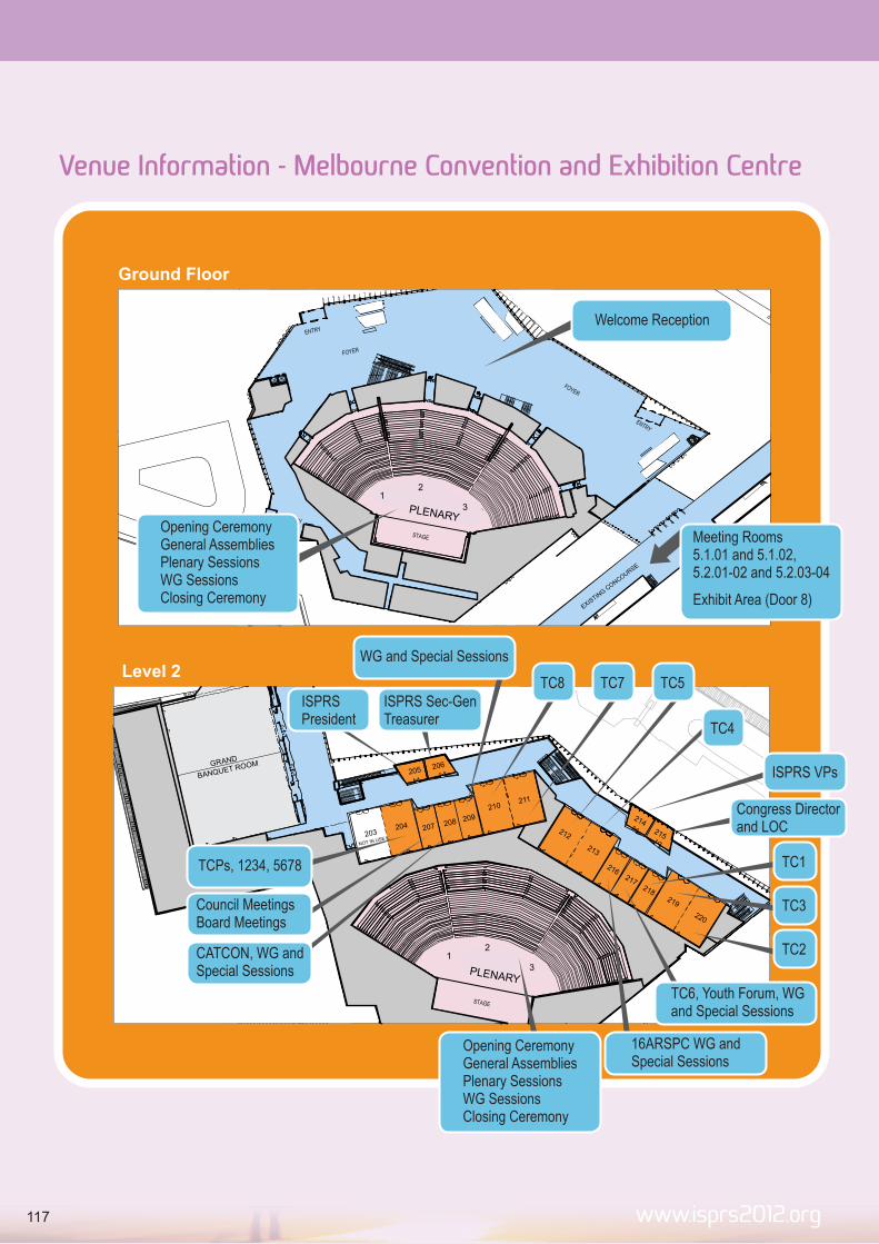
www.isprs2012.org
Ground Floor
12
3
EXISTIN
G CONCOURSE
HILTON MELBOURNE
SOUTH WHARF
PLENARY
12
3
Level 2
211210
209208
207204203
NOT IN USE
GRAND
BANQUET ROOM
216217
213
212
218219
220
205 206
214215
PLENARY
12
3
Venue Information - Melbourne Convention and Exhibition Centre
TC4
ISPRS VPs
Congress Directorand LOC
TC1
TC3
TC2
16ARSPC WG andSpecial Sessions
TC6, Youth Forum, WG and Special Sessions
Opening CeremonyGeneral AssembliesPlenary SessionsWG SessionsClosing Ceremony
WG and Special Sessions
CATCON, WG and Special Sessions
TC8ISPRS President
TC5TC7ISPRS Sec-Gen Treasurer
Council MeetingsBoard Meetings
TCPs, 1234, 5678
Opening CeremonyGeneral AssembliesPlenary SessionsWG SessionsClosing Ceremony
Welcome Reception
Meeting Rooms5.1.01 and 5.1.02, 5.2.01-02 and 5.2.03-04
Exhibit Area (Door 8)
117

www.isprs2012.org
Attendance CertificateA certificate of attendance is included in your name badge.
Car ParkingParking is available at the Melbourne Exhibition Centre and adjacent car parks.
Basic Registration Entitlements Entry to all sessions Attendance at Welcome Reception Congress Satchel Copy of Final Program Digital Copy of Proceedings Entry to the Exhibition Morning and Afternoon Tea each day of the Congress Attendance at the Exhibitors’ Reception
Standard Registration Entitlements Entry to all sessions Attendance at Welcome Reception Congress Satchel Copy of Final Program Digital Copy of Proceedings Entry to the Exhibition Lunch each day of the Congress Morning and Afternoon Tea each day of the Congress Attendance at the Exhibitors’ Reception
Full Registration Entitlements Entry to all sessions Attendance at Welcome Reception Congress Satchel Copy of Final Program Digital Copy of Proceedings Entry to the Exhibition Morning and Afternoon Tea each day of the Congress Lunch each day of the Congress Attendance at the Congress Gala Dinner Attendance at the Exhibitors’ Reception
Day Registration Entitlements Entry to all sessions, ceremonies and receptions on the day of
registration Congress Satchel Copy of Final Program Entry to the Exhibition Lunch on day of attending Congress
Accompanying Persons Entitlements Access to the Exhibition Attendance at the Welcome Reception Attendance at the Opening Ceremony Congress Satchel Attendance at the Closing Ceremony Attendance at the Exhibitors’ Reception Accompanying Persons’ Morning Tea
Congress OfficeICMS Pty Ltd84 Queensbridge Street Southbank, VIC 3006 AUSTRALIAPhone: +61 1300 792 466Fax: +61 3 9682 0288Email: [email protected] Website: www.isprs2012.org
Liability DisclaimerIn the event of industrial disruption or other unforeseen circumstances, the Congress Office, the Organising Committee and the Host Organisations accept no responsibility for loss of monies incurred by participants and /or accompanying persons. The Congress Office, the Congress Committee and the Host Organisations accept no liability for injuries/losses of whatever nature incurred by participants and/or accompanying person, nor for loss or damage to their luggage and/or personal belongings. Participants and or/accompanying persons should make their own arrangements with respect to personal insurance.
Mobile Phones and Pagers As a courtesy to speakers and other delegates, we request that all mobile phones and pagers are in silent mode or switched off before entering sessions.
MessagesThe Congress registration desk staff will take messages for delegates during the Congress. Messages will be posted on the message board, located next to the registration desk. Delegates are requested to check the message board during breaks.
Congress AppThe official ISPRS2012 App will keep you organized during the congress. Within the App you can view the entire program, plan your own schedule, and make direct contact with colleagues at the congress.
Downloading the ISPRS 2012 Mobile App is easy!For iPhone (plus, iPod Touch & iPad) and Android phones: visit your App Store or Android Market on your phone and search for ‘ISPRS 2012’ and download the app like you would any other! For All Other Phone Types (including BlackBerry and all other web browser-enabled phones): Point your mobile browser to: http://m.core-apps.com/invisage-isprs2012. (Username and Password: Photogrammetry)
From there you will be directed to your native app store to download the app for your particular device, or on some phones, bookmark this page for future reference.
Additionally you can also scan the QR code to download.
www.isprs2012.org
ISPRS 2012 Final Program
General Information
118

Name BadgesYour name badge is your entrance ticket to all Congress sessions and the Exhibition. Please wear your name badge at all times. Your tickets for the pre-Congress workshops, lunches and Congress dinner are also included in your name badge holder.
No Smoking PolicyDelegates should be aware that smoking is banned in all public buildings, hotels and restaurants throughout Victoria, including the Congress venue.
TicketsDelegates will receive all pre-booked tickets at registration. Tickets are required for the pre-Congress workshops, site tours, welcome reception and Congress dinner. If you have misplaced your tickets or have not received tickets for functions you wish to attend, please see the staff at the Registration Desk.
WiFiWiFi access is available free of charge throughout the MCEC and Exhibition.
Congress ProceedingsAll delegates registered for the Technical Program receive two USB drives, one containing PDF copies of the papers in the ISPRS Annals of Photogrammetry, Remote Sensing and Spatial Information Sciences and one containing PDF copies of the papers in the International Archives of the Photogrammetry, Remote Sensing and Spatial Information Sciences. Papers in the Annals are accepted based on double blind, peer review and comprise four volumes. Papers in the Archives are accepted based on the abstract only and comprise eight volumes.
All twelve volumes are available as printed proceedings and will be despatched to delegates post-congress. Orders for any of the twelve volumes can be placed at the registration desk. A nominal fee for surface mail or air mail postage will be included as an additional cost.
Volume Fees
Commission 1 (1 Volume) $75
Commission 2 (2 Volumes) $90
Commission 3 (2 Volumes) $120
Commission 4 (2 Volumes) $100
Commission 5 (1 Volume) $75
Commission 6 (1 Volume) $60
Commission 7 (2 Volumes) $120
Commission 8 (1 Volume) $70
All Volumes $700
www.isprs2012.org119

ISPRS 2012 Final Program
www.isprs2012.org
Notes
120

www.isprs2012.org
Notes
121

ISPRS 2012 Final ProgramPr
ogra
m O
verv
iew
9:0
0
9:3
0
10:0
0
10:3
0C
offee
Bre
ak
11:0
0
11:3
0
12:0
0
12:3
0Lunch
Bre
ak
13:0
0
13:3
0
14:0
0
14:3
0
15:0
0
15:3
0C
offee
Bre
ak
16:0
0
16:3
0
17:0
0
17:3
0N
etw
ork
ing
Bre
ak
18:0
0
18:3
0
19:0
0
20:0
0
20:3
0
21:0
0
21:3
0
Tech
nic
al,
Them
e a
nd
Speci
al
AR
SP
CP
lenary
Tech
nic
al,
Them
e a
nd
Speci
al
AR
SP
CP
lenary
Mo
nd
ay
Au
gu
st
27
Exh
ibito
rs R
ece
ptio
n
Short
plu
sIn
tera
ctiv
e
Satu
rday
Sep
tem
ber
1
Th
urs
day
Au
gu
st
30
Fri
day
Au
gu
st
31
Clo
sin
gC
ere
mony
CA
TC
ON
Short
plu
sIn
tera
ctive
Ple
nary
CA
TC
ON
Ple
nary
Technic
al,
Them
e a
nd
Specia
l
Tech
nic
al,
Them
e a
nd
Speci
al
Tech
nic
al,
Them
e a
nd
Speci
al
Tu
esd
ay
Au
gu
st
28
AF
L G
am
e(A
ust
ralia
n R
ule
s F
ootb
all)
Work
shops
and
Tuto
rials
Work
shops
and
Tuto
rials
Work
shops
and
Tuto
rials
Rest
aura
nt
Eve
nin
gand
Foundatio
n
Funct
ion
Ple
nary
Tech
nic
al,
Them
e a
nd
Speci
al
AR
SP
CTech
nic
al,
Them
e a
nd
Speci
al
Welc
om
e
Rece
ptio
n
Pre
-din
ner
drinks
Hom
e H
osp
italit
y E
venin
gT
heatr
e E
venin
gF
ree E
venin
gC
onfe
rence D
inner
Satu
rday
Au
gu
st
25
Wed
nesd
ay
Au
gu
st
29
Tech
nic
al
Tour
Short
plu
sIn
tera
ctiv
e
Tech
nic
al
Tour
Youth
F
oru
m
Youth
F
oru
mA
RS
PC
Tech
nic
al,
Them
e a
nd
Speci
al
AR
SP
C
Busi
ness
Meetin
gs
Openin
g
Cere
mony
Tech
nic
al,
Them
e a
nd
Speci
al
Su
nd
ay
Au
gu
st
26
Ple
nary
Tech
nic
al,
Them
e a
nd
Speci
al
Technic
al,
Them
e a
nd
Specia
l
Tech
nic
al,
Them
e a
nd
Speci
al
Tech
nic
al,
Them
e a
nd
Speci
al
Tech
nic
al,
Them
e a
nd
Speci
al
Tech
nic
al,
Them
e a
nd
Speci
al
Short
plu
sIn
tera
ctiv
e
Technic
al,
Them
e a
nd
Specia
l
Tech
nic
al,
Them
e a
nd
Speci
al
AR
SP
CTe
chnic
al
Tour
Youth
F
oru
m
Short
plu
sIn
tera
ctiv
e
Tech
nic
al
Tour
Youth
F
oru
m
122

123

www.isprs2012.org
124