napoleons structure plan - golden plains shire structure plan ..... 5 2.1 function ..... 5 2.2...
TRANSCRIPT
Napoleons
Structure Plan
2
Table of Contents
1. Introduction .............................................................................................................................................................................................................................................. 4
2. The Structure Plan ................................................................................................................................................................................................................................ 5
2.1 Function ........................................................................................................................................................................................................................................ 5
2.2 Objectives ..................................................................................................................................................................................................................................... 6
2.3 Implementation ............................................................................................................................................................................................................................... 6
3. Napoleons Regional Context .................................................................................................................................................................................................................... 5
4. Napoleons Local Context .......................................................................................................................................................................................................................... 8
4.1 Community and Stakeholder Consultation ................................................................................................................................................................................... 8
4.2 Community Profile ........................................................................................................................................................................................................................ 8
4.3 Population ................................................................................................................................................................................................................................... 10
4.4 Heritage....................................................................................................................................................................................................................................... 11
4.5 Environment & Landscape .......................................................................................................................................................................................................... 12
4.6 Land Use & Development ........................................................................................................................................................................................................... 13
4.7 Open Space ................................................................................................................................................................................................................................. 15
4.8 Civic Cultural and Education Facilities ......................................................................................................................................................................................... 15
4.9 Health & Well-being Facilities ..................................................................................................................................................................................................... 15
4.10 Movement & Transport ............................................................................................................................................................................................................. 16
4.11 Infrastructure ............................................................................................................................................................................................................................. 17
4.12 Enterprise & Business Activity ................................................................................................................................................................................................... 18
4.13 Urban & Built Form .................................................................................................................................................................................................................... 18
4.14 Open Space ................................................................................................................................................................................................................................ 18
5. Vision ...................................................................................................................................................................................................................................................... 19
5.1 Planning for Napoleons Future .................................................................................................................................................................................................. 19
6. Plans ........................................................................................................................................................................................................................................................ 20
6.1 Implementation Plan .................................................................................................................................................................................................................. 24
7. Monitoring & Review ............................................................................................................................................................................................................................. 25
3
Table of Contents cont.
Figures
Figure 1 Structure Plan Study Area ................................................................................................................................................................................................................ 4
Figure 2 Napoleons Regional Context ............................................................................................................................................................................................................ 8 Figure 3 Napoleons Local Context.................................................................................................................................................................................................................. 8
Figure 4 ABS 2011 Census—Greater Napoleons Area ................................................................................................................................................................................ 11
Figure 5 Napoleons Township Zone ............................................................................................................................................................................................................. 15
Figure 6 Dwellings and Lot sizes ................................................................................................................................................................................................................... 15
Figure 7 Kilometres of Graded Roads .......................................................................................................................................................................................................... 18
Figure 8 Napoleons Structure Plan Framework .......................................................................................................................................................................................... 22
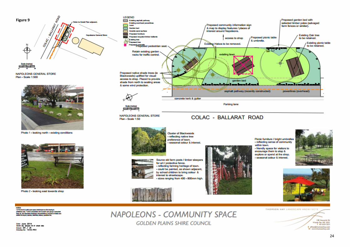
Figure 9 Napoleons Streetscape Concept ..................................................................................................................................................................................................... 23
Figure 10 Implementation Plan ...................................................................................................................................................................................................................... 25
Images
Fire Brigade— Napoleons Cricket Match courtesy of the Ballarat Courier. ....................................................................................................................................................... 7
Napoleons Cricket Match courtesy of the Ballarat Courier. ............................................................................................................................................................................. 17

4
“ A tranquil town set amongst the
backdrop of golden plains and
significant natural beauty”
1. Introduction
This Structure Plan has been prepared by the Golden Plains Shire Council with input from the local community, key
stakeholders, government agencies and service providers. The Napoleons Structure Plan sets out the vision to
guide future development to 2029.
The township of Napoleons is situated in a pleasant rural setting surrounded by undulating land mostly used for
grazing. Napoleons offers a country lifestyle and environment close to services and facilities of the regional City of
Ballarat. The community has a strong sense of connectivity between population and healthy lifestyle activities.
Napoleons is particularly attractive for residents seeking properties with views and a quiet, rural atmosphere.
Napoleons is located approximately 15 kilometres south of Ballarat and within 6 kilometres of Sebastopol and
Buninyong, which are significant residential areas forming part of Ballarat’s suburbs. The town is bisected by the
Colac-Ballarat Road, a transport route connecting the Princes, Hamilton and Midland Highways.
The Structure Plan responds to residential land supply and provides strategic planning direction for the future. The
majority of residential development is directly adjacent to the Colac Ballarat Road. Additional zoned land with
capacity for subdivision is also available.
Napoleons is not serviced with reticulated sewerage and therefore lots sizes must be of a sufficient size to treat
and retain wastewater on site. There were 28 new dwellings constructed for the period 2003 – 2013 in the greater
Napoleons area.
.
Figure 1 Structure Plan Study Area - 1.5km circumference from the town centre

5
“A small country town
that has been slowly
evolving from a farming
community to rural
residential area”
2.1 Function
The purpose and function of the Napoleons Structure Plan is to provide a strategic framework and establish a basis for future land use
planning decisions. The Structure Plan indicates a preferred layout of residential, commercial and other land uses based on a
10-15 year outlook. Council has prepared the Napoleons Structure Plan with input and assistance from the community, key
stakeholders and government. A steering committee has overseen the development of the plan.
The Structure Plan considers the objectives of the Central Highland Regional Growth Plan, 1997 Napoleons Structure Plan and the
Golden Plains Planning Scheme.
Key outputs of the plan include:
A physical vision for the Napoleons township to 2029,
Strategies to guide change that reflect community values and aspirations for the growth of Napoleons,
A set of actions to deliver the strategies,
Integration of the town’s assets and unique qualities into a vision to enhance the appearance, useability and liveability of
Napoleons.
2.2 Objectives
The Plan defines the specific policy and objectives for the future of Napoleons. It identifies opportunities and strategies to realise
those objectives. The Plan will focus on providing for cohesive town development with improved amenity.
2. The Structure Plan
6
2.3 Implementation
The implementation program outlines the priorities, actions and processes required to deliver the objectives of the Structure
Plan. The action include amendments to the local planning policy framework and zoning controls within the township.
A major consideration in the completion of the plan has been the need to recognise the existing capability of Napoleons and the
key influences on growth and development. The projected growth within Ballarat and surrounding rural towns will substantially
determine the growth rate of Napoleons.
The Structure Plan is informed by comprehensive research drawn from the following documents:
Copies of these studies and information are available upon request. Most are available on Council’s website.
State Planning Policy Framework Golden Plains Recreation Strategy 2008-2012
Council’s Municipal Strategic Statement Golden Plains Municipal Public Health Strategy
Napoleons Structure Plan 1997 Golden Plains Early Years Infrastructure Plan 2011- 15
Napoleons Community Plan 2011 ABS Census Data
Golden Plains Environment Strategy DPTLI ‘Towns in time’ and ‘Know your place’
Golden Plains Recreation Strategy Central Highlands Regional Growth Plan 2013
Golden Plains Paths and Trails Strategy Golden Plains Shire Council Plan 2012-2016
Golden Plains Shire Economic Development Plan 2013 Golden Plains Strategic Planning Framework
“Rural, tranquil, unspoilt
convenient and historical”
Kitty Lead Road Napoleons
7
Nap
ole
on
s R
egio
nal
Co
nte
xt
Figure 2
8
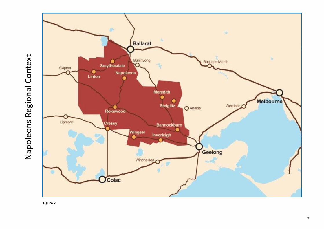
3. Napoleons Regional Context
There are a number of key trends influencing growth in the Shire which have been considered as part of this Structure Plan.
These are as follows:
Linkages to regional cities,
Transport and Infrastructure,
Network settlement clusters,
Growth and development.
Napoleons is part of a network of small-to-medium sized settlements located along an 88 kilometre stretch of the Colac-Ballarat
road linking the Princes and Hamilton Highways to the City of Ballarat.
A key strength of Napoleons is it’s excellent access and linkages to services and infrastructure in the regional City of
Ballarat (population - 93,501, ABS Census 2011). Napoleons provides a range of lifestyle residential properties in an attractive
semi-rural location approximately 8 kilometres from the regional City of Ballarat. It is anticipated that settlements and rural areas
such as Napoleons will experience increased growth as larger cities expand and provide greater employment opportunities.
Growth is expected to occur south-west of Ballarat over the next 30 years. The expansion of the Ballarat University Technology
Park and the Ballarat West Employment Area will provide a significant number of jobs for the region.
Anticipated growth will require a coordinated approach to planning, development of services, transport and infrastructure.
Settlement planning will aim to strike a balance between growth and the objective of creating sustainable communities.
Local planning will be required to consider how clusters of settlements can work together to provide facilities and manage change.
“Great country living with
a huge safety net next door
and an even bigger one a bit
over an hour down the
road”
9
4. Napoleons Local Context
4.1 Community and Stakeholder Consultation
Consultation for the review of the Napoleons Structure Plan involved discussion with key stakeholders and community to identify
strengths, opportunities and constraints. Outcomes from these discussions helped develop an overall vision for the area.
Consultation for the preparation of the Structure Plan was undertaken in the following manner:
One-on-one meetings with Council Strategy Managers.
Meeting with integrated infrastructure agencies and key government agencies.
Consultation with Napoleons Community Coordinators.
Community Survey sent to landholders and occupiers within the Napoleons area.
Community Consultation Session held Wednesday 7 May 2014.
Public exhibition of Draft Napoleons Structure 11 August — 12 September 2014.
Consultation outcomes:
Residential Growth :
The Napoleons community values the rural lifestyle feel and history of the town, further growth in the township should reflect this. In
general the community support some growth in the township to ensure a sustainable and vibrant community. This should be
encouraged through infill development in the Township Zone. The community values retaining the country character of Napoleons with
larger lot sizes of 8000 sqm (.8 ha) and not becoming suburban by keeping the open spaces and the rural living aspect. The community
expressed concern at the limitation to in-fill development on land where there was continued farming activity.
Connectivity:
The general store, school and recreation reserve are vital services valued by the community. Their success is important to the overall
well-being of the town and growth in the town is necessary to ensure the ongoing success of these services. The community value the
connectivity between these services and there is a strong desire for improved physical and social connections between them.
“Vibrant small country town”

10
Figure 3
Napoleons Local Context
11
Road traffic, conditions and maintenance:
The Colac-Ballarat Road is an 88-kilometre State arterial road. The road links a number of small towns including Napoleons, to the Princes,
Hamilton and Midland Highways and the regional cities of Ballarat, Geelong and Warrnambool. Non-compliance with the speed limit on the
Colac-Ballarat Road as it bisects the Napoleons township is an ongoing concern for the community. The community has worked hard to
lobby for a safer environment for pedestrians in the vicinity of the Napoleons Primary School, specifically to install 40km/h flashing speed
limit signs. VicRoads maintains the most recent traffic data available indicates that the Colac-Ballarat Road in the vicinity of the
Napoleons Primary School has less than 1,500 vehicles per day and therefore does not satisfy the warrants for the installation of electronic
school speed zone signage. Council continues to lobby VicRoads on the community’s behalf.
The community value the grading and maintenance of gravel roads and encourage Council to maintain a safe well-graded road network in
the Napoleons area.
Amenity:
Over the next 5-10 years, the community would like to see streetscape enhancements that improve the social connectivity between the
services. The General Store area provides an informal meeting place for the community and visitors to Napoleons. The community consider
streetscape treatments would support traffic calming measures and encourage speed limit compliance in the township area.
Education Facilities:
The community expressed a desire to maintain a community vibrancy that supports educational facilities in Napoleons. The Golden Plains
Shire Early Years Infrastructure Plan 2011 identifies that an early years facility is needed in Napoleons. Council is actively pursuing the
facilitation of this initiative.
4.2 Community Profile
The Napoleons area was traditionally born of a gold mining and farming heritage. Mullock heaps are a visible reminder of a bygone era.
Undulating landscapes provide a township boundary and scenic vistas that continue to be farmed today.

12
The township is located on a plateau bounded by Dog Trap Creek to the west and the Yarrowee River to the east. Geographic
proximity to Ballarat has several impacts on service delivery and settlement patterns in the Napoleons area. Ballarat provides
access to health, education, recreation and retail, employment, cultural and commercial services of a scale and complexity that are
not available locally. In many respects the service and infrastructure provided by Ballarat is appealing to residents because it
offers opportunity to enjoy the benefits of rural/semi-rural living and all the benefits of a city lifestyle close by.
4.3 Population
The greater Napoleons area as defined by the Australian Bureau of Statistics (ABS) 2011 Census (Figure 4) is comprised of 194
dwellings (181 occupied – 13 unoccupied) with total population of 535 people. The greater number of persons in the district are
aged between 0-14 years of age (20.6%) closely followed by 65 years plus group (10.7%). These figures suggest a forecast shift in
housing choices and increased demand for accessible aged care services and facilities outside the Napoleons area.
Of the families in the Napoleons area, 54.4% were couple families with children, 37.6% were couple families without children and
8.1% were one-parent families. The most common occupations in the Napoleons area are in the professional sectors (20.1%),
closely followed by technicians and trades (18.4%) and clerical and administrative workers (12.7%). Of the 181 occupied dwellings
75.8% have broadband connection and 11.7% have no internet connection.
In Napoleons, 30.8% of people attend an education institution, 34.3% attend a primary
school and 16.3% attend tertiary or technical institutions. Groups attending education
institutions other than a primary school are likely to travel to and from secondary
education institutions in Ballarat and seek social opportunities and accessible open
spaces. Survey data indicates facilities and services for this demographic are accessed
from Ballarat. Access to facilities is dependent on individual transport due to poor public
transport services.
“A quiet and growing town with
great facilities school and people”
Figure 4 The Greater Napoleons area as defined by ABS 2011 Census Data
13
“Provincial rural and unsophisticated”
4.4 Heritage
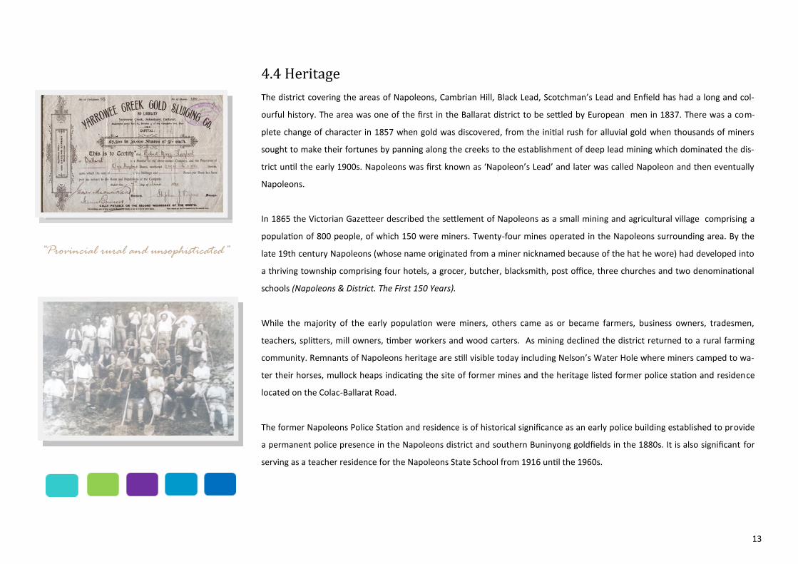
The district covering the areas of Napoleons, Cambrian Hill, Black Lead, Scotchman’s Lead and Enfield has had a long and col-
ourful history. The area was one of the first in the Ballarat district to be settled by European men in 1837. There was a com-
plete change of character in 1857 when gold was discovered, from the initial rush for alluvial gold when thousands of miners
sought to make their fortunes by panning along the creeks to the establishment of deep lead mining which dominated the dis-
trict until the early 1900s. Napoleons was first known as ‘Napoleon’s Lead’ and later was called Napoleon and then eventually
Napoleons.
In 1865 the Victorian Gazetteer described the settlement of Napoleons as a small mining and agricultural village comprising a
population of 800 people, of which 150 were miners. Twenty-four mines operated in the Napoleons surrounding area. By the
late 19th century Napoleons (whose name originated from a miner nicknamed because of the hat he wore) had developed into
a thriving township comprising four hotels, a grocer, butcher, blacksmith, post office, three churches and two denominational
schools (Napoleons & District. The First 150 Years).
While the majority of the early population were miners, others came as or became farmers, business owners, tradesmen,
teachers, splitters, mill owners, timber workers and wood carters. As mining declined the district returned to a rural farming
community. Remnants of Napoleons heritage are still visible today including Nelson’s Water Hole where miners camped to wa-
ter their horses, mullock heaps indicating the site of former mines and the heritage listed former police station and residence
located on the Colac-Ballarat Road.
The former Napoleons Police Station and residence is of historical significance as an early police building established to provide
a permanent police presence in the Napoleons district and southern Buninyong goldfields in the 1880s. It is also significant for
serving as a teacher residence for the Napoleons State School from 1916 until the 1960s.
14
“Comfortable – safe and green”
4.5 Environment and Landscape
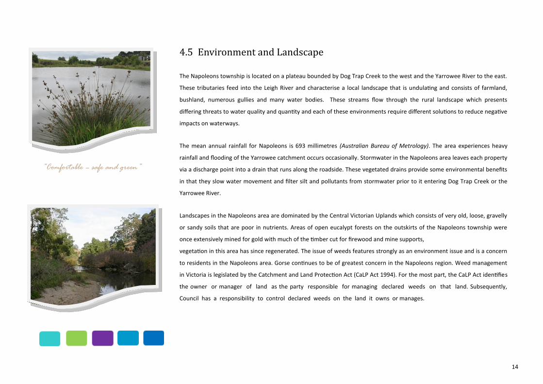
The Napoleons township is located on a plateau bounded by Dog Trap Creek to the west and the Yarrowee River to the east.
These tributaries feed into the Leigh River and characterise a local landscape that is undulating and consists of farmland,
bushland, numerous gullies and many water bodies. These streams flow through the rural landscape which presents
differing threats to water quality and quantity and each of these environments require different solutions to reduce negative
impacts on waterways.
The mean annual rainfall for Napoleons is 693 millimetres (Australian Bureau of Metrology). The area experiences heavy
rainfall and flooding of the Yarrowee catchment occurs occasionally. Stormwater in the Napoleons area leaves each property
via a discharge point into a drain that runs along the roadside. These vegetated drains provide some environmental benefits
in that they slow water movement and filter silt and pollutants from stormwater prior to it entering Dog Trap Creek or the
Yarrowee River.
Landscapes in the Napoleons area are dominated by the Central Victorian Uplands which consists of very old, loose, gravelly
or sandy soils that are poor in nutrients. Areas of open eucalypt forests on the outskirts of the Napoleons township were
once extensively mined for gold with much of the timber cut for firewood and mine supports,
vegetation in this area has since regenerated. The issue of weeds features strongly as an environment issue and is a concern
to residents in the Napoleons area. Gorse continues to be of greatest concern in the Napoleons region. Weed management
in Victoria is legislated by the Catchment and Land Protection Act (CaLP Act 1994). For the most part, the CaLP Act identifies
the owner or manager of land as the party responsible for managing declared weeds on that land. Subsequently,
Council has a responsibility to control declared weeds on the land it owns or manages.

15
‘
“Friendly quiet great fun place on a
city’s doorstep”
4.6 Land Use and Development
The north-west of Golden Plains Shire is where most of the Shire’s rural living type land is located. The pattern of lots reflects
historic subdivisions in the gold mining era or developments approved by former municipalities. Napoleons land use patterns
indicate a spread of rural residential development contained on a range of lot sizes. Napoleons is a country town with a primary
school, general store, CFA, sports facilities including an oval, cricket pitch, tennis courts and a public hall. Land in the study area
(see Figure 1) is generally Township Zone surrounded by Rural Activity Zone. An area of Rural Living Zoned land exists to the
north-west of the township.
Farming activities continue on undeveloped land in the township zone contributing to a rural atmosphere. Development in
Napoleons is at the urban/rural interface of Napoleons and Ballarat where there is an increasing trend to act as a commuter
base for people seeking to locate within travelling distance to Ballarat.
In the 5 year period 2008-2013 Golden Plains Shire received 49 planning permit applications from the wider Napoleons area.
The largest number of applicants sought to develop the land for a dwelling and shed, followed by a lesser number of applications
to construct a shed, subdivision and native vegetation removal. Council’s building development data for the period 2003-2013
indicates 2.8 houses were constructed over this 10 year period. There are significant areas of undeveloped land in the Township
Zone creating a vacant residential lot supply of approximately 26 years based on historical development rates. Additional land
has been identified as the ‘longer term growth area’ for future residential development. This land should be made available once
the zoned land has been taken up. Adding to this supply through further zoning of land to Township Zone would be
inappropriate in the short term.
There is no minimum lot size stipulated within the provisions of the Township Zone. Napoleon is not serviced with reticulated
sewerage and as a consequence land subdivision in the Township Zone is subject to environmental management through land
capability assessment (LCA). To ensure residential lots are capable of treating wastewater to a satisfactory standard it is unlikely
Council would support the creation of lots less than 4000 sqm. Properties located along the Colac-Ballarat Road, are generally
connected to reticulated water supplied by Central Highland Water. The remaining properties in the Township Zone are
generally not supplied by reticulated water and therefore rely on their own private water supply.
16
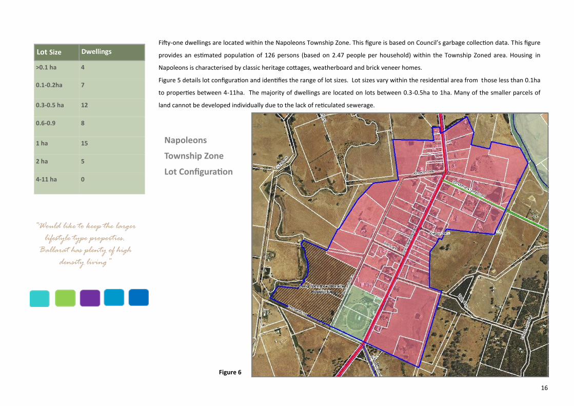
Fifty-one dwellings are located within the Napoleons Township Zone. This figure is based on Council’s garbage collection data. This figure
provides an estimated population of 126 persons (based on 2.47 people per household) within the Township Zoned area. Housing in
Napoleons is characterised by classic heritage cottages, weatherboard and brick veneer homes.
Figure 5 details lot configuration and identifies the range of lot sizes. Lot sizes vary within the residential area from those less than 0.1ha
to properties between 4-11ha. The majority of dwellings are located on lots between 0.3-0.5ha to 1ha. Many of the smaller parcels of
land cannot be developed individually due to the lack of reticulated sewerage.
Napoleons
Township Zone
Lot Configuration
Figure 6
“Would like to keep the larger
lifestyle type properties.
Ballarat has plenty of high
density living”
Lot Size Dwellings
>0.1 ha 4
0.1-0.2ha 7
0.3-0.5 ha 12
0.6-0.9 8
1 ha 15
2 ha 5
4-11 ha 0
17
4.7 Open Space
Napoleons has two key areas of open space being the Napoleons Recreation Reserve and the area at Nelson’s Water Hole. Nelson’s
Water Hole is an informal recreation space with no facilities. The Recreation Reserve had an original area of 10 acres of land which was
proclaimed as a site for Public Recreation on the 18th May 1874. The Reserve forms a more formal open space area with an oval (turf
pitch) and cricket nets and club rooms used extensively by cricket clubs in the greater Napoleons/Ballarat area . Part of the land has
now been developed to include other services including the CFA facilities. The Reserve includes tennis courts, playground, public hall
and toilets. The Golden Plains Shire Paths and Trails Strategy 2013-17 identifies a number of initiatives to enhance open space and
amenity values in Napoleons including restoration of the path between Wells Road and nine Mile Road and development of a path
along the west side of Colac-Ballarat Road.
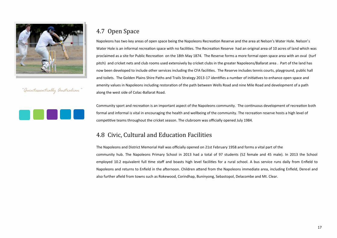
Community sport and recreation is an important aspect of the Napoleons community. The continuous development of recreation both
formal and informal is vital in encouraging the health and wellbeing of the community. The recreation reserve hosts a high level of
competitive teams throughout the cricket season. The clubroom was officially opened July 1984.
4.8 Civic, Cultural and Education Facilities
The Napoleons and District Memorial Hall was officially opened on 21st February 1958 and forms a vital part of the
community hub. The Napoleons Primary School in 2013 had a total of 97 students (52 female and 45 male). In 2013 the School
employed 10.2 equivalent full time staff and boasts high level facilities for a rural school. A bus service runs daily from Enfield to
Napoleons and returns to Enfield in the afternoon. Children attend from the Napoleons immediate area, including Enfield, Dereel and
also further afield from towns such as Rokewood, Corindhap, Buninyong, Sebastopol, Delacombe and Mt. Clear.
“Quintessentially Australian”
18
4.9 Health and Well-being Facilities
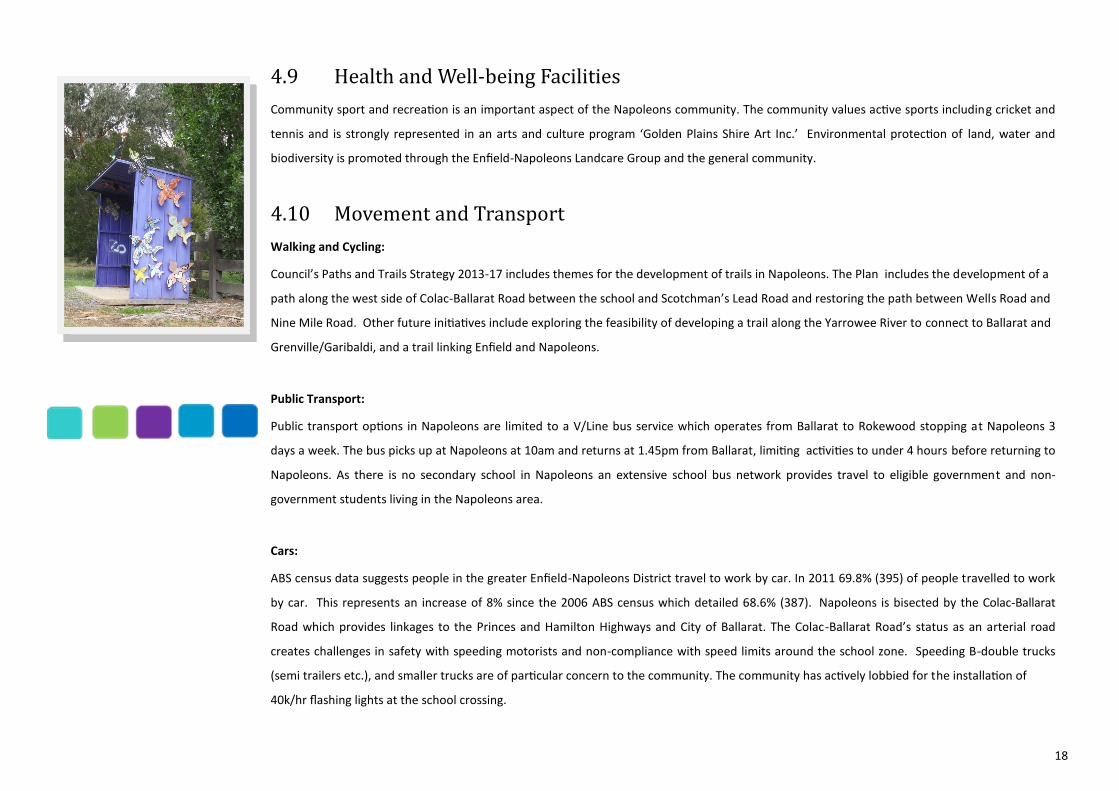
Community sport and recreation is an important aspect of the Napoleons community. The community values active sports including cricket and
tennis and is strongly represented in an arts and culture program ‘Golden Plains Shire Art Inc.’ Environmental protection of land, water and
biodiversity is promoted through the Enfield-Napoleons Landcare Group and the general community.
4.10 Movement and Transport
Walking and Cycling:
Council’s Paths and Trails Strategy 2013-17 includes themes for the development of trails in Napoleons. The Plan includes the development of a
path along the west side of Colac-Ballarat Road between the school and Scotchman’s Lead Road and restoring the path between Wells Road and
Nine Mile Road. Other future initiatives include exploring the feasibility of developing a trail along the Yarrowee River to connect to Ballarat and
Grenville/Garibaldi, and a trail linking Enfield and Napoleons.
Public Transport:
Public transport options in Napoleons are limited to a V/Line bus service which operates from Ballarat to Rokewood stopping at Napoleons 3
days a week. The bus picks up at Napoleons at 10am and returns at 1.45pm from Ballarat, limiting activities to under 4 hours before returning to
Napoleons. As there is no secondary school in Napoleons an extensive school bus network provides travel to eligible government and non-
government students living in the Napoleons area.
Cars:
ABS census data suggests people in the greater Enfield-Napoleons District travel to work by car. In 2011 69.8% (395) of people travelled to work
by car. This represents an increase of 8% since the 2006 ABS census which detailed 68.6% (387). Napoleons is bisected by the Colac-Ballarat
Road which provides linkages to the Princes and Hamilton Highways and City of Ballarat. The Colac-Ballarat Road’s status as an arterial road
creates challenges in safety with speeding motorists and non-compliance with speed limits around the school zone. Speeding B-double trucks
(semi trailers etc.), and smaller trucks are of particular concern to the community. The community has actively lobbied for the installation of
40k/hr flashing lights at the school crossing.

19
4.11 Infrastructure
Water:
Development intensification in the Napoleons townships is constrained by water provision. Reticulated water is supplied via a main feeder pipe
along the Colac-Ballarat Road. Central Highlands Water have advised they may require development within reasonable proximity to the main
feeder pipe to connect to the reticulated water system. Connection costs may be significant for properties away from the main feeder pipe.
Development on out-lying land in Napoleons may require an alternative source of potable water supply.
Sewerage:
A sewerage line exists between Enfield and Ballarat. The line was designed to operate under pressure and is not able to be connected to by
existing or future development in Napoleons without a wholly funded infrastructure upgrade external to the Central Highlands Water Authority.
Power:
Power infrastructure can meet existing and future domestic and industry requirements. A high voltage power line runs north-south of the
Colac-Ballarat Road providing capacity for domestic and 3-phase power. The major feeder line runs from Sebastopol through to the Midland
Highway and can be upgraded to meet growth in the area. Electricity is supplied to all areas, however there is no natural gas available.
Roads:
The road network within the Shire involves a hierarchy comprising declared Highways, Main Roads and Local Roads. Main roads including the
Colac-Ballarat Road are fully managed (except in townships) by VicRoads. The Golden Plains Shire road network includes 712km of gravel roads.
Local roads in Napoleons are the responsibility of Council for management and maintenance. Road maintenance is often raised as an issue due
to the number of unsealed roads in Napoleons. Council conducts an annual grading program on gravel roads within the Shire.
The program provides for each gravel road to be graded on average twice per year. In practice, some of the lightly trafficked roads receive one
grade per year while those that have higher traffic volumes may be graded up to four times per year. Weather conditions affect the delivery of
this service and extended wet or dry periods may not allow gravel roads to be graded as often as required. The most common defects reported
along unsealed roads include potholes, corrugations and general deterioration of road surfaces requiring grading. Maintenance of these defects
is carried out by the Works Department. Figure (7) details the kilometres of gravel roads graded in Napoleons between 2008-2013.
Year Kilometres of
graded roads in
Napoleons
2008 34.5 km
2009 62 km
2010 61.4 km
2011 32.9 km
2012 49.9 km
2013 31.5 km
Figure 7

20
The most common defects reported along unsealed roads include potholes, corrugations and general deterioration of road surfaces requiring
grading. Maintenance of these defects is carried out by the Works Department. Figure (7) details the kilometres of gravel roads graded in
Napoleons between 2008-2013.
Country Fire Authority:
The Napoleons Fire Station was opened in October 2010, replacing the 1982 building. The Napoleons-Enfield Fire Brigade was formed in 1932.
4.12 Enterprise and Business Activity
The main business enterprises in Napoleons in the commercial area, are the General Store and the Stockfeed and Hardware Store. The General
Store is recognised as a landmark and provides integrated services including fuel, postal, newsagency, general convenience retail, takeaway food
and limited casual dining. It is responsive to the needs of its customer base including tourists and other visitors. While predominantly residential,
the Township Zone provides for a range of uses including the opportunity for local businesses to establish within the local community.
4. 13 Urban and Built Form
The topography of the township is relatively flat. The township comprises two formal grid patterns, generally aligned to both sides of the
Colac-Ballarat Road. Wide road reserves, established native trees and open drains are also contributory elements to the country town character.
There are a number of weatherboard and timber cottages together with contemporary brick veneer dwellings. The Colac-Ballarat road bisects the
town area creating wide road verges to give the town area an open rural feel. The visual amenity would benefit from landscaping to create a
village atmosphere. The majority of the activity within the town, centres around the general store and the school/Recreation Reserve.
4.14 Open Space
Napoleons has two key areas of open space, being the Recreation Reserve and a small area at Nelson’s Waterhole located off Thorpe's Road.
(Council managed land… could be low lying...check potential for picnic table and sign to take rubbish home—perhaps signage from the Colac
Ballarat Road) The Recreation Reserve is an informal recreation space with barbecue facilities and playground and is linked to the primary school,
sports facilities and the Memorial Hall. Consideration should be given to open space development in the vicinity of the General Store. The
community view this area as the central hub of the town.
21
5. VISION
A vision as to how Napoleons should be seen in 20 years time has been developed through the structure plan process. The vision
reflects the aims and aspirations of the Council and the local community, and can be used as a basis to guide decisions for the township.
Napoleons will be a place where:
The appearance of the town and its assets are a source of pride and contribute to the safe and welcoming country town
character.
Where residents can enjoy an alternative, affordable quiet and relaxed country lifestyle.
Where the community is connected through participation in projects and events that build pride and enhance the
liveability of the town.
There are opportunities to start a business, value add and develop incomes locally.
The heritage character is celebrated.
The environmental landscape is valued and enhanced.
5.1 Planning for Napoleons Future
Strategic Response
The vision for Napoleons in the medium-to-long term should focus on the local context and role of the town and should include a clear physical
boundary for the town to manage growth.
Activities and Land Use
Objective: To provide for population growth in a managed and sustainable manner that respects the character of Napoleons.
Strategies: The Structure Plan provides for further Low Density Development in the long term and encourages in-fill development where land
capability assessment proves sites are suitable.
Improve the general public realm by providing high amenity pedestrian links that connect key infrastructure including the
Recreation Reserve, the school and the central commercial area.
“Home”
22
Apply landscaping treatment in the township to create a central hub for community and visitors.
Protect residential amenity as well as the ongoing farming activities of the surrounding district.
Ensure new development maintains the Napoleons country town character.
Action:
Implement recommendations of the Napoleons Streetscape Plan.
Incorporate the revised napoleons Structure Plan into the Golden Plains Planning Scheme.
6. Plans
6.1 Precincts Plan see Figure 8
The revision of the Napoleons Structure Plan has identified three (3) distinct precincts with the township. It is important that these
precinct are recognised, and that planning and development can continue in the most appropriate manner.
Recreation Precinct
Strengthen the links between the precincts and encourage high quality pedestrian networks between the precincts.
Develop the precinct in consultation with the community and Council’s Recreation Strategy.
Retain the feel and character of the precinct.
Education Precinct
Strengthen the links between the precincts and encourage high quality pedestrian networks between the precincts.
Commercial Precinct
Encourage appropriate local businesses in Napoleons to develop within the Commercial Precinct.
Retain the Township Zone to allow a mix of business and commercial retailing with residential development.
6.2 Framework Plan see Figure 9
6.3 Streetscape Plan see Figure 10
6.4 Implementation Plan see Figure 11
23
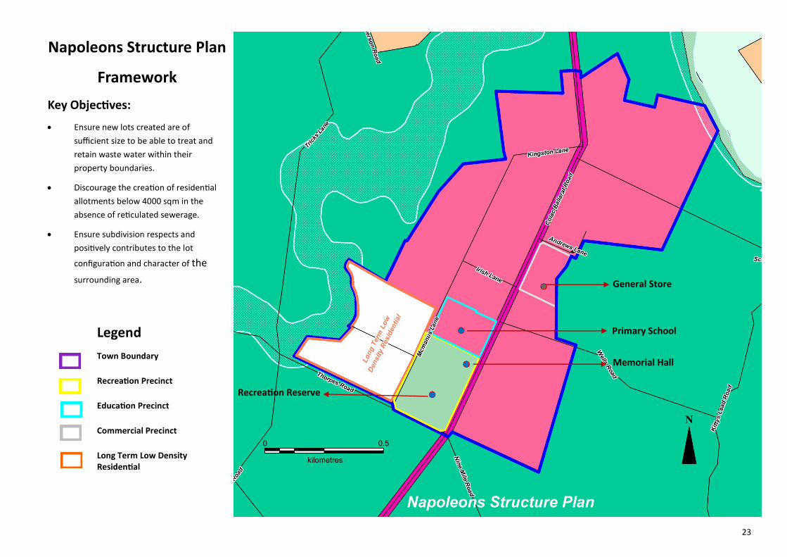
Napoleons Structure Plan
Framework
Key Objectives:
Ensure new lots created are of
sufficient size to be able to treat and
retain waste water within their
property boundaries.
Discourage the creation of residential
allotments below 4000 sqm in the
absence of reticulated sewerage.
Ensure subdivision respects and
positively contributes to the lot
configuration and character of the
surrounding area. General Store
Primary School
Memorial Hall
Recreation Reserve
Legend
Town Boundary
Recreation Precinct
Education Precinct
Commercial Precinct
Long Term Low Density Residential
24
Figure 9

25
6.4 Implementation Plan
The Structure Plan must include or be accompanied by an Implementation Program, which articulates the necessary actions and
strategies required to implement the aims and objectives described in the Development Framework. The Implementation Program
should be adopted by Council and be linked to Council’s corporate plan.
A detailed Implementation Program defines the actions, timeframes, costs, priority, key stakeholders, community engagement
processes and the parties responsible for implementing each action. The implementation Program identifies Council’s budget
requirements and other possible funding sources. The initiatives identified in the Structure Plan will be implemented by a range of
key stakeholders, from both the public and private sectors. The Council and Government Agencies will use the agreed Structure
Plan to set budgets and facilitate the timing and delivery of infrastructure and to establish development criteria in the activity
centre. Private sector interest will use the Structure Plan to guide their actions and development.
The Golden Plains Shire has identified the following actions to be implemented:
Figure 10
Action Commence Duration Lead Agency & Responsible Project Manager
Involved Stakeholder & Community Engage-ment
Cost Priority
1 Amend the Golden Plains Planning Scheme to replace the Napoleons Structure Plan with the new Structure Plan as shown at Figure 9
2014 12 months Golden Plains Shire
Council Officers & Dept. of Transport Plan-ning and Local Infrastructure (DTPLI)
Formal Planning Scheme amendment process
$10K 1
2 Streetscape Works 2014 Golden Plains Shire/Community
Grant Opportunities/ Private Sector
26
6. Monitoring and Review
Council regularly undertakes a review of the residential land supply across the Shire to determine the timing for Structure Plan
reviews.
The implementation program will be integrated into Council’s budget, subject to adoption by Council. This will ensure progress of
actions identified in the Napoleons Structure Plan.
“A quiet little hamlet”