national infrastructure access programme (niap)
TRANSCRIPT

National Infrastructure Access Programme (NIAP)
Research and Innovation Projects
SMARTBAY – IRELAND’S NATIONAL RESEARCH, TEST AND DEMONSTRATION PLATFORM
Dublin City University

Projects1. Demonstrator using in-situ (SmartPhone app)
& synoptic SmartBay data 2
2. WiMax Network Testing 3
3. MultiSens: An Investigation into Satellite Remote Sensing Products in Galway Bay 4
4. Antifouling – deployment of test materials 6
5. Optical Colorimetric Sensor (OCS) testing in the marine environment 7
6. CODAR Surface Current Observations in Galway Bay 8
7. Long endurance observation mini ROV system for remote presence and monitoring in SmartBay 9
8. Stabilisation of data buoy for communication links using elastomeric moorings 11
9. Kinvara Bay Data Fusion 13
10. Test of novel diffusive gradients in thin films (DGT) technology for monitoring labile phosphorus in the interface of water/sediments in Galway Bay 14
11. SmartBay CDOM – a baseline study for optimizing sensor design 15
12. Securing SmartBay via OSNA 16
13. Integration of Smart Event Triggered Ocean Monitoring Platform with SmartBay 17
14. ADCP validation of the Galway Bay High Frequency Radar System 18
15. Integration of Shimmer Sensing Technology into the Open SmartBay Data Platform 19
16. An Interactive 3D Simulation of the Spiddal Wave Energy Test Site 20
17. SmartBay Cork Buoy Communications Infrastructure development 21
18. Air Sea Interaction Profiler Test 22
19. CPOD monitoring to assess the effect if any of wave energy devices on the presence of harbour porpoise 23
20. Visualisation and validation of 2-dimensional hydrodynamic model outputs for Galway Bay 24
21. Real-time Remote Monitoring of Surface Currents and Waves off the Irish West Coast 25
22. Deployment and Analysis of Smart Inertial Measurement Units in a Marine Environment 26
23. Developing a Primary Node in the National MSFD Underwater Noise Monitoring Network 27
24. Kinvara Bay Data Fusion Project Phase II 27

Research and Innovation P
rojectsN
ational Infrastructure Access P
rogramm
e (NIA
P)
1
BackgroundThe SmartBay NIAP fund was made available in 2012 through Dublin City University over a two year period to enable researchers to access the SmartBay Ireland National Test and Demonstration Facility in Galway Bay. Research proposals were invited for funding under a number of activity types that are in line with the objectives of the SmartBay PRTLI Cycle 5 programme. This fund provided small awards (typically €2-25K) to research teams through a national competitive process, which was open to all higher education institutions on the island of Ireland. There were both open and biannual calls.
The SmartBay NIAP fund was established to enable researchers in academia and industry to access the SmartBay Ireland national test and demonstration infrastructure. Proposals to access the infrastructure were brief and required information on the researcher(s), a description of the proposed research and its potential impact to the research team arising from the access to SmartBay Ireland.
A key aspect of the NIAP was to establish a modest fund to support researchers wishing to access the infrastructure through a contribution to additional costs associated with deployments (Infrastructure Access Fund). The call for proposals to access the infastructure was open to all Irish Higher Education Institutions. We regarded this as essential to ensure that the facility is national, rather than regional in character, acting as a catalyst to validate innovative technology platforms and services under real conditions through field deployments, and therefore assisting the transfer of knowledge into products.
Our goal was therefore to rapidly grow the user base to encompass academic research teams, SMEs, and MNCs, nationally and internationally, and demonstrate significant socio-economic impact through the growth of an associated industry base that commercializes the research outputs, or uses the technologies to enhance productivity. Therefore SmartBay plays a critical role in connecting existing research capacity with commercial opportunity, consistent with national policy, as articulated in the ‘Smart Economy’ strategy. In addition, SmartBay offers a unique resource for training and education of graduate and postgraduate students in the challenges of bringing research out of the laboratory, into real scenarios, as part of a larger multidisciplinary effort, wherein they can clearly appreciate the contribution of their work to knowledge generation and economic development.
Since the first calls for proposals in 2012 there has been a significant growth in the number of research teams accessing the infrastructure and the capabilities of the SmartBay team. Without this fund these teams would not have been able to test their technologies in the marine environment with such ease, and therefore drive their research forward successfully. The projects and teams utilising SmartBay are funded through a wide range of mechanisms and the NIAP facilitates the translation of that research into the marine environment.
Initial calls for proposals were for small integration projects and in 2014 we had the launch of larger scale projects and these have just started. At the end of 2014 a final call for proposals will take place for groups that are interested in using the cabled observatory. The cable is due to be in place in the second quarter of 2015 and projects should start shortly after.
Fiona Regan Marine and Environmental Sensing Technology Hub, DCU NIAP Co-ordinator
Res
earc
h an
d In
nova
tion
Pro
ject
sN
atio
nal I
nfra
stru
ctur
e A
cces
s P
rogr
amm
e (N
IAP
)
2
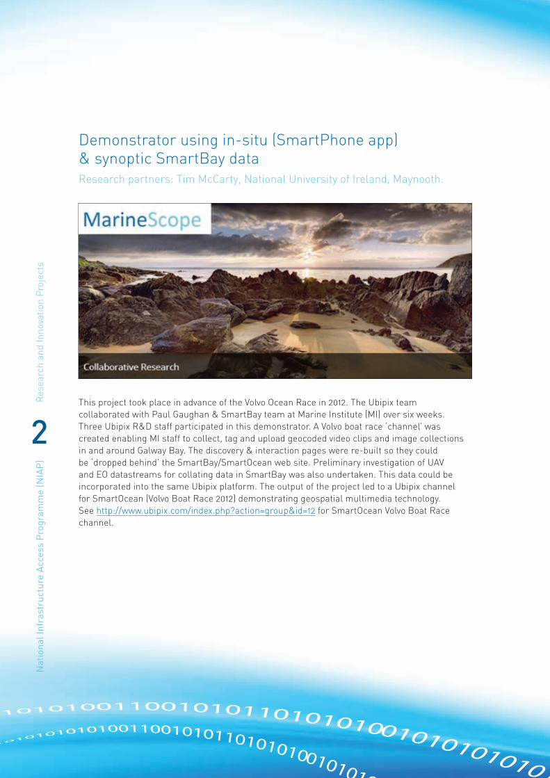
Demonstrator using in-situ (SmartPhone app) & synoptic SmartBay dataResearch partners: Tim McCarty, National University of Ireland, Maynooth.
This project took place in advance of the Volvo Ocean Race in 2012. The Ubipix team collaborated with Paul Gaughan & SmartBay team at Marine Institute (MI) over six weeks. Three Ubipix R&D staff participated in this demonstrator. A Volvo boat race ‘channel’ was created enabling MI staff to collect, tag and upload geocoded video clips and image collections in and around Galway Bay. The discovery & interaction pages were re-built so they could be ‘dropped behind’ the SmartBay/SmartOcean web site. Preliminary investigation of UAV and EO datastreams for collating data in SmartBay was also undertaken. This data could be incorporated into the same Ubipix platform. The output of the project led to a Ubipix channel for SmartOcean (Volvo Boat Race 2012) demonstrating geospatial multimedia technology. See http://www.ubipix.com/index.php?action=group&id=12 for SmartOcean Volvo Boat Race channel.

Research and Innovation P
rojectsN
ational Infrastructure Access P
rogramm
e (NIA
P)
3
WiMax Network TestingResearch partners: Kerry Hartnett, Tolerant Networks
Tolerant Networks developed a project to test a WiMax network in Galway Bay. The company submitted a design to Smartbay on how a router could be used in GSM format and how it could be implemented as an open platform for sensor developers to utilise.
The design of the system was shown and the marine sensor data collection were reported to the European Space Agency (ESA) indicating where nodes could be more easily placed far off-shore and/or on vessels and use satellite connection for transmission of data using Delay Tolerant Networking (DTN) as its back haul or using passing boats to pickup and drop off data. The availability of the satellite link means that we can trade real-time vs. elastic traffic, possibly via QoS (or bundle class-of-service) so that some bundles are sent via the expensive satellite link, whilst others are queued until a passing vessel acting as a data-mule picks them up.
Benefits to the Industry Sector
Open up use of Low Orbit Satellite as means of data collection, extends the range we place sensors also brings in potential competition for GSM networks.
Benefits to the Researcher
Enables more research in the area of DTN in real life scenarios.

Res
earc
h an
d In
nova
tion
Pro
ject
sN
atio
nal I
nfra
stru
ctur
e A
cces
s P
rogr
amm
e (N
IAP
)
4
MultiSens: An Investigation into Satellite Remote Sensing Products in Galway BayResearch partners: Edel O Connor, Dublin City University
SmartBay data from the initial SmartBay pilot project was utilised in this project. This allowed us to set out a framework for the study into satellite remote sensing data at Galway Bay. We carried out an analysis in relation to a number of remote sensing data products for sea surface temperature (SST) and chlorophyll analysis.
The SST data chosen for analysis in this study is from the Global Ocean Data Assimilation Experiment High-resolution Sea-
Surface Temperature Pilot Project (GHRSST-PP). These data products were chosen since a high resolution diagnostic dataset site (HR-DDS) was set up as part of our research.
The High Resolution Diagnostic Data Set (HR-DDS) is a service within GHRSST-PP to allow users to interactively compare, analyse and view SST data products, ocean models datasets and auxiliary datasets from the various streams within GHRSST. The HR-DDS system consists of regularly gridded subsets of all available GHRSST SST. These are resampled if necessary to a common grid within pre-defined sites. The HR-DDS system examines each GHRSST file (L2P and L4) and an HR-DDS file is produced. These files are subsequently made available via FTP. Approximately 200 of these sites are distributed globally. Two of these sites were established in the context of our work – one at Galway Bay and the other in Dublin Bay.
Photo: ESA

Research and Innovation P
rojectsN
ational Infrastructure Access P
rogramm
e (NIA
P)
5
Based on available files, seven of these HR-DDS data products from the Galway Bay site were selected for use in our analysis. These products were compared to SST data from the initial SmartBay environmental monitoring boys at the Mace Head and Mid-Bay test sites.
A number of analyses were carried out in order to determine the most suitable products to use in both tests sites, resulting in the clear determination of one particular HR-DDS product that appeared to be the most suitable. For the chlorophyll analysis, an Ifremer data product currently in use by the Marine Institute and data products from the GlobColour project were investigated. This analysis demonstrated the difficulty in determining the most appropriate product due to the unreliability of in-situ measurements of chlorophyll, and demonstrated the need for an analysis of a wider range of products along with the need for more validation data.
This sets the requirements for the next stage of the project whereby data from the sensors deployed on the Harbour buoy will be used for the next part of the analysis. They will provide further validation data in order to test an extended number of chlorophyll products which may provide more insight into the most suitable products for use in the bay while also examining how the SST and chlorophyll products perform nearer to the shore.
Output
Investigation Into the Use of Satellite Remote Sensing Data Products as Part of a Multi-Modal Marine Environmental Monitoring Network, O’Connor E., Smeaton A.F., O’Connor N.E. and Regan F., SPIE Remote Sensing, Edinburgh, United Kingdom, 24-27 Sept, 2012.

Res
earc
h an
d In
nova
tion
Pro
ject
sN
atio
nal I
nfra
stru
ctur
e A
cces
s P
rogr
amm
e (N
IAP
)
6
Antifouling – deployment of test materialsResearch partners: Fiona Regan, James Chapman, Tim Sullivan and Brendan Heery, Dublin City University
Novel antifouling materials were deployed in Galway Bay for a period of a month. Following this, SmartBay (Paul Gaughan) along with Dublin City University Tim Sullivan and Brendan Heery retrieved the materials along with deployed sensing equipment from the marine buoy. The materials were then taken back to the laboratory in the Marine Institute and taken through a series of fixing and pre-treatment prior to being moved back to the labs in DCU. This was a necessary step as the materials undergo strict analysis in order to quantify biofouling on the samples.
3 publications have been prepared making this the most successful deployment for MESTECH in 2012. Please see below:
Bioinspired synthetic macroalgae: examples from nature for antifouling applications
J Chapman, C Hellio, T Sullivan, R Brown, S Russell, E Kiterringham, International Biodeterioration & Biodegradation 86, 6-13.
Antifouling performances of macro-to micro-to nano-copper materials for the inhibition of biofouling in its early stages
J Chapman, L Le Nor, R Brown, E Kitteringham, S Russell, T Sullivan, Journal of Materials Chemistry B 1 (45), 6194-6200.
Biofouling shown on a sensor housing after deployment in the marine environment

Research and Innovation P
rojectsN
ational Infrastructure Access P
rogramm
e (NIA
P)
7
Optical Colorimetric Sensor (OCS) testing in the marine environmentResearch partners: Lorna Fitzsimons, Tim Sullivan and Brendan Heery, Dublin City University
On 21st June 2012 MESTECH deployed an optical sensor in SmartBay, Galway. MESTECH researchers Brendan Heery and Dr. Timothy Sullivan travelled to the Marine Institute Oceanographic Services centre in Parkmore, Galway to affix the sensors to the Marine Institute buoy deployment cartridge (Image left). The cartridge was subsequently deployed on the Galway Bay monitoring buoy (Image below). After the successful month-long deployment the OCS was retrieved and taken back to DCU, where the collected data was analysed and validated.

Res
earc
h an
d In
nova
tion
Pro
ject
sN
atio
nal I
nfra
stru
ctur
e A
cces
s P
rogr
amm
e (N
IAP
)
8
CODAR Surface Current Observations in Galway BayResearch partners: Stephen Nash, National University of Ireland Galway
A 3D numerical model of Galway Bay was developed using the industry-standard model code EFDC (Environmental Fluid Dynamics Code) for the domain shown in the figure. The model has ten vertical layers and is resolved spatially and temporally at 150 m and 4 s, respectively. Model accuracy was validated by comparing measured and modelled depth-averaged current velocities at points A1, A2 and A3 and measured and modelled water surface levels at T1 and T2.
The research has led to the following conclusions:
• wind plays a significant role in driving surface circulation in Galway Bay;
• omitting wind forcing from a model of an area where wind is an important circulation driver will result in poor model accuracy;
• the response of the surface layer of a 3D model to wind forcing is highly sensitive to the structure of the vertical layers and the type of wind data used;
• offshore winds are typically stronger than onshore winds and specification of offshore winds gives improved accuracy of modelled surface currents;
• given the right wind forcing, the model computes similar surface flows to those measured by CODAR, thus providing indirect validation of CODAR. Deployment of an ADCP in the Inner Bay is required to directly validate CODAR.

Research and Innovation P
rojectsN
ational Infrastructure Access P
rogramm
e (NIA
P)
9
Long endurance observation mini ROV system for remote presence and monitoring in SmartBayResearch partners: Daniel Toal – University of Limerick
There are three current SmartBay projects that have many points of contact. Long endurance observation mini ROV system for remote presence and monitoring in Smartbay, together with Smart Event Triggered Monitoring Platform (INF – 11-32) and Marine Archaeology Site Monitoring (2-130217_nap2k) are projects with great overlap. Hence, it was convenient to integrate them in one big project of developing the platform that will serve as a base for completing the two smaller NIAP projects. With such an approach to the projects, it was possible to save a lot of money for the equipment that will be used in all three projects.
Project description
The goal of the project was to implement reliable and durable solution for remote control of two small ROV’s (Pro 3 and Pro 4). Technology for remote operation of the two mentioned ROV’s through network was already developed and is currently being tested in the laboratories at University of Limerick (above). Solution included development of both hardware and control software. Hardware was developed in such a way to provide easy
and fast deployment of both ROV’s considering the fact that power demands can be satisfied by connecting the hardware to standard 220 V AC power socket. Two ROV’s together with hardware that makes remote control possible is shown below.
Control of small WOV’s through network in labs at University of Limerick

Res
earc
h an
d In
nova
tion
Pro
ject
sN
atio
nal I
nfra
stru
ctur
e A
cces
s P
rogr
amm
e (N
IAP
)
10
Additional feature that was tested is control of ROV’s over the internet which was made possible by connecting the existing network to public IP address. Right now, both ROV’s are deployed and are operating in UL’s wet lab. These tests are a way for ensuring thorough testing of developed technology and simulation of permanent deployment of ROV’s in real ocean environment.
Future work
With all the lab trials completed and hardware developed, the next steps in development of the system are its deployment in real ocean and control over a Wifi link. Deployment will be carried out further in 2013 in Spiddal Wave energy test site (Figure 3). The system will be mounted on existing SmartBay’s buoy, together with Wifi link which will enable control of the ROV from a distance of over a kilometre. Small modification in power supply for ROV’s will be needed. Batteries, wind turbine and solar panels will also be mounted on a buoy. Proposal for these tests have been discussed with John Breslin and Paul Gaughan of SmartBay earlier this February.
Hardwarefor the remote control of two small ROv’s

Research and Innovation P
rojectsN
ational Infrastructure Access P
rogramm
e (NIA
P)
11
Stabilisation of data buoy for communication links using elastomeric mooringsResearch partners: Paul McEvoy, Technology from Ideas
The project investigated current communication link stability with the existing mooring configurations and then evaluate how this could be improved using advanced elastomeric mooring systems. The aim was to identify an elastomeric mooring solution which would deliver stable communication links across all sea states by reducing buoy pitch, yaw and roll. It focussed on the Mobilis db8000 data buoy used by the Marine Institute and used Orcaflex, an industry standard mooring simulation tool.

Res
earc
h an
d In
nova
tion
Pro
ject
sN
atio
nal I
nfra
stru
ctur
e A
cces
s P
rogr
amm
e (N
IAP
)
12The project consisted of the following tasks:
• setting up an accurate db8000 buoy simulation using Orcaflex
• using Orcaflex to model the response of the db8000 buoy with current moorings
• using Orcaflex to model the response of the db8000 buoy with elastomeric moorings
• optimizing the elastomeric moorings to minimize pitch, roll and yaw
• reporting on the results and giving recommendations
It should be noted that this project was principally funded by Technology from Ideas Ltd, with the grant covering the costs of the Orcaflex lease over the period.
The work has resulted in the following outputs
• Model of Mobilis db8000 data buoy
• Existing mooring configuration in Orcaflex
• Elastomer mooring configuration in Orcaflex
• Final presentation of results
Some of the results were also presented at the Oceans 2012 trade show in London and at the ICOE 2012 conference in Dublin.

Research and Innovation P
rojectsN
ational Infrastructure Access P
rogramm
e (NIA
P)
13
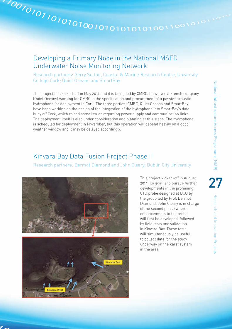
Kinvara Bay Data FusionResearch partners: Dermot Diamond, Dublin City University, Laurence Gill, Trinity College Dublin and Tim McCarthy, National University of Ireland, Maynooth
This collaborative project involves researchers from the groups of Prof. Dermot Diamond (Dublin City University), Prof. Laurence Gill (Trinity College Dublin) and Dr. Tim McCarthy (National University of Ireland, Maynooth). The project focusses on the mapping of submarine freshwater inputs into Kinvara bay from the south Galway karst system, using data
from multiple sources, including fixed point conductivity, temperature and depth (CTD) sensors; mobile boat-mounted CTD sensors with GPS location tracking which allow transects of Kinvara Bay to be performed; and aerial thermal imagery obtained using an unmanned aircraft system (Falcon 8 Octocopter). An initial monitoring exercise was carried out on 11 February 2013, in which data from all three sources was successfully collected. The data is currently being analysed and will provide valuable information on the location and extent of the freshwater inputs into the bay, as well as informing future sensor-based monitoring in the area.
Researchers from DCU (John Cleary and Thomas Phelan) and Trinity College Dublin on board the Smartbay rib at Kinvara, Co. Galway. Researchers from DCU and TCD performed a number of transects of the bay in order to collect time and location-stamped data on conductivity, temperature and depth, while aerial thermal imagery was acquired using NUIM’s Falcon 8 Octocopter.
Res
earc
h an
d In
nova
tion
Pro
ject
sN
atio
nal I
nfra
stru
ctur
e A
cces
s P
rogr
amm
e (N
IAP
)
14
Test of novel diffusive gradients in thin films (DGT) technology for monitoring labile phosphorus in the interface of water/sediments in Galway BayResearch partners: Chaosheng Ahang – National University of Ireland Galway
Diffusive gradients in thin films (DGT) is an emerging technique for bioavailability assessment of chemicals in the environment in waters, sediments and soils. This technique has significant advantages over conventional methods: in situ measurement, time averaged concentrations and high spatial resolution.
The diffusive gradients in thin films (DGT) technology provides a novel approach for the in situ measurement of the labile forms of chemical elements, such as phosphorus (P), sulphur (S), arsenic (As) and metals in waters, sediments and soils. It was invented in Lancaster in 1993. The device uses a hydrogel binding layer impregnated with Chelex resin or other binding agents to accumulate ions. The binding layer is overlain by a diffusive layer of hydrogel and a filter. Ions have to diffuse through the filter and diffusive layer to reach the binding layer. It is the establishment of a constant concentration gradient in the diffusive layer that forms the basis for measuring chemical element concentrations in solutions quantitatively. The effect of temperature can be predicted from the known temperature dependence of the diffusion coefficient.
Compared with conventional methods, DGT has significant advantages:
• In situ measurement
• Time averaged concentrations
• High spatial resolution
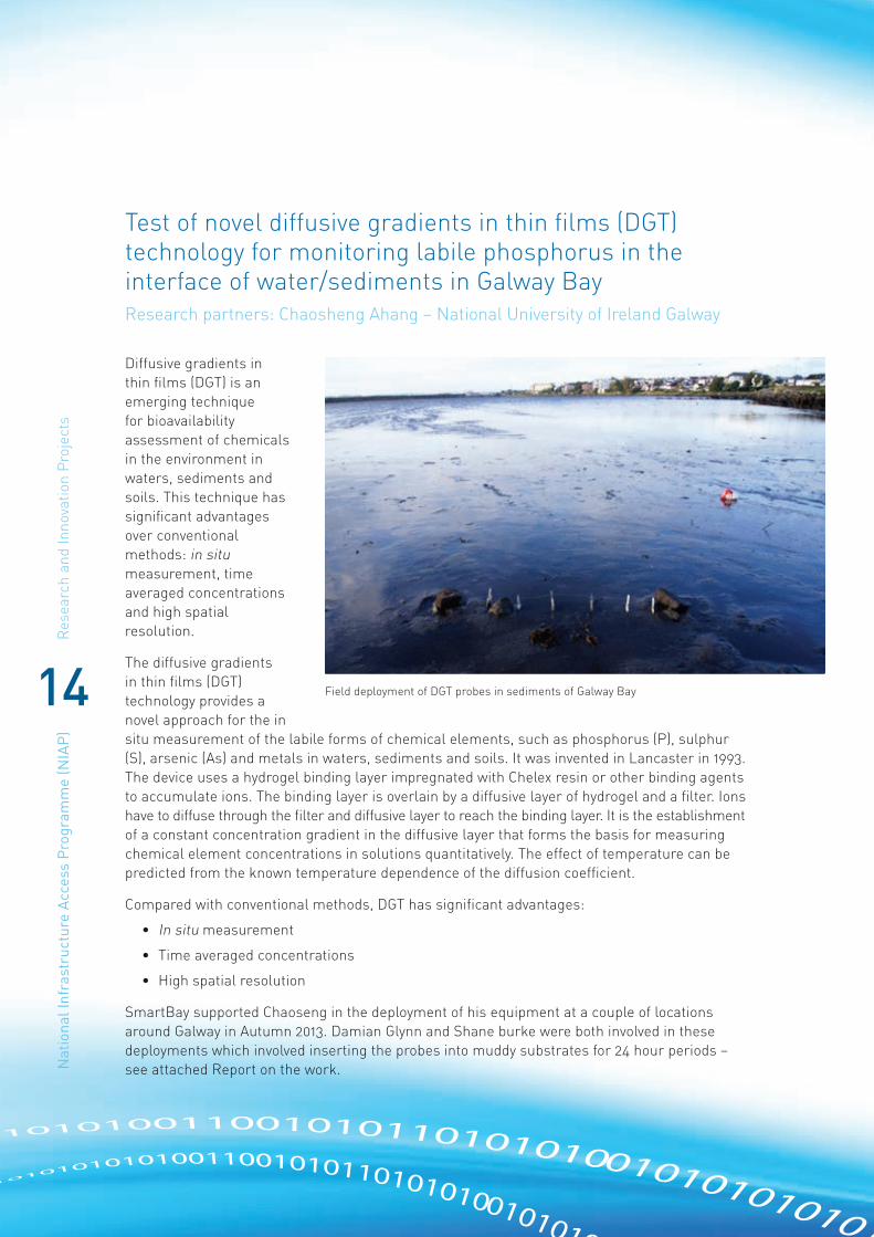
SmartBay supported Chaoseng in the deployment of his equipment at a couple of locations around Galway in Autumn 2013. Damian Glynn and Shane burke were both involved in these deployments which involved inserting the probes into muddy substrates for 24 hour periods – see attached Report on the work.
Field deployment of DGT probes in sediments of Galway Bay

Research and Innovation P
rojectsN
ational Infrastructure Access P
rogramm
e (NIA
P)
15
SmartBay CDOM – a baseline study for optimizing sensor designResearch partners: Peter Croot, National University of Ireland Galway
This project focused on characterizing the optical properties (absorbance and fluorescence) of coloured dissolved organic matter (CDOM) in seawater at the SmartBay buoys and moorings and at other locations in Irish coastal waters and elsewhere. In this work CDOM was measured using a specialized
state of the art instrument, the Horiba Aqualog. At present we have a database of approximately 90 samples from Irish coastal waters, collected during the last year, along with over 700 samples from the Atlantic and Pacific oceans obtained previously. The Irish coastal samples are dominated by humic and/or fulvic fluorescence with some proteins (e.g. tryptophan) also present. The complete data set provides valuable information for the optimal use of optical sensors in the SmartBay array, in particular for the use of specific CDOM or humic sensors or in correcting nitrate sensors (e.g. ISUS) for CDOM absorbance.
Data from Killary harbour shows the relationship between salinity and CDOM fluorescence and absorbance indicating the strong riverine input of CDOM to this fjord. Surface salinities vary according to the tide and to the amount of freshwater input to the fjord.

Res
earc
h an
d In
nova
tion
Pro
ject
sN
atio
nal I
nfra
stru
ctur
e A
cces
s P
rogr
amm
e (N
IAP
)
16
Securing SmartBay via OSNAResearch partners: Michael Schukat, National University of Ireland Galway
The Securing SmartBay (SSB) project will help ensure that gold-plated security mechanisms are integrated into the SmartBay Ireland ICT infrastructure. One of the features of SmartBay is the hugely increased reliance on machine-to-machine communications (M2M).
As SmartBay moves from the ideas-phase to implementation, the security threats surrounding M2M communication have come into focus. This means that the basic security requirements of encryption, authentication, and integrity need to be met, as well as protection against attacks from malware, Denial of Service (DoS) and vulnerability scanning.
At NUI Galway, the OSNA (Open Sensor Network Authentication) project has developed a security architecture, including a customised public key infrastructure to facilitate secure and robust M2M communications, as well as an Intrusion Detection System (IDS) customised for M2M.
The SSB project has met all main deliverables:
• A security framework and management solution optimally designed for the Beaglebone platform as used by SmartBay.
• A modular certification authority (CA) and certificate revocation service optimised for all types of M2M networks.
• An intrusion detection system (IDS) optimised for SmartBay. This can be easily ported to the Beaglebone platform.
A full demo took place on site at NUI,G for Feb 2014.
“We have been more that impressed with all our interactions with the SmartBay Team and look forward to furture collaboration” Hugh Melvin from National University of Ireland Galway.

Research and Innovation P
rojectsN
ational Infrastructure Access P
rogramm
e (NIA
P)
17
Integration of Smart Event Triggered Ocean Monitoring Platform with SmartBayResearch partners: Daniel Toal/Admir Kaknjo, University of Limerick
This project focussed on demonstration deployment and integration of a modular smart event triggered monitoring platform, developed at Mobile & Marine Robotics Research Centre, University of Limerick with SmartBay. The following text describes the overall project: The platform will be equipped with sensors and measuring equipment, as well as communication devices for two way high-speed data exchange. A long endurance modular platform will be deployed with key ultra low power processor and sensors active and substantially the rest of the platform payload systems in sleep/‘off’ mode to preserve battery power.
When the trigger event is detected, the system powers up appropriate sensors for richer dense data sampling including as necessary power-hungry monitoring (e.g. cameras & lights) at the key event horizon. The platform will also be able to serve as a docking platform for mini observation class ROV system (VideoRay), which can be used for inspection and observation of area around the data buoy. Technology, which allows remote interface and control of a mini ROV through a network, has already been developed and tested in laboratory conditions at University of Limerick. This project will provide opportunity to connect the smart event triggered monitoring platform with existing SmartBay infrastructure in Galway Bay and test its performance in real-world conditions.

Res
earc
h an
d In
nova
tion
Pro
ject
sN
atio
nal I
nfra
stru
ctur
e A
cces
s P
rogr
amm
e (N
IAP
)
18
ADCP validation of the Galway Bay High Frequency Radar SystemResearch partners: Stephen Nash, National University of Ireland Galway
The primary aim of this project was validation of the Galway Bay high frequency radar system – CODAR (Coastal Ocean Dynamics Applications Radars) – installed and operated by the Marine Modelling Group of the Ryan Institute for Environmental, Marine and Enerrgy Research, NUI Galway. The system comprises two high frequency radars, installed at Mutton Island and Spiddal Pier (see top figure), which provide live hourly measurements of surface currents in the inner Bay region. The aims of the project were:
• deployment and retrieval of an ADCP in Inner Bay (see Figure 1)
• analysis of ADCP raw data for quality control
• extraction of surface and depth-averaged data
• comparison of ADCP and CODAR currents
The ADCP data has also been extremely useful in allowing further validation of the 3D numerical model of Galway Bay. The lower figure shows a comparison of the x- and y-direction components of surface flows measured by the ADCP and forecast by the model for the same for 24-day period as above (8-31 August, 2013). The high level of agreement between the data confirms the accuracy of the numerical model.
The project has been extremely important as the ADCP data has enabled the first direct validation of the Galway Bay radar system. Validation of the system means that its data can now be used for further research such as development of a forecasting model of the bay.

Research and Innovation P
rojectsN
ational Infrastructure Access P
rogramm
e (NIA
P)
19
Integration of Shimmer Sensing Technology into the Open SmartBay Data PlatformResearch partners: Kieran Daly, Shimmer
This project involved the deployment and integration Shimmer sensing technologies onto the SmartBay platforms and utilisation of the Shimmer programming interfaces to enable users of the SmartBay platform direct access to the data from the shimmer units to investigate marine applications for this data.
The project utilized SmartBay buoys as a test platform to generate large amounts of kinematic data from the shimmer sensors which transmitted back to shore in real-time for analysis. This work was follow on from work started in 2011 which investigated the application of the shimmer units in a test tank in Galway city.
Shimmer is a small wireless sensor platform that can record and transmit physiological and kinematic data in real-time. Designed as a wearable sensor, Shimmer incorporates wireless ECG, EMG, GSR, Accelerometer, Gyro, Mag, GPS, Tilt and Vibration sensors. Shimmer is an extremely extensible platform that enables researchers and industry to be at the leading edge of sensing technology.
Having been originally designed to further research in wearable health sensing, Shimmer has become a highly configurable and flexible sensor platform. It is now widely used by researchers and equipment manufactures to develop new applications and wireless devices in a broad spectrum of specialties.
SmartBay has benefited from allowing users to directly access data feeds from Shimmer Units via the SmartBay data platform – access to the shimmer sensors has encouraged technology developers to use the SmartBay data platform as part of their research.

Res
earc
h an
d In
nova
tion
Pro
ject
sN
atio
nal I
nfra
stru
ctur
e A
cces
s P
rogr
amm
e (N
IAP
)
20
An Interactive 3D Simulation of the Spiddal Wave Energy Test SiteResearch partners: Gavin Duffy, Realsim
The project will deliver a virtual 3D model of the Spiddal Wave Energy test site in Galway Bay. The model combined bathymetry, lidar, ortho photography, graphic design and a powerful interactive visualisation engine in to a multi-purpose simulation suitable for mapping, planning, navigating and promoting the energy test site. The project will utilised existing SmartBay datasets relating to site investigation work carried out at the Spiddal test site in preparation for the deployment of the SmartBay cable. The project also used CAD diagrams, imagery and models of the SmartBay platforms to integrate them into the visualisation programme.
The work from this project helped SmartBay and Realsim to develop innovative projects based on sub-sea visualisation work and provided a useful template to further develop the visualisation of the Spiddal Test as a management tool for site operations which will lead to further opportunities with users of the test site.

Research and Innovation P
rojectsN
ational Infrastructure Access P
rogramm
e (NIA
P)
21
SmartBay Cork Buoy Communications Infrastructure developmentResearch partners: Paul Gaughan, SmartBay Ireland Ltd
A SmartBay Buoy is deployed in Cork Harbour since June 2013. The existing communications solutions on the SmartBay buoy were restrictive in terms of transmission of large volumes of data from the buoy. SeaTech an new Irish SME provided a faster communications solution for the buoy which they installed and ran for 3 months free of charge.
The communications equipment consists of an onmi directional antenna and associated routing hardware. The installation provided the SmartBay platform with increased data transmission capability to the order of 5mb/sec.
The system provider is Seatech were anxious to test their technology on a mobile test platform. The company are part of the IMERC marine cluster in Cork and Cormac Gebruers from IMerc has recommended the technology for SmartBay to trial.
Higher speed communications has allowed the transmission of larger data sets including video and acoustic data from the buoy.
The improved communications infrastructure has improved the data services which can be provided by SmartBay to attract other industry users and also provided an opportunity to showcase the technology of a new Irish SME to help their development in the Marine Communications sector.
The communications infrastructure will be of benefit to all research users of the Cork Buoy platform. Due to the availability of this technology SmartBay has been in a position to facilitate a research project form CMRC on potential acoustic monitoring involving the cork buoy and this communications system.

Res
earc
h an
d In
nova
tion
Pro
ject
sN
atio
nal I
nfra
stru
ctur
e A
cces
s P
rogr
amm
e (N
IAP
)
22
ASIP TestResearch partners: Brian Ward, National University of Ireland Galway
This was a small project to support a field trip in Galway Bay to deploy an Air-Sea Interaction Profiler (ASIP) developed at NUIG. The objective was to test the full operational capability of the instrument.
They also had a new sensor in which they wanted to validate and new students and researchers from which were ready train with regards to the operation of ASIP. The location of the deployment was close to Black Head where they were able to get 40m of water depth. They acquired 26 profiles of the upper 20m of the water column over about 4 hours.
The new sensor mount was tested to determine if this would interfere with the standard profiling procedure. The only issue was that the rise velocity of the profiler was 0.45 m/s, instead of our preferred target of 0.5 m/s. The solution for this would be to remove a little ballast weight, which we will do for future deployments.
There were 5 personnel from the AirSea Laboratory (http://airsea.nuigalway.ie):
• Dr Brian Ward (Director and PI)
• Graig Sutherland (PhD candidate)
• Anneke ten Doeschate (PhD candidate)
• Leonie Esters (PhD candidate)
• Kieran Walesby (Post-doc)
Dr Ward was the developer of the instrument, and both Sutherland and ten Doeschate have deployed ASIP on 4 and 1 occasions, respectively. The other objective for the Galway Bay deployment was to allow the two new researchers (Esters and Walesby) to get some firsthand experience in the deployment of ASIP, as they will be participating in cruises in the Arctic and Southern Ocean next year, and it is critical that they have full capability for operating ASIP.
Plot of fine detail temperature in the upper 20 m of the water column near Black Head, Galway Bay, April 1st 2014

Research and Innovation P
rojectsN
ational Infrastructure Access P
rogramm
e (NIA
P)
23
CPOD monitoring to assess the effect if any of wave energy devices on the presence of harbour porpoiseResearch partners: Joanne O’Brien, Galway-Mayo Institute of Technology
CPOD monitoring to assess the effect if any the effect of wave energy devices on the presence of harbour porpoise.
This project is underway in 2014. It consists in deploying self-contained, self-powered acoustic hydrophones in SmartBay’s buoy at Galway Bay. Two hydrophones were deployed in mid-April and are scheduled for recovery in September. The data from these hydrophones will help to acoustically characterize the wave energy test site and will look for eventual adverse effects of noise there generated on marine mammals.

Res
earc
h an
d In
nova
tion
Pro
ject
sN
atio
nal I
nfra
stru
ctur
e A
cces
s P
rogr
amm
e (N
IAP
)
24
Visualisation and validation of 2-dimensional hydrodynamic model outputs for Galway BayResearch partners: Michael Hartnett, National University of Ireland, Galway
This project aims at integrating the logic used in simulation and gaming engines with the visualization of 2D hydrodynamic model output, using a Geographical Information System context to achieve this objective. The project involves the companies RealSim and Monterey Software, along Prof. Michael Hartnett input with his model of the Galway Bay. An application is sought along the lines of prevention and warning of flooding events in the upper Galway Bay and the city of Galway. The project is due for completion in mid-September.
The top-left figure presents an overview of the data integration process for the 2-dimensional hydrodynamic model outputs.Data Integration Architecture
HF Radar Spiddal Pier

Research and Innovation P
rojectsN
ational Infrastructure Access P
rogramm
e (NIA
P)
25
Real-time Remote Monitoring of Surface Currents and Waves off the Irish West CoastResearch partners: Stephen Nash, National University of Ireland, Galway
The project has kicked-off in 2014 with the installation of a HF Codar unit in Inisheer. SmartBay assisted in the deployment of the unit, and further work will now take place to validate the radar data using a field trip in the South Sound to measure the antenna pattern, and finally the deployment of an ADCP in the South Sound for surface current comparison and validation. The ADCP will be deployed at 50 to 60 m water depth, and special mooring plans had to be devised including a lighted special mark buoy at the surface, for which statutory sanction from CIL has been sought.
NUI Galway Radar System Coverage of Galway Bay
Hourly Surface Current for Galway Bay

Res
earc
h an
d In
nova
tion
Pro
ject
sN
atio
nal I
nfra
stru
ctur
e A
cces
s P
rogr
amm
e (N
IAP
)
26
Deployment and Analysis of Smart Inertial Measurement Units in a Marine EnvironmentResearch partners: Brendan O ‘Flynn, Tyndall National Institute – University College Cork
This project is currently in its final stages with data being gathered in two locations, Galway Bay and Cork. Two WIMU units were prepared and deployed at these two sites using SmartBay’s data buoy platforms as hosts.
A considerable amount of data has already been acquired and made available to Tyndall Institute, which required extensive work regarding the integration of the instruments into the buoy’s internal systems, and the processing and distribution of data. Preliminary data comparison exercises between the WIMU and the permanent sea and swell sensor in the buoys have shown very good agreement between the two, validating the measurements obtained with the novel sensor. The WIMU in Galway will be used in Q4 2014 in tandem with load cell measurements from the TFI moorings.
Current wireless inertial measurement system (not marine ready)
Research and Innovation P
rojectsN
ational Infrastructure Access P
rogramm
e (NIA
P)
27
Developing a Primary Node in the National MSFD Underwater Noise Monitoring NetworkResearch partners: Gerry Sutton, Coastal & Marine Research Centre, University College Cork; Quiet Oceans and SmartBay
This project has kicked-off in May 2014 and it is being led by CMRC. It involves a French company (Quiet Oceans) working for CMRC in the specification and procurement of a passive acoustic hydrophone for deployment in Cork. The three parties (CMRC, Quiet Oceans and SmartBay) have been working on the design of the integration of the hydrophone into SmartBay’s data buoy off Cork, which raised some issues regarding power supply and communication links. The deployment itself is also under consideration and planning at this stage. The hydrophone is scheduled for deployment in November, but this operation will depend heavily on a good weather window and it may be delayed accordingly.
Kinvara Bay Data Fusion Project Phase IIResearch partners: Dermot Diamond and John Cleary, Dublin City University
This project kicked-off in August 2014. Its goal is to pursue further developments in the promising CTD probe designed at DCU by the group led by Prof. Dermot Diamond. John Cleary is in charge of the second phase where enhancements to the probe will first be developed, followed by field tests and validation in Kinvara Bay. These tests will simultaneously be useful to collect data for the study underway on the karst system in the area.

Res
earc
h an
d In
nova
tion
Pro
ject
sN
atio
nal I
nfra
stru
ctur
e A
cces
s P
rogr
amm
e (N
IAP
)
28
Contact Details
Prof. Fiona Regan NIAP Co-ordinator Director, Marine and Environmental Sensing Technology Hub (MESTECH) Dublin City University, Glasnevin, Dublin 9
[email protected] + 353 1 7005765 www.smartbay.ie
Joan Kelly SmartBay Administration Dublin City University, Glasnevin, Dublin 9
[email protected] +353 7007856

Investing in your future
An Roinn Post, Fiontar agus NuálaíochtaDepartment of Jobs, Enterprise and Innovation
SmartBay Ireland is funded under the Programme for Research in Third-Level Institutions (PRTLI) Cycle 5 with collaborating partners including: