nr 322: gps and gis jim graham spring 2010 gps manuals
Post on 22-Dec-2015
215 views
TRANSCRIPT

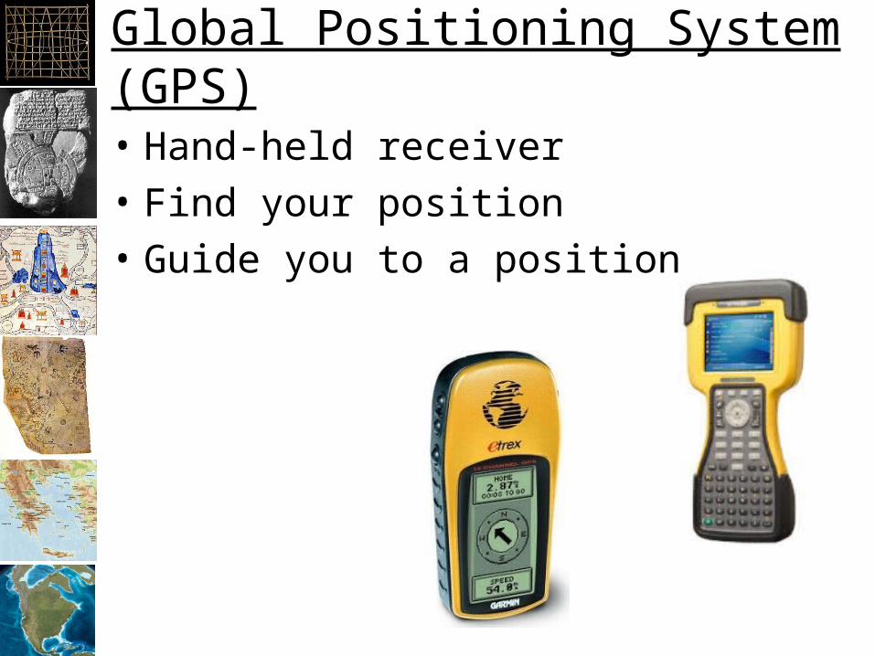
Global Positioning System (GPS)
• Hand-held receiver
• Find your position
• Guide you to a position

Inexpensive
• Bring extra batteries!
• Works inside a plastic bag
Garmin

Natural Resource GPS
• More rugged
• Longer battery life
• More accurate
Trimble

GPS Network
• Utilizes a network of 24 satellites that transmit precise microwave signals
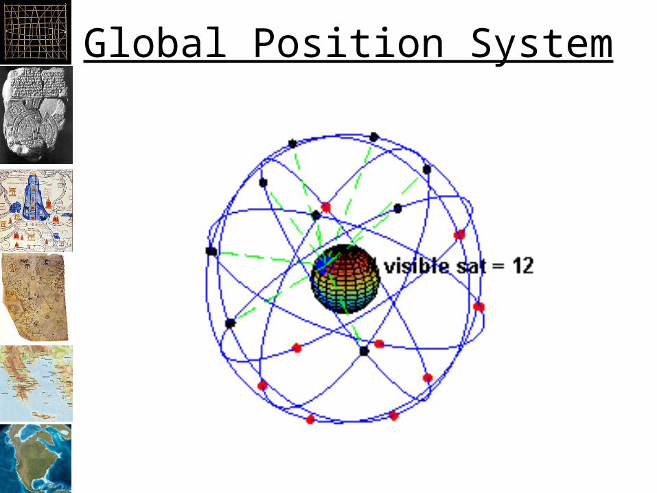
Global Position System

Every point on circle is a possible receiver location
Satellite 1 Location
Receiver Location?
Receiver Location
How do GPS units work?

Satellite 1 Location Satellite 2 Location?
?
How do GPS units work?

Satellite 1 Location Satellite 2 Location
Satellite 3 Location
Known Receiver Location
How do GPS units work?

Accuracy
• Standard GPS1
– Theoretical Limit: 30 centimeters– Typical: 15 meters (45 feet)
• Differential GPS2
– Predicted: 0.67 m per 100 km– Measured: 0.22 m per 100 km
2. http://en.wikipedia.org/wiki/Global_Positioning_System
1. Statement by the President regarding the United States' Decision to Stop Degrading Global Positioning System Accuracy". Office of Science and Technology Policy (May 1, 2000). Retrieved on 2007-12-17.

GPS Use
• Power
• Page
• Up
• Down
• Enter
• Find
Up
Down
Enter
Page
Power
Up
Down
Find
Page
Power
Thumb Stick
LCD Display
LCD Display
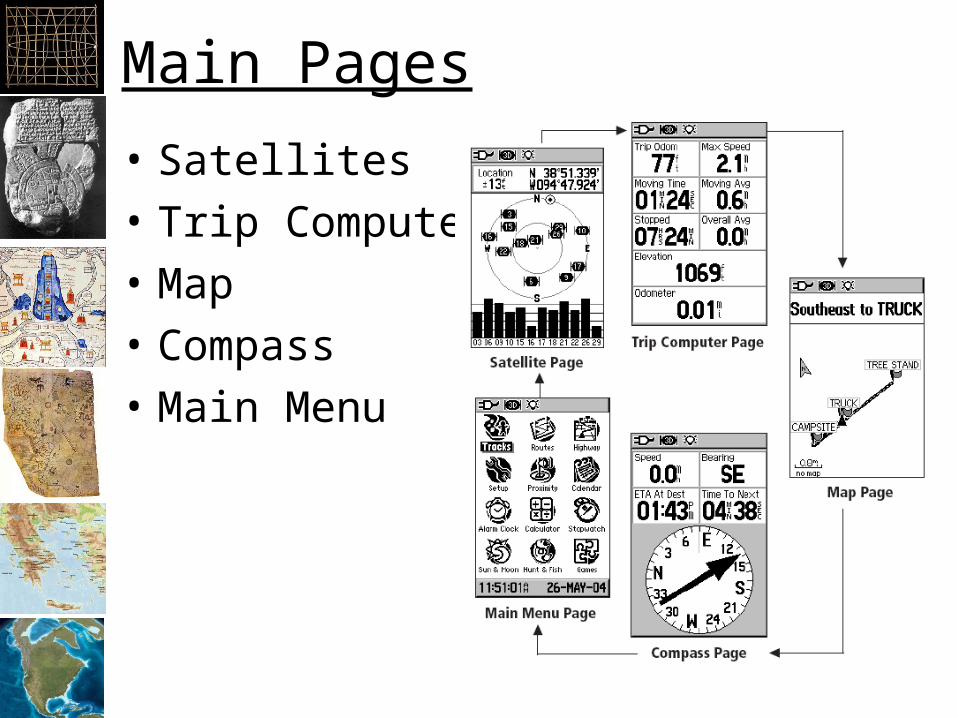
Main Pages
• Satellites
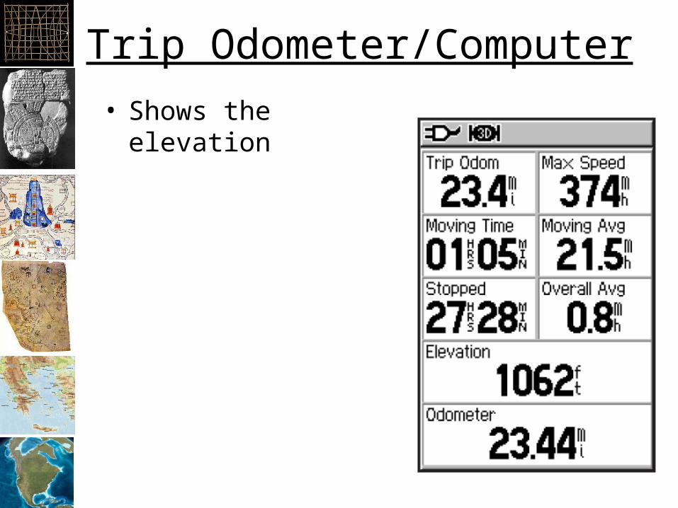
• Trip Computer
• Map
• Compass
• Main Menu

Menu
• Mark = Point
• Waypoint = Point
• Route = Polyline
• Track = Polyline
• Setup


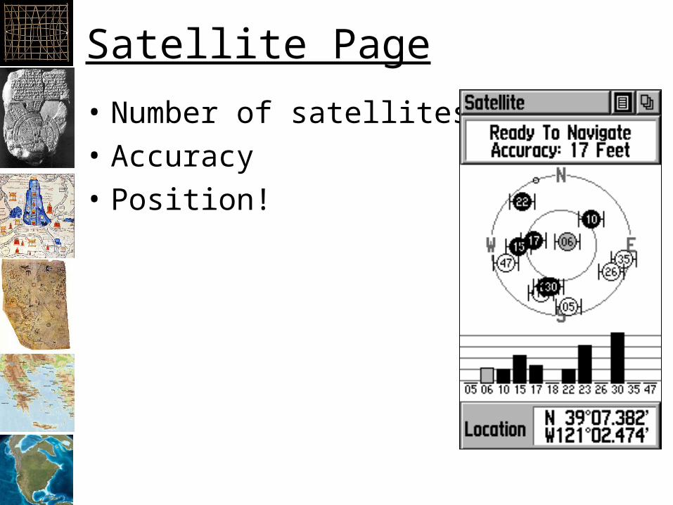
Satellite Page
• Number of satellites
• Accuracy
• Position!


GPS with GIS
• Digitize with:– Way points: points– Tracks: polyline– Route: polyline
• Way Points:– Tree locations– Wildlife sign– Campsites
• Tracks:– Record where you’ve
been– Trails– Animal tracks– Streams
• Routes:– Create a route to
follow– Same as tracks?

DNRGarmin
• Free software from Minnesota Department of Natural Resources– Trimble’s solution is different!
• Standalone or plug-in
• Need special serial cable– https://my.garmin.com/shop/shop.do?pID=6
54– Search for “garmin gps serial cable”

Downloading data
• Install DNR Garmin
• Connect Serial cable to the computer
• Connect serial cable to the connector behind the rubber flap on the top of the back of the GPS (some have small USB connectors now)
• Turn on the GPS!
• Open DNR Garmin


Troubleshooting
• GPS:– DNR Garmin GPS Menu
• Computer:– Control Panels -> Admin Tools -> Computer
Management -> Device Manager -> Ports -> Communications Port -> Properties -> Port Settings
• Make sure Baud rates match – 9800 is Garmin default
• Make sure ports match– Should be Port 1 for serial
Easy GPS
• Tiny, easy to use GIS package
• Free
• EasyGPS.com
• Garmin, Magellan or Lowrance GPS
• Exports to “GPX” format