permitted clearing of native vegetation biodiversity ... · permitted clearing of native vegetation...
TRANSCRIPT
Permitted clearing of native vegetation
Biodiversity assessment guidelines
September 2013
Published by the Victorian Government Department of Environment and Primary Industries Melbourne, September 2013
© The State of Victoria Department of Environment and Primary Industries 2013
This publication is copyright. No part may be reproduced by any process except in accordance with the provisions of the Copyright Act 1968.
Authorised by the Victorian Government, 8 Nicholson Street, East Melbourne
ISBN 978-1-74287-947-5 (Print) ISBN 978-1-74287-981-9 (Pdf)
For more information contact the DEPI Customer Service Centre 136 186
Disclaimer
This publication may be of assistance to you but the State of Victoria and its employees do not guarantee that the publication is without flaw of any kind or is wholly appropriate for your particular purposes and therefore disclaims all liability for any error, loss or other consequence which may arise from you relying on any information in this publication.
Accessibility If you would like to receive this publication in an accessible format, such as large print or audio, please telephone 136 186, or email [email protected]
Deaf, hearing impaired or speech impaired? Call us via the National Relay Service on 133 677 or visit www.relayservice.com.au
This document is also available in PDF format on the internet at www.depi.vic.gov.au/nativevegetation
Cover image: Grassy woodland, northeast Victoria
Permitted clearing of native vegetation Biodiversity assessment guidelines 1
1. Introduction 2
1.1 Purpose of this document 2
1.2 How the planning system applies to the consideration of Victoria’s biodiversity and native vegetation 2
1.3 Scope of these Guidelines 3
1.4 Contents and use of these Guidelines 4
1.5 Future development of these Guidelines 4
2. Biodiversity objectives for permitted clearing of native vegetation 5
2.1 How the objective for permitted clearing of native vegetation is achieved 5
2.2 Native vegetation 5
2.3 No net loss 6
2.4 Contribution made by native vegetation to Victoria’s biodiversity 6
3. Biodiversity information tools 7
3.1 Introduction 7
3.2 Site-based information 8
3.3 Landscape scale information 8
4. Biodiversity risk and the permitted clearing of native vegetation regulations 10
5. Requirement for a permit to remove native vegetation 11
6. Risk-based pathways for applications to remove native vegetation 12
6.1 Risk-based pathways for assessing applications to remove native vegetation 12
6.2 Determining the risk-based pathway of an application 12
7. Application requirements 14
7.1 Requirements for all applications for a permit to remove native vegetation 14
7.2 Low risk-based pathway applications 15
7.3 Additional requirements for moderate and high risk-based pathways applications 15
8. Decision guidelines 16
8.1 Application of the decision guidelines 16
8.2 Low risk-based pathway applications 16
8.3 Moderate risk-based pathway applications 16
8.4 High risk-based pathway applications 17
9. Native vegetation offset requirements 18
9.1 Introduction 18
9.2 When a native vegetation offset is required 18
9.3 Measuring the loss from removing native vegetation and the gain from offset sites 18
9.4 Offset requirements for removing native vegetation 19
9.5 Native vegetation offsets 23
9.6 Alternative permitting and offset arrangements 24
Glossary 26
Contents
2 Permitted clearing of native vegetation Biodiversity assessment guidelines
1. Introduction
1.1 Purpose of this documentThe Permitted clearing of native vegetation – Biodiversity assessment guidelines (the Guidelines) are incorporated into the Victoria Planning Provisions and all planning schemes in Victoria. These Guidelines replace Victoria’s Native Vegetation – A Framework for Action.
The purpose of these Guidelines is to guide how impacts on biodiversity should be considered when assessing an application for a permit to remove, lop or destroy native vegetation. For the purpose of these Guidelines the term ‘remove native vegetation’ includes to lop or destroy native vegetation.
These Guidelines, and the biodiversity information tools they reference, can also be used to guide decision making about the biodiversity impacts of removing native vegetation that must be assessed but that do not require a permit for the purposes of the Planning and Environment Act 1987. This may include assessment of activities that are exempt from requiring a permit to remove native vegetation in planning schemes because they are considered under alternative approval processes.
1.2 How the planning system applies to the consideration of Victoria’s biodiversity and native vegetation
The planning system has two key tools for managing native vegetation for biodiversity outcomes:
• strategic planning which protects and conserves native vegetation that makes a significant contribution to biodiversity
• site-based decision making about whether to grant a permit to remove native vegetation on the basis of biodiversity impacts.
Strategic planning is the most effective tool for identifying potential adverse impacts on biodiversity of new uses and developments and for ensuring adverse impacts are avoided and/or minimised. The site-based permit process for removing native vegetation complements strategic planning. It provides incentives for, and applies rules about:
• avoiding and minimising adverse impacts on biodiversity from removing native vegetation
• offsetting any adverse impact that does occur.
The state planning policy is set out in the State Planning Policy Framework (SPPF). In relation to biodiversity, the SPPF’s purpose is to:
• ensure that biodiversity is considered in strategic planning processes and that potential impacts from uses and developments on biodiversity are identified and appropriately managed. Strategic planning can include the use of zones and overlays to protect and conserve biodiversity
• outline the approach for assessing applications for permits to remove native vegetation.
1
Permitted clearing of native vegetation Biodiversity assessment guidelines 3
The biodiversity impacts from the removal of native vegetation are considered principally through the following provisions within all Victorian planning schemes:
• Clause 52.16 Native Vegetation Precinct Plan
• Clause 52.17 Native Vegetation.
These Guidelines constitute an incorporated document for the purpose of Clause 81.01 of the Victoria Planning Provisions.
1.3 Scope of these GuidelinesThese Guidelines set out the rules and tools for how responsible or referral authorities should consider biodiversity when assessing an application for a permit to remove native vegetation.
Compliance with these Guidelines alone does not ensure the meeting of all relevant planning scheme requirements regarding removing native vegetation.
When assessing a permit to remove native vegetation, these Guidelines must be read by the responsible authority in conjunction with other relevant parts of the planning scheme, including:
• the native vegetation particular provisions
• land use and development policies that relate to native vegetation and biodiversity in the State and Local Planning Policy Framework
• the purpose of relevant zones, overlays or other local controls for removing native vegetation, and their decision guidelines.
In addition to biodiversity outcomes, planning schemes contain non-biodiversity objectives for managing native vegetation, including:
• managing bushfire risk
• preserving landscape values
• minimising land and water degradation
• Aboriginal cultural heritage
• timber harvesting.
Native grassland, northern Victoria
4 Permitted clearing of native vegetation Biodiversity assessment guidelines
These Guidelines address only the biodiversity objective for managing native vegetation. These Guidelines do not interfere with achieving non-biodiversity objectives for native vegetation management, provided that the ‘no net loss’ biodiversity objective is achieved (section 2.3).
The Department of Environment and Primary Industries (DEPI) is the referral authority under Clause 66.02-2 Native vegetation. If an application for a permit to remove native vegetation is referred to DEPI for consideration under this clause, DEPI will consider the application only in relation to statewide biodiversity impacts, in accordance with these Guidelines. DEPI will not consider non-biodiversity objectives for native vegetation management. The responsible authority considers these applications in relation to non-biodiversity objectives.
If vegetation does not meet the definition of native vegetation in section 2.2 of these Guidelines the biodiversity considerations in Clause 52.17 and these Guidelines are not required to be applied. An application for a permit to remove vegetation that does not meet the definition of native vegetation in section 2.2 should not be objected to on the basis of the biodiversity considerations in Clause 52.17, and an offset it not required.
1.4 Contents and use of these GuidelinesThese Guidelines provide background information and explain the tools that are used to prepare and assess an application for a permit to remove native vegetation in relation to biodiversity considerations:
• Section 2 explains the biodiversity objective for the native vegetation permitted clearing regulations
• Section 3 explains the biodiversity information tools that are to be used when assessing the biodiversity impacts of an application for a permit to remove native vegetation, and determining permit conditions
• Section 4 defines how risk is considered in the native vegetation permitted clearing regulations.
Sections 5 to 9 provide guidance for preparing and assessing an application for a permit to remove native vegetation. These sections are summarised in Table 1.
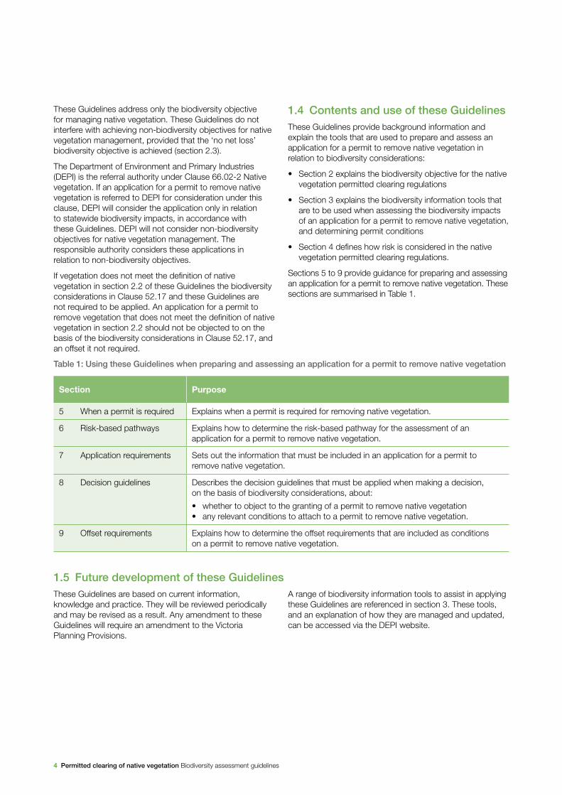
Table 1: Using these Guidelines when preparing and assessing an application for a permit to remove native vegetation
Section Purpose
5 When a permit is required Explains when a permit is required for removing native vegetation.
6 Risk-based pathways Explains how to determine the risk-based pathway for the assessment of an application for a permit to remove native vegetation.
7 Application requirements Sets out the information that must be included in an application for a permit to remove native vegetation.
8 Decision guidelines Describes the decision guidelines that must be applied when making a decision, on the basis of biodiversity considerations, about:
• whether to object to the granting of a permit to remove native vegetation• any relevant conditions to attach to a permit to remove native vegetation.
9 Offset requirements Explains how to determine the offset requirements that are included as conditions on a permit to remove native vegetation.
1.5 Future development of these GuidelinesThese Guidelines are based on current information, knowledge and practice. They will be reviewed periodically and may be revised as a result. Any amendment to these Guidelines will require an amendment to the Victoria Planning Provisions.
A range of biodiversity information tools to assist in applying these Guidelines are referenced in section 3. These tools, and an explanation of how they are managed and updated, can be accessed via the DEPI website.
Permitted clearing of native vegetation Biodiversity assessment guidelines 5
The biodiversity benefits delivered by native vegetation are central to the continued functioning of ecosystems. For this reason, maintaining biodiversity is a primary consideration underpinning decisions about whether to permit the removal of native vegetation.
The objective for permitted clearing of native vegetation in Victoria is:
No net loss in the contribution made by native vegetation to Victoria’s biodiversity.
This section explains this objective and how it is to be achieved.
2.1 How the objective for permitted clearing of native vegetation is achieved
The planning system manages the impacts on biodiversity from native vegetation removal using a risk-based approach. Strategic planning plays a primary role in avoiding and minimising the impacts of uses and developments on native vegetation that makes a significant contribution to biodiversity. The permit and offsetting system complements strategic planning by providing incentives and setting rules so that the removal of native vegetation is avoided and minimised at the site level.
The key strategies for ensuring the objective for permitted clearing of native vegetation is achieved at the permit level are:
• avoiding the removal of native vegetation that makes a significant contribution to Victoria’s biodiversity
• minimising impacts on Victoria’s biodiversity from the removal of native vegetation
• where native vegetation is permitted to be removed, ensuring it is offset in a manner that makes a contribution to Victoria’s biodiversity that is equivalent to the contribution made by the native vegetation to be removed.
Further explanation of how the objective is defined and achieved is set out below.
2.2 Native vegetationNative vegetation is defined in the Victoria Planning Provisions as ‘plants that are indigenous to Victoria, including trees, shrubs, herbs and grasses’.1
For the purpose of these Guidelines, native vegetation is defined by two categories; remnant patches and scattered trees, as outlined below.
Remnant patch
A remnant patch of native vegetation is either:
• an area of vegetation where at least 25 per cent of the total perennial understory plant cover is native
• any area with three or more native canopy trees2 where the canopy foliage cover3 is at least 20 per cent of the area.
Scattered tree
A scattered tree is:
• a native canopy tree that does not form part of a remnant patch.
1 Victoria Planning Provision – Definitions – Clause 72
2 A canopy tree is a mature tree that is greater than 3 meters in height and is normally found in the upper layer of the relevant vegetation type.
3 Foliage cover is the proportion of the ground that is shaded by vegetation foliage when lit from directly above.
22. Biodiversity objectives for permitted clearing
of native vegetation
6 Permitted clearing of native vegetation Biodiversity assessment guidelines
2.3 No net lossThe objective for the permitted clearing of native vegetation is that it results in no net loss. This means permitted clearing has a neutral impact on Victoria’s biodiversity.
In part this is achieved by either avoiding or minimising native vegetation removal, so that all or some of the removal of native vegetation does not occur. The permit and offsetting system is designed to achieve this by:
• creating incentives for landholders to make plans and decisions that avoid and minimise the removal of native vegetation
• setting rules that:
– require minimising impacts on biodiversity from native vegetation removal for proposals that are assessed under the moderate and high risk-based pathways
– do not permit, and therefore avoid, the removal of native vegetation that makes a significant contribution to biodiversity.
When native vegetation removal is permitted, an offset must be secured which achieves a no net loss outcome for biodiversity. To achieve this the offset makes a contribution to Victoria’s biodiversity that is equivalent to the contribution made by the native vegetation that was removed. The type and amount of offset required depends on the native vegetation being removed and the contribution it makes to Victoria’s biodiversity.
Section 2.4 describes the factors that determine the contribution made by native vegetation to Victoria’s biodiversity. Section 9 sets out the rules that ensure an offset provides gains that are equivalent to the loss in the contribution that native vegetation makes to Victoria’s biodiversity following the removal of native vegetation.
2.4 Contribution made by native vegetation to Victoria’s biodiversity
Biodiversity is defined as the variety of all life forms, the different plants, animals and microorganisms, the genes they contain and support, and the ecosystems of which they form a part.
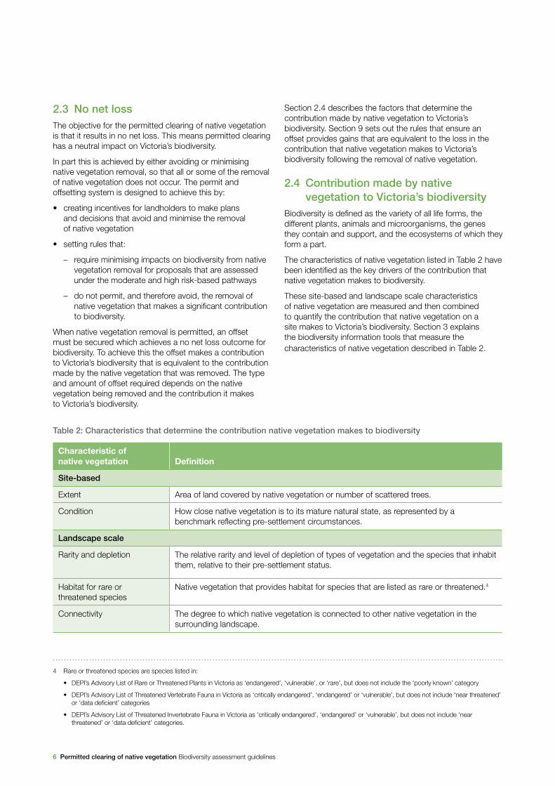
The characteristics of native vegetation listed in Table 2 have been identified as the key drivers of the contribution that native vegetation makes to biodiversity.
These site-based and landscape scale characteristics of native vegetation are measured and then combined to quantify the contribution that native vegetation on a site makes to Victoria’s biodiversity. Section 3 explains the biodiversity information tools that measure the characteristics of native vegetation described in Table 2.
Table 2: Characteristics that determine the contribution native vegetation makes to biodiversity
Characteristic of native vegetation Definition
Site-based
Extent Area of land covered by native vegetation or number of scattered trees.
Condition How close native vegetation is to its mature natural state, as represented by a benchmark reflecting pre-settlement circumstances.
Landscape scale
Rarity and depletion The relative rarity and level of depletion of types of vegetation and the species that inhabit them, relative to their pre-settlement status.
Habitat for rare or threatened species
Native vegetation that provides habitat for species that are listed as rare or threatened.4
Connectivity The degree to which native vegetation is connected to other native vegetation in the surrounding landscape.
4
4 Rare or threatened species are species listed in:
• DEPI’s Advisory List of Rare or Threatened Plants in Victoria as ‘endangered’, ‘vulnerable’, or ‘rare’, but does not include the ‘poorly known’ category
• DEPI’s Advisory List of Threatened Vertebrate Fauna in Victoria as ‘critically endangered’, ‘endangered’ or ‘vulnerable’, but does not include ‘near threatened’ or ‘data deficient’ categories
• DEPI’s Advisory List of Threatened Invertebrate Fauna in Victoria as ‘critically endangered’, ‘endangered’ or ‘vulnerable’, but does not include ‘near threatened’ or ‘data deficient’ categories.
Permitted clearing of native vegetation Biodiversity assessment guidelines 7
3.1 IntroductionA range of biodiversity information tools is required to measure the contribution that native vegetation makes to biodiversity. When considering an application to remove native vegetation, these tools are used to determine:
• the level of biodiversity risk associated with the proposal to remove native vegetation
• the information required before an application for a permit to remove native vegetation can be assessed
• if the no net loss objective can be achieved if the proposed native vegetation removal is permitted
• the type, amount and attributes of the offset that is required in order to achieve the no net loss objective, if the native vegetation removal is permitted.
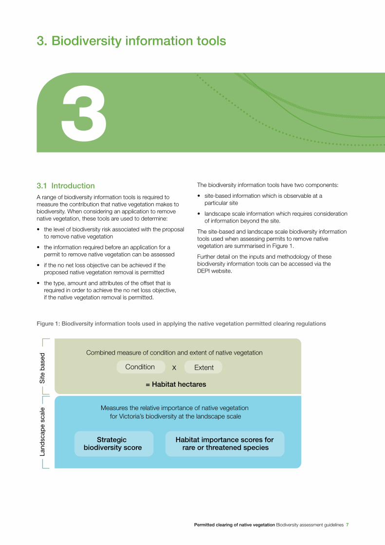
The biodiversity information tools have two components:
• site-based information which is observable at a particular site
• landscape scale information which requires consideration of information beyond the site.
The site-based and landscape scale biodiversity information tools used when assessing permits to remove native vegetation are summarised in Figure 1.
Further detail on the inputs and methodology of these biodiversity information tools can be accessed via the DEPI website.
33. Biodiversity information tools
Figure 1: Biodiversity information tools used in applying the native vegetation permitted clearing regulations
Site
bas
ed
Combined measure of condition and extent of native vegetation
= Habitat hectares
Land
scap
e sc
ale
Habitat importance scores for rare or threatened species
Strategic biodiversity score
Condition Extentx
Measures the relative importance of native vegetation for Victoria’s biodiversity at the landscape scale

8 Permitted clearing of native vegetation Biodiversity assessment guidelines
3.2 Site-based information
3.2.1 Extent
The extent of native vegetation is the area of land covered by native vegetation. Extent also describes the number of scattered trees. Scattered trees are mature native canopy trees that are in a location with little or no native understorey. Extent can be observed and measured at a site. It is also mapped at the landscape scale to show locations where native vegetation is likely to occur.
Extent of a proposal to remove native vegetation is used to determine the risk-based pathway of an application (see section 6) for a permit to remove native vegetation. Extent is also an input to calculating the habitat hectares amount of native vegetation (see section 3.2.3).
3.2.2 Condition
The condition of native vegetation is a site-based measure of how close the native vegetation is to its mature natural state, as represented by a benchmark reflecting pre-settlement circumstances. Most native vegetation in Victoria has been subject to some disturbances (such as historical land use, grazing or weed and pest animal invasion) and subsequently has declined in condition.
In Victoria, the condition of native vegetation is measured at a site using the habitat hectare assessment method. Condition scores are also modelled across the landscape based on survey data and environmental variables. These scores have been mapped across Victoria and can be found in the Native vegetation condition map included in the Native Vegetation Information Management system, found on the DEPI website.
3.2.3 Habitat hectare
Habitat hectare is a site-based measure that combines extent and condition of native vegetation. The current condition of native vegetation is assessed against a benchmark for its Ecological Vegetation Class (EVC). EVCs are classifications of native vegetation types. The benchmark for an EVC describes the attributes of the vegetation type in its mature natural state, which reflects the pre-settlement circumstances. The condition score of native vegetation at a site can be determined through undertaking a habitat hectare assessment.
The habitat hectares of native vegetation is calculated by multiplying the current condition of the vegetation (condition score) by the extent of native vegetation.
habitat hectares = condition score × extent
For practicality, a standard extent amount has been developed for scattered trees, based on the habitat hectare assessment method.
When assessing an application for a permit to remove native vegetation habitat hectares is used:
• to measure the loss in native vegetation condition and extent from removing native vegetation
• to measure the gain in native vegetation condition and extent due to management and security commitments at an offset site
• as an input into the measures of strategic biodiversity value set out in section 3.3.
The Habitat hectare manual details the method for assessing native vegetation at a site in order to calculate losses and gains in habitat hectares.
3.3 Landscape scale informationMeasures of strategic biodiversity value operate at the landscape scale and quantify the relative value of different locations based on characteristics of the site in the context of all other locations across Victoria. When considering the biodiversity impact of removing native vegetation at the landscape scale, the following information tools are used:
• strategic biodiversity score
• habitat importance score for rare or threatened species habitat.
The strategic biodiversity score and habitat importance score are used to measure the contribution that native vegetation makes to Victoria’s biodiversity at the landscape scale. These, combined with site-based habitat hectares amounts, measure the losses that occur due to the removal of native vegetation, and the gains that can be generated at offset sites. The scores are also used to determine the offset requirements if native vegetation removal is permitted (see section 9).

Permitted clearing of native vegetation Biodiversity assessment guidelines 9
3.3.1 Strategic biodiversity score
The strategic biodiversity score of native vegetation at a site is a measure of the site’s importance for Victoria’s biodiversity, relative to other locations across the landscape.
The score is derived using a spatial prioritisation tool that ranks locations in Victoria for their conservation priority on the basis of rarity and level of depletion of the types of vegetation, species habitats, and condition and connectivity of native vegetation. All native vegetation in Victoria has a strategic biodiversity score. Strategic biodiversity scores are mapped in the Strategic biodiversity map. This map is included in the Native Vegetation Information Management system, found on the DEPI website.
3.3.2 Habitat importance score
The habitat importance score is a measure of the importance of a location in the landscape as habitat for a particular rare or threatened species in relation to other suitable habitat for that species. Only native vegetation that is habitat for rare or threatened species has habitat importance scores. If native vegetation is habitat for multiple rare or threatened species it will have habitat importance scores for each species. The Habitat importance map for a rare or threatened species shows the habitat importance scores across its habitat.
The habitat importance score is used to apply the decision guidelines and to determine the offset requirements for permits to remove native vegetation that are assessed in the moderate and high risk-based pathways.
Habitats for rare or threatened species are divided into two groups depending on their area of occupancy: dispersed habitat, or highly localised habitat. The habitat importance score is calculated differently for each of these groups.
Highly localised habitats for rare or threatened species
Highly localised habitats for rare or threatened species are very limited in extent and typically are highly restricted geographically. Highly localised habitats can also be a specific part of a wider-ranging rare or threatened species habitat that is very limited in extent. For example, some species have breeding or roosting colonies that are highly localised habitats. One instance of native vegetation removal in a highly localised habitat could result in a significant biodiversity impact.
All locations within a highly localised habitat for a particular species are considered equally important for that species, so the habitat importance scores of these locations are not ranked.
Dispersed rare or threatened species habitats
Dispersed habitats for rare or threatened species are less limited in extent and less restricted than highly localised habitats. Dispersed habitats often arise where originally widespread habitats have become significantly depleted and fragmented. Habitat for a particular dispersed rare or threatened species is ranked by combining how likely a location is to be habitat for the species, and how connected the location is to other native vegetation. This ranking forms the habitat importance score.
Open mallee, northwest Victoria
10 Permitted clearing of native vegetation Biodiversity assessment guidelines
The native vegetation permitted clearing regulations are designed to manage the risk to biodiversity associated with removing native vegetation. Two factors – extent risk and location risk – are used to determine the risk associated with an application for a permit to remove native vegetation.
Extent risk is determined by the extent of native vegetation that it is proposed to be removed. All other things being equal, the level of risk to biodiversity from the removal of native vegetation increases as the extent of native vegetation to be removed increases.
Location risk is determined by assessing the likelihood that removing a small amount of native vegetation in a location will have an impact on the persistence of a rare or threatened species. Location risk is determined for all areas in the landscape, independent of any particular proposal.
The combination of the two types of risk is used to determine the risk-based pathway for assessing a permit to remove native vegetation. See section 6.
The risk-based pathways determine the process for how a permit application is assessed, including the application requirements and the how the decision guidelines are applied.
4. Biodiversity risk and the permitted clearing of native vegetation regulations
4
Permitted clearing of native vegetation Biodiversity assessment guidelines 11
A permit to remove native vegetation under Clause 52.16 or 52.17 of the Victoria Planning Provisions is required unless:
• the relevant clause states that a permit to remove native vegetation is not required
• an exemption from requiring a permit to remove native vegetation exists under the relevant clause
• the right to remove the native vegetation is provided for in legislation.
If a permit is required to remove native vegetation in these instances, and the vegetation is native as per the definition in section 2.2, then the assessment process set out in sections 6 to 9 of these Guidelines is used.
5. Requirement for a permit to remove native vegetation
5
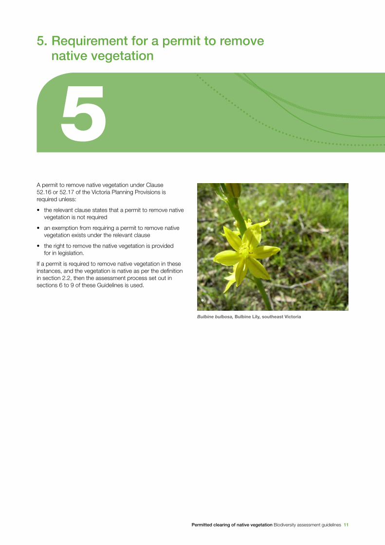
Bulbine bulbosa, Bulbine Lily, southeast Victoria
12 Permitted clearing of native vegetation Biodiversity assessment guidelines
6.1 Risk-based pathways for assessing applications to remove native vegetationThere are three risk-based pathways for assessing an application for a permit to remove native vegetation:
• low risk
• moderate risk
• high risk.
These pathways determine:
• the information that must be provided with an application for a permit to remove native vegetation
• the decision guidelines applied when assessing the application.
6.2 Determining the risk-based pathway of an application
To determine the risk-based pathway, the following risks are considered in relation to the native vegetation proposed to be removed:
• the extent risk
• the location risk.
6.2.1 Extent risk
Extent risk is determined based on the extent of native vegetation proposed to be removed. Extent risk is determined with reference to:
• the area (in hectares) of any remnant patches of native vegetation
• the number of any scattered trees.
If the native vegetation to be removed includes both scattered trees and remnant patch(es) a standard area is assigned to the scattered trees. The area of scattered trees is then added to the area of remnant patch(es) to calculate the total extent.
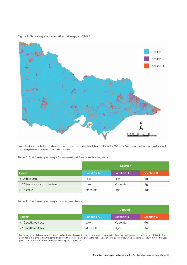
6.2.2 Location risk
Location risk has been determined for all locations in Victoria. The location risk of a particular site is determined by using the Native vegetation location risk map available in the Native Vegetation Information Management system, found on the DEPI website. Native vegetation will be in location A, location B or location C on the Native vegetation location risk map. An example of the map is at Figure 1. The current version of the map must be used when determining the risk-based pathways.
6.2.3 Determining the risk-based pathway
The risk-based pathway is determined by combining the extent risk and the location risk of the native vegetation proposed to be removed, in accordance with Table 3 for remnant patches and Table 4 for scattered trees.
66. Risk-based pathways for applications to
remove native vegetation
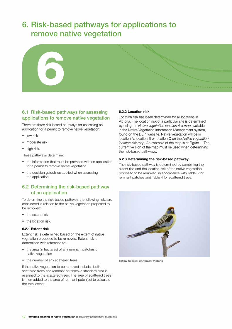
Yellow Rosella, northwest Victoria
Permitted clearing of native vegetation Biodiversity assessment guidelines 13
Figure 2: Native vegetation location risk map, v1.0 2013
Notes: This figure is an illustration only and cannot be used to determine the risk-based pathway. The Native vegetation location risk map used to determine the
risk-based pathways is available on the DEPI’s website.
Table 3: Risk-based pathways for remnant patches of native vegetation
Location
Extent* Location A Location B Location C
< 0.5 hectares Low Low High
≥ 0.5 hectares and < 1 hectare Low Moderate High
≥ 1 hectare Moderate High High
Table 4: Risk-based pathways for scattered trees
Location
Extent* Location A Location B Location C
< 15 scattered trees Low Moderate High
≥ 15 scattered trees Moderate High High
* For the purpose of determining the risk-based pathway of an application to remove native vegetation the extent includes any other native vegetation that was permitted to be removed on the same property with the same ownership as the native vegetation to be removed, where the removal occurred in the five year period before an application to remove native vegetation is lodged.
Location A
Location B
Location C

14 Permitted clearing of native vegetation Biodiversity assessment guidelines
7.1 Requirements for all applications for a permit to remove native vegetation
The information that must be provided when applying for a permit to remove native vegetation depends on the risk-based pathway of the application: low, moderate or high (as defined in section 6).
All permit applications must include the information set out in Table 5 below as appropriate.
Table 5: Application requirements for all applications for a permit to remove native vegetation
Number Application requirements
1. The location of the site of native vegetation to be removed. This includes the address of the property.
2. A description of the native vegetation to be removed including:
• whether the native vegetation is a remnant patch, or scattered trees, in accordance with the definitions in section 2.2
• the area of any remnant patches of native vegetation
• the number of any scattered trees.
3. Maps or plans containing the following information:
• north point and property boundaries
• all areas of native vegetation, clearly showing the native vegetation to be removed (including any area that the Country Fire Authority has recommended for removal or management for fire protection purposes)
• all scattered trees to be removed
4. Recent dated photographs of the native vegetation to be removed.
5. The risk-based pathway of the application to remove native vegetation.
6. Where the purpose of removal, destruction or lopping of native vegetation is to create defendable space, a statement is required that explains why removal, destruction or lopping of native vegetation is necessary. The statement must have regard to other available bushfire risk mitigation measures. This requirement does not apply to the creation of defendable space in conjunction with an application under the Bushfire Management Overlay.
7. A copy of any property vegetation plan that applies to the site.
77. Application requirements
Permitted clearing of native vegetation Biodiversity assessment guidelines 15
Number Application requirements
8. Details of any other native vegetation that was permitted to be removed on the same property with the same ownership as the native vegetation to be removed, where the removal occurred in the five year period before the application to remove native vegetation is lodged.
9. The strategic biodiversity score of the native vegetation to be removed.
10. The offset requirements should a permit be granted to remove native vegetation.
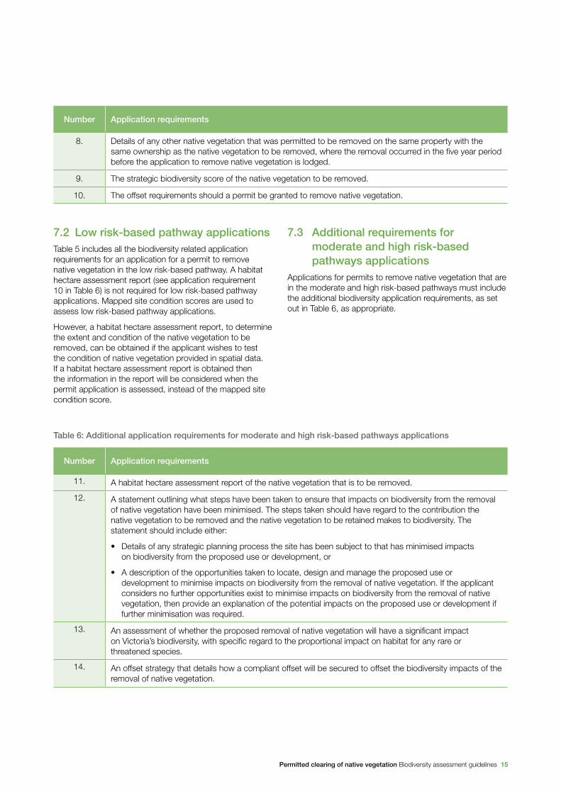
Table 6: Additional application requirements for moderate and high risk-based pathways applications
Number Application requirements
11. A habitat hectare assessment report of the native vegetation that is to be removed.
12. A statement outlining what steps have been taken to ensure that impacts on biodiversity from the removal of native vegetation have been minimised. The steps taken should have regard to the contribution the native vegetation to be removed and the native vegetation to be retained makes to biodiversity. The statement should include either:
• Details of any strategic planning process the site has been subject to that has minimised impacts on biodiversity from the proposed use or development, or
• A description of the opportunities taken to locate, design and manage the proposed use or development to minimise impacts on biodiversity from the removal of native vegetation. If the applicant considers no further opportunities exist to minimise impacts on biodiversity from the removal of native vegetation, then provide an explanation of the potential impacts on the proposed use or development if further minimisation was required.
13. An assessment of whether the proposed removal of native vegetation will have a significant impact on Victoria’s biodiversity, with specific regard to the proportional impact on habitat for any rare or threatened species.
14. An offset strategy that details how a compliant offset will be secured to offset the biodiversity impacts of the removal of native vegetation.
7.2 Low risk-based pathway applicationsTable 5 includes all the biodiversity related application requirements for an application for a permit to remove native vegetation in the low risk-based pathway. A habitat hectare assessment report (see application requirement 10 in Table 6) is not required for low risk-based pathway applications. Mapped site condition scores are used to assess low risk-based pathway applications.
However, a habitat hectare assessment report, to determine the extent and condition of the native vegetation to be removed, can be obtained if the applicant wishes to test the condition of native vegetation provided in spatial data. If a habitat hectare assessment report is obtained then the information in the report will be considered when the permit application is assessed, instead of the mapped site condition score.
7.3 Additional requirements for moderate and high risk-based pathways applications
Applications for permits to remove native vegetation that are in the moderate and high risk-based pathways must include the additional biodiversity application requirements, as set out in Table 6, as appropriate.
16 Permitted clearing of native vegetation Biodiversity assessment guidelines
8.1 Application of the decision guidelinesThe decision guidelines are applied according to the risk-based pathway of the application for a permit to remove native vegetation. If the application for a permit to remove native vegetation satisfies the decision guidelines for the relevant risk-based pathway then the permit should not be refused, or objected to on the basis of the biodiversity considerations in Clause 52.17.
If a permit to remove the native vegetation is granted, the permit conditions specify that an offset must be secured, in accordance with the requirements in section 9.
Note that if the vegetation to be removed does not meet the native vegetation definition in section 2.2 these decision guidelines are not required to be applied. An application for a permit to remove vegetation that does not meet the definition of native vegetation in section 2.2 should not be objected to on the basis of the biodiversity considerations in Clause 52.17, and an offset is not required.
8.2 Low risk-based pathway applications
8.2.1 Information considered
The following information about the native vegetation proposed to be removed is considered when applying the decision making guidelines:
• the information in the application requirements (see Table 5)
• DEPI’s biodiversity information tools are used to determine:
– the condition score
– the strategic biodiversity score.
8.2.2 Decision guidelines
The following must be considered in relation to biodiversity when assessing an application for a permit to remove native vegetation:
• whether the vegetation is native (see section 2.2)
• whether the application is in the low risk-based pathway
• whether the proposed development is in accordance with any property vegetation plan that applies to the site.
8.3 Moderate risk-based pathway applications
8.3.1 Information considered
The following information about the native vegetation proposed to be removed is considered when applying the decision making guidelines:
• the information in the application requirements (see Table 5 and Table 6)
• DEPI’s biodiversity information tools are used to determine:
– the strategic biodiversity score
– the habitat importance score(s)
• the information provided in the habitat hectare assessment report including the condition score.
88. Decision guidelines
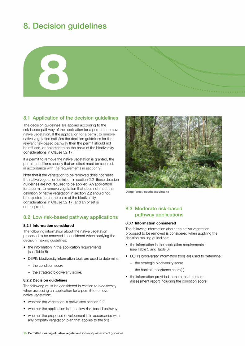
Damp forest, southeast Victoria
Permitted clearing of native vegetation Biodiversity assessment guidelines 17
8.3.2 Decision guidelines
The following must be considered in relation to biodiversity when assessing an application for a permit to remove native vegetation:
• whether the vegetation is native (see section 2.2)
• whether the application is in the moderate risk-based pathway.
If the application satisfies these criteria, proceed with its assessment in relation to biodiversity impacts on the following basis:
• whether the proposed development is in accordance with any property vegetation plan that applies to the site
• whether reasonable steps have been taken to ensure that impacts of the proposed removal of native vegetation on biodiversity have been minimised. These steps should have regard to the contribution to biodiversity made by the native vegetation to be removed and the native vegetation to be retained. Reasonable steps are considered to have been taken when one of the following applies:
– the site has been the subject of a comprehensive DEPI supported regional or landscape scale strategic planning process that has resulted in minimising adverse impacts on biodiversity from the removal of native vegetation
– opportunities have been taken to locate, design and manage the proposed use or development to minimise impacts on biodiversity from the removal of native vegetation, and there is sufficient evidence that any further actions to minimise impacts on biodiversity from the removal of native vegetation will:
› undermine the key objectives of the proposal, or
› materially increase the cost of the proposal
• whether an offset has been identified that meets the requirements set out in section 9
• the need to remove, destroy or lop native vegetation to create defendable space to reduce the risk of bushfire to life and property, having regard to the other available bushfire risk mitigation measures.
8.4 High risk-based pathway applications
8.4.1 Information considered
The following information about the native vegetation proposed to be removed is considered when applying the decision making guidelines:
• the information in the application requirements (see Table 5 and Table 6)
• DEPI’s biodiversity information tools are used to determine:
– the strategic biodiversity score
– the habitat importance score(s)
• the information provided in the habitat hectare assessment report including the condition score.
8.4.2 Decision guidelines
The following must be considered in relation to biodiversity when assessing an application for a permit to remove native vegetation:
• whether the vegetation is native (see section 2.2)
• whether the application is in the high risk-based pathway.
If the application satisfies these criteria, proceed with its assessment in relation to biodiversity impacts on the following basis:
• whether the proposed development is in accordance with any property vegetation plan that applies to the site
• whether reasonable steps have been taken to ensure that impacts of the proposed removal of native vegetation on biodiversity have been minimised. These steps should have regard to the contribution to biodiversity made by the native vegetation to be removed and the native vegetation to be retained. Reasonable steps are considered to have been taken when one of the following applies:
– the site has been the subject of a comprehensive DEPI supported regional or landscape scale strategic planning process that has resulted in minimising adverse impacts on biodiversity from the removal of native vegetation
– opportunities have been taken to locate, design and manage the proposed use or development to minimise impacts on biodiversity from the removal of native vegetation, and there is sufficient evidence that any further actions to minimise impacts on biodiversity from the removal of native vegetation will:
› undermine the key objectives of the proposal, or
› materially increase the cost of the proposal
• whether the native vegetation to be removed makes a significant contribution to Victoria’s biodiversity. This includes considering:
– impacts on important habitat for rare or threatened species, particularly highly localised habitat
– proportional impacts on remaining habitat for rare or threatened species5
– if the removal of the native vegetation will contribute to a cumulative impact that is a significant threat to the persistence of a rare or threatened species
– the availability of, and potential for, gain from offsets
• whether an offset has been identified that meets the requirements set out in section 9
• the need to remove, destroy or lop native vegetation to create defendable space to reduce the risk of bushfire to life and property, having regard to the other available bushfire risk mitigation measures.
5 Proportional impacts should take into consideration any other native vegetation that was permitted to be removed on the same property with the same ownership as the native vegetation to be removed, where the removal occurred in the five years period before an application to remove native vegetation is lodged.

18 Permitted clearing of native vegetation Biodiversity assessment guidelines
9.1 IntroductionThis section sets out how to determine the offset requirements if the removal of native vegetation is permitted. The section also sets out what is required in order for a site to be considered an offset, and what is required to deliver gain from the offset site.
9.2 When a native vegetation offset is required
A native vegetation offset is required when a permit is granted to remove native vegetation in accordance with these Guidelines. The offset requirements are specified as a condition on the permit to remove native vegetation.
9.3 Measuring the loss from removing native vegetation and the gain from offset sites
Biodiversity equivalence scores are metrics used to:
• quantify losses in the contribution to Victoria’s biodiversity from removing native vegetation
• quantify gains in the contribution to Victoria’s biodiversity from securing and managing an offset site
• provide an input into the test for determining whether a specific or general offset is required.
Biodiversity equivalence scores combine site-based and landscape scale information to obtain an overall measure of the contribution to biodiversity that is lost from removing native vegetation, or gained from securing and managing an offset. As set out in section 3, the contribution that native vegetation makes to Victoria’s biodiversity is dependent on the following characteristics of native vegetation:
• site-based – condition and extent measured in habitat hectares
• landscape level – relative importance for Victoria’s biodiversity, measured either by the strategic biodiversity score or habitat importance score(s).
There are two types of biodiversity equivalence scores:
• the general biodiversity equivalence score measures the contribution that native vegetation on a site makes to Victoria’s biodiversity overall
• the specific biodiversity equivalence score measures the contribution that native vegetation on a site makes to the habitat of a particular species. This score is calculated for each rare or threatened species for which the site provides habitat.
How these two scores are calculated is set out below.
General biodiversity equivalence score
The general biodiversity equivalence score is obtained by multiplying a site’s habitat hectares by its strategic biodiversity score, as follows:
general biodiversity equivalence score = habitat hectares × strategic biodiversity score
Specific biodiversity equivalence score
The specific biodiversity equivalence score is obtained by multiplying a site’s habitat hectares by its habitat importance score, as follows:
specific biodiversity equivalence score = habitat hectares × habitat importance score
99. Native vegetation offset requirements
Permitted clearing of native vegetation Biodiversity assessment guidelines 19
For moderate and high risk-based pathway applications habitat hectares is calculated using information from the habitat hectare assessment. For low risk-based pathway applications habitat hectares is calculated using the mapped condition score for the site.6
The following section sets out the process for using biodiversity equivalence scores, first to determine the amount of loss that has occurred due to clearing, and then to inform offset requirements.
6 From the Native vegetation condition map, DEPI.
9.4 Offset requirements for removing native vegetation
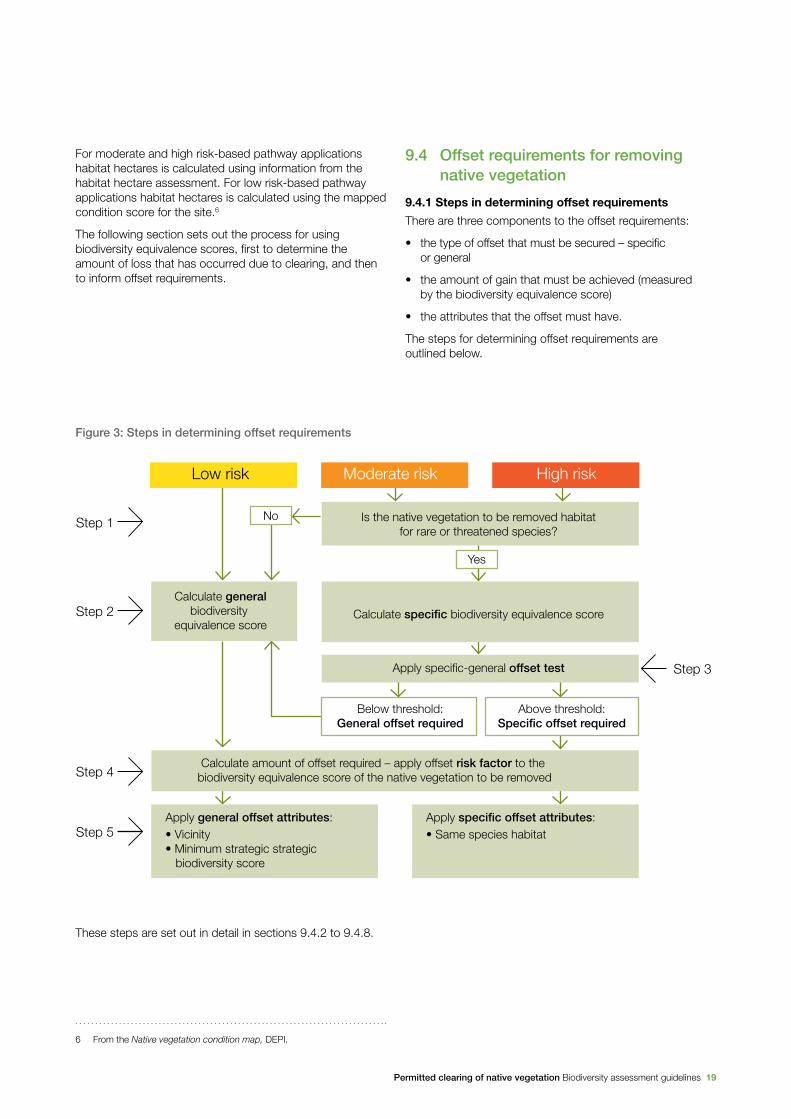
9.4.1 Steps in determining offset requirements
There are three components to the offset requirements:
• the type of offset that must be secured – specific or general
• the amount of gain that must be achieved (measured by the biodiversity equivalence score)
• the attributes that the offset must have.
The steps for determining offset requirements are outlined below.
Figure 3: Steps in determining offset requirements
Calculate generalbiodiversity
equivalence scoreCalculate specific biodiversity equivalence score
Is the native vegetation to be removed habitatfor rare or threatened species?
Calculate amount of offset required – apply offset risk factor to the biodiversity equivalence score of the native vegetation to be removed
Apply general offset attributes:• Vicinity• Minimum strategic strategic biodiversity score
Apply specific offset attributes:• Same species habitat
Step 1
Step 2
Step 4
Step 5
Step 3
Low risk Moderate risk High risk
Apply specific-general offset test
Below threshold:General offset required
Above threshold:Specific offset required
Yes
No
These steps are set out in detail in sections 9.4.2 to 9.4.8.
20 Permitted clearing of native vegetation Biodiversity assessment guidelines
9.4.2 Step 1 – Is the native vegetation to be removed habitat for rare or threatened species?
The Habitat importance maps are used to determine if the native vegetation to be removed is habitat for a rare or threatened species. This step is only required for moderate and high risk-based pathway applications.
If the application is in the low risk-based pathway, or the location of the native vegetation to be removed is not habitat for a rare or threatened species, then a general offset is required.
9.4.3 Step 2 – Determine the relevant biodiversity equivalence score
Using the approach set out in section 9.3, calculate the specific or general biodiversity equivalence score for the vegetation to be removed.
If the native vegetation to be removed is habitat for one or more rare or threatened species, and the application is in the moderate or high risk-based pathway, then a specific offset may be required. Note that if the native vegetation to be removed is habitat for multiple species then the specific biodiversity equivalence score must be calculated for each of these species.
If the native vegetation to be removed is in the low risk-based pathway or is not habitat for one or more rare or threatened species, then calculate the general biodiversity equivalence score, and go to step 4.
9.4.4 Step 3 – Determine the type of offset required
Specific and general offsets
Offsets are required to deliver gain in the contribution to Victoria’s biodiversity that is equivalent to the loss from the native vegetation removed. This gain is achieved through a strategic approach that maximises benefits to biodiversity by:
• directing offsets to areas that are strategically important for biodiversity
• ensuring that offsets provide protection for the most important habitat for rare or threatened species, when these are significantly impacted.
To achieve these dual objectives, when the removal of native vegetation has a significant impact on habitat for a specific rare or threatened species, the offset must compensate for the removal of that particular species’ habitat. This is referred to as a specific offset.
When the removal of native vegetation does not have a significant impact on the habitat of a particular rare or threatened species, a general offset must be obtained. A general offset requires that the contribution to Victoria’s biodiversity made by the offset be equal to the loss of the contribution to Victoria’s biodiversity from the removal of native vegetation. The vegetation and habitat attributes of the offset do not, however, need to match closely those attributes of the native vegetation to be removed.
Specific-general offset test
To determine whether a specific or general offset is required, the specific-general offset test is applied. Where a site is habitat for a particular rare or threatened species, the specific-general offset test measures the proportion of a species habitat that will be lost if the removal of native vegetation is permitted.
The specific-general offset test is undertaken for each relevant species. First the specific biodiversity equivalence score for each rare or threatened species that the native vegetation is habitat for is determined. The specific biodiversity equivalence score for a particular species is then divided by the sum of the specific biodiversity equivalence scores across all remaining habitat for that species. This gives the proportion of the remaining habitat for the species that is to be to removed, weighted by its importance for that species.
When the native vegetation to be removed is a proportion of habitat for a rare or threatened species that is greater than the specific offset threshold, a specific offset is required for that species. A specific offset is required for a rare or threatened species when:7
specific biodiversity equivalence score of native vegetation to be removed
sum of the specific biodiversity equivalence
scores of all remaining habitat of the species impacted
> specific offset threshold
This test determines on a case by case basis whether a specific offset is required for removing native vegetation.
If it is determined that no specific offsets are required then a general offset it required. In this case calculate the general biodiversity equivalence score of the vegetation to be removed, and then go to step 4.
7 For the purpose of applying the specific-general offset test the numerator includes any other native vegetation that was permitted to be removed on the same property with the same ownership as the native vegetation to be removed, where the removal occurred in the five year period before an application to remove native vegetation is lodged.
Permitted clearing of native vegetation Biodiversity assessment guidelines 21
Multiple species
Native vegetation can provide important habitat for multiple rare or threatened species. When this occurs offsets are required to mitigate the impact of removing native vegetation for all species that have been significantly impacted: that is, when a specific offset is required according to the specific-general offset test set out above.
The specific-general offset test must be undertaken for each rare or threatened species that the native vegetation to be removed is habitat for. When a specific offset is required according to the specific-general offset test for multiple species, the offset or offsets obtained must satisfy the specific offset requirements for all of these species.
9.4.5 Step 4 – Apply the offset risk factor to calculate the required offset amount
There is a risk that the gain from undertaking the offset will not adequately compensate for the loss from the removal of native vegetation. If this were to occur, despite obtaining an offset, the overall impact from removing native vegetation would result in a loss in the contribution of native vegetation to Victoria’s biodiversity.
To address the risk of offsets failing, an offset risk factor is applied to the calculation of the loss of biodiversity value from removing native vegetation. The biodiversity equivalence score of the native vegetation measures the loss (see section 9.3). This score must then be adjusted with a risk factor. There are different risk factors for the removal of native vegetation that requires general offsets and specific offsets, as set out in Table 7.
Table 7: Offset risk factors for offset types
Offset type Offset risk factor
General offset 1.5
Specific offset 2
The following formula shows how the risk adjusted biodiversity equivalence score is calculated to determine the amount of offset that is required.
risk adjusted general biodiversity equivalence score
= general biodiversity equivalence scoreclearing × 1.5
risk adjusted specific biodiversity equivalence score
= specific biodiversity equivalence scoreclearing × 2
The offset secured is required to have an equivalent biodiversity equivalence score to the risk adjusted biodiversity equivalence score of the native vegetation removed, determined by the equations above.
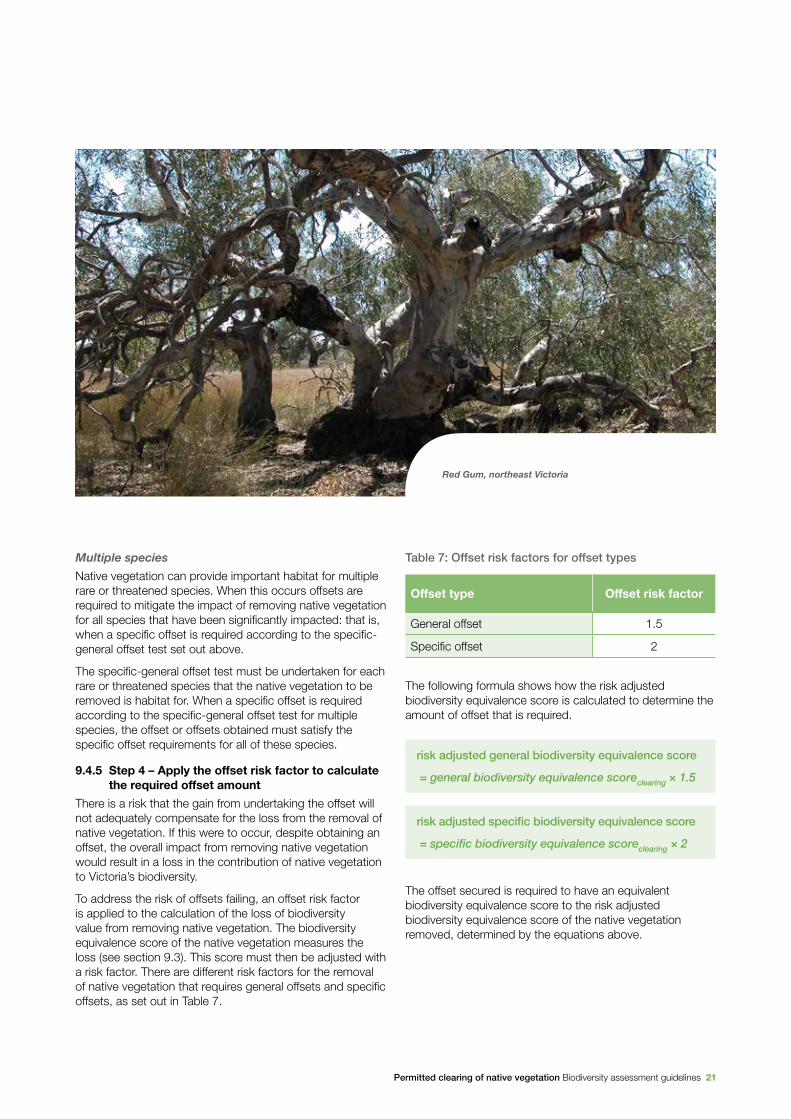
Red Gum, northeast Victoria

22 Permitted clearing of native vegetation Biodiversity assessment guidelines
9.4.6 Step 5 – Determine the offset attributes
Specific offset attributes
When a specific offset is required the offset must provide habitat for all species that require a specific offset. Where a species habitat is located is determined by the Habitat importance map for that species. This requirement is to ensure offsets are located in areas that provide habitat for the species impacted by the removal of native vegetation.
If specific offsets are required for multiple species, an offset, or multiple offsets, must provide habitat for each relevant species.
General offset attributes
When a general offset is required the offset secured must have the following attributes.
Minimum strategic biodiversity score
The strategic biodiversity score of the offset site must be at least 80 per cent of the strategic biodiversity score of the native vegetation to be removed. This is to ensure offsets are located in areas with a strategic value that is comparable to, or better than, native vegetation to be removed.
Vicinity
The offset must be located within the same Catchment Management Authority boundary or municipal district as the native vegetation to be removed. This requirement is to maintain a link between the location of the offset and the site of the native vegetation to be removed.
9.4.7 Summary of offset requirements
The requirements that must be satisfied for general and specific offsets are set out in Table 8.
Table 8: Summary of offset requirements
Risk –based pathway
Offset type
Offset amount Offset attributes
Risk adjusted biodiversity equivalence score
Habitat for species Vicinity
Strategic biodiversity score
Low riskGeneral offset
1.5 times the general biodiversity equivalence score of the native vegetation to be removed.
No restrictions In the same Catchment Management Authority boundary or municipal district as the native vegetation to be removed.
At least 80 per cent of the strategic biodiversity score of the native vegetation to be removed.
Moderate or high risk
General offset
1.5 times the general biodiversity equivalence score of the native vegetation to be removed.
No restrictions In the same Catchment Management Authority boundary or municipal district as the native vegetation to be removed.
At least 80 per cent of the strategic biodiversity score of the native vegetation to be removed.
Specific offset
For each species impacted, 2 times the specific biodiversity equivalence score of the native vegetation to be removed.
Suitable habitat for each rare or threatened species that a specific offset is required for, according to the specific-general offset test7
No restrictions No restrictions
8
For specific offsets, alternative offset arrangements, that do not meet the specific offset requirements set out in Table 8 may be considered, on a case by case basis. Alternative offsets must provide equivalent outcomes for the species impacted as those offsets that meet the requirements. Alternative offsets must be to the satisfaction of the Secretary of DEPI. DEPI provides guidelines for how alternative offsets will be considered.
8 See section 9.4.4 for details of the specific-general offset test.
Permitted clearing of native vegetation Biodiversity assessment guidelines 23
9.4.8 Timing for securing an offset
The timing of securing the offset is important. Sourcing offsets upfront minimises the loss in the contribution to biodiversity provided by native vegetation over the interim period between the time when the removal of native vegetation occurs and the time when the offset reaches maturity. Offsets that are sourced upfront also provide a greater degree of assurance that the impact of the clearing can be adequately offset before native vegetation is removed.
A compliant offset must be secured, to the satisfaction of the responsible or referral authority, before the native vegetation is removed. This could be either:
• a security agreement for the offset site that includes an onsite management plan
• evidence of a secured third party offset, such as an allocated credit register extract from the native vegetation credit register.
The condition on the permit to remove native vegetation must specify this requirement.
9.5 Native vegetation offsets
9.5.1 Introduction
Section 9.4 sets out how to determine the offset requirements for removing native vegetation in order to provide compensation for loss to Victoria’s biodiversity. The offset requirements include the amount of gain the offset must provide, measured using the biodiversity equivalence score, and the required attributes of the offset.
This section details the requirements that an offset site must satisfy to be an eligible offset, and how the offset site can deliver biodiversity gains.
To offset native vegetation removal, the offset site must also satisfy the offset requirements for the native vegetation that was removed. This includes having the required attributes (for example, being habitat for particular species), and being able to provide gain equivalent to the loss that has occurred from removing native vegetation.
9.5.2 What can be a native vegetation offset
A native vegetation offset can be one of, or a combination of, the following:
• improvement in the condition of existing vegetation with ongoing management and protection using an appropriate security arrangement, either on the same property as the removal of native vegetation, or on a third party’s site
• revegetation of a site with ongoing management and protection using an appropriate security arrangement, either on the same property as the removal of native vegetation, or on a third party’s site. Note that there are restrictions on when revegetation can be an offset (see section 9.5.3).
To be an offset for removing native vegetation, the site must also meet the minimum requirements set out in section 9.5.3.
9.5.3 Minimum requirements of an offset site
Site eligibility
These factors must be considered in determining whether a particular area of native vegetation is an eligible offset:
• current land use and future land use (where known)
• existing offsets or other existing agreements
• identified threats to native vegetation condition.
Permanency
The offset site must provide permanent gain, and therefore must be secure. Security must occur through one of the following:
• a recognised agreement with a relevant government agency or authority, supported by legislation
• transferring freehold land to a secure Crown land reserve managed for conservation purposes
• reclassifying unreserved Crown land to a reserve managed for conservation purposes, under the Crown Land (Reserves) Act 1978.
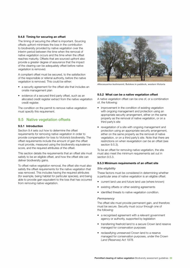
Allocasuarina leuhmannii, Bulokes in paddock, western Victoria
24 Permitted clearing of native vegetation Biodiversity assessment guidelines
The extent to which gains can be delivered from security arrangements depends on the following characteristics of the security arrangement:
• permanency
• level of monitoring of, and compliance with, its requirements
• that the offset is exhausted after use and cannot be used to offset other native vegetation removal
• transparency of the arrangement to landowners and future landowners.
Additionality
For the native vegetation on an offset site to deliver gains in the contribution to biodiversity which can be used to offset removing native vegetation, management commitments must be undertaken that maintain and improve the condition of native vegetation.
Gain can only be generated by management commitments that are in addition to existing obligations under legislation, existing agreements or contracts.
Revegetation
Generally, revegetation sites are not eligible offsets for removing native vegetation that is assessed under the moderate and high risk-based pathways.
Revegetation sites can be eligible offsets for removing native vegetation that is assessed under the low risk-based pathway. Eligible revegetation offsets must be carried out according to DEPI’s revegetation standards. These standards outline site suitability criteria and what actions and outcomes are required to achieve the offset.
9.5.4 Calculating gains in the contribution to Victoria’s biodiversity from an offset
The gain scoring method is used to calculate the expected gain in the contribution to Victoria’s biodiversity made by native vegetation at an offset site. The gain scoring method is set out in the Native vegetation gain scoring manual. Gains in the contribution that native vegetation makes to biodiversity are determined based on the biodiversity equivalence score of the offset site, and the security and management actions agreed to be undertaken.
9.6 Alternative permitting and offset arrangements
9.6.1 Property vegetation plans
Property vegetation plans provide for alternative permit and offset arrangements. Property vegetation plans replicate the permit process by permitting the removal and offsetting of native vegetation on a property to occur over a period of ten years, if the removal and offsetting accord with the property vegetation plan.
Property vegetation plans provide landowners with a longer term, strategic pathway for onsite native vegetation management. The plan identifies areas on the property where native vegetation can be removed and actions that must be undertaken to meet offset obligations.
Property vegetation plans are assessed against the decision making guidelines associated with the level of risk of the proposed vegetation removal, as set out in section 6 of these Guidelines. All offset arrangements must comply with the rules associated with offsets, as set out in section 9 of these Guidelines.
The approved property vegetation plan is submitted with any permit application to remove native vegetation. As offsets are already identified in this plan, the permit application and approval process is streamlined and any permit is granted with a ten year validity, instead of the usual two year period.
9.6.2 Offsets for timber harvesting of native vegetation
The objective for timber harvesting of native vegetation is that it results in ‘no net loss in the contribution made by the native vegetation to Victoria’s biodiversity.’
If a planning permit is required to remove native vegetation for timber harvesting the application for a permit is assessed in accordance with the relevant decision guidelines in the planning scheme. If a permit is granted to remove native vegetation for timber harvesting then an offset is required. The specific-general offset test is used to determine whether a general or specific offset is required.

Permitted clearing of native vegetation Biodiversity assessment guidelines 25
General offsets (not including scattered trees)
Where all or part of a remnant patch of native vegetation is to be removed for timber harvesting and a general offset is required, the offset can be delivered through the regeneration of native vegetation in the same location as the native vegetation removed. This regeneration must meet the following requirements, which must be included on the permit to remove native vegetation for timber harvesting:
• For clearfell harvesting the native vegetation regenerated on the site must be able to achieve a condition score which is at least 50 per cent of its condition score immediately before it was harvested, within ten years of harvesting.
• For selective harvesting of native vegetation the reduction in the condition score of the site, due to the selective harvesting, must not be greater than 50 per cent of the condition score of the site immediately before it was harvested.
• The area regenerated must be protected by a recognised agreement with a relevant government agency or authority, supported by legislation, for the ten year period following the timber harvesting.
Planning permit conditions apply until regeneration achieves the equivalent condition of the native vegetation immediately before it was harvested.
Specific offsets
Where the removal of native vegetation for timber harvesting requires a specific offset then the offset cannot be satisfactorily achieved through regeneration. Removal of native vegetation for timber harvesting that requires a specific offset must be offset in accordance with the requirements set out in Section 9.4 and summarised in Table 8.
Offsets for removal of scattered trees
Scattered trees cannot be regenerated satisfactorily on the same site from where they are removed. If scattered trees are removed for timber harvesting they must be offset in accordance with the requirements set out in Section 9.4 and summarised in Table 8.
Table 9: Summary of offset requirements for timber harvesting
Type of native vegetation
Offset type required
Offset amount
Offset attributes
Habitat for species Vicinity
Strategic biodiversity score
Remnant patch
General offset
Clearfell harvesting – regeneration achieving at least 50% of the condition score of the native vegetation to be removed, within 10 years of harvesting.
n/a Same location at native vegetation that was removed.
n/a
Selective harvesting – reduction in the condition score of the site, due to the selective harvesting, not greater than 50% of the condition score of the site.
Specific offset
As per Table 8 As per Table 8
As per Table 8
As per Table 8
Scattered tree
General or specific offset
As per Table 8 As per Table 8
As per Table 8
As per Table 8
26 Permitted clearing of native vegetation Biodiversity assessment guidelines
Avoid – Avoiding removing any native vegetation when undertaking a use or development. This can be either by not permitting or not going ahead with the use or development, or locating it elsewhere so that removing native vegetation is not required.
Biodiversity – The variety of all life forms, the different plants, animals and microorganisms, the genes they contain, and the ecosystems of which they form a part.
BushBroker – A program coordinated by DEPI to match parties that require native vegetation offsets with third party suppliers of native vegetation offsets.
Canopy tree – A mature tree that is greater than 3 meters in height and is normally found in the upper layer of the relevant vegetation type. Ecological Vegetation Class descriptions provide a list of typical canopy species.
Dispersed habitat – Habitat for a rare or threatened species whose habitat is spread over a relatively broad geographic area.
Ecological vegetation class (EVC) – A native vegetation type classified on the basis of a combination of its floristic, life form, environmental and ecological characteristics.
Extent risk – The level of risk to biodiversity from the removal of native vegetation based on the area and/or number of scattered trees to be removed.
Foliage cover - Proportion of the ground that is shaded by vegetation foliage when lit from directly above.
Gain – Predicted improvement in the contribution to Victoria’s biodiversity achieved from an offset, calculated by combining site gain with the strategic biodiversity score or habitat importance score of the site. Gain is measured with biodiversity equivalence scores or units.
General biodiversity equivalence score/units – Score or units used to quantify the relative overall contribution of a site to Victoria’s biodiversity.
General offset – An offset that is required when a proposal to remove native vegetation is not deemed, by application of the specific-general offset test, to have a significant impact on habitat for any rare or threatened species.
General provisions – Operational requirements in planning schemes which are consistent across the state, relating to matters such as administrative provisions, ancillary activities and referral of applications.
Habitat hectare assessment – A site-based measure of the condition of native vegetation with reference to the benchmark for the same type of native vegetation. The assessment generates a condition score of between 0 and 1.
Habitat hectare benchmark – A reference point for each vegetation type that represents the average condition of mature stands that are likely to reflect pre-settlement circumstances.
Habitat hectares – Combined measure of condition and extent of native vegetation. This measure is obtained by multiplying the site’s condition score (measured between 0 and 1) with the area of the site (in hectares).
Habitat importance map – A map that indicates the importance of locations as habitat for a particular rare or threatened species. This map is based on modelled data.
Habitat importance score – Measure of the importance of the habitat located on a site for a particular rare or threatened species.
Highly localised habitat – Habitat for rare or threatened species whose habitat is spread over a very restricted area (i.e. less than 2,000 ha). This can also be applied to a similarly limited sub-habitat that is disproportionately important for a wide-ranging rare or threatened species.
Incorporated document – A document that is included in the list of incorporated documents in a planning scheme. These documents affect the operation of the planning scheme.
Landholder – An owner, occupier, proprietor or holder of land.
Landowner – Owner of land.
Landscape scale information – Mapped or modelled information based on data collected across the landscape rather than just on a particular site.
Local Planning Policy Framework – Framework outlining a Municipal Strategic Statement and the Local Planning Policies that apply to the local government area.
Location risk – The risk that removing a small amount of native in a particular location will have an impact on the persistence of a rare or threatened species.
Glossary
Permitted clearing of native vegetation Biodiversity assessment guidelines 27
Loss – Loss in the contribution to Victoria’s biodiversity when native vegetation is fully or partially removed, as measured in biodiversity equivalence scores or units.
Minimise – Locating, designing or managing a use or development to reduce the impacts on biodiversity from the removal of native vegetation.
Native vegetation – Native vegetation is defined in the Victoria Planning Provisions as ‘plants that are indigenous to Victoria, including trees, shrubs, herbs and grasses’.
Native vegetation condition – A site-based measure of how close native vegetation is to its mature natural state, as represented by a benchmark reflecting pre-settlement circumstances.
Native vegetation credit – Gains in the contribution that native vegetation makes to Victoria’s biodiversity that are registered on the native vegetation credit register. Native vegetation credits are offered for sale to parties who are required to offset the removal of native vegetation.
Native vegetation credit register – A statewide register of native vegetation credits that meet minimum standards for security and management of sites. The register is administered by the Department of Environment and Primary Industries, and records the creation, trade and allocation of credits to meet specific offset requirements.
Native vegetation extent – Area of land covered by native vegetation or the number of scattered trees.
Native vegetation particular provision – Clause 52.17 in the Victoria Planning Provisions that relates to the removing, destroying or lopping of native vegetation.
No net loss – An outcome where a particular gain in the contribution to Victoria’s biodiversity is equivalent to an associated loss in the contribution to Victoria’s biodiversity from permitted clearing.
Offset – Protection and management (including revegetation) of native vegetation at a site to generate a gain in the contribution that native vegetation makes to Victoria’s biodiversity. An offset is used to compensate for the loss to Victoria’s biodiversity from the removal of native vegetation.
Offset market – A system which facilitates trade of native vegetation credits between parties requiring offsets and third party suppliers of offsets.
Particular Provisions – Provisions in the Victoria Planning Provisions that relate to specific activities (for example, native vegetation is a Particular Provision).
Perennial – A plant that lives for more than two years. Perennials include species that are always visible e.g. shrubs and trees, but also include species that are not always visible above ground.
Permit – A legal document that gives permission for a use or development on a particular piece of land.
Permitted clearing – Removal of native vegetation for which a planning permit has been granted to remove native vegetation.
Permitted clearing regulations – The rules in the planning system that regulate permits for the removal of native vegetation.
Planning provisions – See Victoria Planning Provisions.
Planning scheme – Policies and provisions for the use, development and protection of land in a local government area.
Planning system – Victoria’s land-use planning system that includes the Victoria Planning Provisions and each local government’s planning scheme.
Property – land under common occupation particularly for the purpose of rating, billing or habitation. Property is typically described by street addresses or a rate assessment number. A property can consist of one parcel, many parcels, or part of a parcel, where a parcel is the smallest unit of land able to be transferred within Victoria’s cadastral system.
Rare or threatened species – A species that is listed in:
• DEPI’s Advisory List of Rare or Threatened Plants in Victoria as ‘endangered’, ‘vulnerable’, or ‘rare’, but does not include the ‘poorly known’ category
• DEPI’s Advisory List of Threatened Vertebrate Fauna in Victoria as ‘critically endangered’, ‘endangered’ or ‘vulnerable’, but does not include ‘near threatened’ or ‘data deficient’ categories
• DEPI’s Advisory List of Threatened Invertebrate Fauna in Victoria as ‘critically endangered’, ‘endangered’ or ‘vulnerable’, but does not include ‘near threatened’ or ‘data deficient’ categories.

28 Permitted clearing of native vegetation Biodiversity assessment guidelines
Referral authority – An authority that a permit application is referred to for decision under Section 55 of the Planning and Environment Act 1987. All referral requirements are specified in Clause 66 of planning schemes.
Remnant patch of native vegetation – Either:
• an area of vegetation where at least 25 per cent of the total perennial understory plant cover is native
• any area with three or more native canopy trees where the canopy foliage cover is at least 20 per cent of the area.
Responsible authority – The authority charged with the responsibility for administering and enforcing particular aspects of a planning scheme.
Scattered tree – A native canopy tree greater than three metes in height that does not form part of a remnant patch of native vegetation (see definition of remnant patch of native vegetation).
Site – An area of land that contains contiguous patches of native vegetation or scattered trees, within the same ownership.
Site-based information – Information that is collected at a site.
Site gain – Predicted improvement in the condition, or the condition and extent, of native vegetation at a site (measured in habitat hectares) generated by the landowner committing to active management and increased security.
Site loss – Loss in the condition, or condition and extent, of native vegetation when native vegetation is fully or partially removed, measured in habitat hectares.
Species persistence – The continued existence of a species into the future.
Specific biodiversity equivalence score/units – With reference to a specific species, a score or units used to quantify the relative contribution of a site to Victoria’s biodiversity.
Specific-general offset test – A test used to determine whether a general or specific offset is required based on the impact of native vegetation removal on the habitat for rare or threatened species.
Specific offset – An offset that is targeted to a particular species (or multiple species) impacted by the removal of native vegetation.
State Planning Policy Framework – A collection of clauses in the Victoria Planning Provisions that inform planning authorities and responsible authorities of those aspects of state planning policy which they are to take into account and give effect to in planning and administering their respective areas.
Strategic biodiversity map – A map that shows the relative value of a location in the landscape with regard to its condition, extent, connectivity and the support function it plays for species. The map is based on modelled data.
Strategic biodiversity score – A score that quantifies the relative value of a location in the landscape with regard to its condition, extent, connectivity and the support function it plays for species.
Strategic planning – A coordinated approach to planning where areas for conservation and areas which can be cleared are strategically identified.
Victoria Planning Provisions – A list of planning provisions that provides a standard template for individual planning schemes.
Understorey – The lower layers of vegetation, including the shrub layer, grass layer and ground layer. The understorey may comprise native and non-native species.
Zone – A zone in the Victoria Planning Provisions is a set of permitted uses of land which are defined spatially.


www.depi.vic.gov.au
For more information call the Customer Service Centre 136 186
DTP
LI 7
841/
13