(preliminary)(final) field plan review...
TRANSCRIPT

FINAL FIELD PLAN REVIEW INSPECTION REPORT
PI No.: 0007414, Camden CountyPROJECT NUMBER: CSSTP-0007-00(414)
Widening/Reconstruction – CR 90/Colerain Road from west of I-95 to east of Kings Bay Road
INSPECTION DATE: 12/9/15REPORT DATE: 12/11/15
RESPONSE ACCEPTED DATE: 2/29/16
This inspection was requested by Albert V. Shelby, III, State Program Delivery Engineer. The Project Manager is David Moyer.
The plans were prepared by Moreland Altobelli.
The report was prepared by John Kopotic, Design Engineer 2, and accepted by Lisa L. Myers, State Project Review Engineer, Office of Engineering Services.
The NEPA document was approved on 3/21/13.
This report is being distributed via E-mail.
The Inspection Plans were reviewed in Camden County Annex Building prior to the site inspection.
The PFPR was conducted 10/4/12 and responses received 3/25/13. The complete FFPR submittal package was received by the Office of Engineering Services on 11/12/15. This project is currently scheduled for the 7/22/16 Letting.
All comments marked with an arrow symbol () shall be addressed with a written response by the Project Manager. As per Plan Development Process, responses to all comments will be written in complete sentences and will clearly state the action taken to address the comment. If a comment requests a specific action and the Project Manager determines that no action or a different action will be taken, the response should clearly explain the Project Manager’s decision. All responses shall be submitted in Word format (a pdf of the document will not be accepted).
MAAI responses dated January 5, 2016 are in bold red italics.
Projects Let to construction after July 1, 2013 will require the use of the 2011 AASHTO “GREEN BOOK”, GDOT Design Manual, 2011 Roadside Design Guide, 2012 Guide for the Development of Bicycle Facilities. Projects Let to Construction after October 2013 will require the use of the 2013 Georgia Standard Specifications. Please revise all notes that make reference to previous GDOT Design Manuals and Specifications. Any substandard features that cannot be complied with due to project restraints will require the submission of a design exception/variance to the State Design Policy and Support Engineer.
PROJECT DESCRIPTION
The proposed Colerain Road/ CR 90 typical section is two 12-foot lanes in each directionseparated by a 20-foot raised median. The purpose of this Revised Concept Report is to changethe urban shoulder section from 4-foot bike lanes and 5-foot sidewalks on both sides to a 10-footmulti-use path on the north side and a 5-foot sidewalk on the south side of proposed ColerainRoad as a cost savings measure while meeting Camden County's bike route system requirementsfor Colerain Road. The rural shoulder section from 2664 feet west of I-95 to relocated BrazellRoad is changed to an urban section to eliminate the need for barrier separation between thetravel lanes and the multi-use path on the proposed bridge over I-95. The rural shoulder section

PRELIMINARY FIELD PLAN REVIEW INSPECTION REPORT: P.I. NO. 0007414PAGE 2 CAMDEN COUNTY
from 3800 feet west of Winding Road is changed to an urban section. The substantial residential development planned for this area would use the sidewalks to the nearbycounty high school. The rural shoulder section for 440 west of Winding Road to 1500 feet east of Kings Bay Road would remain but implementation of Value Engineering Study alternatives changed the typical section from 4-foot bike lanes and 10-foot shoulders (6’6” paved and 3’6” grass) to 10-foot shoulders consisting of a 4-foot bake lane and 6-foot grass strip in each direction.
DESIGN DATA
CURRENT TRAFFIC ADT: 16,900 (2019)
DESIGN TRAFFIC ADT: 28,200 (2039)
PERCENT TRUCKS: 6.4% (24 HR = 7.5%)
CURRENT POSTED SPEED: 45/55 MPH
SPEED DESIGN: 45 MPH
FUNCTIONAL CLASSIFICATION: Urban Minor Arterial
The Concept Report was approved on 3/12/09.
ENVIRONMENTAL
GENERAL ENVIRONMENTAL COMMENTS:
The Environmental Resources Impact Table (Environmental Resources Impact Table) will be coordinated with the project's Environmental Commitments Table and other plan notes to illustrate the restrictions associated with various environmental resources. The responsibility for inserting the table into the plans will rest with the designer, and its content and accuracy will be confirmed by the NEPA analyst who is responsible for environmentally certifying the project. The table shall be included in the General Notes section of all plans beginning with projects that have field plan reviews scheduled for September 1, 2010, and later and/or projects that are scheduled to be let in November 2010 or later. All Environmentally Sensitive Area (ESA) flags on plan sheets shall be changed to read "ESA - See Environmental Resources Impact Table in General Notes for construction restrictions." The ESA notes shall be placed on ALL plan sheets where an ESA exists.
RIGHT OF WAY
NUMBER OF PARCELS: 114 APPRAISED: 103
ACQUIRED DEEDS: 62 with 9 pending
ACQUISITION BY: LOC
TYPE ACCESS CONTROL: By permit/ Partial L/A
GENERAL RIGHT OF WAY COMMENTS:
District 5 Traffic Operations advises R/W will be required for the SW quadrant, see drawing 27-005.
MAAI will relocate the proposed signal strain pole in the southwest quadrant of Colerain Rd/ Wildcat Dr to eliminate need for required R/W from Parcel 39 which has already been closed.

PRELIMINARY FIELD PLAN REVIEW INSPECTION REPORT: P.I. NO. 0007414PAGE 3 CAMDEN COUNTY
DESIGN EXCEPTIONS
DESIGN EXCEPTIONS REQUIRED: Substandard SE Rate – Curve 9
DESIGN EXCEPTIONS REQUESTED: 10/10/12
DESIGN EXCEPTIONS APPROVED: 1/29/13
DESIGN VARIANCES
DESIGN VARIANCES REQUIRED: None
DESIGN VARIANCES REQUESTED: N/A
DESIGN VARIANCES APPROVED: N/A
SPECIAL PROVISIONS
PROJECT SPECIFIC SPECIAL PROVISIONS FURNISHED FOR THE INSPECTION:
Section 107.23.G. - Protection of Federally Protected SpeciesSection 108 – Prosecution and ProgressSection 150.11 – Traffic Control (Special Conditions)Section 209 – Subgrade ConstructionSection 520.3.05.B. – Piling (Drill Pilot Holes)Section 615 – Jacking or Boring Pipe (Directional Boring)Section 625 – Visual BarriersSection 636 – Highway SignsSection 881 – Fabrics
ADDITIONAL PROJECT SPECIFIC SPECIAL PROVISIONS REQUIRED:
Section 107.21 - Contractor’s Worksite Utility Coordination SupervisorSection 639 – Strain Poles for Overhead Sign and Signal AssembliesSection 647 - Traffic Signal InstallationSection 660 – Sanitary Sewer SystemSection 670 – Water Distribution System
GENERAL SPECIAL PROVISION COMMENTS:
Contracts Administration should include the Special Provision adding the Fine Grader due to this being a widening project with at least on mile of continuous full width paving.
Restrictions to traffic interruptions are recommended.
The Contractor shall not install lane closure; perform flagging, or move equipment or materials on the travel way that interferes with traffic between the hours of 6:00 A.M. to 9:00 A.M. and 2:00 P.M. to 6:00 P.M. Monday through Friday.
Interstate lane closures:
Single lane closures:
Single lane closures will be allowed between the hours of 9:00 P.M. to 5:00 A.M. Sunday through Saturday.
Double lane closures:

PRELIMINARY FIELD PLAN REVIEW INSPECTION REPORT: P.I. NO. 0007414PAGE 4 CAMDEN COUNTY
Double lane closures and pacing are allowed to be installed on I-95 between the hours of 12:00 A.M. to 5:00 A.M. Monday through Friday and 12:00 A.M. to 10:00 A.M. Saturday to Sunday.
The District 5 Construction Office requests the restrictions to traffic interruptions be revised to:The Contractor shall not install lane closure; perform flagging, or move equipment or materials on the travel way that interferes with traffic between the hours of 7:00 A.M. to 8:30 A.M. and 2:30 P.M. to 4:00 P.M. Monday through Friday.
I-95 shall not have double lane closures installed or pace traffic between 7am and 7pm. Single lane closures on I095 are permitted 24 hrs a day.
Please submit the Section 108 and Section 150 Special Provisions to the Office of Construction for their review. This should be done after the Preliminary Field Plan Review, but prior to the assembly of the Final Plan Documents.
MAAI will revise Special Provision Section 150.11 to restrict traffic interruptions as requested:
The Contractor shall not install lane closure; perform flagging, or move equipment or materials on the travel way that interferes with traffic between the hours of 7:00 A.M. to 8:30 A.M. and 2:30 P.M. to 4:00 P.M. Monday through Friday.
I-95 shall not have double lane closures installed or pace traffic between 7am and 7pm. Single lane closures on I095 are permitted 24 hrs a day.
MAAI will submit the Section 108 and Section 150 Special Provisions to the Office of Construction prior to the assembly of the Final Plan Documents.
ESTIMATED CONTRACT TIME: The Inspection Team recommends 36 months.
VALUE ENGINEERING
Total Project Programmed Cost: $33,853,481.07
VE Study Date: 6/8/09 – 6/11/09
VE Implementation Approval Date: 9/30/19
VE Reversal 1 – 2/6/12VE Reversal 2 – 2/10/12VE Reversal 3 – 1/28/13
General VE Comments: None
CONSTRUCTION PLANS
01-XXX COVER SHEET
Revise the note Limit of Construction on Colerain Road to read Begin Construction and End Construction. Limit of Construction is used on side roads.
MAAI will revise the note Limit of Construction on Colerain Road to read Begin Construction and End Construction. Verify the Project Designation shown as Full Oversight. Current records show this project as
Exempt.
MAAI will revise Project Designation from Full Oversight to Exempt.

PRELIMINARY FIELD PLAN REVIEW INSPECTION REPORT: P.I. NO. 0007414PAGE 5 CAMDEN COUNTY
Add the Location and Design approval date of 4/3/13.
MAAI will add the Location and Design approval date of 4/3/13.
02-XXX INDEX
Please ensure all applicable GA Standards and Details are included and the latest revision dates are shown.
Label CONCRETE SIDE BARRIER TYPES 2, 2A, 2B & 2C GDOT Construction Standard 4948b and move to Drawing 02-002 where the Standards are listed.
The CONCRETE SIDE BARRIER shown in the plans are “slant face” TYPES 2-S, 2-SA, & 2-SB. Current GDOT drawings do not reference Std number. MAAI will move to and label drawings as GASTD 4948B.
Add GDOT Construction Detail D5 HEADWALLS SAFETY INLETS WITH GRATES.
MAAI will add GDOT Construction Detail D5 HEADWALLS SAFETY INLETS WITH GRATES, 6/95.
Add GDOT Construction Detail D6 FABRICATION DETAILS FOR SAFETY GRATES (ALL KINDS AND SIZES).
MAAI will add GDOT Construction Detail D6 FABRICATION DETAILS FOR SAFETY GRATES (ALL KINDS AND SIZES) 10/72.
Add GDOT Construction Standard 5001m DROP INLET TYPES M-1 & M-2 ADJACENT TO CONRETE BARRIER (SHEET 1 0F 2).
The FFPR plans do not call for these types of drop inlets. MAAI will verify use of and add GDOT Construction Standard 5001m DROP INLET TYPES M-1 & M-2 ADJACENT TO CONRETE BARRIER (SHEET 1 0F 2) accordingly.
Add GDOT Construction Standard 5001mp DROP INLET TYPES M-1 & M-2 ADJACENT TO CONRETE BARRIER (SHEET 2 0F 2).
The FFPR plans do not call for these types of drop inlets. MAAI will verify use of and add GDOT Construction Standard 5001m DROP INLET TYPES M-1 & M-2 ADJACENT TO CONRETE BARRIER (SHEET 2 0F 2) accordingly.
Add GDOT Construction Standard 4280 GUARDRAIL LOCATION ON ROADS WITH CURB & GUTTER, HEADER CURB OR INTEGRAL CURB.
The FFPR plans call for GADOT Std 4391 GUARDRAIL LOCATION ON ROADS WITH CURB & GUTTER, HEADER CURB OR INTEGRAL CURB 31 inch guardrail height and not STD 4380 which is for 27 inch height.
Add GDOT Construction STD 4948a CONCRETE SIDE BARRIER TYPES 7-C, 7-R, 7-T, 7-W.
The CONCRETE SIDE BARRIER shown in the plans are “slant face” MAAI will add GDOT Construction modified STD 4948 Special Design CONCRETE SIDE BARRIER TYPES 2-S,6-S,7-CS, 7-RS, 7-TS, 7-WS 3/05.
04-XXX GENERAL NOTES
General Comments

PRELIMINARY FIELD PLAN REVIEW INSPECTION REPORT: P.I. NO. 0007414PAGE 6 CAMDEN COUNTY
Add General Note: All WCR’s located within the radii shall be 8” thick, paid as CONC SIDEWALK, 8 IN.
MAAI will add General Note: All WCR’s located within the radii shall be 8” thick, paid as CONC SIDEWALK, 8 IN. MAAI will add pay item 441-0108 accordingly.
Add a General Note that any utilities or signal operations damaged by the Contractor will be replaced in kind at no additional expense to the department.
MAAI will add a General Note that “Any utilities or signal operations damaged by the Contractor will be replaced in kind at no additional expense to the department.”
Drawing 04-001
Revise Note 1 “these projects” to “this project”.
MAAI will revise Note 1 “these projects” to “this project”.
Note 2: Use full pay item descriptions for the driveway pavement layers. Use Recycled Asphaltic Concrete.
MAAI will label Recycled Asphaltic Concrete and full pay item descriptions for the driveway pavement layers.
Note 2: The Mainline Plan and Summary of Quantities drawings have valley gutter with asphalt driveways which this note does not specify for asphalt driveways.
The PFPR Report page 6, general note 3rd comment requested to delete concrete valley gutter reference from asphalt drive info. MAAI will relabel such info.
Replace Note 5 with the following revised General Note: All borrow and waste sites for this project shall be environmentally approved prior to construction activities occurring in them. All common fill or excess material disposed outside the project right of way shall be placed in either a permitted solid waste facility, a permitted inert waste landfill or in an engineered fill. : See Section 201 of the Standard Specification and Supplements thereto for additional information.
MAAI will replace Note 5 with the following revised General Note: All borrow and waste sites for this project shall be environmentally approved prior to construction activities occurring in them. All common fill or excess material disposed outside the project right of way shall be placed in either a permitted solid waste facility, a permitted inert waste landfill or in an engineered fill. : See Section 201 of the Standard Specification and Supplements thereto for additional information.”
Drawing 04-002
Ensure all notes provided in the Approved Soil Survey for the Filter Fabric Placement Detail are provided.
MAAI will add all text provided in the Approved Soil Survey Section 9 Groundwater to the Filter Fabric Placement Detail shown.
Drawing 04-003
The detail description and graphics refers to a footing which is not applicable to an MSE wall which is shown.
MAAI will revise “Footing” to “End of Strips or Mesh” which is applicable to an MSE wall shown.

PRELIMINARY FIELD PLAN REVIEW INSPECTION REPORT: P.I. NO. 0007414PAGE 7 CAMDEN COUNTY
Based on Earthwork Cross Sections Drawing No. 23-052 thru 23-059 the section where the undercut is required has either a Type 2 side barrier, Type 2 side Barrier with ground mounted visual Barrier or MSE wall. Details are needed to reflect all three of these configurations.
MAAI will add Details and applicable station range to reflect Type 2-S, 2-SA and 2-SB side barrier with and without ground mounted visual Barrier wall.
The undercut section specifies 3 feet minimum thickness which implies there are sections where more than feet of undercut is required but no guidance is provided for any variation of the undercut thickness.
MAAI will add WFI Report Section 5 Recommendations last sentence which states “This work should be done at the direction of the Engineer for actual undercut limits and depths.”
Drawing 04-004
Revise the ERIT to include USTs.
MAAI will add info for UST sites 1, 2, 7, & 14 being Parcels 9, 10, 14 and 44 respectively.
Drawing 04-005
Replace the General Notes – Standard Signs with current Standard & Overhead sign General Notes dated 1 October 2015.
MAAI will replace the General Notes with the Standard Signs with current Standard & Overhead sign General Notes dated 1 October 2015.
05-XXX TYPICAL SECTIONS
General Comments
GDOT has defined the Safety Edge as the standard treatment for the outside edge of all uncurbed pavements whether edge of travel lane or shoulder (excluding pavement behind guardrail). If it is not practical to provide the Safety Edge, then a decision to omit shall require a comprehensive study by an engineer and the prior approval of a Design Variance from the GDOT Chief Engineer. The Safety Edge placement should be noted on the construction plan typical sections, with reference to GDOT Construction Detail P-7 for details and method of quantity calculation. Verify that Safety Edge treatment is referenced throughout Typical Sections accordingly.
MAAI will verify that Safety Edge treatment is referenced throughout Typical Sections. MAAI will label both sides of applicable typical section and delete the label “Typ”.
Remove the R/W information as it is shown as varies and does not convey any useful information.
MAAI will remove all R/W information from typical sections.
Flag/note what material is to be placed between the curb & gutter and sidewalk.
MAAI will Flag and add to Required Pavement Depths Legend what material to be placed between the curb & gutter and sidewalk. FFPR plans call for grassing.
Provide left turn detail.
MAAI will provide left turn detail(s).
PRELIMINARY FIELD PLAN REVIEW INSPECTION REPORT: P.I. NO. 0007414PAGE 8 CAMDEN COUNTY
Why is a 3:1 front slope specified on the right side of the typical section and a 4:1 is specified on the left side or vice versa even though the Revise Concept Report specifies 4:1 will be used. For example see Typical section No.3 and 4 on Drawing No. 05-002.
As the proposed roadside ditch depth increases the 4:1 slope(s) are steepened to 3:1 to minimize the impacts to the properties.
Per the GDOT Pavement Design Manual, if paving material is supplied from Florida or soil cement, top soil or other soil bases are used, then show a Square Yard measure for payment if weighing is inconvenient. If Square Yard measurement is specified, the typical section shall be clearly dimensioned along the top finished surface and dimensions noted as the “Width of Payment.” Show the GAB Pay Limits for each applicable Typical Section.
Per the GDOT Pavement Design Manual, MAAI will show a Square Yard measure for paving material, soil cement, top soil and other soil bases used. The typical section shall be clearly dimensioned along the top finished surface, dimensions noted as the “Width of Payment.” and GAB Pay Limits labeled for each applicable Typical Section.
Drawing 05-001
Label P7 the left side shoulder for consistency since both sides have the proposed pavement labeled.
MAAI will label both sides of applicable typical section and delete the label “Typ”.
Graphically Typical Section No. 2 is shown as superelevated section but on the Mainline Plan Drawing No. 13-001 is specified as normal crown. See Curve Data No. 1.
MAAI will verify typical section line work represents a normal crown roadway section and revise if necessary.
Drawing 05-002
Revise Typical Section No. 3 to end and begin at the Begin Bridge/End Bridge not approach slabs (STA 41+77.19 not STA 41+47.19 & STA 44+70.19 not STA 45+00.09).
MAAI will revise Typical Section No. 3 to end and begin at the Begin Bridge/End Bridge not approach slabs (STA 41+77.19 not STA 41+47.19 & STA 44+70.19 not STA 45+00.09).
Typical Section No. 3 median width is shown as a constant width but it varies on the Mainline Plan Drawing. This comment also applies to other all applicable typical sections. Varies “0’-20’ should be added above the 6” Concrete Median in Typical Section No. 3, 4, and others.
Typical Section No. 3 and others show the median width as a constant 20’ width. These typical sections do not reflect plan locations where left turn lanes are provided. MAAI will label “Varies 20’ to 0’”, add left turn detail(s) and add “See Typical Section Note 1” which states “See Roadway Plans for Turn Lane and Taper Locations.”
Varies “0’-20” should be added above the 6” Concrete Median in Typical Section No. 3.
Typical Section No. 3 and others show the median width as a constant 20’ width. These typical sections do not reflect plan locations where left turn lanes are provided. MAAI will label “Varies 20’ to 0’”, add left turn detail(s) and add “See Typical Section Note 1” which states “See Roadway Plans for Turn Lane and Taper Locations.”
Use GDOT guardrail detail.

PRELIMINARY FIELD PLAN REVIEW INSPECTION REPORT: P.I. NO. 0007414PAGE 9 CAMDEN COUNTY
Typical Section No. 3 Shldr Detail Sta 188+70 to Sta 201+27.28 dimensions shown reflect requirements for the 10’ sidewalk (multi-use path). MAAI will add “Ga STD 4391” to currently labeled guardrail standards 4380 and 4385.
The Visual Barrier is to be constructed following a GDOT Sound Barrier Detail but enough information is not given as to which GDOT Detail to follow. As shown it appears the Visual Barrier is ground mounted in a continuous manner but the only part that is mounted in the ground and through the side barrier footing are posts. Label the detail accordingly.
MAAI will add “See Drawings 33-001 to 33-004 and 34-001 for Visual Barrier Details.”
Remove the two 10’ Dimensions above the 7 ½” Integral Concrete Median.
Typical Section No. 3- 7 ½” Integral Conc Median detail show the median width as a constant 20’ width. This detail does not reflect plan locations where left turn lanes are provided. MAAI will label “Varies 20’ to 0’”, add left turn detail(s) and add “See Typical Section Note 1” which states “See Roadway Plans for Turn Lane and Taper Locations.”
Determine if GDOT STD 4391 should be added for type and location of proposed guardrail to be installed on the shoulder behind the 10’ Multi-Use Path.
MAAI will add “Ga STD 4391” to currently labeled guardrail standards 4380 and 4385.
Drawing 05-003
Add GDOT STD 4948b to the note below Typical Section No. 6 pertaining to concrete side barrier.
The CONCRETE SIDE BARRIER shown in the plans are “slant face” TYPES 2-S, 2-SA, & 2-SB. Current GDOT drawings do not reference Std number. MAAI will label drawings as GASTD 4948B.
The 2nd station range for Typical Section No. 6 is asterisked but the note is not provided. Please provide the note.
The 2nd station range for Typical Section No. 6 asterisk refers to the asterisk shown with NC crossslope shown (*NC) on the left side of typical section.
Drawing 05-004
Revise Typical Sections No. 7 and No. 8 to show Varies 0’-20’ for 6” Concrete Median shown to be installed.
Typical Section No. 7 & 8 show the median width as a constant 20’ width. These typical sections do not reflect plan locations where left turn lanes are provided. MAAI will label “Varies 20’ to 0’”, add left turn detail(s) and add “See Typical Section Note 1” which states “See Roadway Plans for Turn Lane and Taper Locations.”
Drawing 05-005
Explain what the two 10’ Dimensions shown to the left and right of Construction C/L is depicting. It appears that these dimensions aren’t needed based off what is shown in Typical Section No. 9.
The two 10’ Dimensions shown to the left and right of Construction C/L clarify the location of the overall median width which comprises the 12’ left turn lane and the 8’ raised median. Since the incremental dimensions which total the 10’ dimension left of the construction centerline is shown MAAI will delete these overall 10’ dimensions.
Drawing 05-006

PRELIMINARY FIELD PLAN REVIEW INSPECTION REPORT: P.I. NO. 0007414PAGE 10 CAMDEN COUNTY
Explain the dimensions shown to the left and right of Construction C/L for Typical Section No. 10.
The dimensions left and right of Construction C/L on Typical Section No. 10 clarify the roadway section shown on the plans. The four lane divided section (2- 12’ lanes in each direction separated by a 20’ median (12’ left turn lane, 8’ median) is shown between Sta 310+00 and Sta 316+55.53. The proposed roadway section tapers from Sta 315+58 to Sta 319+00 to 20.61’ left (8.61 median,12’ lane,) and 22.15’ right (3.68’ median, 12’lane, 10.15 lane) of the construction centerline.
Drawing 05-007
Show Full Depth Pavement to the face of the Guardrail.
MAAI will show Full Depth Pavement to the face of the Guardrail and paving under guardrail per Ga Const Detail S4 sheet 2 of 2.
Drawing 05-008
A note is needed so the contractor doesn’t install the guardrail post then pour the slope paving around it. Refer to the Roadside Design Guide.
MAAI will refer to the Roadside Design Guide for applicable note so the contractor doesn’t install the guardrail post then pour the slope paving around it.
Typical Section on top of page needs to have number added.
MAAI will add number to typical section.
Drawing 05-010
Typical Section No. 20 and No. 21 doesn’t match what is shown in the Crossroad Plans and should be revised to match.
The Begin/End Overlay & Widening Stations match the typical sections. MAAI will revise Typical Section No. 20 to reflect proposed ditch section on left side of Winding Rd and the Limit of Shoulder Construction Sta 1+94.16 Rt. MAAI will revise Typical Section No. 21 to reflect proposed left turn lane widening on left side Kings Bay Rd.
Drawing 05-014
Flag the P7 Safety Edge on the Temporary Pavement sections.
MAAI will show and label Safety Edge treatment on all Temporary Pavement Sections.
06-XXX SUMMARY OF QUANTITIES
Please ensure correct pay items and quantities are entered into CES (Cost Estimation System) after the plans have been revised according to the FFPR Inspection comments.
MAAI will ensure correct pay items and quantities are entered into CES (Cost Estimation System) after the plans have been revised according to the FFPR Inspection comments.
Ensure all pay items are included in the plan set and all pay item quantities are correct.
MAAI will ensure all pay items are included in the plan set and all pay item quantities are correct.
Drawing 06-001

PRELIMINARY FIELD PLAN REVIEW INSPECTION REPORT: P.I. NO. 0007414PAGE 11 CAMDEN COUNTY
Revise the standard number to show 4948b in the Concrete Barrier Items summary box.
The CONCRETE SIDE BARRIER shown in the plans are “slant face” TYPES 2-S, 2-SA, & 2-SB. Current GDOT drawings do not reference Std number. MAAI will label as GASTD 4948B.
The height range for the Visual Barrier should be listed.
MAAI will add the height range for the Visual Barrier.
The detour drainage structure quantities are specified as Lump but is not clear what lump sum item this is referring to.
The Detour Drainage Structure refers to each drainage structure (DI, MH ect.) and the linear feet of temporary pipe exiting said detour drainage structure as shown on the drawing series 20 temporary drainage profiles. MAAI will add note to the effect.
The MSE section of Wall No. 1 has a barrier not a coping. See Cross Section Drawing No. 23-055 and Retaining Wall Plans Drawing No. 32-001.
MAAI will verify the treatment on top of the MSE wall. The pay item and cross sections reference Coping B while the typical section on retaining wall drawing 32-001 shows a Traffic Barrier Type H per Georgia Stabilized Embankment Traffic Barrier and Coping Detail.
Drawing 06-002
Alternate Base Quantities: Typically GDOT uses the pre-mixed soil cement pay item. And required Portland cement is paid for separately.
MAAI will change pay items to 301-4141 SY Pre-mixed soil-cem Stab Base Crs, 6 in, incl matl and haul; 301-4161 SY Pre-mixed soil-cem Stab Base Crs, 8 in, incl matl and haul; and 301-5000 Tn Portland Cement.
On the staging cross sections it appears leveling is being shown around temporary pavement areas but no quantities are provided. For example see the section above the existing pavement at STA 96+50 on Drawing No. 19-241.
MAAI will verify leveling areas on construction staging plans and add quantities accordingly.
The typical Section for Colerain Road specifies leveling or variable depth milling but no item for variable depth milling is provided.
The SY quantity for variable depth milling was included under Mill Asph Conc Pvmt 1 ½”. MAAI will revise pay item to “Mill Asph Conc Pvmt Variable Depth”. This pay item will include SY quantity for Mill Asph Conc Pvmt 1 ½”.
Drawing 06-003
Driveway quantities comments: The asphalt commercial driveway pavement layers is specified as 1.5” of 12.5 mm and 2” of 19.0 mm Superpave thus the 19.0 mm quantity should be higher than the 12.5 mm but there are location where it isn’t. For example see commercial driveway at STA 56+20 RT.
MAAI will verify the 12.5 and 19 mm superpave quantities shown for commercial driveways and revise accordingly.

PRELIMINARY FIELD PLAN REVIEW INSPECTION REPORT: P.I. NO. 0007414PAGE 12 CAMDEN COUNTY
Driveway quantities comments: General Note Drawing No. 04-001 specifies 8” Valley Gutter with 6” concrete driveway and 6” Valley Gutter with 4” concrete driveway. But on this drawing has 6” Valley Gutter with 6” concrete driveway specified. For example see driveway at STA 76+47 and STA 103+48 LT.
MAAI will revise the General Note Drawing No. 04-001 to specify 8” concrete driveway pavement with 8” Valley Gutter or 8” Valley Gutter with Curb and 6” concrete driveway pavement with 6” Valley Gutter to provide a uniform paving section and match summary of quantities.
Driveway quantities comments: General Note Drawing No. 04-001 specifies only 4” or 6” of concrete for driveways but on this drawing 8” is specified. For example see driveway at STA 12+50 LT.
MAAI will revise the General Note Drawing No. 04-001 to specify 8” concrete driveway pavement with 8” Valley Gutter or 8” Valley Gutter with Curb and 6” concrete driveway pavement with 6” Valley Gutter to provide a uniform paving section and match summary of quantities.
Drawing 06-007 – 06-018
List the STD number for Capping Minor Structures.
MAAI will add Ga Std 9031L to Capping Minor Structure.
Drawing 06-009
Triple and double cross drain pipes are used in multiple locations throughout the project but on the summary they are quantified as a single pipe. For example see N2 RT at STA 113+79.6 where the linear foot is given as 192 feet instead of 192 x 3 = 576 feet. Also the rip-rap quantity is missing.
Triple and double cross drain pipes are used in multiple locations throughout the project. The drainage SOQ drawing and the pipe profiles list the structure number as Rt (right pipe), CTR (center pipe) and Lt (left pipe). Each structure number has its own pipe length shown. For example see N2 RT at STA 113+79.6 where the linear foot is given as 192, N1 CTR at STA 113+70.5 RT where the linear foot is given as 190, and N1 Lt at STA 113+63.6 where the linear foot is given as 191. The FFPR plans use a GaSTD 1125 HW for multiple lines as inlet and outlet structures. The skew of the cross drain accounts for the difference in pipe lengths.
Headwall quantities are not provided.
The FFPR plans use a GaSTD 1125 HW for multiple lines as inlet and outlet structures. The pay item Class A Concrete including reinforcing Steel is shown on the drainage SOQ drawings.
Drawing 06-018
The District 5 Construction Office recommends placing 12 inches of TP 2 Foundation Backfill under all cross-drains. Ensure adequate quantity is provided.
The FFPR plans have 6” of TP 2 Foundation Backfill under all cross-drains less than 48” diameter per the PFPR comment. MAAI will revise pipe profiles and quantity to 12 inches of TP 2 Foundation Backfill under all cross-drains. It was discussed at the FFPR to put 12 inches of TP 2 Foundation Backfill under all pipes including side drain pipes for driveways. Unless otherwise instructed MAAI will include quantity for side drain pipes under driveways.

PRELIMINARY FIELD PLAN REVIEW INSPECTION REPORT: P.I. NO. 0007414PAGE 13 CAMDEN COUNTY
Drawing 06-019
The District 5 Construction Office requests the MAINTENANCE OF CONSTRUCTION EXIT be increased to 56 which would provide 2 clean outs of each exit.
MAAI will increase the MAINTENANCE OF CONSTRUCTION EXIT to 56 each which would provide 2 clean outs of each exit.
The District 5 Construction Office requests the Temporary Grassing be increased to 158 AC.
MAAI will increase the Temporary Grassing to 158 AC. The quantity for Mulch will be revised accordingly.
Drawing 06-021 thru 06-023
Replace Type 3 reflective sheeting with Type 9.
MAAI will revise the Type 3 to Type 9 reflective sheeting.
Drawing 06-023
Change Remove & Reset to Remove & Replace.
MAAI will revise Highway Signs Remove & “Reset” to Remove & “Replace”.
CES (Cost Estimation System)
Pay Item 500-1006 is a lump size item. Revise the quantity to show 1 not 1216.
MAAI will revise pay item 500-1006 Lump Sum quantity to 1 not 1216. The 1216 cy quantity for reference only is shown in parenthesis with pay item description.
Pay Item 511-3000 is a lump sum item. Revise the quantity to show 1 not 227511. Usually the quantity required is added to the description in parentheses as was done on Pay Item 500-1006.
MAAI will revise pay item 511-3000 Lump Sum quantity to 1 not 227511. The 227511 lb quantity for reference only will be shown in parenthesis with pay item description.
Ensure sign pay items are revised per current standards dated 1 October 2015.
MAAI will ensure sign pay items are revised per current standards dated 1 October 2015.
10-XXX TRAFFIC DIAGRAM SHEETS
The District 5 Traffic Operations recommends dual lefts onto Kings Bay Road.
MAAI will analyze HCS for dual lefts from Colerain Rd eastbound onto Kings Bay Road using the year 2019 Peak Hour Traffic of 335 as shown on Traffic Diagram drawing 10-004. It was discussed at the FFPR to look at converting the Colerain Rd inside eastbound thru lane to the second left turn lane versus adding another lane. This scenario will require HCS analysis of the thru and right turn lane movements with the year 2019 Peak Hour Traffic of 390 and 65 respectively. MAAI will submit results to GDOT for review, comment and or approval prior to revising plans.
11-XXX CONSTRUCTION LAYOUT/STAKE-OUT SHEET
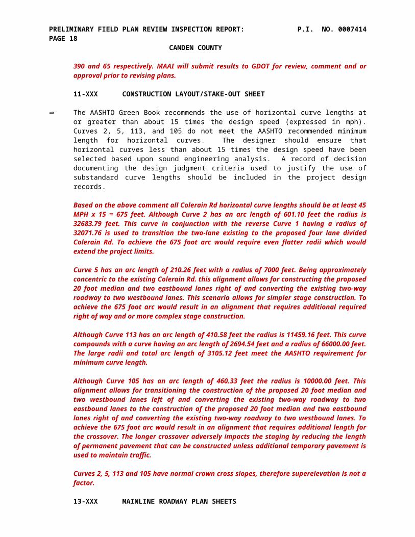
The AASHTO Green Book recommends the use of horizontal curve lengths at or greater than about 15 times the design speed (expressed in mph). Curves 2, 5, 113, and 105 do not meet the AASHTO recommended minimum length for horizontal curves. The designer should ensure that

PRELIMINARY FIELD PLAN REVIEW INSPECTION REPORT: P.I. NO. 0007414PAGE 14 CAMDEN COUNTY
horizontal curves less than about 15 times the design speed have been selected based upon sound engineering analysis. A record of decision documenting the design judgment criteria used to justify the use of substandard curve lengths should be included in the project design records.
Based on the above comment all Colerain Rd horizontal curve lengths should be at least 45 MPH x 15 = 675 feet. Although Curve 2 has an arc length of 601.10 feet the radius is 32683.79 feet. This curve in conjunction with the reverse Curve 1 having a radius of 32071.76 is used to transition the two-lane existing to the proposed four lane divided Colerain Rd. To achieve the 675 foot arc would require even flatter radii which would extend the project limits.
Curve 5 has an arc length of 210.26 feet with a radius of 7000 feet. Being approximately concentric to the existing Colerain Rd. this alignment allows for constructing the proposed 20 foot median and two eastbound lanes right of and converting the existing two-way roadway to two westbound lanes. This scenario allows for simpler stage construction. To achieve the 675 foot arc would result in an alignment that requires additional required right of way and or more complex stage construction.
Although Curve 113 has an arc length of 410.58 feet the radius is 11459.16 feet. This curve compounds with a curve having an arc length of 2694.54 feet and a radius of 66000.00 feet. The large radii and total arc length of 3105.12 feet meet the AASHTO requirement for minimum curve length.
Although Curve 105 has an arc length of 460.33 feet the radius is 10000.00 feet. This alignment allows for transitioning the construction of the proposed 20 foot median and two westbound lanes left of and converting the existing two-way roadway to two eastbound lanes to the construction of the proposed 20 foot median and two eastbound lanes right of and converting the existing two-way roadway to two westbound lanes. To achieve the 675 foot arc would result in an alignment that requires additional length for the crossover. The longer crossover adversely impacts the staging by reducing the length of permanent pavement that can be constructed unless additional temporary pavement is used to maintain traffic.
Curves 2, 5, 113 and 105 have normal crown cross slopes, therefore superelevation is not a factor.
13-XXX MAINLINE ROADWAY PLAN SHEETS
General Comments
Flag radius of ALL Pre-curved guardrail sections and include additional Type 1 anchors. Refer to Ga. Std. 4386.
MAAI will label radius of ALL Pre-curved guardrail sections and include additional Type 1 anchors.
Add Detectable Warning Strips in cut throughs in concrete islands curb cut ramps (WCR).
MAAI will show Detectable Warning Strips in cut throughs in concrete islands curb cut ramps (WCR).
Ensure R/W Markers are provided at each PC, PT.
MAAI will ensure R/W Markers are provided at all breaks in R/W line.
Callout type of curb cut ramps/wheelchair ramps (WCR) proposed.
MAAI will label all curb cut ramps/wheelchair ramps (WCR) types and delete the label “Typ” shown.
PRELIMINARY FIELD PLAN REVIEW INSPECTION REPORT: P.I. NO. 0007414PAGE 15 CAMDEN COUNTY
Use the GDOT line style for the proposed ditches. As shown on the drawings it tends to blend in with the other proposed construction lines making it hard to differentiate.
MAAI will use the GDOT line style for the proposed ditches.
The Office of Roadway Design suggests spelling out the abbreviation CSB as Concrete Side Barrier.
MAAI will relabel “CSB” as “Conc Side Barrier”
Label offset and station where proposed sidewalk changes direction.
MAAI will label offset and station where proposed sidewalk changes direction.
It appears the curb and gutter from the mainline is not aligned with the edge of pavement of the rural section at the intersection. For example see intersection of Jimmy Ln with Colerain Road on Drawing No. 13-004.
The face of proposed curb is drawn to tie to the back of the proposed shoulder pavement. The setback of the C&G provides additional turning area at radius returns.
Label proposed rip-rap areas in addition to the type and the thickness.
MAAI will add “SY” of rip-rap to the type and the thickness.
Show Begin/End Station Numbers for all sidewalk and curb and gutter.
MAAI will verify all Begin/End Station Numbers for all sidewalk and curb and gutter is labeled.
Location of OBF needs revising as Req’d R/W is located behind it (27+80 to 33+00). R/W Markers is shown to be placed behind the OBF and work isn’t allowed behind it.
The OBF cannot be placed behind Required R/W or Easement because there are no rights to enter the property beyond said Required R/W or Easement. Therefore the OBF will be placed on the Required R/W or Easement line.
Ensure that Typical Sections, Mainline Plans and Cross Sections all match. For example, guardrail being installed at approximately 111+80RT to 114+80RT +/- isn’t shown in Typical Sections or Cross Sections.
The Rural Shoulder w/ Guardrail and Urban Shoulder w/ Guardrail Details on drawing 5-013 cover this and other applicable areas. A note “See plans for Location” is shown for each detail. The FFPR cross section drawings 23-034 show the proposed guardrail.
Clarify the need for the local service Rd. @ STA 29+00 RT. It appears to lead to a wetland.
Local Service Rd No. 2 was originally constructed under the Interchange Project to maintain access to the otherwise landlocked parcel adjacent to the I-95 southbound on-ramp. This project will relocate Local Service Rd No 2 beyond the Reqd L/A at the proposed right turn lane to I-95 southbound as shown to maintain access to the otherwise landlocked parcel adjacent to the I-95 southbound on-ramp.
Add rock check dams as directed by engineer needed.
MAAI will add quantity for rock check dams to be used as directed by engineer.
Remove the label for the STR Number for driveway pipes.

PRELIMINARY FIELD PLAN REVIEW INSPECTION REPORT: P.I. NO. 0007414PAGE 16 CAMDEN COUNTY
The STR Number for driveway pipes is shown for referencing pipe profiles.
Add rip rap protection for driveway pipes where needed.
MAAI will add rip rap protection for driveway pipes where needed.
Drawing 13-000
R/W Marker is shown at about STA 14+24 LT but Begin Project and Construction station are shown at 15+00 and 15+50.
MAAI will delete R/W Markers shown at about STA 14+24 LT which are beyond the Begin Project and Construction station shown at 15+00 and 15+50.
Drawing 13-001
The super elevation rate for Curve # 41 and 42 for the relocated Service Road is not provided. Since the typical section specifies NC or RC and directs the Contractor to the cross sections similar instruction here would be useful.
MAAI will add super elevation rate and show SE transition info for Curve # 41 and 42 for the relocated Service Road.
According to the Cross Section Drawing No. 23-004 Service Road # 2 is outside of the existing topo and not tied in to the existing ground thus making impossible to quantify accurately the impact to Wet Land # 2 and ensure enough required right-of-way is acquired.
MAAI will complete existing groundlines Sta 30+50 to Sta 32+00 far right.
Bring water under driveway instead of bucking grade going under Relocated Local Service Road No. 2.
Although the Colerain Rd grade is going uphill the existing driveway at Sta 27+44 Rt is a high point because there is no existing sidedrain pipe to carry the roadside ditch under the driveway. The proposed ditch and sidedrain pipe shown on the FFPR plans retain the direction of existing ditch flow.
Verify that there isn’t a low point being induced in the SE quadrant of the intersection between Colerain Road and Relocated Local Service Road No. 2.
MAAI will verify that there isn’t a low point being induced in the SE quadrant of the intersection between Colerain Road and Relocated Local Service Road No. 2.
Add rip rap protection cross drain under Relocated Local Service Road No. 2.
MAAI will add rip rap protection for cross drain under Relocated Local Service Road No. 2.
Clarify what type of spillway is placed underneath the 10’ multi-use path and 5’ concrete sidewalk. Flag with STD or Detail number. Ensure STD or Detail is provided.
MAAI will reference drawing number 38-001 showing the Special Catch Basin Detail.
R/W Markers are shown behind the OBF STA 28+62.98 RT to STA 15+12.09 (Relocated Service Road #2). No work is to occur outside the OBF. Move the OBF so that the markers can be placed. This applies to all locations where this occurs throughout the plans.

PRELIMINARY FIELD PLAN REVIEW INSPECTION REPORT: P.I. NO. 0007414PAGE 17 CAMDEN COUNTY
The OBF cannot be placed behind Required R/W or Easement because there are no rights to enter the property beyond said Required R/W or Easement. Therefore the OBF will be placed on the Required R/W or Easement line.
Drawing 13-002
WCR should be parallel to crosswalks, i.e. direct pedestrians into crosswalk. An additional WCR is needed in the SW quadrant for the EB travel crossing the I-95 SB On Ramp.
MAAI will verify all WCR are parallel to crosswalks. MAAI will add an additional WCR in the SW quadrant for the EB travel crossing the I-95 SB On Ramp.
The Office of Roadway Design suggests changing the Wheel Chair Ramp at about STA 35+00 RT to a modified B ramp to align better with the northeast and southwest quadrants. As shown it is oriented to the northeast quadrant only but the Signing and Marking Plan Drawing No. 26-003 shows it being connected by crosswalks to both quadrants mentioned. This comment also applies to Mainline Plan Drawing No. 13-003 refer to Signing and Marking Plan Drawing No. 26-004 at the ramps intersection.
MAAI will verify all WCR and crosswalk alignments. MAAI will verify the WCR type(s) in the southwest quadrant.
Verify the need for STRs C2.1 and D2 (Don’t appear to catch much water).
MAAI will verify the need for STR C2.1. Catch Basin D2 is used primarily to turn longitudinal storm drain to outfall D1 at proposed roadside ditch.
Add concrete spillways (GA STD 9013) at the end of curb and gutter along Ramps A & B.
MAAI will add concrete spillways (GA STD 9013) at the end of curb and gutter along Ramps A & B.
Add R/W Marker on PT 33+41.10.
A R/W Marker is not shown at Const CL Sta PT 33+41.10 left because it is not a break but a point on Reqd R/W line between Sta 31+65.00, 105.00 to Sta 33+57.60, 115.00 Lt.
Drawing 13-003
WCR should be parallel to crosswalks, i.e. direct pedestrians into crosswalk. Determine if the WCR on the east side of the I-95 NB On Ramp can be shifted to better align with crosswalk.
MAAI will verify all WCR are parallel to crosswalks.
The Office of Roadway Design suggests if the drainage calculation will support it, that it would make sense to connect the side drain pipe from J4 to J2.2 instead of to J3.
Catch Basins Str J4 and J3 are located 38’ right of the construction centerline which is typically at the normal edge of the two lane pavement. This allows the proposed storm pipe from J4 to J3 to run under the right turn lane where there is adequate cover over the proposed 24” pipe.
The required structure depth of catch basin J2.2 to connect this 24” pipe would not allow for a positive pipe grade to structure 2.1 and outfall J1. It was discussed at the FFPR to connect J4 to J2.2 and possibly low point J2.1 then outfall to the proposed roadside ditch. MAAI will verify this scenario.
Explain or verify the need for both the 24” RCP from Drainage STR J-3 to J-4 and the 18” RCP from Drainage STR J2.2 to J2.1 to J2. Tie STR J4 to J2.2 and removing pipe from J4 to J3.
PRELIMINARY FIELD PLAN REVIEW INSPECTION REPORT: P.I. NO. 0007414PAGE 18 CAMDEN COUNTY
Catch Basins Str J4 and J3 are located 38’ right of the construction centerline which is typically at the normal edge of the two lane pavement. This allows the proposed storm pipe from J4 to J3 to run under the right turn lane where there is adequate cover over the proposed 24” pipe.
The required structure depth of catch basin J2.2 to connect this 24” pipe would not allow for a positive pipe grade to structure 2.1 and outfall J1. It was discussed at the FFPR to connect J4 to J2.2 and possibly low point J2.1 then outfall to the proposed roadside ditch. MAAI will verify this scenario which will delete 24” pipe J4 to J3, revise the pipe size J3 to J1 from 24” to 18” and delete 18” pipe from J2.1 and J2 MH.
It is not clear where the runoff from the driveway spillway at about STA 57+49 LT drains.
The proposed spillway replaces an existing drop inlet which outfalls into an existing roadside ditch in the northeast quadrant of Colerain Rd/ Brazell Rd (tie-in) which flows along the east (right) side of existing Brazell Rd (tie-in).
Explain the need for Drainage STRs H-1, G-2, J-1 and others like them.
Structures H1 and G2 as shown on pipe profiles 22-015 and 22-013 respectively are manholes used to drop inverts of 18’ pipes from the roadside catch basins to the outfall structures. This scenario allows for an outfall pipe grade of 1.00% thus a desirable outlet velocity.
Structure J2 is a manhole used to connect the 18” pipe from J2.1. This manhole would be deleted under the drainage scenario to connect J4 to J2.2 and possibly low point J2.1 then outfall to the proposed roadside ditch.
Place concrete spillways (GA STD 9013) at the end of curb and gutter along Ramps C & D.
MAAI will add concrete spillways (GA STD 9013) at the end of curb and gutter along Ramps C & D.
Determine if STR I6 can be eliminated, in island near WCR.
MAAI will verify if STR I6 can be eliminated, in island near WCR.
Extend curb and gutter past driveway on left side of Brazell Road.
MAAI will verify extending curb and gutter from Sta 2+77.26 shown to approximately Sta 3+00 tying into existing C&G of main driveway.
Drawing 13-004
Verify that there isn’t a low point being induced in the SE quadrant of the intersection between Colerain Road and Access Road A.
MAAI will verify that there isn’t a low point being induced in the SE quadrant of the intersection between Colerain Road and Access Road A.
Verify that there isn’t a low point being induced in the SW quadrant of the intersection between Colerain Road and Relocated Bessie Lane.
MAAI will verify that there isn’t a low point being induced in the SW quadrant of the intersection between Colerain Road and Relocated Bessie Lane.
Add concrete spillways (GA STD 9013) at the end of curb and gutter along Relocated Brazell Road and Jimmy Lane.

PRELIMINARY FIELD PLAN REVIEW INSPECTION REPORT: P.I. NO. 0007414PAGE 19 CAMDEN COUNTY
MAAI will add concrete spillways (GA STD 9013) at the end of curb and gutter along Relocated Brazell Road and Jimmy Lane
Add rip rap protection at the end of the ditch @ STA 14+00 RT Jimmy Lane.
MAAI will add rip rap protection at the sidedrain pipe outfall @ STA 13+60 RT Jimmy Lane.
There are R/W Markers proposed for Jimmy Lane that are outside the Construction Limits. No work can occur outside the Construction Limits.
MAAI will delete the R/W Markers proposed for Jimmy Lane that are outside the Construction Limits.
Drawing 13-005
Add concrete spillways (GA STD 9013) at the end of curb and gutter along Christina Lane.
MAAI will add concrete spillways (GA STD 9013) at the end of curb and gutter along Christina Lane.
Verify that STR K24 is required. Drainage cross section shows pavement and curb and gutter sloping away from STR.
Structure K24 is primarily used to change pipe direction from left edge of roadway to the left (high) side of the median of the superelevated roadway. The catch basin will also intercept the two foot of left turn lane and two foot gutter. The drainage profile on drawing 22-025 is drawn to reflect the proposed longitudinal pipe out of the structure k24 and not the crosslope of the left turn lane pavement. MAAI will add the template from the construction centerline to structure K24 to clarify the interception of the runoff from the two foot of left turn lane and two foot gutter.
Add R/W Marker on PC 81+71.37.
A R/W Marker is not shown at Const CL Sta PC 81+71.37 right because it is not a break but a point on Reqd R/W line between Sta 81+24.00,62.00 to Sta 82+24.00 50.00 Rt.
Drawing 13-003
There are R/W Markers proposed for Christina Lane that are outside the Construction Limits. No work can occur outside the Construction Limits.
MAAI will delete the R/W Markers proposed for Christina Lane that are outside the Construction Limits.
Drawing 13-006
Add flankers around the low point at 99+27 LT.
MAAI will add flankers around the low point at 99+27 LT.
Drawing 13-007
Revise TP I Rip Rap at Drainage STR N 2 to TP 3 Rip Rap, 18”.
MAAI will revise TP I Rip Rap at Drainage STR N 2 to TP 3 Rip Rap, 18”.

PRELIMINARY FIELD PLAN REVIEW INSPECTION REPORT: P.I. NO. 0007414PAGE 20 CAMDEN COUNTY
Revise the Typical Sections and Cross Sections to match what is shown on the Mainline Plans from STA 111+80 RT to 114+80 RT +/-. Guardrail is shown as being installed at this location and isn’t shown in the typical sections or cross sections.
The Rural Shoulder w/ Guardrail and Urban Shoulder w/ Guardrail Details on drawing 5-013 cover this and other applicable areas. A note “See plans for Location” is shown for each detail. The FFPR cross section drawings 23-034 show the proposed guardrail.
Verify that there aren’t low points being induced in the radius returns in the SE quadrant of Wildcat Blvd and the SW quadrants of the driveways @ 115+01 and 116+95.
MAAI will verify that there aren’t low points being induced in the radius returns in the SE quadrant of Wildcat Blvd and the SW quadrants of the driveways @ 115+01 and 116+95.
Move label L5.
MAAI will clean L5 / survey text overwrites.
Verify outfall of ditch on left side of Bristol Hammock Road. Doesn’t appear to outfall into an existing ditch or lower terrain.
MAAI will verify outfall of ditch on left side of Bristol Hammock Road.
Revise the note for pavement obliteration to read “Remove existing base and pavement and grade to drain.” In addition, hatch the pavement to be removed.
MAAI will revise the note for pavement obliteration to read “Remove existing base and pavement and grade to drain.” and hatch the pavement to be removed.
Drawing 13-008
The distance for the drainage flanking structures (assuming T3 and T5 represent the flanking structure for the low point STR T4) from the low point seems excessive. According to the information provided on Drawing No. 15-008 it should be located 63 feet from the low point structure of the approximate 110 feet shown. Check all drainage flanking structure locations.
Structures T3 & T5 locations are required for gutter spread. MAAI will add flankers around the low point at 128+40 LT.
Revise the Typical Sections and Cross Sections to match what is shown on the Mainline Plans from STA 126+00LT/RT to 128+00 LT/RT +/-. Guardrail is shown as being installed at this location and isn’t shown in the typical sections or cross sections.
The Rural Shoulder w/ Guardrail and Urban Shoulder w/ Guardrail Details on drawing 5-013 cover this and other applicable areas. A note “See plans for Location” is shown for each detail. The FFPR cross section drawings 23-038 & 039 show the proposed guardrail.
Show Limits of Construction for Driveway located at STA 130+00 LT.
MAAI will show slope limits and label LOC for Driveway located at STA 130+00 LT.
Verify that STR Q6 is at a low point.
MAAI will verify that STR Q6 is at a low point.
Utilize 4’ flat bottom ditches for outfalls for individual drainage structures.

PRELIMINARY FIELD PLAN REVIEW INSPECTION REPORT: P.I. NO. 0007414PAGE 21 CAMDEN COUNTY
The use of outfall pipes from individual drainage structures to the 4’ flat bottom ditch versus the longitudinal storm drain pipe shown would be a major design change that would affect the completion of the final construction plans and project let date.
In some areas the 4’ flat bottom ditch located at the toe of the roadway fill has a minimum grade of 0.002 ft/ft to convey the offsite water flowing towards Colerain Rd to the cross drains. The longitudinal storm drain provides a minimum 0.003 ft/ft grade to convey the roadway runoff to the cross drains. Combining the roadway and offsite runoff in the 4’ flat bottom ditch, if feasible, would require additional engineering time and costs.
A portion of the drive at STA 123+83 RT is off R/W and easement.
There is an existing 10’ utility and slope easement between the existing R/W and proposed driveway easement shown. This easement was a condition in the driveway permit approval that was reviewed by MAAI for compatibility with this project.
The District 5 Construction Office recommends replacing the existing 12” under Wildcat Drive with 18” RCP.
MAAI will replace the existing 12” under Wildcat Drive with an 18” pipe. The required P9 structure depth for an 18” pipe will require revising pipe inverts and structure heights for P8 to P2.
Drawing 13-009
Driveway – adjust east WCR north for better alignment to cut through.
MAAI will verify the location of easterly WCR with respect to the median cut through.
Utilize 4’ flat bottom ditches for outfalls for individual drainage structures.
The use of outfall pipes from individual drainage structures to the 4’ flat bottom ditch versus the longitudinal storm drain pipe shown would be a major design change that would affect the completion of the final construction plans and project let date.
In some areas the 4’ flat bottom ditch located at the toe of the roadway fill has a minimum grade of 0.002 ft/ft to convey the offsite water flowing towards Colerain Rd to the cross drains. The longitudinal storm drain provides a minimum 0.003 ft/ft grade to convey the roadway runoff to the cross drains. Combining the roadway and offsite runoff in the 4’ flat bottom ditch, if feasible, would require additional engineering time and costs.
Drawing 13-010
Drainage flanking STRs for low point STRs AA1 and AA3 are not provided. Please add.
MAAI will add flanking STRs for low point STR AA2. MAAI will verify if flanking structures are required for median low point STR AA3 which has a left turn lane pavement drainage area approximately 300’ long x 4’ wide.
Utilize 4’ flat bottom ditches for outfalls for individual drainage structures.
The use of outfall pipes from individual drainage structures to the 4’ flat bottom ditch versus the longitudinal storm drain pipe shown would be a major design change that would affect the completion of the final construction plans and project let date.
In some areas the 4’ flat bottom ditch located at the toe of the roadway fill has a minimum grade of 0.002 ft/ft to convey the offsite water flowing towards Colerain Rd to the cross drains. The longitudinal storm drain provides a minimum 0.003 ft/ft grade to convey the

PRELIMINARY FIELD PLAN REVIEW INSPECTION REPORT: P.I. NO. 0007414PAGE 22 CAMDEN COUNTY
roadway runoff to the cross drains. Combining the roadway and offsite runoff in the 4’ flat bottom ditch, if feasible, would require additional engineering time and costs.
Move STR F2 to STA 156+00 to serve as a flanker.
Clarify STR F2? There is a catch basin Str FF2 located at Sta 157+00 primarily to turn pipe to outfall FF1 adjacent to the 54” cross drain EE4 to EE1.
Verify that there isn’t a low point being induced in the radius returns in the SW quadrant of Settlers Hammock Way.
MAAI will verify that there isn’t a low point being induced in the radius returns in the SW quadrant of Settlers Hammock Way.
Verify that STR AA3 is required. Drainage cross section shows pavement and curb and gutter sloping away from structure.
Median low point STR AA3 has a left turn lane pavement drainage area approximately 300’ long x 4’ wide.
Explain the reason rip rap protection at outfall GG1 is being eliminated.
MAAI will add rip rap protection at outfall GG1.
Drainage STRs DD1, DD2, DD3, and the 30” RCP between them is off R/W. All permanent drainage STRs should be placed on R/W.
This existing drainage was originally on private property. The 7/19/2013 right of way plan revision added the existing right of way for Settler’s Hammock Way per plans obtained from the Camden County. The relocated drainage on Parcel 41B shown and labeled as Easement for Construction of Drainage (temporary) will need to be revised. MAAI will check the R/W acquisition status to see if the Parcel is closed and if we need to make the revision under another Parcel number.
Verify that the existing 30” under Settlers Hammock Way does not require replacement.
This existing drainage was originally on private property. The 7/19/2013 right of way plan revision added the existing right of way for Settler’s Hammock Way per plans obtained from the county. MAAI will consult with Camden County as to replacing the existing 30” under Settlers Hammock Way.
Drawing 13-011
Utilize 4’ flat bottom ditches for outfalls for individual drainage structures.
The use of outfall pipes from individual drainage structures to the 4’ flat bottom ditch versus the longitudinal storm drain pipe shown would be a major design change that would affect the completion of the final construction plans and project let date.
In some areas the 4’ flat bottom ditch located at the toe of the roadway fill has a minimum grade of 0.002 ft/ft to convey the offsite water flowing towards Colerain Rd to the cross drains. The longitudinal storm drain provides a minimum 0.003 ft/ft grade to convey the roadway runoff to the cross drains. Combining the roadway and offsite runoff in the 4’ flat bottom ditch, if feasible, would require additional engineering time and costs.
Add flankers at 50’ from low point at 159+30 LT & RT.

PRELIMINARY FIELD PLAN REVIEW INSPECTION REPORT: P.I. NO. 0007414PAGE 23 CAMDEN COUNTY
MAAI will add flanking STRs for low point STR FF. MAAI will verify if flanking structures are required for median low point STR FF4.1 which has a left turn lane pavement drainage area approximately 270’ long x 4’ wide.
Drawing 13-012
Label the Begin/End points for the concrete side barriers, MSE wall and Visual Barrier on the left side.
The begin/end and types of Concrete Side Barrier, MSE wall and Visual Barrier are listed in a table in the lower right corner of drawing 13-012.
It appears that drainage STRs II4, II3, and the 18” RCP is off R/W. All permanent drainage structures should be placed on R/W.
The construction of the concrete side barrier requires the relocation of existing private drainage structures. Proposed Drainage STRs II4, II3, and the 18” RCP and Str AH3 and AH2 are shown to be constructed on Easement for Construction of Drainage (temporary).
It was requested during the PFPR to add an additional WCR to both the NE & NW quadrants to better align with 2 crosswalks. The response was will evaluate crosswalk alignments with respect to WCR’s. The WCR’s are located to avoid impacting the existing signal mast arm poles to remain. Additional WCR is still needed.
MAAI will add additional WCR.
It was pointed out during the PFPR that the curb and island at drive STA 182+50 RT will be damaged during construction. Show to repair and tie to existing. The response was will show driveway reconstruction for proposed pipe and add Easement for Construction of Driveway as required. Replacement of curb and island not shown.
The line work for reconstruction of the pavement and curb and gutter required for the installation of the 42” pipe is shown per Ga Std 1030D. The line work for reconstruction of the median nose to accommodate the proposed sidewalk is shown. MAAI will label accordingly.
Drawing 13-013
The transition between the existing rounded end of the raised median and the proposed raised median is not shown at about STA 186+21.36.
MAAI will revise proposed median tie to existing median and End Mill & Inlay/ Begin Full Depth Pavement station accordingly.
Utilize 4’ flat bottom ditches for outfalls for individual drainage structures.
The use of outfall pipes from individual drainage structures to the 4’ flat bottom ditch versus the longitudinal storm drain pipe shown would be a major design change that would affect the completion of the final construction plans and project let date.
In some areas the 4’ flat bottom ditch located at the toe of the roadway fill has a minimum grade of 0.002 ft/ft to convey the offsite water flowing towards Colerain Rd to the cross drains. The longitudinal storm drain provides a minimum 0.003 ft/ft grade to convey the roadway runoff to the cross drains. Combining the roadway and offsite runoff in the 4’ flat bottom ditch, if feasible, would require additional engineering time and costs.
Place flankers at 50’ from low point at 196+00 and 197+00 LT & RT.
MAAI will add flankers at 50’ from low point at 196+00 and 197+00 LT & RT.

PRELIMINARY FIELD PLAN REVIEW INSPECTION REPORT: P.I. NO. 0007414PAGE 24 CAMDEN COUNTY
Take water from STRs MM6, MM7, MM2.3 and MM2.4 to low point at STA 196+50. Remove pipe from MM6 to MM5 and MM2.3 to MM2.2.
MAAI will verify this drainage scenario. The proposed 18” cross drain at low point Sta 196+50 may need to be upsized too handle the additional flow Strs MM6.1, MM6, MM7, MM2.3 and MM2.4.
Drawing 13-014
Drainage STR OO3 is not shown graphically.
STR OO3 is a 1019B drop inlet which is shown in the gutter. MAAI will verify that it is shown as a modified for double grate.
Verify if driveway and gate at STA 207+00 RT is being relocated.
This was previously discussed during R\W acquisition. MAAI will verify status of replacing the driveway and gate.
Verify the need for STR PP7. It is located within 25’ of the high point and also appears to be orientated in the wrong direction.
MAAI will verify the location of Str PP7. The roadway is in full superelevation and has a left turn lane and taper. The roadway has a high point at centerline Sta 210+23.33 and Sta 208+80, 10 foot right.
Drawing 13-015
Shift PP6.1 back away from the median nose.
MAAI will relocate PP6.1 from Sta 212+20 to Sta 212+02 to meet the desirable 25’ offset to median opening per GA Const Detail M-3A.
QQ5 and QQ4 structure types don’t match the callouts in the drainage profiles.
QQ5 and QQ4 structure types are drawn per the callout on drainage profile drawing 22-100. Str QQ5 is a low point 1034D on the right turn lane taper. Str QQ4 is a 1033D. Note that there are separate eastbound and westbound profiles shown on drawing 15-014.
Place a 1034D at STA 216+47 LT.
Str QQ5 (1034D) is shown at the low point in the right turn lane taper Sta 216+25, 43.40’ Lt per drawing 22-100. The low point at the westbound PGL is at Sta 216+46.67, 10’ left as shown on drawing 15-014.
Utilize 4’ flat bottom ditches for outfalls for individual drainage structures.
The use of outfall pipes from individual drainage structures to the 4’ flat bottom ditch versus the longitudinal storm drain pipe shown would be a major design change that would affect the completion of the final construction plans and project let date.
In some areas the 4’ flat bottom ditch located at the toe of the roadway fill has a minimum grade of 0.002 ft/ft to convey the offsite water flowing towards Colerain Rd to the cross drains. The longitudinal storm drain provides a minimum 0.003 ft/ft grade to convey the roadway runoff to the cross drains. Combining the roadway and offsite runoff in the 4’ flat bottom ditch, if feasible, would require additional engineering time and costs.
Place flankers at 50’ from low point at 220+90 LT & RT and 219+90 RT.

PRELIMINARY FIELD PLAN REVIEW INSPECTION REPORT: P.I. NO. 0007414PAGE 25 CAMDEN COUNTY
MAAI will add flankers at 50’ from low point at 220+40.82 LT (TT2) and 220+40 RT (SS3). There is no low point at Sta 219+90 RT.
Drawing 13-016
The radius for Curve # 112 is specified as 11246.73’ and based on the Green Book normal crown should be used for the design superelevation. Explain why reverse crown is being used.
A reverse crown is used to obtain adequate cover over the triple 30” crossdrain at Sta 218+55, RR4 to RR1, drawing 22-101 and 48” crossdrain at Sta 235+61, Str YY2 to YY1, drawing 22-107.
Utilize 4’ flat bottom ditches for outfalls for individual drainage structures.
The use of outfall pipes from individual drainage structures to the 4’ flat bottom ditch versus the longitudinal storm drain pipe shown would be a major design change that would affect the completion of the final construction plans and project let date.
In some areas the 4’ flat bottom ditch located at the toe of the roadway fill has a minimum grade of 0.002 ft/ft to convey the offsite water flowing towards Colerain Rd to the cross drains. The longitudinal storm drain provides a minimum 0.003 ft/ft grade to convey the roadway runoff to the cross drains. Combining the roadway and offsite runoff in the 4’ flat bottom ditch, if feasible, would require additional engineering time and costs.
Place flankers at 50’ from low point at 227+00 LT & RT, 232+69 RT and 238+59 RT.
MAAI will add flankers at 50’ from low point at 226+50 LT & RT, 232+19.18 RT and 239+09.39 RT.
Determine if STR XX2 can be tied to the 48” RCP eliminating 18” outfall RCP.
MAAI will verify if STR XX2 can be tied to the 48” RCP eliminating 18” outfall RCP.
Drawing 13-017
Place flankers at 50’ from low point at 239+20 LT, 240+20 LT and 239+59 RT.
MAAI will add flankers at 50’ from low point at 239+69.51 LT. There is no low point at Sta 240+20 LT and 239+59 RT.
Flag the PT for Curve 113. Add R/W Marker. During the FFPR the Designer stated it is flagged as PCC 250+90.27. This station is 20.93’ beyond the length of curve shown for Curve 113.
There is a station equality labeled at the PC Sta 246+58.76 Back = Sta 246+79.69 Ahead. When adding curve arc length of 410.58 to the ahead PC Sta 246+79.69 = PCC Sta 250+90.27. There is a R\W marker shown at PCC Sta 250+97.27 Lt.
Drawing 13-018
Verify if islands for Winding Road (North) are being relocated.
MAAI will label “Remove Conc Islands”.
Place concrete spillways (GA STD 9013) at the end of curb and gutter along Winding Road (North) LT & RT.
MAAI will add concrete spillways (GA STD 9013) at the end of curb and gutter along Winding Road (North) LT & RT.

PRELIMINARY FIELD PLAN REVIEW INSPECTION REPORT: P.I. NO. 0007414PAGE 26 CAMDEN COUNTY
Verify that there isn’t a low point being induced in the SW quadrant of the intersection between Colerain Road and Winding Road (South).
MAAI will verify that there isn’t a low point being induced in the SW quadrant of the intersection between Colerain Road and Winding Road (South).
It appears that guardrail is not needed STA 257+75 to STA 270+00 RT.
Guardrail is shown from STA 257+75 to STA 270+00 RT to protect the 2:1 front slope of roadside ditch. A flatter front slope would shift the proposed ditch closer to the existing 18”SDR 26 sanitary sewer force main shown on the cross sections drawing 23-085 to 089.
Drawing 13-019
Type 3 rip rap is shown for the outfall at STR GGG1. Determine if TP 1 is required in an ESA.
MAAI will revise Type 3 to Type 1 rip rap for the outfall at STR GGG1.
Show Limits of Construction for driveway at STA 272+70 LT.
MAAI will add Limit of Construction for driveway at STA 272+70 LT.
Verify if driveway and gate at STA 280+00 LT is being relocated.
The driveway at STA 280+00 LT is being relocated to Sta 283+56 LT to eliminate the severe skew angle. MAAI will verify if property owner is being compensated for gate in R/W negotiations.
It appears that guardrail is not needed STA 271+50 to STA 274+00 RT, STA 280+00 to STA 285+80 RT.
Guardrail is shown from STA 271+50 to STA 274+00 RT, Sta 280+00 to Sta 285+80 RT to protect the 2:1 front slope of roadside ditch. A flatter front slope would shift the proposed ditch closer to the existing 18”SDR 26 sanitary sewer force main shown on the cross sections drawing 23-089 to 094.
Drawing 13-019
Add R/W Marker on PT 277+84.82 LT.
A R/W Marker is not shown at Const CL Sta PT 277+84.82 left because it is not a break but a point on Reqd R/W line between Sta 275+00, 70.00 to Sta 279+50.00, 80.00 Lt.
Drawing 13-020
Show Limits of Construction for driveway at STA 289+20 LT and 285+81 RT.
MAAI will add Limit of Construction for driveways at STA 289+20 LT and 285+81 RT.
It appears that guardrail is not needed STA 280+00 to STA 285+80 RT, STA 287+50 to STA 288+25 RT, and STA 289+00 to STA 300+00 RT.
Guardrail is shown from STA 280+00 to STA 285+80 RT, Sta 287+50 to Sta 288+25 RT and Sta 289+00 to Sta 300+00 RT to protect the 2:1 or 3:1 front slope of roadside ditch. A flatter front slope would shift the proposed ditch closer to the existing 18”SDR 26 sanitary sewer force main shown on the cross sections drawing 23-092 to 099.
Drawing 13-021

PRELIMINARY FIELD PLAN REVIEW INSPECTION REPORT: P.I. NO. 0007414PAGE 27 CAMDEN COUNTY
It appears that guardrail is not needed STA 289+00 to STA 300+00 RT.
Guardrail is shown from STA 289+00 to STA 300+00 RT to protect the 2:1 or 3:1 front slope of roadside ditch. A flatter front slope would shift the proposed ditch closer to the existing 18”SDR 26 sanitary sewer force main shown on the cross sections drawing 23-092 to 099.
Drawing 13-022
Show rip rap at STR 0001.
MAAI will add rip rap at STR 0001.
Add R/W Marker on PT 311+55.53 RT.
A R/W Marker is not shown at Const CL Sta PT 311+55.53 right because it is not a break but a point on Reqd R/W line between Sta 310+93.49, 80.00 to Sta 312+42.60, 70.00 Rt.
Add R/W Marker on PC 316+55.53 LT & RT.
A R/W Marker is not shown at Const CL Sta PC 316+55.53 left or right because they are not breaks but points on Reqd R/W line between Sta 314+80.00, 85.00 to Sta 317+00.00, 85.33 LT and Sta 312+42.60, 70.00 to Sta 317+40.16 68.87 Rt respectively.
14-XXX CROSSROAD/SIDE STREET/FRONTAGE ROAD/RAMP PLAN SHEETS
Drawing 14-004
Extend the ditch on left side of Ramp A to outfall of pipe STA 41+00.
MAAI will extend the ditch on left side of Ramp A to outfall of pipe STA 41+00.
Drawing 14-005
On Google Earth the existing ditch on Brazell Road is about 23 feet away from the edge of pavement on the right side and about 16 feet on the left side. The proposed ditch as shown does not appear to tie in to the existing. For example as measured on the drawing the proposed ditch on the left side is shown at about 6 feet away from the edge of pavement.
MAAI will verify the location of the ditch tie-ins on Brazell Rd.
There is a R/W Markers proposed for Relocated Brazell Road that is outside the Construction Limits. No work can occur outside the Construction Limits.
MAAI will delete R/W Marker that are outside the Construction Limits.
Drawing 14-007
Place rip rap protection at the end of the ditches @ STA 12+00 LT & RT Bessie Lane.
MAAI will add rip rap protection at the end of the ditches @ STA 12+00 LT & RT Bessie Lane.
Drawing 14-008
Revise Crossroad Plans for Winding Road (North and South) to match what is shown in Typical Sections 19 and 20 (Sta. #’s doesn’t match).

PRELIMINARY FIELD PLAN REVIEW INSPECTION REPORT: P.I. NO. 0007414PAGE 28 CAMDEN COUNTY
The Begin/End Overlay & Widening Stations match the typical sections. MAAI will revise Typical Section No. 20 to reflect proposed ditch section on left side of Winding Rd and the Limit of Shoulder Construction Sta 1+94.16 Rt.
Drawing 14-009
Revise Crossroad Plans for Kings Bay Road (North and South) to match what is shown in Typical Section 21.
MAAI will revise Typical Section No. 21 to reflect proposed left turn lane widening on left side Kings Bay Rd.
15-XXX MAINLINE ROADWAY PROFILE SHEETS
Grades for all tangents along the PGL should be shown in percentage to four (4) decimal place accuracy in accordance with the PPG Section 15.002 Required Information.
MAAI will show grades to four (4) decimal place accuracy in accordance with the PPG Section 15.002 Required Information.
Verify the k value for the curve with PVI at STA 236+20. It appears this should equal 500.0000.
MAAI will revise the k value for the curve with PVI at STA 236+20 to 500.0000.
16-XXX CROSSROAD/SIDE STREET/FRONTAGE ROAD/RAMP PROFILE SHEETS
Drawing 16-022
The existing ground line is missing from a section of the proposed profile.
MAAI will complete the existing ground line missing from a section of the proposed profile.
17-XXX DRIVEWAY PROFILE SHEETS
No comment.
18-XXX SPECIAL GRADING – N/A
19-XXX CONSTRUCTION STAGING & STAGING CROSS-SECTION PLAN SHEETS
General Comments
Add a note that the moving of signals during staging is the Contractor’s responsibility with no additional cost to the department.
MAAI will add a project specific note to section 4 stating “Any adjustment of existing traffic signal(s) to maintain traffic as shown in the Construction Staging Plans shall be the Contractor’s responsibility at no additional cost to the department.”
Drawing 19-001
Proposed temporary ditches are shown on the staging cross sections but not shown on the staging plan drawings. For example see Drawing 19-001 and 19-037.
Proposed temporary ditches and pipes per cross section drawing 19-037 are shown and labeled on drawing 19-001 as “2’ FB Ditch” with flow arrows on drawing 19-001 & 19-002.
Stage 1

PRELIMINARY FIELD PLAN REVIEW INSPECTION REPORT: P.I. NO. 0007414PAGE 29 CAMDEN COUNTY
Water is trapped in median @ STA 70+50 (19-004 & 19-048).
MAAI will verify if water is trapped in median @ STA 70+50 (19-004 & 19-048) and add temporary drainage structures as necessary.
Determine if temporary barrier is really needed @ STA 156+50 to STA 159+00 (19-010 excavation for pipe is approx. 40’ from travel lane).
Temporary barrier is shown @ STA 156+50 to STA 159+00 to protect the traveling public from the adjacent construction and hauling equipment that will be required to remove 54” headwall, excavate and extend the 54” cross drain pipe.
Water in median travels from STA 236+00 to STA 219+00 before it can escape. Determine if a temporary pipe is needed, (19-015, 19-016, 19-091, and 19-096).
MAAI will verify if additional temporary drainage structure(s) and outfall(s) are required in the temporary 2’ FB ditch between STA 236+00 to STA 219+00 (19-015, 19-016, 19-091, and 19-096).
Explain the use of temporary asphalt @ STA 305+50 to STA 309+00 (19-022, 19-023, 19-122, and 19-123).
The variable width temporary pavement from STA 305+50 to STA 309+00 Lt (19-022, 19-023, 19-122, and 19-123) abuts the existing pavement. As shown in Stage 3 (19-213 & 214) this existing and temporary pavement is used to shift two-way traffic from existing Colerain Rd south of Kings Bay Rd onto the permanent pavement constructed in Stage 1 so that the remaining width of Colerain Rd can be constructed. Stage 5 (19-324 & 325) shifts two-way traffic onto pavement constructed in Stage 3 so that the remaining full width of Colerain Rd can be constructed. The use of variable width temporary pavement in the northeast quadrant of Colerain Rd/ Kings Bay Rd in Stage 1 eliminates the wedge construction of permanent pavement that would otherwise be required to remove the existing pavement in Stage 5.
Stage 3
There does not appear to be enough room for a left turn lane and barrier wall @ STA 36+00 to STA 38+40 and STA 47+50 to STA 49+43 (19-229, 19-194, 19-223, 19-195, 19-234).
The temporary barrier is located on the 2’ grass shoulder of Stage 2 construction (19-171 to 176). The barrier will remain in place until the left side of Colerain Road is brought up to grade. MAAI will show the Stage 2 left shoulder and slope line work on the corresponding Stage 3 cross-sections.
Water trapped in median @ STA 54+00 (19-195, 19-235, 19-236).
MAAI will reverse ditch direction so water flows to Sta 52+90 temporary DI 17T.
Settlers Way has a section @ STA 8+50 to STA 9+00 that is a single lane for 2 lanes of traffic (19-202).
The note “Lane closure on two lane road using flaggers shall be in accordance with the Manual on Uniform Traffic Control Devices for Streets and Highways …” is shown on the drawing.
Brazell Tie-In has a section @ STA 7+80 that is a single lane for 2 lanes of traffic (19-220, 19-221).

PRELIMINARY FIELD PLAN REVIEW INSPECTION REPORT: P.I. NO. 0007414PAGE 30 CAMDEN COUNTY
The note “Lane closure on two lane road using flaggers shall be in accordance with the Manual on Uniform Traffic Control Devices for Streets and Highways …” is shown on the drawing.
Jimmy Ln. has a section @ STA 13+00 to STA 14+00 that is a single lane for 2 lanes of traffic (19-196).
The note “Lane closure on two lane road using flaggers shall be in accordance with the Manual on Uniform Traffic Control Devices for Streets and Highways …” is shown on the drawing.
Stage 4
Jimmy Ln. has a section @ STA 13+00 to STA 14+00 that is a single lane for 2 lanes of traffic, (same condition in stage 3) (19-282).
The note “Lane closure on two lane road using flaggers shall be in accordance with the Manual on Uniform Traffic Control Devices for Streets and Highways …” is shown on the drawing.
Driveway @ STA 275+00 doesn’t have access (19-289).
MAAI will omit a length of median construction in Stage 3 to allow access to driveway Sta 275+00 Rt. The median will be constructed in Stage 5 as either an integral or curb & gutter median.
Ramp A @ STA 41+00 doesn’t appear to have enough room to get traffic to left side of ramp. Determine if temporary asphalt is needed (19-294).
MAAI will verify Ramp A @ STA 41+00 has sufficient width to get traffic to left side of ramp. MAAI will extend End Milling, Overlay and Widening Station/ Begin Full Width/Full Depth Pavement Sta 42+70 as required to provide sufficient width.
Stage 5
Driveway @ STA 141+25 has no access (19-312).
MAAI will omit a length of median construction in Stage 3 to allow access to driveway Sta 141+25 Rt. The median will be constructed in Stage 6 as either an integral or curb & gutter median. The integral raised driveway island will be constructed in Stage 6.
20-XXX CONSTRUCTION STAGING DETAILS
General Comments
The temporary pavement shown above the retained existing pavement appears to be constructed of leveling but on the Typical Section Drawing No. 05-14 for temporary pavement only full depth pavement sections are shown. Also the hatching used on the staging plan drawings depicts temporary full depth pavement. For example see cross sections from STA 164+50 to 165+50.
MAAI will add a temporary pavement typical section depicting areas of overlay & leveling. The temporary pavement legend does not differentiate between full depth or overlay and leveling. The hatching used on plans 19-010 & 011 reflect the overlay and leveling or full depth temporary pavement shown on cross sections 19-075 to 078. All faded back line work will be darkened for clarity.
The cross sections for the right section from STA 219+00 to 256+00 are not provided. Clarify what phase is going to be constructed.

PRELIMINARY FIELD PLAN REVIEW INSPECTION REPORT: P.I. NO. 0007414PAGE 31 CAMDEN COUNTY
Staging cross sections as well as plan sheets are currently included to verify traffic control and interim grading/drainage between areas under construction and existing pavement. Plan sheets are included to verify traffic control on newly constructed pavement and to show remaining roadway template under construction. Colerain Rd Sta 219+00 to Sta 256+00 Rt is shown in Stage 3, drawings 19-207 to 19-210, as constructing the remaining width of Colerain Rd. Adding cross sections for this latter stage which only completes the proposed roadway template would result in additional sheets to the plan set.
Drawing 19-091
Temporary concrete barrier are placed incorrectly. For example see STA 220+50 where it is shown as been buried by the construction fill and some barrier is shown being placed in the temporary ditch. This comment applies to other cross section showing similar situation.
Temporary concrete barrier shown at Sta 219+50, 220+00 and 220+50 is only required for construction of the cross drain. Once the pipe is placed, backfilled and the ground brought back to grade the temporary barrier can be removed. A note to this effect will be added to all applicable cross sections.
Some of the temporary ditch does not have outfall locations. For example see cross sections from STA 51+00 to 53+50. The low point for the temporary ditch is located at STA 53+00 but no outfall is provided. This comment applies to other ditches showing the same situation.
Assuming the comment applies to Stage 1 the staging plan 19-003 and temporary pipe profile 20-012 shows a temporary drop inlet 17T and temporary pipe to permanent drainage structures J3 to J2 and outfall J1.
Drawing 19-229
Proposed permanent pavement is shown being constructed under the temporary concrete barrier. For example see STA 37+50. This comment applies other cross sections with the same situation.
The temporary barrier is located on the 2’ grass shoulder of Stage 2 construction (19-171 to 176). The barrier will remain in place until the left side of Colerain Road is brought up to grade. MAAI will show the Stage 2 left shoulder and slope line work on the corresponding Stage 3 cross-sections.
Drawing 19-240
Explain if there is a reason why on some cross sections the travel lane is reduced to 10 feet even though it appears there is enough pavements to maintain 11 feet. For example see STA 93+00. This comment is applies to other cross sections with the same situation.
The staging crossover shown on drawing 19-006 has a baseline. The mainline cross sections show the offset from the construction centerline to this crossover baseline. From Sta 90+00 to Sta 100+50 there is a “one-foot” dimension to the left of this offset line which when added to the 10’ dimension shown equals an 11’ lane. From Sta 101+00 to Sta 102+50 there is a “varying” dimension to the left or right of this offset line which when added to the variable dimension shown equals an 11’ lane.
21-XXX DRAINAGE AREA MAP
Show total disturbed area of project.
MAAI will add the total disturbed area of project.
Show total project size.

PRELIMINARY FIELD PLAN REVIEW INSPECTION REPORT: P.I. NO. 0007414PAGE 32 CAMDEN COUNTY
MAAI will add the total project size.
Add flow arrows.
MAAI will add flow arrows.
Show post construction velocities.
MAAI will add post construction velocities.
Show post construction headwaters.
MAAI will add post construction headwaters.
Show disturbed area for each basin.
MAAI will add disturbed area for each basin.
22-XXX DRAINAGE PROFILES
General Comments
The minimum required storm drain pipe size by GDOT is 18” but 15” is shown on the profiles. For example see side drain pipe from drainage STR D6 to D5.
The structure height of D6 for an 18” pipe does not allow for positive flow to outfall Str D1. MAAI will revise drainage layout to eliminate the 15” pipe.
Verify that catch basins are a minimum of 10’ from radius returns.
The centers of the catch basin boxes are a minimum of 5.17’ on the downstream end and 16.34’ on the upstream end from radius returns. These offsets satisfy the 3’and 6’ gutter transitions as shown on the Ga Stds.
Add hydraulic grade line for longitudinal systems.
MAAI will add hydraulic grade line for longitudinal systems.
For segments that exceed 45 degrees in delta, break the segments into separate lines.
Comment needs clarification for an MAAI response.
Add design year velocities at outfalls.
MAAI will add design year velocities at outfalls.
Label outfalls at the end of the pipe instead of the back of the STR.
The FFPR plans label the outfalls at the end of the FES or other precast structures and at the end of the pipe or box culvert for Headwall, Wingwalls and Parapets or other cast in place structures. Restationing all outfalls to the end of the pipe will require recalculating offsets and pipe grades accordingly.
Drawing 22-001
Add drainage profiles for STRs A1 through A7 and B1 through B5. Verify that there is enough depth between ditch elevation and EOP of roadway for proposed type of structure.
MAAI will add drainage profiles for STRs A1 through A7 and B1 through B5.

PRELIMINARY FIELD PLAN REVIEW INSPECTION REPORT: P.I. NO. 0007414PAGE 33 CAMDEN COUNTY
Drainage profiles for driveways are not required.
Drainage profiles for driveways are included in the plans to verify compatibility of ditch grades and pipe inverts, pipe lengths for quantities and pipe cover.
Increase the slope on pipes from 0.20% to 0.30% to match the slope of Colerain Road.
Ditch grades at the toe of fill are based on the existing ground and will not necessarily match the roadway grades.
Drawing 22-002
Verify the need for safety end sections for STRs AD1 and AD2.
MAAI will change inlet/ outfall structures to 1120 FES.
Drawing 22-003
Drainage profile for driveway is not required.
Drainage profiles for driveways are included in the plans to verify compatibility of ditch grades and pipe inverts, pipe lengths for quantities and pipe cover.
Verify the need for safety end sections.
MAAI will change inlet/ outfall structures to 1120 FES.
Drawing 22-004 – 22-006
Longitudinal slopes are very shallow, should have a minimum slope of 0.22% for an 18 inch pipe to achieve a minimum velocity of 3 ft/sec when flowing full.
The longitudinal slopes for the 18” pipes from Str C5 to C2 are 0.21%.
Verify the need for a safety end section for STR D1.
MAAI will change outfall structure to 1120 FES.
Drawing 22-007
Propose Drainage STR D5 has a 15” and 18” pipe attached to it therefore the minimum height of the structure should accommodate the 18” pipe which is 4.17 feet for 1019B TP V-1. According to the information provided on the profile the height of the structure is ((25.71-22.28) +0.5) = 3.93’.
Per Ga STD 1019B Tp V-1 w/ hood the bottom slab thickness is 8”. Therefore 25.71-22.28 +0.67 = 4.10’ as shown.
Verify minimum depth of STRs D6 and D4.
Str D5 shows a structure height of 4.10’ versus the 4.17’ required per Ga STD 1019B. Str D6 shows a structure height of 4.76’ versus the 4.83’ required per the Ga STD 1033D. The difference of 0.07’ should not adversely affect the construction of the drainage structures.
Longitudinal slopes are very shallow, should have a minimum slope of 0.22% for an 18 inch pipe to achieve a minimum velocity of 3 ft/sec when flowing full.
The longitudinal slopes from Str D6 to D1 are 0.18%. The structure heights for an 18” pipe do not allow for a slope of 0.22%.

PRELIMINARY FIELD PLAN REVIEW INSPECTION REPORT: P.I. NO. 0007414PAGE 34 CAMDEN COUNTY
Verify the need for a safety end section for STR C1.
MAAI will change outfall structure to 1120 FES.
Drawing 22-008
Show perpendicular pipes for STR E2.
MAAI will show the 18” pipes coming into and out of E2. MAAI will revise the invert 33.58 to 32.41 and pipe grade E3 to E2 from 3.96% to 4.47%.
Increase the depth of STR E2 to reduce slope of pipe.
Increasing the 6’ height of Str E2 will result in additional depth quantity. The manhole Str E1 is used to drop pipe inverts and provide a 1.00% outfall grade.
Drawing 22-010
Show perpendicular pipes for STR F3.
MAAI will show the 18” pipes coming into and out of F3.
Drawing 22-015
Increase the depth of STR H1 to reduce slope of pipe.
Increasing the 6’ height of Str H2 will result in additional depth quantity. The manhole Str H1 is used to drop pipe inverts and provide a 1.00% outfall grade.
Drawing 22-016
Verify the need for a safety end sections for STRs I1 and J1.
MAAI will change outfall structures to 1120 FES.
Verify the minimum height for STR J2.
It was discussed at the FFPR to connect J4 to J2.2 and possibly low point J2.1 then outfall to the proposed roadside ditch. MAAI will verify this scenario which will delete 24” pipe J4 to J3, revise the pipe size J3 to J1 from 24” to 18” and delete 18” pipe from J2.1 and J2 MH.
Drawing 22-018
Drainage profiles for driveways are not required.
Drainage profiles for driveways are included in the plans to verify compatibility of ditch grades and pipe inverts, pipe lengths for quantities and pipe cover.
Verify the need for a safety end sections for STRs AF1 and AF2.
These structures are for a side drain pipe under a rural driveway.
Verify the structure type for STR J7.
Str J7 is a 1034D shown at the low point in the right turn lane taper.
Drawing 22-025

PRELIMINARY FIELD PLAN REVIEW INSPECTION REPORT: P.I. NO. 0007414PAGE 35 CAMDEN COUNTY
Verify proposed ground line between K24-K23.
MAAI will verify the proposed ground line between K24-K23.
Drawing 22-031
Verify structure type for STR K8.
Str K8 is a 1034D shown at the low point in the eyebrow for u-turn pavement which length has been modified for the driveway at Sta 97+76 Lt.
Drawing 22-035
Verify the need for a safety end section for STRs K1.
STR K1 is located in the northwest corner of Colerain Rd and Bristol Hammock Rd which has a rural typical section.
Drawing 22-050
Verify the structure type for STR M3.1.
STR M3.1 is a Ga Std 1033F catch basin for use with integral curbs 6” height located in the integral median.
Drawing 22-051
Show HW elevations.
MAAI will add HW elevations.
Drawing 22-055
Replace the existing 12” RCP between P9 and P8.
MAAI will replace the existing 12” under Wildcat Drive with an 18” pipe. The required P9 structure depth for an 18” pipe will require revising pipe inverts and structure heights for P8 to P2.
Verify invert elevations for STR P7.
The invert for P7 should be 13.38. However MAAI will replace the existing 12” under Wildcat Drive with an 18” pipe. The required P9 structure depth for an 18” pipe will require revising pipe inverts and structure heights for P8 to P2.
Drawing 22-056
The plans propose to retain an existing 12” RCP. Recommend replacing this pipe with 18” RCP.
MAAI will replace the existing 12” under Wildcat Drive with an 18” pipe. The required P9 structure depth for an 18” pipe will require revising pipe inverts and structure heights for P8 to P2.
Drawing 22-059
Show HW elevations.
MAAI will add HW elevations.

PRELIMINARY FIELD PLAN REVIEW INSPECTION REPORT: P.I. NO. 0007414PAGE 36 CAMDEN COUNTY
Drawing 22-060
Drainage profiles for driveways are not required.
Drainage profiles for driveways are included in the plans to verify compatibility of ditch grades and pipe inverts, pipe lengths for quantities and pipe cover.
Verify the need for a safety end sections for STRs AG1 and AG2.
These structures are for a side drain pipe under a rural driveway.
Verify the structure type for STR T4.1.
STR T4.1 is a Ga Std 1033G catch basin for use with curb (6”mountable) & gutter located in the concrete median.
Drawing 22-064
Increase the depth of STRs V4 and V5 so that pipes will have a minimum slope of 0.22% for an 18 inch pipe to achieve a minimum velocity of 3 ft/sec when flowing full.
The longitudinal slope for the 18” pipes from Str V5 to V4 is 0.20%.
Drawing 22-068A
Drainage profiles for V line are missing.
Line V profiles are on drawings 22-063 to 22-065. Drawing 22-064 has comment above. There is no drawing 22-068A.Drawing 22-072
Verify STR Z3 meets minimum height requirements per STD 1011A.
MAAI will verify STR Z3 meets minimum height requirements per STD 1011A.
Verify the need for a safety end sections for STRs Z3.1 and Z1.
MAAI will change inlet/ outfall structure to 1120 FES.
Drawing 22-076
Verify the need for a safety end sections for STRs AG1 and AG2.
These structures on drawing 22-060 are for a side drain pipe under a rural driveway.
Show HW elevations.
MAAI will add HW elevations.
Drawing 22-077
Reference where to find details for STR DD1.
MAAI will add and reference to details for STR DD1.
STR DD1 drawn at different heights in different views.
MAAI will verify drawing of STR DD1.

PRELIMINARY FIELD PLAN REVIEW INSPECTION REPORT: P.I. NO. 0007414PAGE 37 CAMDEN COUNTY
Drawing 22-078
Show HW elevations.
MAAI will add HW elevations.
Drawing 22-086
The proposed ground does not appear to be drawn correctly between GG10 and GG11.
MAAI will revise proposed ground to reflect raised median between GG10 and GG11.
Drawing 22-088
The plans propose to tie an 18” RCP from STR II4 to STR II3 which feeds into an existing 15” pipe to STR II2 which outfalls with a 24” pipe. Determine if the 15” pipe should be replaced.
The construction of the concrete side barrier requires the relocation of existing private drainage structures and 15” pipe. The relocated pipes are 18” per GDOT’s minimum size. Right of Way acquisition has been ongoing since 6/12/2013 and the plans do not include an easement to replace the existing private 15” pipe to remain.
Drawing 22-089
Verify STR JJ2 meets minimum height requirements per STD 1011A.
MAAI will verify STR JJ2 meets minimum height requirements per STD 1011A.
Drawing 22-094
The backslope between STRs NN1 and NN2 appears to go from a 4:1 to a 3:1 at approximately 60’ RT. If this is where the clear zone is then a safety end section is not required. If the 4:1 needs to be extended, then the ditch should be pushed out.
MAAI will change outfall structure to 1120 FES.
Drawing 22-100
Reanalyze system to account for low point between STRs QQ5 and QQ4.
Str QQ5 (1034D) is shown at the low point in the right turn lane taper Sta 216+25, 43.40’ Lt per drawing 22-100. The low point at the westbound PGL is at Sta 216+46.67, 10’ left as shown on drawing 15-014.
Drawing 22-101
Show HW elevations.
MAAI will add HW elevations.
Drawing 22-104
Don’t need to show driveway pipe profiles.
Drainage profiles for driveways are included in the plans to verify compatibility of ditch grades and pipe inverts, pipe lengths for quantities and pipe cover.
Check clearance under driveway along Jimmy Lane

PRELIMINARY FIELD PLAN REVIEW INSPECTION REPORT: P.I. NO. 0007414PAGE 38 CAMDEN COUNTY
MAAI will verify pipe cover at Jimmy Lane driveway.
Drawing 22-106
Check clearance under roadway between WW2 and WW1.
MAAI will verify cover at outlet pipe STR WW2.
Drawing 22-107
Show HW for cross drain YY.
MAAI will add HW elevations.
Drawing 22-113
Increase size of pipe from 15” to 18” between BBB4.1 and BBB 4.
The FFPR plans show 15 LF- 18” @ 1.00% between BBB4.1 and BBB4.
Drawing 22-118
Verify the need for a safety end section for STRs DDD1.
MAAI will change outfall structure to 1120 FES.
Drawing 22-119 – 22-120
Verify STR EEE2 meets minimum height requirements per STD 1011A.
MAAI will verify STR EEE2 meets minimum height requirements per STD 1011A.
Drawing 22-123
Show HW for cross drains GGG and HHH.
MAAI will add HW elevations.
Drawing 22-125
Verify JJJ2 structure type.
The concrete median was changed from curb & gutter to integral for traffic control in Stages 3 4 and 5. MAAI will revise STR JJJ2 from a Ga Std 1033G catch basin for use with curb (6”mountable) & gutter to a Ga Std 1033F catch basin for use with integral curbs 6” height located in the integral median accordingly.
Remove MMM2 callout.
MAAI will remove MMM2 callout at the end of outfall KKK1.
Drawing 22-126
Don’t need to show driveway pipe profiles.
Drainage profiles for driveways are included in the plans to verify compatibility of ditch grades and pipe inverts, pipe lengths for quantities and pipe cover.

PRELIMINARY FIELD PLAN REVIEW INSPECTION REPORT: P.I. NO. 0007414PAGE 39 CAMDEN COUNTY
Drawing 22-089
Verify STR SSS2 meets minimum height requirements per STD 1011A.
MAAI will verify STR SSS2 shown on 22-129 meets minimum height requirements per STD 1011A.
Drawing 22-132 – 22-133
Don’t need to show driveway pipe profiles.
Drainage profiles for driveways are included in the plans to verify compatibility of ditch grades and pipe inverts, pipe lengths for quantities and pipe cover.
Verify the needs for safety end sections.
These structures are for a side drain pipe under rural driveways.
Drawing 22-134
Don’t need to show driveway pipe profiles (Not labeled correctly).
Drainage profiles for driveways are included in the plans to verify compatibility of ditch grades and pipe inverts, pipe lengths for quantities and pipe cover.
Verify the needs for safety end sections.
Winding Road is a rural typical section.
23-XXX CROSS SECTIONS
General Comments
Some cross sections have 3 elevations shown at the baseline. On most of them one elevation is listed twice. On at least one all 3 elevations are different. For example see STA 28+50 on Drawing No. 23-004.
MAAI will delete all elevation text that is not applicable.
Drawing 23-000
Typical Section No. 1 specifies a 2-feet wide full depth shoulder construction at STA 15+50 that is not included in this cross section.
MAAI will show the 2-feet wide full depth shoulder construction at STA 15+50.
Drawing 23-004
Label the cross slope for Service Road # 2.
MAAI will label the cross slope for Service Road # 2.
Drawing 23-006
Remove integral median from cross section at STA 36+00 to match Mainline Plan Drawing No. 13-002.
MAAI will remove integral median from cross section at STA 36+00. The median begins at Sta 36+07.

PRELIMINARY FIELD PLAN REVIEW INSPECTION REPORT: P.I. NO. 0007414PAGE 40 CAMDEN COUNTY
The front slope behind the guardrail is shown as 3:1. Explain why 2:1 slopes are not used. If it is based on a Soil Survey Report recommendation why are 2:1 slopes used in some locations? For example see Drawing No. 23+007 and Drawing No. 23-034.
Proposed minimum 3:1 slopes are used for maintenance purposes per the revised September 5, 2012 approved Soil Survey Report which recommended “maximum 3:1 slopes where possible and 2:1 slopes only in areas where 3:1 slopes are not feasible.” Proposed 2:1 slopes are used at cross drains and along the right (south) side of Colerain Road Sta 258+00 to Sta 274+00 and Sta 281+00 to Sta 299+00 to minimize proposed ditch impacts to an existing sanitary sewer force main.
Drawing 23-006 to 23-008
The cross sections in this section look like the existing ground is been extended to meet toe of the proposed slope indicating existing topography does not exist in this area. This comment applies to other cross sections with the same situation.
MAAI will verify existing ground lines.
Drawing 23-008
Proposed guardrail is shown going through the concrete wing wall. See cross section at STA 41+50 LT on Drawing No. 23-0011. This comment is valid for STA 45+00 RT.
MAAI will revise the guardrail line work.
Drawing 23-031
If the location of the utility pole shown is correct on Mainline Plan Drawing No. 23-031 it is located in a driveway.
MAAI will verify pole location shown Sta 103+50 Lt against utility mark-up and resolve accordingly.
Drawing 23-047
Cross Section at STA 154+50 RT shows proposed 30” double side drain pipes under the flat bottom ditch but it appears enough cover is not provided.
MAAI will verify proposed ground line over double pipes.
Drawing 23-053
Offsite drainage is draining toward the proposed side barrier without a proposed ditch provided. For example see cross section at STA 174+50 LT.
MAAI will show that the existing swale that is affected by the concrete side barrier construction is replaced and ties to the proposed swale which flows to drop inlet II4 shown on drawing 22-088.
The temporary shoring should only be shown on the staging cross sections and not on this drawing.
MAAI will add Stage 2 cross sections Sta 172+50 to Sta 186+00 and delete shoring shown on 23-052 to 23-057.
Drawing 23-069

PRELIMINARY FIELD PLAN REVIEW INSPECTION REPORT: P.I. NO. 0007414PAGE 41 CAMDEN COUNTY
Provide cross slope for the raised median section since a grade separation of -/+ 1 foot is shown between the left and right section. This comment applies to other cross sections shown in the same situation.
MAAI will add cross slope for the raised median section where a grade separation of -/+ 1 foot is shown between the left and right section.
Drawing 23-069 to 23-077
The proposed median in these cross section are shown as grassed but on the typical sections it is depicted as concrete.
MAAI will add concrete median line work on cross-sections where applicable.
Drawing 23-078
An existing tree is shown at STA 244+31.64 RT but on Mainline Plan Drawing No. 13-017 the tree is shown at STA 244+30 RT and a proposed ditch is shown going through the tree. If the tree is to be retained orange barrier fence and a note should be provided on the mainline drawing. This comment applies to other cross sections that show similar situation.
MAAI will verify beginning of ditch at Sta 244+30 Rt. Orange Barrier fence will be added to plans at all locations where the trees are to remain within the R/W or Easements.
24-XXX UTILITY PLANS
Electrical: Georgia Power-DistributionGeorgia Power-TransmissionOkefenokee EMC
Gas: Atlanta Gas Light
Sewer: City of KingslandCity of St. Marys
Water: City of KingslandCity of St. Marys
Telephone: TDS/Camden Telephone
Railroad: None
Cable TV: Kingsland CableComcast
Other: None
Utility location was performed by Utility Owner Mark-ups.
Plans have been sent to Utility Companies.
Marked Plans have been received from Utility Companies.
The Public Interest Determination (PID) Procedure (in accordance with Policy 6863-12) for the relocation, removal, and adjustment of Utility facilities is not applicable to this project.
General Utility Comments:

PRELIMINARY FIELD PLAN REVIEW INSPECTION REPORT: P.I. NO. 0007414PAGE 42 CAMDEN COUNTY
The City of Kingsland and the City of St. Marys was approved for Utility Aid. Their relocations will be included in the roadway contract. This office is currently working with both cities to obtain the 44 Series Plans.
Georgia Power Transmission has Reimbursable Relocations.
Provide Utility Legend Sheet in front of the Utility Plans.
MAAI will add Utility Legend Sheet.
Existing Aerial TV should be “x” out where it is to be removed.
MAAI will verify versus utility mark-ups and “x” out where existing Aerial TV is to be removed.
Electrical Distribution should be “x” out where it is to be removed.
MAAI will verify versus utility mark-ups and “x” out where Electrical Distribution is to be removed.
Matchline of Sheets 24-011, 24-012 & 24-013 need to be corrected.
MAAI will revise matchline Stations of drawing 24-011, 24-012 & 24-013.
Remove old STA numbers on Sheets 24-011, 24-012 & 24-013.
MAAI will delete old centerline STA numbers on drawings 24-011, 24-012 & 24-013.
The District 5 Traffic Operations recommends joint use poles.
The use of joint poles needs to be resolved between GDOT and the utility companies.
Drawing 24-006
The note specifies to “Clear from E.O.P. to North side of Utility Easement on North side of Colerain Rd” but no Utility Easement is shown or labeled.
All permanent easements are to be acquired with rights to place utilities as noted “Easement for Construction & Maintenance of Slopes & Utilities” in the legend on the construction plans and approved R/W plans.
25-XXX LIGHTING PLANS & DETAILS – N/A
26-XXX SIGNING AND MARKING PLANS & DETAILS
General Comments
Per MUTCD section 2E.31, the suffix letter shall be separated from the exit number by a space having a width of between ½ and ¾ of the height of the suffix letter. Please review all signs and ensure this criterion is met.
MAAI will review all signs and ensure this criterion is met.
Ensure that all signs using a diagrammatic sign or arrow per lane sign meet the standards in section 2E.20 of the MUTCD.
MAAI will review all signs and ensure this criterion is met.

PRELIMINARY FIELD PLAN REVIEW INSPECTION REPORT: P.I. NO. 0007414PAGE 43 CAMDEN COUNTY
Per Section 9.2 of the GDOT Signing and Marking Design Guidelines, Clearance Diagrams for Type I structures require that the entire width of the roadway be shown with future signs (see Section 10 of the GDOT Signing and Marking Design Guidelines for example). In addition per Section 10.2 of the GDOT Signing and Marking Design Guidelines New Type I Structures shall be designed to accommodate maximum loading. The maximum loading (sq. ft.) can be calculated by multiplying the width of the roadway plus half of each shoulder by maximum height of 22 feet. Ensure that all clearance diagrams and design areas for all proposed Type 1 Structures are updated accordingly.
The FFPR plans do not include any Type I structures.
Refer to Construction Detail T-15A, dated June 2015, for placement of RPM’s.
MAAI will refer to Construction Detail T-15A, dated June 2015, for placement of RPM’s.
Add sign R5-1 left of sign R6-2R in median for right-in/right-out driveways/roads.
MAAI will add sign R5-1 left of sign R6-2R in median for right-in/right-out driveways/roads.
For ALL signs flagged as Remove & Reset, if these are standard MUTCD signs they shall be replaced to ensure current retro-reflectivity standards are met.
MAAI will replace ALL MUTCD signs flagged as Remove & Reset to ensure current retro-reflectivity standards are met.
For ALL commercial driveways 18’ or wider, with full access, add stop sign R1-1, stop bar & DBL yellow.
MAAI will add stop sign R1-1, stop bar & DBL yellow for ALL commercial driveways 18’ or wider, with full access.
Remove quantities from call out notes.
MAAI requests leaving the quantities on call out notes.
All warning diamond signs need to be at least 36”.
MAAI will revise all warning diamond signs to be at least 36”.
Unsignalized intersections require an island separation between right turn lane and thru/left shared lane. Only signalized intersection can have multi lanes into multi lanes.
Disposition of the multi-lanes will be resolved on an intersection by intersection basis. MAAI will restripe for an island separation between right turn lane and thru/left shared lane where feasible.
Verify need to set back island from Colerain Rd travel lanes, at 45 MPH, only a 4ft offset is required.
MAAI will verify island set back from Colerain Rd travel lanes and revise to 4 ft where necessary.
Show truncated domes on ADA Ramps.
MAAI will show truncated domes on ADA Ramps.
Cleanup plans sheets. Some call out notes are on top of one another.
MAAI will cleanup text/ line work overwrites on plans sheets.

PRELIMINARY FIELD PLAN REVIEW INSPECTION REPORT: P.I. NO. 0007414PAGE 44 CAMDEN COUNTY
All W3-1 signs approaching Colerain Road need to be 36”.
MAAI will revise all W3-1 signs approaching Colerain Road to 36”.
Add hatching to stripe out partial acceleration lanes at intersections.
MAAI will add hatching to stripe out partial acceleration lanes at intersections.
Multi-use path signs are not shown.
MAAI will add applicable Multi-use path signs.
Drawing 26-001
STA 16+74RT: Move W6-1 sign to STA 23+00RT.
MAAI will move W6-1 sign from STA 16+74RT to STA 23+00RT.
Drawing 26-002
STA 23+53LT: Move W6-2 sign to STA 27+70LT.
MAAI will move W6-2 sign from STA 23+53LT to STA 27+70LT.
See MUTCD Figure 3B-14 for lane-reduction transition markings.
MAAI will refer to the MUTCD Figure 3B-14 for lane-reduction transition markings.
Drawing 26-003
Approval will be required by the Bridge Office for remounting sign to new bridge. Previous request have been denied and Type 1 structures were added to the plans. Clearance Diagrams are not included in the plan set and will need to be submitted to the Office of Bridge Design.
MAAI will submit the plan for relocating R series signs to new bridge to the GDOT Bridge Office for approval.
STA 49+13 LT Ramp A, specify sign R5-1 be mounted 3’ from bottom of sign to top of curb. Sign at STA 49+37 RT Ramp A will be mounted at normal height.
MAAI will add note specifying “Mount the bottom of the R5-1 sign at Sta 49+13 LT Ramp A 3’ from top of curb.”
STA 36+07LT & STA 36+17RT: Double indicate R9 Series signs.
MAAI will double indicate the R9 Series signs at STA 36+07LT & STA 36+17RT.
STA 47+25LT & STA 52+00RT: Verify R5-10a signs.
MAAI will verify the R5-10a signs at STA 47+25LT & STA 52+00RT.
See comment for 27-003 regarding pulling back medians on Colerain Rd.
MAAI will refer to comment for 27-003 regarding pulling back medians on Colerain Rd.
Drawing 26-004

PRELIMINARY FIELD PLAN REVIEW INSPECTION REPORT: P.I. NO. 0007414PAGE 45 CAMDEN COUNTY
STA 49+22 LT Ramp C, specify sign R5-1 be mounted 3’ from bottom of sign to top of curb. Sign at STA 49+41 RT Ramp C will be mounted at normal height.
MAAI will add note specifying “Mount the bottom of the R5-1 sign at Sta 49+22 LT Ramp C 3’ from top of curb.”
STA 47+25LT & STA 52+00RT: Verify R5-10a signs. Per 2009 MUTCD, R5-10a should read “No Pedestrians Bicycles Motor-Driven Cycles” not “Pedestrians Bicycles Motor-Driven Cycles Prohibited”.
MAAI will verify the R5-10a signs at STA 47+25LT & STA 52+00RT per the 2009 MUTCD, R5-10a which reads “No Pedestrians Bicycles Motor-Driven Cycles” not “Pedestrians Bicycles Motor-Driven Cycles Prohibited”.
Drawing 26-005
Add striped island and R1-2 sign for right turn lane on Colerain Rd. WB approach onto Brazell Rd.
MAAI will add striped island and R1-2 sign for right turn lane on Colerain Rd. WB approach onto Brazell Rd.
Drawing 26-009
Add crosswalk for N/S on west side.
MAAI will verify the addition of a crosswalk for N/S on west side or deletion of the WCR shown Sta 119+75 Lt.
Realign the crosswalks from the radius to the islands so they are perpendicular to the travel lane they are crossing.
MAAI will realign, where applicable, the crosswalks from the radius to the islands so they are perpendicular to the travel lane they are crossing.
STA 119+62 LT: Double indicate R9 Series signs.
MAAI will double indicate the R9 Series signs at STA 119+62 LT.
Drawing 26-010
STA 141+55 RT: Change to R1-1 stop sign.
MAAI will change the R1-2 yield sign to a R1-1 stop sign at STA 141+55 RT.
Drawing 26-012
STA 162+00: Add R5-1 & R5-1a signs for median opening.
MAAI will add R5-1 & R5-1a signs for median opening at STA 162+00.
Drawing 26-023
See comment for 27-009 regarding pulling back medians on Kings Bay Road.
MAAI will refer to comment on 27-009 regarding pulling back medians on Kings Bay Road.
Add Type 8 Arrow. See MUTCD Figure 3B-14 for lane-reduction transition markings.

PRELIMINARY FIELD PLAN REVIEW INSPECTION REPORT: P.I. NO. 0007414PAGE 46 CAMDEN COUNTY
MAAI will add Type 8 Arrow and refer to the MUTCD Figure 3B-14 for lane-reduction transition markings.
STA 313+00 RT: Change to W9-2L sign.
MAAI will change the W9-1R sign to a W9-2L sign at STA 313+00 RT.
Drawing 26-025
Add Type 4 Wrong Way arrow, STA 44+50 and sign R5-1A, DBL indicated. Signs shall be mounted 3’ above edge of travel way elevation.
MAAI will add Type 4 Wrong Way arrow, STA 44+50 and sign R5-1A, DBL indicated. MAAI will add note specifying “Mount the bottom of the R5-1A signs at Sta 44+50 Ramp C 3’ above edge of travel way elevation.”
Drawing 26-026
Move Type 4 arrow to STA 41+60. Add sign R5-1A, DBL indicate. Signs shall be mounted 3’ above edge of travel way elevation.
MAAI will move Type 4 arrow to STA 41+60 and add sign R5-1A, DBL indicated. MAAI will add note specifying “Mount the bottom of the R5-1A signs at Sta 41+60 Ramp A 3’ above edge of travel way elevation.”
27-XXX TRAFFIC SIGNAL PLANS
GDOT requires that all traffic and intersection control devices (stop and go traffic signals, flashing beacons, school flashers) on the State Highway system be permitted. The Project Manager shall ensure that all proposed traffic control devices have approved permits issued by the State Operations Engineer and Chief Engineer, prior to the devices being included as a contract item in the plans. The following locations, as shown in the plans, will require permitting and/or permit revisions:
Existing Signalization
Colerain Road @ N. Gross Road/Marsh Harbor Pkwy (Off system)Colerain Road @ Kings Bay Road (Off system)
Proposed Signalization
Colerain Road @ I-95 Southbound RampColerain Road @ Wildcat Drive (Off system)Colerain Road @ N. Gross Road/Marsh Harbor Pkwy (Off system)Colerain Road @ Kings Bay Road (Off system)
General Comments:
The Project Manager shall consult with TMC and District Traffic Operations to ensure that all signalized locations are permitted prior to submission of the final plan package to Contracts Administration.
Final Plans will be submitted upon incorporating all applicable FFPR comments to TMC and District Traffic Operations for processing the permits.
General Comments
Version 4.1 of the GDOT Traffic Signal Design Guideline (TSDG) was released this fall. Within the new release there are some major changes regarding the design requirements for signal

PRELIMINARY FIELD PLAN REVIEW INSPECTION REPORT: P.I. NO. 0007414PAGE 47 CAMDEN COUNTY
design plan sheet (27-XXX). Some of the major changes are listed below. It should also be noted that a full list of major changes can be found in the memo on the second page of the TSDG. ( http://www.dot.ga.gov/PartnerSmart/DesignManuals/SignalDesignManual/Traffic%20Signal %20Design%20Guidelines.pdf#search=Signal%20Design%20Guidelines )
Recommended signal plan sheet layout All locations not interconnected to fiber or wireless communications should include a 4G
router Updated signal heads Updated pedestrian signal heads Updated options and cells for detection New design examples Circles around phasing numbers
MAAI has done bullet items 1, 3, 4, and 7 above. MAAI will do bullet item 2, 5 & 6 above.
Show truncated domes on ADA Ramps.
MAAI will show truncated domes on ADA Ramps.
Add AUX File to all signal cabinet call out notes.
MAAI will add AUX File to all signal cabinet call out notes.
Verify quantities. Update quantities to reflect revisions.
MAAI will verify and update quantities to FFPR reflect revisions.
Pulse loops, use distance line from stop bar to trailing edge of loop. Remove distance call out note.
MAAI will remove distance call out note for Pulse Loops.
Move R10-5A sign to left side of FYA signal head.
MAAI will move R10-5A sign to left side of FYA signal head.
Make R, Y, G larger on the signal head diagrams.
MAAI will make R, Y, G larger on the signal head diagrams.
Show separation in loop saw out minimum 6” to pull boxes.
MAAI will show separation in loop saw out minimum 6” to pull boxes.
Verify Type IV Strain Pole locations in call out notes. The offset distances & locations for some of the Type IV strain poles are incorrect.
MAAI will verify Type IV Strain Pole locations in call out notes and correct as necessary.
Adjust the refuge islands to the Elongated Refuge Island (see diagram, GDOT Traffic Signal Design Guidelines, page 15).
Right of Way acquisition has been ongoing since 6/12/2013 and the plans do not include the required right of way necessary to adjust the refuge islands to the Elongated Refuge Island (see diagram, GDOT Traffic Signal Design Guidelines, page 15).
Remove quantities from call out notes.

PRELIMINARY FIELD PLAN REVIEW INSPECTION REPORT: P.I. NO. 0007414PAGE 48 CAMDEN COUNTY
MAAI requests leaving the quantities on call out notes. A note stating that “Quantities are for information only. The Contractor should field verify prior to ordering materials.” is shown on the plan.
Do not install pull boxes, strain poles, etc. in drainage areas.
MAAI will verify that pull boxes, strain poles, etc. are not installed in drainage areas.
Concrete strain pole to concrete refuge island per quadrant: Install (1) 2” TP 3 conduit Directional Bore.
MAAI will add (1) 2” TP 3 conduit Directional Bore for Concrete strain pole to concrete refuge island per quadrant.
Cleanup plans sheets. Some call out notes are on top of one another.
MAAI will cleanup text/ line work overwrites on plans sheets.
Drawing 27-002
Add note: Remove school flasher when the signal at Wildcat Drive becomes operational.
MAAI will add note: “Remove school flasher at Wildcat Drive when the signal becomes operational”.
Add a note stating the existing flashing beacon will be removed at Winding Road.
MAAI will add a note stating “The Contractor shall remove the existing flashing beacon at Winding Road at no additional cost to the Department.
Drawing 27-003
Change rightmost phase 2 head to a three section [red ball – yellow ball – green up arrow] to reinforce that driver cannot turn right.
MAAI will change rightmost phase 2 head to a three section [red ball – yellow ball – green up arrow] to reinforce that driver cannot turn right.
Change leftmost phase 6 head to a three section [red ball – yellow ball – green up arrow] to reinforce that driver cannot turn left.
MAAI will change leftmost phase 6 head to a three section [red ball – yellow ball – green up arrow] to reinforce that driver cannot turn left.
Show detectable warning pads on design.
MAAI will show detectable warning pads on design.
Show LR pedestrian sign cell.
MAAI will show LR pedestrian sign cell.
Ensure 4’ offset exists on all sides of the island.
MAAI will verify island set back from Colerain Rd travel lanes and revise to 4 ft where necessary.
The call out for the pedestrian accommodations in the median for P4 calls for 2 P4 pedestrian signs and an LR sign. The design shows installing pedestrian signal heads but this is not listed in

PRELIMINARY FIELD PLAN REVIEW INSPECTION REPORT: P.I. NO. 0007414PAGE 49 CAMDEN COUNTY
the callout. Pedestrian signal heads are not required in the median unless a pedestrian cannot see the pedestrian head on the far side, only one ped-push button is required with the LR sign. Verify what you will be doing here.
MAAI will change to just push buttons in the median.
Show R3-1 (No Right Turn) and R3-2 (No Left Turn) signs and location on signal span.
MAAI will show R3-1 (No Right Turn) and R3-2 (No Left Turn) signs and location on signal span.
Show R9-3a, R9-3BL, and R9-3BR signs and locations (double indicated).
MAAI will show R9-3a, R9-3BL, and R9-3BR signs and locations (double indicated).
Phase 5, install loop homerun to median, install bore and pull box in median.
MAAI will add Phase 5 loop homerun to median, install bore and pull box in median.
Recommend using one pedestrian pole in the NW quadrant refuge island.
MAAI will use one pedestrian pole in the NW quadrant refuge island.
Pull back median where the (2) P4 heads are located, remove P4 signal, and adjust the crosswalk. Pedestrian refuge is not needed.
MAAI will pull back median where the (2) P4 heads are located, remove P4 signal, and adjust the crosswalk.
D3-1 sign shows the roadway as Laurel Island Pkwy, but the plan sheet shows Colerain Rd. These roadway names need to match.
MAAI will add “Laurel Island Parkway” to title blocks drawings 27-003 & 27-004. Per Camden County, Colerain Rd is actually Laurel Island Parkway from I-95 to Winding Rd which is the City Of Kingsland limits. This matches the Interstate exit signs. Colerain Rd is correct from Winding Rd. which is the City of St Mary’s limits to east of Kings Bay Rd. A note to this effect can be placed on the cover sheet to clarify the road names.
Ensure no utility conflicts, see Sheet 24-002.
MAAI will review utility drawing 24-002 for conflicts.
Remove BBS External from Type IV strain pole call out.
MAAI will remove BBS External from Type IV strain pole call out.
Add ‘External’ to Control Cabinet w/ Battery Back System call out.
MAAI will add ‘External’ to Control Cabinet w/ Battery Back System call out.
Drawing 27-004
See GDOT 332 Cabinet Pin Outs table for the following comments: Upper Input File: Add ‘L5’ in Slot 1/Channel 1-Function. Upper Input File: Add ‘ADV’ in Slot 11/Channel 1-Function. Upper Input File: Add ‘ENB’ in Slot 11/Channel 2-Function. Lower Input File: Remove ‘L5’ in Slot 1/Channel 1-Function. Lower Input File: Add ‘ADV’ in Slot 11/Channel 1-Function. Lower Input File: Add ‘ENB’ in Slot 11/Channel 2-Function.

PRELIMINARY FIELD PLAN REVIEW INSPECTION REPORT: P.I. NO. 0007414PAGE 50 CAMDEN COUNTY
MAAI will refer to GDOT 332 Cabinet Pin Outs table for the above comments.
Drawing 27-005 – this signal is off system
ADA ramps are shown for a west leg crossing but no crosswalk is shown.
MAAI will add a crosswalk for the west leg crossing.
Remove P2 from under pedestrian head cell.
MAAI will remove P2 from under pedestrian head cell.
Verify need to set back island from Colerain Rd travel lanes, at 45 mph only a 4’ offset is required.
MAAI will verify island set back from Colerain Rd travel lanes and revise to 4 ft where necessary
Callout R560-5 and R1-2 sign placements.
MAAI will callout R560-5 and R1-2 sign placements.
Modify island design in SE quadrant to guide right turning vehicles into the through lane. Add bulb-out striping in the radius and then taper into the EB right turn lane for the RIRO driveway.
MAAI will modify island design in SE quadrant to guide right turning vehicles into the through lane. MAAI will add bulb-out striping in the radius and then taper into the EB right turn lane for the RIRO driveway.
Verify need for BBS at this intersection.
BBS is need at this intersection. Wildcat Drive is a minor collector roadway which serves several schools and businesses.
The Office of Traffic Operations recommends realigning the crosswalks from the radius to the islands so that they are perpendicular to the travel lane they are crossing.
MAAI will realign the crosswalks from the radius to the islands so that they are perpendicular to the travel lane they are crossing.
Show detectable warning strips.
MAAI will show detectable warning strips.
Flag required R/W.
MAAI will label existing and required R/W.
Show R9-3a, R9-3BL, and R9-3BR signs and locations.
MAAI will show R9-3a, R9-3BL, and R9-3BR signs and locations.
Right-of-Way will be required for the SW quadrant.
MAAI will relocate the proposed signal strain pole in the southwest quadrant of Colerain Rd/ Wildcat Dr to eliminate need for required R/W from Parcel 39 which has already been closed.

PRELIMINARY FIELD PLAN REVIEW INSPECTION REPORT: P.I. NO. 0007414PAGE 51 CAMDEN COUNTY
Move note to General Signal Notes: “Note: Remove school flasher when the signal becomes operational.”
MAAI will note to General Signal Notes.
Change “Install (1) 2” TP 3 conduit w/ loop lead-in cable” to TP 2 conduit.
MAAI will change “Install (1) 2” TP 3 conduit w/ loop lead-in cable” to TP 2 conduit.
D3-1 sign shows the roadway as Laurel Island Pkwy, but the plan sheet shows Colerain Rd. These roadway names need to match.
MAAI will add “Laurel Island Parkway” to title blocks drawings 27-003 & 27-004. Per Camden County, Colerain Rd is actually Laurel Island Parkway from I-95 to Winding Rd which is the City Of Kingsland limits. This matches the Interstate exit signs. Colerain Rd is correct from Winding Rd. which is the City of St Mary’s limits to east of Kings Bay Rd. A note to this effect can be placed on the cover sheet to clarify the road names.
Verify if joint use poles are needed in the SW quadrant and the north quadrants, see Sheet 24-008.
The use of joint poles needs to be resolved between GDOT and the utility companies.
SW quadrant should have one pedestrian signal head.
MAAI will add a P4 pedestrian signal head and crosswalk for N/S on west side.
Drawing 27-006
Remove Battery Backup System from quantities.
BBS is need at this intersection. Wildcat Drive is a minor collector roadway which serves several schools and businesses.
See GDOT 332 Cabinet Pin Outs table for the following comments: Upper Input File: Add ‘L5’ in Slot 1/Channel 1-Function. Upper Input File: Add ‘ADV’ in Slot 11/Channel 1-Function. Upper Input File: Add ‘ENB’ in Slot 11/Channel 2-Function. Lower Input File: Remove ‘L5’ in Slot 1/Channel 1-Function. Lower Input File: Add ‘ADV’ in Slot 11/Channel 1-Function. Lower Input File: Add ‘ENB’ in Slot 11/Channel 2-Function.
MAAI will refer to GDOT 332 Cabinet Pin Outs table for the above comments.
Drawing 27-007 – this signal is off system
Verify need to set back island from Colerain Rd travel lanes, at 45 mph only a 4’ offset is required.
MAAI will verify island set back from Colerain Rd travel lanes and revise to 4 ft where necessary.
Separate lead in wires to pull boxes.
MAAI will show new lead-in wire, in new pull box and conduit.
Add callout for the pedestrian accommodations to be installed in the medians on Kings Bay Rd, see comment for 27-003 about requirements for pedestrian accommodations in the median.

PRELIMINARY FIELD PLAN REVIEW INSPECTION REPORT: P.I. NO. 0007414PAGE 52 CAMDEN COUNTY
This comment applies to drawing 27-009. MAAI will show new lead-in wire, in new pull box and conduit. MAAI will add just push buttons in the median.
Add hatching to stripped out partial acceleration lanes in the North and South radii.
This comment applies to drawing 27-009. MAAI will add hatching to striped out partial acceleration lanes in the North and South radii.
Change “Install (1) 2” TP 3 conduit” to TP 2 conduit.
This comment applies to drawing 27-009. MAAI will change “Install (1) 2” TP 3 conduit” to TP 2 conduit.
Drawing 27-008
Add quantity for Loop Saw Cut, unit LF.
MAAI will add quantity for Loop Saw Cut, unit LF.
Drawing 27-009
Pull back median where the (2) P2 and (2) P6 heads are located, remove P2 & P6 signals, and adjust the crosswalk.
MAAI will verify pulling back median where the (2) P2 and (2) P6 heads are located, remove P2 & P6 signals, and adjust the crosswalk.
All pull boxes need to be TP 2 except next to the TP IV strain poles.
MAAI will revise all pull boxes to TP 2 except next to the TP IV strain poles.
Install quadrupole loops for L4C, L4D, L8C, and L8D.
MAAI will add quadrupole loops for L4C, L4D, L8C, and L8D.
Kings Bay Road is posted 45 MPH and listed on the speed ordinance as 45 MPH. Change speed limit on plan sheet.
MAAI will change Kings Bay Road speed limit to 45 MPH on plan sheet.
Kings Bay Road: Change distance from stop bar to pulse loops to 330ft.
MAAI will change distance from stop bar to pulse loops to 330ft on Kings Bay Road.
Pulse loops, King Bay Road, STA 7+40: Correct loop labels for phase 8, L8A inside, L8B outside.
MAAI will correct pulse loop labels for phase 8, L8A inside, L8B outside on King Bay Road, STA 7+40
Switch R1-2 & R560-5 call outs in NE quadrant.
MAAI will switch R1-2 & R560-5 call outs in NE quadrant.
Use type 2 conduits where directional bore is not required.
MAAI will use type 2 conduits where directional bore is not required.
Ensure at least 4ft spacing between stop bar and crosswalks.

PRELIMINARY FIELD PLAN REVIEW INSPECTION REPORT: P.I. NO. 0007414PAGE 53 CAMDEN COUNTY
MAAI will ensure at least 4ft spacing between stop bar and crosswalks.
Verify if joint use poles are needed in all quadrants, see Sheet 24-022.
The use of joint poles needs to be resolved between GDOT and the utility companies.
L1 left turn lane: Left turning movements of 335 on Sheet 10-004 justify for dual left lanes. It is recommended to install dual left lanes for Phase 1.
MAAI will analyze HCS for dual lefts from Colerain Rd eastbound onto Kings Bay Road using the year 2019 Peak Hour Traffic of 335 as shown on Traffic Diagram drawing 10-004. It was discussed at the FFPR to look at converting the Colerain Rd inside eastbound thru lane to the second left turn lane versus adding another lane. This scenario will require HCS analysis of the thru and right turn lane movements with the year 2019 Peak Hour Traffic of 390 and 65 respectively. MAAI will submit results to GDOT for review, comment and or approval prior to revising plans.
Drawing 27-010
Remove Battery Backup System from quantities.
BBS is need at this intersection. Wildcat Drive is a minor collector roadway which serves several schools and businesses.
See GDOT 332 Cabinet Pin Outs table for the following comments: Upper Input File: Change to ‘L5’ in Slot 1/Channel 1-Function. Upper Input File: Change to ‘L7’ in Slot 5/Channel 1-Function. Upper Input File: Add ‘ADV’ in Slot 11/Channel 1-Function. Upper Input File: Add ‘ENB’ in Slot 11/Channel 2-Function. Lower Input File: Change to ‘L5’ in Slot 1/Channel 1-Function. Lower Input File: Change to ‘L3’ in Slot 5/Channel 1-Function. Lower Input File: Add ‘ADV’ in Slot 11/Channel 1-Function. Lower Input File: Add ‘ENB’ in Slot 11/Channel 2-Function.
MAAI will refer to GDOT 332 Cabinet Pin Outs table for the above comments.
Drawing 27-011
Verify sizes for Series D sizes per new GDOT Signing & Marking Guidelines, Edition 3.1.
MAAI will verify sizes for Series D sizes per new GDOT Signing & Marking Guidelines, Edition 3.1.
28-XXX ATMS / ITS PLANS – N/A
29-XXX LANDSCAPING PLANS & DETAILS – N/A
30-XXX MITIGATION PLANS (Wetland, Streams) – N/A
31-XXX RETAINING WALL ENVELOPES
No comments.
32-XXX RETAINING WALL PLANS
Note enough information is provided on how to transition from MSE wall to a Concrete Side Barrier Type 2 or vice versa and also from Concrete Side Barrier Type 2 to Type 7.

PRELIMINARY FIELD PLAN REVIEW INSPECTION REPORT: P.I. NO. 0007414PAGE 54 CAMDEN COUNTY
MAAI will verify and add any notes and or details on how to transition from MSE wall to a Concrete Side Barrier Type 2 or vice versa and also from Concrete Side Barrier Type 2 to Type 7.
33-XXX NOISE BARRIER ENVELOPES
No comments.
34-XXX NOISE BARRIER PLANS
No comments.
35-XXX BRIDGE PLANS
Existing Bridge ID No.: 039-02936F-001.70E
Proposed Bridges: 293’-0” X 72’-0” gutter to gutter reinforced concrete bridge
General Bridge Comments:
Bridge Stakeout Inspection Date:
Date the Results of Bridge Stakeout Inspection were forwarded to the GDOT Office of Bridge Design:
If this information is not available during the FPR the GDOT Project Manager will be required to provide these dates as responses to the FPR Report.
MAAI will provide any information regarding the Bridge Stakeout Inspection.
36-XXX BRIDGE CULVERT PLANS – N/A
37-XXX MISCELLANEOUS STRUCTURES – N/A
38-XXX SPECIAL CONSTRUCTION DETAILS
Determine if the Special Catch Basin Detail has been approved by GDOT. It has a structural component to it.
MAAI will submit Special Catch Basin Detail to GDOT for review, comment or approval.
39-XXX SPECIAL DESIGN BOX CULVERTS – N/A
44-XXX UTILITY RELOCATION PLANS – N/A
The City of Kingsland and the City of St. Marys was approved for Utility Aid. Their relocations will be included in the roadway contract.
EROSION CONTROL PLANS
Items proposed in plans:
PermanentSTN DUMPED RIP RAP, TP 1, 18 INSTN DUMPED RIP RAP, TP 3, 12 INPLASTIC FILTER FABRICPERMANENT GRASSINGAGRICULTURAL LIMEFERTILIZER MIXED GRADE

PRELIMINARY FIELD PLAN REVIEW INSPECTION REPORT: P.I. NO. 0007414PAGE 55 CAMDEN COUNTY
FERTILIZER NITROGEN CONTENTEROSION CONTROL MATS, SLOPES
TemporaryTEMPORARY GRASSINGMULCHCONSTRUCTION EXITCONSTRUCT AND REMOVE SILT CONTROL GATE, TP 3CONSTRUCT AND REMOVE TEMPORARY PIPE SLOPE DRAINCONSTRUCT AND REMOVE FABRIC CHECK DAM - TYPE C SILT FENCECONSTRUCT AND REMOVE TEMPORARY SEDIMENT BARRIER
OR BALED STRAW CHECK DAMCONSTRUCT AND REMOVE INLET SEDIMENT TRAPMAINTENANCE OF TEMPORARY SILT FENCE, TP AMAINTENANCE OF TEMPORARY SILT FENCE, TP CMAINTENANCE OF CHECK DAMS - ALL TYPESMAINTENANCE OF SILT CONTROL GATE, TP 3MAINTENANCE OF CONSTRUCTION EXITMAINTENANCE OF INLET SEDIMENT TRAPWATER QUALITY MONITORING AND SAMPLINGWATER QUALITY INSPECTIONSTEMPORARY SILT FENCE, TYPE ATEMPORARY SILT FENCE, TYPE CBARRIER FENCE (ORANGE), 4 FT
Additional items recommended:
PermanentNone
TemporaryCONSTRUCT AND REMOVE RIP RAP CHECK DAMS, STONE PLAIN RIP RAP/SAND BAGSROCK FILTER DAMSSTONE FILTER BERMSFILTER RINGS
MAAI will add the temporary erosion control items listed above.
General Erosion Control Comments:
The designer should note that the new NPDES GAR100002 permit became effective September 24, 2013. GDOT projects submitted for upcoming Lettings that do not have NOI approval prior to September 24, 2013, are required to be in compliance with the new permit. The Office of Design Policy and Support has been updating information and guidance to be published on GDOT’s ROADS website. If you have any questions, please contact Brad McManus.
50-XXX EROSION CONTROL PLANS – COVER SHEET
Replace the signature block for “Submitted by” (per the PPG to be omitted for Consultant plans and replace with “Recommended for Approval By” signature block (State Program Delivery Engineer).
MAAI will replace the “Submitted by” signature block with “Recommended for Approval By” signature block (State Program Delivery Engineer).
51-XXX EROSION CONTROL PLANS – EROSION, SEDIMENTATION, & POLLUTION CONTROL GENERAL NOTES SHEET
ES&CP Checklist

PRELIMINARY FIELD PLAN REVIEW INSPECTION REPORT: P.I. NO. 0007414PAGE 56 CAMDEN COUNTY
Complete checklist item 9, 22, and 23. For checklist item 22 refers to TMDL Implementation Plans for sediment. If there is not a TMDL Implementation Plan for sediment, provide a statement that there is not one.
MAAI will complete checklist item 9, 22, and 23. For checklist item 22 (TMDL Implementation Plans for sediment) MAAI will provide a statement that there is not one.
Drawing 51-001
Under Sequence of Major Activities it states that there are 6 stages. Plans only show 4 stages.
There are 6 stages of construction shown in the erosion control plans. Stage 1 goes from drawing 54-033 to 54-065, Stage 2 goes from 54-0066 to 54-078, Stage 3 goes from 54-079 to 54-107, Stage 4 goes from 54-108 to 54-116, Stage 5 goes from 54-117 to 54-119 and Stage 6 goes from 54-120 to 54-124.
Drawing 51-003
Consider adding additional sampling locations.
MAAI will verify adding additional sampling locations.
52-XXX EROSION CONTROL PLANS – EROSION CONTROL LEGEND & UNIFORM CODE SHEET
No comments.
53-XXX EROSION CONTROL PLANS – DRAINAGE AREA MAP
Information is a replication of 22-001. 22-001 should be documentation for what is going into the drainage system. 53-001 should be documentation for the outfall.
MAAI will verify that the information shown documents the outfall.
Show total disturbed area of project.
MAAI will show total disturbed area of project.
Show total project size.
MAAI will show total project size.
Identify stream state waters within 200 feet of the project.
MAAI will identify stream state waters within 200 feet of the project.
Show/label receiving waters.
MAAI will show/label receiving waters.
Add flow arrows.
MAAI will add flow arrows.
Show outfall designation.
MAAI will show outfall designation.

PRELIMINARY FIELD PLAN REVIEW INSPECTION REPORT: P.I. NO. 0007414PAGE 57 CAMDEN COUNTY
Add pre and post condition velocities.
MAAI will add pre and post condition velocities.
Show total disturbed area for each basin.
MAAI will show total disturbed area for each basin.
Show Average outfall channel slopes.
MAAI will show Average outfall channel slopes
54-XXX EROSION CONTROL PLANS – BEST MANAGEMENT PRACTICES (BMP) LOCATION DETAILS
General Comments
Label all ESA’s lines as “ESA – See General Notes ‘Environmental Resources Impact Table’ for construction restrictions”.
FFPR plans have all ESA’s lines as “ESA – See General Notes ‘Environmental Resources Impact Table’ for construction restrictions”.
Replace Rt-BSg3 with Fr.
MAAI will replace Rt-BSg3 with Fr.
Verify the need for perimeter silt fence at all locations throughout the project.
Perimeter silt fence is shown for Phase 1 Initial BMP’s required for the clearing and grubbing from R/W to R/W or Easement to Easement area.
Add a row of hay bales between the double row of Type C silt fence in sensitive areas.
MAAI will add a row of hay bales between the double row of Type C silt fence in sensitive areas.
Add ditch checks in areas of defined existing ditches.
MAAI will add ditch checks in areas of defined existing ditches.
Verify that there aren’t any existing drop inlets that should to protected by a Sd2.
MAAI will verify that there aren’t any existing drop inlets that should to protected by a Sd2.
Do not break silt fence at 90 degrees.
MAAI will revise silt fence that is shown breaking at 90 degrees.
Utilize J-hooks at the silt fence termini where tying into driveways.
MAAI will show J-hooks at the silt fence termini where tying into driveways.
Place a note for Ds1, Ds2 and Du for all disturbed areas. Contractor will clear and grub before beginning Phase 2.
MAAI will add Ds1, Ds2 and Du for all disturbed areas in Phase 1
Place St-Rp label out next to rip rap outlet protection callouts.

PRELIMINARY FIELD PLAN REVIEW INSPECTION REPORT: P.I. NO. 0007414PAGE 58 CAMDEN COUNTY
MAAI will verify that St-Rp label is next to rip rap outlet protection callouts.
Verify that silt fence ditch checks are currently allowed.
MAAI will verify that silt fence ditch checks are still allowed.
Overlapping text needs to be cleaned up on all sheets.
MAAI will clean text/ line work overwrites on all sheets.
Fade back work previously completed for clarity.
FFPR plans show areas under construction as shaded. Areas of construction previously completed are unshaded. MAAI will verify fading back work previously completed will enhance clarity.
Drawing 54-001
The double row of silt along the perimeter of Relocated Local Access Road No. 2 does not appear to be drawn correctly.
MAAI will relocate the double row of silt fence for ESA WL2 inside the Orange Barrier Fence shown adjacent to the Required R/W.
Drawing 54-002
Remove the jog in the silt fence around the construction exists along I-95 to provide easier access to and from the interstate.
MAAI will remove the jog in the silt fence around the construction exit along I-95 to provide easier access to and from the interstate.
Modify silt fence at STA 36+25 RT to stay outside construction limits.
MAAI will modify silt fence along Ramp B to stay inside existing R/W.
Utilize J-hooks at STA 38+50 LT.
MAAI will show J-hooks at STA 38+50 LT.
Drawing 54-003
Orange Barrier Fence in NW quadrant of Ramp D intersection is not shown.
MAAI will extend the Orange Barrier Fence for ESA WL3 in NW quadrant of Ramp D intersection back to Colerain Rd Sta 47+00.
Move Environmental Resources Note.
MAAI will move Environmental Resources Note for clarity.
Relocate Construction Exists at STA 49+00 LT & RT due to the steepness of the existing slopes.
MAAI will verify relocating Construction Exists at STA 49+00 LT & RT due to the steepness of the existing slopes.
Place inlet protection BMP for pipe at STA 3+15 RT Brazell Road.

PRELIMINARY FIELD PLAN REVIEW INSPECTION REPORT: P.I. NO. 0007414PAGE 59 CAMDEN COUNTY
MAAI will add inlet protection BMP for pipe at STA 3+15 RT Brazell Road.
Shift the Construction Exit in the SW quadrant of Brazell Road south so that it doesn’t sit on existing drainage structure.
MAAI will shift the Construction Exit in the SW quadrant of Brazell Road south so that it doesn’t sit on the existing drainage structure.
Drawing 54-004
Relocate Construction Exits between STA 68+00 and 69+00 so that they don’t disrupt existing drainage flow.
MAAI will relocate Construction Exits at STA 68+00 and 69+00 to between the existing ditch and the required R/W.
Drawing 54-007
Recommend instead of jogging silt fence at STA 112+15 LT and 113+00 LT place rock filter dams.
MAAI will verify placing rock filter dams instead of jogging silt fence at STA 112+15 LT and 113+00 LT .
Remove silt gate at outfall of triple 36” RCP and 24” RCP.
MAAI will remove silt gate flagged at the outfall of triple 36” RCP Sta 113+00 Lt. There are silt gates flagged at the inlet of triple 36” Sta 113+50 Rt and not at the 24” outlet.
Drawing 54-008
Modify OBF to run parallel with easement in a northerly direction at STA 127+50 LT.
MAAI will modify the OBF to run northerly along the driveway easement at STA 127+50 LT.
Drawing 54-012
Silt fence limits are inside construction limits – STA 175+50 – STA 178+50 LT.
MAAI will relocate silt fence to between the slope limits and easement line from Sta 175+70 +/- to STA 179+00 +/- LT.
Drawing 54-013
There are two silt control gates at STA 191+50 RT and STA 192+00 LT where there doesn’t appear to be any pipes.
A review of the database shows no existing driveway side drain pipes. MAAI will delete silt gates Sta 191+50 RT and Sta 192+00 Lt accordingly.
Drawing 54-014
Move note for ESA Wetland No. 10.
MAAI will move note for ESA Wetland No. 10 for clarity.
Drawing 54-015
Move OBF outside of proposed silt fence – STA 213+00 RT.

PRELIMINARY FIELD PLAN REVIEW INSPECTION REPORT: P.I. NO. 0007414PAGE 60 CAMDEN COUNTY
MAAI will move OBF to follow and lie between the easement line and the silt fence.
Move silt fence around end sections of triple 30” RCP.
MAAI will move silt fence up and around the end sections of triple 30” RCP.
Verify location of double row of silt fence is located in area of concentrated flow coming from OW 9D to triple 30” RCP.
MAAI will move the double row of silt fence to follow and lie between the Orange Barrier Fence and the slope limits then up and around the end sections of triple 30” RCP.
Drawing 54-016
Place inlet protection BMP for pipe at STA 229+50 RT.
MAAI will add inlet protection BMP for pipe at STA 229+50 RT.
Wrap silt fence around pipe at STA 335+60.
MAAI will wrap silt fence up and around pipe at STA 335+60 LT and RT.
Drawing 54-019
Place rock filter dams at STA 269+90 RT, STA 271+50 RT and STA 279+50 LT.
MAAI will add rock filter dams at STA 269+90 RT, STA 271+50 RT and STA 279+50 LT.
Run silt parallel to stream buffer STA 271+50 LT.
The silt fence runs along the driveway and slope easement. There is no easement to run the silt fence along the stream buffer STA 271+50 LT.
Drawing 54-020
Wrap silt fence around fill limits STA 289+00 RT.
MAAI will wrap silt fence along driveway easement STA 289+00 RT.
Drawing 54-021
Wrap silt fence around pipe at STA 301+15.
MAAI will wrap silt fence around pipe at STA 301+15 Lt and Rt...
Drawing 54-022
Add inlet protection to pipes at STA 312+00 RT, STA 312+15 LT, 315+90 LT, 316+50 RT and 319+50 RT.
MAAI will add inlet protection to pipes at STA 312+00 RT, 312+15 LT, 313+00, Lt, 315+90 LT, 316+50 RT and 319+50 RT.
Add an Orange Barrier Fence around Wetland No. 15.
Wetland No. 15 is being totally impacted between Sta 316+00 to Sta 324+50 Lt. OBF is shown at Sta 324+50 Lt drawing 54-023.
PRELIMINARY FIELD PLAN REVIEW INSPECTION REPORT: P.I. NO. 0007414PAGE 61 CAMDEN COUNTY
Drawing 54-023
Silt fence is outside R/W STA 324+50 LT.
MAAI will delete silt fence shown between WL15 and existing R/W from Sta 324+50 to325+00 Lt. The silt fence shown from Sta 324+50 to325+00 Lt between the roadway and WL15 will remain.
Drawing 54-024
Place inlet protection for drainage pipe at STA 40+40 Ramp C.
MAAI will add inlet protection for drainage pipe at STA 40+40 Ramp C.
Drawing 54-027
Place inlet protection for drainage pipe at STA 41+00 Ramp A.
MAAI will add inlet protection for drainage pipe at STA 41+00 Ramp A.
Drawing 54-031
Move label for Silt Control Gate.
MAAI will move label for Silt Control Gates for clarity.
Drawing 54-032
Move label for Wetland 14 Environmental Resource.
MAAI will move label for Wetland 14 Environmental Resource for clarity.
Eliminate silt control gate on left side of pipe at STA 5+40.
MAAI will eliminate silt control gate on left (outlet) side of pipe at STA 5+40.
Drawing 54-034
Clarify why the silt fence across driveway at STA 27+50 RT is connected.
MAAI will end silt fence on either side of driveway at STA 27+50 RT.
Eliminate double row of silt fence on south side of Local Service Road No. 2.
MAAI will eliminate the duplicate double row of silt fence on south side of Local Service Road No. 2.
Drawing 54-035
Recommend placing silt fence east of Ramp B detour in Phase 1 instead of the silt fence that has to be removed in this stage.
MAAI will place silt fence for left side of Ramp B detour shown on Phase 2 Stage 1 drawing 54-35 in Phase 1 drawing 54-002.
Construct rip rap at STR D1 and at pipe located at STA 53+80 RT Ramp B.
MAAI will add riprap at outfalls D1 and QQQ1.

PRELIMINARY FIELD PLAN REVIEW INSPECTION REPORT: P.I. NO. 0007414PAGE 62 CAMDEN COUNTY
Drawing 54-036
Construct silt fence west of Ramps C & D detours in Phase 1. Also terminate where it crosses silt fence running parallel to the mainline.
MAAI will place silt fence for left side of Ramp C & D detours shown on Phase 2 Stage 1 drawings 54-036, 54-058 and 54-060 in Phase 1 drawings 54-003, 54-024 & 54-026.
Silt fence ditch checks between STA 53+00 and STA 55+00 are orientated in the wrong direction and probably can’t be constructed within the confines of the area.
MAAI will orientate the correct direction of Silt fence ditch checks between STA 53+00 and STA 55+00.
STR 18T probably can’t be built and maintained under traffic without a barrier.
The 4:1 slope and a 10’ offset from the travel way to the drop inlet per drawing 20-012 should be adequate to construct and maintain the structure.
Drawing 54-037
Clarify why silt fence is placed on the south side of roadway in front of existing silt fence.
The faded back line work is the perimeter silt fence placed in Phase 1 Initial BMP’s. The darker line work is the silt fence placed for Stage 1 construction.
Drawing 54-038
Clarify why silt fence is placed on the south side of roadway in front of existing silt fence.
The faded back line work is the perimeter silt fence placed in Phase 1 Initial BMP’s. The darker line work is the silt fence placed for Stage 1 construction.
Drawing 54-039
Clarify why silt fence is placed on the south and north sides of roadway in front of existing silt fence.
The faded back line work is the perimeter silt fence placed in Phase 1 Initial BMP’s. The darker line work is the silt fence placed for Stage 1 construction.
Drawing 54-040
Clarify why silt fence is placed on the north side of roadway in front of existing silt fence.
The faded back line work is the perimeter silt fence placed in Phase 1 Initial BMP’s. The darker line work is the silt fence placed for Stage 1 construction.
Construct rip rap at STRs K1 and 33T.
MAAI will add riprap for outfalls K1 and 33T.
Drawing 54-041
Clarify why silt fence is placed on the north side of roadway in front of existing silt fence.
The faded back line work is the perimeter silt fence placed in Phase 1 Initial BMP’s. The darker line work is the silt fence placed for Stage 1 construction.

PRELIMINARY FIELD PLAN REVIEW INSPECTION REPORT: P.I. NO. 0007414PAGE 63 CAMDEN COUNTY
Drawing 54-043
Clarify why silt fence is placed on the west side of driveway (STA 53+97 LT) in front of existing silt fence.
The faded back line work is the perimeter silt fence placed in Phase 1 Initial BMP’s. The darker line work is the silt fence placed for Stage 1 construction.
Align silt fence ditch checks with ditch (STA 155+00 – STA 156+00 RT).
MAAI will align silt fence ditch checks with ditch (STA 155+00 – STA 156+00 RT).
Construct FES and inlet protection at STR CC2.
Cross drain CC2 to CC1 is stage constructed. STR CC2 has a Stage 1 temporary pipe plug drawing 19-010.
Drawing 54-044
Clarify why silt fence is placed on the north side of roadway in front of existing silt fence.
The faded back line work is the perimeter silt fence placed in Phase 1 Initial BMP’s. The darker line work is the silt fence placed for Stage 1 construction.
Drawing 54-045
Show BMPs from Phase 1.
MAAI will show and fade back all BMPs from Phase 1.
Add rip rap protection at pipe outfalls.
MAAI will add rip rap protection at pipe outfalls.
Drawing 54-047
Clarify why the silt fence is connected across driveway at STA 207+00 RT.
MAAI will end silt fence on either side of driveway STA 207+00 RT.
Remove callout for DBL Row of Silt Fence that is pointing to existing fence.
MAAI will remove callout for DBL Row of Silt Fence that is pointing to existing fence.
Place DBL Row of Silt Fence from STA 209+50 to STA 211+00 RT where it needs to be in its final condition in Phase 1.
MAAI will move Phase 1 drawing 54-015 DBL Row of Silt Fence from STA 209+50 to STA 211+00 RT to inside and parallel to Orange Barrier Fence shown.
Drawing 54-048
If QQ2 is to be constructed, place Sd2-F around it.
There is a leader line from the Sd2-F symbol pointing to QQ2.
Clarify why silt fence is placed on the north side of roadway in front of existing silt fence.

PRELIMINARY FIELD PLAN REVIEW INSPECTION REPORT: P.I. NO. 0007414PAGE 64 CAMDEN COUNTY
The faded back line work is the perimeter silt fence placed in Phase 1 Initial BMP’s. The darker line work is the silt fence placed for Stage 1 construction.
Place rip rap callout for STR PP1.
MAAI will add rip rap callout for STR PP1.
Determine if the temporary barrier will block flow in temporary ditch at STA 220+00.
The 10’ sections of temporary barrier should be placed so that it straddles the temporary ditch at STA 220+00.
Drawing 54-049
Clarify why silt fence is placed on the north side of roadway in front of existing silt fence.
The faded back line work is the perimeter silt fence placed in Phase 1 Initial BMP’s. The darker line work is the silt fence placed for Stage 1 construction.
Re-grade the temporary ditch with its high point at STA 237+00.
MAAI will verify if the temporary ditch can be re-graded to make its high point at STA 237+00. The 10’ sections of temporary barrier should be placed so that it straddles the temporary ditch at STA 237+00.
Drawing 54-050
Clarify why silt fence is placed on the north side of roadway in front of existing silt fence.
The faded back line work is the perimeter silt fence placed in Phase 1 Initial BMP’s. The darker line work is the silt fence placed for Stage 1 construction.
Move Ds1/DS2 label @ STA 250+50.
MAAI will move Ds1/DS2 label @ STA 250+50 for clarity.
Drawing 54-052
Re-clip sheet near Winding Road (North) matchline.
MAAI will re-clip sheet near Winding Road (North) matchline.
Remove callout leader pointing to temp pipe plug @ STA 254+00.
MAAI will remove Sd2-F callout leader pointing to temp pipe plug @ STA 254+00.
Drawing 54-053
Determine if the temporary barrier will block flow in temporary ditch at STA 272+00.
The 10’ sections of temporary barrier should be placed so that it straddles the temporary ditch at STA 272+00.
Drawing 54-054
It appears that the temporary barrier block flow in temporary ditch at STA 289+00.
The 10’ sections of temporary barrier should be placed so that it straddles the temporary ditch at STA 289+00.

PRELIMINARY FIELD PLAN REVIEW INSPECTION REPORT: P.I. NO. 0007414PAGE 65 CAMDEN COUNTY
Clarify why silt fence is placed on the north side of roadway in front of existing silt fence.The faded back line work is the perimeter silt fence placed in Phase 1 Initial BMP’s. The darker line work is the silt fence placed for Stage 1 construction.
Place a rock filter dam at end of proposed ditch heading into 5’x4’ RCBC on south side of roadway.
MAAI will add a rock filter dam at end of proposed ditch heading into 5’x4’ RCBC on south side of roadway.
Drawing 54-055
Clarify why silt fence is placed on the north side of roadway in front of existing silt fence.
The faded back line work is the perimeter silt fence placed in Phase 1 Initial BMP’s. The darker line work is the silt fence placed for Stage 1 construction.
Proposed silt fence on south side of constructed roadway is in the existing roadway.
MAAI will verify if silt fence on south side of constructed roadway is in the existing roadway and revise accordingly.
Drawing 54-058
Clarify why silt fence is placed on the front of existing silt fence on both sides of Ramp C.
The faded back line work is the perimeter silt fence placed in Phase 1 Initial BMP’s. The darker line work is the silt fence placed for Stage 1 construction.
Drawing 54-062 – 54-064
Clarify why silt fence is placed on the front of existing silt fence on both sides of roadway.
The faded back line work is the perimeter silt fence placed in Phase 1 Initial BMP’s. The darker line work is the silt fence placed for Stage 1 construction.
Drawing 54-066
Silt fence along south side of Relocated Local Service Road No. 2 is not in correct location.
MAAI will relocate the double row of silt fence for ESA WL2 inside the Orange Barrier Fence shown adjacent to the Required R/W.
Drawing 54-067 – 54-068
Silt fence ditch checks are shown in traveled roadway.
MAAI will reduce the line work size of the ditch check symbol.
Drawing 54-071
Add rip rap outfall protection at STR CC5.
MAAI will add rip rap outfall protection at STR CC1 and BB1.
Drawing 54-071
Move north arrow.

PRELIMINARY FIELD PLAN REVIEW INSPECTION REPORT: P.I. NO. 0007414PAGE 66 CAMDEN COUNTY
MAAI will move north arrow to right corner of drawing for consistency.
Overlapping text @ Begin Lane Shift Note.
MAAI will verify overlapping text @ Begin Lane Shift Note.
Drawing 54-073
Proposed STR 002 and corresponding BMP appears to be in a travel lane.
MAAI will verify if proposed STR 002 and corresponding BMP appears to be in a travel lane and resolve as needed.
Drawing 54-080
Align Sd2-F with catch basins @ STA 23+50 and STA 24+75 LT.
MAAI will align Sd2-F with catch basins @ STA 23+50 and STA 24+75 LT.
Existing silt fence along south side of Local Service Road Number 2 isn’t correct.
MAAI will relocate the double row of silt fence for ESA WL2 inside the Orange Barrier Fence shown adjacent to the Required R/W.
Drawing 54-081
Leave existing silt fence along north side of roadway.
The faded back line work is the perimeter silt fence placed in Phase 1 Initial BMP’s. The darker line work is the silt fence placed for Stage 1 construction.
Drawing 54-082
Construction exit is shown infringing upon Ramp D Detour.
MAAI will relocate the construction exit away the Ramp D Detour shown.
Proposed drainage structures are shown infringing upon Ramp D Detour.
The proposed drainage structures shown infringing upon Ramp D Detour are not constructed until Stage 4 drawing 19-241, BMP drawing 54-108. MAAI will delete the drainage accordingly.
Drawing 54-083
Verify the ingress and egress of traffic movements at Relocated Brazell Road.
MAAI will revise the location of the construction exit shown Sta 62+50 to Sta 63+00 Lt to maintain reloc Brazell Rd access from Stage 2 drawing 19-142, BMP 54-069.
Drawing 54-084
Eliminate proposed exterior silt fence along north side of roadway.
The faded back line work is the perimeter silt fence placed in Phase 1 Initial BMP’s. The darker line work is the silt fence placed for Stage 1 construction.
Drawing 54-087

PRELIMINARY FIELD PLAN REVIEW INSPECTION REPORT: P.I. NO. 0007414PAGE 67 CAMDEN COUNTY
Rt-BSg3 on wrong end of pipe @ STA 125+50 RT.
MAAI will move the Rt-BSg3 to AM2 the inlet side of pipe.
Drawing 54-093
Place double row of silt fence at STA 209+00 – STA 211+50 RT at final condition in Phase 1.
MAAI will move Phase 1 drawing 54-015 DBL Row of Silt Fence from STA 209+50 to STA 211+00 RT to inside and parallel to Orange Barrier Fence shown.
Drawing 54-095
Add outlet protection @ STR XX1.
MAAI will add outlet protection @ STR XX1.
Drawing 54-096
Move overlapping note @ STA 240+00 LT.
MAAI will move overlapping note @ STA 240+00 LT.
Drawing 54-098
Silt fence ditch checks are orientated in the wrong direction between STA 271+00 – STA 274+50 RT.
MAAI will orientate the correct direction of Silt fence ditch checks between STA 271+00 and STA 274+50.
Drawing 54-093
Place double row of silt fence at STA 304+00 – STA 306+50 RT at final condition in Phase 1.
MAAI will move Phase 1 drawing 54-015 DBL Row of Silt Fence from STA 209+50 to STA 211+00 RT to inside and parallel to Orange Barrier Fence shown.
Drawing 54-113
Add rip rap protection to 42” pipe under driveway @ STA 182+00 RT.
MAAI will add rip rap protection to 42” pipe under driveway @ STA 182+00 RT.
Drawing 54-116
Overlapping notes need to be edited.
MAAI will edit overlapping notes Sta 3+75.
Drawing 54-118
Add rip rap protection to 24” pipes under driveways @ STA 314+00 RT and STA 316+50 RT.
MAAI will add rip rap protection to 24” pipes under driveways @ STA 314+00 RT and STA 316+50 RT.
Move ESA note in left corner of page.

PRELIMINARY FIELD PLAN REVIEW INSPECTION REPORT: P.I. NO. 0007414PAGE 68 CAMDEN COUNTY
MAAI will move ESA note in left corner of page for clarity.
General Comments 54-125 – 54-208
Show as Phase 3 and eliminate all the individual stages.
The Phase 3 Final BMP’s are shown and labeled by Stage to match the Phase 2 Construction Stage BMP’s so that the Contractor knows what areas he is to place Final BMP’s. If the Stage references are deleted in the Phase 3 BMP title blocks the contractor have look at the plan view for the information.
Show matting in Phase 2.
Matting is a Final BMP and is shown in Phase 3 otherwise what is to prevent the contractor from disturbing it if placed in Phase 2 Construction BMP’s.
Show final conditions with General Note that is currently on sheet and add General Note stating Ds3 and Du – All Disturbed Areas.
Ds3 is already shown on the Phase 3 BMP plans. MAAI will add DU symbol at the same locations.
55-XXX EROSION CONTROL PLANS – EROSION CONTROL WATERSHED MAP & SITE MONITORING LOCATION
No comments.
56-XXX EROSION CONTROL PLANS – CONSTRUCTION STANDARDS & DETAILS
No comments.
60-XXX RIGHT OF WAY PLANS – N/A
No comments.
FIELD INSPECTION
The traffic loops at Gross Road/ Marsh Harbor Pkwy will be damaged by the milling of Colerain Road. Ensure adequate materials are provided for replacement of loops.
MAAI will ensure adequate materials are provided for replacement of loops at Gross Road/ Marsh Harbor Pkwy that be damaged by the milling of Colerain Road
LLM / CSL / jmk
PRELIMINARY FIELD PLAN REVIEW INSPECTION REPORT: P.I. NO. 0007414PAGE 69 CAMDEN COUNTY
PERSONNEL PRESENT

PRELIMINARY FIELD PLAN REVIEW INSPECTION REPORT: P.I. NO. 0007414PAGE 70 CAMDEN COUNTY
PERSONNEL SUBMITTING E-MAIL COMMENTS
Christopher Raymond Office of Traffic OperationsLeslie Ogden District 5 Utilities OfficeBryan Wingate R/W – Local Government – ActingDanielle Easterling District 5 Traffic OperationsNebiat Abraham Office of Roadway DesignKorey Murray District 5 Construction OfficeChris Brannen District 5 Area Office ConstructionMitchell Greenway Stantec
c: Meg PirkleGlenn BowmanAlbert ShelbyDavid MoyerMatt BennettCory KnoxBryan CzechKorey MurrayMichael CarmichaelTroy PittmanDerek EdenfieldCynthia PhillipsDallory RozierRobert McCallMichael GarnerRoss EtheridgeCharles HastyDavid PattersonDale BrantleyLee UpkinsAndrew HeathWalt Taylor Andy Casey Bill DuvallTheresa HolderTroy ByersCindy VanDykeHiral PatelGail D’AvinoEric DuffGlenn WilliamsDerrick CameronTroy PattersonDaryl WilliamsChristy LovettJohn Kopotic

FINAL FIELD PLAN REVIEW INSPECTION REPORT: P.I. NO. 0007414PAGE 71 CAMDEN COUNTY
SCORING RESULTS PER TOPPS 2440-2Project Number: County: PI No.: Project Designed By:CSSTP-0007-00(414) CAMDEN 0007414 DOT Office: Office of Program Delivery
Project Manager: David MoyerDate FPR Held:
12/9/15 Preliminary Final Consultant/Design Office:
Moreland Altobelli
Project Type:Choose appropriate project type: Bridge Replacement Intersection Improvement Design-Build
Rural Widening & Reconstruction Interchange Reconstruction New Location Roadway
Urban Widening & Reconstruction Rural Interstate Reconstruction Traffic Signal Upgrades
Maintenance Resurfacing Urban Interstate Reconstruction ATMS/ITS
Major Minor
Urban Rural
FOCUS AREAS SCORE RESULTS
Presentation 80 Did not follow PDP Missing information Incorrect
quantities Did not follow PPG Conflicting information Missing pay items Unclear requirements Incorrect information Incorrect pay items
Notes:
Judgment 100 Did not follow Concept Report Did not follow GDOT policy Did not follow AASHTO requirements Did not perform adequate QA/QC procedures
Notes:
Environmental 90 Not consistent with Environmental Document Did not address environmental commitments Not consistent with Environmental Permits Unreasonable environmental
commitments/requirements ESA’s not shown/incorrect on plans
Notes:
Right of Way 90 Did not provide adequate Right of Way/Easements Was not consistent with constraints to accessing
property Did not show physical characteristics of property
Notes: may need additional R/W for signal, R/W Markers outside construction limits
Utility 100 Did not show existing Utilities on plans Utility Legend discrepancies Did not define all
conflicts Did not show Strain Pole locations Did not show all relocations Did not show
Contract itemsNotes:
Constructabili 100 Did not provide Staging Cross Sections Did not include Intermediate Completion Dates Did not address Temporary Drainage Did not address Side Road Staging Staging will not

FINAL FIELD PLAN REVIEW INSPECTION REPORT: P.I. NO. 0007414PAGE 72 CAMDEN COUNTY
ty work as shownNotes:
Schedule 100 Submitted late for Scheduled Let Date Incomplete Initial Submittal Submitted late for R/W
Authorization Additional Field Plan Review required Extensive Re-do workNotes: