presented by reza wahadj university of california, san diego (ucsd) geodatabases
TRANSCRIPT

Presented by
Reza WahadjUniversity of California , San Diego (UCSD)
GeoDatabases

Geometry
Point Curve Surface
LineString Polygon MultiSurface
Line LinearRing
MultiCurve
MultiPolygon MultiLineString
Composed
Type
Relationship SpatialReferenceSystem
GeometryCollection
MultiPoint
Spatial Types – OGC Simple Features

The Geodatabase Data ModelDesigning and Building GeodatabasesEditing, Long Transactions and Versioning
OverviewOverview
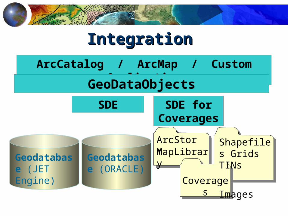
Geodatabase (JET Engine)
Geodatabase (ORACLE)
ArcCatalog / ArcMap / Custom ApplicationGeoDataObjects
SDE SDE for Coverage
sArcStormMapLibrary
Coverages
Shapefiles Grids TINs
Images
IntegrationIntegration

The ArcInfo 8 GeodatabaseThe ArcInfo 8 Geodatabase
A new object oriented geographic data model - all relational data storage using ArcSDEVersioning and long transactionsData Access Objects for application software developersComponent based technology (COM)

Elements of a Elements of a GeodatabaseGeodatabase
The Geodatabase Data Model
Feature Dataset
Feature Class
Relationship Class
Geometric Geometric NNetworketwork
Annotation Class
Object Class

Elements of a GeodatabaseElements of a Geodatabase
Objects , Object ClassesFeatures , Feature ClassesFeature DatasetsValidation Rules, DomainsRelationships , Relationship ClassesSpatial ReferencesGeometric Networks
The Geodatabase Data Model

Objects and Object ClassesObjects and Object Classes
An object is an instance of an object classAll objects in an object class have the same properties and behaviorAn object can be related to other objects via relationships
The Geodatabase Data Model

Attribute
O bject
O bject c lass
Feature
Feature class
Relationship
Relationship c lass
Network
Colum n, F ield
Row
T able
Row with geom etry colum n
T able w ith geom etry colum n
Row with two foreign keys
T able w ith two foreign key colum ns
T ables linking elem ents to features
Relational viewObject view
The Geodatabase Data Model

FeaturesFeatures
Spatial objectLocation
• Attribute of type Geometry
Spatial relationshipsInstance of a feature class
The Geodatabase Data Model

Feature ClassesFeature Classes
Same type of geometrySame type of spatial reference system
Store spatial objects (features)
The Geodatabase Data Model

Feature DatasetsFeature Datasets
Container Same spatial referenceAnalogous to a coverage
The Geodatabase Data Model

Object and Feature BehaviorObject and Feature Behavior
End users and data modelers can :• Instantiate classes with predefined behavior• Control the default value and acceptable values for
any attribute in a class (domains)• Partition the objects in a class into like groups
(subtypes)• Control the general and network relationships in
which an object can participate
Rule based, no programming required
The Geodatabase Data Model

Controlling and Specifying Object Controlling and Specifying Object BehaviorBehavior
Custom Objects
Subtype Specification
Domains and Validation Rules
Connectivity Rules
Feature Type Selection
Relationships
The Geodatabase Data Model

SubtypesSubtypes
Similar groups of objectsLightweight classification mechanism
same attributes and behaviordifferent default values and domains
The Geodatabase Data Model

Validation RulesValidation Rules
Attribute domainsConnectivity rulesRelationship rules
... are stored in the Geodatabase
Custom rules... are code based
The Geodatabase Data Model

Validation RulesValidation Rules
The editor in ArcMap provides tools to test object validityRules are evaluated, under user control, during object editing :
Create a new selection showing all invalid objects within a specified areaRestrict the current selection to invalid objects only
The Geodatabase Data Model

DomainsDomainsA named set of acceptable values for a fieldTypes of domains
RangeCoded values
Can be shared across multiple object classes
The Geodatabase Data Model

DomainsDomainsSplit policies
Default valueDuplicateGeometry ratio
Merge policiesDefault valueSum valuesWeighted average
Area PropertyTax Ow ner
4500 1125 B ob S m ith
Area PropertyTax Ow ner
10000 2500 B ob S m ith
Area PropertyTax Ow ner
5500 1375 B ob S m ith
Split
G eom etry ra tio D up lica teP rope rty o f the
geom etry
Area PropertyTax Ow ner
12000 3000 M ary Jones
Area PropertyTax Ow ner
10000 2500 B ob S m ith
Area PropertyTax Ow ner
22000 5500 C ity
A dd ition D e fau lt va lueP rope rty o f the
geom etry
Merge
The Geodatabase Data Model

Domains in ArcMapDomains in ArcMap
Attribute editor uses domain valuesIdentifies illegal valuesProvides legal value lists
The Geodatabase Data Model

RelationshipsRelationships
Association between two objectsThe Geodatabase maintains the referential integrity of relationships when objects are deleted Related objects can message each other
•eg. move, rotate
The Geodatabase Data Model

Pole AttachmentsPole AttachmentsComposite relationshipComposite relationship:: ppole to ole to
ttransformerransformer
Select a pole and move itSelect a pole and move it …the transformer follows…the transformer follows
The Geodatabase Data Model
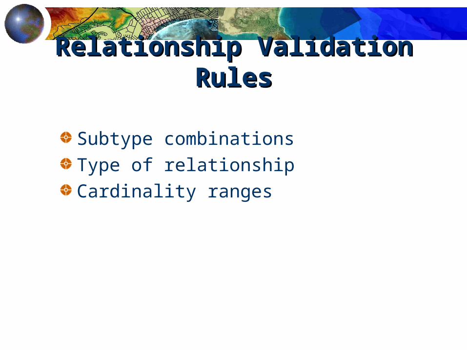
Relationship Validation Relationship Validation RulesRules
Subtype combinationsType of relationshipCardinality ranges
The Geodatabase Data Model

Geometric NetworksGeometric Networks
Models a network relationship between a set of feature classesEach feature class has a topological role in the network (junction or edge)A network may have multiple feature classes in the same topological role
The Geodatabase Data Model

Geometric Geometric NNetworksetworks
Lateral
Service
Main
Feed
ValveFeature
ClassesGeometric Network
The Geodatabase Data Model

Geometric Geometric NNetworksetworks
A geometric network and its feature classes must all belong to the same feature dataset
The Geodatabase Data Model

Feature Datasets and Geometric Feature Datasets and Geometric NetworksNetworks
Water
Water
FD = Feature Dataset
GN = Geometric Network
FC = FeatureClass
OC = Object Class
J = Junction
E = Edge
FD
GN
FC FC FC FC FC
J J E E E
ServiceValve Main Lateral Feed
The Geodatabase Data Model
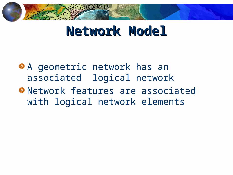
Network ModelNetwork Model
A geometric network has an associated logical networkNetwork features are associated with logical network elements
The Geodatabase Data Model

GeometryGeometry and Connectivity and Connectivity
Geometric network contains features and geometryLogical network contains elements and connectivityConnectivity established via geometric coincidence
j123
j126
j124
j125
idj123j124j125j126
geom etry
Junction Feature
ide1e2e3
geom etryEdge Feature
GeometricNetw ork
j123j124j125j126
Junction
j124, e1
Adjacent Junction and Edge
j123, e1 j125, e2 j126, e3j124, e2j124, e3
C onnectiv ity T able
Logical Netw ork
The Geodatabase Data Model

Network AnalysisNetwork Analysis
Connectivity tracingCycle detectionEstablishment of flow directionsUpstream and downstream tracingIsolation tracingTrouble call tracing
The Geodatabase Data Model

Multiple Approaches Multiple Approaches PossiblePossible
The ‘Build Using Existing Data’ approachThe ‘Define in ArcCatalog’ approachThe ‘Define Using CASE and UML’ approach
Designing and Building GeoDatabases

‘Build Using Existing Data’ Build Using Existing Data’ ApproachApproach
Use ArcCatalog and ArcToolbox to load coverages and shapefilesUse ArcCatalog to refine and extend loaded feature classes
build network topologyadd domains and rules
Designing and Building GeoDatabases

‘‘Define in ArcCatalog’ Define in ArcCatalog’ ApproachApproach
Use ArcCatalog to define new empty object classes.Define validation rules. Use the object editor and object loaders (in ArcMap) to populate your feature classes.
Designing and Building GeoDatabases

‘‘Define Define UUsing UML / Case sing UML / Case Tools’ ApproachTools’ Approach
Use UML to define your domain object model, based on the generic Geodatabase object model.Use a UML Case Tool - eg. Visio, Rational Rose to specify the UML model.
Supports the systematic design of large systems
Designing and Building GeoDatabases

VersionsVersions
Named state of the databaseMultiple coexisting versionsDiffer in row state
Editing, Long Transaction and Versioning

VersioningVersioning
Default versionA user can work with any version
Default:Default:As BuiltAs Built
User1User1User1User1
User2User2User2User2
User3User3User3User3
Version:Version:Plan 1Plan 1
User4User4User4User4
User5User5User5User5
Version:Version:Design 1Design 1
User6User6User6User6
Version:Version:Design 2Design 2
Electric NetElectric Net
Editing, Long Transaction and Versioning

Multi User EditingMulti User Editing
Versioned GeodatabaseModify any versionOnly see your own changesTemporary child versionWhen the Edit Session is saved the temporary version is posted
Editing, Long Transaction and Versioning

Direct MultiDirect Multi U User Editingser Editing
Editor AEditor A Editor BEditor B Editor CEditor C
Editing, Long Transaction and Versioning

Conflict ResolutionConflict Resolution
Conflicting feature(s)
Conflicting
field
Versions
Conflicting FeatureClas
s
Conflicts are automatically detected
Editing, Long Transaction and Versioning
Options to resolve conflict

CASE and UMLUsing CASE and UML for design and building a Geodatabase
Custom Object DevelopmentUsing ESRI code generation and schema wizards for building custom objects
Application DevelopmentUsing ESRI Geodatabase Access Objects

Detailed SessionsDetailed Sessions
Using ArcCatalog to design and manage GeodatabasesWorking with versions in ArcInfo 8Working with networks in ArcInfo 8

Detailed SessionsDetailed Sessions
Tuesday 14.00 Uhr C122• Tina Kapka, ESRI Redlands – An Overview
of ArcInfo 8 Geodatabase
Wednesday 14.00 Uhr C122• Tina Kapka, ESRI Redlands – Object
Concepts: What ESRI users should know

Spatial RelationsEquals – same geometriesDisjoint – geometries share common pointIntersects – geometries intersectTouches – geometries intersect at common boundaryCrosses – geometries overlapWithin– geometry withinContains – geometry completely containsOverlaps – geometries of same dimension overlapRelate – intersection between interior, boundary or exterior

Contains Relation

Touches Relation

Spatial Methods
Distance – shortest distanceBuffer – geometric bufferConvexHull – smallest convex polygon geometryIntersection – points common to two geometriesUnion – all points in geometriesDifference – points different between two geometriesSymDifference – points in either, but not both of input geometries

Convex Hull and Difference Methods

Grid Index (multi-level)

Point and Region Quadtrees

R-tree

Study Area
Minimum Bounding Rectangle
Minimum Bounding Rectangle