san francisquito creek joint powers authority len materman, executive...
TRANSCRIPT
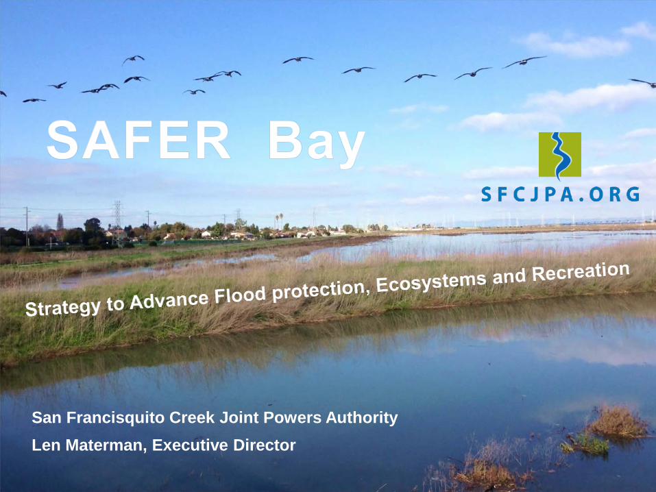
San Francisquito Creek Joint Powers Authority Len Materman, Executive Director
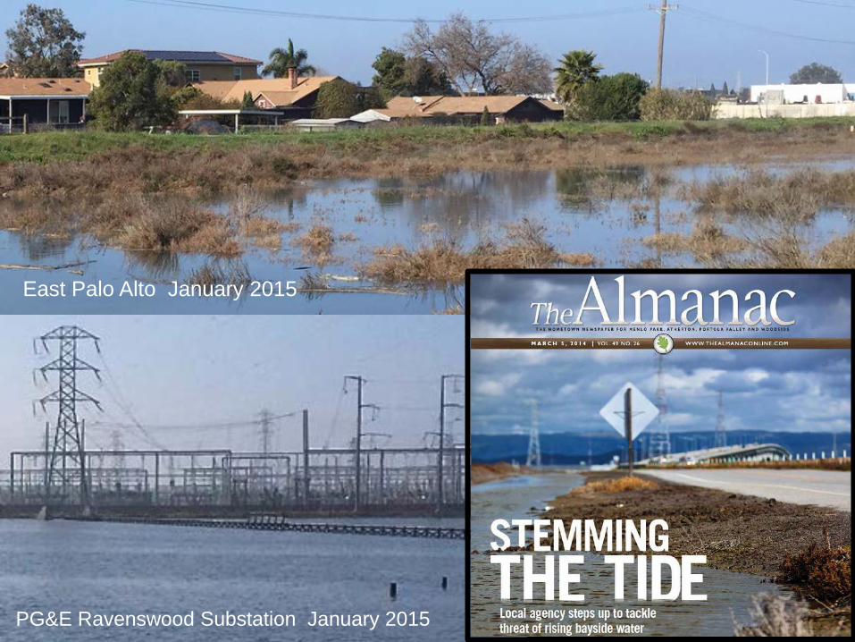
East Palo Alto January 2015
PG&E Ravenswood Substation January 2015
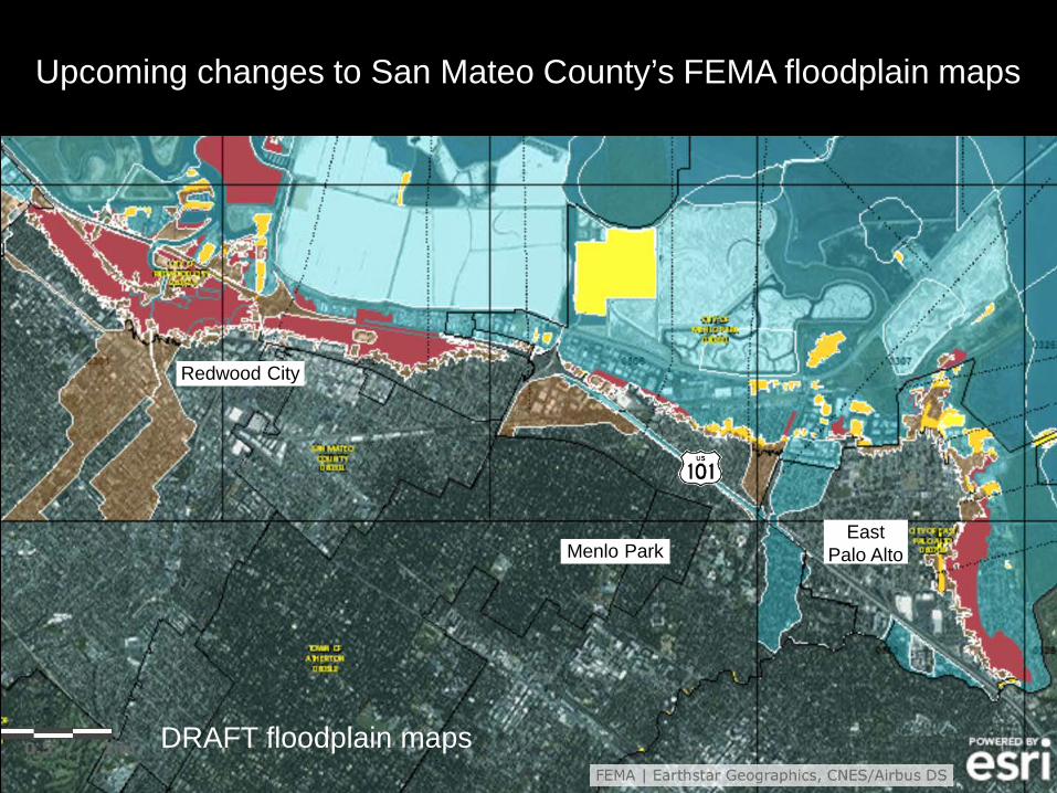
Upcoming changes to San Mateo County’s FEMA floodplain maps
Menlo Park East
Palo Alto
Redwood City
DRAFT floodplain maps
Palo Alto
Menlo Park
East Palo Alto
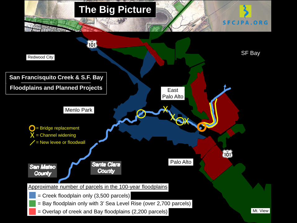
= Creek floodplain only (3,500 parcels) = Bay floodplain only with 3’ Sea Level Rise (over 2,700 parcels) = Overlap of creek and Bay floodplains (2,200 parcels)
Approximate number of parcels in the 100-year floodplains
SF Bay
X X X
= Bridge replacement = Channel widening = New levee or floodwall X
Redwood City
Mt. View
Floodplains and Planned Projects
San Francisquito Creek & S.F. Bay
The Big Picture
Menlo Park
Palo Alto
3’ of SLR with a 100-year Bay tide
East Palo Alto
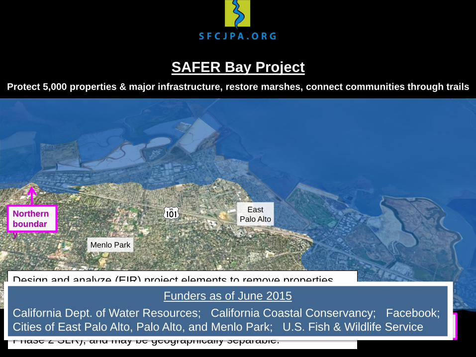
Design and analyze (EIR) project elements to remove properties from the FEMA floodplain (100-year tide + 2’ freeboard), with up to 3’ of Sea Level Rise. Construction (not yet funded) may occur in phases (Phase 1 FEMA, Phase 2 SLR), and may be geographically separable.
Northern boundary
Southern boundary
Funders as of June 2015 California Dept. of Water Resources; California Coastal Conservancy; Facebook; Cities of East Palo Alto, Palo Alto, and Menlo Park; U.S. Fish & Wildlife Service
SAFER Bay Project Protect 5,000 properties & major infrastructure, restore marshes, connect communities through trails
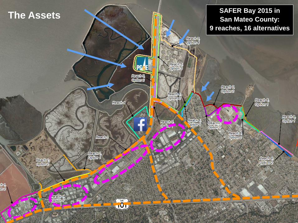
SAFER Bay 2015 in San Mateo County:
9 reaches, 16 alternatives
The Assets
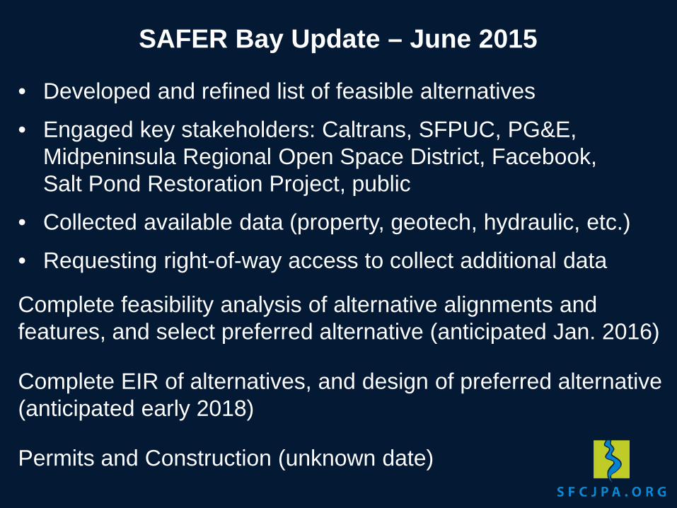
• Developed and refined list of feasible alternatives
• Engaged key stakeholders: Caltrans, SFPUC, PG&E, Midpeninsula Regional Open Space District, Facebook, Salt Pond Restoration Project, public
• Collected available data (property, geotech, hydraulic, etc.)
• Requesting right-of-way access to collect additional data
Complete feasibility analysis of alternative alignments and features, and select preferred alternative (anticipated Jan. 2016)
Complete EIR of alternatives, and design of preferred alternative (anticipated early 2018)
Permits and Construction (unknown date)
SAFER Bay Update – June 2015