semi-presidential system
TRANSCRIPT
SEMI-PRESIDENTIAL SYSTEM
The semi-presidential system is a system of government in which a president and a prime minister are both active participants in the day-to-day
administration of the state. It differs from a republic in that it has a popularly elected head of state who is more than a purely ceremonial figurehead, and from the presidential system in that the cabinet, although named by the president,
is responsible to the legislature, which may force the cabinet to resign through a motion of no confidence.
The term was first used in a 1978 work by political scientist Maurice Duverger to describe the French Fifth Republic, which he dubbed a regime semi-presidential.
Semi-presidential systems may sometimes experience periods in which the President and the Prime Minister are from differing and opposing political
parties. This is called "cohabitation", a term which originated in France when the situation first arose in the 1980s. In most cases, cohabitation results from a system in which the two executives are not elected at the same time or for the
same term. For example, in 1981, France elected both a Socialist president and legislature, which yielded a Socialist premier. But whereas the president's term of
office was for seven years, the National Assembly only served for five. When, in the 1986 legislative election, the French people elected a right-center Assembly, Socialist President Mitterrand was forced into "cohabitation" with a rightist
premier.
Cohabitation can create an effective system of checks and balances or a period
of bitter and tense stonewalling, depending on the attitudes of the two leaders, the ideologies of their parties, or the demands of their constituencies. As a typical example, Sri Lankan politics for several years witnessed a bitter struggle
between the President and the Prime Minister, belonging to different parties and elected separately, over the negotiations with the LTTE to resolve the
longstanding civil war.
Division of powers
The powers that are divided between president and prime minister can vary greatly between countries. In France, for example, in case
ofcohabitation when the president and the prime minister come from opposing parties, the president is responsible for foreign policy and the prime minister
for domestic policy.[2] In this case, the division of powers between the prime minister and the president is not explicitly stated in the constitution, but has evolved as a political convention. In Finland, by contrast, this particular aspect of
the separation of powers is explicitly stated in the constitution: "foreign policy is led by the president in cooperation with the cabinet".

Republic of Senegal
Senegal (French: le Sénégal), officially the Republic of Senegal (République du
Sénégal, IPA: [ʁepyblik dy seneɡal]), is a country in western Africa. It owes its name to the Sénégal River that borders it to the east and north. Senegal is
externally bounded by the Atlantic Ocean to the west, Mauritania to the north, Mali to the east, and Guinea and Guinea-Bissau to the south; internally it almost completely surrounds The Gambia, namely on the north, east and south,
exempting Gambia's short Atlantic Ocean coastline. Senegal covers a land area of almost 197,000 square kilometres (76,000 sq mi), and has an estimated
population of about 13 million. The climate is tropical with two seasons: the dry season and the rainy season.
Location
Senegal is located on the west of the African continent. It lies between latitudes 12° and 17°N, and longitudes 11° and 18°W.
The Senegalese landscape consists mainly of the rolling sandy plains of the western Sahel which rise to foothills in the southeast. Here is also found
Senegal's highest point, an otherwise unnamed feature near Nepen Diakha at 584 m (1,916 ft). The northern border is formed by the Senegal River, other rivers include the Gambia and Casamance Rivers. The capital Dakar lies on
the Cap-Vert peninsula, the westernmost point of continental Africa.
The Cape Verde islands lie some 560 kilometres (350 mi) off the
Senegalese coast, but Cap Vert ("Cape Green") is a maritime placemark, set at the foot of "Les Mammelles", a 105-metre (344 ft) cliff resting at one end of the Cap Vert peninsula onto which is settled Senegal's capital Dakar, and 1
kilometre (0.6 mi) south of the "Pointe des Almadies", the western-most point in Africa.
Population
Senegal has a wide variety of ethnic groups and, as in most West African countries, several languages are widely spoken. The Wolof are the largest single
ethnic group in Senegal at 43%; the Fula and Toucouleur (also known as Halpulaar'en, literally "Pulaar-speakers") (24%) are the second biggest group,
followed by the Serer (14.7%), then others such as Jola (4%), Mandinka (3%), Maures or (Naarkajors), Soninke, Bassari and many smaller communities (9%). (See also the Bedick ethnic group.) Just as in
the Gambia, these figures should be taken with caution.
About 50,000 Europeans (mostly French) and Lebanese] as well as smaller
numbers of Mauritanians and Moroccans[citation needed] reside in Senegal, mainly in the cities. The majority of Lebanese work in commerce. Also located primarily in urban settings are small Vietnamese communities as well as a growing number
of Chinese immigrant traders, each numbering perhaps a few hundred people.There are also tens of thousands of Mauritanian refugees in Senegal,
primarily in the country's north.
French is the official language, used regularly by a minority of Senegalese educated in a system styled upon the colonial-era schools of French origin
(Koranic schools are even more popular, but Arabic is not widely spoken outside of this context of recitation). Most people also speak their own ethnic language
while, especially in Dakar, Wolof is the lingua franca. Pulaar is spoken by the Fulas and Toucouleur. The Serer language is widely spoken by Serers and non-Serers (including president Sall, whose mother and wife are Serers), so are
the Cangin languages, whose speakers are ethnically Serers.
Portuguese Creole is a prominent minority language in Ziguinchor, regional
capital of the Casamance, where some residents speak Kriol, primarily spoken in Guinea-Bissau. Cape Verdeans speak their native creole, Cape Verdean Creole, and standard Portuguese.
Capital
Dakar, the capital city of Senegal, is located at the westernmost tip of the country
on the Cap-Vert peninsula. About 500 kilometres (300 mi) off the coast, in the Atlantic Ocean, lie the Cape Verde Islands. During the 17th and 18th centuries, numerous trading posts, belonging to various colonial empires, were established
along the coast. The town of St. Louis became the capital of French West Africa (Afrique occidentale française, or AOF) before it was moved to Dakar in
1902. Dakar later became its capital in 1960 at the time of independence from France.
Education
The Senegalese education system is based on its French equivalent. Articles 21
and 22 of the Constitution adopted in January 2001 guarantee access
to education for all children. However, due to limited resources and low demand
for secular education in areas where Islamic education is more prevalent, the law
is not fully enforced. Many families send their children toprivate schools.

Education is compulsory and free up to the age of 16. In 2002, the gross primary enrolment rate was 80%, and the net primary enrolment rate was 69%. Gross
and net enrolment rates are based on the number of students formally registered in primary school and therefore do not necessarily reflect actual school
attendance. In 2000, 41.2% of children ages 5 to 14 years were attending school. Primary school attendance statistics are not available for Senegal. As of 2001, 80% of children who started primary school were likely to reach grade 5.
The Ministry of Labor has indicated that the public school system is unable to cope with the number of children that must enroll each year. As a result, many
school-age children seek education and training through more informal means. A large number apprentice themselves to a shop, where they receive no wages. One government official estimated there are 100,000 children apprenticed
in Dakar. The Agence Nationale de la Statistique et de la Démographie (ANSD) reports that as of 2001, 32.5% of children age 10–14 had begun their
professional lives.

Democratic Republic of São Tomé and Príncipe
São Tomé and Príncipe, officially the Democratic Republic of São Tomé and Príncipe, is a Portuguese-speaking island nationin the Gulf of Guinea, off the
western equatorial coast of Central Africa. It consists of two archipelagos around the two main islands:São Tomé and Príncipe, located about 140 kilometres (87 mi) apart and about 250 and 225 kilometres (155 and 140 mi), respectively,
off the northwestern coast of Gabon. Both islands are part of an extinct volcanic mountain range. São Tomé, the sizable southern island, is
situated just north of the equator. It was named in honour of Saint Thomas by Portuguese explorers who arrived at the island on his feast day.
With a population of 163,000 (2010), São Tomé and Príncipe is the second-
smallest African country (the Seychelles being the smallest). It is the smallest country in the world in terms of population that is not a former British overseas
territory, a former United States trusteeship, or one of the European microstates. It is also the smallest Portuguese-speaking country.
The name in Portuguese, São Tomé e Príncipe, is pronounced [sɐ̃w̃ tuˈmɛ i
ˈpɾĩsɨpɨ]. Pronunciation of São Tomé and Príncipe in English varies, with dictionaries citing the most common pronunciations
as /ˌsaʊ toʊˈmeɪ ən ˈprɪnsɨpə/ SOW-toh-MAY-ən PRIN-sip-ə and/ˌsaʊ tɒˈmeɪ ənd ˈprɪnsɨpeɪ/ SOW-to-MAY-ənd PRIN-si-pay.
Location
The islands of São Tomé and Príncipe, situated in the equatorial Atlantic and Gulf of Guineaabout 300 and 250 kilometres (190 and 160 mi), respectively,
off the northwest coast of Gabon, constitute Africa's second smallest country. Both are part of the Cameroon volcanic mountain line, which also includes the islands of Annobón to the southwest, Bioko to the northeast (both part
of Equatorial Guinea), and Mount Cameroon on the coast of Gulf of Guinea. Pico de São Tomé
São Tomé is 50 km (30 mi) long and 30 km (20 mi) wide and the more mountainous of the two islands. Its peaks reach 2,024 m (6,640 ft) - Pico de São Tomé. Príncipe is about 30 km (20 mi) long and 6 km (4 mi) wide. Its peaks
reach 948 m (3,110 ft) - Pico de Príncipe. Swift streams radiating down the mountains through lush forest and cropland to the sea cross both islands.
The equator lies immediately south of São Tomé Island, passing through an islet Ilhéu das Rolas.

The Pico Cão Grande (Great Dog Peak) is a landmark volcanic plug peak, located at0°7′0″N 6°34′00″E in southern São Tomé. It rises dramatically over
300 m (1,000 ft) above the surrounding terrain and the summit is 663 m (2,175 ft) above sea level.
Population
The first ever census was carried out in 2011 with the help of the National Statistic Institute (INE) of Cape Verde.
Of São Tomé and Príncipe's total population estimated at 163,784 by the government agency about 157,500 live on São Tomé and 6,000 on Príncipe. All
are descended from various ethnic groups that have migrated to the islands since 1485. Seven groups are identifiable:
Mestiços, or mixed-blood, descendants of Portuguese colonists and African
slaves brought to the islands during the early years of settlement from Benin, Gabon, and Congo (these people also are known as filhos da terra or "sons of the land");
Angolares, reputedly descendants of Angolan slaves who survived a 1540 shipwreck and now earn their livelihood fishing;
Forros, descendants of freed slaves when slavery was abolished;
Serviçais, contract laborers from Angola, Mozambique, and Cape Verde, living temporarily on the islands;
Tongas, children of serviçais born on the islands;
Europeans, primarily Portuguese and Sephardi Jews
Asians, mostly Chinese minority, including Macanese people of mixed Portuguese and Chinese ancestry from Macau.
In the 1970s, there were two significant population movements—the exodus of most of the 4,000 Portuguese residents and the influx of several hundred São Toméan refugees from Angola. The islanders have been absorbed largely into a
common Luso-African culture. Almost all belong to the Roman Catholic, Evangelical Protestant, or Seventh-day Adventist Churches, with a small but growing Muslim population.
Although a small country, São Tomé and Príncipe has four national languages: Portuguese (the official language, spoken by 95% of the population),
and the Portuguese-based creoles Forro (85%), Angolar (3%) and Principense (0.1%). French is also taught in schools, as the country is a member of Francophonie.
Education
Education in São Tomé and Príncipe is compulsory for four years. Primary
school enrollment and attendance rates were unavailable for São Tomé and
Principe as of 2001. The educational system has a shortage of classrooms,
insufficiently trained and underpaid teachers, inadequate textbooks and
materials, high rates of repetition, poor educational planning and management,
and a lack of community involvement in school management. Domestic financing
of the school system is lacking, leaving the system highly dependent on foreign
financing.

Republic of Mozambique
Mozambique, officially the Republic of
Mozambique (Portuguese: Moçambique or República de Moçambique, pronounced: [ʁɛˈpublikɐ di musɐ̃ˈbiki]), is a country in south-
eastern Africa bordered by the Indian Ocean to the east, Tanzania to the north, Malawi and Zambia to the northwest, Zimbabwe to the west and Swaziland and South Africa to the southwest. The capital city is Maputo,
formerly known as Lourenço Marques.
Between the 1st and 5th centuries AD, Bantu-speaking peoples migrated from
farther north and west. Swahili, and later also Arab, commercial ports existed along the coasts until the arrival of Europeans. The area was explored by Vasco da Gama in 1498 and colonized by Portugal in 1505. Mozambique became
independent in 1975, and became the People's Republic of Mozambique shortly thereafter. It was the scene of an intense civil war lasting from 1977 to 1992.
Mozambique is endowed with rich and extensive natural resources. The country's economy is based largely on agriculture, but with industry, mainly food and beverages, chemical manufacturing, aluminium and petroleum production, is
growing fast. The country's tourism sector is also growing. South Africa is Mozambique's main trading partner and source of foreign direct
investment. Portugal, Spain, and Belgium are also among the country's most important partners. Since 2001 Mozambique is one of the world's top ten for annual average GDP growth. However, Mozambique still has one of the
lowest GDP per capita, one of the worst human development index and one of the highest inequality in the world, as well as having the world's lowest life
expectancy.
The only official language of Mozambique is Portuguese, with roughly half of the population speaking it as a second language and few as a first language.
Languages widely spoken natively include Swahili, Makhuwa, and Sena. The largest religion in Mozambique is Christianity, with significant Muslim and African
traditional religious minorities. Mozambique is a member of the Union, Commonwealth, the Community of Portuguese Language Countries, the Latin Union, Cooperation and Southern African Development Community.
Population
The north-central provinces of Zambezia and Nampula are the most populous,
with about 45% of the population. The estimated four million Macua are the dominant group in the northern part of the country;
the Sena and Shona (mostly Ndau) are prominent in the Zambezi valley, and the Shangaan (Tsonga) dominate in southern Mozambique. Other groups include Makonde, Yao,Swahili, Tonga, Chopi,

and Nguni (including Zulu). Bantu people comprise 97.8% of the population, with the rest including White Africans (largely of Portuguese ancestry), Euro-Africans
(mestiço people of mixed Bantu and Portuguese heritage), and Indians. Roughly 45,000 people of Indian descent reside in Mozambique.
During Portuguese colonial rule, a large minority of people of Portuguese descent lived permanently in almost all areas of the country, and Mozambicans with Portuguese blood at the time of independence numbered
about 360,000. Many of these left the region after independence from Portugal in 1975. There are various estimates for the size of Mozambique's Chinese
community, ranging from 7,000 to 12,000 as of 2007.
Education
Since independence from Portugal in 1975, school construction and teacher-
training enrollments have not kept up with population increases. Especially after the Mozambican Civil War (1977–1992), with post-war enrollments reaching all-time highs due to stability and youth population growth, the quality of education
suffered. All Mozambicans are required by law to attend school through the primary level; however, a lot of children in Mozambique do not go to primary
school because they have to work for their families' subsistence farms for a living. In 2007, one million children still did not go to school, most of them from poor rural families, and almost half of all teachers in Mozambique were still
unqualified. Girls’ enrollment increased from 3 million in 2002 to 4.1 million in 2006 while the completion rate increased from 31,000 to 90,000, which testified a
very poor completion rate.
After grade 7, students must take standardised national exams to enter secondary school, which runs from 8th to 10th grade. Space in Mozambican
universities is extremely limited; thus most students who complete pre-university school do not immediately proceed on to university studies. Many go to work as
teachers or are unemployed. There are also institutes which give more vocational training, specialising in agricultural, technical, or pedagogical studies, which students may attend after grade 10 in lieu of a pre-university school.
After independence from Portugal in 1975, a number of Mozambican students continued to be admitted every year at Portuguese high schools, polytechnical
institutes, and universities, through bilateral agreements between the Portuguese government and the Mozambican government.
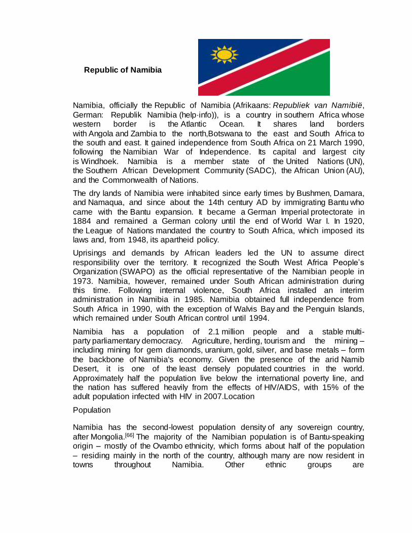
Republic of Namibia
Namibia, officially the Republic of Namibia (Afrikaans: Republiek van Namibië,
German: Republik Namibia (help·info)), is a country in southern Africa whose western border is the Atlantic Ocean. It shares land borders
with Angola and Zambia to the north,Botswana to the east and South Africa to the south and east. It gained independence from South Africa on 21 March 1990, following the Namibian War of Independence. Its capital and largest city
is Windhoek. Namibia is a member state of the United Nations (UN), the Southern African Development Community (SADC), the African Union (AU),
and the Commonwealth of Nations.
The dry lands of Namibia were inhabited since early times by Bushmen, Damara, and Namaqua, and since about the 14th century AD by immigrating Bantu who
came with the Bantu expansion. It became a German Imperial protectorate in 1884 and remained a German colony until the end of World War I. In 1920,
the League of Nations mandated the country to South Africa, which imposed its laws and, from 1948, its apartheid policy.
Uprisings and demands by African leaders led the UN to assume direct
responsibility over the territory. It recognized the South West Africa People’s Organization (SWAPO) as the official representative of the Namibian people in
1973. Namibia, however, remained under South African administration during this time. Following internal violence, South Africa installed an interim administration in Namibia in 1985. Namibia obtained full independence from
South Africa in 1990, with the exception of Walvis Bay and the Penguin Islands, which remained under South African control until 1994.
Namibia has a population of 2.1 million people and a stable multi-party parliamentary democracy. Agriculture, herding, tourism and the mining – including mining for gem diamonds, uranium, gold, silver, and base metals – form
the backbone of Namibia's economy. Given the presence of the arid Namib Desert, it is one of the least densely populated countries in the world.
Approximately half the population live below the international poverty line, and the nation has suffered heavily from the effects of HIV/AIDS, with 15% of the adult population infected with HIV in 2007.Location
Population
Namibia has the second-lowest population density of any sovereign country,
after Mongolia.[66] The majority of the Namibian population is of Bantu-speaking origin – mostly of the Ovambo ethnicity, which forms about half of the population
– residing mainly in the north of the country, although many are now resident in towns throughout Namibia. Other ethnic groups are
the Herero and Himba people, who speak a similar language, and the Damara, who speak the same "click" language as the Nama.
In addition to the Bantu majority, there are large groups of Khoisan (such as Nama and Bushmen), who are descendants of the original inhabitants of
Southern Africa. The country also contains some descendants of refugees from Angola. There are also two smaller groups of people with mixed racial origins, called "Coloureds" and "Basters", who together make up 6.5% (with the
Coloureds outnumbering the Basters two to one). There is a large Chinese minority in Namibia.[ Whites of Portuguese, Dutch, German, British
and French ancestry make up about 7% of the population; they form the second-largest population of European ancestry, both in terms of percentage and actual numbers, in Sub-Saharan Africa after South Africa. MostNamibian whites and
nearly all those of mixed race speak Afrikaans and share similar origins, culture, and religion as the white and coloured populations of South Africa. A smaller
proportion of whites (around 30,000) trace their family origins directly back to German colonial settlers and maintain German cultural and educational institutions. Nearly all Portuguese settlers came to the country from the
former Portuguese colony of Angola. The 1960 census reported 526,004 persons in the South West Africa, including 73,464 whites (14 percent).
Namibia conducts a census every ten years. After independence the first Population and Housing Census was carried out in 1991, further rounds followed in 2001 and 2011.The data collection method is to count every person resident in
Namibia on the census reference night, wherever they happen to be. This is called the de facto method. For enumeration purposes the country is demarcated
into 4,042 enumeration areas. These areas do not overlap with constituency boundaries in order to get reliable data for election purposes as well.
The 2011 Population and Housing Census counted slightly more than 2,100,000
inhabitants of Namibia. The exact numbers have not yet been published.
Capital
Windhoek
Education
Namibia has compulsory free education for 10 years between the ages of 6 and
16. Grades 1–7 are primary level, grades 8–12 secondary. In 1998, there were 400,325 Namibian students in primary school and 115,237 students in secondary schools. The pupil-teacher ratio in 1999 was estimated at 32:1, with about 8% of
the GDP being spent on education.
Most schools in Namibia are state-run, but a few private schools are also part of
the country's education system. Among these are St. Pauls College,St. Boniface College (30 kilometres east of Rundu)Windhoek Afrikaanse Privaatskool, Deutsche Höhere Privatschule, and Windhoek

Gymnasium. Windhoek International School is the only school in Namibia that uses the International Baccalaureate. Curriculum development, educational
research, and professional development of teachers is centrally organised by the National Institute for Educational Development (NIED) in Okahandja.
There are four teacher training colleges, three colleges of agriculture, a police training college, a Polytechnic at university level, and a National University.

Mongolia
Mongolia i/mɒŋˈɡoʊliə/ (Mongolian: Монгол улс (help·info), literally Mongol country/state) is a landlocked country in East andCentral Asia. It is bordered
by Russia to the north and China to the south, east and west. Although Mongolia does not share a border with Kazakhstan, its western-most point is only 38
kilometres (24 mi) from Kazakhstan's eastern tip. Ulan Bator, the capital and largest city, is home to about 45% of the population. Mongolia's political system is a parliamentary republic.
The area of what is now Mongolia has been ruled by various nomadic empires, including the Xiongnu, the Xianbei, the Rouran, theGökturks and others.
The Mongol Empire was founded by Genghis Khan in 1206. After the collapse of the Yuan Dynasty, the Mongols returned to their earlier pattern of constant internal conflict and occasional raids on the Chinese borderlands. In the 16th and
17th centuries, Mongolia came under the influence of Tibetan Buddhism. At the end of the 17th century, all of Mongolia had been incorporated into the area ruled
by the Qing Dynasty. During the collapse of the Qing Dynasty in 1911, Mongolia declared independence, but had to struggle until 1921 to firmly establish de facto independence from the Republic of China, and until 1945 to gain
international recognition.
The country came under strong Russian and Soviet influence; in 1924,
the Mongolian People's Republic was declared, and Mongolian politics began to follow the same patterns as the Soviet politics of the time. After the breakdown of communist regimes in Eastern Europe in late 1989, Mongolia saw its
own Democratic Revolution in early 1990, which led to a multi-party system, a new constitution in 1992, and transition to a market economy.
At 1,564,116 square kilometres (603,909 sq mi), Mongolia is the 19th largest and the most sparsely populated independent country in the world, with a population of around 2.75 million people. It is also the world's second-largest landlocked
country after Kazakhstan. The country contains very little arable land, as much of its area is covered by steppes, with mountains to the north and west and theGobi
Desert to the south. Approximately 30% of the population are nomadic or semi-nomadic. The predominant religion in Mongolia isTibetan Buddhism, and the majority of the state's citizens are of Mongol ethnicity, though Kazakhs, Tuvans,
and other minorities also live in the country, especially in the west. About 20% of the population live on less than US$1.25 per day. Mongolia joined the World
Trade Organization in 1997 and seeks to expand its participation in regional economic and trade regimes.
Location
t 1,564,116 km2 (603,909 sq mi), Mongolia is the world's 19th-largest country (after Iran). It is significantly larger than the next-largest country, Peru. It mostly

lies between latitudes 41°and 52°N (a small area is north of 52°), and longitudes 87° and 120°E.
The geography of Mongolia is varied, with the Gobi Desert to the south and with cold and mountainous regions to the north and west. Much of Mongolia consists
of steppes. The highest point in Mongolia is the Khüiten Peak in the Tavan bogd massif in the far west at 4,374 m (14,350 ft). The basin of the Uvs Lake, shared with Tuva Republic in Russia, is a natural World Heritage Site. Most of
the country is hot in the summer and extremely cold in the winter, with January averages dropping as low as −30 °C (−22 °F).
The country is also subject to occasional harsh climatic conditions known as zud. The annual average temperature in Ulan Bator is 0°C, making it the world's coldest capital city. Mongolia is high, cold, and windy. It has an extreme
continental climate with long, cold winters and short summers, during which most of its annual precipitation falls. The country averages 257 cloudless days a year,
and it is usually at the center of a region of high atmospheric pressure. Precipitation is highest in the north (average of 200 to 350 millimeters (7.9 to 13.8 in) per year) and lowest in the south, which receives 100 to 200 millimeters
(3.9 to 7.9 in) annually. The highest annual precipitation of 622.297mm occurred in the forests of Bulgan Province close to the border with Russia and the lowest
of 41.735mm occurred in the Gobi Desert (period 1961-1990). The sparsely populated far north of Bulgan Province averages 600mm in annual precipitation which means it receives more precipitation than Beijing (571.8mm)
or Berlin (571mm).
The name "Gobi" is a Mongol term for a desert steppe, which usually refers to a
category of arid rangeland with insufficient vegetation to support marmots but with enough to support camels. Mongols distinguish Gobi from desert proper, although the distinction is not always apparent to outsiders unfamiliar with the
Mongolian landscape. Gobi rangelands are fragile and are easily destroyed by overgrazing, which results in expansion of the true desert, a stony waste where
not even Bactrian camels can survive.
Population
Mongolia's total population as of July 2007 is estimated by U.S. Census Bureauat
2,951,786 people, ranking at around 138th in the world in terms of population. But the U.S. Department of State Bureau of East Asian and Pacific Affairs uses
the U.N. estimationsinstead of the U.S. Census Bureau estimations. United Nations Department of Economic and Social Affairs Population Division]estimates Mongolia's total population (mid 2007) as 2,629,000 (11% less than the U.S.
Census Bureau figure). UN estimates resemble those made by the Mongolian National Statistical Office (2,612,900, end of June 2007). Mongolia's population
growth rate is estimated at 1.2% (2007 est.). About 59% of the total population is under age 30, 27% of whom are under 14. This relatively young and growing population has placed strains on Mongolia's economy.
Since the end of socialism, Mongolia has experienced a decline of total fertility rate (children per woman) that is steeper than in any other country in the world,
according to recent UN estimations: in 1970–1975, fertility was estimated to be 7.33 children per woman, but 2005–2010 prospects are 1.87 (4 times less).
Ethnic Mongols account for about 95% of the population and consist of Khalkha and other groups, all distinguished primarily by dialects of the Mongol language. The Khalkha make up 86% of the ethnic Mongol population. The remaining 14%
include Oirats, Buryats and others. Turkic peoples (Kazakhs, Tuvans, and Chantuu (Uzbek) constitute 4.5% of Mongolia's population, and the rest are
Russian, Chinese, Korean and American nationalities.
Education
During the state socialist period, education was one of the areas of significant
achievement in Mongolia. Illiteracy was virtually eliminated, in part through the use of seasonal boarding schools for children of nomadic families. Funding to
these boarding schools was cut in the 1990s, contributing to slightly increased illiteracy.
Primary and secondary education formerly lasted 10 years, but was expanded to
11 years. Since the 2008–2009 school year, new first graders are using the 12 year system. As such, full transition to the 12-year system will not happen until
the 2019–2020 school year, when the current third graders graduate.
As of 2006, across Mongolia English is taught in all secondary schools beginning in fourth grade. Edu
Mongolian national universities are all spin-offs from the National University of Mongolia and the Mongolian University of Science and Technology.
The broad liberalization of the 1990s led to a boom in private institutions of higher education, although many of these establishments have difficulty living up to their name of "college" or "university".
http://en.wikipedia.org/wiki/Semi-presidential_system
http://chartsbin.com/view/6kx
http://en.wikipedia.org/wiki/

PARLIAMENTARY REPUBLIC
A parliamentary republic or parliamentary constitutional republic is a type
of republic which operates under aparliamentary system of government - meaning a system with no clear-cut separation of powers between the executive
and legislative branches. There are a number of variations of parliamentary republics. Most have a clear differentiation between thehead of government and the head of state; with the head of government holding real power, much
like constitutional monarchies. Some have fused the roles of head of state and head of government, much like Presidential systems.
For the first case mentioned above, in particular, the form of executive-branch arrangement is distinct from most other parliamentary and semi-presidential republics which separate the head of state (usually designated as the
"president") from the head of government (usually designated as "prime minister", "premier" or "chancellor") and subject the latter to the confidence of
parliament and a flexible tenure in office while the head of state lacks either dependency, and investing either office with the majority of executive power.
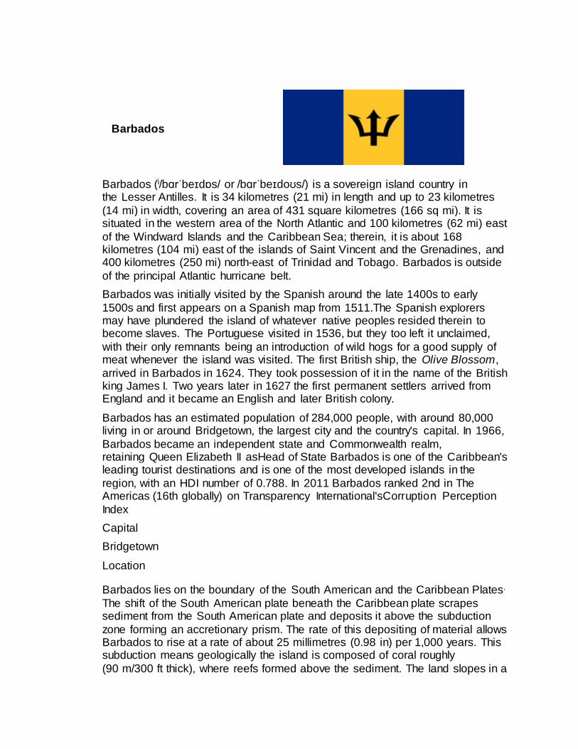
Barbados
Barbados (i/bɑrˈbeɪdɒs/ or /bɑrˈbeɪdoʊs/) is a sovereign island country in the Lesser Antilles. It is 34 kilometres (21 mi) in length and up to 23 kilometres
(14 mi) in width, covering an area of 431 square kilometres (166 sq mi). It is situated in the western area of the North Atlantic and 100 kilometres (62 mi) east
of the Windward Islands and the Caribbean Sea; therein, it is about 168 kilometres (104 mi) east of the islands of Saint Vincent and the Grenadines, and 400 kilometres (250 mi) north-east of Trinidad and Tobago. Barbados is outside
of the principal Atlantic hurricane belt.
Barbados was initially visited by the Spanish around the late 1400s to early
1500s and first appears on a Spanish map from 1511.The Spanish explorers may have plundered the island of whatever native peoples resided therein to become slaves. The Portuguese visited in 1536, but they too left it unclaimed,
with their only remnants being an introduction of wild hogs for a good supply of meat whenever the island was visited. The first British ship, the Olive Blossom,
arrived in Barbados in 1624. They took possession of it in the name of the British king James I. Two years later in 1627 the first permanent settlers arrived from England and it became an English and later British colony.
Barbados has an estimated population of 284,000 people, with around 80,000 living in or around Bridgetown, the largest city and the country's capital. In 1966,
Barbados became an independent state and Commonwealth realm, retaining Queen Elizabeth II asHead of State Barbados is one of the Caribbean's leading tourist destinations and is one of the most developed islands in the
region, with an HDI number of 0.788. In 2011 Barbados ranked 2nd in The Americas (16th globally) on Transparency International'sCorruption Perception
Index
Capital
Bridgetown
Location
Barbados lies on the boundary of the South American and the Caribbean Plates.
The shift of the South American plate beneath the Caribbean plate scrapes sediment from the South American plate and deposits it above the subduction
zone forming an accretionary prism. The rate of this depositing of material allows Barbados to rise at a rate of about 25 millimetres (0.98 in) per 1,000 years. This subduction means geologically the island is composed of coral roughly
(90 m/300 ft thick), where reefs formed above the sediment. The land slopes in a

series of "terraces" in the west and goes into an incline in the east. A large proportion of the island is circled by coral reefs.
The erosion of limestone rock in the North East of the island, in the Scotland District, has resulted in the formation of various caves andgullys, some of which
have become popular tourist attractions such as Harrison's Cave and Welchman Hall Gully. On the Atlantic East coast of the island coastal landforms, including stacks, have been created due to the limestone composition of the area.
Population
Barbados has a population of about 281,968 and a population growth rate of
0.33% (Mid-2005 estimates). It currently ranks as: the 4th most densely
populated country in the Americas (18th globally), and the 10th most
populated island country in the region, (101st globally). Close to 90% of all
Barbadians (also known colloquially as Bajan) are of African descent ("Afro-
Bajans") and mixed-descent. The remainder of the population includes groups of
Europeans ("Anglo-Bajans" / "Euro-Bajans") mainly from the United Kingdom,
Ireland, Chinese, Bajan Muslims from India. Other groups in Barbados include
people from the United Kingdom, United States and Canada. Barbadians who
return after years of residence in the U.S. and children born in America to Bajan
parents are called "Bajan Yankees", this term is considered derogatory by
some.Generally, Bajans recognise and accept all 'children-of-the-island' as
Bajans, and refer to each other as such.
Education
Barbados' literacy rate is ranked close to 100%, with both UNESCO and the
Minister of Education stating that Barbados was in the top 5 countries worldwide
for literacy rate.]thus placing the country alongside many of the industrialised
nations of the world. The mainstream public education system of Barbados is
fashioned after the British model. The government of Barbados spends 6.7% of
the GDP on education (2008).[1] All young people in the country must attend
school until age 16. Barbados has over 70 primary schools, and over 20
secondary schools throughout the island. There are also a number of private
schools catering to various teaching models
including Montessori and International Baccalaureate. Degree level education in
the country is provided by the Barbados Community College.

Saint Kitts and Nevis
The Federation of Saint Kitts and Nevis (i/seɪnt ˌkɪts ænd ˈniːvɪs/; also known as the Federation of Saint Christopher and Nevis), located in the Leeward Islands, is
a federal two-island state in the West Indies. It is the smallest sovereign state in theAmericas, in both area and population.
The capital city and headquarters of government for the federated state
is Basseterre on the larger island of Saint Kitts. The smaller island of Nevis lies about 2 miles (3 km) southeast of Saint Kitts, across a shallow channel called
"The Narrows".
Historically, the British dependency of Anguilla was also a part of this union, which was then known collectively as Saint Christopher-Nevis-Anguilla. Saint
Kitts and Nevis are geographically part of the Leeward Islands. To the north-northwest lie the islands of Sint Eustatius, Saba, Saint Barthélemy, Saint-
Martin/Sint Maarten and Anguilla. To the east and northeast are Antigua and Barbuda, and to the southeast is the small uninhabited island of Redonda, and the island of Montserrat, which currently has an active volcano (seeSoufrière
Hills).
Saint Kitts and Nevis were among the first islands in the Caribbean to be settled
by Europeans. Saint Kitts was home to the first English and French colonies in the Caribbean, and thus has also been titled "The Mother Colony of the West Indies".
Location
Saint Kitts and Nevis is a twin-island federation whose economy is characterised
by its dominant tourism, agriculture and light manufacturing industries. Sugar was the primary export from the 1640s on, but rising production costs, low world
market prices, and the government's efforts to reduce dependence on it have led to a growing diversification of the agricultural sector. In 2005, the government decided to close down the state-owned sugar company, which had experienced
losses and was a significant contributor to the fiscal deficit. Former sugar plantations still dominate the St. Kitts landscape, however many of the cane
fields are being burned to make room for land development, especially on the northern side of the island, in the parishes of Saint John Capisterre and Christchurch. The agricultural, tourism, export-oriented manufacturing, and
offshore-banking sectors are being developed and are now taking larger roles in the country's economy. The growth of the tourism sector has become the main
foreign exchange earner for Saint Kitts and Nevis. The country has also developed a successful apparel assembly industry and one of the largest electronics assembly industries in the Caribbean.

St. Kitts is dependent on tourism to drive its economy. Tourism to the island has been expanding since 1978. In 2009 there were 587,479 arrivals to Saint Kitts
compared to 379,473 in 2007. This growth represents an increase of just under 40% in a 2 year period. As tourism grows the demand for vacation property
increases in conjunction.
St Kitts & Nevis also acquires foreign direct investment from their citizenship by investment program, outlined in their Citizenship Act of 1984. Interested parties
can acquire Citizenship if they pass the government's background checks and make an investment into an approved real estate development.
Population
African descent 75.1%, Afro-European 12.3%, mulatto 5.3%, East Indian and
Afro-East Indian 5%, Other 3.3%, South Asian ethnic groups 3%[4]
As of July 2000, there were 42,696 inhabitants; their average life expectancy was
72.4 years. Emigration has historically been very high, and high levels of such in the country has resulted in a continuous decrease in the country's population by about 25% since its peak of about 51,100 in 1960.
Emigration from St. Kitts & Nevis to the United States:
1986–1990: 3,513
1991–1995: 2,730
1996–2000: 2,101
2001–2005: 1,756
2006–2010: 1,817
Emigration from St. Kitts & Nevis to the United Kingdom:
The 2001 Census showed 7,091 Saint Kitts and Nevis born people in the UK, with almost 20,000 of direct descent.
Capital
Basseterre
Education
There are eight publicly administered high/secondary level schools in St Kitts-Nevis, and several private secondary schools.
Public high/secondary schools
Cayon High School (CHS)
Basseterre High School (BHS)
Washington Archibald High School (WAHS)
Verchilds High School (VHS)

Charles E. Mills Secondary School (CEMS)
Charlestown Secondary School (CSS)
Gingerland Secondary School (GSS)
Saddlers Secondary School (SSS)
Private high/secondary schools
St Theresa's Convent School and St. Joseph's School, which merged in 2010 to form the Immaculate Conception Catholic School (ICCS) – Kindergarten to
Grade 11 (or 5th form) – the traditional Caribbean final secondary school grade.
Lyn Jeffers Secondary School
Lyn Jeffers Primary School
Saint Christopher Preparatory school
Montessori Academy.

Saint Lucia
Saint Lucia i/seɪnt ˈluːʃə/ (French: Sainte-Lucie) is a sovereign island country in
the eastern Caribbean Sea on the boundary with the Atlantic Ocean.[4] Part of the Lesser Antilles, it is located north/northeast of the island of Saint Vincent, northwest of Barbados and south of Martinique. It covers a land area of
617 km2 (238.23 sq mi) and has a population of 174,000 (2010). Its capital is Castries. Two Nobel laureates, Arthur Lewis, an economist, and Derek
Walcott, a poet and playwright, have come from the island. It is the nation with the second most such honorees per capita after the Faroe Islands.
One of the Windward Islands, it was named after Saint Lucy of Syracuse by the
French, the first European colonizers. They signed a treaty with the native Carib people in 1660. England took control of the island from 1663 to
1667; in ensuing years, it was at war with France 14 times and rule of the island changed frequently (it was seven times each ruled by the French and British). In 1814, the British took definitive control of the island. Because it switched so often
between British and French control, Saint Lucia was also known as the "Helen of the West Indies".
Saint Lucia has a legal system based on British common law. The judiciary is independent and conducts generally fair public trials.[citation needed] The financial sector has weathered the global financial crisis, but the recession has hurt
tourism.
Representative government came about in 1924 (with universal suffrage from
1953). From 1958 to 1962, the island was a member of the Federation of the West Indies. On February 22, 1979, Saint Lucia became an independent state of the Commonwealth of Nationsassociated with the United Kingdom. The island
nation celebrates this every year with a public holiday. It is also a member of la Francophonie.
Location
The volcanic island of Saint Lucia is more mountainous than many
other Caribbeanislands, with the highest point being Mount Gimie, at 950 metres (3,120 ft) above sea level. Two other mountains, the Pitons, form the island's most famous landmark. They are located between Soufrière and Choiseul on the
western side of the island. Saint Lucia is also one of the few islands in the world that boasts a drive-in volcano.
The capital city of Saint Lucia is Castries(Population 9,400), where 5.4 % of the population lives. Major towns include Gros Islet, Soufrière and Vieux Fort. The local climate is tropical, moderated by northeast trade winds, with a dry season
from December 1 to May 31, and a wet season from June 1 to November 30.
Population

The population of 174,000(in 2010) is evenly divided between urban and rural areas, although the capital, Castries, contains more than one-third of the
population. Saint Lucia's population is predominantly of African and mixed African-European descent, with a small Indo-Caribbean minority (3%). Members
of other or unspecified ethnicity groups, account for about 2% of the population.
The official language is English; however Saint Lucian Creole French(Kwéyòl), which is a French-based Creole colloquially referred to as "Patwah" (Patois), is
spoken by 95% of the population. This Antillean Creole is used in literature and music, and is gaining official acknowledgement. It is derived chiefly
fromFrench and West African languages, with some vocabulary from Carib and other sources. Saint Lucia is a member of La Francophonie.
Saint Lucia boasts the highest ratio of Nobel laureates produced with respect to
the total population of any sovereign country in the world. Two winners have come from Saint Lucia:Sir Arthur Lewis won the Nobel Prize in Economics in
1979, and Derek Walcott received the Nobel Prize in Literature in 1992. Both were born on the same day in 1915 and 1930, respectively: January 23.
About 70% of the population is Roman Catholic, influenced from the days of
French Catholic rule and evangelization. Most of the rest belong to other Christian denominations, including Seventh-day
Adventisms (7%), Pentecostalism (6%), Anglicanism (2%), Evangelical Christianity (2%), and the Baptist faith; in addition, about 2% of the population adheres to the Rastafari movement.
Despite a high emigration rate, the population is growing rapidly, about 1.2% per year. Migration from Saint Lucia is primarily to Anglophone countries, with
the United Kingdomhaving almost 10,000 Saint Lucian-born citizens, and over 30,000 of Saint Lucian heritage. The second most popular destination for Saint Lucian expatriates is the United States, where combined (foreign and national
born Saint Lucians) almost 14,000 reside. Canada is home to a few thousand Saint Lucians. Most other countries in the world have fewer than 50 citizens of
Saint Lucian origin (the exceptions being Spain and France with 124 and 117 Saint Lucian expats respectively).
Education
The Education Act provides for free and compulsory education in Saint Lucia from the ages of 5 to 15.Public spending on education was at 5.8 % among the
2002–2005 GDP. Saint Lucia has one university; University of the West Indies Open Campus. and a few medical schools – International American University −
College of Medicine, Destiny University School of Medicine and Health Sciences, and the oldest of which is Spartan Health Sciences University. The leading secondary school for boys is St Mary's College which taught both Sir Arthur
Lewis and Derek Walcott and for girls St. Joseph's Convent, alma mater of Dame Pearlette Louisy, their Governor General.

Canada
Canada ( /ˈkænədə/) is a North American country consisting of ten provinces and three territories. Located in the northern part of the continent, it extends from
the Atlantic Ocean in the east to the Pacific Ocean in the west, and northward into the Arctic Ocean. Spanning over 9,900,000 km2 (3,800,000 sq mi), Canada
is the world's second-largest country by total area, and its common borderwith the United States is the longest land border in the world.
The land that is now Canada has been inhabited for millennia by
various Aboriginal peoples. Beginning in the late 15th century, Britishand French colonial expeditions explored, and later settled, along the region's Atlantic coast.
France ceded nearly all of its colonies in North America in 1763 after the Seven Years' War. In 1867, with the union of three British North American colonies throughConfederation, Canada was formed as a federal dominion of four
provinces. This began an accretion of provinces and territories and a process of increasing autonomy; the Canada Act 1982 severed the vestiges of legal
dependence on Britain.
Canada is a federal state that is governed as a parliamentary democracy and a constitutional monarchy, with Queen Elizabeth II as its head of state. The
country is officially bilingual at the federal level. Canada's diversified economy is one of the world's largest, and is reliant upon its abundant natural resources and upon trade – particularly with the United States, with which Canada has had
a long and complex relationship. It is a member of the G7, G8, G20, NATO, OECD, WTO, Commonwealth of
Nations, Francophonie, OAS,APEC, and United Nations.
Location
Canada occupies a major northern portion of North America, sharing land
borders with the contiguous United States to the south and the US state of Alaska to the northwest. Canada stretches from the Atlantic Ocean in the east
to the Pacific Ocean in the west; to the north lies the Arctic Ocean.[76][77] Greenland is to the northeast, while Saint Pierre and Miquelon is south of Newfoundland.
By total area (including its waters), Canada is the second-largest country in the world, after Russia. By land area alone, Canadaranks fourth. The country lies
between latitudes 41° and 84°N, and longitudes 52° and 141°W.
Since 1925, Canada has claimed the portion of the Arctic between 60° and 141°W longitude, but this claim is not universally recognized. Canada is home to
the world's northernmost settlement, Canadian Forces Station Alert, on the northern tip of Ellesmere Island – latitude 82.5°N – which lies 817 kilometres

(508 mi) from the North Pole. Much of the Canadian Arctic is covered by ice and permafrost. Canada has the longest coastline in the world, with a total length
of 202,080 kilometres (125,570 mi); additionally, its border with the United States is the world's longest land border, stretching 8,891 kilometres (5,525 mi).
Population and Education
The 2011 Canadian census counted a total population of 33,476,688, an increase of around 5.9 percent over the 2006 figure. Between 1990 and 2008,
the population increased by 5.6 million, equivalent to 20.4 percent overall growth. The main drivers of population growth are immigrationand, to a lesser extent, natural growth. About four-fifths of the population lives within 150 kilometres
(93 mi) of the United States border. Approximately 80 percent of Canadians live in urban areas concentrated in the Quebec City – Windsor Corridor, the
BC Lower Mainland, and theCalgary–Edmonton Corridor in Alberta. In common with many other developed countries, Canada is experiencing a demographic shift towards an older population, with more retirees and fewer people of working
age. In 2006, the average age was 39.5 years; by 2011, it had risen to approximately 39.9 years.
According to the 2006 census, the country's largest self-reported ethnic origin is Canadian (accounting for 32% of the population), followed byEnglish (21%), French (15.8%), Scottish (15.1%), Irish (13.9%), German (10.2
%), Italian (4.6%), Chinese (4.3%), First Nations (4.0%), Ukrainian(3.9%), and Dutch (3.3%). There are 600 recognized First Nations governments or bands, encompassing a total of 1,172,790 people.
Canada's aboriginal population is growing at almost twice the national rate, and four percent of Canada's population claimed aboriginal identity in 2006. Another
16.2 percent of the population belonged to a non-aboriginal visible minority. The largest visible minority groups are South Asian (4.0%), Chinese (3.9%) and Black (2.5%). Between 2001 and 2006, the visible minority population rose
by 27.2 percent. In 1961, less than two percent of Canada's population (about 300,000 people) could be classified as belonging to a visible minority group, and
less than one percent as aboriginal. By 2007, almost one in five (19.8%) were foreign-born, with nearly 60 percent of new immigrants coming from Asia (including theMiddle East).
The leading sources of immigrants to Canada were China, the Philippines and India.[171] According to Statistics Canada, visible minority groups could account
for a third of the Canadian population by 2031.
Canada has one of the highest per-capita immigration rates in the world, driven by economic policy and family reunification, and is aiming for between 240,000
and 265,000 new permanent residents in 2012, a similar number of immigrants as in recent years In 2010, a record 280,636 people immigrated to Canada. New
immigrants settle mostly in major urban areas like Toronto and Vancouver Canada also accepts large numbers of refugees The country resettles over one in 10 of the world’s refugees

According to the 2001 census, 77.1 percent of Canadians identify as Christian; of this, Catholics make up the largest group, accounting for 43.6 percent of the
population. The largest Protestant denomination is the United Church of Canada (accounting for 9.5% of Canadians), followed
byAnglicans (6.8%), Baptists (2.4%), Lutherans (2%), and other Christian denominations (4.4%). About 16.5 percent declare no religious affiliation, and the remaining 6.3 percent are affiliated with non-Christian religions, the largest of
which are Islam (2.0%) and Judaism (1.1%).
Canadian provinces and territories are responsible for education. The mandatory
school age ranges between 5–7 to 16–18 years, contributing to an adult literacy rate of 99 percent In 2002, 43 percent of Canadians aged 25 to 64 possessed a post-secondary education; for those aged 25 to 34, the rate of post-secondary
education reached 51 percent The Programme for International Student Assessment indicates that Canadian students rank well above the OECD
average, particularly in mathematics, sciences, and reading.

Democratic People's Republic of Korea
The Democratic People's Republic of
Korea (Chosŏn'gŭl: 조선민주주의인민공화국), often abbreviated
to DPRK or PRK, and commonly referred to as North Korea ( listen), is a country in East Asia, located in the northern half of the Korean Peninsula. Its capital and
largest city is Pyongyang. The Korean Demilitarized Zone serves as the buffer zone between North Korea and South Korea. The Amnok River, or Yalu River, and the Tumen River form the international border between North Korea and
the People's Republic of China. A small section of the Tumen River in the far northeastern region of North Korea is located along the border with theRussian
Federation.
The Korean peninsula was governed by the Korean Empire from the late 19th century to early 20th century, until it was annexed by the Empire of Japan,
following the end of the Russo-Japanese War in 1910.
Following the surrender and dissolution of the Empire of Japan at the end
of World War II, the Korean peninsula was divided into two occupied zones in 1945, the northern half of the peninsula being occupied by the Soviet Union, and the southern half of the peninsula being occupied by the United States, in a move
that was opposed by nearly all Koreans.
North Korea refused to participate in a United Nations–supervised election held
in the south in 1948, which led to the creation of separate Korean governments for the two occupation zones, the Democratic People's Republic of Korea in the north, and the Republic of Korea in the south. North Korea and South Korea both
claimed sovereignty over the entire Korean peninsula, which led to the start of the Korean War in mid-1950. The United Nations' Armistice Agreement of
1953 ended the fighting in a cease-fire, however, the two countries remain officially still at war against each other to this day, for a formal peace treaty ending the war was never signed. Both states were accepted into the United
Nations in 1991.
North Korea is a single-party state under a united front led by the Korean
Workers' Party (KWP). The country's government follows the Juche ideology of self-reliance, developed by the country's first and only President, Kim Il-sung. After his death, Kim Il-sung was declared the country's Eternal
President. Juche became the official state ideology, replacing Marxism-Leninism, when the country adopted a new constitution in 1972, though Kim Il-sung had
been using it to form policy since at least as early as 1955.
With the dissolution of the Soviet Union in December 1991, North Korea lost a major trading partner, and an important strategic ally. This, combined with a
series of natural disasters, led to the North Korean famine, which lasted from 1994 to 1998, killing an estimated 800,000 and 3,500,000 people through

starvation. Facing these circumstances, North Korean leader Kim Jong-Il adopted Songun, or a "military-first" policy in order to strengthen the country
and its government. In 2009, references to Communism (Chosŏn'gŭl: 공산주의)
were systematically removed from legal documents altogether.
Many outside organizations describe North Korea as a totalitarian, Stalinist dictatorship with an elaborate cult of personality around the
Kim family and one of the lowest-ranking human rights records of any country. The North Korean government denies this. North Korea is one of the
world's most militarized countries, with a total of 9,495,000 active, reserve, and paramilitarypersonnel. It is a nuclear-weapons state and has an active space program.
Location
North Korea occupies the northern portion of the Korean Peninsula, lying between latitudes 37° and 43°N, and longitudes 124° and131°E. It covers an area of 120,540 square kilometres (46,541 sq mi). North Korea shares land
borders with China and Russia to the north, and borders South Korea along the Korean Demilitarized Zone. To its west are the Yellow Sea and Korea Bay,
and to its east lies Japan across the Sea of Japan (East Sea of Korea). The highest point in North Korea is Paektu-san Mountain at 2,744 metres (9,003 ft). The longest river is the Amnok River which flows for 790 kilometres (491 mi). The
capital and largest city is Pyongyang; other major cities include Kaesong in the south, Sinuiju in the northwest, Wonsan and Hamhung in the east
and Chongjin in the northeast.
Population
North Korea's population of roughly 24 million is one of the most ethnically and linguistically homogeneous in the world, with very small numbers of
Chinese, Japanese, Vietnamese, South Korean, and European expatriate minorities.
According to the CIA World Factbook, North Korea's life expectancy was 63.8 years in 2009, a figure roughly equivalent to that ofPakistan and Burma and slightly lower than Russia. Infant mortality stood at a high level of 51.3, which is
2.5 times higher than that of China, 5 times that of Russia, 12 times that of South Korea.
According to the UNICEF "The State of the world's Children 2003" North Korea appears ranked at the 73rd place (with first place having the highest mortality rate), between Guatemala (72nd) and Tuvalu (74th). North Korea's Total fertility
rate is relatively low and stood at 2.0 in 2009, comparable to those of the United States and France.[
Education
Education in North Korea is free of charge, compulsory until the secondary level,
and is controlled by the government. The state also used to provide school

uniforms free of charge until the early 1990s. Heuristics is actively applied in order to develop the independence and creativity of students. Compulsory
education lasts eleven years, and encompasses one year of preschool, four years of primary education and six years of secondary education. The school
curriculum has both academic and political content.
Primary schools are known as people's schools, and children attend them from the age of 6 to 9. Then from age 10 to 16, they attend either a regular secondary
school or a special secondary school, depending on their specialties.
Higher education is not compulsory in North Korea. It is composed of two
systems: academic higher education and higher education for continuing education. The academic higher education system includes three kinds of institutions: universities, professional schools, andtechnical schools. Graduate
schools for master's and doctoral level studies are attached to universities, and are for students who want to continue their education. Two notable universities in
the DPRK are the Kim Il-sung University and Pyongyang University of Science and Technology, both in Pyongyang. The former, founded in October 1946, is an elite institution whose enrollment of 16,000 full- and part-time students in the
early 1990s occupies, in the words of one observer, the "pinnacle of the North Korean educational and social system."
North Korea is one of the most literate countries in the world, with an average literacy rate of 99%.
http://en.wikipedia.org/wiki/Parliamentary_republic
http://en.wikipedia.org/w/index.php?search=monarch+does+not+personality+exercise+power
&title=Special%3ASearch
http://en.wikipedia.org/wiki/Saint_Kitts_and_Nevis
http://en.wikipedia.org/wiki/Saint_Lucia
http://en.wikipedia.org/wiki/North_Korea