turkey
TRANSCRIPT

118/06/2012
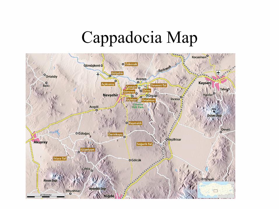
Cappadocia Map

These pictures belong to the region of Cappadocia (Turkey), occupies an area of nearly 10,000 ha, surrounded by 10 extinct volcanoes, its like a lunar landscape is what distinguishes it as a unique geological formation in the world. Included within the World Heritage of UNESCO (No. 357).

One of the best ways to appreciate the expansive, diverse landscape of Cappadocia's landscape is from above, in a hot-air balloon..

A skilled pilot can take you right into a valley, sail through it so the rock cones loom on either side, then climb the edge of a tall fairy chimney.

The trip usually lasts an hour
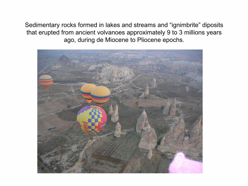
Sedimentary rocks formed in lakes and streams and “ignimbrite” diposits that erupted from ancient volvanoes approximately 9 to 3 millions years
ago, during de Miocene to Pliocene epochs.

The rocks of Cappadocia near Goreme eroded into hundreds od spectacular pillars and minaret.

Ignimbriteds may be white, grey, pink, beige, brown or black depeding on their compostion and density.

The trip usually ends with a champagne toast, a
ballooning tradition.
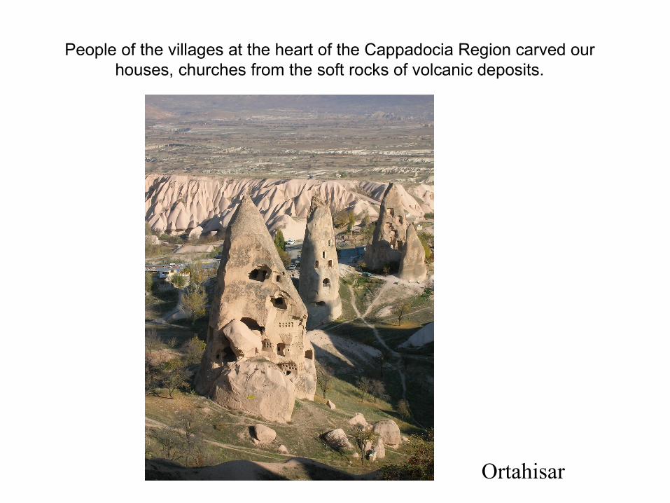
People of the villages at the heart of the Cappadocia Region carved our houses, churches from the soft rocks of volcanic deposits.
Ortahisar
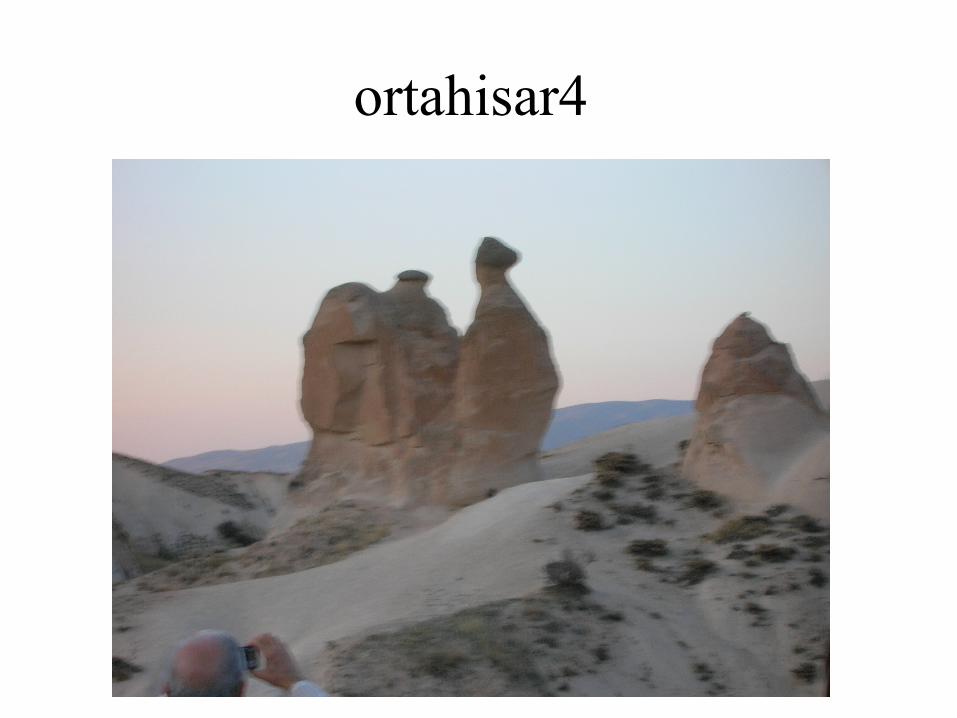
ortahisar4
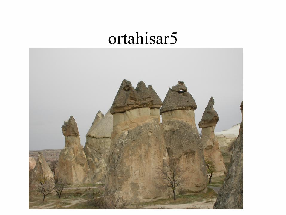
ortahisar5
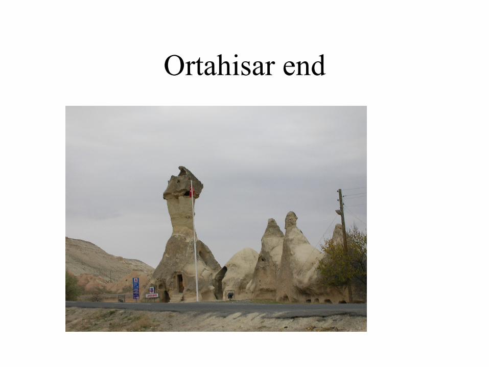
Ortahisar end
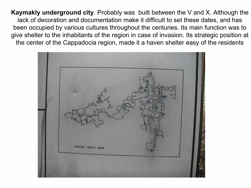
Kaymakly underground city. Probably was built between the V and X. Although the lack of decoration and documentation make it difficult to set these dates, and has
been occupied by various cultures throughout the centuries. Its main function was to give shelter to the inhabitants of the region in case of invasion. Its strategic position at
the center of the Cappadocia region, made it a haven shelter easy of the residents

A stable is located on the first floor. The small size of the stable could indicate that other stables exist in the sections not yet opened. To the left
of the stable is a passage with a millstone door. The door leads into a church. To the right of the stables are rooms, possibly living spaces.

The third floor contains the most important areas of the underground compound: storage places, wine or oil presses, and kitchens.
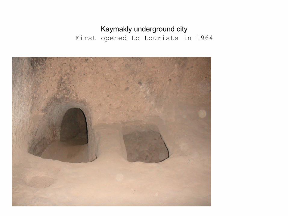
Kaymakly underground cityFirst opened to tourists in 1964
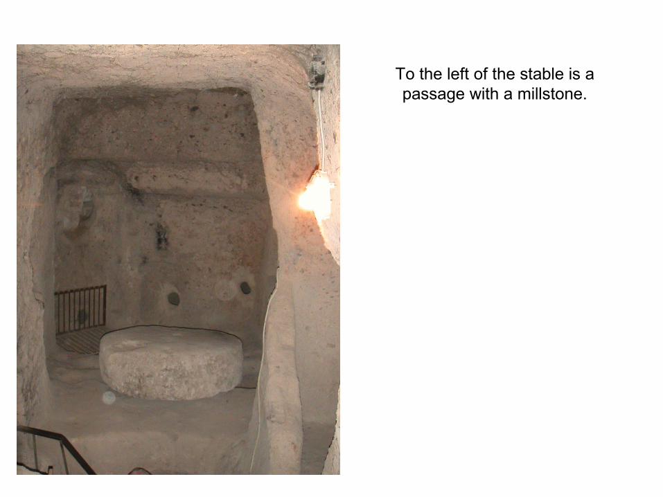
To the left of the stable is a passage with a millstone.

Possibly stable

Of the four floors open to tourists, each space is organized around ventilation shafts. This makes the design of each room or open space
dependent on the availability of ventilation.
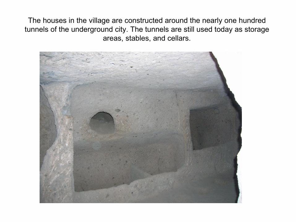
The houses in the village are constructed around the nearly one hundred tunnels of the underground city. The tunnels are still used today as storage
areas, stables, and cellars.

The houses in the village are constructed around the nearly one hundred tunnels of the underground city.
The tunnels are still used today as storage areas, stables, and cellars.

The complex contains more than 30 carved-from-rock churches and chapels, some having superb frescoes inside, dating from the ninth century to the eleventh century.
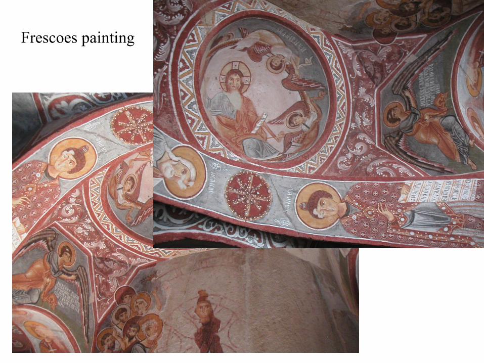
goreme1Frescoes painting

An other chapel
