utah reorganizes its gis around web services
TRANSCRIPT
NATIONAL STATES GEOGRAPHIC INFORMATION COUNCIL
2105 Laurel Bush Rd. Bel Air, MD 21015 443-640-1075 www.nsgic.org
ReorganizingAround Web
ServicesBert Granberg
Matt Peters
Utah Automated GeographicReference Center
NATIONAL STATES GEOGRAPHIC INFORMATION COUNCIL
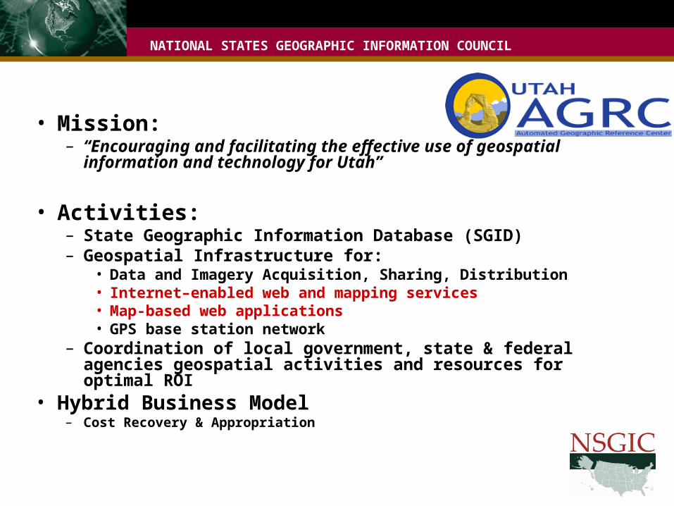
• Mission:– “Encouraging and facilitating the effective use of geospatial
information and technology for Utah”
• Activities:– State Geographic Information Database (SGID)– Geospatial Infrastructure for:
• Data and Imagery Acquisition, Sharing, Distribution• Internet–enabled web and mapping services• Map-based web applications• GPS base station network
– Coordination of local government, state & federal agencies geospatial activities and resources for optimal ROI
• Hybrid Business Model– Cost Recovery & Appropriation
NATIONAL STATES GEOGRAPHIC INFORMATION COUNCIL
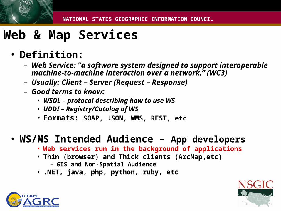
• Definition:– Web Service: "a software system designed to support interoperable
machine-to-machine interaction over a network.” (WC3)– Usually: Client – Server (Request – Response)– Good terms to know:
• WSDL – protocol describing how to use WS• UDDI – Registry/Catalog of WS• Formats: SOAP, JSON, WMS, REST, etc
• WS/MS Intended Audience – App developers• Web services run in the background of applications• Thin (browser) and Thick clients (ArcMap,etc)
– GIS and Non-Spatial Audience • .NET, java, php, python, ruby, etc
Web & Map Services
NATIONAL STATES GEOGRAPHIC INFORMATION COUNCIL
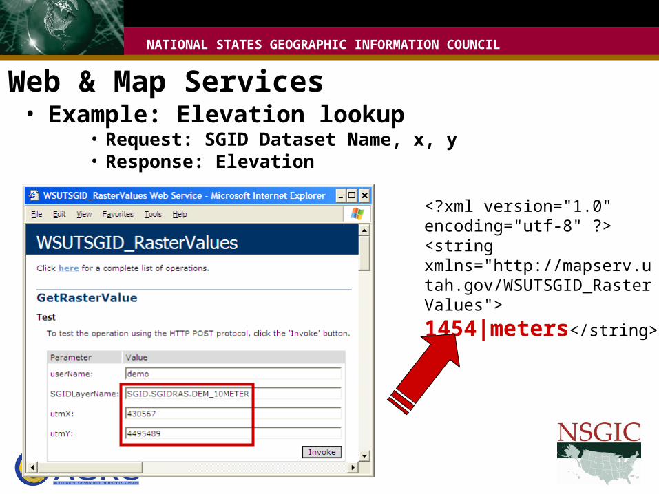
• Example: Elevation lookup• Request: SGID Dataset Name, x, y• Response: Elevation
Web & Map Services
<?xml version="1.0" encoding="utf-8" ?> <string xmlns="http://mapserv.utah.gov/WSUTSGID_RasterValues">
1454|meters</string>
NATIONAL STATES GEOGRAPHIC INFORMATION COUNCIL
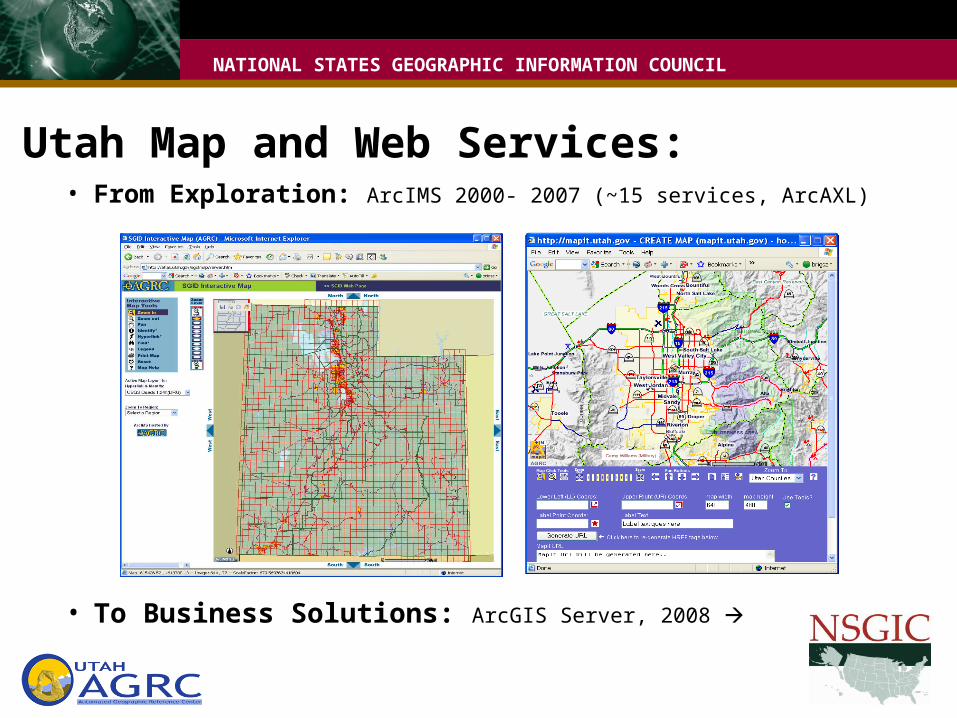
• From Exploration: ArcIMS 2000- 2007 (~15 services, ArcAXL)
• To Business Solutions: ArcGIS Server, 2008
Utah Map and Web Services:
NATIONAL STATES GEOGRAPHIC INFORMATION COUNCIL
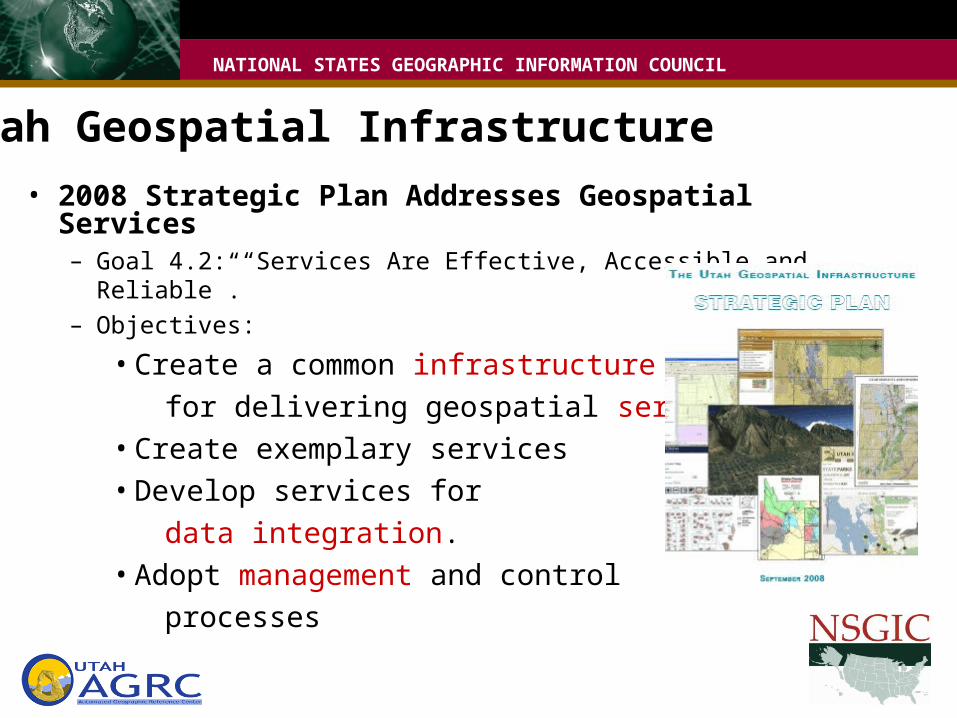
• 2008 Strategic Plan Addresses Geospatial Services– Goal 4.2: “Services Are Effective, Accessible and Reliable”.– Objectives:
• Create a common infrastructure for delivering geospatial services• Create exemplary services• Develop services for data integration.• Adopt management and control processes
Utah Geospatial Infrastructure
NATIONAL STATES GEOGRAPHIC INFORMATION COUNCIL
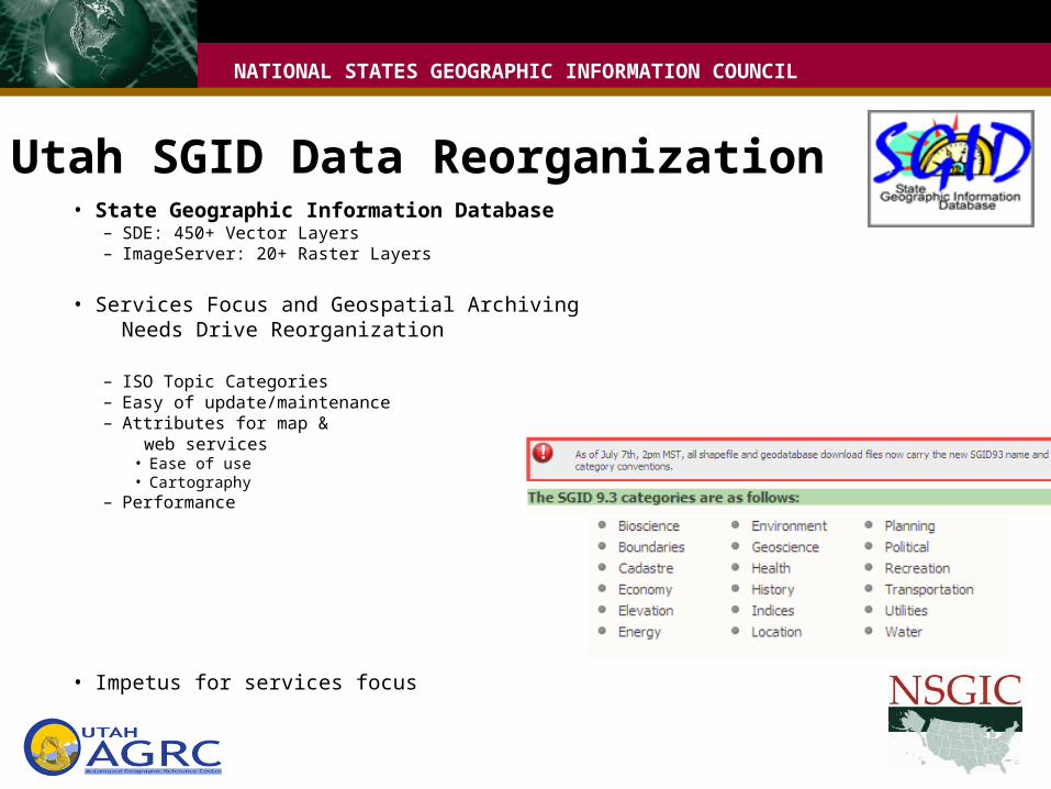
• State Geographic Information Database– SDE: 450+ Vector Layers– ImageServer: 20+ Raster Layers
• Services Focus and Geospatial Archiving Needs Drive Reorganization
– ISO Topic Categories– Easy of update/maintenance– Attributes for map & web services
• Ease of use• Cartography
– Performance
• Impetus for services focus
Utah SGID Data Reorganization
NATIONAL STATES GEOGRAPHIC INFORMATION COUNCIL
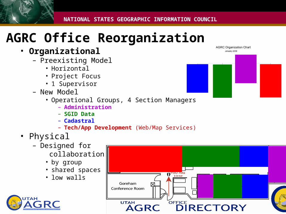
• Organizational– Preexisting Model
• Horizontal• Project Focus• 1 Supervisor
– New Model• Operational Groups, 4 Section Managers
– Administration– SGID Data– Cadastral– Tech/App Development (Web/Map Services)
• Physical– Designed for collaboration:
• by group• shared spaces• low walls
AGRC Office Reorganization
NATIONAL STATES GEOGRAPHIC INFORMATION COUNCIL
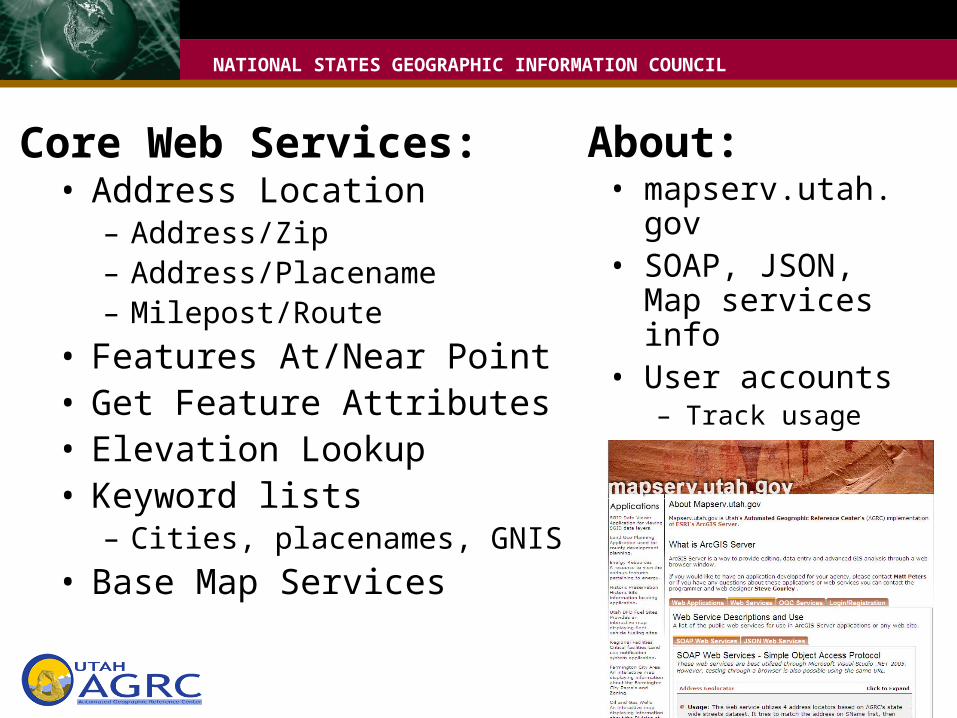
Core Web Services:• Address Location
– Address/Zip– Address/Placename– Milepost/Route
• Features At/Near Point• Get Feature Attributes• Elevation Lookup• Keyword lists
– Cities, placenames, GNIS• Base Map Services
• mapserv.utah.gov• SOAP, JSON, Map
services info• User accounts
– Track usage– Communicate with
users
About:

NATIONAL STATES GEOGRAPHIC INFORMATION COUNCIL
Componentizing Strategy:• 1st Gen: Design web service to specific use
– District Lookup• Address legislators, tax districts, etc.• Easy for application developers
NATIONAL STATES GEOGRAPHIC INFORMATION COUNCIL
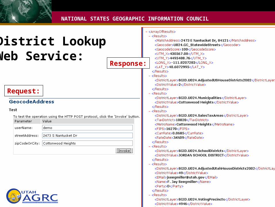
District LookupWeb Service:
Request:
Response:
NATIONAL STATES GEOGRAPHIC INFORMATION COUNCIL
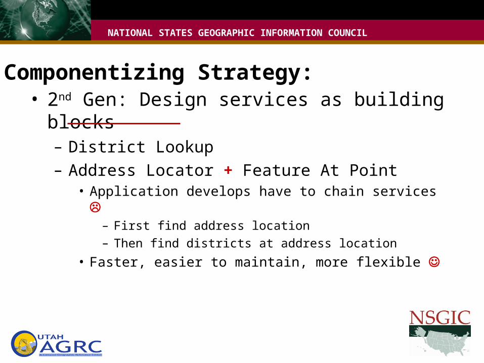
Componentizing Strategy:• 2nd Gen: Design services as building blocks
– District Lookup– Address Locator + Feature At Point
• Application develops have to chain services – First find address location– Then find districts at address location
• Faster, easier to maintain, more flexible
NATIONAL STATES GEOGRAPHIC INFORMATION COUNCIL
Web Service Advantages• Get more from investment, reach wider audience• Application Developers don’t need to maintain own
geospatial infrastructure, licenses, & data• Contract with end user defined by request and response
definitions– Frontend Input/Output parameters must stay the same– Backend methodology & data can be changed without breaking
contract
• Custom handling of tasks • Example: Address Locator
NATIONAL STATES GEOGRAPHIC INFORMATION COUNCIL
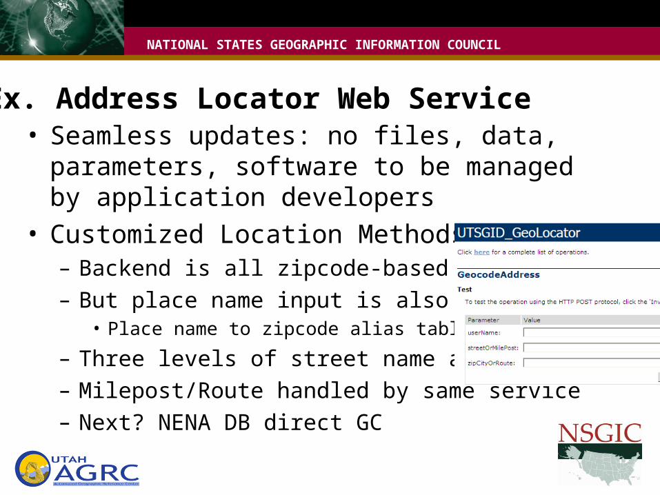
Ex. Address Locator Web Service• Seamless updates: no files, data, parameters,
software to be managed by application developers• Customized Location Methods:
– Backend is all zipcode-based geocoding– But place name input is also allowed
• Place name to zipcode alias table
– Three levels of street name aliasing– Milepost/Route handled by same service– Next? NENA DB direct GC
NATIONAL STATES GEOGRAPHIC INFORMATION COUNCIL
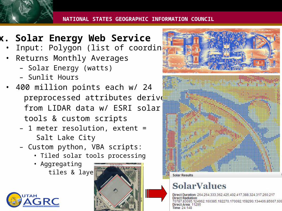
Ex. Solar Energy Web Service• Input: Polygon (list of coordinate pairs)• Returns Monthly Averages
– Solar Energy (watts) – Sunlit Hours
• 400 million points each w/ 24 preprocessed attributes derived from LIDAR data w/ ESRI solar tools & custom scripts
– 1 meter resolution, extent = Salt Lake City– Custom python, VBA scripts:
• Tiled solar tools processing• Aggregating tiles & layers
NATIONAL STATES GEOGRAPHIC INFORMATION COUNCIL
Core Statewide Map Services:• Publish once, integrate into applications
– WMS base map services• Imagery (via Image Server)• Imagery/Streets Hybrid (tile cache)
– ImageServer• Aerial Photography, CIR, (vintages available)• Scanned Maps
– USGS topo series– Geology base maps
• Hillshades
NATIONAL STATES GEOGRAPHIC INFORMATION COUNCIL
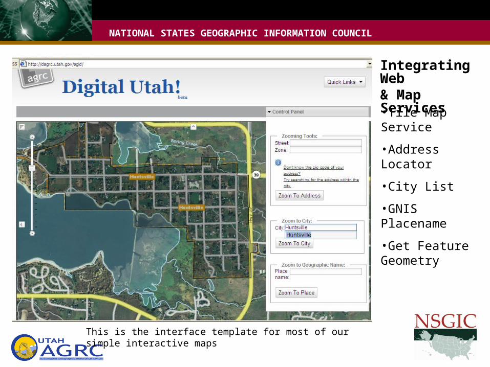
Integrating Web& Map Services
•Tile Map Service
•Address Locator
•City List
•GNIS Placename
•Get Feature Geometry
This is the interface template for most of our simple interactive maps
NATIONAL STATES GEOGRAPHIC INFORMATION COUNCIL
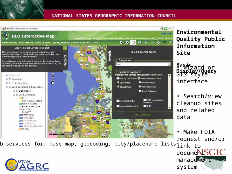
Environmental Quality Public Information Site
Basic Display/Query
• Wizard or GIS style interface
• Search/view cleanup sites and related data
• Make FOIA request and/or link to document management systemUses web services for: base map, geocoding, city/placename lists
NATIONAL STATES GEOGRAPHIC INFORMATION COUNCIL
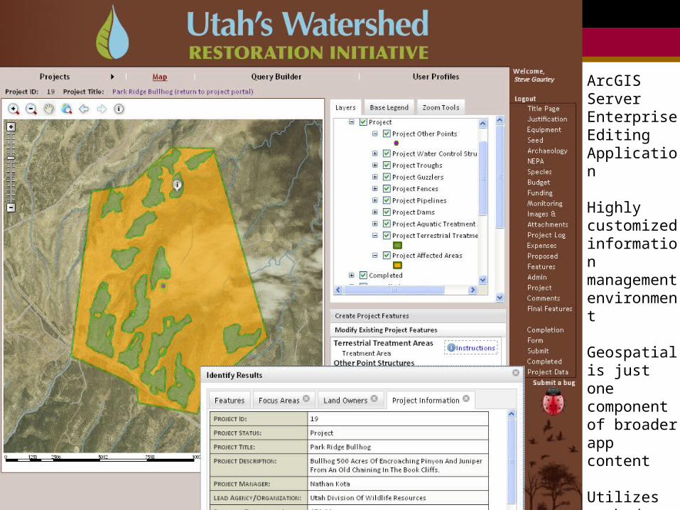
DNR Watershed Restoration Initiative: ArcGISServerEnterpriseEditingApplication
Highlycustomizedinformationmanagementenvironment
Geospatialis just one componentof broader app content
Utilizescachedmapservices
NATIONAL STATES GEOGRAPHIC INFORMATION COUNCIL
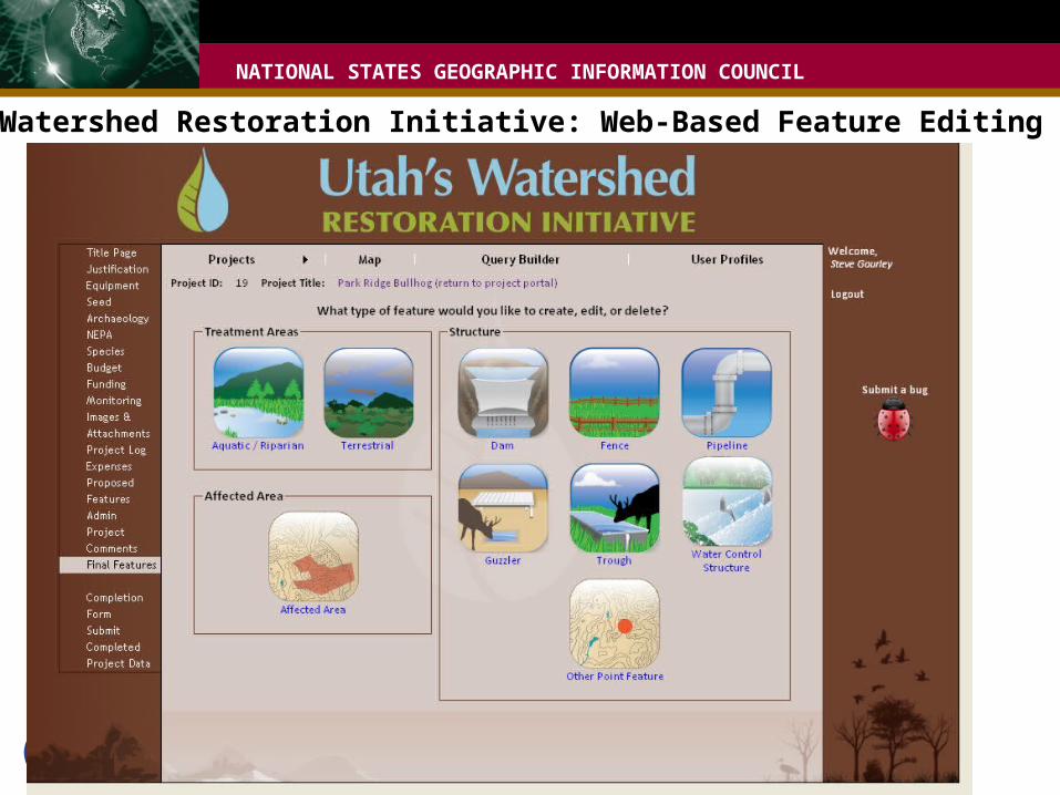
DNR Watershed Restoration Initiative: Web-Based Feature Editing
NATIONAL STATES GEOGRAPHIC INFORMATION COUNCIL
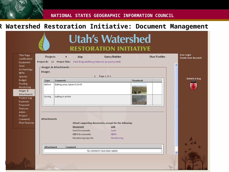
DNR Watershed Restoration Initiative: Document Management
NATIONAL STATES GEOGRAPHIC INFORMATION COUNCIL
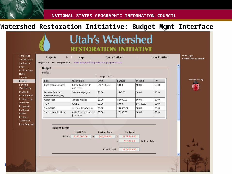
DNR Watershed Restoration Initiative: Budget Mgmt Interface
NATIONAL STATES GEOGRAPHIC INFORMATION COUNCIL
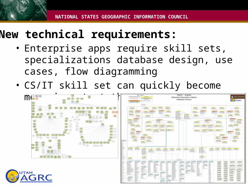
New technical requirements:• Enterprise apps require skill sets, specializations
database design, use cases, flow diagramming• CS/IT skill set can quickly become more important
than geospatial

NATIONAL STATES GEOGRAPHIC INFORMATION COUNCIL
What’s next:• Refine management processes for web/map services• More core web & map services• Outreach to developers• App Dev Projects
– Agriculture - salinity– Oil & Gas– Biotics - T & E species– Regional 3 fish DB– Health info integration (IBIS, flu)

NATIONAL STATES GEOGRAPHIC INFORMATION COUNCIL
Summary: SSDI Geospatial Web Services• Extend benefits of geospatial investment• Takes commitment, forethought, resources• Important focus areas
– Geography CS, IT– Industry standards– Performance orientation, focus can't be on the size of the
data pile– Reaching non-GIS audiences with GIS data and maps
NATIONAL STATES GEOGRAPHIC INFORMATION COUNCIL
Comments/Questions• [email protected] @mattagrc• [email protected] @bertagrc
• mapserv.utah.gov