verification and evaluation of geological-mining...
TRANSCRIPT
VERIFICATION AND EVALUATION OF GEOLOGICAL-MINING INFORMATION – FACILITATED BY COLOMBIAN MINERAL RESOURCES LTD, FOR DIFFERENT COAL AREAS IN COLOMBIA.
1
VERIFICATION AND EVALUATION OF GEOLOGICAL-MINING
INFORMATION – FACILITATED BY COLOMBIAN MINERAL RESOURCES LTD, FOR DIFFERENT COAL AREAS IN COLOMBIA
STUDY PRESENTED TO
COLOMBIAN MINERAL RESOURCES LTD
REQUESTED BY LHM Casey McGrath CORPORATE ADVISER FOR PLUS MARKET
FINAL REPORT
ORIGINAL
PRESENTED BY
Bogota D.C., June 2011
VERIFICATION AND EVALUATION OF GEOLOGICAL-MINING INFORMATION – FACILITATED BY COLOMBIAN MINERAL RESOURCES LTD, FOR DIFFERENT COAL AREAS IN COLOMBIA.
2
INDEX
SUMMARY ................................................................................... 3
INTRODUCTION .......................................................................... 4
1. OBJECTIVE .......................................................................... 4
2. GEOGRAPHIC LOCATION ..................................................... 4
3. METHODOLOGY ................................................................... 6
4. RESULTS ............................................................................. 9
5. GLOSSARY ........................................................................ 11
BIBLIOGRAPHY ........................................................................ 13
VERIFICATION AND EVALUATION OF GEOLOGICAL-MINING INFORMATION – FACILITATED BY COLOMBIAN MINERAL RESOURCES LTD, FOR DIFFERENT COAL AREAS IN COLOMBIA.
3
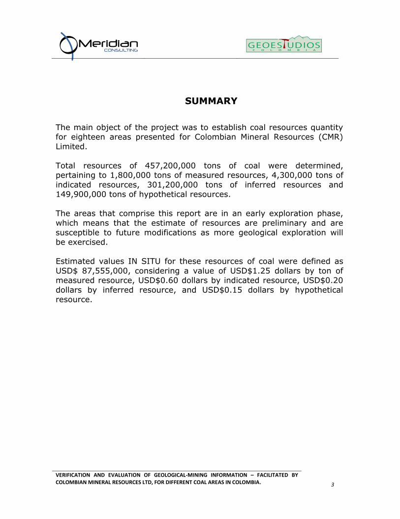
SUMMARY
The main object of the project was to establish coal resources quantity for eighteen areas presented for Colombian Mineral Resources (CMR)
Limited.
Total resources of 457,200,000 tons of coal were determined, pertaining to 1,800,000 tons of measured resources, 4,300,000 tons of
indicated resources, 301,200,000 tons of inferred resources and 149,900,000 tons of hypothetical resources.
The areas that comprise this report are in an early exploration phase,
which means that the estimate of resources are preliminary and are
susceptible to future modifications as more geological exploration will be exercised.
Estimated values IN SITU for these resources of coal were defined as
USD$ 87,555,000, considering a value of USD$1.25 dollars by ton of measured resource, USD$0.60 dollars by indicated resource, USD$0.20
dollars by inferred resource, and USD$0.15 dollars by hypothetical resource.
VERIFICATION AND EVALUATION OF GEOLOGICAL-MINING INFORMATION – FACILITATED BY COLOMBIAN MINERAL RESOURCES LTD, FOR DIFFERENT COAL AREAS IN COLOMBIA.
4
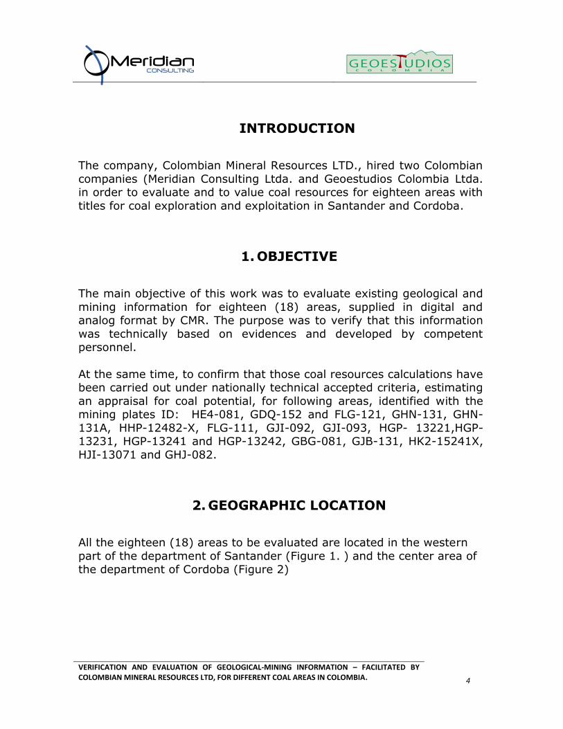
INTRODUCTION
The company, Colombian Mineral Resources LTD., hired two Colombian
companies (Meridian Consulting Ltda. and Geoestudios Colombia Ltda. in order to evaluate and to value coal resources for eighteen areas with
titles for coal exploration and exploitation in Santander and Cordoba.
1. OBJECTIVE
The main objective of this work was to evaluate existing geological and
mining information for eighteen (18) areas, supplied in digital and analog format by CMR. The purpose was to verify that this information
was technically based on evidences and developed by competent personnel.
At the same time, to confirm that those coal resources calculations have been carried out under nationally technical accepted criteria, estimating
an appraisal for coal potential, for following areas, identified with the mining plates ID: HE4-081, GDQ-152 and FLG-121, GHN-131, GHN-
131A, HHP-12482-X, FLG-111, GJI-092, GJI-093, HGP- 13221,HGP-13231, HGP-13241 and HGP-13242, GBG-081, GJB-131, HK2-15241X,
HJI-13071 and GHJ-082.
2. GEOGRAPHIC LOCATION
All the eighteen (18) areas to be evaluated are located in the western
part of the department of Santander (Figure 1. ) and the center area of the department of Cordoba (Figure 2)

VERIFICATION AND EVALUATION OF GEOLOGICAL-MINING INFORMATION – FACILITATED BY COLOMBIAN MINERAL RESOURCES LTD, FOR DIFFERENT COAL AREAS IN COLOMBIA.
5
Figure 1. Area location in Santander.
Figure 2. Area location in Cordoba.
VERIFICATION AND EVALUATION OF GEOLOGICAL-MINING INFORMATION – FACILITATED BY COLOMBIAN MINERAL RESOURCES LTD, FOR DIFFERENT COAL AREAS IN COLOMBIA.
6
3. METHODOLOGY
3.1. INFORMATION ANALYSIS
The information supplied was evaluated by our technicians for each area. A summary of this information is presented for separated areas.
The only evaluated information was the supplied by CMR which was compared with public information, mainly with INGEOMINAS geological
maps. For this information the following items were analyzed:
Mining property and superficial rights: location of each area
and mining ID was located, finding kind of title, plate (mining ID), the location, owner, and legal agreements with third parties, such
as companies, perquisites, native titles, etc.; also including information as historic places, national parks, mining reserves, and
evaluating environmental passives, among other factors.
Operational security should be established for any area, identifying possible impediments in this sense.
Historic Exploration: Old information developed for recognition
and evaluation of those exploration areas such as public reports hired mainly by INGEOMINAS, ECOCARBÓN or by other private and
public companies.
Geology: Our Company compiled geological information like geological models, stratigraphic relation among formations,
structural geology and geometry of the coal beds. The confidence or uncertainty for geological interpretation. The nature of used
data for the geological assumptions. The consequence of all alternative interpretations developed for the resource estimation.
The use of the geological tools for real resource estimation.
Mining parameters: The analysis of assumptions made on
proposed exploitation methods and basic mining designs were considered.
VERIFICATION AND EVALUATION OF GEOLOGICAL-MINING INFORMATION – FACILITATED BY COLOMBIAN MINERAL RESOURCES LTD, FOR DIFFERENT COAL AREAS IN COLOMBIA.
7
Data consolidation methods: Methods utilized to define the
resources of coal were examined.
Diagrams: Maps, sections and tables included in the available information, showing bed coal intervals were evaluated when they
helped to clarify the information.
Other exploration data: Any other exploration data was evaluated, such as geological - geophysical, geo-metallurgic,
topographical, hydrologic, samples collected, densities, composition, and other aspects due to report. Based on the
general data taken from the Colombian Coals Evaluations, coal
quality corresponds to bituminous coals for thermal use.
Additional works: Any additional work to project lateral extensions or estimated depth extension was analyzed.
3.2. RESOURCES QUANTIFICATION
To define resources, concepts applied in national norm, were considered. (See glossary).
Measured and indicated Resources: Those resources that comply with the national parameters, based on dependable studies
according to the developed information appraisal, and were
calculated using drilling data, or outcrops control points, that guarantee coal beds continuity.
Inferred Resources: As inferred resources were considered those
coal beds where the geological knowledge permits to establish that they are located in a geological unit known as coal producer; in
addition there is sufficient geological information that permits our team to calculate coal resources according to the established
parameters; besides they include adequate structural data in order to determine the geological subsurface model. For this work the
depth limit for coal resources estimation was established in 1,200 m.

VERIFICATION AND EVALUATION OF GEOLOGICAL-MINING INFORMATION – FACILITATED BY COLOMBIAN MINERAL RESOURCES LTD, FOR DIFFERENT COAL AREAS IN COLOMBIA.
8
Hypothetical resources: As hypothetical resources were
considered those areas where the geological knowledge (stratigraphic and geological cartography), permits to establish that
they are found on a geological unit known as coal producer, but which geological information or outcrops control points are
considered not sufficient for establishing with a moderate certainty the sub surface geological model. For this work the depth limit for
coal resources estimation was established in 1,200 m.
Note: Areas with zero potential were defined as those not included in a known coal producer formation or located on geological units with non-
exploitable coal beds. That qualification will remain until some
geological recognitions are developed, finding coal zones, and other information, that can be used to consider as a coal resource.
3.3. RESOURCE EVALUATION
To establish the cost of each ton located in situ, we use our consultants and experience for other coal economic evaluations, and the theoretical
concepts exposed in the seminar "TRAINING ON INTERNATIONAL STANDARDS, FOR RESERVES APPRAISAL, MINING PROJECTS AND
BUSINESS PLAN IN THE MINING SECTOR" organized by the Mines Ministry. Those values are valid evaluating current geological knowledge
and the average used in previous analysis of this kind of resources in the country.
These values are estimated according to some marketing information, such as recent local negotiations for coal areas. However this valuation
is not based on some specific study, therefore it should be taken as a variable and empirical reference over time.
Ton of Measured resource: Us$ 1.25
Ton of Indicated resource: Us$ 0.60 Ton of Inferred resource: Us$ 0.20
Ton of Hypothetical resource: Us$ 0.15

VERIFICATION AND EVALUATION OF GEOLOGICAL-MINING INFORMATION – FACILITATED BY COLOMBIAN MINERAL RESOURCES LTD, FOR DIFFERENT COAL AREAS IN COLOMBIA.
9
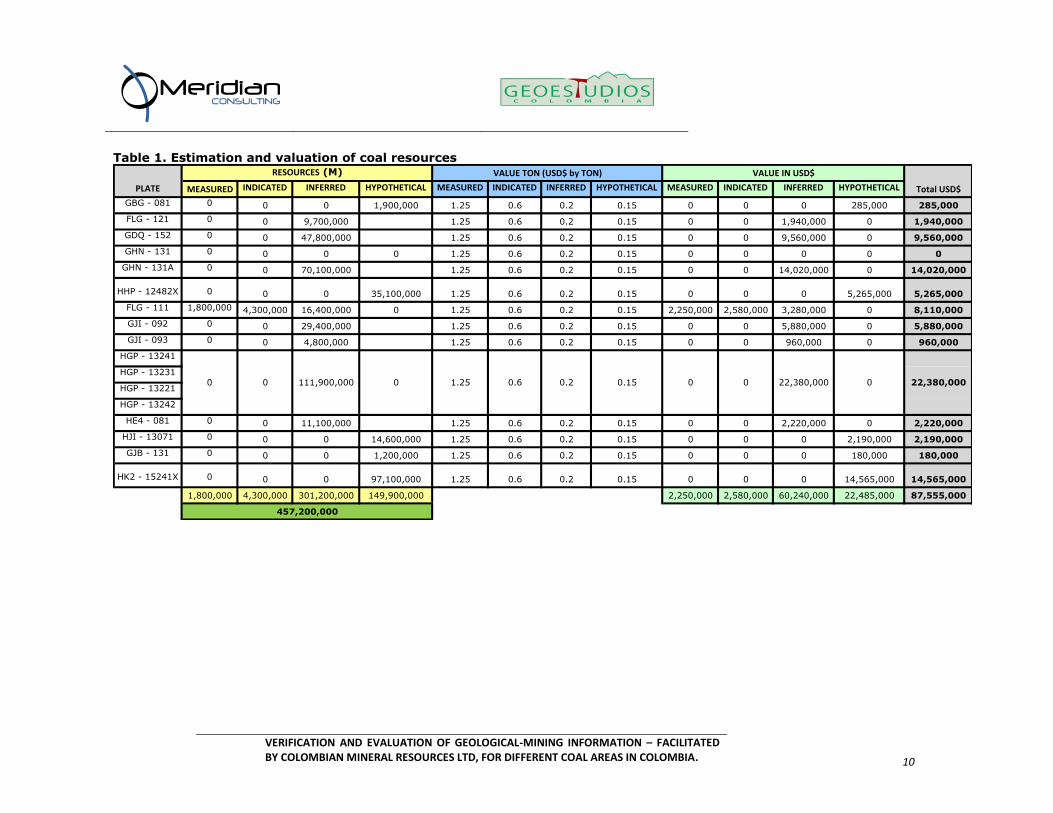
4. RESULTS
The results of those calculations for the eighteen study areas are
presented in table 1.
Measured Resources: 1,800,000 tons Indicated Resources 4,300,000 tons
Inferred Resources 301,200,000 tons Hypothetical Resources 149,900,000 tons
Total Resources: 457,200,000 tons
Estimated Value Us$ 87,555,000
VERIFICATION AND EVALUATION OF GEOLOGICAL-MINING INFORMATION – FACILITATED BY COLOMBIAN MINERAL RESOURCES LTD, FOR DIFFERENT COAL AREAS IN COLOMBIA.
10
Table 1. Estimation and valuation of coal resources
MEASURED INDICATED INFERRED HYPOTHETICAL MEASURED INDICATED INFERRED HYPOTHETICAL MEASURED INDICATED INFERRED HYPOTHETICAL
GBG - 081 0 0 0 1,900,000 1.25 0.6 0.2 0.15 0 0 0 285,000 285,000
FLG - 121 0 0 9,700,000 1.25 0.6 0.2 0.15 0 0 1,940,000 0 1,940,000
GDQ - 152 0 0 47,800,000 1.25 0.6 0.2 0.15 0 0 9,560,000 0 9,560,000
GHN - 131 0 0 0 0 1.25 0.6 0.2 0.15 0 0 0 0 0
GHN - 131A 0 0 70,100,000 1.25 0.6 0.2 0.15 0 0 14,020,000 0 14,020,000
HHP - 12482X 0 0 0 35,100,000 1.25 0.6 0.2 0.15 0 0 0 5,265,000 5,265,000
FLG - 111 1,800,000 4,300,000 16,400,000 0 1.25 0.6 0.2 0.15 2,250,000 2,580,000 3,280,000 0 8,110,000
GJI - 092 0 0 29,400,000 1.25 0.6 0.2 0.15 0 0 5,880,000 0 5,880,000
GJI - 093 0 0 4,800,000 1.25 0.6 0.2 0.15 0 0 960,000 0 960,000
HGP - 13241
HGP - 13231
HGP - 13221
HGP - 13242
HE4 - 081 0 0 11,100,000 1.25 0.6 0.2 0.15 0 0 2,220,000 0 2,220,000
HJI - 13071 0 0 0 14,600,000 1.25 0.6 0.2 0.15 0 0 0 2,190,000 2,190,000
GJB - 131 0 0 0 1,200,000 1.25 0.6 0.2 0.15 0 0 0 180,000 180,000
HK2 - 15241X 0 0 0 97,100,000 1.25 0.6 0.2 0.15 0 0 0 14,565,000 14,565,000
1,800,000 4,300,000 301,200,000 149,900,000 2,250,000 2,580,000 60,240,000 22,485,000 87,555,000
PLATE
RESOURCES (M) VALUE TON (USD$ by TON) VALUE IN USD$
Total USD$
457,200,000
0 22,380,0000.6 0.2 0.15 0 0 22,380,0000 0 111,900,000 0 1.25
VERIFICATION AND EVALUATION OF GEOLOGICAL-MINING INFORMATION – FACILITATED BY COLOMBIAN MINERAL RESOURCES LTD, FOR DIFFERENT COAL AREAS IN COLOMBIA.
11
5. GLOSSARY
The definitions presented here are taken from:
ECOCARBÓN, 1995, Normas generales de muestreo y análisis de carbones,
INGEOMINAS, 2010, El carbón, Muestreo, análisis y clasificación de recursos y reservas
MEASURED RESOURCES
This category includes the verified coal beds that have the highest degree of geological confidence, supported by outcrops control points
or drilling data which radius of influence vary up to 250m. This coal bed category includes anthracitic, bituminous and sub-bituminous
coal which thickness surpasses the 0,4m or 0,75m for lignite coal. The depth limit for coal resources estimation is established in 1,200
m.
INDICATED RESOURCES
This category includes the verified coal beds that have moderate degree of geological confidence, supported by outcrops control points
or drilling data which radius of influence vary between 250m and 750m. This coal bed category includes anthracitic, bituminous and
sub-bituminous coal which thickness surpasses the 0,4m or 0,75m for lignite coal. The depth limit for coal resources estimation is
established in 1,200 m.
The Indicated Resource calculations are done on the base of geological evidence, by extension of coal bed and thicknesses from
measurement and sampling points.
INFERRED RESOURCES
It represents coal beds identified with a low degree of geological confidence which reliability scope is supported by at least one outcrop
control point which radius of influence varies from 750m to 2250m. This coal bed category includes anthracitic, bituminous and sub-

VERIFICATION AND EVALUATION OF GEOLOGICAL-MINING INFORMATION – FACILITATED BY COLOMBIAN MINERAL RESOURCES LTD, FOR DIFFERENT COAL AREAS IN COLOMBIA.
12
bituminous coal which thickness surpasses the 0.4m or 0.75m for
lignite coal. The depth limit for coal resources estimation is established in 1,200 m.
HYPOTHETICAL RESOURSES
They are a non-discovered, “IN SITU” resources category. The extension of inferred resources is comparable with known coal
deposits that can be expected under analogous geological conditions. For example, an area where coal bed related unit outcrops can be
found, even if no coal beds have been found in that area.
VERIFICATION AND EVALUATION OF GEOLOGICAL-MINING INFORMATION – FACILITATED BY COLOMBIAN MINERAL RESOURCES LTD, FOR DIFFERENT COAL AREAS IN COLOMBIA.
13
BIBLIOGRAPHY
Ingeominas, 2004. El Carbón Colombiano. Recursos, reservas y
calidad. Minminas, Ingeominas y Minercol, Bogotá.