wx-352 weather forecasting. pg-13 weather joke this had most of the state of michigan laughing for 2...
Post on 21-Dec-2015
215 views
TRANSCRIPT

WX-352 Weather Forecasting
PG-13 Weather Joke• This had most of the state of Michigan laughing for 2
days and a very embarrassed female news anchor who will, in the future, likely think before she speaks.
What happens when you predict snow but don't get any. A true story...
A female news anchor that, the day after it was supposed to have snowed and didn't, turned to the weatherman and asked: "So Bob, where's that 8 inches you promised me last night?"
Not only did HE have to leave the set, but half the crew did too they were laughing so hard!

TV Weatherman in Serious Need of Medication


Four Forecasting Steps:
• 1) Assess the present state, called the analysis, by plotting 6 hourly surface and 12 hourly sounding data
• 2) Predict a future state by running a computer model of weather changes…
• 3) Interpret the model results, called a prognostic chart, given forecasting experience…apply ROTs
• 4) Translate forecast into something that is useful

Persistence Forecast Method
The persistence method works well when weather patterns change very little and features on the weather maps move very slowly. It also works well in places like southern California, where summertime weather conditions vary little from day to day.
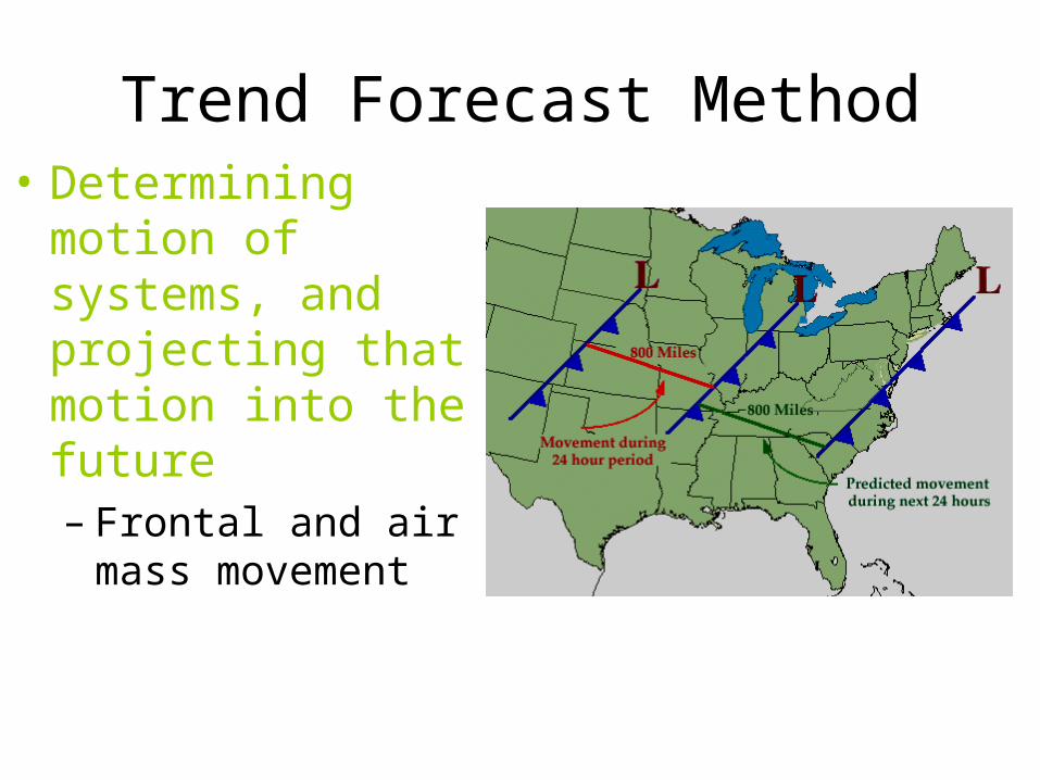
Trend Forecast Method• Determining motion
of systems, and projecting that motion into the future– Frontal and air mass
movement
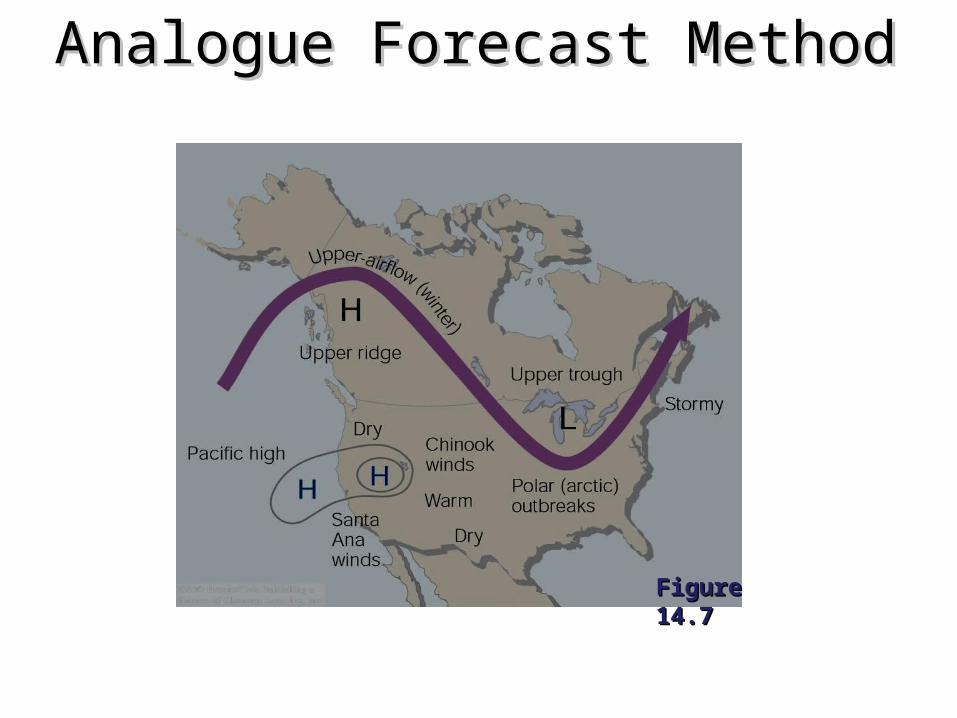
Analogue Forecast MethodAnalogue Forecast Method
Figure 14.7Figure 14.7

Forecast Using Climatology• Using long-term average weather to
predict future conditions– Most useful for long-range forecasting– Includes probability forecast methods

Climatology--Winds

Forecasting Using ProbabilityForecasting Using Probability
Figure 14.6Figure 14.6
- Climate records can be used to generate probability forecasts for a - Climate records can be used to generate probability forecasts for a given event.given event.
-- Florida has less than a 5% chance of snow on December 25th, -- Florida has less than a 5% chance of snow on December 25th, while northern Minnesota has had snow on that date for each of the past while northern Minnesota has had snow on that date for each of the past 30 years.30 years.
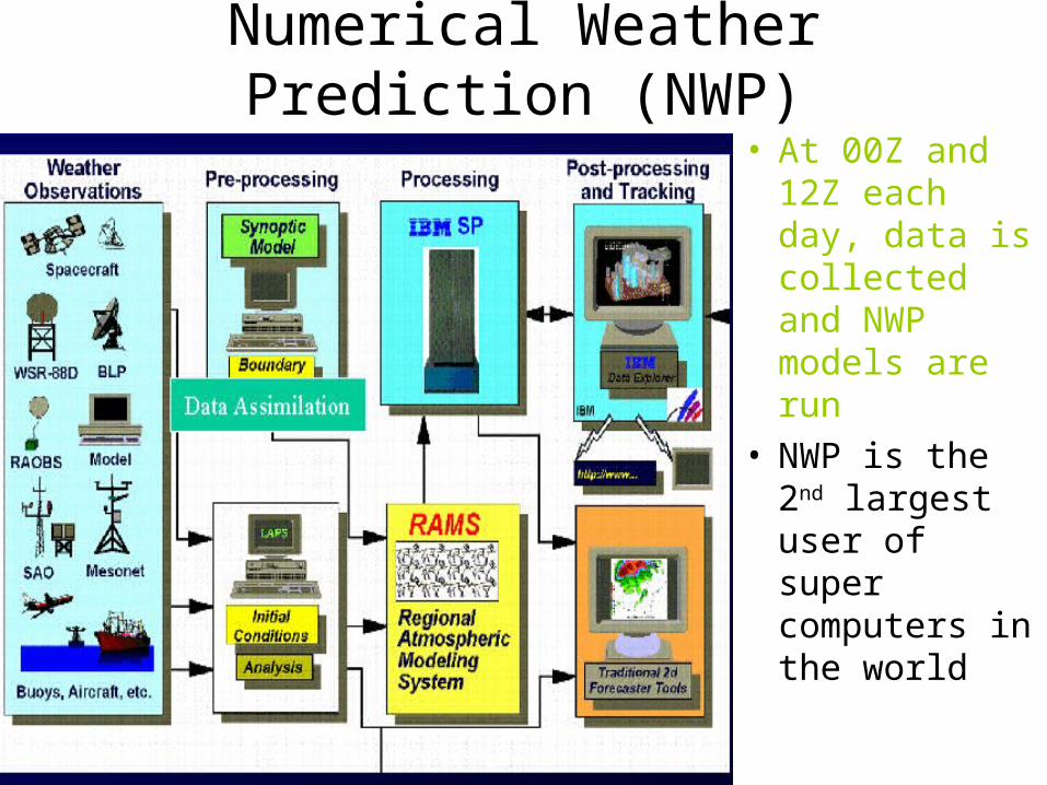
Numerical Weather Prediction (NWP)
• At 00Z and 12Z each day, data is collected and NWP models are run
• NWP is the 2nd largest user of super computers in the world

NWP--Limitations
• While NWP has greatly improved the accuracy of weather forecasts, it still haves significant limitations
• Usually the best method for forecasting weather 12 hours to 5 days in the future
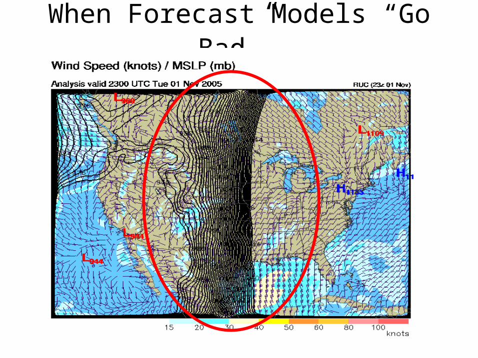
When Forecast Models “Go Bad”…
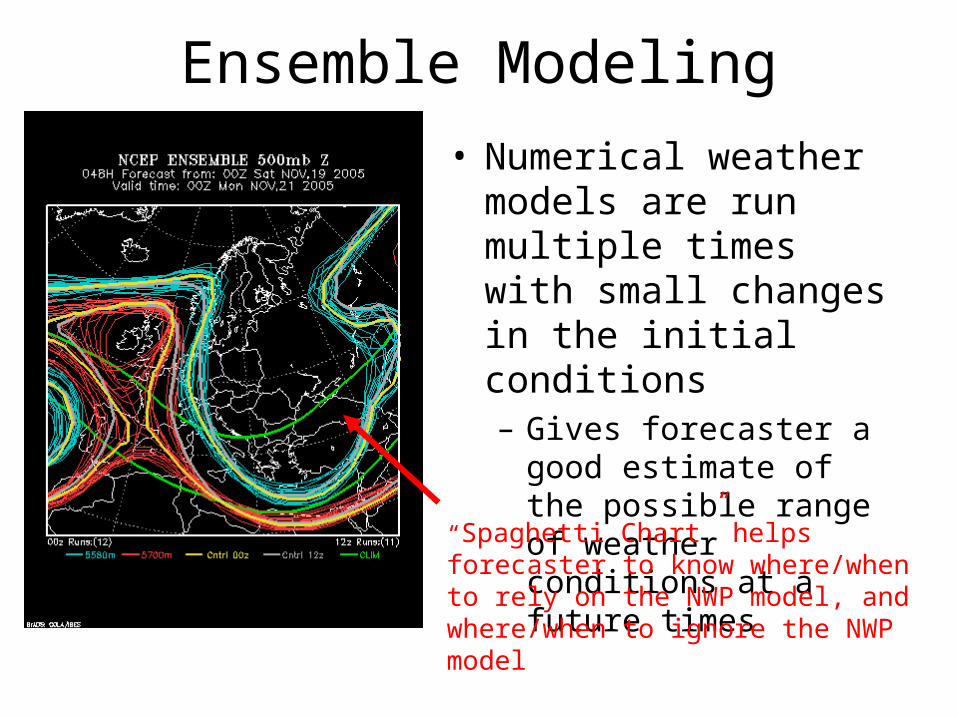
Ensemble Modeling
• Numerical weather models are run multiple times with small changes in the initial conditions– Gives forecaster a good
estimate of the possible range of weather conditions at a future times
“Spaghetti Chart” helps forecaster to know where/when to rely on the NWP model, and where/when to ignore the NWP model

Figure 14.8AFigure 14.8A
Figure 14.8BFigure 14.8B
Weekly and Monthly Forecasts• 30-90 day outlook of weather
conditions– Doesn’t give a specific forecast
• Warmer or cooler (wetter/dryer) than normal
– Uses ensemble modeling and analogue methods
• Slightly better than climatology alone
• These 90 day outlooks were downloaded after Christmas, 2005. How accurate do you think they were?

Forecast Periods- Nowcasting (less than 6 hours)
- Mainly surface observations, weather satellite and radar, and persistence or trend forecasts
- Short-range (<3 days)- Trend and analogue methods, weather charts and
numerical weather forecast products- Medium range (3-8 days)
- Analogue forecasts, numerical weather forecast products, climatology
- Long-range (>8 days)- Climatology; NWP Ensembles
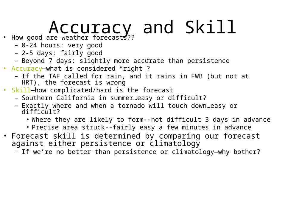
Accuracy and Skill• How good are weather forecasts??
– 0-24 hours: very good– 2-5 days: fairly good– Beyond 7 days: slightly more accurate than persistence
• Accuracy—what is considered “right”?– If the TAF called for rain, and it rains in FWB (but not at HRT), the forecast
is wrong• Skill—how complicated/hard is the forecast
– Southern California in summer…easy or difficult?– Exactly where and when a tornado will touch down…easy or difficult?
• Where they are likely to form--not difficult 3 days in advance• Precise area struck--fairly easy a few minutes in advance
• Forecast skill is determined by comparing our forecast against either persistence or climatology– If we’re no better than persistence or climatology—why bother?

NWS Probability of Precipitation
• Probability of Precipitation (PoP) describes the chance of an event occurring at any point in the forecast area, over a certain period of time (usually 12 hours).
• PoP is defined as: PoP = Pa x Pc, where:– Pa =the probability that
precipitation will occur somewhere in the forecast area during the forecast period and
– Pc =the percent of the area that will receive measurable precipitation, if it does occur
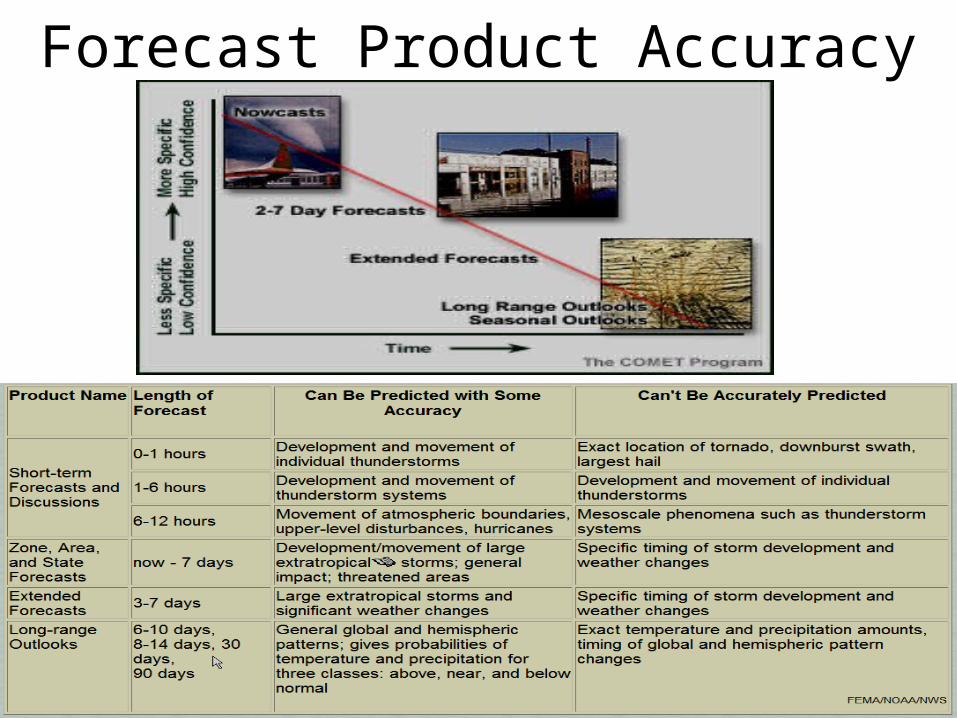
Forecast Product Accuracy
Forecast Practice
Scenarios

Forecasting with Surface Forecasting with Surface ChartsCharts
This simplified 6 AM Tuesday surface weather map is This simplified 6 AM Tuesday surface weather map is useful for short time interval predictions of fronts and useful for short time interval predictions of fronts and associated weather.associated weather.

Surface Chart PredictionsSurface Chart Predictions- 3-hour pressure - 3-hour pressure tendencies plotted tendencies plotted on on isallobarisallobar maps maps help predict the help predict the movement of movement of highs and lows highs and lows -Lows tend to Lows tend to move toward the move toward the region of greatest region of greatest pressure fall, pressure fall, while highs move while highs move toward the region toward the region of greatest rise.of greatest rise.
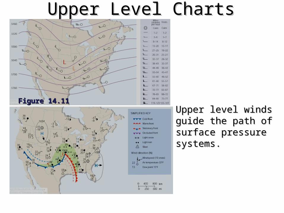
Upper Level ChartsUpper Level Charts
Figure 14.11Figure 14.11
Upper level winds guide the Upper level winds guide the path of surface pressure path of surface pressure systems.systems.
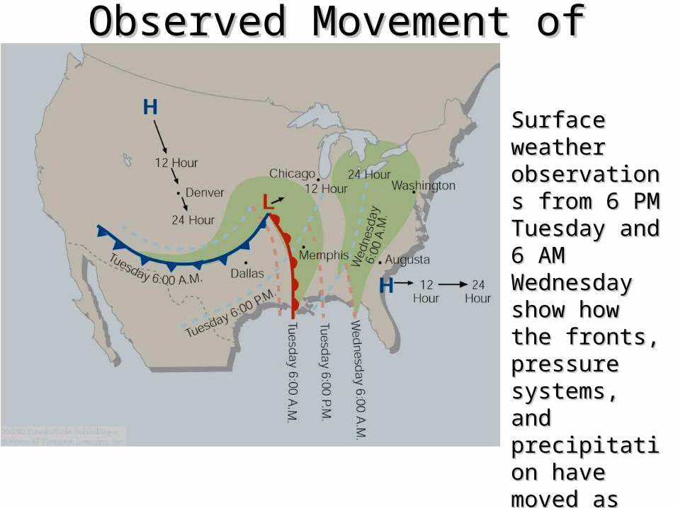
Observed Movement of FrontsObserved Movement of Fronts
Surface weather Surface weather observations observations from 6 PM from 6 PM Tuesday and 6 Tuesday and 6 AM Wednesday AM Wednesday show how the show how the fronts, pressure fronts, pressure systems, and systems, and precipitation precipitation have moved as have moved as predicted.predicted.
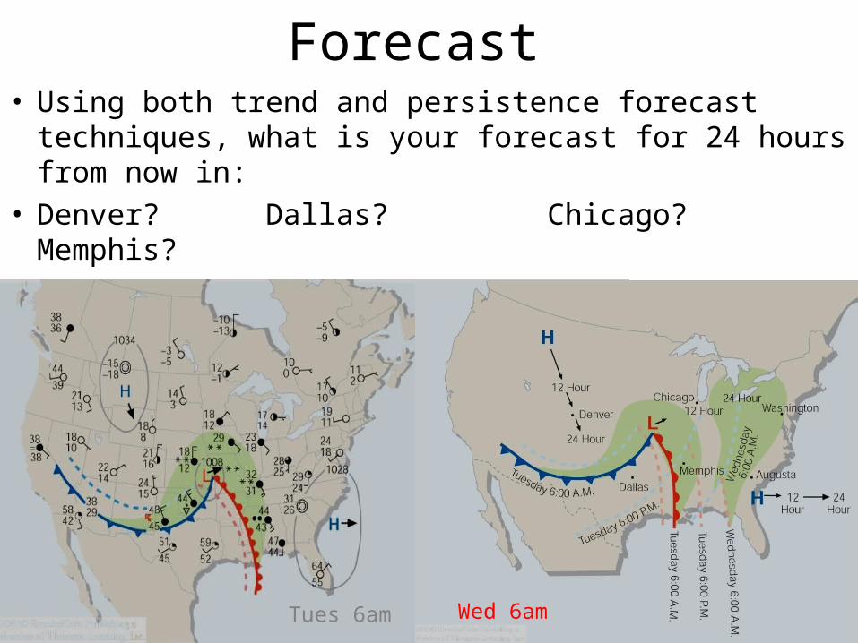
Forecast • Using both trend and persistence forecast techniques,
what is your forecast for 24 hours from now in:• Denver? Dallas? Chicago? Memphis?• Washington? Augusta?
Tues 6am Wed 6am

Observed Weather for 6 AM Observed Weather for 6 AM WednesdayWednesday
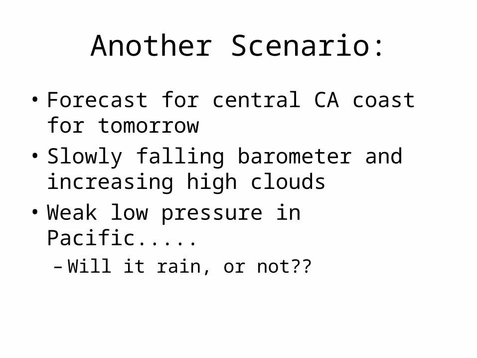
Another Scenario:
• Forecast for central CA coast for tomorrow
• Slowly falling barometer and increasing high clouds
• Weak low pressure in Pacific.....– Will it rain, or not??

Surface Weather for 4 PM Surface Weather for 4 PM SundaySunday
Look at 500mb chart for clues:

500 mb Chart for 4 PM Sunday500 mb Chart for 4 PM Sunday
564 line across the area (local ROT); Omega High present…but cold advection and shortwave may change the stagnant upper pattern; upper-level divergence??

12, 24, & 36 hour Progs12, 24, & 36 hour Progs
Forecaster has access to several forecast models -Which one is best? -- Choice is based on initialization and experience….
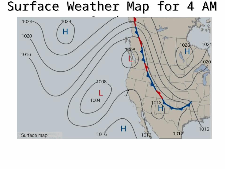
Surface Weather Map for 4 AM Surface Weather Map for 4 AM SundaySunday

500 mb Chart for 4 AM Monday500 mb Chart for 4 AM Monday

IR Satellite for 6:45 AM MondayIR Satellite for 6:45 AM Monday
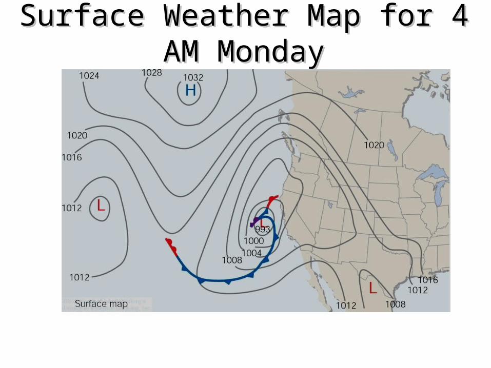
Surface Weather Map for 4 AM Surface Weather Map for 4 AM MondayMonday

Visible Satellite for 9 AM Visible Satellite for 9 AM TuesdayTuesday
Forecast Applications

Weather Impacts on Aviation Mishaps
• 88% of all weather-related aircraft mishaps occurred under IMC (Instrument Meteorological Conditions)
• 83% of fatal crashes involved FAR Part 91 (General Aviation) aircraft
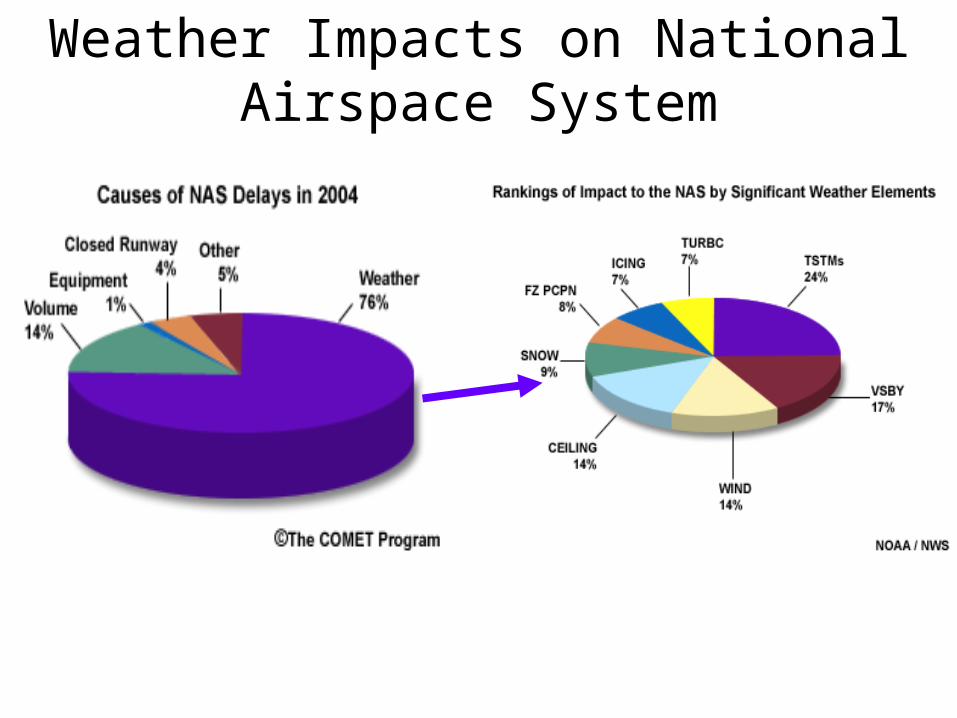
Weather Impacts on National Airspace System
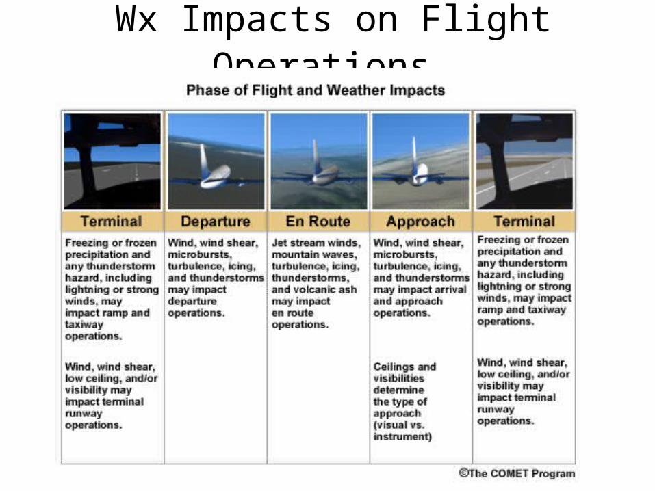
Wx Impacts on Flight Operations

< VFR Conditionsceiling (broken or overcast cloud bases) are more than 1,000 feet above the ground, and the visibility
is three miles or more, the weather is VFR.

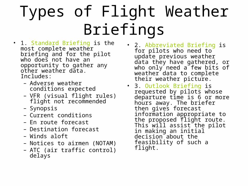
Types of Flight Weather Briefings
• Briefings and Advisories: All pilots must obtain a formal weather briefing during preflight. Based upon the following pilot's information a briefing is given: – Type of flight (VFR or IFR), aircraft type, departure and
destination airport, flight route, flight altitudes, estimated time of departure (ETD), estimated time of arrival (ETA)
• There are three types of briefings that are offered to pilots by "pilot weather briefers" who have been certificated by the National Weather Service, and work at local Flight Service Stations and Weather Service Offices. – Pilots need to know which weather briefing to request:
• The Standard Briefing• The Abbreviated Briefing • The Outlook Briefing
Types of Flight Weather Briefings
• 1. Standard Briefing is the most complete weather briefing and for the pilot who does not have an opportunity to gather any other weather data. Includes: – Adverse weather conditions
expected – VFR (visual flight rules) flight
not recommended – Synopsis – Current conditions – En route forecast – Destination forecast – Winds aloft – Notices to airmen (NOTAM) – ATC (air traffic control)
delays
• 2. Abbreviated Briefing is for pilots who need to update previous weather data they have gathered, or who only need a few bits of weather data to complete their weather picture.
• 3. Outlook Briefing is requested by pilots whose departure time is 6 or more hours away. The briefer then gives forecast information appropriate to the proposed flight route. This will assist the pilot in making an initial decision about the feasibility of such a flight.