1916 – 02 – the verdun campaign – u3a - wordpress.com · this map shows the western front...
TRANSCRIPT

Slide 1
The Verdun Campaign
Was this the World’s First
‘Fake News’ Story ?

Slide 2
Shibboleths about the Battle of Verdun
Source: Pinterest.com
‘The Battle of Verdun was the longest battle of World
War I and in world history. It was fought from
February 21 to December 18, in 1916, between the
French and German armies around the town of
Verdun, France. The battle involved more than two
and a half million men and it developed in a space
less that 8 sq miles and consisted of a ring of
underground fortifications which the German
attempted to take.’
Six assertions can be identified in this brief web based piece. • It was the longest battle of the War • It was fought from Feb 21 to Dec 18 • It was fought ‘around’ the town of Verdun • It involved more than 21/2 million men • It occurred in a space of less than 8 square miles • The Germans attempted to take a ring of French underground fortifications
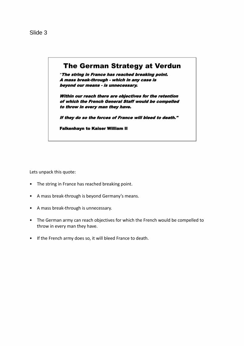
Slide 3
The German Strategy at Verdun"The string in France has reached breaking point.
A mass break-through - which in any case is
beyond our means - is unnecessary.
Within our reach there are objectives for the retention
of which the French General Staff would be compelled
to throw in every man they have.
If they do so the forces of France will bleed to death."
Falkenhayn to Kaiser William II
Lets unpack this quote: • The string in France has reached breaking point. • A mass break-through is beyond Germany’s means. • A mass break-through is unnecessary. • The German army can reach objectives for which the French would be compelled to
throw in every man they have. • If the French army does so, it will bleed France to death.
Slide 4
The Verdun Salient
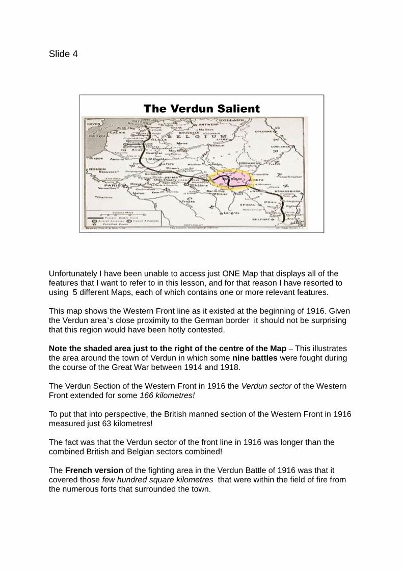
Unfortunately I have been unable to access just ONE Map that displays all of the features that I want to refer to in this lesson, and for that reason I have resorted to using 5 different Maps, each of which contains one or more relevant features. This map shows the Western Front line as it existed at the beginning of 1916. Given the Verdun area’s close proximity to the German border it should not be surprising that this region would have been hotly contested. Note the shaded area just to the right of the centre of the Map – This illustrates the area around the town of Verdun in which some nine battles were fought during the course of the Great War between 1914 and 1918. The Verdun Section of the Western Front in 1916 the Verdun sector of the Western Front extended for some 166 kilometres! To put that into perspective, the British manned section of the Western Front in 1916 measured just 63 kilometres! The fact was that the Verdun sector of the front line in 1916 was longer than the combined British and Belgian sectors combined! The French version of the fighting area in the Verdun Battle of 1916 was that it covered those few hundred square kilometres that were within the field of fire from the numerous forts that surrounded the town.
However , according to the German version of this campaign, the fighting referred to as being at Verdun actually took place on many different battle fields across the much broader region covering thousands of square kilometres. If you Google Verdun today you will still find many references describe the Battle for Verdun as taking place in the immediate area around the town. A second feature in this Map shows that the Verdun section of the Western Front line existed in a ‘salient’ (Glossary term) – A salient is a battlefield feature where a front line bulges into enemy territory. A salient is surrounded by the enemy on three sides, making the troops occupying the salient vulnerable to enemy fire from the front and the sides (enfilading fire). The final point on this Map is to note the strategic location of St Mihiel (not St Michel!) which unfortunately is not shown on the other Maps.

Slide 5
Forts in the Verdun Region
There are a number of key take outs to be gained from this map. After 1871 and in preparation for their next war with Germany, the French had constructed more than forty forts of various sizes and strengths on the higher hills and ridges near to Verdun, deliberately designed to block any potential German invasion across their common border which was just 40 kilometres away. In 1914 these forts were supplied via the town of Verdun, which itself was served by two rail lines, one routed along on the northern rim of the valley and the other along the southern rim. The third transport route to Verdun was provided by the Voie Sacree (Sacred Way Road) and an accompanying light rail system that was routed along the centre of the valley. Critically , if any of those supply routes to Verdun was disrupted, it would have been much more difficult for the French to resupply the soldiers in the many forts located around the town. A second thing we can discern is that the township of Verdun itself was dissected by the Muese River, which effectively meant that the town itself was divided into two parts.


Slide 6
Verdun Topography
The first thing to note in this Map is that the town of Verdun sits at the eastern end at the head of a ‘U’ shaped valley which is surrounded by high ground on three sides of the town. But more significantly, from a military viewpoint, the map shows the town is ringed on three sides by commanding heights, which effectively meant that the town itself had little military value. Logically, an invading German army, marching from an easterly direction, could have simply crossed the Muese River north and / or south of Verdun, and thereby bypassed what was militarily and strategically an irrelevant objective. More importantly, an invading army in control of high ground around Verdun could use its artillery from those vantage points to not only bombard the town at will, but more critically choke off its vital transport routes and thereby block supply to the reliant French forts.
Slide 7
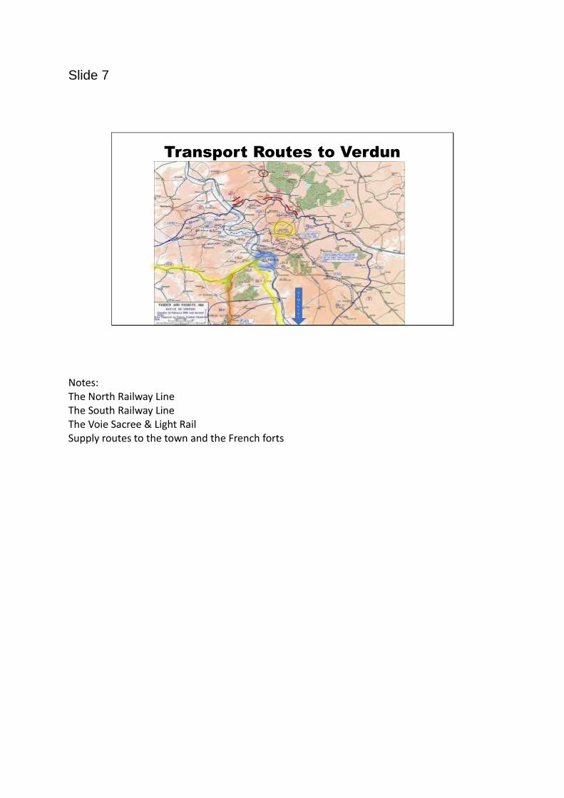
Transport Routes to Verdun
S
t
M
i
h
i
e
l
Notes: The North Railway Line The South Railway Line The Voie Sacree & Light Rail Supply routes to the town and the French forts
Slide 8
The Meuse River
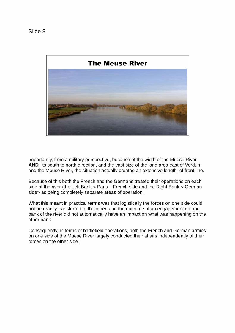
Importantly, from a military perspective, because of the width of the Muese River AND its south to north direction, and the vast size of the land area east of Verdun and the Meuse River, the situation actually created an extensive length of front line. Because of this both the French and the Germans treated their operations on each side of the river (the Left Bank < Paris – French side and the Right Bank < German side> as being completely separate areas of operation. What this meant in practical terms was that logistically the forces on one side could not be readily transferred to the other, and the outcome of an engagement on one bank of the river did not automatically have an impact on what was happening on the other bank. Consequently, in terms of battlefield operations, both the French and German armies on one side of the Muese River largely conducted their affairs independently of their forces on the other side.

Slide 9
Verdun –A Pretty Town in a Valley
Note the surrounding hills – a town in a basin (like Wodonga)

Slide 10
An Overview of the Verdun Battles 1914-1918
Verdun - Battle One - Date 6-12 September 1914 - The first German offensive took place on the left bank of the Muese River
Verdun - Battle Two – Date 23 September - 4 October 1914
The first German offensive on the right bank of the Muese River.
Verdun Battle Three - 1914 - 1915 -The French launched left bank Mid-winter offensives
Verdun Battle Four – The French launched right bank offensives from January to early April 1915 -the Battle of the Woevre
Verdun Battle Five - the famous 1916 Verdun battles -
From February - July 1916 the Germans launched a successful right bank attack to take St Mihiel, and then a left bank attack to take the Vauquis.
Verdun Battle Six - Three months later, from October through to December 1916
The French army launched a series of infantry counter attacks on the right bank & suffered very heavy casualties against the defensive German army.
Verdun Battle Seven – October 1917 (Autumn) – The French launched a left bank offensive.
Verdun Battle Eight - August 1918 - First Franco-American offensive
Verdun Battle Nine - September 1918 - Second Franco-American offensive threw the Germans from St Mihiel as the latter were making a withdrawal.
Slide 11
German Territorial Gains in 1916
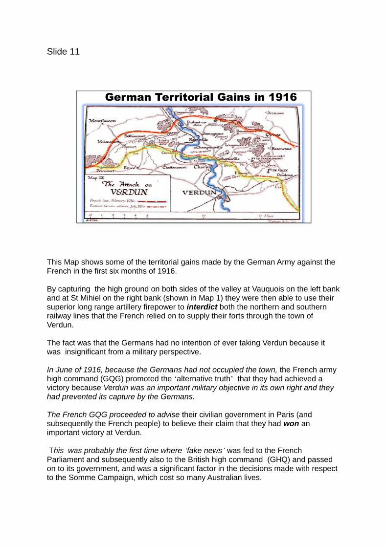
This Map shows some of the territorial gains made by the German Army against the French in the first six months of 1916. By capturing the high ground on both sides of the valley at Vauquois on the left bank and at St Mihiel on the right bank (shown in Map 1) they were then able to use their superior long range artillery firepower to interdict both the northern and southern railway lines that the French relied on to supply their forts through the town of Verdun. The fact was that the Germans had no intention of ever taking Verdun because it was insignificant from a military perspective. In June of 1916, because the Germans had not occupied the town, the French army high command (GQG) promoted the ‘alternative truth’ that they had achieved a victory because Verdun was an important military objective in its own right and they had prevented its capture by the Germans. The French GQG proceeded to advise their civilian government in Paris (and subsequently the French people) to believe their claim that they had won an important victory at Verdun. This was probably the first time where ‘fake news’ was fed to the French Parliament and subsequently also to the British high command (GHQ) and passed on to its government, and was a significant factor in the decisions made with respect to the Somme Campaign, which cost so many Australian lives.

Sadly the Verdun fallacy remains unquestioned by most Western military historians to this day! At the same time however the German army commander Eric von Falkenhayn recognised a more sophisticated fact that acknowledged Verdun’s political importance in the French national psyche at that time.
Slide 12
The Vauquis Butte
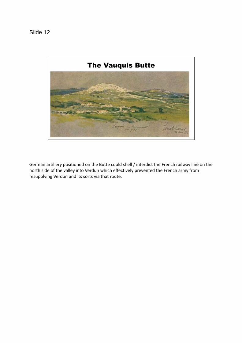
German artillery positioned on the Butte could shell / interdict the French railway line on the north side of the valley into Verdun which effectively prevented the French army from resupplying Verdun and its sorts via that route.

Slide 13
St Mihiel
Slide 14
St Mihiel
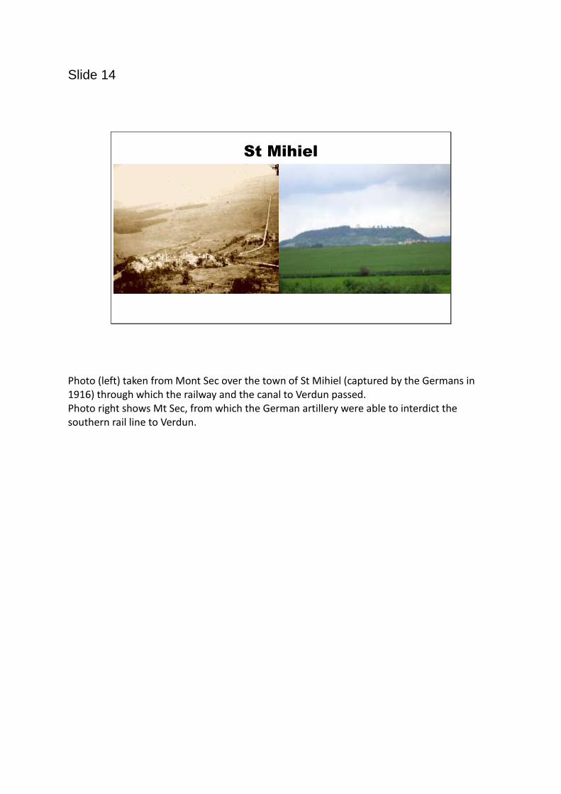
Photo (left) taken from Mont Sec over the town of St Mihiel (captured by the Germans in 1916) through which the railway and the canal to Verdun passed. Photo right shows Mt Sec, from which the German artillery were able to interdict the southern rail line to Verdun.
Slide 15
The Voie Sacree
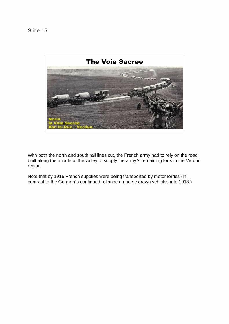
With both the north and south rail lines cut, the French army had to rely on the road built along the middle of the valley to supply the army’s remaining forts in the Verdun region. Note that by 1916 French supplies were being transported by motor lorries (in contrast to the German’s continued reliance on horse drawn vehicles into 1918.)
Slide 16
Revised German Infantry Tactics
1914 1916
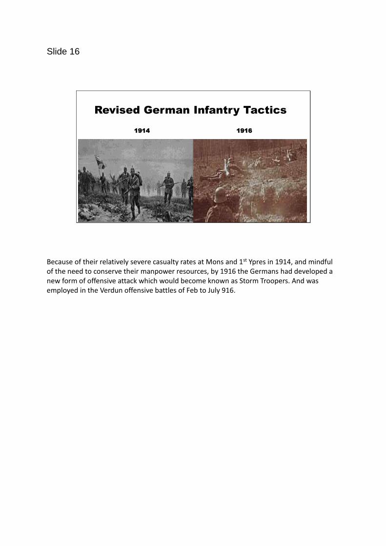
Because of their relatively severe casualty rates at Mons and 1st Ypres in 1914, and mindful of the need to conserve their manpower resources, by 1916 the Germans had developed a new form of offensive attack which would become known as Storm Troopers. And was employed in the Verdun offensive battles of Feb to July 916.
Slide 17
At Verdun the Germans employed new infantry offensive tactics – ‘Storm Troopers’
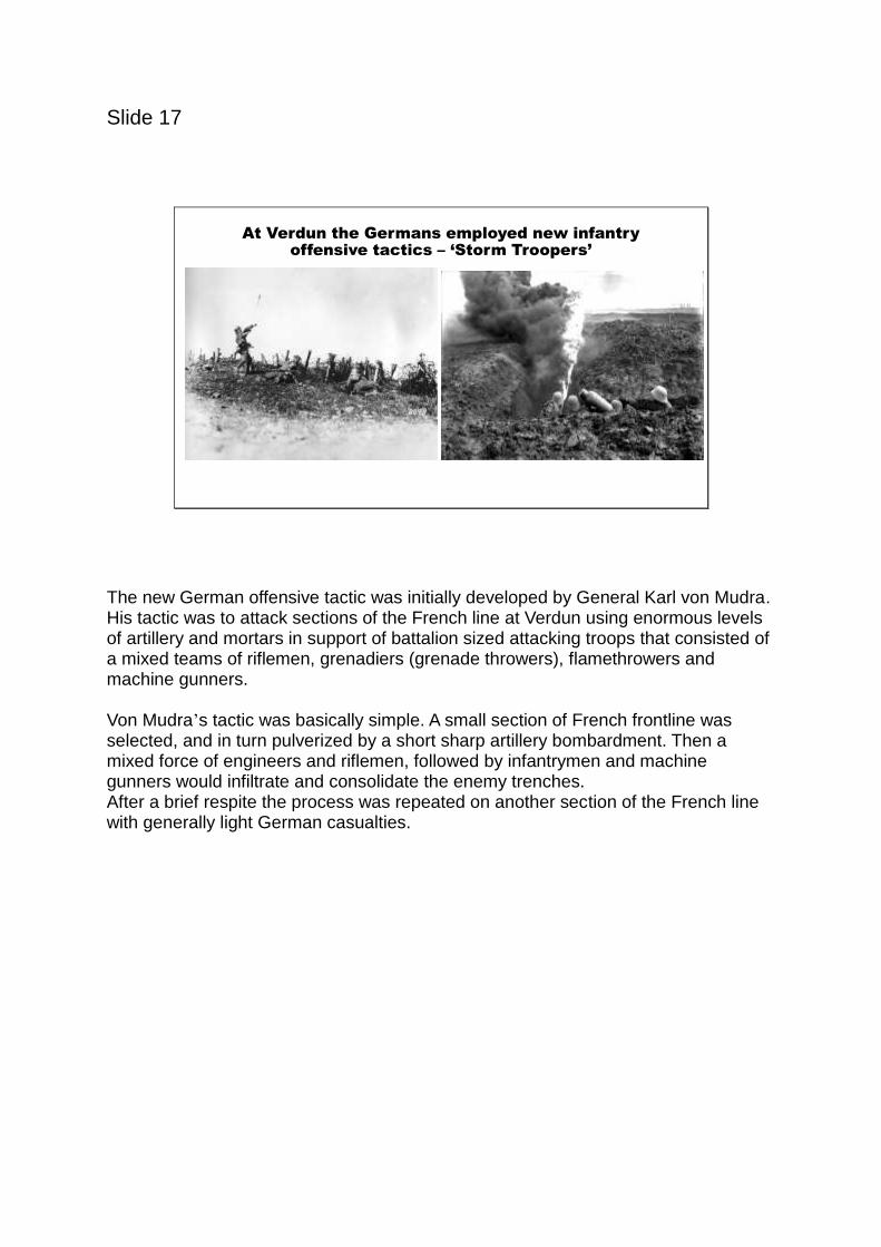
The new German offensive tactic was initially developed by General Karl von Mudra. His tactic was to attack sections of the French line at Verdun using enormous levels of artillery and mortars in support of battalion sized attacking troops that consisted of a mixed teams of riflemen, grenadiers (grenade throwers), flamethrowers and machine gunners.
Von Mudra’s tactic was basically simple. A small section of French frontline was selected, and in turn pulverized by a short sharp artillery bombardment. Then a mixed force of engineers and riflemen, followed by infantrymen and machine gunners would infiltrate and consolidate the enemy trenches.
After a brief respite the process was repeated on another section of the French line with generally light German casualties.
Slide 18
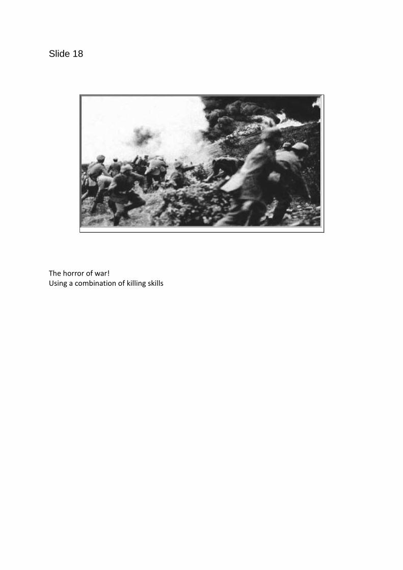
The horror of war! Using a combination of killing skills

Slide 19
Verdun 1916 - The Outcome
Despite his successes in capturing key strategic assets such as the Varquis and St Mihiel, and killing numerous Frenchmen, von Falkenhayn’s strategy to ‘bleed the French army white’ had failed, and in late 1916 he
was replaced by the dynamic duo of Hindenburg and Ludendorff.

Slide 20
French Casualties - 1916French Losses on
the
Western Front -1916
Deaths – 295,368
Wounded* –600,000
Ossuary of Douaumont Figures include Somme casualties
Slide 21
Youtube – BBC Documentary – The Battle of Verdun - 49 minutes 32 seconds