college of earth, ocean, and atmospheric sciences research...
TRANSCRIPT

College of Earth, Ocean, and Atmospheric Sciences
Research Highlights 2013–14

About the CollegeThe College of Earth, Ocean, and Atmospheric Sciences (CEOAS) is internationally recognized as a leader in the study of the Earth as an integrated system. It operates numerous state-of-the art laboratories and two oceanographic research vessels, the 177-foot ocean-going Oceanus and the Elakha, a 54-foot coastal research vessel. The College has an annual budget of more than $50 million, with much of the research support coming from the National Science Foundation, National Oceanic and Atmospheric Administration, National Aeronautics and Space Administration and other federal agencies.
CEOAS has over 100 faculty, 200 graduate students and 600 undergraduate students. Graduate programs include a Master’s degree in Marine Resource Management, and Master’s and Ph.D. degrees in Ocean, Earth and Atmospheric Sciences; Geology; and Geography. Undergraduate majors are Earth Sciences and Environmental Sciences.
ContactsCollege of Earth, Ocean, and Atmospheric SciencesOregon State University104 CEOAS Admin BuildingCorvallis, OR 97331-5503541-737-3504
ceoas.oregonstate.edu
Mark Abbott, Dean, 541-737-5195Jack Barth, Associate Dean for Research, 541-737-1607 Anita Grunder, Associate Dean for Academic Programs, 541-737-5189 Student Services, 541-737-1201Doug Brusa, Director of Development, 541-207-8686
Photo courtesy of Dudley Chelton, Distinguished Professor Emeritus, College of Earth, Ocean, and Atmospheric Sciences, Oregon State University
2 College of Earth, Ocean, and Atmospheric Sciences

Our roots go deep at the College of Earth, Ocean, and Atmospheric Sciences. Our century-long contribution to the geosciences is coupled with more than 50 years of premier research in ocean science. Together, our programs encompass the Earth as an integrated system — from atoms, to oceans, to the atmosphere.
Our faculty are tackling fundamental problems that advance our understanding of the world, such as the origins of the Earth’s magnetic field (page 5), the unforeseen consequences of deep-ocean exploitation (page 9), and the link between sea level rise and the Greenland ice sheet (page 12). The Ocean Observatories Initiative has made headway in deploying coastal infrastructure components that will give us unprecedented data for improved detection and forecasting of environmental changes to the ocean and seafloor (page 7). The Regional Class Research Vessel project recently completed key milestones in the design phase that will help create the next generation of ships for coastal science (page 4). Meanwhile, we welcome new faculty whose expertise in GIS, natural hazards, ocean physics, and more will complement existing programs and help build new research fronts (page 19).
You can read more about our faculty leaders and their important work in these pages, or by visiting our website.
Mark Abbott, Dean
http://www.ceoas.oregonstate.edu 3

Regional Class Research Vessel project meets key milestonesIn 2013, the National Science Foundation (NSF) selected Oregon State University to lead the design refresh and construction of as many as three new coastal research vessels to address critical issues related to climate change, ocean circulation, natural hazards, human health and marine ecosystems. With the completion of two important milestones in the design refresh phase, the effort to rejuvenate the U.S. research fleet is one step closer to reality.
“We’ve made it through the conceptual design review (CDR) and preliminary design review (PDR), both key milestones along the way to update the design of the vessel,” said Demian Bailey, the university’s former marine superintendent and research vessel project manager.
Approval of the PDR will set the design baseline of the research vessels. “The point of PDR was to create a comprehensive, bottom-up scope, cost and schedule for the project, including what the technical design is going to look like,” he said.
Bailey and his team, including Clare Reimers, the project scientist and principal investigator, anticipate NSF approving the PDR package and then reporting its recommendation to the National Science Board in November.
“We’re on time and under budget. NSF seems pleased with our performance so far,” he said, adding that they are making strides toward receiving funding as part of NSF’s Major Research Equipment and Facilities Construction.
With funding in place, he expects a shipyard to be determined at the end of 2016 and vessel construction to begin in 2017. The vessels will feature advanced sensors and sampling systems, and through telepresence capabilities and satellite communications, will bring science at sea to classrooms, the public and researchers ashore.
Bailey attributes the project’s success so far to a competent team of scientists and technicians.
“We have a lot of passion and dedication from the team. The ocean-going science community is counting on us to get it right and on time,” he said.
Mark Abbott, dean of the College of Earth, Ocean, and Atmospheric Sciences at Oregon State University, said the vessels are a critical part of the ocean sciences research portfolio. “Even with the proliferation of new platforms to study the ocean such as cabled observatories and underwater robots, ships continue to play a critical role in observing and understanding the ocean as well as in testing new technologies,” he said. “The next generation of research vessels will continue this tradition by providing state-of the-art platforms for scientists and students to explore and understand our ocean planet.”
4 College of Earth, Ocean, and Atmospheric Sciences

N
S N
S
N
S
Liquid Mantle
Liquid Core
Solid Mantle
Solid Mantle Enriched in Fe
Solid Core
N
S Source Region for Magnetic Field
Hadean-Archean
Proterozoic Moderna b c
Solid Earth
Magma ocean could have given early Earth magnetic field The Earth’s early magnetic field was previously thought to have originated within Earth’s liquid metal core, as it does today. But a new study suggests that the ancient magnetic field may actually have originated from a giant magma ocean deep inside the mantle. The rotation and convection of the electrically conducting fluid was potentially strong enough to cause a “dynamo effect,” which continually re-generates a magnetic field.
The study comes on the heels of recent estimates from mineral physics experiments indicating that heat flowing out of the core needs to be nearly three times greater to create enough convection to generate a dynamo. In other words, the core alone could not sustain the massive heat flow for the entire 3.5-billion-year history of Earth’s magnetic field.
Ellen Svadlenak
Trace Metal Zoning
University Honors College student Ellen Svadlenak is working with Professor John Dilles to analyze trace metal zoning in Colombian emeralds and their host rocks, in an attempt to understand how those trace metal concentrations evolved during emerald growth. Her work is part of the Research Experience for Undergraduates, and she was recently honored with an Excellence in Earth Science award.
Eric Kirby
GSA Fellow
Kirby has been named as a Geological Society of America (GSA) 2014 Fellow. Kirby’s research blends the fields of tectonics and geomorphology, and his research into fault system evolution has taken him from California to Tibet to Japan.
Lead author Leah Ziegler, a research associate at the College of Earth, Ocean, and Atmospheric Sciences, was inspired to find an alternative theory when she read about how interactions between Jupiter’s magnetic field and a magma ocean within its moon, Io, may be the origins of Io’s very weak magnetic field. She and co-author Dave Stegman, a geophysicist at the University of California, San Diego, modeled a range of possible electrical conductivities. They found that a long-lived magma ocean could be a primary dynamo source on Earth.
If the model is correct, it could have sweeping implications for life on Earth. It could mean the Earth possessed a magnetic field early in its existence, shielding the scorching sun and making way for life.
“It’s really a difficult puzzle right now, explaining how the magnetic field on Earth has lasted so long,” Ziegler said. “Research in this area will be a key to understanding how Earth went from being one big rock to being the planet we know it as today.”
Illustration of three phases of geodynamo generation: (a) Earliest Earth until circa 2.5 Ga, a basal magma ocean in the mantle hosts a thin-shell dynamo. (b) Second stage, characterized by an almost fully solidified mantle. Greater heat flux out of core allows for thermal convection to drive dynamo in fluid core. (c) As core cools, solid inner core initiates and grows. Geodynamo powered by thermal and compositional convection enhanced by core solidification, leading to stronger average field strength.
http://www.ceoas.oregonstate.edu 5

Ocean/Air Fluxes, Flows
Physics of ocean undertowOver the last 40 years, scientists have developed sophisticated models to understand the physics of ocean undertow, yet such models require a super computer to run them quickly. A new study co-authored by Tuba Ozkan-Haller, a professor of coastal engineering at Oregon State University, may change that. Using linear wave theory, she and her colleague Greg Guannel of the Natural Capital Project used idealized forms to simplify the process, thereby providing a more easily deployed solution to predict how undertows interact with shorelines and cause erosion. In turn, land-use managers and engineers can better prepare for erosion and create more sustainable beaches.
Several other simplified models have been developed in the past, but each came to a different solution. Ozkan-Haller and Guannel created a more consistent way to describe the force of undertows, the strongest of which is the force exerted by water moving from the top of the wave to the bottom. With a streamlined approach, future research will be able to focus on improving the predictive power of the model rather than debating the methodology.
Observing air-sea interaction physics to understand the Madden-Julian Oscillation Researchers at the College of Earth, Ocean, and Atmospheric Sciences have been trying to improve our ability to forecast a phenomenon known as the Madden-Julian Oscillation (MJO), an eastward-moving pulse of heavy rainfall and strong winds that travels around the equator and has broad impacts on climate and weather. While statistical indices of the MJO from past records show that it has a cycle of about 30-60 days, predicting when it will start remains a challenge for forecasters.
An observational study in the Indian Ocean, the region where the MJO starts and grows to its full strength, hopes to answer some outstanding questions about its genesis. A new paper by CEOAS professors Jim Moum, Simon de Szoeke, and co-authors presents new in-situ observations and describes the interactions between the ocean and atmosphere. Improved forecasting will help scientists anticipate events under the influence of the MJO, from seasonal rain forecasts in the tropics, to El Niño, to tropical cyclones.
“We don’t know the physical laws, or the reason an MJO happens. If we knew that, we could make a deterministic model,” de Szoeke said.
De Szoeke is particularly interested in the relationship between evaporation and rainfall in the MJO. “Evaporation is important, because that’s how the ocean loses most of its heat. But evaporation alone is not closing the moisture budget and explaining the rainfall in the MJO.”
The question remains, then, if evaporation does not account for all of the MJO’s rainfall, what else might be contributing? “We know moisture converges on a large scale over the warmest sea surface temperature in the Indian and Pacific Oceans, and on a small scale into the rain storms found in the MJO. We don’t know if the ocean is important for the MJO. That’s a fascinating basic question,” de Szoeke said. He has a few nascent theories that he will be exploring in future research, but determining such air-sea interactions and their effect on the MJO has both basic and broad implications.
“The more we learn about it, the less we understand about it,” de Szoeke said. “At the same time, seasonal forecasting is really important for people trying to grow things and anticipate when the rains will come.”
James N. Moum
American Meteorological Society
James Moum received the 2014 Henry Stommel Research Award and was named as a 2014 Fellow for the American Meteorological Society. Moum, an expert in small-scale ocean mixing, works with the Ocean Mixing Group at Oregon State University.
6 College of Earth, Ocean, and Atmospheric Sciences

The Ocean Observatories Initiative (OOI) team has deployed key pieces of the coastal OOI infrastructure along both east and west coasts. These include the second phase deployment of the Pioneer Array off the coast of New England and the initial deployment for the Endurance Array in the Northeast Pacific.
The Endurance Array will include a network of fixed and mobile assets to observe cross-shelf and along-shelf variability in the coastal upwelling region of the Oregon and Washington coasts, and provide synoptic, multi-scale observations of the eastern boundary current regime.
The Endurance Array cruise, April 17-21, was conducted on the Research Vessel Oceanus, departing and returning from Newport, Ore. The cruise accomplished six main objectives: deployment of the Oregon Inshore Surface Mooring, Washington Offshore Wire-Following Profiler Mooring, Oregon Inshore Coastal Surface-Piercing Profiler Mooring, Washington Inshore Communications Mooring, three Teledyne-Webb Slocum robotic gliders and pre- and post- deployment CTD casts with water sampling at each of the mooring sites. All four moorings and three gliders were successfully deployed, carrying a total of 48 oceanographic instruments that are currently sending data back to shore.
The Coastal Global Component of the OOI is led by scientists from the Woods Hole Oceanographic Institution, Oregon State University and Scripps Institution of Oceanography. Info: oceanobservatories.org
Oregon State University marine technician Dave O’Gorman and OOI Endurance Array technician Chris Holm prepare to deploy a Teledyne-Webb Slocum glider (an autonomous underwater robot) off of the back deck of the R/V Oceanus, while Oregon State faculty research assistant Tully Rohrer documents the operation. (Photo credit: Mike Vardaro, Oregon State University)
Ocean Observatories Initiative deploys coastal infrastructure components
http://www.ceoas.oregonstate.edu 7

Coastal and Near-Shore Oceanography
Coastal survey: Oregon beaches see more short-term erosionA new assessment of shoreline change along the Pacific Northwest coast from the late 1800s to present found that while the majority of beaches are stable or slightly accreting (adding sand), many Oregon beaches have experienced an increase in erosion hazards in recent decades.
The assessment is part of a series led by the U.S. Geological Survey to study shoreline change in the nation’s coastal regions to more comprehensively monitor coastal erosion and land loss.
Peter Ruggiero, an Oregon State University coastal hazards specialist and lead author on the report, said the findings provide baseline data to analyze future impacts of climate change, sea level rise and storms on the Northwest’s shorelines, he added.
“In a general sense, Oregon has faced much more erosion in the short term than has southwest Washington,” Ruggiero said. The Tillamook County area of Oregon is identified as one of the worst areas for erosion. The risk of land loss is significant from higher waves and rising sea levels, Ruggiero noted.
He has been working with Tillamook County leaders and the Neskowin Coastal Hazards Committee on a response plan to erosion and climate change impacts. He and his colleagues are working to create new models predicting local impacts of sea level rise, and also incorporating socio-economic variables such as cost of adaptation.
Nearly 20 feet of sea cliff at Gleneden Beach, Ore., eroded away in one November weekend in 2006, and came close to undercutting several homes. Scientists now believe rising wave heights and coastal embayments may increase the risk of erosion. (Photo credit: Tony/Stein/Oregon State Parks)
April Abbott
Rare Earth Elements
April Abbott is a Ph.D. student in Ocean Ecology and Biogeochemistry studying the rare earth elements and neodymium isotopes in sedimentary pore waters with Brian Haley and James McManus. While at Oregon State, she has received the Teaching Assistant Excellence award and the CEOAS Student Research Fellowship.
8 College of Earth, Ocean, and Atmospheric Sciences

The world’s oceans are vast and deep, yet rapidly advancing technology and the quest for extracting resources from previously unreachable depths is beginning to put the deep seas on the cusp of peril, an international team of scientists warned.
“The deep sea is the largest habitat on Earth, it is incredibly important to humans and it is facing a variety of stressors from increased human exploitation to impacts from climate change,” said Andrew Thurber, an Oregon State University marine scientist.
The deep sea is important to many critical processes that affect the Earth’s climate, including acting as a “sink” for greenhouse gases – helping offset the growing amounts of carbon dioxide emitted into the atmosphere. It also regenerates nutrients through upwelling that fuel the marine food web in productive coastal systems such as the Pacific Northwest of the United States, Chile and others.
Increasingly, fishing and mining industries are going deeper and deeper into the oceans to extract natural resources. There are additional threats to these unique habitats, including ocean acidification, warming temperatures and possible changes to ocean circulation through climate change.
“One concern is that many of these areas are in international waters and outside of any national jurisdiction,” noted Thurber. “Yet the impacts are global, so we need a global effort to begin protecting and managing these key, albeit vast, habitats.”
A new OSU study looks at how exploiting the ocean’s vast resources have put it in peril.
Gary Egbert
AGU Fellow
Gary Egbert has been named a 2014 Fellow of the American Geophysical Union for his diverse work in ocean tides and electromagnetic imaging of the solid Earth. In one pioneering study, he and his colleagues used satellite altimetry data to show that ocean tides lose significant energy over rough topography in the open ocean.
Scientists caution against exploitation of deep ocean
http://www.ceoas.oregonstate.edu 9
Elemental Cycles and Food Webs
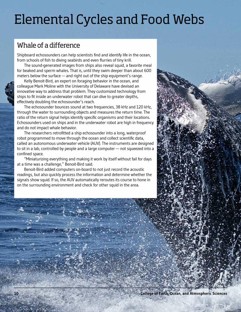
Whale of a differenceShipboard echosounders can help scientists find and identify life in the ocean, from schools of fish to diving seabirds and even flurries of tiny krill.
The sound-generated images from ships also reveal squid, a favorite meal for beaked and sperm whales. That is, until they swim deeper than about 600 meters below the surface — and right out of the ship equipment’s range.
Kelly Benoit-Bird, an expert on foraging behavior in the ocean, and colleague Mark Moline with the University of Delaware have devised an innovative way to address that problem. They customized technology from ships to fit inside an underwater robot that can dive to greater depths, effectively doubling the echosounder’s reach.
The echosounder bounces sound at two frequencies, 38 kHz and 120 kHz, through the water to surrounding objects and measures the return time. The ratio of the return signal helps identify specific organisms and their locations. Echosounders used on ships and in the underwater robot are high in frequency and do not impact whale behavior.
The researchers retrofitted a ship echosounder into a long, waterproof robot programmed to move through the ocean and collect scientific data, called an autonomous underwater vehicle (AUV). The instruments are designed to sit in a lab, controlled by people and a large computer — not squeezed into a confined space.
“Miniaturizing everything and making it work by itself without fail for days at a time was a challenge,” Benoit-Bird said.
Benoit-Bird added computers on-board to not just record the acoustic readings, but also quickly process the information and determine whether the signals show squid. If so, the AUV automatically reroutes its course to hone in on the surrounding environment and check for other squid in the area.
10 College of Earth, Ocean, and Atmospheric Sciences

Carbon cycling, ocean acidification and observational technology developmentThe ocean carbon cycle is at the heart of ocean CO2 uptake, hypoxia and ocean acidification — and OSU-CEOAS scientists, including Burke Hales, are at the forefront of this research. While there are long-term trends in the open ocean of increased acidification and loss of oxygen, the dynamic nature of the carbon cycle in coastal and estuarine systems results in natural variability that can both intensify and mitigate these long-term trends. The key to comprehending these interactions is understanding carbon-system dynamics, and adequately observing variation in the waters of the land-ocean margin.
Research at Oregon State University has shown that the leading impact of ocean acidification on marine ecosystems is a CO2-driven decrease in stability of calcium carbonate minerals, which many organisms depend on for survival. With colleague George Waldbusser, Hales traced the impacts on commercially important clams, mussels and oysters to the increased energy demands of shell formation during early larval life stages, rather than to the co-varying change in ocean pH. Current decreases in shell stability reflect present-day oceans CO2 levels, and will become acute decades before other physiological factors respond to pH. In collaboration with colleagues at NOAA-PMEL, his study on pteropods, a type of small shelled zooplankton that is a critical early food source for juvenile salmon, showed that areas where the water column was predominantly less favorable for shell formation led to increasingly deformed and damaged shell structures.
In another study of carbon cycle dynamics within a large estuary on the Atlantic coast, Hales and colleagues from UNC and Texas A&M showed that these systems are small, steady, long-term sinks for CO2. However, this feature is dramatically reversed by intermittent large storms. A unique set of observations immediately prior to and after the passage of Hurricane Irene showed that the Neuse River-Pamlico Sound system returned as much CO2 to the atmosphere in only a few days associated with the storm as it had consumed over the preceding several years, constituting a source as large as the entire North Atlantic sink during that interval.
All of this work has been critically dependent on novel technological approaches to observation and experimental manipulation of the carbonate system. Hales has developed analytical instrumentation that can provide real-time measurement of properties of the carbonate system that were not previously detectable, with state-of-the-art accuracy and precision, superior instrument response time and dynamic range coverage — all at a fraction of the cost of status quo instrumentation. These instruments have been built and delivered to field stations and aquaculture facilities from San Diego to Alaska on the West Coast, with systems in development for deployment in Mexico, New Zealand, Australia and Chile.
David Cade
Acoustic Scattering
During his master’s work, David Cade developed a method to mathematically define scattering layers and used that tool to examine relationships between the environment and ecologically important features in the Gulf of California. He is currently a Ph.D. student at Stanford University. There, he is interested in studying predator-prey dynamics and ecosystem-level ecology using both passive acoustic monitoring and active acoustic survey techniques.
http://www.ceoas.oregonstate.edu 11

Climate Change
Understanding abrupt climate change A study by researchers at Oregon State University probed the geologic past to understand mechanisms of abrupt climate change. The study pinpoints the emergence of synchronized climate variability in the North Pacific Ocean and the North Atlantic Ocean a few hundred years before the rapid warming that took place at the end of the last ice age about 15,000 years ago.
Summer Praetorius, a doctoral student in marine geology and Alan Mix, a professor of ocean ecology and biochemistry, suggest that the combined warming of the two oceans may have provided the tipping point for abrupt warming and rapid melting of the northern ice sheets.
This new discovery by OSU researchers resulted from an exhaustive 10-year examination of marine sediment cores recovered off southeast Alaska where geologic records of climate change provide an unusually detailed history of changing temperatures on a scale of decades to centuries over many thousands of years.
“Synchronization of two major ocean systems can amplify the transport of heat toward the polar regions and cause larger fluctuations in northern hemisphere climate,” said Praetorius. “This is consistent with theoretical predictions of what happens when Earth’s climate reaches a tipping point.”
“That doesn’t necessarily mean that the same thing will happen in the future,” she pointed out, “but we cannot rule out that possibility.”
Study links Greenland ice sheet collapse, sea level rise 400,000 years agoA new study suggests that a warming period more than 400,000 years ago pushed the Greenland ice sheet past its stability threshold, resulting in a nearly complete deglaciation of southern Greenland and raising global sea levels some 4-6 meters.
Co-authored by Associate Professor Anders Carlson, the study is one of the first to target how the vast Greenland ice sheet responded to warmer temperatures during that period, which were caused by changes in the Earth’s orbit around the sun.
“The climate 400,000 years ago was not that much different than what we see today, or at least what is predicted for the end of the century,” said Carlson. “The forcing was different, but what is important is that the region crossed the threshold allowing the southern portion of the ice sheet to all but disappear.
“This may give us a better sense of what may happen in the future as temperatures continue rising,” Carlson added.
A research team hiking to sample the Greenland ice-sheet margin in south Greenland. (photo by Kelsey Winsor)
12 College of Earth, Ocean, and Atmospheric Sciences

The Northwest is facing increased risks from the decline of forest health, earlier snowmelt leading to low summer stream flows, and an array of issues facing the coastal region, according to a new climate assessment report.
Written by a team of scientists coordinated by the Oregon Climate Change Research Institute (OCCRI) at Oregon State University, the report is the first regional climate assessment released since 1999.
OSU’s Philip Mote, director of the institute and one of three editors of the 270-page report (as well as the 1999 report), said the document incorporates a lot of new science as well as some additional dimensions – including the impact of climate change on human health and tribal issues. A summary of the report is available online at: http://occri.net/reports
The report outlines how these three issues are affected by climate change.
“Studies are showing that snowmelt is occurring earlier and earlier and that is leading to a decline in stream flows in summer,” Mote said. “Northwest forests are facing a huge increase in wildfires, disease and other disturbances that are both direct and indirect results of climate change. And coastal issues are mounting and varied, from sea level rise and inundation, to ocean acidification. Increased wave heights in recent decades also threaten coastal dwellings, roads and other infrastructure.”
The report was funded by the National Oceanic and Atmospheric Administration, through the Oregon Legislature’s support of the Oregon Climate Change Research Institute at OSU, and by in-kind contributions from the authors’ institutions.
Collier Glacier in the Oregon Cascade Range once filled this valley - note marks on North Sister, at left, from its maximum size more than 100 years ago. It’s now shrunk to less than half of its previous mass. (Photo courtesy of Oregon State University)
Ed Brook
AGU Fellow
Ed Brook has been named a 2014 Fellow of the American Geophysical Union (AGU) for his research in Earth’s ancient climates using ice cores, specializing in the history of greenhouse gases. His studies have helped explain the processes that led to large-scale or rapid climate shifts throughout Earth’s history.
Wildfires, snowmelt, coastal issues top Northwest risks
http://www.ceoas.oregonstate.edu 13

Natural Hazards
Scientists calculate friction of Japan’s 9.0 earthquake in 2011An international team of scientists that installed a borehole temperature observatory following the 2011 Tohoku-Oki earthquake in Japan has been able to measure the “frictional heat” generated during the rupture of the fault – an amount the researchers say was smaller than expected, which means the fault is more slippery than previously thought.
It is the first time scientists have been able to use precise temperature measurements to calculate the friction dynamics of fault slip.
“This gives us some unprecedented insights into how earthquakes actually work,” said Robert Harris, a geophysicist at Oregon State University and co-author of the study. “No one really knows how much frictional resistance there is to slip and for the first time, this gives us some idea.”
The study was funded by the Japan Agency for Marine-Earth Science and Technology, the Integrated Ocean Drilling Program, the National Science Foundation, and the Gordon and Betty Moore Foundation.
Volcanoes can go quickly from dormant to activeA new study suggests that the magma sitting 4-5 kilometers beneath the surface of Oregon’s Mount Hood has been stored in near-solid conditions for thousands of years, but that the time it takes to liquefy and potentially erupt is surprisingly short — perhaps as little as a couple of months.
The key, scientists say, is to elevate the temperature of the rock to more than 750 degrees Celsius, which can happen when hot magma from deep within the Earth’s crust rises to the surface. It is the mixing of the two types of magma that triggered Mount Hood’s last two eruptions – about 220 and 1,500 years ago, said Adam Kent, an Oregon State University geologist and co-author of the study.
Tyler Schlieder
Continental Volcanism
Tyler Schlieder recently graduated after working with Robert Duncan to study the timing and composition of continental volcanism in western Saudi Arabia. A former member of the National Society of Collegiate Scholars and three-time winner of the CEOAS award for excellence in geology, Schleider is now studying igneous petrology and geochemistry as a graduate student at Northern Arizona University.
OSU geologist Adam Kent uses a laser ablation machine to measure chemical compositions in volcanic rock. (photo by Jeff Basinger)
The collaborative study between Oregon State and the University of California, Davis is important because little was known about the physical conditions of magma storage and what it takes to mobilize the magma. The researchers hope to apply these techniques to other, larger volcanoes to see if they can determine their potential for shifting from cold storage to potential eruption, a development that might bring scientists a step closer to forecasting volcanic activity.
14 College of Earth, Ocean, and Atmospheric Sciences

Geographic Information Science
Tyler Susa
Sediment Transport
Tyler Susa recently graduated with a Bachelor of Science in Earth Science. As an undergraduate, he received the Richard W. Chambers undergraduate research scholarship for his work in sediment transport, and was a member of the Coastal Imaging Lab, where he studied coastal hazards, nearshore processes and the application of coastal science in addressing societal needs. Susa is now training to become a nuclear submarine officer.
Measuring nearshore depths from a distance Estimating the depths and shapes of underwater terrain — known as bathymetry — is one of the more challenging problems in nearshore dynamics. Conditions are always hostile and change rapidly, necessitating frequent surveys. Typical approaches such as GPS surveying are time-intensive, expensive and logistically
complicated. While LIDAR has become a popular tool for airborne sensing, it is expensive and only works in clear waters such as the tropics where the bottom is visible.
A recent study authored by Rob Holman, oceanography professor at Oregon State University, describes a new algorithm based on data from inexpensive digital video cameras that allows accurate estimation of ocean depth using only measurements of surface wave speeds. The finding brings researchers closer to understanding and predicting critical nearshore variability, including erosion and the health of our ocean coasts.
“This allows us to see how the beach is changing, and we can do it with cameras and automated processing,” Holman said. “People have been wanting this since WWII.”
Researchers called the algorithm cBathy due to the primary role of wave celerity, or the speed of wave propagation, in estimating bathymetry. Holman and his team tested the algorithm over two years at Duck, N.C., and Agate Beach, Ore. — two very different environments. In both instances, performance was excellent, although somewhat degraded during storm conditions. Overall, the algorithm provides a much-needed tool for quantitative nearshore monitoring and prediction.
Holman’s study follows his decades-long operation of the Argus system, a global network of fully digital video technology that provides low-cost, continuous video-based measurements of coastal change at many sites around the world. “This program has changed the way nearshore sciences is thought about and carried out. And the addition of cBathy is a real game-changer,” he said.
A novel spatial tool for forest managersAnticipating climate change impacts in forest ecosystems has often relied on complex model simulations that are difficult to interpret for the user. Small budgets, lack of available time and lack of GIS expertise may also constrain the ability of forest managers to evaluate multiple management scenarios.
Helen Jenny, an assistant professor (senior research) in Geographic Information Science, has proposed a more accessible spatial tool that uses a novel visualization method called four-dimensional (4-D) statistical surfaces. Her method combines motion and 3-D statistical surfaces to improve visual awareness and location of change in complex time series. Specifically, it visualizes attribute values as surfaces, which are interpolated and animated over time; the interactive attribute surfaces are combined with color-coding and contour lines to support absolute and relative height judgment as well as faster perception and better location of change. As a result, forest managers can better understand forest succession, climate change effects, seed dispersal, disturbances, and other management challenges.
http://www.ceoas.oregonstate.edu 15

Water Resources
Dams provide resilience to Columbia from climate change impactsDams have been vilified for detrimental effects to water quality and fish passage, but a new study suggests that these structures provide “ecological and engineering resilience” to climate change in the Columbia River basin.
The study, which was published in the Canadian journal Atmosphere-Ocean, looked at the effects of climate warming on stream flow in the headwaters and downstream reaches of seven sub-basins of the Columbia River from 1950 to 2010. The researchers found that the peak of the annual snowmelt runoff has shifted to a few days earlier, but the downstream impacts were negligible because reservoir management counteracts these effects.
The net effect of reservoir management is to reduce amplitude of water flow variance by containing water upstream during peak flows for flood control, or augmenting low flows in late summer. While authorized primarily for flood control, reservoir management also considers water release strategies for fish migration, hydropower, ship navigation and recreation.
“The dams are doing what they are supposed to do, which is to use engineering – and management – to buffer us from climate variability and climate warming,” said Julia Jones, an Oregon State University hydrologist and co-author on the study.
Charred forests and snowmeltAnne Nolin and her Ph.D. student Kelly Gleason have presented new evidence showing that particles and burned woody debris from charred forests increase snowmelt.
The expert in snow hydrology found that while snow accumulation was greater in burned forests, snowpack disappeared earlier and faster compared with unburned forests. Shed from the burned forest canopy, large amounts of charred debris accumulate on the snowpack surface, darkening the snow and reducing the amount of sunlight that is reflected back to space (called the “albedo effect”). When combined with increased sunlight transmitted through the burned forest canopy, the darker snowpack absorbs the solar energy, effectively speeding up the rate of snowmelt.
The study follows Nolin’s extensive research showing that temperature-sensitive Pacific Northwest snowpacks are at risk to global warming. It also underscores the complex feedback loops between climate change, fires and snow accumulation. As climate change pushes temperatures higher and with continued fire suppression, wildfire frequency, size, intensity and duration will increase. Continued large high-severity forest fires will then reduce the albedo effect and change the amount and timing of snowmelt runoff.
“In a warming world where we have declining snowpacks and moisture-stressed forests, we can expect more wildfires and even greater impacts on snowpacks and forest ecosystems,” Nolin said.
Roy Haggerty
GSA Fellow
Haggerty has been named as a Geological Society of America (GSA) 2014 Fellow for his internationally recognized research in the physics of water-ecosystem interactions, specifically in advancing our knowledge of mass transport in, and exchanges between, ground- and surface-water.
A new Oregon State University study in the high Cascades documents how charred wood, bark and debris darkens the snow, lowers the reflectivity, and increases solar radiation, leading to more rapid snowmelt (photo courtesy of Kelly Gleason, OSU).
16 College of Earth, Ocean, and Atmospheric Sciences

Undergraduate The College is committed to delivering outstanding undergraduate education that prepares tomorrow’s science professionals. Bachelor’s of Science degree programs in Earth Sciences and in Environmental Sciences provide the foundation for diverse careers that apply environmental science, geography, geology and earth system science in consulting, management, education, planning, and research.
The majors provide a broad foundation in basic sciences, and specialization through options. All students complete practical, experiential learning through a combination of field courses, internships and research experience. The College also serves thousands of undergraduates through minors and general interest courses.
Earth SciencesThe Earth Sciences Bachelor’s degree has options in Geography, Geology, and Ocean Science. A Climate Science option is under development.
The Geography option is designed for students interested in the interaction of society with natural processes and resources. A particular strength lies in the application of spatial techniques, such as GIS and remote sensing.
The Geology option is designed for students with interest in understanding earth processes, from deep causes of earthquakes and volcanoes to surface processes and climate change. This option emphasizes field experience.
The Ocean Science option is intended for students who are interested in the marine environment, from coastal mangroves in the tropics to the ice-covered Arctic Ocean, and how it interacts with and influences planet Earth. This option emphasizes a field experiences, including ship time on a research vessel.
Environmental SciencesThe Bachelor’s degree in Environmental Sciences encompasses the most diverse range of science options. It is designed for students who have a broad range of interests in the natural environment and the interaction of humans with the environment. The options allow exploration of environmental science policy, as well as environmental aspects of a wide range of sciences including biology, zoology, ecology, and earth, ocean and atmospheric sciences. Students sample courses in diverse colleges and departments, and may earn their degree on campus or through our Ecampus program. All majors engage in an internship or field experience.
Academic Programs
Graduate DegreesThe College prepares students to seek out new ideas and innovative approaches to the complex issues of planetary-scale science. With its focus on innovation and exploration, the College builds upon a strong tradition of analytical and computational technology, allowing students to create and integrate new observing systems and numerical models, pursue real-time and mobile applications, collaborate locally and globally, and build new approaches to research, teaching, and publishing. It has over 100 faculty and 200 graduate students.
GeographyGeography is the study of human use and interaction with the Earth and the identification of spatial and temporal variation in natural and human processes. The program has an applied orientation with three areas of excellence: 1) geospatial technologies and analysis; 2) water, climate, and society; and 3) resources, planning and hazards.
GeologyGeology is an integrative field, drawing on mathematics, chemistry, physics and biology to understand the interactions of the lithosphere with the biosphere, atmosphere and hydrosphere. Students pursue research ranging from study of the earth’s interior workings to paleoclimate, natural hazards, tectonics and Earth resources.
Ocean, Earth, and Atmospheric SciencesOceanography, the application of the sciences to the study of the oceans, is an interdisciplinary environmental science concerned with all processes: biological, chemical, geological, and physical, as well as the interactions within the ocean. Areas include atmospheric sciences, biological oceanography, chemical oceanography, geological oceanography, geophysics, and physical oceanography.
Marine Resource Management Marine Resource Management (MRM) is a science-based, interdisciplinary master’s program that combines the study of biological and physical science of the marine environment with the study of the social, economic, legal, educational and political processes that govern human uses of marine and coastal resources. Graduates from the program are trained to bridge the gap between science and policy.
CertificatesAn undergraduate certificate in Geographic Information Science is also available. The College offers Professional certificates at the graduate level for Geographic Information Science and Water Conflict Management and Transformation.
http://www.ceoas.oregonstate.edu 17
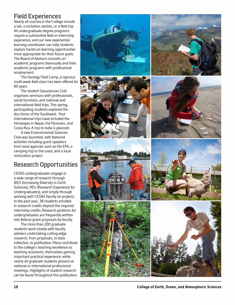
Field ExperiencesNearly all courses in the College include a lab, a recitation section, or a field trip. All undergraduate degree programs require a substantive field or internship experience, and our new experiential learning coordinator can help students explore hands-on learning opportunities most appropriate for their future goals. The Board of Advisors consults on academic programs biannually and links academic programs with professional employment.
The Geology Field Camp, a rigorous multi-week field class has been offered for 80 years.
The student Geosciences Club organizes seminars with professionals, social functions, and national and international field trips. This spring, participating students explored the dry climes of the Southwest. Past international trips have included the Himalayas in Nepal, the Pyrenees, and Costa Rica. A trip to India is planned.
A new Environmental Sciences Club was launched, with featured activities including guest speakers from local agencies such as the EPA, a camping trip to the coast, and a local restoration project.
Research OpportunitiesCEOAS undergraduates engage in a wide range of research through IDES (Increasing Diversity in Earth Sciences), REU (Research Experience for Undergraduates), and simply through working with CEOAS faculty on projects. In the past year, 38 students enrolled in research credits beyond the required internship credits. Research positions for undergraduates are frequently written into federal grant proposals by faculty.
The more than 200 graduate students work closely with faculty advisers undertaking cutting-edge research, from proposals, to data collection, to publication. Many contribute to the college’s teaching excellence as teaching assistants, themselves gaining important practical experience, while nearly all graduate students present at national or international professional meetings. Highlights of student research can be found throughout this publication.
18 College of Earth, Ocean, and Atmospheric Sciences

New FacultyPatrick Corcoran, associate professor, is a hazards outreach specialist with Extension Sea Grant. With a focus on tsunami preparedness, coastal storms and shoreline change, his goal is to improve natural hazard resiliency among coastal communities.
Robert K. Cowen is the director of the Hatfield Marine Science Center in Newport. Cowen’s studies encompass coastal fish ecology, fishery oceanography, plankton imaging systems, larval transport and connectivity of marine organism populations. He earned his Ph.D. from Scripps Institution of Oceanography.
Helen Jenny joins Oregon State as an assistant professor (senior research) in GIScience. Her research aims to better understand, visualize and distribute geospatial datasets by combining methods from cartography, GIS and computer graphics. Jenny earned her Ph.D. from the Institute of Cartography and Geoinformation in Switzerland.
Anna Kelbert is a new assistant professor (senior research) in geology and geophysics, with research interests spanning magnetotellurics, global electromagnetics, inverse problems and cyberinfrastructure. She earned her Ph.D. in geophysics from Cardiff University, UK.
Robert Kennedy, an assistant professor in geosciences, focuses on novel conceptual and analytical approaches to directly observe landscape change processes using satellite-based imagery. He comes from Boston University and earned his Ph.D. in 2004 from Oregon State University.
Mitch Lyle joins the college as a professor (senior research) in geology and geophysics. His research interests include Cenozoic paleoceanography, the North American water cycle and Pleistocene dynamics of the California Current System. He earned his Ph.D. in oceanography from Oregon State.
David Noone joins Oregon State as an associate professor in physics of oceans and atmospheres. Making use of information from water isotopes and other trace gases, he seeks to expose the interplay between components of the climate system and water. Noone earned his Ph.D. from the University of Melbourne in 2001.
Larry O’Neill, an assistant professor in physics of oceans and atmospheres, studies air-sea interactions, satellite meteorology and oceanography, atmospheric boundary layer and ocean mixed layer dynamics. He earned his Ph.D. in oceanography from Oregon State in 2007.
Alyssa Shiel joins Oregon State as an assistant professor in geology and geophysics. Her research seeks to identify the source and fate of metals in the environment, improve our understanding of natural metal cycling and to evaluate the impact of anthropogenic activities on natural systems. She earned her Ph.D. in 2010 from the University of British Columbia.
Andrew Thurber is a recent assistant professor (senior research) in ocean ecology and biogeochemistry. Through a variety of isotopic and molecular analyses, he identifies and quantifies trophic linkages between metazoans and bacteria and archaea in soft sediment systems. He earned his Ph.D. from Scripps Institution of Oceanography.
Nick Tufillaro, an associate professor (senior research) in ocean ecology and biogeochemistry, specializes in ocean and fresh water remote sensing, dynamical analysis of physical and biogeochemical ocean processes, and the design of optic and electronic instrumentation for environmental monitoring. He received his Ph.D. in physics from Bryn Mawr College and pursued postdoctoral studies at the Woods Hole Oceanographic Institution.
http://www.ceoas.oregonstate.edu 19

College of Earth, Ocean, and Atmospheric SciencesOregon State University
104 CEOAS Admin BuildingCorvallis, OR 97331-5503
541-737-3504ceoas.oregonstate.edu