digitalglobe created the smartest,digitalglobe created the smartest, ... -more potential for...
TRANSCRIPT
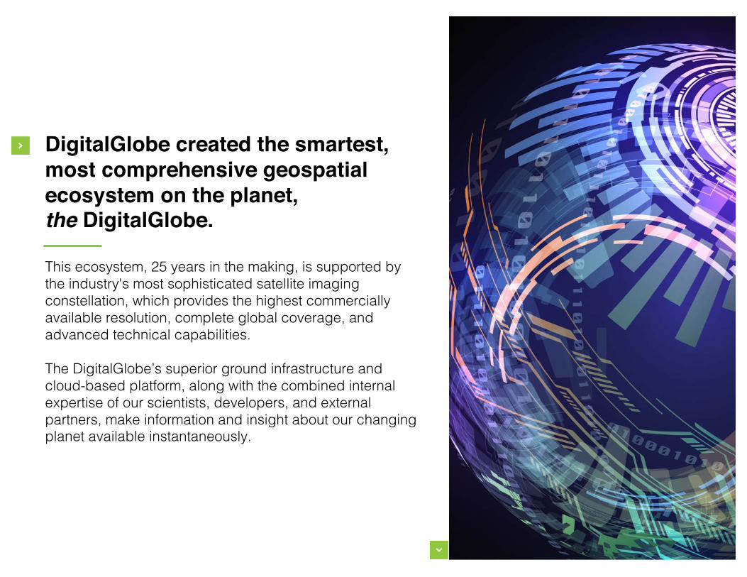
DigitalGlobe created the smartest,most comprehensive geospatialecosystem on the planet,the DigitalGlobe.
This ecosystem, 25 years in the making, is supported by the industry's most sophisticated satellite imaging constellation, which provides the highest commercially available resolution, complete global coverage, and advanced technical capabilities.
The DigitalGlobe’s superior ground infrastructure and cloud-based platform, along with the combined internal expertise of our scientists, developers, and external partners, make information and insight about our changing planet available instantaneously.
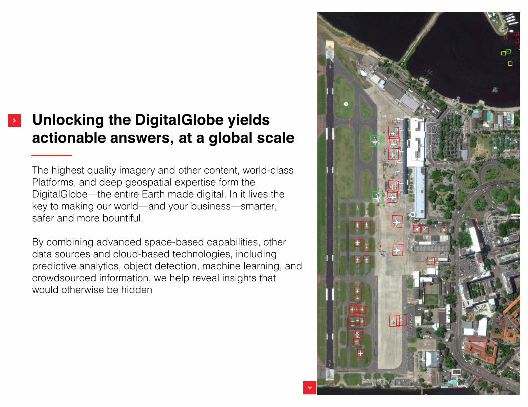
Unlocking the DigitalGlobe yieldsactionable answers, at a global scale
The highest quality imagery and other content, world-class Platforms, and deep geospatial expertise form the DigitalGlobe—the entire Earth made digital. In it lives the key to making our world—and your business—smarter, safer and more bountiful.
By combining advanced space-based capabilities, other data sources and cloud-based technologies, including predictive analytics, object detection, machine learning, and crowdsourced information, we help reveal insights that would otherwise be hidden
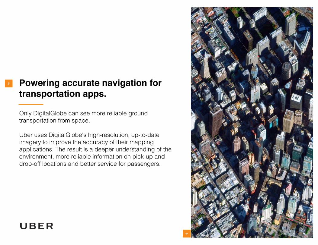
Powering accurate navigation fortransportation apps.
Only DigitalGlobe can see more reliable ground transportation from space.
Uber uses DigitalGlobe's high-resolution, up-to-date imagery to improve the accuracy of their mapping applications. The result is a deeper understanding of the environment, more reliable information on pick-up and drop-off locations and better service for passengers.

Calculating population density toexpand internet reach.
Only DigitalGlobe can see enhanced global connectivity from space.
We are using advanced algorithms and geospatial expertise to create images that Facebook uses to precisely map populations. These answers fuel infrastructure development and economic growth by expanding internet access in remote regions.
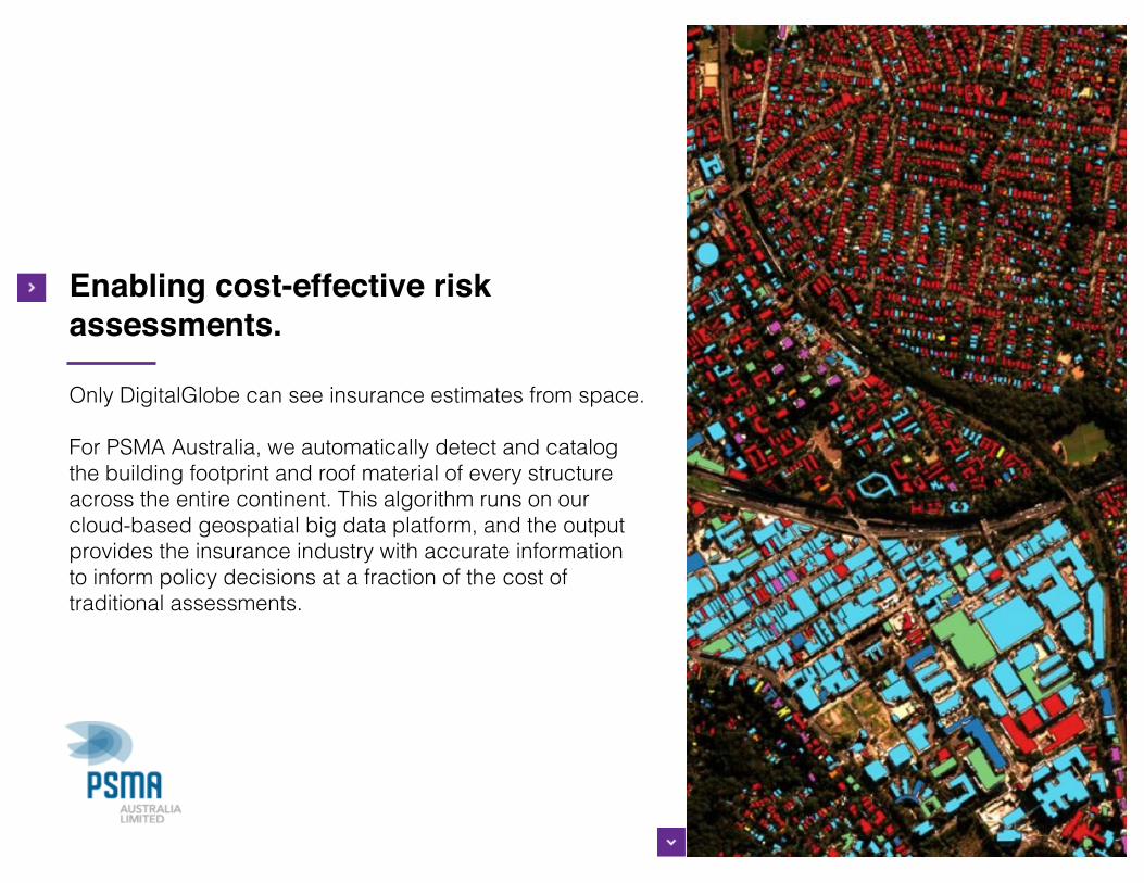
Enabling cost-effective riskassessments.
Only DigitalGlobe can see insurance estimates from space.
For PSMA Australia, we automatically detect and catalog the building footprint and roof material of every structure across the entire continent. This algorithm runs on our cloud-based geospatial big data platform, and the output provides the insurance industry with accurate information to inform policy decisions at a fraction of the cost of traditional assessments.
Seeabetterworld.
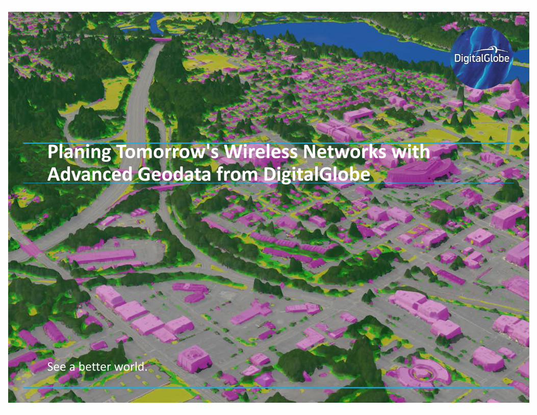
Planing Tomorrow'sWirelessNetworkswithAdvancedGeodata fromDigitalGlobe
DigitalGlobeProprietaryandBusinessConfidential
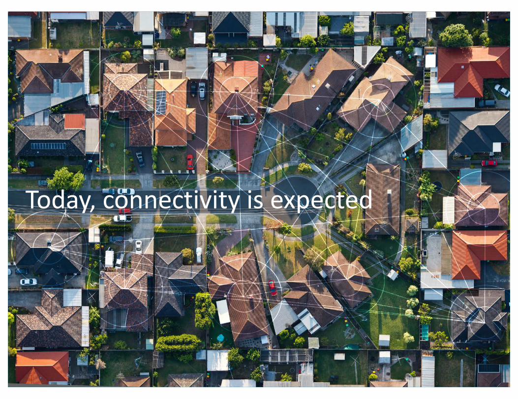
Today,connectivityisexpected
DigitalGlobeProprietaryandBusinessConfidential5/22/17Toupdatethefooterwiththepresentationtitle,findHeader&FooterintheInserttabandApplytoAll9
DigitalGlobeProprietaryandBusinessConfidential
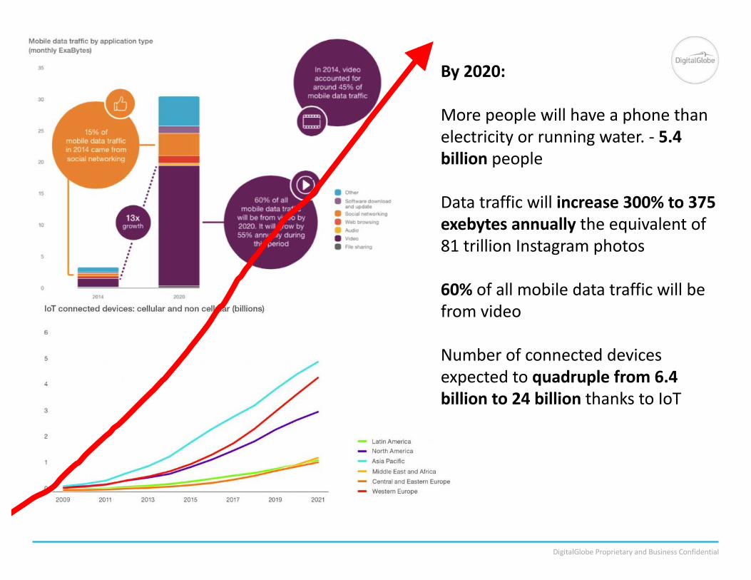
By2020:
Morepeoplewillhaveaphonethanelectricityorrunningwater.- 5.4billionpeople
Datatrafficwillincrease300%to375exebytes annuallytheequivalentof81trillionInstagramphotos
60% ofallmobiledatatrafficwillbefromvideo
Numberofconnecteddevicesexpectedtoquadruplefrom6.4billionto24billionthankstoIoT
DigitalGlobeProprietaryandBusinessConfidential
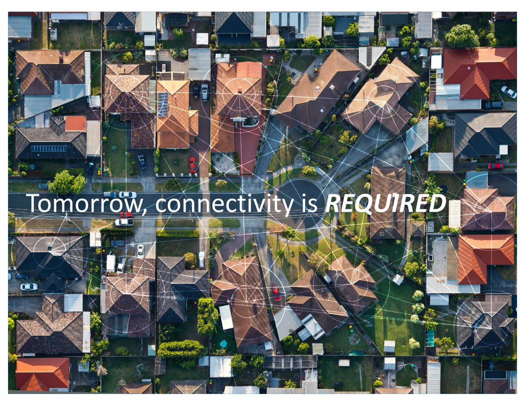
Tomorrow,connectivityisREQUIRED
DigitalGlobeProprietaryandBusinessConfidential
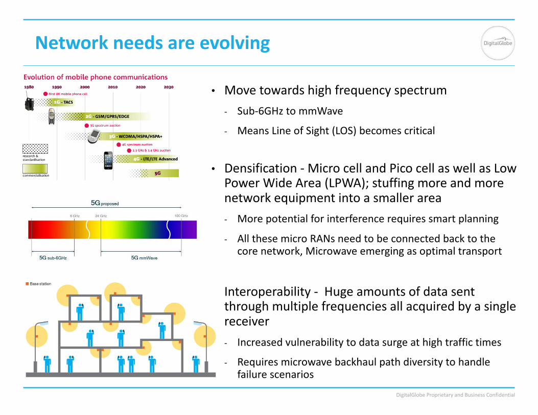
Networkneedsareevolving
• Movetowardshighfrequencyspectrum- Sub-6GHztommWave
- MeansLineofSight(LOS)becomescritical
• Densification- MicrocellandPicocellaswellasLowPowerWideArea(LPWA);stuffingmoreandmorenetworkequipmentintoasmallerarea- Morepotentialforinterferencerequiressmartplanning
- AllthesemicroRANsneedtobeconnectedbacktothecorenetwork,Microwaveemergingasoptimaltransport
• Interoperability- Hugeamountsofdatasentthroughmultiplefrequenciesallacquiredbyasinglereceiver- Increasedvulnerabilitytodatasurgeathightraffictimes
- Requiresmicrowavebackhaulpathdiversitytohandlefailurescenarios
DigitalGlobeProprietaryandBusinessConfidential
DigitalGlobeProprietaryandBusinessConfidential

DigitalGlobeProprietaryandBusinessConfidential
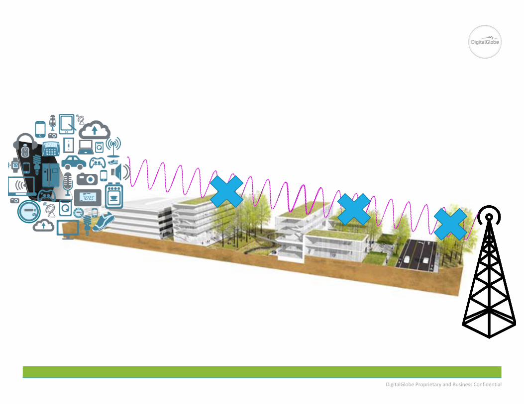
TraditionalAreaforAdvancedNetworks
15
DigitalGlobeProprietaryandBusinessConfidential
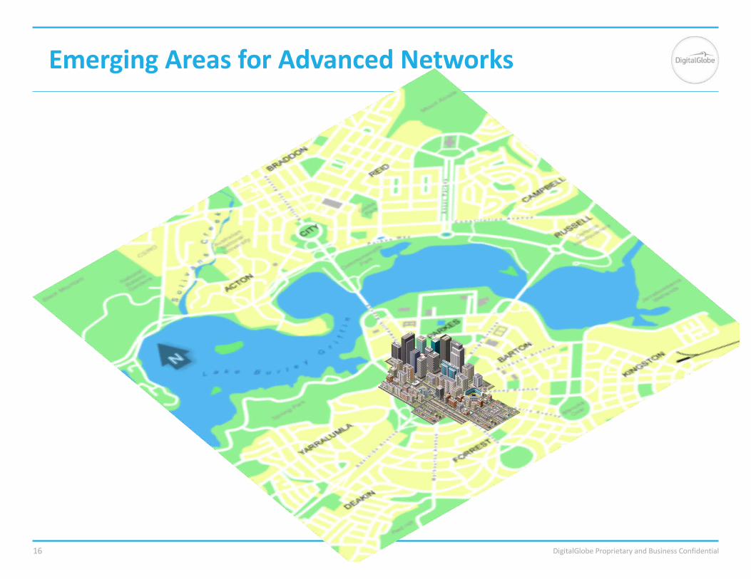
EmergingAreasforAdvancedNetworks
16
DigitalGlobeProprietaryandBusinessConfidential
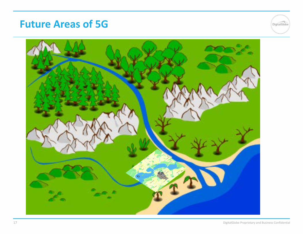
FutureAreasof5G
17
DigitalGlobeProprietaryandBusinessConfidential5/22/17Toupdatethefooterwiththepresentationtitle,findHeader&FooterintheInserttabandApplytoAll18
DigitalGlobeProprietaryandBusinessConfidential
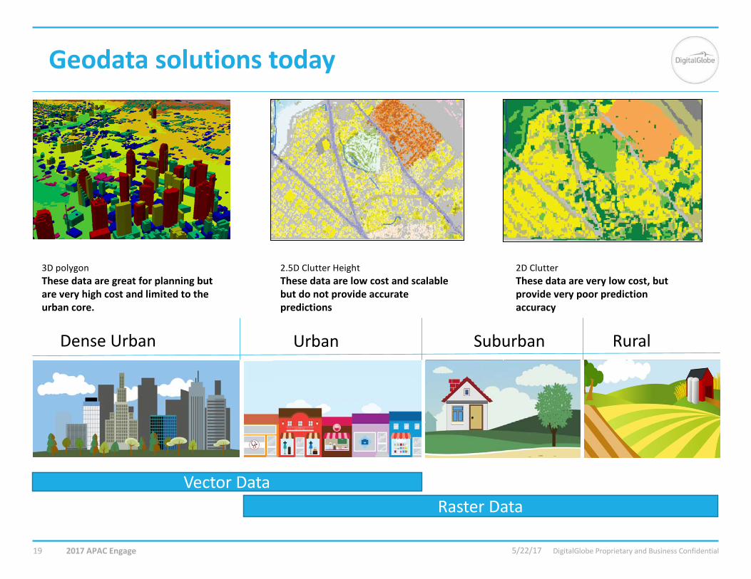
Geodatasolutionstoday
2017APACEngage
3DpolygonThesedataaregreatforplanningbutareveryhighcostandlimitedtotheurbancore.
2.5DClutterHeightThesedataarelowcostandscalablebutdonotprovideaccuratepredictions
2DClutterThesedataareverylowcost,butprovideverypoorpredictionaccuracy
DenseUrban Urban Suburban Rural
VectorDataRasterData
5/22/1719

DigitalGlobeProprietaryandBusinessConfidential
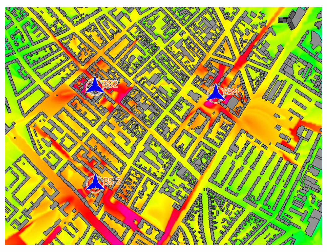
ClutterheightdatausedRFmodelinginSuburbanareas
1Mile
Olympia,WAVricon clutterheightdatanowavailableforallregionsatafractionofthecostoftraditional3D
DigitalGlobeProprietaryandBusinessConfidential
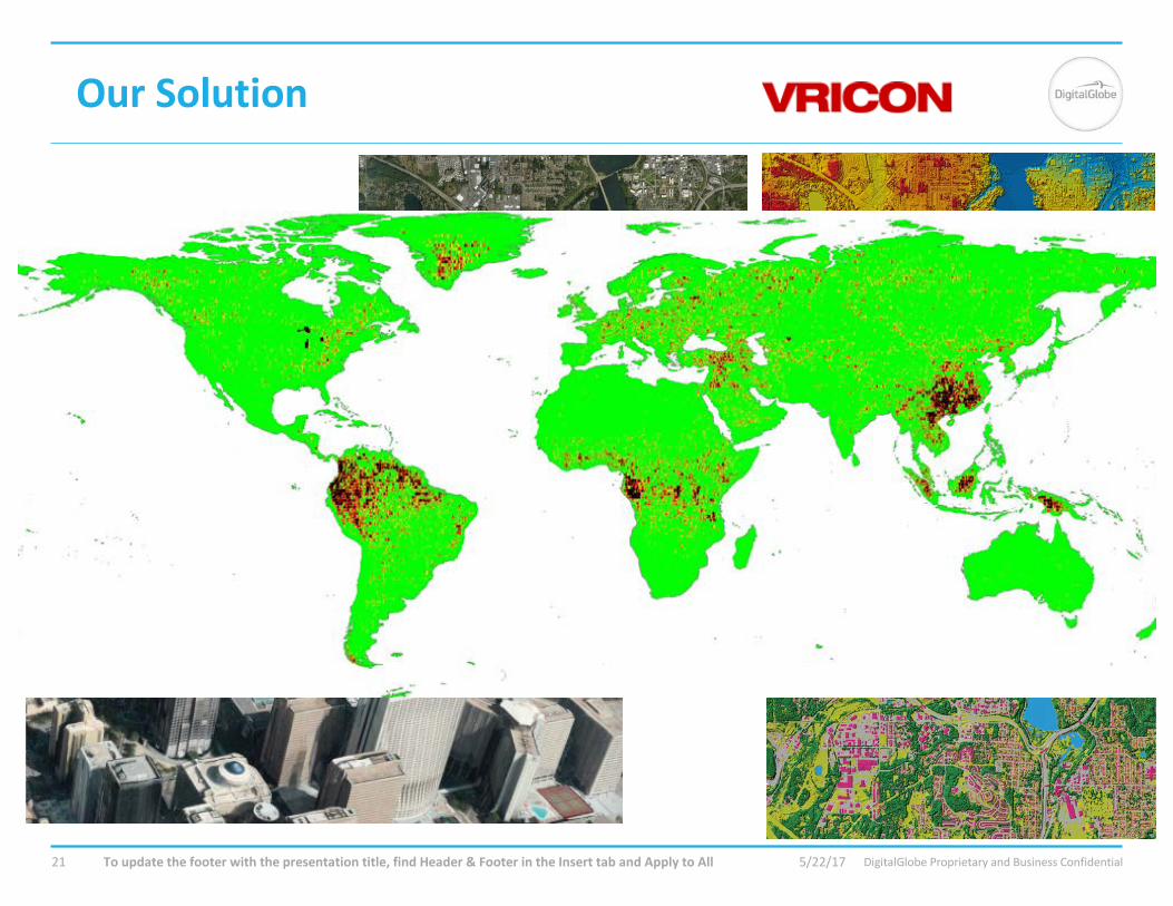
OurSolution
5/22/17Toupdatethefooterwiththepresentationtitle,findHeader&FooterintheInserttabandApplytoAll21
DigitalGlobeProprietaryandBusinessConfidential
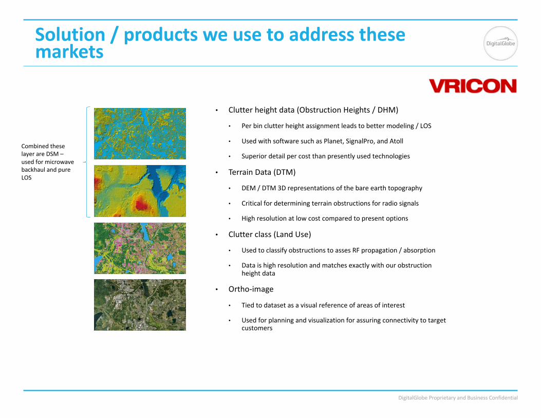
Solution/productsweusetoaddressthesemarkets
• Clutterheightdata(ObstructionHeights/DHM)
• Perbinclutterheightassignmentleadstobettermodeling/LOS
• UsedwithsoftwaresuchasPlanet,SignalPro,andAtoll
• Superiordetailpercostthanpresentlyusedtechnologies
• TerrainData(DTM)
• DEM/DTM3Drepresentationsofthebareearthtopography
• Criticalfordeterminingterrainobstructionsforradiosignals
• Highresolutionatlowcostcomparedtopresentoptions
• Clutterclass(LandUse)
• UsedtoclassifyobstructionstoassesRFpropagation/absorption
• Dataishighresolutionandmatchesexactlywithourobstructionheightdata
• Ortho-image
• Tiedtodatasetasavisualreferenceofareasofinterest
• Usedforplanningandvisualizationforassuringconnectivitytotargetcustomers
CombinedtheselayerareDSM–usedformicrowavebackhaulandpureLOS
DigitalGlobeProprietaryandBusinessConfidential
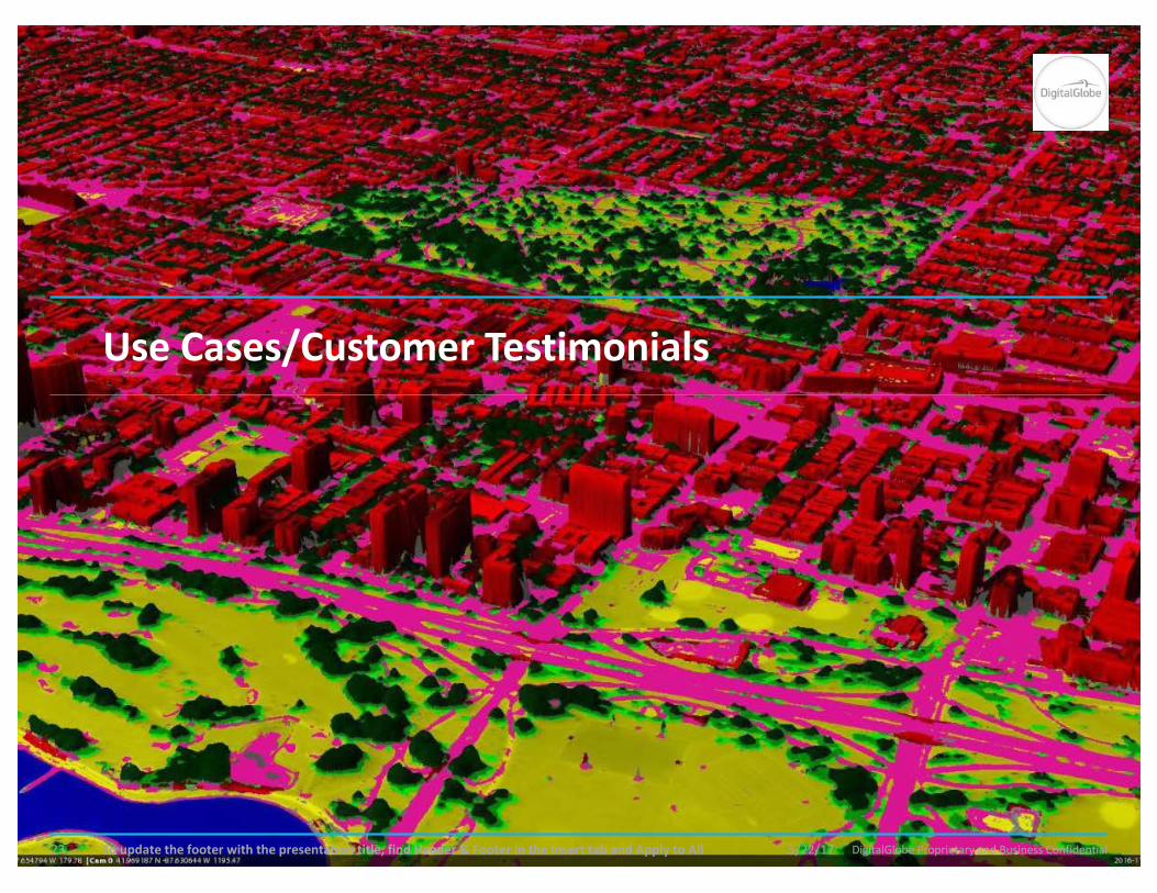
UseCases/CustomerTestimonials
5/22/17Toupdatethefooterwiththepresentationtitle,findHeader&FooterintheInserttabandApplytoAll23
DigitalGlobeProprietaryandBusinessConfidential
FindingSolutionsforMicrowaveBackhaulPlanners
Problem:lowaccuracyobstructionheightGeodata iscreatingahighfailurerateofplannedmicrowavelinks.§ Currentremedy:
§ Numerousfieldvisits&re-visits
§ Re-planningofmicrowavelinks
§ Longerthanrequiredplanning&developmentschedules
• Vricon elevationdataavailablethroughDigitalGlobecould:§ Reducemicrowaveplanningschedule
§ Reducefieldvisits/truckrolls/costs
§ Enableaquickertimetomarket
§ Enableearlierrealestateplanningandprocurement,withknownalternatives

DigitalGlobeProprietaryandBusinessConfidential
FujitsuUseCase– RealisticMWpathprofiles
5/22/17Toupdatethefooterwiththepresentationtitle,findHeader&FooterintheInserttabandApplytoAll25
“Thankstothishigh-qualityclutterheightdata,wehaveseena98%decreaseinfalsepositives.”
—WadeMcKinMicrowaveSolutionsArchitectV,Fujitsu

DigitalGlobeProprietaryandBusinessConfidential
FixedWirelessBroadbandUseCase
ProblemOverview
• WirelessInternetServiceProviderdeliversservicesinRFspectrumbetween2.5and5.8GHzusingrelativelylowpowertransmitterswithhighgainantennas
• Technologyrangesfrompurelineofsight(5GHz)tonearlineofsight(2.5GHz)
• Advertisingtounqualifiedlocationsiswastefulandinefficient
• Installationfailuresduetolineofsightobstructionsrepresent~30%ofinstallationattempts
• CurrenttoolsarelimitedintheirabilitytopredictLOSduetopoorqualitypubliclyavailableterrain-onlymodels
5/22/17Toupdatethefooterwiththepresentationtitle,findHeader&FooterintheInserttabandApplytoAll26
DigitalGlobeProprietaryandBusinessConfidential
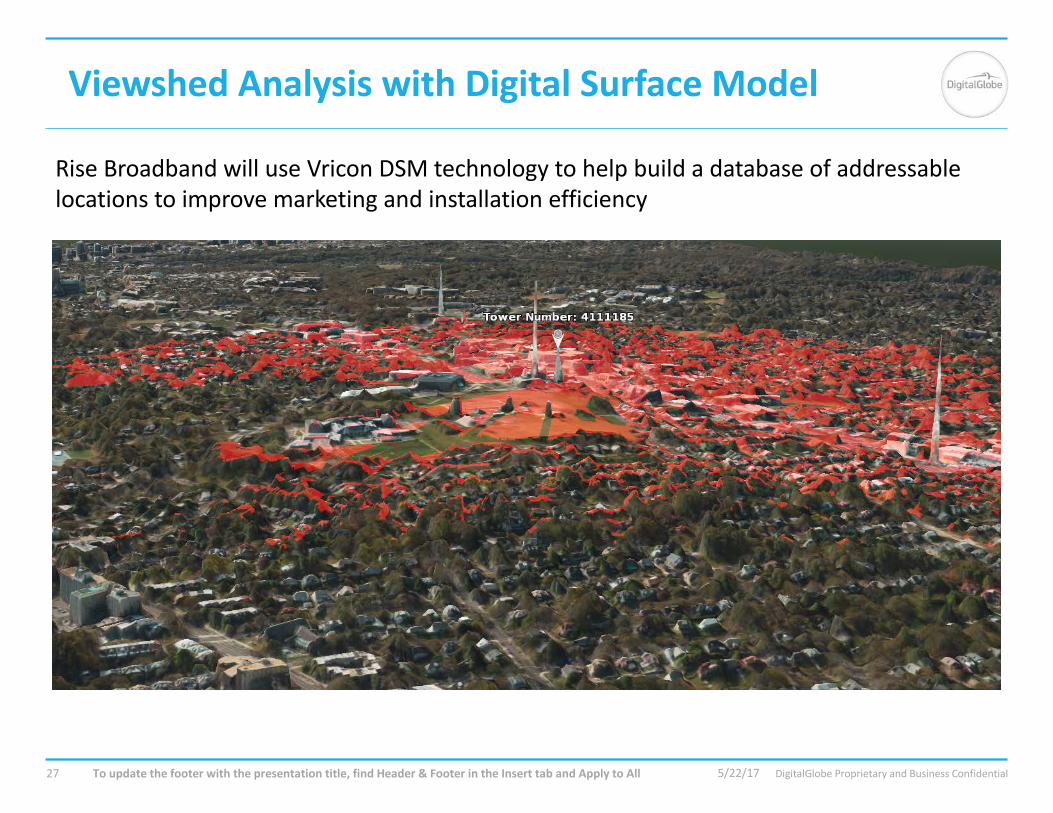
Viewshed AnalysiswithDigitalSurfaceModel
5/22/17Toupdatethefooterwiththepresentationtitle,findHeader&FooterintheInserttabandApplytoAll27
RiseBroadbandwilluseVricon DSMtechnologytohelpbuildadatabaseofaddressablelocationstoimprovemarketingandinstallationefficiency
DigitalGlobeProprietaryandBusinessConfidential
UseCase– Viewshed/LineofSight
5/22/17Toupdatethefooterwiththepresentationtitle,findHeader&FooterintheInserttabandApplytoAll28
“Ourcustomerserviceteamwillusethetoolsbuiltaroundthehigh-resolutionDSMtoverifyourabilitytoconnectthecustomertoanaccesspointonanearbytower,eliminatingalargeamountoffailedinstallationtruckrolls.Bybeingoneofthefirstfixedwirelessinternetserviceproviderstoembracehigh-resolutionsurfaceelevationdata,wewillrealizesignificantsavingswecanthenapplytootherpartsofourbusiness.”
—DamonEstepSeniorVicePresidentofTechnology,RiseBroadbandMay15,2017
DigitalGlobeProprietaryandBusinessConfidential
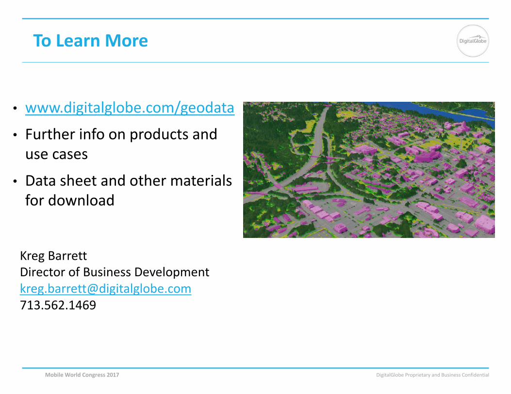
ToLearnMore
MobileWorldCongress2017
• www.digitalglobe.com/geodata
• Furtherinfoonproductsandusecases
• Datasheetandothermaterialsfordownload
KregBarrettDirectorofBusinessDevelopmentkreg.barrett@digitalglobe.com713.562.1469
DigitalGlobeProprietaryandBusinessConfidentialMobileWorldCongress2017
www.digitalglobe.com/geodata