forest emission at l-band: modeling, applications and the
TRANSCRIPT

Forest emission at L-band: Modeling, applications and the
experience of SMOS
P. Ferrazzoli, C. Vittucci, L. Guerriero,
University of Rome Tor Vergata
Y. Kerr, P. Richaume
CESBIO, Toulouse

Summary
Forest modeling at L band: motivations, selected approach,
comparisons with experimental data.
Application to spaceborne signatures: simplified input data set,
calibration of a first order RT model, main outcomes, critical
issues.
The experience of SMOS: current 2-parameter retrieval
algorithm, results obtained by a 3-parameter algorithm,
currently retrieved vegetation optical depth (VOD) and soil
moisture (SM) over forests.
Possible active/passive instruments synergy.
Suggestions for future work and experiments.

Modeling: motivations
Science;
Need to create a synthetic data base of forest emission data at
L band, since few measurements were available;
Need to get an insight into complex forest issues: multiple
scattering, different roles of forest components (trunks,
branches, leaves, litter) for a given biomass.

Modeling: selected approach
The model developed at Tor Vergata University adopted the
discrete approach, mostly used for radar studies, in the
passive version.
Considers the geometry of different forest components, and
multiple scattering.

Basic aspects
(Ferrazzoli and Guerriero 1996)
• Is based on radiative transfer theory;
• Adopts a discrete approach to represent forest
elements;
• Combines contributions of forest elements by a
matrix algorithm which includes multiple
scattering;
• Combines vegetation scattering with reflection
and scattering from the soil;
• Computes the emissivity of the whole canopy,
soil and single components.
Crown (branches and leaves)
Trunks
Soil
Includes the litter as a dielectric layer, with reflections at upper and lower
interfaces (Della Vecchia et al., 2007)
Modeling: selected approach

Modeling: Litter characterization (1)Litter is described as a continuous layer made by a mixture of air
and dielectric material.
Empirical formulas relate:
•Litter biomass to LAI (through litter-fall estimates by Cannell, 1982)
•Litter thickness to biomass (Putuhena et al. 1996)
•Litter moisture to soil moisture (Bray experiment)
Permittivity of dielectric material is computed by means of vegetation
permittivity routine
Permittivity of litter mixture is computed by “refractive” mixture formula (Ulaby et
al. 1986)
Soil
Litter

Modeling: Litter characterization (2)
Steps
•Computation of reflectivity for soil+litter layer composite, using a coherent
multiple reflection model (Ulaby et al. 1982), as a function of layer
thickness
•Smoothing, to account for spatial inhomogeneities in the horizontal plane
•Computation of the permittivity of an equivalent uniform half-space with
flat interface
•Introduction of roughness
•Computation of bistatic scattering coefficient (by IEM)
•Combination with standing vegetation contributions

Required Inputs:
Soil moisture
Soil roughness
Litter coverage
Tree density (ha^-1)
Distribution of dimensions for trunks, branches, leaves
Distribution of orientations for trunks, branches, leaves
Permittivity of trunks, branches, leaves
Available by:
Direct measurements (in case of campaigns)
Allometric equations
Literature data
Modeling: Required input data

Previous comparisons with experimental data
The model was tested vs. ground-based and airborne
measurements collected over various forests
• Les Landes (France), Pine (Della Vecchia, P. Ferrazzoli, J.-P. Wigneron,
J. Grant, IEEE GRS Letters, 2007)
• Tuscany (Italy), Broadleaf (A. Della Vecchia, P. Ferrazzoli, L. Guerriero,
R. Rahmoune, S. Paloscia, S. Pettinato, E. Santi, IEEE TGRS, 2010)
• Finland, mixed (R.Rahmoune, A.Della Vecchia, P.Ferrazzoli,
L.Guerriero, F.Martin-Porqueras, Proc. IGARSS 2009)
• Australia, Eucalyptus (R. Rahmoune, P. Ferrazzoli, J. P. Walker, J. P.
Grant, Proc. MICRORAD 2010)
Application to spaceborne signatures
Spaceborne missions are finalized to retrieve physical parameters, particularly soil moisture at L band.
Retrieval algorithms are based on forward models and retrieval techniques
1st order Radiative Transfer (RT) model is used for soil covered by vegetation
There is need to relate RT parameters to variables available at large scale.
We selected Leaf Area Index (LAI).

Generation of the input data set
LAI from available data bases (e.g. ECOCLIMAP)
Empirical relationships between LAI and Leaf dry
biomass (Bartelink, 1997).
Typical values of vegetation moisture and permittivity
(from active remote sensing literature)
Distributions of dbh (diameter at breast height)
Single tree allometric equations for different forest
kinds (Jenkins et al., 2003)

Empirical relationships between LAI and Leaf dry
biomass (Bartelink, 1997).
Relationships between litter biomass (“litter-fall”) and
leaf dry biomass (Cannel, 1982). (High variability related
to climatic conditions, to be investigated)
Relationships between litter thickness and litter biomass
(Yoshinobu et al., 2004).
Generation of the input data set (litter)

Parametric simulations for deciduous forests,
in full leaf developmentEmissivity as a function of SMC at L band
LAI=1
LAI=2
LAI=3
LAI=4
With litter
Without litter

LAI
(1 to 6)
LAI
(1 to 6)
Examples of emissivity trends
Total emissivity and components vs. angle, L band, V
polarization SMC = 10%, Broadleaf forests.

Examples of transmissivity trends
Transmissivity of components and total vs. angle, L band,
V polarization, Broadleaf forests.
LAI
(1 to 6)
LAI
(1 to 6)

Fitting the parameters of a simple RT model
Model outputs have been used to fit the albedo and the optical
depth of an “equivalent” 1st order RT model.
Steps
• A soil roughness hstd (1.5 cm) was selected
• The roughness factor h of the simple model was set by
imposing the surface emissivity of the simple model to be
equal to the surface emissivity of the physical model
• The physical model was run at both polarizations, an
angular range 5°-55° and a SMC range 5%-30%
• The simple model was run for the same conditions
• ω and τ were selected in order to have the minimum rms
difference between outputs of the two models

Fitting the parameters of a simple RT model
The estimate of ω is more reliable for dense forests
ω
ω=0.08

Estimate of ω and τ
a)In full leaf development (LAI = LAImax)LAI=fF LAIF + fV LAIVτ = fF τF + fV τV
τV = bV LAIV (herbaceous vegetation)Running the theoretical model and fitting the outputs toRT-0:τF= τFW (wood) + τFL (leaf) + τL (litter) = bF LAIFω = 0.08
b) In other seasons (LAI < LAImax)τFW (wood) and τL (litter) unchangedτFL (leaf) and τV (herbaceous vegetation) related to LAIω = 0.08

Comments
Important outcomes from preliminary modeling work
(confirmed by real spaceborne signatures):
• The most important effects depend on branches;
• Seasonal variations are small;
• Maximum LAI is an important parameters, at least at
continental scale;
• Reasonable estimate of optical depth, at least for broadleaf
forests.
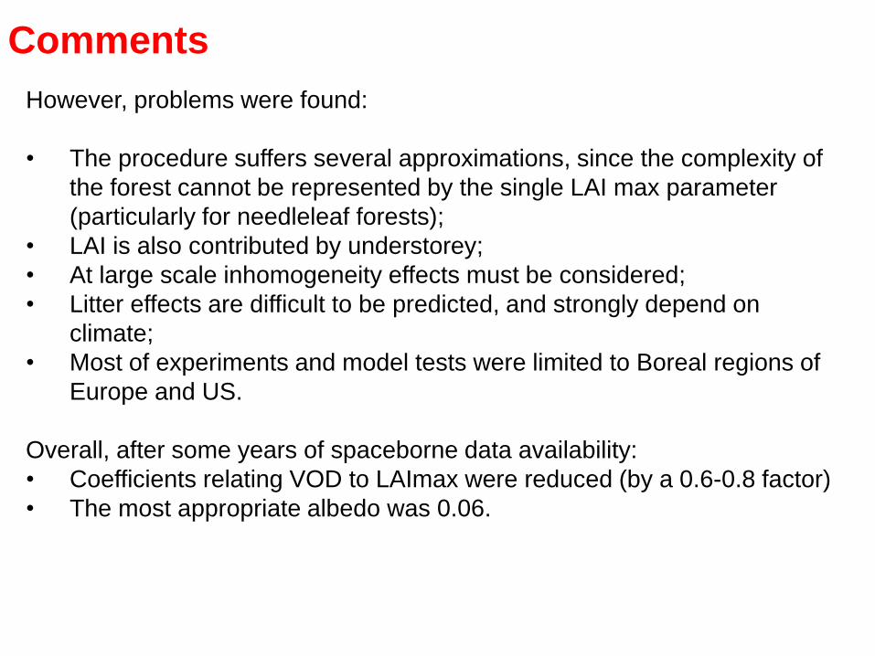
Comments
However, problems were found:
• The procedure suffers several approximations, since the complexity of
the forest cannot be represented by the single LAI max parameter
(particularly for needleleaf forests);
• LAI is also contributed by understorey;
• At large scale inhomogeneity effects must be considered;
• Litter effects are difficult to be predicted, and strongly depend on
climate;
• Most of experiments and model tests were limited to Boreal regions of
Europe and US.
Overall, after some years of spaceborne data availability:
• Coefficients relating VOD to LAImax were reduced (by a 0.6-0.8 factor)
• The most appropriate albedo was 0.06.

The SMOS SM L2 Algorithm
An RT-0 forward model is run for each angle and
for each land cover of SMOS pixels. Inputs: land
cover, ECMWF, ECOCLIMAP
Outputs are aggregated for SMOS pixels, and
compared with measurements.
Simulated TB’s are compared vs. measured TB’s.
An iterative procedure is started to minimize the “cost
function”.
SM and optical depth of the dominant cover type
(low vegetation or forest) are retrieved as outputs of
this iterative procedure (2P algorithm).

The forward model for forests
RT-0 inputs for soil: SM (first guess), h
RT-0 inputs for vegetation: τ (first guess), ω
h = 0.3 (fixed)
SM by ECMWF
τ (first guess) and ω are obtained using the
already indicated procedure.

The 3P algorithm
A 3-parameter retrieval exercise was made off-line.
In this case SM, τ and ω were simultaneously
retrieved. This method is not proposed as
operational, since produces unstable solutions for
mixed pixels.
However, it provided useful results when the forest
fraction (FFO) was close to 100%.
Four 8-day intervals of 2011 and 2012 were
selected.

Forest
fraction
Time
interval
Number τ mean τ std ω mean ω std
90%-95% February
2011
9766 0.88 0.26 0.055 0.025
95%-100% February
2011
32920 0.94 0.23 0.064 0.019
90%-95% July 2011 10379 0.90 0.25 0.054 0.024
95%-100% July 2011 33905 0.96 0.22 0.062 0.018
90%-95% November
2011
10365 0.87 0.26 0.051 0.023
95%-100% November
2011
34316 0.93 0.22 0.059 0.018
90%-95% February
2012
10145 0.91 0.27 0.051 0.024
95%-100% February
2012
33806 0.98 0.23 0.060 0.019
3-parameter retrieval results over Pantropical
forests (latitude <20°), for four 8-day time intervals

Forest
fraction
Continent Number τ mean τ std ω mean ω std
90%-95% South
America
5815 0.92 0.25 0.057 0.027
95%-100% South
America
24446 0.98 0.21 0.064 0.017
90%-95% Africa 3914 0.79 0.25 0.049 0.042
95%-100% Africa 7463 0.81 0.23 0.060 0.038
3-parameter retrieval results over two continents for
8 days in July 2011

Scatterplot of retrieved ω vs. retrieved τ. July 2011,
Pantropical forests, Forest fraction > 95%
ω
τ
0.06

July 2011, Pantropical forests, Forest fraction>95%
ω mean vs. τ
0.06
ω std vs. τ
N of samples vs. τ

Boreal forests of North America with Forest fraction >95%
Needleleaf (green)
Broadleaf (blue)

Broadleaf forests of North America, Forest fraction>95%
July November
ω mean vs. τ
ω std vs. τ
N of samples vs. τ

Needleleaf forests of North America, Forest fraction>95%
July November
ω mean vs. τ
ω std vs. τ
N of samples vs. τ

Comments about albedo results
For tropical forests with FFO>95% the value ω=0.06 isconfirmed, on average, but with a slight decreasing
trend vs. τ
For Boreal forests, similar values are observed in July,but there is a decrease in November for needleleaf.
The std of ω decreases when increasing τ

Analysis of VOD and SM retrievalsobtained by current (620) SMOS L2
algorithm
SM: main objective of the mission.
VOD (vegetation optical depth τ) also important:
• To improve the performance of the algorithm;
• To achieve a new product, with applications tomonitoring of carbon storage and exchange.

Comparison between VOD and Forest
Height data base
Simard et al., (2009): Estimated by ICESat GLAS over lidar tracks, with
MODIS ancillary data to fill cross track Lidar gaps. The extention is obtained
using Random Forest Model.
The database also provides the RMSE computed comparing direct Lidar
measurements and model predictions. We only selected data with RMSE <
5m.

Comparison between optical thickness and
a novel AGB database
Pantropical AGB database by Avitabile et al. (2015): Fusion of previous
AGB maps (Baccini et al., Saatchi et al.) reported an RMSE 15 - 21 %
lower than that of the inputs maps and unbiased estimates.

South America (Forest fraction > 70%):
SMOS τ
(July
2015)
AMSR2 τ
(July
2015)
Forest
height
Forest
biomass

Africa (Forest fraction > 70%):
Forest
height Forest
biomass
SMOS τ
(July
2015)
AMSR2 τ
(July
2015)

Comparison between VOD (SMOS and AMSR2) and
forest parameters (par.). Average July 2015
τ = b1 par. + b2
par.
Forest height by Simard et al. (2011)
AGB by Avitabile et al. (2015)
τ vs. par. correlation (R2)
R2
SMOS
b1
SMOS
b2
SMOS
R2
AMSR2
b1
AMSR2
b2
AMSR2
Forest Height
South America
0.72 0.022 0.31 0.55 0.016 0.63
Forest Height
Africa
0.67 0.020 0.29 0.64 0.017 0.64
Biomass
South America
0.62 0.002 0.42 0.34 0.001 0.77
Biomass
Africa
0.57 0.002 0.45 0.45 0.001 0.83
Test:

Seasonal maps (2013)
SMOS τ AMSR2 τ
JANUARY JANUARY
JULY JULY

SMOS τ AMSR2 τ
Seasonal maps (2015)
JANUARY
JULY
JANUARY
JULY

Conclusions about VOD Investigations
Comparison between VOD and two databases including the novel AGB
dataset (Avitabile et al, 2015).
Linear regression analysis with different forest parameter registers an
overall better performance of L band
b2 coefficient represents the intercept of linear regression due to
contribution of understory and short trees. C band shows higher b2 as
expected
SMOS VOD shows temporal stability, particularly in tropical forests
Overall, SMOS optical depth can be a possible new contributor
data source for estimating forest biomass (or wood volume) and
its changes at global scale.
Reference: Vittucci et al, RSE, 2016

SM retrieval results (8-day average maps)
8 days February 2011 8 days July 2011 Forest fraction

Analysis of V620 TB’s and retrievals on
forest nodes of the Scan-Snotel Network
• For each SCAN-SNOTEL node, the closest SMOS node was
taken in order to make the comparison.
• Multitemporal trends of 2015 have been plotted for:
Retrieved SM;
Measured SM;
Retrieved τ ;
Average TBV in a 37.5°-42.5° range;
Average TBH in a 37.5°-42.5° range.

Node 2179: Sudduth Farms

Node 2089: Reynolds
Homestead

Node 2003: Wabeno 1

Node 1011: MF Nooksack

Problems
• Underestimation of SM at the highest latitudes (forwardmodel: ω?, soil permittivity?).
• Underestimation of SM or retrieval failure for forest fractionsin a 70%-90% range (land cover, simulation of TB in notretrieved fraction).
• Missing or suspicious ground measurements (e.g. SM=0 forlong time intervals). One sample per SMOS pixel is notsufficient.

Retrieval is difficult at higher latitudes and/or
lowest temperatures, not necessarily below
freezing values
Investigations in progress:
• Changes in wood permittivity;
• Changes in soil permittivity, for a given SM (organic
soils);
• Deeper and more stable litter;
• Higher differences between canopy and soil
temperatures.

Active-Passive sinergy at L band: Model simulations
(Guerriero et al, JSTARS 2016)

SMAPEX 2011
Airborne campaign over the Gillenbah Forest
(Australia) with PLMR radiometer and PLIS
scatterometer.
Active-Passive Experimental data
Forests
Crops
Bare Soil

AQUARIUS AND SMOS
σ°HH and eH data from Aquarius (beam 3) are
combined with SMOS L3 Vegetation Optical Depth
(VOD) and Soil Moisture (SM), for the closest pixels.All orbits on 1, 2, 3 July 2012. Pixels with RFI were discarded.

Simulated sensitivities to SM
Brightness Temperature Backscattering coefficient

L band radar:
Useful to precisely identify forest cover,
but
poor dynamic range related to SM variations under
forests.
Further investigations with L and C band are in
progress:SIMULATING L/L-BAND AND C/L-BAND ACTIVE-PASSIVE
COVARIATION OF CROPS WITH THE TOR VERGATA
SCATTERING AND EMISSION MODEL FOR A SMAP-
SENTINEL 1 COMBINATION
M. Link, D. Entekhabi, T. Jagdhuber, P. Ferrazzoli, L. Guerriero,
M. Baur, R. Ludwig
Presentation at IGARSS 2017

Suggestions for future experiments
• Select pixels at different latitudes;
• Cover SM measurements with sufficient sampling;
• Consider the fundamental importance of branches;
• Investigate seasonal variations of wood permittivity
and litter properties;
• Monitor vertical distribution of temperature.