galashiels masterplan january 2018 stallan-brand
TRANSCRIPT

Galashiels Masterplan January 2018 Stallan-Brand
247
Enabling Infrastructure
9 Stallan-BrandGalashiels Masterplan Stallan-BrandGalashiels Masterplan

Galashiels Masterplan January 2018 Stallan-Brand
249
LANDSCAPE STRATEGY
1.0 Introduction
On behalf of Scottish Borders Council and the Borders Railway Blueprint Programme, Wardell Armstrong have been appointed to support the team in the development of the Galashiels Masterplan. The Masterplan represents a unique opportunity to review the functionality and the appeal of the town centre, build upon the momentum generated by the Borders Railway and the future appeal of the Tapestry as a cultural destination. The landscape is integral to the character of Galashiels and areas of significant investment in the public realm have been made to support the vitality of the town. This reports aims to build upon the existing areas of investment in the context of a town centre wide approach and specifically respond to the key areas of investment identified in the Masterplan.
2.0 Landscape and Public Realm Appraisal
Understanding the Opportunity
Already the vital urban centre for a large number of neighbouring rural settlements, Galashiels has the opportunity to become a thriving Borders destination at the heart of the community. Putting streets and placemaking at the heart of the design process our approach aims to build on the existing strengths of Galashiels to create a place which embodies the six key qualities of a successful place.1. Distinctive 2. Safe & Pleasant3. Welcoming4. Adaptable5. Resource Efficient6. Easy to Move Around
3.0 Landscape and Public Realm Objectives
Galashiels Town Centre has an exciting opportunity to capitalise on the footfall of the railway and the future visitors to the Tapestry building. However, it also needs to diversify and extend its appeal to support its use as a visitor destination and community hub town throughout the year. Fundamental to the success of the town, is the appeal and vibrancy of its’ town centre. We have identified that the strategic investment in Channel Street is key, along with the link between the Interchange and the town centre. These key landscape and public realm projects aim to support economic improvements through:
• Improving the appeal of the shopping street and improving accessibility and linkages to the public transport interchange
• Creating spaces that users can connect with both physically and emotionally – which leads to increased footfall and time spent
• Realising increased saleability and rentability of the existing commercial property
There are three core landscape objectives:• Improve Connectivity• Improve Vibrancy• Support Identity
These interlinked objectives promote: • Reconnection of the town centre, particularly to the
Interchange through the creation of a walkable core and enhanced sense of arrival
• Improved town centre legibility and accessibility for all users through signage upgrades, consideration of a town centre wide Signage Strategy
• Greater connectivity with the water front through Environmental Improvements and new riverside walkways
• Rebalanced priority focused on pedestrian access and pedestrian footfall in the town centre through extended footways, decluttering and improved connectivity
• Improved community use and enhanced place appeal which can extend visitor dwell times and encourage greater events and civic uses
• Animation- the sense of a happening place, linked to Galashiels’ existing established art and creative community
• Sense of place and identity: Galashiels has a unique sense of place which includes the textile heritage but should also celebrate its contemporary role in Textile and Fashion education
• Build on Tapestry momentum and the architectural vision of an extended Market Square on the west and east of the principal shopping street, Channel Street.
• Use materials, detailing and elements to add interest and identity- potentially reinforced through a town centre wide Arts Strategy
4.0 Masterplan Areas
The following 6 Development Parcels have been identified in the Masterplan:
• Stirling Street- hotel development and Interchange Linkage
• Channel Street- major public realm investment• Overhaugh Street- interventions to diversify use and
connectivity• Bridge Street- new residential development and
riverside walkway• Sime Place- new pedestrian bridge and public realm
linked to a National Textiles Building and cultural quarter
• Linear Parks- improved accessibility and appeal of the waterfronts
1. Stirling StreetThe Landscape and Public realm is focussed on improving connectivity of the Interchange with the town centre and supporting an enhanced sense of arrival. Extended crossing and footway upgrades are envisaged along with extension of the existing area of public realm investment at the footbridge to create a new arrival plaza. A new section of Gala Water walkway is included as well as opening up of the vegetation to improved riverside views and sense of connectivity with the water.
2. Channel StreetThe principal area of public realm investment, the Landscape and Public Realm masterplan identifies that there are three key nodes where pedestrian footfall is anticipated to be highest. The existing urban realm is now reaching the end of its product life and the street has suffered deterioration, furniture clutter, adhoc parking and lower quality drainage installations.
We have identified that the primary focus of investment should be within these three nodes but there is a significant opportunity to improve the quality along Channel Street as a whole. Through consultation, we have identified there is an opportunity to narrow the carriageway width, remove parking and extend the footways. Key servicing and vehicle access needs should be retained.
3. Overhaugh StreetThe Landscape and Public realm vision is focussed on smaller scale interventions to improve access and connectivity as well as place appeal. We have identified that there is an opportunity to work with the local creative community to develop gable end and lighting solutions to significantly add to the experience of this town centre street.
4. Bridge StreetThe Landscape and Public realm supports the architectural vision for residential dwellings strongly related to the waterside. A network of private, semi-private and public open spaces are created along with the riverside path.
5. Sime PlaceImproved connectivity and widened appeal are key to this location and the landscape and public realm proposals build on the architectural vision for a new destination building linked to the cultural textile hub. A new play space is created to improve the appeal of the town centre to families and diversify the town’s offer. It is envisaged that hard surface public realm spaces are closely linked to building arrival spaces and café uses. A new section of waterfront walkway and vegetation management is also proposed.
6. Linear ParksGalashiels connection with the water is one of its’ key identifying features. Currently, access is adhoc with some paths in place but not consistent through the town centre. A connected walkway is proposed along with areas of vegetation removal and wider environmental management of the banks to improve the succession, health and biodiversity of this key feature.
The historic mill lades are an asset but are currently underutilised. A number of properties turn their back on this feature and barbed wire, security fencing and fly tipping significantly reduce appeal. The landscape and public realm masterplan identifies the need for a phased programme of interventions to improve the access and appeal over time as funding becomes available. This naturalistic landscape suits a low key treatment such as crushed whin paths, vegetation clearances, new native groundcover planting and potentially limited areas of boardwalk.

Galashiels Masterplan January 2018 Stallan-Brand
251
5. Town Centre Wide Proposals
The landscape and public realm of Galashiels is interconnected and whilst we recognise that there are several individual projects, there are a number of projects which are town centre wide. These are:
• Town Centre Arts Strategy: focussed on animating the town centre environment, strengthening the town’s unique identity and supporting greater visitor numbers/ increased visitor dwell times. Working closely with the creative community, a series of short term installations could be programmed along with funding applications for more permanent displays and features.
• Town Centre Signage Strategy: considering opportunities for enhanced town centre accessibility and appeal through elements such as orientation board signs, town centre models, improved directional signage, town centre noticeboards and working with beacon technology.
• Town Centre Lighting Strategy: linked to an art strategy to improve the appeal and perceived animation of the town centre at night and during winter months. Consideration should also be made for Christmas lighting
• Environmental Improvements: Stretching the length of the town centre waterways, there is an opportunity to consider a strategy for environmental improvements that could be implemented over a phased basis. There is also an exciting opportunity to link with the arts and lighting strategies.
To support quality and consistency within the public realm, we have also developed an outline materials, softworks and furniture palette to inform a potential future detailed design guide.
Additionally, a key town centre wide recommendation is the need for a town centre champion with the power to control elements such as advertising boards/ low quality shop fronts and promote the town centre wide projects.
6. Consultation
The public realm and landscape was a key element of the discussions at the recently attended Place Styling Event which saw local community representatives, creative community representatives and local business representatives attend a walking tour and workshop. The event held on 24th May 2017 was hugely successful and was used as an opportunity to test the emerging landscape and public realm ideas along with the wider masterplan.
The key discussions and the link to potential projects is summarised from a landscape perspective below. Full details are provided in the supporting Place Styling Summary.
LANDSCAPE STRATEGY
Galashiels Masterplan January 2018 Stallan-Brand
253
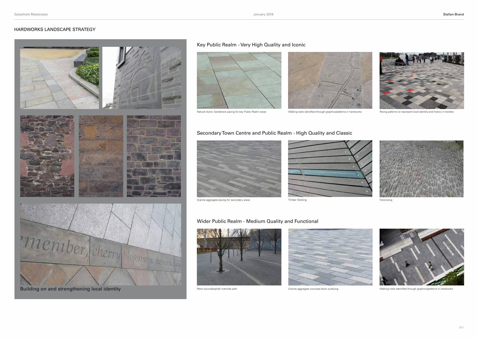
HARDWORKS LANDSCAPE STRATEGY
Key Public Realm - Very High Quality and Iconic
Secondary Town Centre and Public Realm - High Quality and Classic
Wider Public Realm - Medium Quality and Functional
Granite aggregate paving for secondary areas
Natural stone: Sandstone paving for key Public Realm areas
HoronisingTimber Decking
Granite aggregate concrete block surfacing Building on and strengthening local identity
Walking trails identified through graphics/patterns in hardworks Paving patterns to represent local identity and history in textiles
Resin bound/asphalt riverside path Walking trails identified through graphics/patterns in hardworks

Galashiels Masterplan January 2018 Stallan-Brand
255
SOFTWORKS LANDSCAPE STRATEGY
Building on and strengthening local identity
Key Public Realm - Very High Quality and Iconic
Secondary Town Centre and Public Realm - High Quality and Classic
Wider Public Realm - Medium Quality and Functional
Street trees such as Pyrus chanticleer or Tilia cordata Hedge planting: Formal Hedge Ornamental areas
Amenity grass Green walls
Native wetland edge incl. birch and willows Amenity grass
Formal street trees
Natural Planting

Galashiels Masterplan January 2018 Stallan-Brand
257
LANDSCAPE STRATEGY - STREET FURNITURE
Planters with integral seating
Bin stores Building on and strengthening local identity
Key Public Realm - Very High Quality and Iconic
Secondary Town Centre and Public Realm - High Quality and Classic
Wider Public Realm - Medium Quality and Functional
Timber and granite: Seating
Lighting: Overhead lighting
Timber seating
Lighting: Overhead lighting Directional signpost
Directional signpost
Informative signage

Galashiels Masterplan January 2018 Stallan-Brand
259
GALA WATER
PARK
STIRLING STREET
600X450 -SW
300 VC - FW
500 CI - FW
LADHOPE VALE
CHANNEL STREET
300 VC - FW
FOU
LW
ATER
SURFACE
WATER
SUR
FAC
EW
ATER
FOUL
WAT
ER
DO
UG
LAS
BRID
GE
TRANSPORT
INTERCHANGE
SURFACEWATER
SURFACE
WATER
BRID
GE
PLA
CE
GALA WATER
FOU
L
WATER
450 CI - FW
225 VC - FW 300
VC -
CS
225 VC - CS375 VC -SW
LADHOPE VALE
500 CI - FW
STREET
MAR
KET
EXISTING SURFACEWATER OUTFALL
225 VC - FW
225 VC - FW
225 VC - SW
225 VC - FW
225 VC - FW 225 VC - FW
225 VC - FW550 CI - FW
450 VC - FW
300 VC - SW
375
VC -S
W
SURFACEWATER
FOULWATER
300 VC - SW
225 VC - SW
500 CI - FW
300
VC -
SW
300 VC - SW
300 VC - SW
225 VC - FW
225 VC - FW
225
VC -
FW
225 VC - FW
450 VC - FW
CHANNEL STREET
SIME
PLACE
BRIDGE STREET
HIGH STREET
FOULWATER
SURFACE
WATER
OVERHAUGH STREET
MAR
KET STREET
FOU
L
WATER FO
UL
WATER
SURFACEWATER SUR
FAC
EW
ATER
FOULWATER
FOULWATER
FOU
L
WATER
SUR
FACE
WATER
GALA WATER
FOU
LW
ATER
SURF
ACE
WAT
ER
CURRIE ROAD
MILL LADE
MILL LADEMILL LADE
OVERHAUGH STREET
EXISTING SURFACEWATER OUTFALL
EXISTING SURFACEWATER OUTFALL
STREET
EXISTING SURFACEWATER OUTFALL
ZONE 1
ZONE 2
ZONE 3
ZONE 4ZONE 5
ZONE 6
N
SW
E
EXISTING FOUL WATER225 VC - SW
EXISTING SURFACE WATER450 CI - FW
FOULWATER
SURFACE WATERDISCHARGE
SURFACEWATER
FOUL WATERDISCHARGE
The six proposed regeneration zones aim to promote soft landscaping where possible, ultimately reducing the existing impermeable catchments. This is particularly the case for the ‘Linear Park’ zone which will look to expose the Mill Lade and incorporate Sustainable Drainage System (SuDS), targeting the four pillars of SuDS design: water quantity, water quality, amenity and biodiversity. It is proposed that all development zones will connect to the existing public Scottish Water (SW) surface water and foul water networks as appears to currently take place at these locations.
Prior to discharge to the SW surface water network, it is anticipated that surface water runoff will be attenuated to the 1 in 2 year Greenfield return period where possible, which is approximately equivalent to 4.5l/s/ha. The
existing surface water network ultimately discharges to the Gala Water and therefore appropriate SuDS treatment are likely to be required within the development sites to attenuate and treat the runoff. SuDS treatment and attenuation methods may include but are not limited to permeable paving, filter trenches, natural swales and rainwater harvesting tanks.
The proposed generated foul water is expected to discharge to the existing Scottish Water network, ultimately collected via the 550CI Foul Water pipe flowing eastbound along Gala Water.
SEPA, under the Water Environment (Controlled Activities) (Scotland) Regulations 2011, will review the Surface Water Strategy and provide approval by way of
DRAINAGE & SUDS STRATEGY
an agreement in principle. In order to comply with this regulation, the drainage will be designed in accordance with the SuDS Manual, CIRIA C753, which was updated in 2015.
Preliminary consultation has been made to Scottish Water in the form of submission of the Pre-Development Enquiry forms. The proposed drainage design is to comply with the guidance given in Sewers for Scotland (3rd Edition) and will ultimately be subject to Technical Approval by Scottish Water.

Galashiels Masterplan January 2018 Stallan-Brand
261
FLOODING
SEPA and Scottish Water have advised that there is record of historical flooding within Galashiels from the Gala Water and Mill Lade, in the vicinity of the proposed regeneration zones.
Two existing flood prevention schemes (FPS) exist for Gala Water, consisting of earth/rock embankments and floodwalls.
The existing schemes are: • Plumtree & Wilderhaugh FPS (2010)
Protects the town centre to the 1 in 75 year eventLocated 0.5km west upstream of the proposed development
• Netherdale FPS (1987, upgraded 2014) Protects Netherdale area to the 1 in 200 year eventLocated 1.3km east downstream from the proposed development.
The proposed drainage design will look to provide further flooding defences as assessed to be required for the six regeneration zones. This assessment will look to integrate the proposed design with the Tweed Local Flood Risk Management Plan and further flooding studies currently being undertaken by the Scottish Borders Council. It is understood that the Scottish Borders Council is committed in undertaking a Galashiels Surface Water Management Plan before 2020 and a Natural Flood Management Study before 2022.
Notable flood defences are likely to be integrated into the design at the Hotel Site (Zone 1), Residential Site (Zone 4) and the Mill Lade Linear Park (Zone 6). The design will aim to activate and utilise the riverside areas, whilst ensuring that the flood risk is unaffected and integrates with the Council’s Tweed Local Flood Management Plan (July 2016).
CURRIE ROAD
GALA W
ATER ROUNDABOUT
Burnsid
e Brae
ParkBus
iness
Galaba
nk
Tk
ESS
ESS
CURRIE ROAD
STATION BRAE
7
17
16
6
15
2327
STREET
PATON
QUEEN STREET
Sluice
ELM
RO
W
5
13
18
817
2529
7
1
Ellwyn
House
ALBERT PLACE
1to12
CourtWilde
rhaug
h
13to20
Whinwoo
ds
Mill Le
ad
11
TCBs
13
George
Craig B
ridge
14
114
59
PARK
BRID
GE
PLA
CE
GALA WATER
LADHOPE VALE
STREET
MAR
KET
CHANNELSIME PLACE
BRIDGE STREET
OVERHAUGH
MILL LADE
STREET
N
SW
E
MILL LADE
MILL LADE
GALA WATERGALA WATER
LADHOPE VALE
STREET
STREET
MILL RETAIL
PARKPLUMTREEHALL BRAE
KING STREET
STIRLING STREET
HU
NTE
R'S
BRID
GE
PLUMTREE & WILDERHAUGH FLOODPREVENTION SCHEME (2010)· 0.5km UPSTREAM FROM PROPOSED DEVELOPMENT· WALL TO NORTHERN BANK
EMBANKMENT TO SOUTHERN BANK· PROTECTS TOWN CENTRE UP TO THE 1 IN 75 YR EVENT
45
1
2
3
6
GALA WATER
NETHERDALE FLOOD PREVENTIONSCHEME (1987, 2014)· 1.3km DOWNSTREAM FROM PROPOSED
DEVELOPMENT· EMBANKMENTS, WALLS & FLOODGATES TO
SOUTHERN BANK· PROTECTS NETHERDALE AREA TO THE 1 IN
200 YR EVENT
1 IN 10 YR RIVER FLOODING EXTENTSHIGH LIKELIHOOD
(Extent is approximately defined and has beenrecreated based on SEPA online Flood Maps)
1 IN 200 YR RIVER FLOODING EXTENTSMEDIUM LIKELIHOOD
(Extent is approximately defined and has beenrecreated based on SEPA online Flood Maps)
MILL LADE INLET FROM GALA WATERWITH AUTOMATED INLET CONTROL
CULVERTED SECTIONS OFMILL LADE TO BE EXPOSED
FLOOD DEFENCE REQUIRED AS PARTOF RIVERFRONT LANDSCAPING
GALASHIELS FLOODINGPOTENTIALLY VULNURABLE
AREA (PVA) 13/04Netherdale FPS Wall, Galashiels (Geograph – J.Barton 2015)
Example flood protection wall – (Redi-Rock Flood walls)
Galashiels Gala Water (ITV Border, 2015)
Galashiels Masterplan January 2018 Stallan-Brand
263
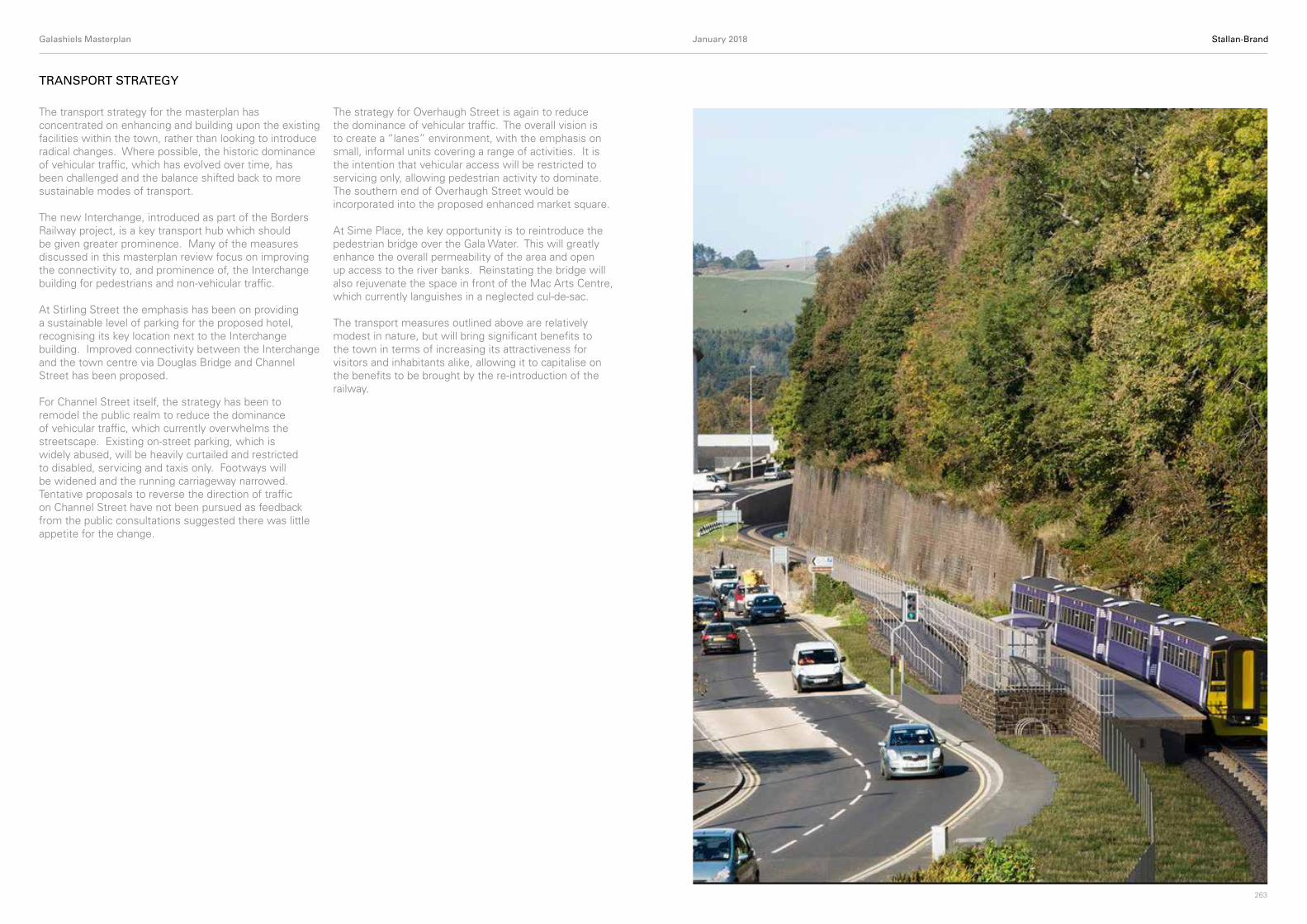
TRANSPORT STRATEGY
The transport strategy for the masterplan has concentrated on enhancing and building upon the existing facilities within the town, rather than looking to introduce radical changes. Where possible, the historic dominance of vehicular traffic, which has evolved over time, has been challenged and the balance shifted back to more sustainable modes of transport.
The new Interchange, introduced as part of the Borders Railway project, is a key transport hub which should be given greater prominence. Many of the measures discussed in this masterplan review focus on improving the connectivity to, and prominence of, the Interchange building for pedestrians and non-vehicular traffic.
At Stirling Street the emphasis has been on providing a sustainable level of parking for the proposed hotel, recognising its key location next to the Interchange building. Improved connectivity between the Interchange and the town centre via Douglas Bridge and Channel Street has been proposed.
For Channel Street itself, the strategy has been to remodel the public realm to reduce the dominance of vehicular traffic, which currently overwhelms the streetscape. Existing on-street parking, which is widely abused, will be heavily curtailed and restricted to disabled, servicing and taxis only. Footways will be widened and the running carriageway narrowed. Tentative proposals to reverse the direction of traffic on Channel Street have not been pursued as feedback from the public consultations suggested there was little appetite for the change.
The strategy for Overhaugh Street is again to reduce the dominance of vehicular traffic. The overall vision is to create a “lanes” environment, with the emphasis on small, informal units covering a range of activities. It is the intention that vehicular access will be restricted to servicing only, allowing pedestrian activity to dominate. The southern end of Overhaugh Street would be incorporated into the proposed enhanced market square.
At Sime Place, the key opportunity is to reintroduce the pedestrian bridge over the Gala Water. This will greatly enhance the overall permeability of the area and open up access to the river banks. Reinstating the bridge will also rejuvenate the space in front of the Mac Arts Centre, which currently languishes in a neglected cul-de-sac.
The transport measures outlined above are relatively modest in nature, but will bring significant benefits to the town in terms of increasing its attractiveness for visitors and inhabitants alike, allowing it to capitalise on the benefits to be brought by the re-introduction of the railway.

Galashiels Masterplan January 2018 Stallan-Brand
265
CARBON STRATEGY
Key Considerations
Key considerations when considering sustainable energy design and the incorporation of low zero carbon technologies include:
• Scottish Building Regulations: • National Planning and Local Planning stipulations• District energy systems – potential for connection to
existing infrastructure • Range of building types to include retail,
supermarket, library, community centre, school and town housing
Energy Hierarchy
The fundamental strategy for the organic growth of both developments is to achieve a continued optimum energy strategy using systems and technologies to reduce energy requirements, energy costs/waste and minimise environmental impact.
It is proposed that the overall approach for the scheme should follow an iterative ‘design hierarchy’ strategy, this process should be continuously considered throughout the design and throughout each phase of the development.
Legislation & Guidance
The variety of building types and sites proposed within the Galashiels development creates challenges to mitigate the effect of climate change by reducing carbon emissions. This is the central pillar within the Scottish Building Regulations (Section 6) for domestic buildings (21% reduction in carbon emissions over 2010 standards) and non-domestic buildings (43% reduction in carbon emissions over 2010 standards). There are a number of design standards within the building regulations that need to be adhered to. In meeting these should help toward gaining compliance. At present, there are no carbon reduction targets specified in planning by The Scottish Borders Council.
Low Energy Design Strategy
It is thought that to pass these building regulations, buildings will have to be constructed with a best practice air tightness of around 3m3/(m2.hr) with a high efficient gas fired boiler and low energy lighting. There may be a need in some circumstances for a PV installation or communal heating in the case of the flats.
Taking design principals from the Irvine Bay regeneration, where possible, any new buildings should be orientated to maximise daylighting. It should also be noted that building regulations will, in time, become more onerous. Therefore, alternate solutions for heating such as air source heat pumps may need to be utilised in future.
In terms of investigating district heating solutions two sites have been investigated, one in London and one in Edinburgh. Both of these networks were constructed in line with a new development on brownfield and greenfield land respectively. Due to the zones around Galashiels town centre being already developed it would not be technically or economically feasible to develop a new district heat network here.
There is however potential for the primary and secondary school in zone G to be linked by a new district heat network with the possibility of linking this with the flats in zone H. The council would support such a network if it can be accommodated without unacceptable significant adverse impacts or effects, giving due regard to relevant environmental, community and cumulative impact considerations.
In connecting to an existing network, there are none at present near to the proposed zones.

Galashiels Masterplan January 2018 Stallan-Brand
267
UTILITY SERVICING STRATEGY
Electricity
In order to assess the anticipated electricity demand of the proposed development sites, we have applied BSRIA rule of thumb electrical loads to the various buildings. Our load study shows a total of 3.77MVA of new load. The load analysis of the Galashiels electrical infrastructure indicates that the new load associated with the Development Plan will not require any reinforcement of the Primary (33/11kV) substations or the general 11kV distribution network supplying Galashiels.
It is anticipated that four new secondary (11/0.4kV) substations will be required and one secondary substation will have to be upgraded. SPEN have assessed the requirements for each of the development sites and confirmed the total budget cost for the estimated electricity infrastructure alterations to support the development plan is £1,250,000.
Gas
To assess the anticipated natural gas demand of the proposed development sites we have applied rule of thumb calculations, standard mechanical engineering design principals and utilised previous utility project experience. Our study provides estimated “un-diversified” loads for each site identified as part of the overall masterplan development.
SGN have reviewed the load assessment and provided a brief written confirmation of any required reinforcement works. Currently we have no budget cost figures for any proposed gas works. We have however opened dialogue with a national Multi-Utility company to try and obtain an initial budget quotation.
Water
To assess the anticipated water demand of the proposed development sites we have applied rule of thumb calculations, standard mechanical engineering design principals and utilised previous utility project experience. Our study provides estimated “un-diversified” loads for each site identified as part of the overall masterplan development. Load estimations have been passed to Goodsons Associates to enable a “Pre Development Enquiry” to be raised with Scottish Water.
Currently we have no budget cost figures for any proposed water works. We have opened dialogue with a national Multi-Utility company to try and obtain an initial budget quotation.
Telecommunications
There is extensive Openreach BT underground duct infrastructure serving all properties within the town. Openreach have a license obligation to provide service to any new customer requiring a connection and developers are not normally charged for this provision of service. As Openreach BT will not consider new developments until planning permission is granted and site plans of each individual development are available for them to plan their network, no further proposals for new services will be available, however all new ducts will be free issue to the developers and as the area is well serviced no major issues are anticipated. There are no major diversion works likely to be required.
High speed fibre broadband is available via BT within Galashiels.
Vodafone have some limited underground duct and fibre network infrastructure in the centre of Galashiels. It is unlikely that Vodafone will invest in new infrastructure at this time.
The proposed utility servicing strategy for the Galashiels development is summarised below:
Galashiels Masterplan January 2018 Stallan-Brand
269
Town Enhancement Services
In addition to the traditional statutory utility provision such as gas, water and electricity, there are several other opportunities to introduce further ancillary services within the master plan development in order to provide additional services to the community.
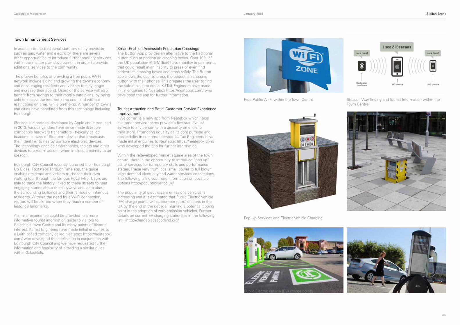
The proven benefits of providing a free public Wi-Fi network include aiding and growing the towns economy and encouraging residents and visitors to stay longer and increase their spend. Users of the service will also benefit from savings to their mobile data plans, by being able to access the internet at no cost, and without restrictions on time, while on-the-go. A number of towns and cities have benefitted from this technology including Edinburgh.
iBeacon is a protocol developed by Apple and introduced in 2013. Various vendors have since made iBeacon-compatible hardware transmitters - typically called beacons - a class of Bluetooth device that broadcasts their identifier to nearby portable electronic devices. The technology enables smartphones, tablets and other devices to perform actions when in close proximity to an iBeacon.
Edinburgh City Council recently launched their Edinburgh Up Close: Footsteps Through Time app, the guide enables residents and visitors to choose their own walking tour through the famous Royal Mile. Users are able to trace the history linked to these streets to hear engaging stories about the alleyways and learn about the surrounding buildings and their famous or infamous residents. Without the need for a Wi-Fi connection, visitors will be alerted when they reach a number of historical landmarks.
A similar experience could be provided to a more informative tourist information guide to visitors to Galashiels town Centre and its many points of historic interest. KJ Tait Engineers have made initial enquiries to a Leith based company called Neatebox https://neatebox.com/ who developed the application in conjunction with Edinburgh City Council and we have requested further information and feasibility of providing a similar guide within Galashiels.
Smart Enabled Accessible Pedestrian CrossingsThe Button App provides an alternative to the traditional button push at pedestrian crossing boxes. Over 10% of the UK population (6.5 Million) have mobility impairments that could result in an inability to press or even find pedestrian crossing boxes and cross safely. The Button app allows the user to press the pedestrian crossing button with their phones. This prepares the user to find the safest place to cross. KJ Tait Engineers have made initial enquiries to Neatebox https://neatebox.com/ who developed the app for further information.
Tourist Attraction and Retial Customer Service Experience Improvement “Welcome” is a new app from Neatebox which helps customer service teams provide a five star level of service to any person with a disability on entry to their store. Promoting equality as its core purpose and accessibility in customer service. KJ Tait Engineers have made initial enquiries to Neatebox https://neatebox.com/ who developed the app for further information.
Within the redeveloped market square area of the town centre, there is the opportunity to introduce “pop-up” utility services for termporary stalls and performance stages. These vary from local small power to full blown large demand electricity and water services connections. The following link gives more information on possible options http://popuppower.co.uk/
The popularity of electric zero emissions vehicles is increasing and it is estimated that Public Electric Vehicle (EV) charge points will outnumber petrol stations in the UK by the end of the decade, marking a potential tipping point in the adoption of zero emission vehicles. Further details on current EV charging stations is in the following link khttp://chargeplacescotland.org/
Free Public Wi-Fi within the Town Centre IBeacon Way finding and Tourist Information within the Town Centre
Pop-Up Services and Electric Vehicle Charging
Public Electric Vehicle (EV) charge points