greater water security with groundwater - denmark …irland.um.dk/en/~/media/irland/documents/white...
TRANSCRIPT
Groundwater mapping and sustainable groundwater management
TH
E RET
HIN
K W
AT
ER N
ETW
OR
K | W
AT
ER R
ESOU
RCES | FEB
RU
AR
Y 20
13
white paper
Greater water security
with groundwater

Greater water security with groundwaterGroundwater mapping and sustainable groundwater management
Version 1.0
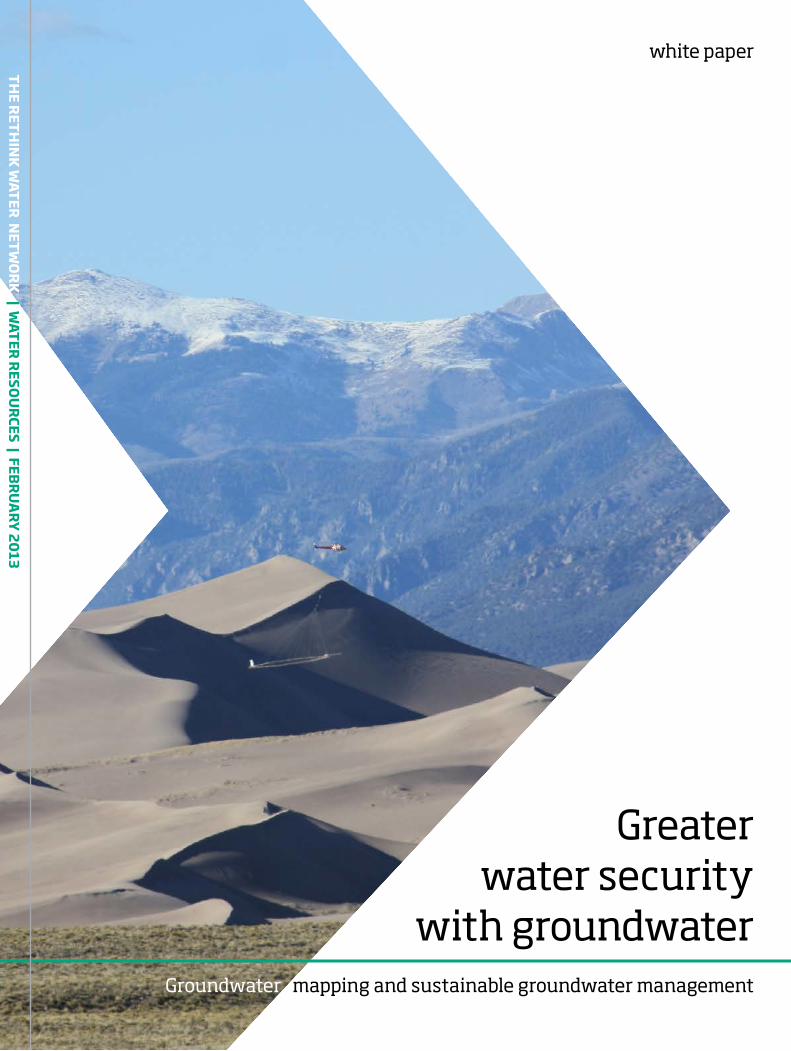
Frontpage pictureSkyTEM technology for groundwater survey in Colorado, USA
About this white paperThis white paper is developed by the Rethink Water network in Denmark. The work is coordinated by the Danish Water Forum.
The Rethink Water Network consists of more than 50 technology and consulting companies, water utilities, water organisations and governmental bodies. It was established to support our partners internationally in developing the highest quality water solutions.
Quoting this white paperPlease quote this white paper and its articles: “Klee, P. (Ed.), 2013. Greater water security
with groundwater - Groundwater mapping and sustainable groundwater management. The Rethink Water network and Danish Water Forum white papers, Copenhagen. Available at www.rethinkwater.dk”
Editor Danish Water Forum Pia Klee [email protected]
Contributors Alectia Flemming Pedersen [email protected] COWI Anders Refsgaard [email protected] Danish Water Forum Pia Klee [email protected] DHI Torsten Vammen Jacobsen [email protected] EnviDan Jens Dyrberg [email protected] GEUS Geological Surveys of Denmark and Greenland Richard Thomsen [email protected] GEUS Geological Surveys of Denmark and Greenland Verner Søndergaard [email protected] I-GIS Torben Bach [email protected] Rambøll Peter Thomsen [email protected] SkyTEM Surveys Flemming Effersø [email protected] Aarhus Geophysics Andrea Viezzoli [email protected] Aarhus University Anders Vest Christiansen [email protected]
© The Rethink Water Network & Danish Water Forum 2013
Providing enough fresh water for a growing population and for increasing industrial produc-tion is a critical issue in many countries. Climate change is affecting global rainfall patterns and water distribution. Since there is approximately 100 times more groundwater on Earth than fresh surface water, it makes sense to exploit groundwater as a source of water. In many parts of the world, especially in arid or seasonally dry regions, groundwater can provide a stable and sustainable source of high quality water.
Failed investmentsThere is a history of many failed investments in groundwater well fields. The most impor-tant cause has been the difficulty in assess-ing project feasibility and sustainability due to in adequate knowledge, data and tools. Sustain able exploitation requires that the main recharge areas are protected to ensure that aqui fer replenishment comes from clean water.
Efficient methods and tools existBecause of a relative shortage of surface water, Denmark has always relied heavily on ground-water. Danish companies are now among the world’s leading experts in exploiting this re-source. Groundwater can be located very ef-ficiently, and groundwater management made sustainable with modelling and monitoring systems. Today there is great demand around the world for this expertise and the associated technologies, which include surveying tech-
Executive summary
niques, integrated water resource modelling and decision-making systems. Multiple benefits from groundwater use Groundwater is less exposed to pollution than surface water, the water quality is higher and it requires less treatment. Moreover, water utili-ties can benefit from planning long term. They can avoid major investment linked to surface water infrastructure and enjoy a higher level of water security. Groundwater mapping and sustainable groundwater management en-sure improved knowledge of the availability of water resources, a critical factor in attracting new companies and industry. By investing in groundwater usage local business partners will develop their competence through knowledge transfer from international experts. This crea-tes a strong platform for expanding the local water business to other regions.
Management must be integrated It is important to understand that it only takes a few contaminants and/or an unbalanced ap-proach to utilisation for groundwater resources to be damaged forever. Some of the critical is-sues or barriers can be addressed or resolved by accurate groundwater mapping and sustainable groundwater management, or with integrated water resources management. Groundwater is an important part of the hydrological cycle and should be managed in an integrated way with other water resources.
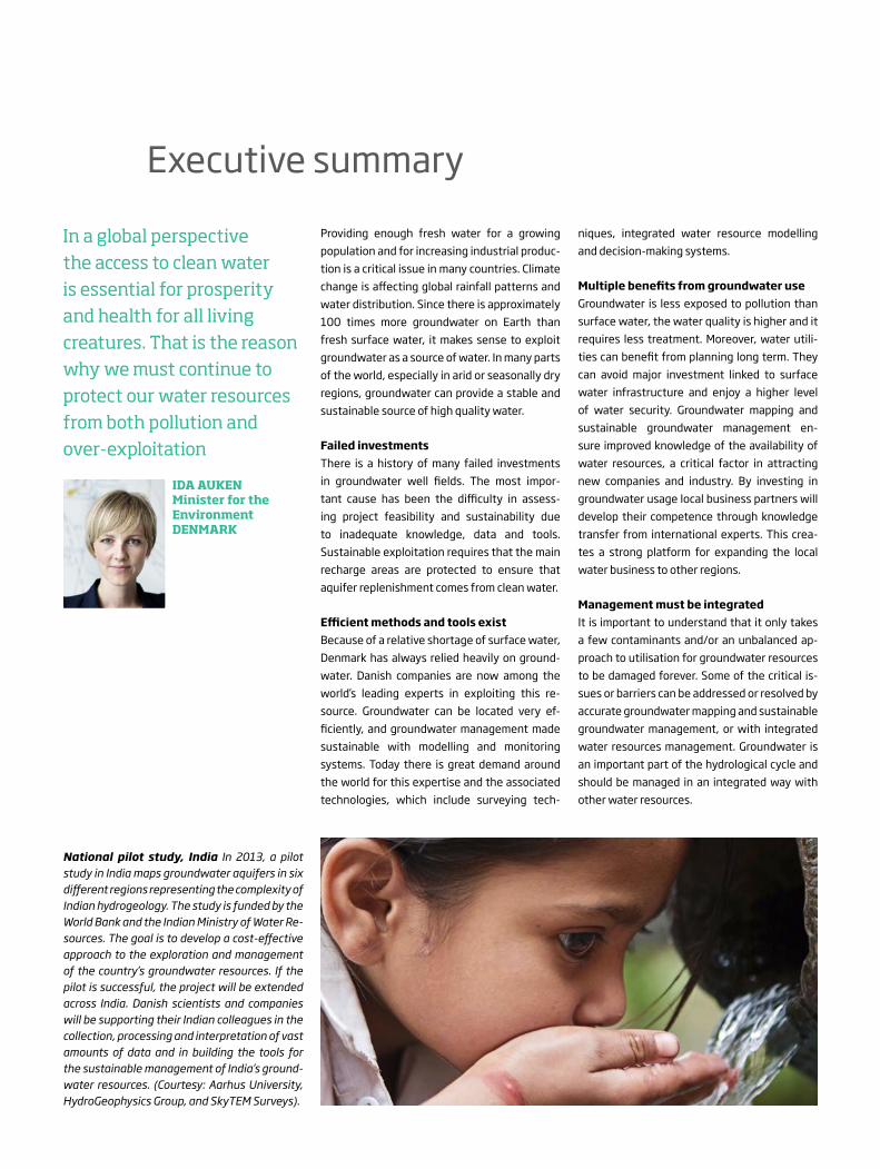
National pilot study, India In 2013, a pilot study in India maps groundwater aquifers in six different regions representing the complexity of Indian hydrogeology. The study is funded by the World Bank and the Indian Mini stry of Water Re-sources. The goal is to develop a cost-effective approach to the exploration and management of the country’s groundwater resources. If the pilot is successful, the project will be extended across India. Danish scientists and companies will be supporting their Indian colleagues in the collection, processing and interpretation of vast amounts of data and in building the tools for the sustainable management of India’s ground-water resources. (Courtesy: Aarhus University, HydroGeophysics Group, and SkyTEM Surveys).
In a global perspective the access to clean water is essential for prosperity and health for all living creatures. That is the reason why we must continue to protect our water resources from both pollution and over-exploitation
IDA AUKEN Minister for the EnvironmentDENMARK


WHITE PAPER - GROUNDWATER MAPPING AND SUSTAINABLE MANAGEMENT | 5
1. The right knowledge makes groundwater last forever 1
2. Methods and tools for mapping and hydrogeological modelling 4
3. Policies and administration of groundwater resources 9
4. The benefits of investing in groundwater supply 12
5. Avoiding problems with groundwater 14
6. Groundwater as a part of integrated water resources management 15
If your goal is water efficiency, Denmark is ready as a partner 18

WHITE PAPER - GROUNDWATER MAPPING AND SUSTAINABLE MANAGEMENT | 1
groundwater
sand
claysea
spring
artesian well
dug wellbore hole
clay
groundwater table
© Carsten Egestal Thuesen, GEUS
Providing enough fresh water for a growing population and for increasing industrial produc-tion is a critical issue for many countries. Clima te change is affecting global rainfall patterns and water distribution. Since there is approximately 100 times more groundwater than fresh sur-face water on Earth, it makes sense to exploit this important source of water. In many parts of the world, especially in arid or seasonally dry regions, groundwater can provide a stable and sustainable source of high-quality water.
Sustainable groundwater exploitationGroundwater can be located very efficiently with advanced airborne geophysical mapping me thods, and groundwater management can be achieved sustainably with groundwater modelling technologies and monitoring sys-tems. The key is a credible groundwater model, which guards against over-extraction from the wells. Over-exploitation of the resource will come at the expense of future generations.
Mapping programme in DenmarkAn ambitious groundwater mapping program-me laid the foundation for the groundwater exper tise of Danish companies. Today this expertise, which includes surveying technolo-gies, software tools for integrated water re-source modelling and decision-making systems is in global demand. The programme began in 1998 when the government adopted a plan for hydro geological investigation. The aim was to produce an accurate picture of Danish aqui-fers with respect to their location, distribution, extension and interconnection and to produce
maps identifying the weak points in the system. Site-specific groundwater protection zones were established to prevent ground water conta mination from urban development and agricultural sources. Summary of the Danish site-specific ground-water protection strategy:
1) Spatially dense hydrogeological mapping based on existing data supplemented with new geophysical surveys, drilling surveys, water sampling and hydrological model-ling. The mapping is aimed at establishing site-specific protection zones. Vulnerability is inter preted in relation to the local hydro-logical and chemical conditions.
1. The right knowledge makes groundwater last forever
Groundwater resources are often overlooked. But for many countries ground-water exploitation can be carried out sustainably, and provide a reliable supply of water for current and future generations
RICHARD THOMSENGeophysicist and Hydrologist
GEUS GEOLOGICAL SURVEYS OF DENMARK AND GREENLAND
Water cycle The water cycle is an endless cycle where water runs from layers in the ground towards rivers, lakes and the sea. There it evapo-rates, falls from the sky as rain or snow and begins its journey again into the ground. To understand this process in detail, it is necessary to understand the factors that control the flow of water. Efficient mapping of groundwater and of the protection it needs are essential for opti-mal management of the resource. (Courtesy: GEUS).
Classification Groundwater classification map with subdivision of Denmark into highly valu-able, valuable, and less valuable groundwater-abstraction areas. (Courtesy: GEUS).

WHITE PAPER - GROUNDWATER MAPPING AND SUSTAINABLE MANAGEMENT | 2
Groundwater recharge The UNESCO Worldwide Hydro Geo-logical Mapping and Assessment Programme has developed this map showing groundwater recharge in millimetres per year around the world. In areas where groundwater recharge is limited, and the geological conditions particularly complex, groundwater mapping and management based on hydrological models is essential for sustainable groundwater exploitation. (Source: www.whymap.org)
Tokyo
Sydney
Lima
Cairo
Seoul
DelhiDhaka
Lagos
Paris
Osaka
Manila
Tehran
Lahore
Mumbai
Bogota
London
Moscow
Madras
Beijing
Bangkok
Karachi
Jakarta
ChicagoTianjinNew York Istanbul
Calcutta
Shanghai
Santiago
Kinshasa
Shenyang
Hyderabad
Sao Paulo
Hong Kong
Bangalore
Mexico City
Los Angeles
Buenos Aires
Rio de Janeiro
St. Petersburg
Groundwater Resources of the World
© BGR Hannover / UNESCO Paris 20080 1000 2000 3000 4000 5000 km
extra
cted
from
: Wor
ld-w
ide
Hyd
roge
olog
ical
Map
ping
and
Ass
essm
ent P
rogr
amm
e (W
HY
MA
P);
ww
w.w
hym
ap.o
rg
Groundwater resources
in major groundwater basins
in areas withcomplex hydrogeological structurein areas with local and shallow aquifers
groundwater recharge (mm/a)very high high medium low very low
0220100300
Surface water & Geography
continuous ice sheet
large freshwater lake
large saltwater lake
major river
selected city
2) Mapping and assessment of all past, present, and possible future sources of contamination — both point sources and diffuse sources.
3) Development of an action plan with legally binding regulations for future land use in the groundwater protection zones.
Water vital for growth and welfareThe groundwater mapping programme in Den-mark is financed directly by those using the water. Public and private water consumers pay an additional 0.04 euros per cubic metre of wa-ter (0.2 dollars per 1,000 US gallons). In 2015, when the programme ends, the total cost will have been around 250 million euros (325 mil-lion dollars) with more than 25 percent of the money spent on geophysical mapping. Other countries may not be equally ambitious, but in-vesting in some sort of scheme for groundwater or surface water development is essential when facing constraints on water resources. An unre-
liable water supply will have a negative impact on a country’s growth and welfare opportuni-ties, since these are very closely correlated with water security. Failed investments historicallyHistorically, there have been many failed in-vestments in groundwater well fields. The most important cause has been the difficulty in as-sessing project feasibility and sustainability due to inadequate knowledge, data and tools. Since groundwater development and exploita-tion requires sizeable, long-term investment, there has to be a strong platform enabling a country or region to take the best decisions. Investments include the infrastructure around groundwater abstraction, and water treatment plants. The correct location of these facilities — taking into account the distribution of the groundwater, the consumers and the environ-ment — is essential.
In addition, a groundwater aquifer responds very slowly to outside impacts. Sustainable exploitation requires that the main recharge areas are protected such that replenishment of the aquifer comes from uncontaminated water. To avoid unforeseen negative impacts or insuf-ficient yields, an analysis of long-term devel-opment and variability of the climate and the hydrological system is required. It must include both the aquifers as they are and how they are likely to develop over time, as the groundwater is exploited. Furthermore, recharge areas must be mapped and included in future land planning to avoid contamination of the resource. Based on data collection, mapping, analytical tools and models, the resource availability and possible impacts are assessed to support groundwater development and decision making.
Tokyo
Sydney
Lima
Cairo
Seoul
DelhiDhaka
Lagos
Paris
Osaka
Manila
Tehran
Lahore
Mumbai
Bogota
London
Moscow
Madras
Beijing
Bangkok
Karachi
Jakarta
ChicagoTianjinNew York Istanbul
Calcutta
Shanghai
Santiago
Kinshasa
Shenyang
Hyderabad
Sao Paulo
Hong Kong
Bangalore
Mexico City
Los Angeles
Buenos Aires
Rio de Janeiro
St. Petersburg
Groundwater Resources of the World
© BGR Hannover / UNESCO Paris 20080 1000 2000 3000 4000 5000 km
extra
cted
from
: Wor
ld-w
ide
Hyd
roge
olog
ical
Map
ping
and
Ass
essm
ent P
rogr
amm
e (W
HY
MA
P);
ww
w.w
hym
ap.o
rg
Groundwater resources
in major groundwater basins
in areas withcomplex hydrogeological structurein areas with local and shallow aquifers
groundwater recharge (mm/a)very high high medium low very low
0220100300
Surface water & Geography
continuous ice sheet
large freshwater lake
large saltwater lake
major river
selected city
WHITE PAPER - GROUNDWATER MAPPING AND SUSTAINABLE MANAGEMENT | 3
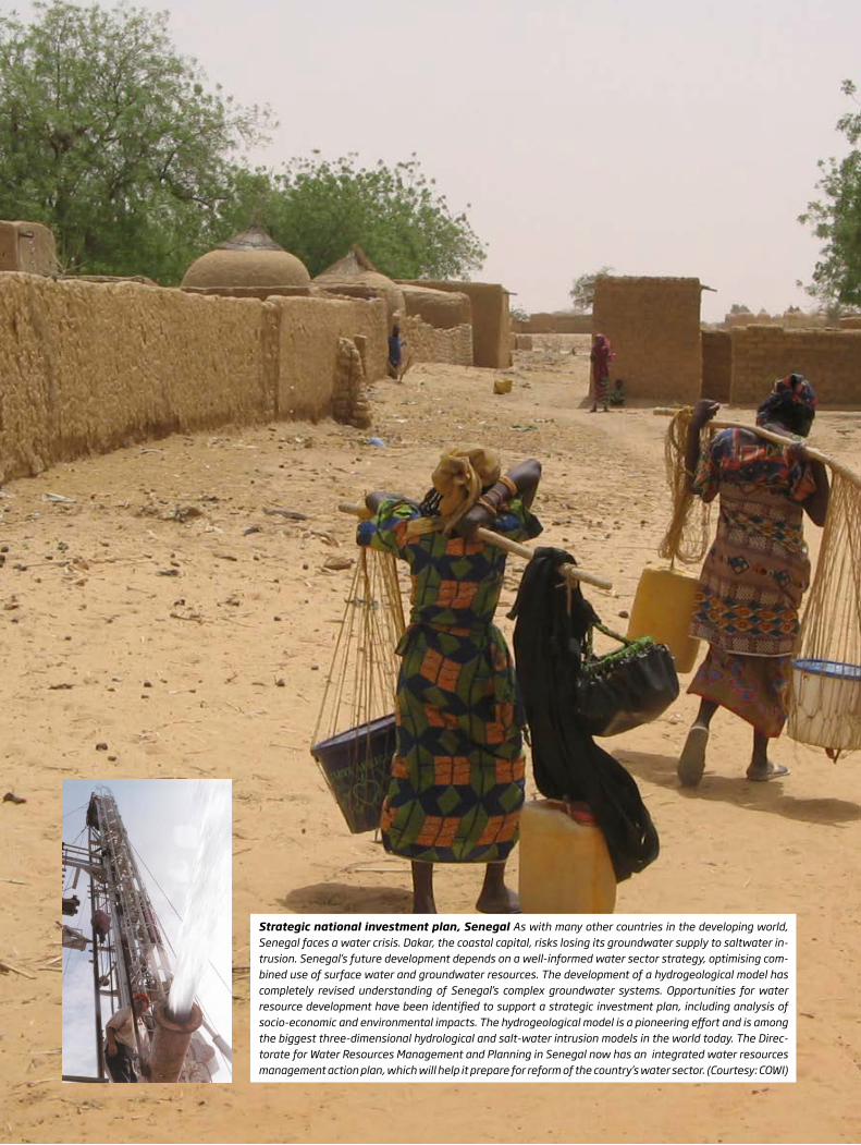
Strategic national investment plan, Senegal As with many other countries in the developing world, Senegal faces a water crisis. Dakar, the coastal capital, risks losing its groundwater supply to saltwater in-trusion. Senegal’s future development depends on a well-informed water sector strategy, optimising com-bined use of surface water and groundwater resources. The development of a hydrogeological model has completely revised understanding of Senegal’s complex groundwater systems. Opportunities for water resource development have been identified to support a strategic investment plan, including analysis of socio-economic and environmental impacts. The hydrogeological model is a pioneering effort and is among the biggest three-dimensional hydrological and salt-water intrusion models in the world today. The Direc-torate for Water Resources Management and Planning in Senegal now has an integrated water resources management action plan, which will help it prepare for reform of the country’s water sector. (Courtesy: COWI)

WHITE PAPER - GROUNDWATER MAPPING AND SUSTAINABLE MANAGEMENT | 4
2. Methods and tools for mapping and hydrogeological modelling
The Danish government’s decision to protect and secure Denmark’s groundwater for future ge nerations has led to new innovative methods and tools that today constitute a proven setup for conducting groundwater mapping on a large scale. Developments include new geophysical mapping methods, a unique geophysical data-base, world-class data processing tools and pro-tocols, and innovative 3D geological modelling software. The advanced methods and tools are scientifically and internationally documented and are continuously being improved through tests and the establishment of new boreholes. Mapping using two data sourcesIn most parts of the world groundwater map-ping is based only on one data source: drilling information. However, low borehole density means that this strategy often leaves many un-certainties in the models. In Denmark, and a few other countries, geophysical measurements are used in conjunction with drilling to map aqui-fers. Intensive, large-scale use of geophysical methods, particularly airborne electromagnetic surveys in an integrated workflow together with drilling, makes mapping results more accu-rate and reliable.
Borehole data contributes significantly when mapping overall geology, but inevitably the density is low and most boreholes are quite shallow. Spatially dense geophysical measure-ments can be used to establish the basis of a hydrogeological model. Strategically located boreholes may then be drilled to confirm the geophysical data. They provide critical infor-
ma tion for translating interpretations of the geophysical data into a geological model. Used together, the two datasets multiply their re-spective descriptive and modelling capabilities.
Two methods, the electrical and the electro-mag netic methods, are particularly useful a mong the geophysical methods since there are strong correlations between both the mea su-red resistivity and the lithology of the subsur-face, and between the resistivity values and water salinity. Thus, airborne mapping with electromagnetic methods provides detailed area- covering input for a geological model of the subsurface, at basin scale. The data density obtained over large areas using airborne sur-veys is many times greater than can be achieved with ground-based surveys, and magnitudes larger than that of drilling surveys.
Transient electromagnetic measurementThe SkyTEM system, developed in Denmark, is recognized as one of the best airborne transient electromagnetic measurement systems in the world, and the only system developed speci fi -cally to meet the high data quality require ments of hydrogeological mapping. Airborne survey methods produce data sets with a high lateral density. Typically, a survey is flown with parallel lines at a distance of 100-500 metres, depen-ding on the target and the complexity of the geo logy. The in-line soun ding distance is typi-
Groundwater model A hydrogeological model is a simplified description of a real geological system. Creating a perfect replica of the geology is impossi-ble using only geological and geophysical surveys and drilling, because a geological system is extremely complicated. But creating a groundwater model, though simplified, can support decision making in groundwater management. The more detailed and precise the in-put data is, the more realistic and useful the calculations of flow and storage of water in the underground system will be. (Courtesy: GEUS).
© GEUS
Airborne data sampling can now generate a detailed 3D-picture of subsurface struc-tures. But just as 3D brain scans require detailed analysis by experts, so airborne geophysics needs analysis and interpretation of data by professionals, in order to fully understand the geology
VERNER SØNDERGAARDResearch Geophysicist
GEUS GEOLOGICAL SURVEYS OF DENMARK AND GREENLAND
WHITE PAPER - GROUNDWATER MAPPING AND SUSTAINABLE MANAGEMENT | 5
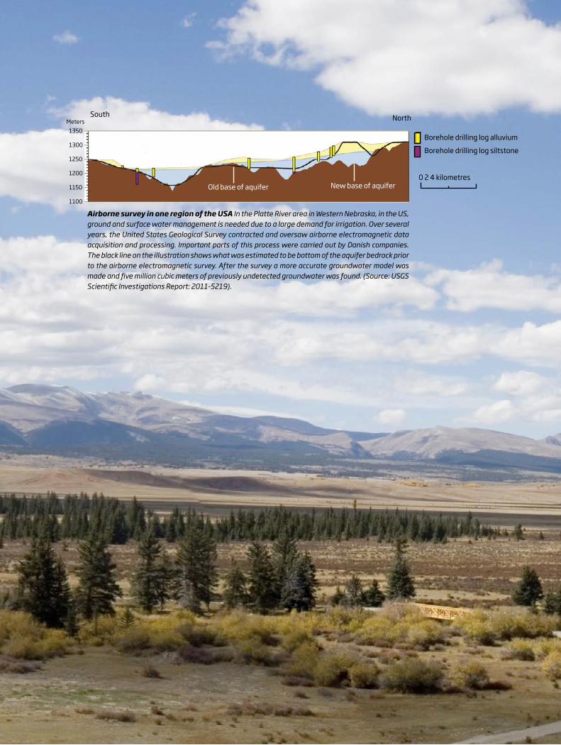
Airborne survey in one region of the USA In the Platte River area in Western Nebraska, in the US, ground and surface water management is needed due to a large demand for irrigation. Over several years, the United States Geological Survey contracted and oversaw airborne electromagnetic data acquisition and processing. Important parts of this process were carried out by Danish companies. The black line on the illustration shows what was estimated to be bottom of the aquifer bedrock prior to the airborne electromagnetic survey. After the survey a more accurate groundwater model was made and five million cubic meters of previously undetected groundwater was found. (Source: USGS Scientific Investigations Report: 2011-5219).
1350
1300
1250
1200
1150
1100
0 2 4 kilometres
Borehole drilling log alluvium
Borehole drilling log siltstone
South North
New base of aquiferOld base of aquifer
Meters

WHITE PAPER - GROUNDWATER MAPPING AND SUSTAINABLE MANAGEMENT | 6
cally 20-40 metres with a depth of investiga-tion around 300 metres below the surface. The standard output is therefore a 3D description of the subsurface, from the surface to a depth of 300 metres, based on hundreds of data points per square kilometre. The quantitative geophy-sical results needed for the hydro geological mo-del are obtained apply ing ri gourous protocols in terms of data acqui sition, processing, inver sion and data integration. Alongside the develop-ment of the SkyTEM system a dedicated data processing, inversion and visualisation sys tem has been built, called the Aarhus Workbench. Other geophysical methodsIn order to improve the models, the airborne measurements are often supplemented by oth-er measures, such as seismic measures to sup-ply detailed structural information not obtained by the airborne methods, or the magnetic reso-nance sounding (MRS). Magnetic resonance sounding measures water content directly, and can distinguish salty groundwater from heavy clay, for example.
Other important mapping methodsGeophysical data is typically supplemented by other data. This includes new boreholes, pump ing tests, groundwater head mapping, water mapping and soil chemistry mapping. New boreholes are drilled in areas where pre-cise knowledge about the geological structure of the groundwater system is lacking. Pumping test analyses give valuable information about the hydrogeological structure of the system. Systematic mapping of the groundwater head is used to determine flow patterns and the inter-
action between multiple aquifer systems and surface water systems. Groundwater chemistry mapping based on water samples from multiple boreholes provides information that can help with groundwater protection and may help shed light on the subsurface structure, thus helping with the interpretation of data from other sources.
ModellingGeological, hydrogeological and hydrological as well as groundwater chemistry models are needed to identify groundwater protection areas , optimum well locations, sustainable wa-ter extraction levels and so on. These models are developed by combining airborne measure-ments, ground-based geophysical measure-ments and data from boreholes using a 3D mod-elling tool. This requires a multitude of skills and the experienced geological modeller combines an understanding of geophysical data, a know-ledge of geological development processes and history, and a practical understanding of the na-ture of rock and soil. To facilitate model building, new geological modelling software has been developed, called GeoScene3D. A consistent, documented and retraceable path leads from the first well drillings and air-borne survey and groundwater chemistry data, through the processing and analysis, to the fi-nal model. It is crucial that the entire workflow, from collection of the electromagnetic meas-urement data to generation of the groundwater model, is carried out to the highest technical level and with the highest possible degree of accuracy, transparency and documentation.
It is our experience that the acquisition of dense, accurate geophysical data, that is followed by rigorous processing procedures, adds valuable information to the existing knowledge of the hydro geology and towards better management of the resources
ANDREA VIEZZOLIDirector
AARHUS GEOPHYSICS
PROTECTING GROUND WATER, 2001
THE COUNTYOF AARHUS
562 564 566 568 572 576
Grundfør
Mundelstrup
Borum
Søften
Trige
Sabro
Hinnerup
1 kmTEM - sonderinger-60-45-30-15
015304560
Tilst
Elevation in metres
Map based on 1400 TEM soundings
Grundfør
City
The prequartenary clay surface
1 kmBoring-60
-45-30-15
015304560
Elevation in metres
Map based on 518 borings
Grundfør
Hinnerup
Grundfør
Trige
Søften
Sabro
MundelstrupCity Tilst
Accuracy of mapping This diagram shows our understanding of the aquifer structures before and after geophysical mapping based on air-borne transient electromagnetic measurement in an area of Denmark. The survey revealed completely unknown aquifers in the area. Fig-ure 1 shows our understanding of the aquifers based solely on well drilling. The dark blue ar-eas are thick aquifers; red colours show areas with no aquifer or a thin aquifer. Figure 2 shows the same area after geophysical mapping by ground based TEM. The revised interpretation shows substantial differences in aquifer loca-tion, which have subsequently been verified by new boreholes. (Courtesy: GEUS).
Figure 1 - Map based on 518 boreholes Figure 2 - Map based on 1,400 TEM soundings
© GEUS© GEUS

WHITE PAPER - GROUNDWATER MAPPING AND SUSTAINABLE MANAGEMENT | 7
Step 2 The Aarhus Workbench software allows geophysicists to turn the SkyTEM raw data into accurate, transparent and well-documented 3D resistivity models of the subsurface, which are the geophysical basis for the groundwater mapping programme. The software is unique, as it was developed specifically for the hydro-geological application of airborne geophysical data. It incorporates tools for applying data processing and modelling protocols to ensure the results meet the quality required in ground-water mapping. (Courtesy: Aarhus Geophysics).
Step 1 The SkyTEM airborne survey system has proved to be an invaluable aid in the large-scale mapping of groundwater resources in Denmark, and other countries, through the detailed mapping of the subsurface resistivity. The system transmits an electromagnetic signal towards the ground, and translates the signal it receives back into a resistivity model. (Courtesy: Aarhus University, HydroGeophysics Group and GEUS).
2
1

WHITE PAPER - GROUNDWATER MAPPING AND SUSTAINABLE MANAGEMENT | 8
Step 3 When the geophysical data has been processed, and interpreted, specific structures in the subsurface can be identified. The task is to identify different layers and structures based on differences in electrical conductivity. Knowledge about the electrical properties of different sediments is crucial to distinguishing the various geophysical structures. This step relies heavily on information from boreholes in the area. Once the structures have been identified, geological mod-elling can be carried out, using the GeoScene3D tool. (Courtesy: GEUS).
Fig. 11
Miocene clay
Miocene silt/sand
Glaciotectonic complex
Clay till
Meltwater sand
Glaciolac. clay
Meltwater sand
Saline groundwater
Miocene clay
Miocene silt/sand
Clay till Meltwater sand
Miocene silt/sand
Saline groundwater
Saline groundwater
Miocene clay
Miocene clay
Meltwater sand
Miocene silt/sand?
Glaciotectonic complex
Paleogene clay
Profile 2
Profile 1 South North
West East
1 10 100Resistivity [Ωm]
1000
0 1000 2000 3000 4000 5000 6000 7000 8000 9000 10000 11000 12000 13000 14000 15000 16000 17000 18000 19000 20000
0 2000 4000 6000 8000 10000 12000 14000 16000 18000 20000 22000 24000 26000 28000 30000 32000
km
km
Step 5 A groundwater model reveals how groundwater flow is determined by geological structures. All the necessary details for the ground water model are exported directly from GeoScene3D into the hydrological modelling software. Calculations of groundwater flow path lines, to mention one example, are completely dependent on the quality of the input from the geological model especially when it comes to more complex subsurface geological structures. An example would be the incised valleys shown in the example here. (Courtesy: GEUS).
Step 4 In GeoScene3D both airborne and bore-hole data is collated in a 3D environment. The geo logist, in collaboration with the hydrogeolo-gist and hydrochemist, can now develop a geolo-gical model for the area being studied. The result is a model that can be used in groundwater flow calculations by applying hydrological modelling software, such as MikeShe, Modflow or FeFlow. (Courtesy: I-GIS).
4
5
3
Source: Jørgensen et al. 2012: Transboundary geo-physical mapping of geological elements and salinity distribution critical for the assessment of future sea water intrusion in response to sea level rise. Hydrology and Earth System Sciences, 1845-1862.
WHITE PAPER - GROUNDWATER MAPPING AND SUSTAINABLE MANAGEMENT | 9
3. Policies and administration of groundwater resources
In order to obtain the best results, groundwater exploitation should always form part of a long term strategy, with sustainable groundwater supply a political priority and with the neces-sary resources allocated. In Denmark, both public and private water consumers pay 0.04 euros per cubic metre of water consumed (0.2 dollars per 1,000 US gallons). This money funds the groundwater mapping and management programme. Public entities have been appoint-ed to ensure that the results of groundwater mapping are used to the best effect, and inter-preted within a wider context.
Administration and managementBefore initiating a groundwater mapping pro-gramme it is important to consider what the re-sults will be used for, and how they will be used
Groundwater mapping is the first step to a stable and sustainable water supply. But mapping requires good data collection and secure data management. More importantly still, there has to be the political will to protect groundwater resources.
JAN REISZHead of National
Groundwater Mapping Office DANISH NATURE AGENCY
in management of the water resources. It is parti cularly important to allocate resources for an administration that will ensure data collec-tion and interpretation, and determine which public authorities will be responsible for the administration.
National databases and standards In order to draw the necessary conclusions from survey data, the data must be available, reliable and accurate. National databases are essential for storing data and results securely. If they are made easily accessible they can also be of great value in the future. Data has to be stored in a well-documented and consistent manner. Uni-form standards and guidelines exist and should be referred to, to ensure the quality of the data before it is put into the databases.
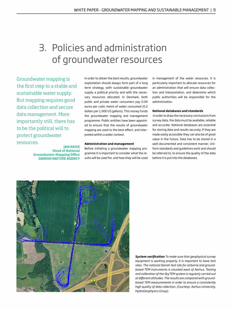
System verification To make sure that geophysical survey equipment is working properly, it is important to have test sites. The national Danish test site for airborne and ground-based TEM instruments is situated west of Aarhus. Testing and calibration of the SkyTEM system is regularly carried out at different altitudes. The results are compared with ground-based TEM measurements in order to ensure a consistently high quality of data collection. (Courtesy: Aarhus University, HydroGeophysics Group).

WHITE PAPER - GROUNDWATER MAPPING AND SUSTAINABLE MANAGEMENT | 10
The Danish Government has prioritised data se-curity ever since initiating the national ground-water mapping programme in 1998. GEUS Geological Surveys of Denmark and Greenland has established national databases for all geo-physical data, data from both pre-existing and new wells, water chemistry and hydraulic data. Uniform standards and guidelines are in place to ensure that the primary data is comparable and quality assured. This is essential for further pro-cessing of the data. In addition, databases for the geological and hydrogeological models, and for all reports on groundwater mapping, have been developed. A set of integrated software products, making the data easily available and the data processing uniform, has been devel-oped in Denmark and supports efficiency.
A close and professional collaboration between public authorities, universities and consulting companies means that Denmark has developed excellentexpertise in sustainable groundwater supply
PETER THOMSENProject Manager and Geophysicist
RAMBØLL
Groundwater: a political priorityEffective use of data is essential for successful groundwater mapping, but interpretion of data alone is not enough. The results of ground-water mapping must eventually be used for the management and protection of aquifers. This requires that groundwater be placed higher on the political agenda and that administrative units, responsible for the future use of mapping results, be designated. Public entities should also be designated to monitor the groundwater resources that have been mapped and ensure that they are protected.
National pilot study, Thailand In 2011, the Thai Government initiated a pilot study about 350 km north of Bangkok led by the Department of Ground-water Resources. The aim of the study was to map aquifers in a test area of 1000 square kilometres with assistance, knowledge transfer and training in geological modelling contributed by the Danish engineering and software companies EnviDan, SkyTEM Surveys and I-GIS along with GEUS. GEUS also assisted with the supply and implementation of a geophysical database.

WHITE PAPER - GROUNDWATER MAPPING AND SUSTAINABLE MANAGEMENT | 11
Regional mapping, Malaysia New technology makes it possible to map water and minerals from the air. In Southeast Asia, in Malaysia, airborne technology has been used for very large geophysical surveys of groundwater. These involved flying over 15,000 kilometres (9,000 miles) in 30-40 kilometres (18-25 miles) long parallel tracks, cove ring an area of 3,000 square kilo metres (1,100 square miles). Several Danish com-panies worked together in order to carry out drilling, down hole logging, water-quality testing, well field design, geological and hydrological modelling. The survey revealed a potential source of 500 million litres of groundwater per day (130 million US gallons). (Courtesy: SkyTEM Surveys and EnviDan International).
WHITE PAPER - GROUNDWATER MAPPING AND SUSTAINABLE MANAGEMENT | 12
A key argument for using groundwater — be-sides the obvious argument of there being a shortage of surface water — is that ground water is better protected from contamination than surface water. The quality is higher and the water requires less treatment. It is important to take care that aquifers do not get contaminat-ed, which can lead to high clean up costs. Other-wise, in many places, using groundwater can be economically beneficial and secure a safe and stable water supply across both public and com-mercial sectors.
Postponing investments There are potential financial benefits for wa-ter utilities who supplement a water supply based on surface water resources with new ground water resources. They may be better able to plan long term. They may also be able to postpone major investments in surface wa-ter infrastructure, or in assuring a higher level of water security. The treatment process for ground water is simpler and cheaper compared with that for surface water, and increasing the volume of supply is much easier, since there is no need to build dams.
4. The benefits of investing in groundwater supply
Addressing the needs of industry Groundwater mapping and sustainable ground-water management provide better knowledge of the availability of water resources, a critical factor in attracting new companies and indus-try. Companies can benefit from improved water efficiency, better water quality and supply se-curity. Mines, the food and beverage industries and the agricultural sector often fight over wa-ter with other sectors or groups. Groundwater may provide the solution. Moreover, ground-water extraction leaves a smaller footprint on the environment if managed properly. All of the above contribute to boosting economic growth.
Knowledge transfer to local partnersInvestment in groundwater mapping and su-stain able water management has the addition-al benefit for local business partners of teach-ing them new skills. The Danish experience of coope rating with other countries is that know-ledge transfer from international experts crea-tes a strong platform for expanding the local water business to other regions.
Groundwater can provide a stable supply of water for industry. If used sustainably, groundwater can contribute positively to economic growth and development
JENS DYRBERGProject Manager
ENVIDAN INTERNATIONAL
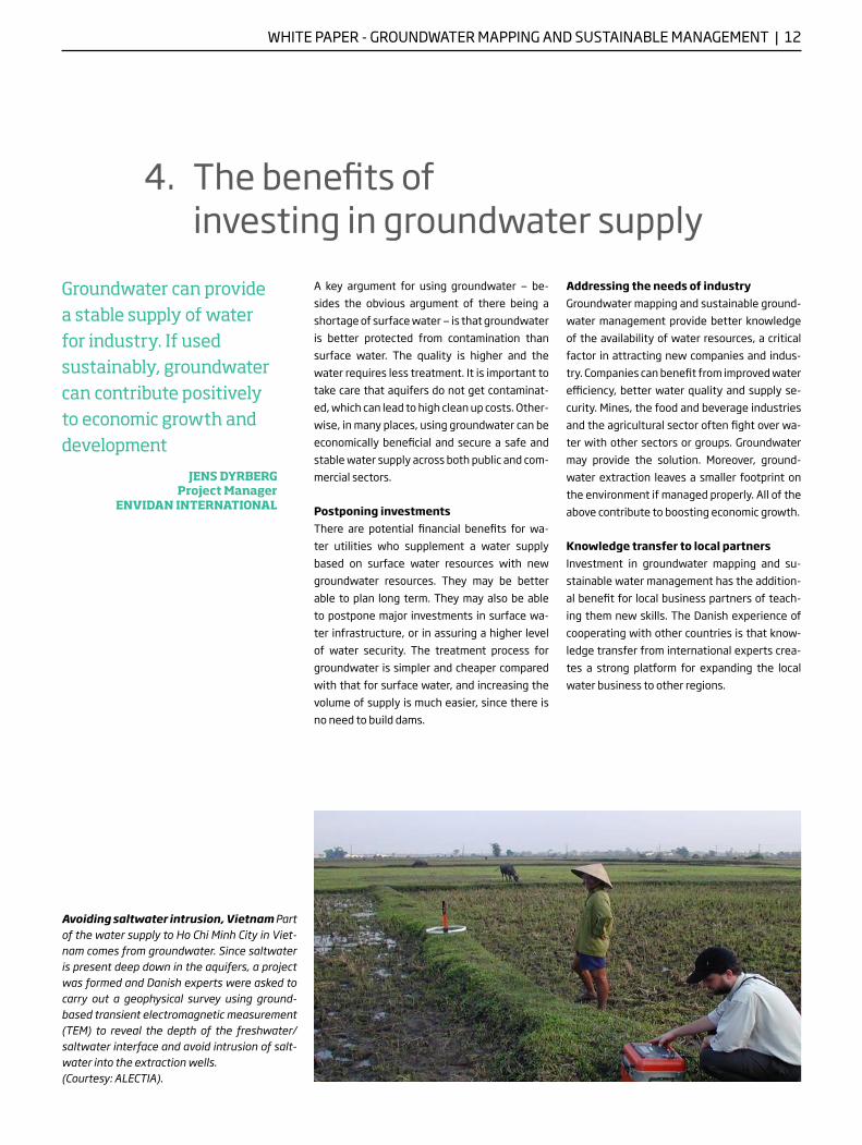
Avoiding saltwater intrusion, Vietnam Part of the water supply to Ho Chi Minh City in Viet-nam comes from groundwater. Since saltwater is present deep down in the aquifers, a project was formed and Danish experts were asked to carry out a geophysical survey using ground-based transient electromagnetic measure ment (TEM) to reveal the depth of the freshwater/saltwater interface and avoid intrusion of salt-water into the extraction wells. (Courtesy: ALECTIA).
WHITE PAPER - GROUNDWATER MAPPING AND SUSTAINABLE MANAGEMENT | 13
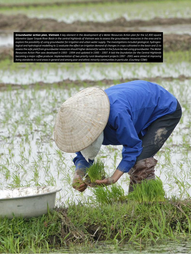
Groundwater action plan, Vietnam A key element in the development of a Water Resources Action plan for the 12,300 square kilometre Upper Srepok River Basin in the central highlands of Vietnam was to assess the groundwater resources in the area and to explore the possibility of using groundwater for irrigation and urban water supply. The investigations included geological, hydrogeo-logical and hydrological modelling to 1) evaluate the effect on irrigation demand of changes in crops cultivated in the basin and 2) to assess the safe yield from groundwater resources should higher demand for water in the future be met using groundwater. The Water Resources Action Plan was developed in 1993 - 1994 and updated in 1995 – 1997. It laid the foundation for the Central Highlands becoming a major coffee producer. Implementation of two priority rural development projects 1997 - 2001 were aimed at improving living standards in rural areas in general and among poor and ethnic minority communities in particular. (Courtesy: COWI)

WHITE PAPER - GROUNDWATER MAPPING AND SUSTAINABLE MANAGEMENT | 14
Abstraction well B4 and monitoring well 99.257, Beder
Metres above sea level
120
100
80
60
40
20
0
20
18
16
14
12
10
0
2
4
6
8
Sulphate mg/l
Water level
1968 1973 1978 1984 1989 1995 2000 2006 2011 2017
Sulphatemg/l
Ground waterlevel
Sulphatecontent
Guide value 50 mg/l
Max. admissible value 250 mg/l
Source: Aarhus Water, GEUS.
5. Avoiding problems with groundwater
It only takes a few contaminants and/or an unbalanced approach to utilisation for ground-water resources to be damaged forever. Some of the critical issues can be resolved through accurate groundwater mapping, sustainable groundwater management and with integrated management of water resources.
Here are some of the main challenges and how they can be resolved:
— Saltwater intrusion can be avoided by map-ping the freshwater and groundwater inter-face and by revealing previously undetected freshwater aquifers in coastal areas
— Land subsidence in cities is a risk that can be addressed by tapping into groundwater re-sources outside cities. This ensures that well fields are located in more remote areas or in areas less vulnerable to land subsidence
Problems associated with groundwater exploitation can often be resolved with accurate groundwater mapping and sustainable management.
FLEMMING PEDERSENHead of Department, Geophysicist
ALECTIA
Sustainable yield, Denmark The capacity of a water pumping station in Beder in Denmark was originally calculated using traditional hy-drogeological analysis of the borehole data, combined with a short-term pumping test. These methods provided an incomplete un-derstanding of the complexity of the aquifer dynamics, and as a result the capacity of the pumping station was overestimated. After pumping began in 1968 the water table fell by over 10 metres and the sulphate concentra-tion increased. Based on advanced geophysical mapping and 3D hydrological modelling the sus-tainable yield estimate was reduced in 1990 by 35 percent. The water table has now risen to a sustainable level and the sulphate content has stabilised. (Courtesy: GEUS)
— Poor water quality can be an issue, even with groundwater. Groundwater mapping means that better decisions can be taken on where and how deep to sink wells, away from pollu-tants or poor natural chemistry
— Even if previous wells have yielded disap-pointing results, improved mapping can lead to better well locations, revealing a potential for successful wells
— Poor administration of groundwater resour-ces may have caused severe problems in the past. Better knowledge about aquifers pro-vides the basis for implementing the neces-sary administrative structure
— If faced with a deteriorating quality in exist-ing wells, groundwater mapping and model-ling can improve understanding. It can create a platform for sustainable exploitation of the groundwater resource in the future

WHITE PAPER - GROUNDWATER MAPPING AND SUSTAINABLE MANAGEMENT | 15
arid environments artificial recharge of aquifers at farm scale or at aquifer storage and recovery sites (ASR) may be a feasible solution. However, at the risk of polluting the aquifer unless ad-equate precautions are taken.
Integrated planning and managementIntegrated Water Resources Management, IWRM, is an accepted framework for water planning and water resource management. It encourages a holistic, multi-sector, participa-tory process focusing on river catchments and shared use of water. Groundwater development and exploitation should be viewed in this overall context. IWRM is a process, which according to Global Water Partnership — a network founded in 1996 to foster integrated water resource management — “promotes the coordinated de-velopment and management of water, land, and related resources, in order to maximize the resultant economic and social benefits in an equit able manner without compromising the sustainability of vital ecosystems”. This includes more coordinated development and management of land and water, surface water
Groundwater is an important part of the hydro-logical cycle. Groundwater is interconnected with surface water and form one resource; hence groundwater and surface water should be managed together in river catchments. Ground-water use must therefore be evaluated with re-spect to its impact on both surface water (e.g. wetland and stream depletion) and the aquifer. Also, the risk of salinity intrusion in river deltas and coastal areas increases with groundwater pumping as flow between aquifers and surface water bodies are altered. Groundwater protec-tion and contamination control is closely con-nected to surface activities and land use man-agement.
Assuring sustainable groundwater use Making reliable recharge estimates for aquifers requires a geological model and the assessment of distributed hydrogeological properties. It also involves accounting for the interaction be-tween surface water and groundwater. Balan-cing groundwater recharge against ground-water abstraction is essential to achieving sustainable groundwater use. In water scarce,
6. Groundwater as a part of integrated water resources management
Sustainable groundwater developmentIllustration of sustainable groundwater man-agement balancing recharge and water use (modified from Hiscock, K.M., Rivett, M.O. & Davison, R.M. 2002, Sustainable Groundwater development).
Artificial Recharge (irrigation losses,
wastewater returns)
Natural Recharge (excess rainfall, surface
water seepage)
Aquifer Storage (groundwater resource)
SUSTAINABLE GROUNDWATER DEVELOPMENT
Indirect Recharge (aquitard leakage,
cross-formational flow)
Water for development (agriculture & industry)
Water for the environment (Springs, surface water, wetlands, coastal zone)
Water for People(drinking water & Sanitation
and livelihood)
Economic Benefits Human BenefitsEnvironmental Benefits
Groundwater can be ex ploi ted across large areas to meet local demand and affordability. In a healthy aquifer it can be transported over huge distances free of charge and without evapo-ration losses. However, balancing recharge against abstraction is essential.
ANDERS REFSGAARDProject and Market Director
COWI

WHITE PAPER - GROUNDWATER MAPPING AND SUSTAINABLE MANAGEMENT | 16
and groundwater, the river basin and its adja-cent coastal, marine environment and upstream and downstream interests. However, integrated water resources management is not just about managing physical resources and developing appropriate management instruments, it is also about (i) creating an enabling environment with supporting policies, legislative framework and attractive financing and incentive structure and (ii) defining institutional roles including creating institutional roles and building organisational capacities. At its simplest, IWRM is a logical and appealing concept. It is based on the idea that the many different uses of water resources are interdependent.
Avoiding an unsustainable approachIn many countries, the need for groundwater has increased in response to overexploitation and contamination of surface water resources. As the groundwater table has fallen, wells have been deepened, leading to continued ground-water mining. Signs of an imbalance and un-
sustainable water use initially become visible in dry years, in the form of dried-out wells, river beds and wetlands. Continued extraction will eventually reach a level from which it will take decades to recover at low natural recharge rates. As the cost of pumping increases with depth, the alternative may be to move well fields to newly developed aquifers and invest in pipelines. The result is often insufficient, ineffi-cient or costly water supply, which has profound impacts on production and livelihood.
Shortfalls, water stress and unreliable supply are likely to become increasingly common with climate change. The higher population pressure underscores the need to address both present problems and future scenarios. Appropriate groundwater management, monitoring and regulation from a solid knowledge base are part of the solution. Acknowledging the integrated nature of water resources will help secure both the resource and any investments in water in-frastructure in the long term.
Comprehensive water management Along the coast of Eastern China, between Weifang and Yantai, the water supply from groundwater is under threat. An unsustainable level of pumping has led to severe problems in relation to both the water quantity and quality. This has had a negative impact on both regional economic development and the environment. Progressive intrusion of seawater into the aquifer has been observed during recent decades with elevated salinity concentrations now extending more than 10 km from the coastline. Attempts to artificially increase the groundwater re-charge from surface water reservoirs have not effectively pushed back the interface between fresh and saline water. A comprehensive water manage-ment project was undertaken and different management scenarios were analysed. Results showed that the salinity intrusion could be counteracted by adjusting re¬charge and pumping levels by 25 percent of the current levels, thereby avoiding high salinity concentrations at city well fields. In this work the MIKE software developed DHI is an important tool for integrated surface water and groundwater modelling and in assessing groundwater resources and impacts. DHI integrated management modelling concepts was implemented using FEFLOW, MIKE SHE and MIKE11. (Courtesy: DHI).
A growing demand for water from agriculture and industry places stress on freshwater resources. Groundwater exploitation must form part of an integrated water manage-ment plan
TORSTEN V. JACOBSENHydrologist, DHI

WHITE PAPER - GROUNDWATER MAPPING AND SUSTAINABLE MANAGEMENT | 18
Geographically, Denmark may be only a tiny speck in the Northern Hemisphere, but our countryhas one of the world’s longest coastlines and it is the world’s largest shipping nation. The water in the harbour of our capital, Copenhagen, is so clean that people swim in it, and our tap water is as pure as the fi nest spring water.
Our knowledge about water is no coincidence. It began long ago, when we as Vikings spread fear and terror across the seas. Today, we want to spread something entirely diff erent: know ledge and collaboration on how to improve water safety and water effi ciency.
Denmark knows waterDenmark is not physically powerful, but we be-lieve that knowledge is power. We know about water effi ciency, because successive govern-ments have addressed our country’s limited natu ral resources, concentrating on using them effi ciently. As a nation we are known for our ability to collaborate and for the fact that we strive to provide a safe, pleasant and healthy environment for people to live in.
Knowledge transfer for mutual benefi tOur expertise is in helping customers and stake -holders reach safe and eff ective water solu tions ,while developing their ability to profi t from that knowledge in turn. We do our work while main-taining a healthy respect for diff e rent perspec-tives and agendas, as well as for the environ-ment. As a country, we see great opportunity for mutual benefi t in the transfer of knowledge and the growth in both partners’ business.
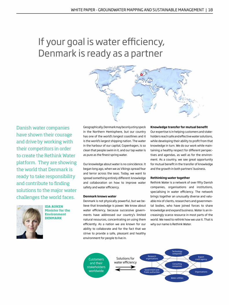
Rethinking water togetherRethink Water is a network of over fi fty Danishcompanies, organisations and institutions, spe cialising in water effi ciency. The network brings together an unusually diverse and valu-able mix of clients, researchers and governmen-tal bodies , who have joined forces to share know ledge and expand business. Water is an in-creasingly scarce resource in most parts of the world. We need to rethink how we use it. That is why our name is Rethink Water.
Customers and their
stakeholders worldwide
Consulting companies
Water utilities
Government and Public authorities Organisations
Technology companies
Export credit agency
Danish water companies have shown their courage and drive by working with their competitors in order to create the Rethink Water platform. They are showing the world that Denmark is ready to take responsibility and contribute to fi nding solutions to the major water challenges the world faces.
Research organisations
IDA AUKEN Minister for the EnvironmentDENMARK
If your goal is water effi ciency, Denmark is ready as a partner
Solutions for water effi ciency
WHITE PAPER - URBAN WATER | 1
BW Negative Logo / State of Green
GreyC - M 0 - Y - K 10
DarkC 0 - M 0 - Y 0 - K 0
Consulting companies Alectia alectia.com Bonnerup Consult bonnerup.net COWI cowi.com EnviDan envidan.com Gromtmij grontmij.dk Moe & Brødsgaard moe.dk Orbicon orbicon.com NIRAS niras.com Rambøll ramboll.com TREDJE NATUR tredjenatur.dk Øllgaard ollgaard.dk
Technology companies Adept Water Technology adeptwatertech.com Aquaporin aquaporin.dk AVK avkvalves.com Billund Aquaculture billund-aqua.dk Biokube biokube.com Danish Rootzone Technology rootzone.dk EcoBeta ecobeta.com Freewater freewater.dk Grundfos grundfos.com HOH BWT hoh.com I -GIS i-gis.dk LiqTech International liqtech.com MJK Automation mjk.com Mycometer mycometer.com NOV Flexibles nov.com/fps Novozymes novozymes.com OxyGuard International oxyguard.com PROAGRIA Environment proagria.dk Robotek robotek.dk Scandinavian No-Dig Centre no-dig.dk Siemens siemens.com/energy/aeration Silhorko-Eurowater eurowater.com SkyTEM Surveys skytem.com Stjernholm stjernholm.dk UltraAqua ultraaqua.com Wavin wavin.com Aarhus Geophysics aarhusgeo.com Per Aarsleff aarsleff .com
Research institutes & demonstration projects Danish Technological Institute teknologisk.dk DHI dhigroup.com Geological Surveys of Denmark and Greenland geus.dk Kalundborg Industrial Water Demonstration Site symbiosis.dk
Water utilities Greater Copenhagen Utility hofor.dk VCS Denmark vcsdenmark.com North Water nordvand.dk Aarhus Water aarhusvand.dk
Organisations related to water Copenhagen Cleantech Cluster cphcleantech.com Confederation of Danish Industry di.dk Danish Water Technology Group dk-water.com Danish Water and Wastewater Association danva.dk Danish Water Forum danishwaterforum.dk Danish Water Services danishwater.dk State of Green Consortium stateofgreen.com Water In Urban Areas Network waterinurbanareas.dk
Governmental bodies & other sponsors City of Copenhagen kk.dk Capital Region of Denmark regionh.dk Danish Trade Council um.dk Danish Ministry of the Environment mim.dk Danish Nature Agency naturstyrelsen.dk The Branding Denmark Fund mfonden.dk
Find more white papers, learn more about the Rethink Water network and get in touch with us at:
www.rethinkwater.dk