hurricanes by:caroline mccormack laura mals nick chignoli erin rembold
TRANSCRIPT
HurricanesHurricanes
By:Caroline McCormackBy:Caroline McCormackLaura MalsLaura Mals
Nick ChignoliNick ChignoliErin RemboldErin Rembold

ERER
The Birth of a Tropical CycloneThe Birth of a Tropical CycloneA Tropical Cyclone forms and A Tropical Cyclone forms and strengthens when these three strengthens when these three conditions occur:conditions occur:
– A Pre-existing disturbance with A Pre-existing disturbance with thunderstormsthunderstorms
– Warm (at least 80 degrees Fahrenheit) Warm (at least 80 degrees Fahrenheit) ocean temperatures to a depth of ocean temperatures to a depth of about 150 feetabout 150 feet
– Light upper level winds that do not Light upper level winds that do not change much in direction and speed change much in direction and speed throughout the depth of the throughout the depth of the atmosphere (low wind shear)atmosphere (low wind shear)
Heat and energy are gathered by the Heat and energy are gathered by the disturbance through contact with the disturbance through contact with the warm ocean waters. warm ocean waters. The winds near the ocean surface The winds near the ocean surface spiral into a low pressure area.spiral into a low pressure area.Warm ocean waters add moisture and Warm ocean waters add moisture and heat to the rising air, which adds heat to the rising air, which adds energy to power the storm. energy to power the storm.
ERER
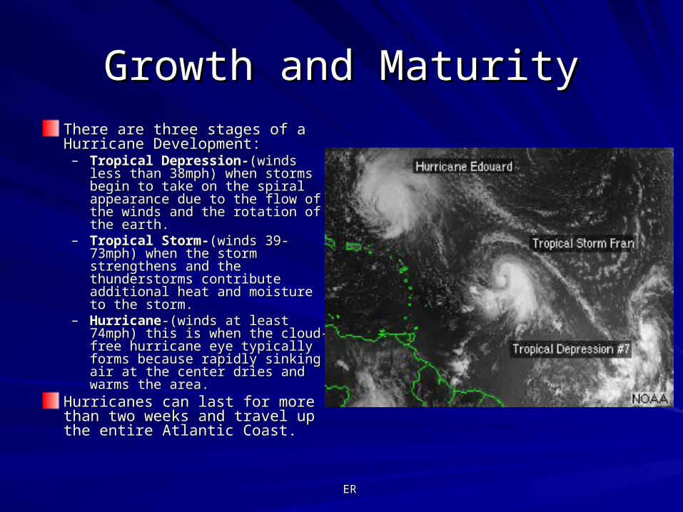
Growth and MaturityGrowth and MaturityThere are three stages of a There are three stages of a Hurricane Development:Hurricane Development:– Tropical Depression-Tropical Depression-(winds less (winds less
than 38mph) when storms begin than 38mph) when storms begin to take on the spiral appearance to take on the spiral appearance due to the flow of the winds and due to the flow of the winds and the rotation of the earth.the rotation of the earth.
– Tropical Storm-Tropical Storm-(winds 39-(winds 39-73mph) when the storm 73mph) when the storm strengthens and the strengthens and the thunderstorms contribute thunderstorms contribute additional heat and moisture to the additional heat and moisture to the storm.storm.
– HurricaneHurricane-(winds at least 74mph) -(winds at least 74mph) this is when the cloud-free this is when the cloud-free hurricane eye typically forms hurricane eye typically forms because rapidly sinking air at the because rapidly sinking air at the center dries and warms the area. center dries and warms the area.
Hurricanes can last for more than Hurricanes can last for more than two weeks and travel up the entire two weeks and travel up the entire Atlantic Coast.Atlantic Coast.
ERER
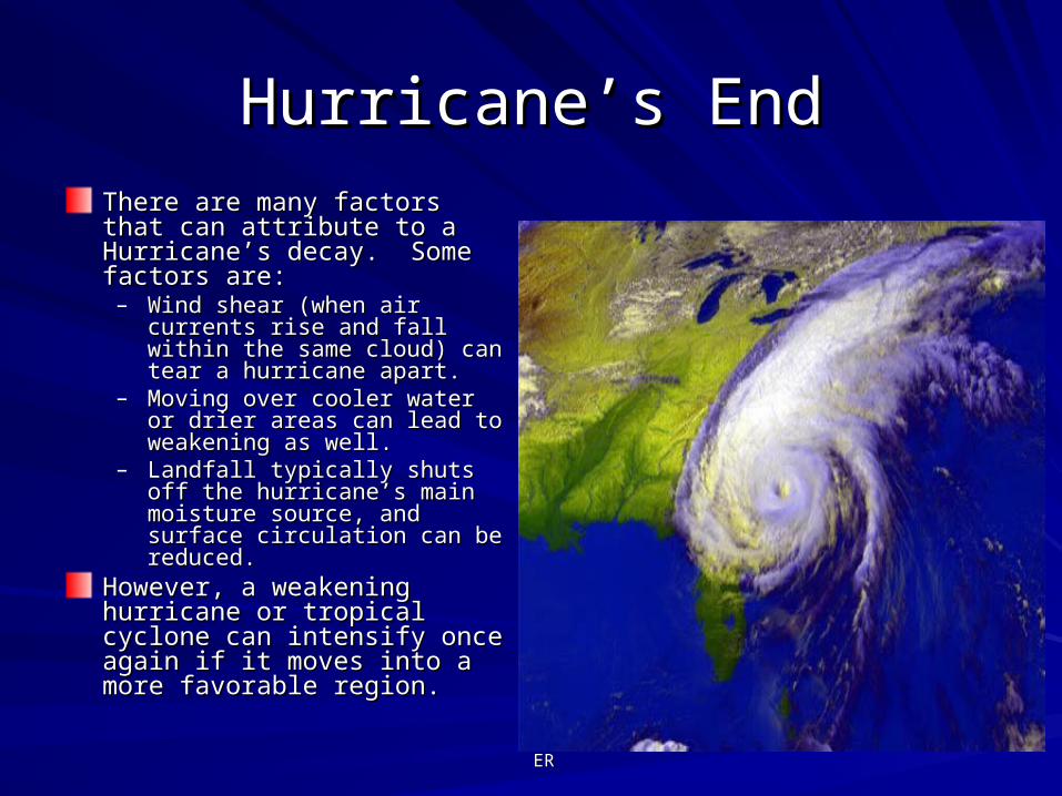
Hurricane’s EndHurricane’s EndThere are many factors that can There are many factors that can attribute to a Hurricane’s decay. attribute to a Hurricane’s decay. Some factors are:Some factors are:– Wind shear (when air currents rise Wind shear (when air currents rise
and fall within the same cloud) can and fall within the same cloud) can tear a hurricane apart.tear a hurricane apart.
– Moving over cooler water or drier Moving over cooler water or drier areas can lead to weakening as areas can lead to weakening as well.well.
– Landfall typically shuts off the Landfall typically shuts off the hurricane’s main moisture source, hurricane’s main moisture source, and surface circulation can be and surface circulation can be reduced.reduced.
However, a weakening hurricane However, a weakening hurricane or tropical cyclone can intensify or tropical cyclone can intensify once again if it moves into a more once again if it moves into a more favorable region. favorable region.
ERER
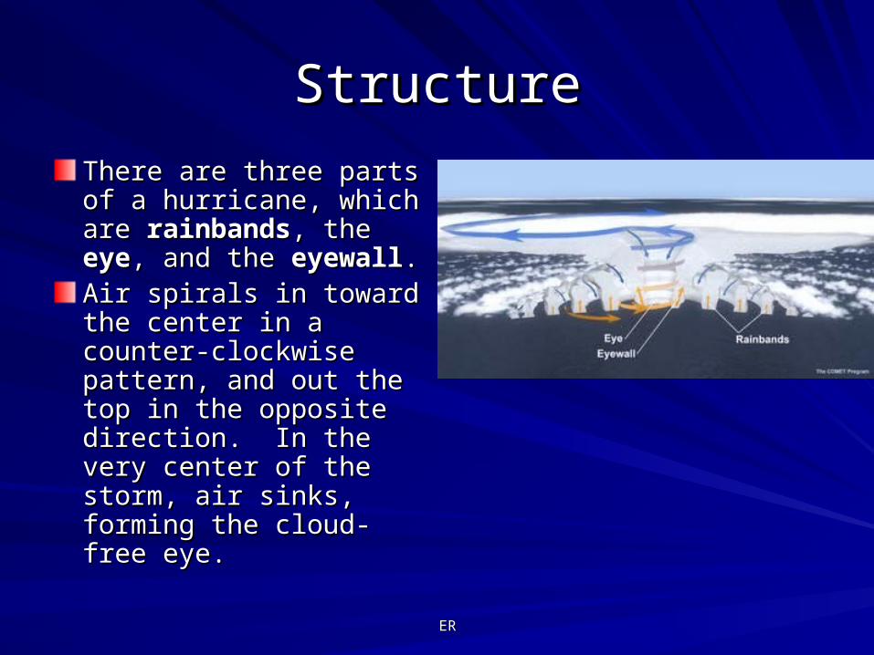
StructureStructure
There are three parts of a There are three parts of a hurricane, which are hurricane, which are rainbandsrainbands, the , the eyeeye, and , and the the eyewalleyewall..Air spirals in toward the Air spirals in toward the center in a counter-center in a counter-clockwise pattern, and clockwise pattern, and out the top in the opposite out the top in the opposite direction. In the very direction. In the very center of the storm, air center of the storm, air sinks, forming the cloud-sinks, forming the cloud-free eye. free eye.
ERER
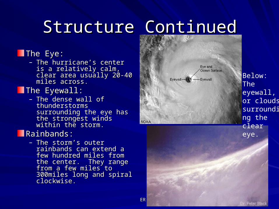
Structure ContinuedStructure Continued
The Eye:The Eye:– The hurricane’s center is a The hurricane’s center is a
relatively calm, clear area relatively calm, clear area usually 20-40 miles across.usually 20-40 miles across.
The Eyewall:The Eyewall:– The dense wall of The dense wall of
thunderstorms surrounding thunderstorms surrounding the eye has the strongest the eye has the strongest winds within the storm. winds within the storm.
Rainbands:Rainbands:– The storm’s outer The storm’s outer
rainbands can extend a few rainbands can extend a few hundred miles from the hundred miles from the center. They range from a center. They range from a few miles to 300miles long few miles to 300miles long and spiral clockwise. and spiral clockwise.
Below: The eyewall, or clouds surrounding the clear eye.

ERER
Where Hurricanes FormWhere Hurricanes FormThe map to the right shows places The map to the right shows places throughout the world where throughout the world where tropical cyclones originate.tropical cyclones originate.At the equator, ocean surface At the equator, ocean surface temperatures are warm enough to temperatures are warm enough to produce hurricanes, but none produce hurricanes, but none form. This is because there is not form. This is because there is not enough coriolis force (air or water enough coriolis force (air or water currents caused by the rotation of currents caused by the rotation of the Earth) to create spin and the Earth) to create spin and induce a potential hurricane. induce a potential hurricane. They are most commonly found in They are most commonly found in the northern hemisphere, but can the northern hemisphere, but can also be produced in the Pacific also be produced in the Pacific and Indian Oceans in the southern and Indian Oceans in the southern hemisphere. Note: In other parts hemisphere. Note: In other parts of the world a Hurricane is also of the world a Hurricane is also known as a typhoon, tempest, or a known as a typhoon, tempest, or a monsoon.monsoon.
LMLM
Who Tracks Hurricanes?Who Tracks Hurricanes?
The National Hurricane The National Hurricane Center (NHC) Center (NHC) Located in Miami, FloridaLocated in Miami, FloridaTracks Tropical cyclones Tracks Tropical cyclones from the tropical from the tropical depression stage through depression stage through the hurricane stage over the hurricane stage over the following areas:the following areas:North Atlantic OceanNorth Atlantic OceanCaribbean SeaCaribbean SeaGulf of MexicoGulf of MexicoEastern Pacific OceanEastern Pacific Ocean

LMLM
How Does NHC Track Hurricanes?How Does NHC Track Hurricanes?
To forecast the track and To forecast the track and intensity of tropical cyclones, intensity of tropical cyclones, NHC uses mathematical NHC uses mathematical computer models. computer models. Models – represent tropical Models – represent tropical cyclone and its environment.cyclone and its environment.Computers – forecast the Computers – forecast the future motion and intensity of future motion and intensity of a cyclonea cycloneHurricane Forecasters – Hurricane Forecasters – interpret model results to interpret model results to arrive at a final track and arrive at a final track and intensity forecastintensity forecast
LMLM
What Models are Used to Forecast What Models are Used to Forecast Hurricanes?Hurricanes?
The mathematical models used at NHC are of three The mathematical models used at NHC are of three basic types: basic types: Statistical – Uses current information about hurricanes Statistical – Uses current information about hurricanes and comparing it to historical knowledge.and comparing it to historical knowledge.Dynamical – Uses results of global atmospheric model Dynamical – Uses results of global atmospheric model forecasts; Takes current wind, temperature, pressure forecasts; Takes current wind, temperature, pressure and humidity observations and make forecasts on the and humidity observations and make forecasts on the atmosphere.atmosphere.Combination (Statistical and Dynamical together) – Combination (Statistical and Dynamical together) – Dynamical models ignore the behavior or historical Dynamical models ignore the behavior or historical storms, thus combination models were constructed to storms, thus combination models were constructed to capitalize on the strength of both the statistical and capitalize on the strength of both the statistical and dynamical models.dynamical models.

LMLM
When & How Do They Warn When & How Do They Warn People at Risk?People at Risk?
A hurricane watch is issued A hurricane watch is issued when there is a threat of when there is a threat of hurricane conditions within hurricane conditions within 24-36 hours. 24-36 hours. A hurricane warning is issued A hurricane warning is issued when hurricane conditions when hurricane conditions (winds of 74 miles per hour or (winds of 74 miles per hour or greater, or dangerously high greater, or dangerously high water and rough seas) are water and rough seas) are expected in 24 hours or less.expected in 24 hours or less.They make announcements They make announcements and provide official and provide official instructions through radio instructions through radio broadcasts and television broadcasts and television reports. reports.
LMLM
Emergency OfficialsEmergency OfficialsEmergency OfficialsEmergency Officials
LMLM
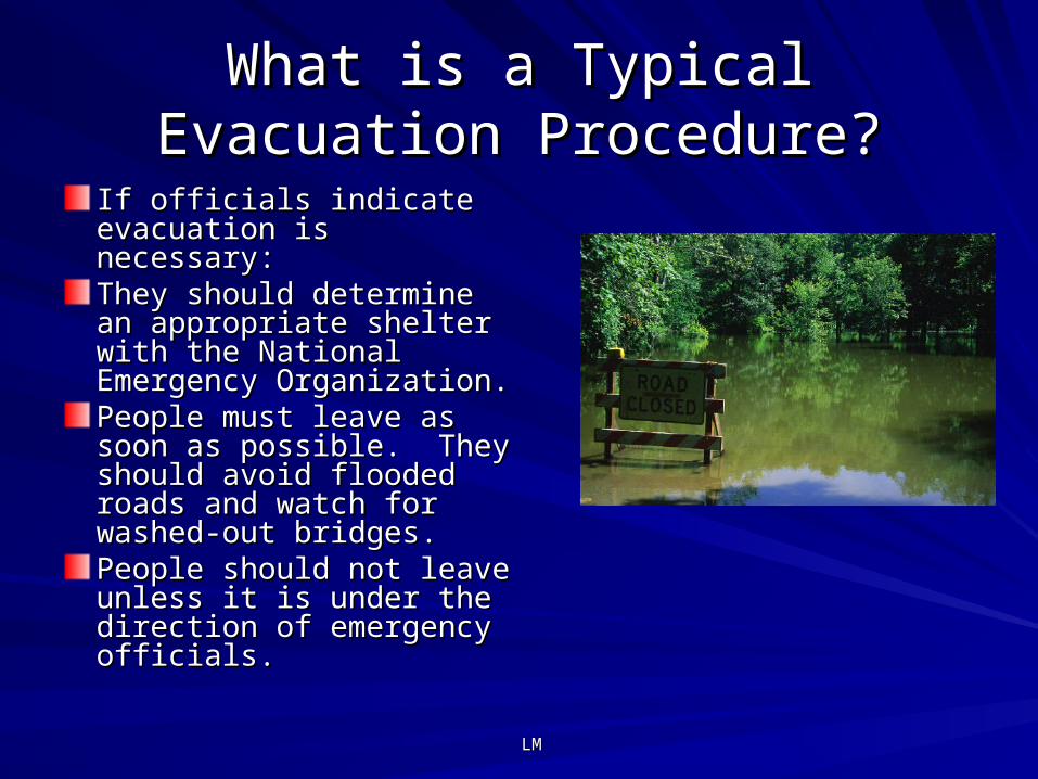
What is a Typical Evacuation What is a Typical Evacuation Procedure?Procedure?
If officials indicate If officials indicate evacuation is necessary:evacuation is necessary:They should determine an They should determine an appropriate shelter with the appropriate shelter with the National Emergency National Emergency Organization.Organization.People must leave as soon People must leave as soon as possible. They should as possible. They should avoid flooded roads and avoid flooded roads and watch for washed-out watch for washed-out bridges. bridges. People should not leave People should not leave unless it is under the unless it is under the direction of emergency direction of emergency officials.officials.
NCNC
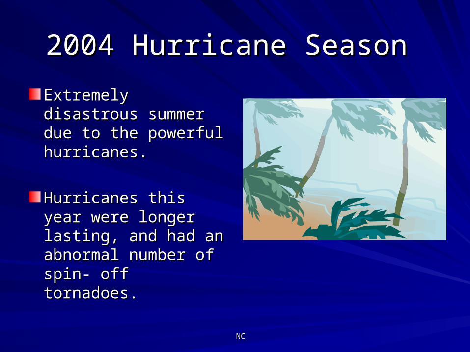
2004 Hurricane Season 2004 Hurricane Season
Extremely disastrous Extremely disastrous summer due to the summer due to the powerful hurricanes.powerful hurricanes.
Hurricanes this year Hurricanes this year were longer lasting, were longer lasting, and had an abnormal and had an abnormal number of spin- off number of spin- off tornadoes.tornadoes.
NCNC
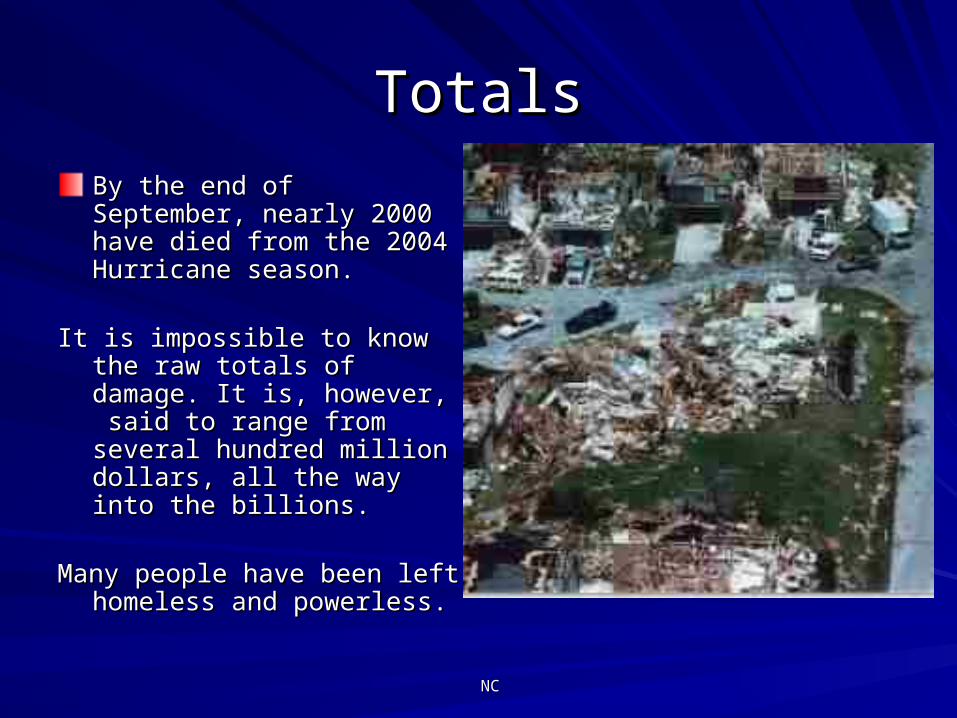
TotalsTotals
By the end of September, By the end of September, nearly 2000 have died from the nearly 2000 have died from the 2004 Hurricane season.2004 Hurricane season.
It is impossible to know the raw It is impossible to know the raw totals of damage. It is, totals of damage. It is, however, said to range from however, said to range from several hundred million dollars, several hundred million dollars, all the way into the billions.all the way into the billions.
Many people have been left Many people have been left homeless and powerless.homeless and powerless.
NCNC
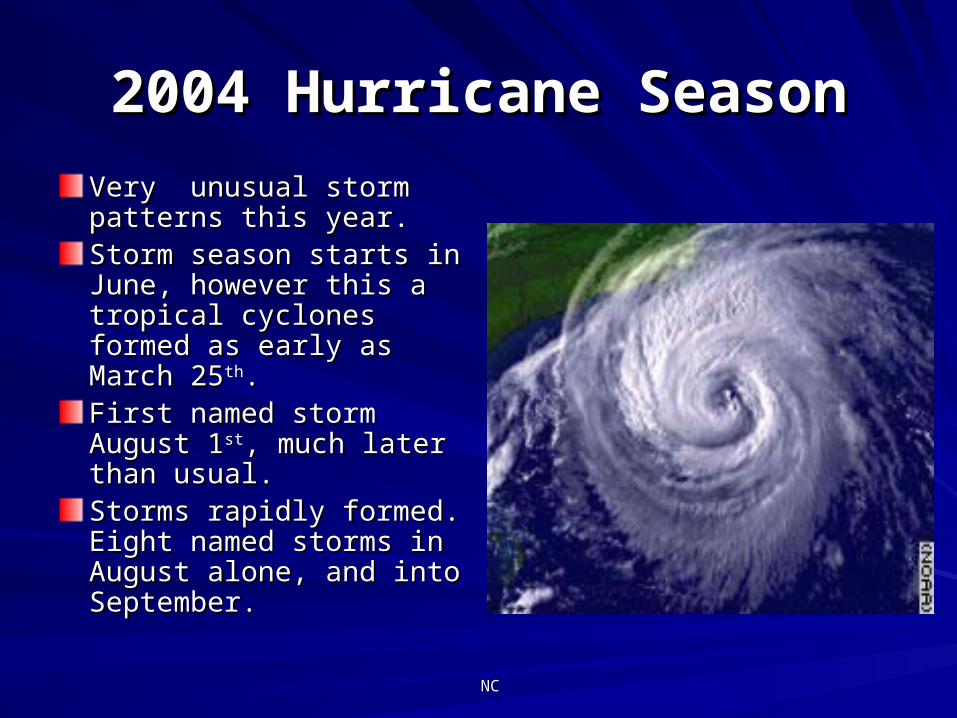
2004 Hurricane Season2004 Hurricane Season
Very unusual storm Very unusual storm patterns this year.patterns this year.Storm season starts in Storm season starts in June, however this a June, however this a tropical cyclones formed tropical cyclones formed as early as March 25as early as March 25thth. . First named storm August First named storm August 11stst, much later than usual., much later than usual.Storms rapidly formed. Storms rapidly formed. Eight named storms in Eight named storms in August alone, and into August alone, and into September.September.
NCNC
Pre-Season OutlookPre-Season Outlook
On May 17, prior to the start of the season, NOAA forecasters On May 17, prior to the start of the season, NOAA forecasters predicted a 50% probability of activity above the normal range.predicted a 50% probability of activity above the normal range.
NOAA predicted 12-15 tropical storms, 6-8 of those becoming NOAA predicted 12-15 tropical storms, 6-8 of those becoming hurricanes, and 2-4 of those hurricanes reaching at least Category 3 hurricanes, and 2-4 of those hurricanes reaching at least Category 3 strength strength
William Gray, noted forecaster, predicted 14 named storms, 8 William Gray, noted forecaster, predicted 14 named storms, 8 reaching hurricane strength, and 3 reaching Category 3 strength. reaching hurricane strength, and 3 reaching Category 3 strength.
has 6 to 14 tropical storms, 4 to 8 of which reach hurricane strength, has 6 to 14 tropical storms, 4 to 8 of which reach hurricane strength, and 1 to 3 of those reaching Category 3 strength.and 1 to 3 of those reaching Category 3 strength.
NCNC
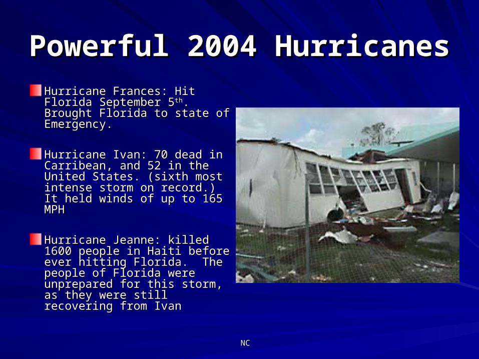
Powerful 2004 HurricanesPowerful 2004 Hurricanes
Hurricane Frances: Hit Florida Hurricane Frances: Hit Florida September 5September 5thth. Brought . Brought Florida to state of Emergency.Florida to state of Emergency.
Hurricane Ivan: 70 dead in Hurricane Ivan: 70 dead in Carribean, and 52 in the Carribean, and 52 in the United States. (sixth most United States. (sixth most intense storm on record.) It intense storm on record.) It held winds of up to 165 MPHheld winds of up to 165 MPH
Hurricane Jeanne: killed 1600 Hurricane Jeanne: killed 1600 people in Haiti before ever people in Haiti before ever hitting Florida. The people of hitting Florida. The people of Florida were unprepared for Florida were unprepared for this storm, as they were still this storm, as they were still recovering from Ivanrecovering from Ivan
NCNC
"Overall, this has been a very "Overall, this has been a very destructive and costly hurricane destructive and costly hurricane
season. The official totals are not in season. The official totals are not in yet, but this will likely go down as yet, but this will likely go down as the costliest hurricane season on the costliest hurricane season on
record in the U.S."record in the U.S."
Stu Ostro of the Weather Stu Ostro of the Weather Channel. Channel.
CMCM
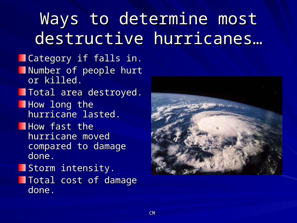
Ways to determine most Ways to determine most destructive hurricanes…destructive hurricanes…
Category if falls in.Category if falls in.Number of people hurt or Number of people hurt or killed.killed.Total area destroyed.Total area destroyed.How long the hurricane How long the hurricane lasted. lasted. How fast the hurricane How fast the hurricane moved compared to moved compared to damage done.damage done.Storm intensity. Storm intensity. Total cost of damage Total cost of damage done. done.

CMCM
Deadliest Deadliest Hurricane Hurricane
Between 1900 and 2000, the Between 1900 and 2000, the Hurricane that caused the most Hurricane that caused the most damage in the US was in damage in the US was in Galveston Texas. It occurred in Galveston Texas. It occurred in 1900 and was considered a 1900 and was considered a category 4 Hurricane. 8000 category 4 Hurricane. 8000 deaths were recorded as a deaths were recorded as a result of this hurricane, but result of this hurricane, but records show that it could have records show that it could have caused anywhere from 10,000 caused anywhere from 10,000 to 12,000 deaths to 12,000 deaths
http://www.aoml.noaa.gov/hrd/Landsea/deadly/Table2.htm
CMCM
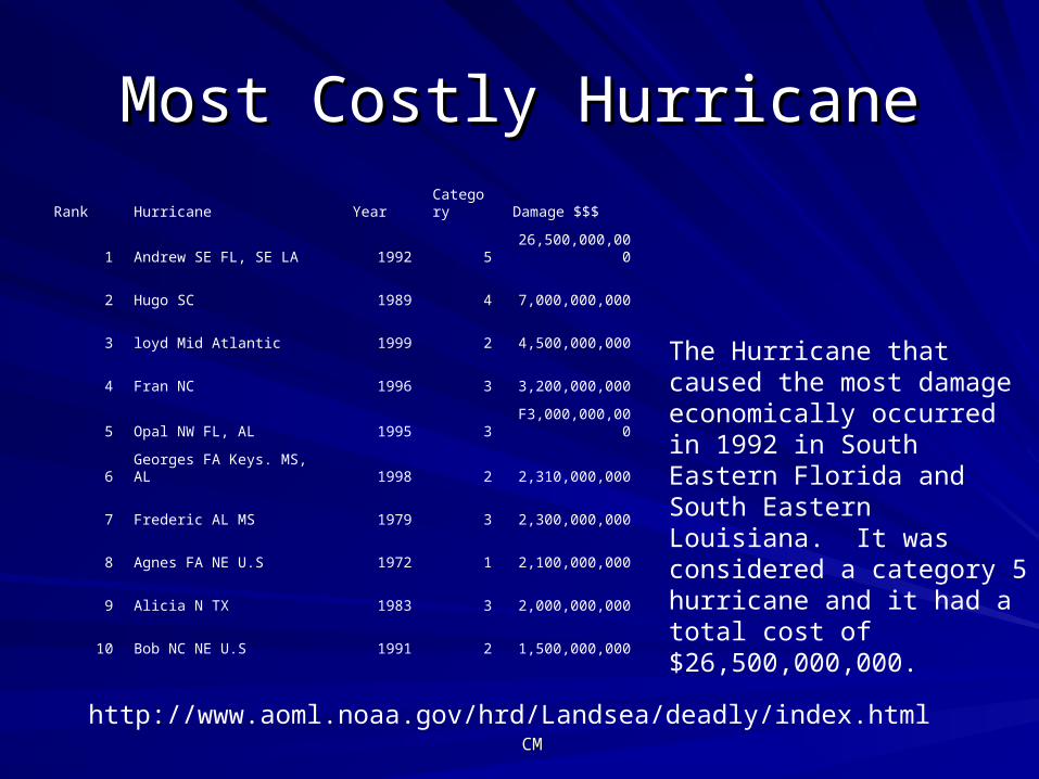
Most Costly HurricaneMost Costly Hurricane
Rank Hurricane Year Category Damage $$$
1 Andrew SE FL, SE LA 1992 5 26,500,000,000
2 Hugo SC 1989 4 7,000,000,000
3 loyd Mid Atlantic 1999 2 4,500,000,000
4 Fran NC 1996 3 3,200,000,000
5 Opal NW FL, AL 1995 3 F3,000,000,000
6 Georges FA Keys. MS, AL 1998 2 2,310,000,000
7 Frederic AL MS 1979 3 2,300,000,000
8 Agnes FA NE U.S 1972 1 2,100,000,000
9 Alicia N TX 1983 3 2,000,000,000
10 Bob NC NE U.S 1991 2 1,500,000,000
The Hurricane that caused the most damage economically occurred in 1992 in South Eastern Florida and South Eastern Louisiana. It was considered a category 5 hurricane and it had a total cost of $26,500,000,000.
http://www.aoml.noaa.gov/hrd/Landsea/deadly/index.html
CMCM
Most Intense…Most Intense…
Hurricanes are ranked by estimated central Hurricanes are ranked by estimated central pressure at time of landfall. pressure at time of landfall.
The most intense Hurricane that hit the mainland of The most intense Hurricane that hit the mainland of the U.S. occurred in 1935. It was unnamed and the U.S. occurred in 1935. It was unnamed and was considered a category 5 Hurricane. It struck was considered a category 5 Hurricane. It struck the Florida Keys. the Florida Keys.
The minimum pressure was 892 (mb)The minimum pressure was 892 (mb)
The maximum pressure was 26.35 (in)The maximum pressure was 26.35 (in)
CMCM
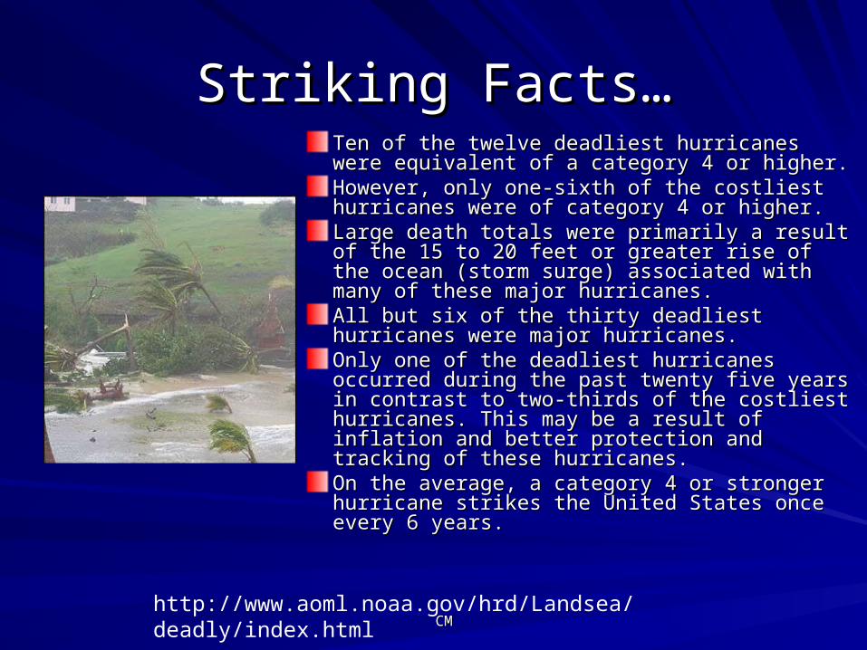
Striking Facts…Striking Facts…Ten of the twelve deadliest hurricanes were Ten of the twelve deadliest hurricanes were equivalent of a category 4 or higher. equivalent of a category 4 or higher. However, only one-sixth of the costliest However, only one-sixth of the costliest hurricanes were of category 4 or higher. hurricanes were of category 4 or higher. Large death totals were primarily a result of the Large death totals were primarily a result of the 15 to 20 feet or greater rise of the ocean (storm 15 to 20 feet or greater rise of the ocean (storm surge) associated with many of these major surge) associated with many of these major hurricanes. hurricanes. All but six of the thirty deadliest hurricanes were All but six of the thirty deadliest hurricanes were major hurricanes. major hurricanes. Only one of the deadliest hurricanes occurred Only one of the deadliest hurricanes occurred during the past twenty five years in contrast to during the past twenty five years in contrast to two-thirds of the costliest hurricanes. This may two-thirds of the costliest hurricanes. This may be a result of inflation and better protection and be a result of inflation and better protection and tracking of these hurricanes. tracking of these hurricanes. On the average, a category 4 or stronger On the average, a category 4 or stronger hurricane strikes the United States once every 6 hurricane strikes the United States once every 6 years. years.
http://www.aoml.noaa.gov/hrd/Landsea/deadly/index.html
CMCM
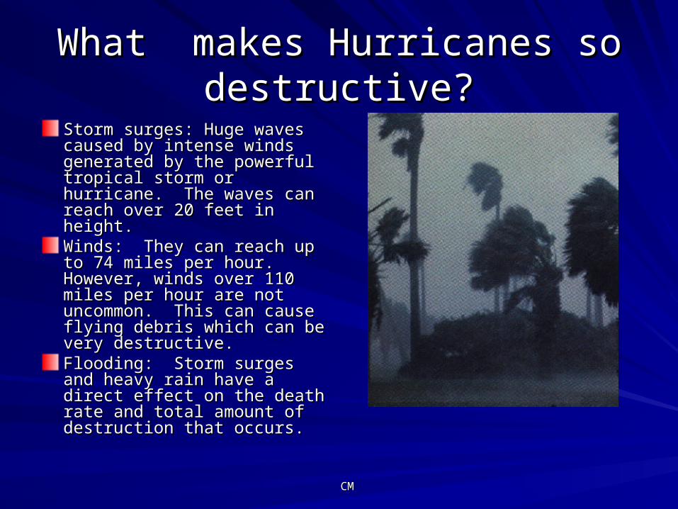
What makes Hurricanes so What makes Hurricanes so destructive?destructive?
Storm surges: Huge waves Storm surges: Huge waves caused by intense winds caused by intense winds generated by the powerful generated by the powerful tropical storm or hurricane. tropical storm or hurricane. The waves can reach over 20 The waves can reach over 20 feet in height.feet in height.Winds: They can reach up to Winds: They can reach up to 74 miles per hour. However, 74 miles per hour. However, winds over 110 miles per hour winds over 110 miles per hour are not uncommon. This can are not uncommon. This can cause flying debris which can cause flying debris which can be very destructive.be very destructive.Flooding: Storm surges and Flooding: Storm surges and heavy rain have a direct effect heavy rain have a direct effect on the death rate and total on the death rate and total amount of destruction that amount of destruction that occurs. occurs.
ResourcesResources
http://hurricanes.noaa.gov/prepare/origin.htmhttp://hurricanes.noaa.gov/prepare/origin.htmhttp://ww2010.atmos.uiuc.edu/(Gh)/guides/mtr/hurr/grow/init.rxmlhttp://ww2010.atmos.uiuc.edu/(Gh)/guides/mtr/hurr/grow/init.rxmlhttp://science.howstuffworks.com/hurricane4.htmhttp://science.howstuffworks.com/hurricane4.htmhttp://www.fema.gov/hazards/hurricanes/http://www.fema.gov/hazards/hurricanes/http://www.aoml.noaa.gov/general/lib/hurricbro.htmlhttp://www.aoml.noaa.gov/general/lib/hurricbro.htmlhttp://en.wikipedia.org/wiki/2004_Atlantic_hurricane_seasonhttp://en.wikipedia.org/wiki/2004_Atlantic_hurricane_seasonhttp://www.noaanews.noaa.gov/stories2004/s2225.htmhttp://www.noaanews.noaa.gov/stories2004/s2225.htmhttp://www.cnn.com/2004/WEATHER/05/17/hurricane.forecast/indexhttp://www.cnn.com/2004/WEATHER/05/17/hurricane.forecast/index.html.htmlhttp://news.nationalgeographic.com/news/http://news.nationalgeographic.com/news/2004/09/0927_040927_jeanne.html2004/09/0927_040927_jeanne.htmlhttp://www.aoml.noaa.gov/hrd/Landsea/deadly/Table2.htmhttp://www.aoml.noaa.gov/hrd/Landsea/deadly/index.html