hydrologic modeling of the apalachicola… · hydrologic modeling of the...
TRANSCRIPT

HYDROLOGIC MODELING OF THE APALACHICOLA–CHATTAHOOCHEE–FLINT RIVER BASIN USING THE U.S. GEOLOGICAL SURVEY
PRECIPITATION RUNOFF MODELING SYSTEM
By Jacob H. LaFontaine,1 Lauren E. Hay,2 Roland Viger,3 and Steven L. Markstrom2
AUTHOR: 1/Hydrologist, U.S. Geological Survey, Georgia Water Science Center, Peachtree Business Center, Suite 130, 3039 Amwiler Road, Atlanta, GA 30360; 2/Hydrologist, U.S. Geological Survey National Research Program, Lakewood, CO 80225; 3/Geographer, U.S. Geological Survey National Research Program, Lakewood, CO 80225 REFERENCE: Proceedings of the 2011 Georgia Water Resources Conference, held April 11–13, 2011, at the University of Georgia.
Abstract. The U.S. Geological Survey (USGS) Southeast Regional Assessment Project (SERAP) was initiated in 2009 to help environmental resource managers assess the potential effects of climate change on ecosystems. One component of the SERAP program is the development and calibration of a set of multiresolution hydrologic models of the Apalachicola–Chattahoochee–Flint (ACF) River Basin. The ACF River Basin, which is home to numerous fish and wildlife species of conservation concern, is regionally important for water supply and is a focus of complementary environmental and climate-change research. Hydrologic models of varying spatial extents and resolutions are required to address varied local-to-regional water-resource management questions as required by the scope and limitations of potential management actions. These models were developed by using the USGS Precipitation Runoff Modeling System (PRMS). The coarse-scale model developed for the ACF River Basin has a contributing area of approximately 50,700 square kilometers. Six fine-resolution PRMS models, ranging in size from 396 to 2,690 square kilometers, are nested within the coarse-scale model and have been developed for the following basins: the upper Chatta-hoochee, Chestatee, and Chipola Rivers, and Ichawaynocha-way, Potato, and Spring Creeks. Both coarse- and fine-scale models simulate basin hydrology using daily timesteps, measured climatic data, and basin characteristics, such as land cover and topography. Measured streamflow data are used to calibrate and evaluate computed basin hydrology. Being able to project future hydrologic conditions for this set of models will rely on the use of land cover projections in conjunction with downscaled Global Climate Model results.
INTRODUCTION
To help environmental resource managers assess potential effects of climate change on ecosystems, the U.S. Geological Survey (USGS) Southeast Regional Assessment Project (SERAP) is developing regional models and other science tools (Dalton and Jones, 2010). Models and data produced by SERAP will be used in a collaborative process between the USGS, U.S. Fish and Wildlife Service, state and federal partners, nongovernmental organizations, and academia. Integration of the models developed by SERAP is shown in
Figure 1. One component of the SERAP is development and calibration of a set of multiresolution hydrologic models, as highlighted in Figure 1, of the Apalachicola–Chattahoochee–Flint (ACF) River Basin. The ACF River Basin (Fig. 2), which is home to numerous fish and wildlife species of conservation concern, is regionally important for water supply and is a focus of complementary environmental and climate-change research. Hydrologic models of varying spatial extents and resolutions are required to address varied local-to-regional water-resource management questions as required by the scope and limitations of potential management actions. These models were developed using the USGS Precipitation Runoff Model-ing System (PRMS). A coarse-scale hydrologic model of the ACF River Basin (approximately 50,700 square kilometers [km2]) and six fine-scale models (ranging in size from 396 to 2,690 km2) were developed as part of this study to simulate natural streamflow in the basin and to compare simulated streamflows at various model scales using climate data from both point and gridded sources. The models simulate natural streamflow for the period 1950–1999 based on a daily timestep.
Description of Precipitation-Runoff Models
The ACF River Basin was modeled by using a nested approach composed of a coarse-scale model of the entire basin and six fine-scale models for subbasins of interest (Table 1). The coarse-scale model simulates streamflow to address regional hydrologic questions and provides a regional frame-work for identifying future fine-scale models in the basin. The fine-scale models simulate streamflow at more points in a given subbasin than the coarse-scale model. In the collabora-tive process, aquatic occupancy modeling (Fig. 1) makes use of the detailed streamflow information simulated by the fine-scale hydrologic models to simulate the presence and persis-tence of fishes and mussels.
Precipitation-Runoff Modeling System
The PRMS is a deterministic, distributed-parameter, physical-process based hydrologic model (Leavesley and others, 1983). The primary objectives of this modeling system are (1) simulation of land-surface hydrologic processes,

including evapotranspiration, runoff, infiltration, interflow, snowpack, and soil moisture on the basis of distributed climate information (temperature, precipitation, and solar radiation); (2) simulation of hydrologic water budgets at the watershed scale with temporal scales ranging from days to centuries; (3) integration with models used for natural-resource management or other scientific disciplines; and (4) creation of a modular design that allows the selection of alternative hydrologic-process algorithms from either the standard module library or user-provided provisional modules.
Delineation and Parameterization
Typically, the delineation of a PRMS hydrologic model is done by overlaying a USGS Digital Elevation Model (DEM) with the study basin using the geographical information system (GIS) Weasel software developed by Viger and Leavesley (2007). The DEM was used to develop the modeled stream network and divide the basin into a series of reaches separated
by points called HRUs (Fig. 2). The HRUs simulate the hydro-logic response of the basin (streamflow) to air temperature and precipitation. The stream network is used to route streamflow from the HRUs through the basin. Initially, HRUs were delin-eated based on the stream network, a maximum area threshold, and changes in elevation from the DEM. These delineations were further refined by including points of interest in the basin, such as locations of streamflow gages, minimum flows, sam-pling sites, etc. Once the stream network and HRUs were defined, the GIS Weasel software was used to parameterize the model by using terrain, soil, land-cover, impervious-area, and vegetation data. Included in the land-cover category is a GIS coverage of surface depressions in the basin. Large numbers of these relatively small waterbodies can have substantial hydrologic effects on streamflow. The simulation of these surface depressions, as discussed in Viger and others (2009), was used in this set of hydrologic models. Each segment in the stream network and each HRU was treated as a homo-geneous entity with parameters that represent an aggregation of the information contained in the data coverages used.
Statisticallydownscaled
GCMs
Aquaticoccupancymodeling
Probabilisticclimate change
Avian range dynamics
Integratedterrestrial
assessment
Integratedcoastal
assessment
Optimalconservation
strategies
Hydrologicmodeling
Streamtemperature
Channelclassification
Water bodies
Riparianvegetation
Historicalland coverDynamically
downscaledGCMs
Currentclimate
Figure 1. Information flow diagram for the Southeast Regional Assessment Project. The hydrologic model-ing team receives information from several project teams and provides output that will be used as input by the stream temperature and aquatic occupancy models. [GCMs, Global Climate Models]

Figure 2. Example of a fine-scale hydrologic model nested within the coarse-scale hydrologic model. Ichawa-nochaway Creek is located in the lower Flint River Basin and comprises 2,690 square kilometers (km2). Each of the coarse-scale hydrologic response units (HRUs) in the fine-scale model areas are split into smaller HRU’s that provide detailed flow information used by the aquatic occupancy modeling shown in Figure 1. The HRU’s range in size from 5 km2 to 1,900 km2 for the coarse-scale model and from <0.5 km2 to 70 km2 for the fine-scale models.
Apalachicola–Chattahoochee–Flint River Basin coarse-scale model
0 5 10 15 20 25 MILES
0 50 KILOMETERS25
N
ChestateeRiver Basin
UpperChattahoochee
River Basin
PotatoCreekBasin
ChipolaRiverBasin
SpringCreekBasin
Ichawaynochaway Creek Basinfine-scale model
IchawaynochawayCreek belowNewton, GA,
subarea
ALA
BAM
A
Physiographic provincesand river basins
BLUE RIDGEHIGHLANDRIM
PIEDMONT
Gulf of Mexico
Atlantic Ocean
GEORGIA
FLORIDA
Flint River
Basin
ChattahoocheeRiver Basin
ApalachicolaRiver Basin
COASTAL PLAIN
CUMBERLAND
PLATEAU
VALLEY AND RIDGE
USGS streamgage
EXPLANATION
Hydrologic response unit boundary
ChickasawhatcheeCreek
subarea
PachitlaCreek
subarea
IchawaynochawayCreek at
Milford, GA,subarea
Area not modeled
Climate Data
The PRMS requires the input of daily maximum and mini-mum air temperatures and daily precipitation data. Climate station data provided by the National Weather Service Coopera-tive Observer Program (National Oceanic and Atmospheric Administration, 2010) typically are used for PRMS models. Initially, 79 of these climate stations were used to for the coarse-scale hydrologic model. The model was then adjusted to use climate data from one-eighth degree (about 12 kilometers [km]) gridded products developed for the conterminous United States by Maurer and others (2002). A Web-based GIS interface called the Geo Data Portal was then used to spatially transfer the gridded climate data to the model HRUs. The gridded climate data currently available are for 1950–1999; however, the grid-ded climate data and projections are being downscaled for 2000–2099 by using statistical and dynamical procedures.
Streamflow Data
The USGS streamflow-gaging network (http://waterwatch.usgs.gov/) was used to obtain daily-flow data for calibration and evaluation of the hydrologic models. For this study, 57 streamgages were selected based on a minimum drainage area of 25 km2 and a minimum of 10 years of daily-flow record. The spatial distribution of the selected streamgages is shown in Figure 2. Streamflow data are retrieved and formatted for the hydrologic models by using Downsizer, a graphical user interface (GUI) developed by Ward-Garrison and others (2009).
Nested Modeling Approach
Efficient development and interpretation of hydrologic models for the SERAP required that models of varying spatial scales be developed. A single, fine-scale model of the whole ACF River Basin would be time and cost prohibitive. For
computational efficiency, the coarse-scale model was developed to (1) represent the overall water balance and hydrologic processes of the system and (2) provide a regional framework for fine-scale hydrologic models. The calibrated coarse-scale model also can provide initial precalibration values for some parameters used in the fine-scale models.
By using the coarse-scale HRUs and the stream network, selected fine-scale basins were delineated so the fine-scale HRUs nested within the coarse-scale HRUs, and the fine-scale stream-segment nodes include the coarse-scale stream-segment nodes (Fig. 2). By matching the fine- and coarse-scale model delineations, direct comparisons can be made across model scales. In the event that the calibrated fine-scale models out-perform the coarse-scale model, outputs from the fine-scale models can be used to refine the coarse-scale model. Initial results indicate that for certain subbasins, the coarse-scale model performs as well as the fine-scale models, but in other parts of the basin, the fine-scale models more accurately simu-late the hydrology.
Hydrologic ModelsSeven hydrologic models were developed for the ACF River
Basin—one coarse-scale basinwide model and six fine-scale models. The six fine-scale models simulate two subbasins (upper Chattahoochee and Chestatee Rivers) in the northern part of the ACF River Basin, one subbasin (Potato Creek) in the central part of the basin, and three subbasins (Chipola River and Ichawaynochaway and Spring Creeks) in the southern part of the basin (Fig. 2). The subbasins for which fine-scale models were developed were selected based on representing the different physiographic provinces in the ACF River Basin, current and projected urbanization, and critical areas of ecologi-cal habitat. The upper Chattahoochee River, Chestatee River, and Potato Creek subbasins are relatively undeveloped in terms of urbanization and agriculture, whereas the Chipola River
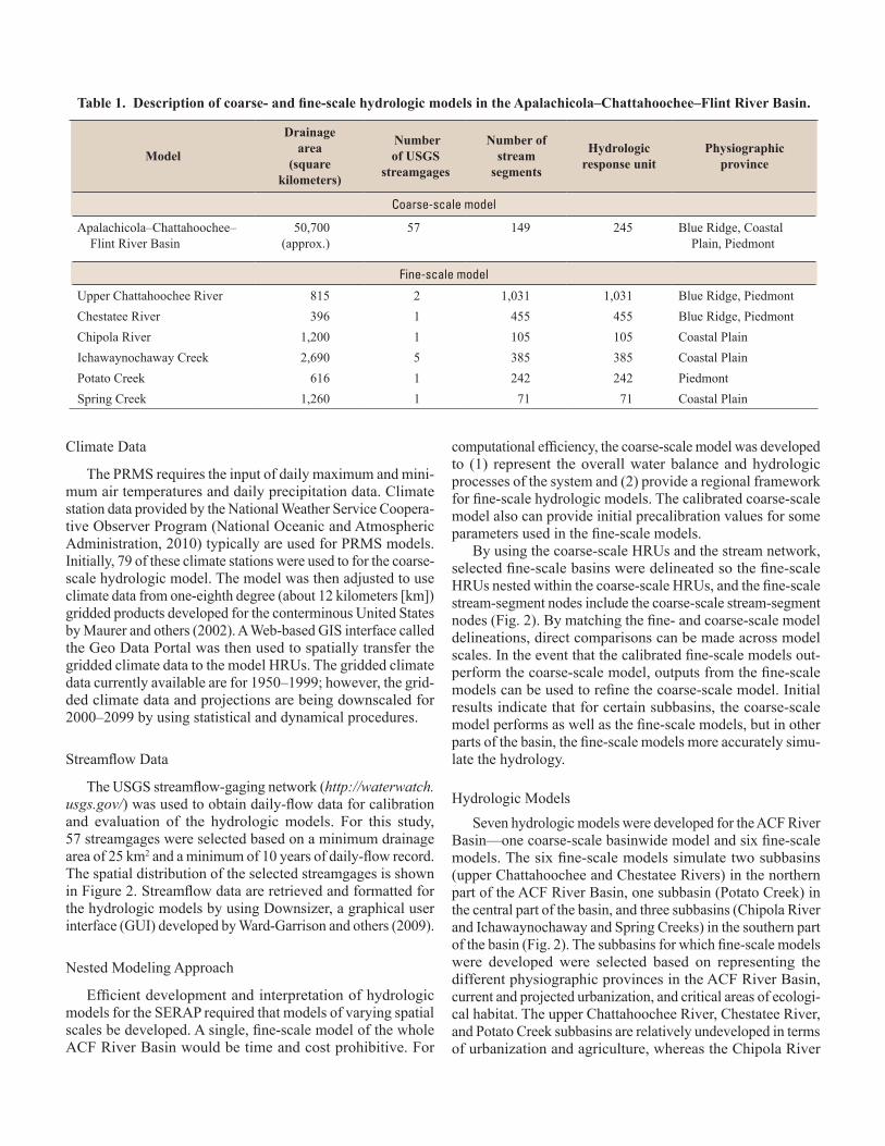
Table 1. Description of coarse- and fine-scale hydrologic models in the Apalachicola–Chattahoochee–Flint River Basin.
Model
Drainage area
(square kilometers)
Number of USGS
streamgages
Number of stream
segments
Hydrologic response unit
Physiographic province
Coarse-scale model
Apalachicola–Chattahoochee–Flint River Basin
50,700 (approx.)
57 149 245 Blue Ridge, Coastal Plain, Piedmont
Fine-scale model
Upper Chattahoochee River 815 2 1,031 1,031 Blue Ridge, PiedmontChestatee River 396 1 455 455 Blue Ridge, PiedmontChipola River 1,200 1 105 105 Coastal PlainIchawaynochaway Creek 2,690 5 385 385 Coastal PlainPotato Creek 616 1 242 242 PiedmontSpring Creek 1,260 1 71 71 Coastal Plain

and Ichawaynochaway and Spring Creek subbasins are heavily developed by agriculture.
The models were calibrated by using Luca software, a multiobjective, stepwise, wizard-style GUI (Hay and others, 2006; Hay and Umemoto, 2006). This GUI uses the Shuffled Complex Evolution (Duan and others, 1993) global search algorithm to calibrate parameters for PRMS hydrologic models. A procedure has been developed to calibrate each model by using the following variables: (1) mean monthly solar radiation, (2) mean monthly potential evapotranspiration, (3) annual and monthly flows, (4) timing of daily flows, (5) magnitude of high-flow days, and (6) magnitude of low-flow days. Model parameters were adjusted to optimize the simulation of these six variables for historical climate and streamflow data for the period 1990–1999. Once the models were calibrated, they were evaluated using historical climate and streamflow data for the period 1980–1989. Plots of annual-, monthly-, and daily-flow statistics were used to evaluate the accuracy of the model simulations.
This suite of hydrologic models can be used to study the effects of changing climate and landscape on the hydrologic response of the ACF River Basin. The hydrologic modeling output can also be used as input for stream temperature and aquatic occupancy modeling being done by others in the SERAP collaborative process (Fig. 1).
SUMMARY
Multiresolution hydrologic models of the Apalachicola–Chattahoochee–Flint (ACF) River Basin, developed as part of the Southeast Regional Assessment Project (SERAP), are helping assess the potential effects of climate change on eco-systems. Hydrologic models of varying spatial extents and resolutions were developed to address varied local-to-regional water-resource management questions as required by the scope and limitations of potential management actions. Seven models were developed by using the U.S. Geological Survey (USGS) Precipitation Runoff Modeling System (PRMS).
A coarse-scale model for the ACF River Basin, with a con-tributing area of approximately 50,700 square kilometers, is coupled with six fine-scale subbasin models, ranging in size from 396 to 2,690 square kilometers, for the upper Chatta-hoochee, Chestatee, and Chipola Rivers, and Ichawaynochaway, Potato, and Spring Creeks. These subbasins were selected based on representation of the different physiographic provinces, cur-rent and projected urbanization, and critical areas of ecological habitat. All of the models simulate basin hydrology for the period 1950–1999 using a daily timestep, measured climate data, and basin characteristics, such as land cover and topography. Mea-sured streamflow data from 57 USGS streamgages were used to calibrate and evaluate computed basin hydrology. Being able to project future hydrologic conditions for this set of models will rely on the use of land cover projections in conjunction with downscaled Global Climate Model results.
REFERENCES CITED
Dalton, M.S., and Jones, S.A., comps., 2010, Southeast Regional Assessment Project for the National Climate Change and Wildlife Science Center, U.S. Geological Survey: U.S. Geological Survey Open-File Report 2010–1213, 38 p.
Duan, Q., Gupta, V.K., and Sorooshian, S., 1993, A shuffled complex evolution approach for effective and efficient global minimization: Journal of Optimization Theory and Its Applications, v. 76, no. 3, p. 501–521.
Hay, L.E., Leavesley, G.H., Clark, M.P., Markstrom, S.L., Viger, R.J., and Umemoto, M., 2006, Step wise, multiple objective calibration of a hydrologic model for a snow-melt dominated basin: Journal of the American Water Resources Association, v. 42, no. 4, p. 877–890.
Hay, L.E., and Umemoto, M., 2006, Multiple-objective stepwise calibration using Luca: U.S. Geological Survey Open-File Report 2006–1323, 28 p.
Leavesley, G.H., Lichty, R.W., Troutman, B.M., and Saindon, L.G., 1983, Precipitation-runoff modeling system—User’s manual: U.S. Geological Survey Water-Resources Investigations Report, 83–4238, 207 p.
Maurer, E.P., Wood, A.W., Adam, J.C., Lettenmaier, D.P., and Nijssen, B., 2002, A long-term hydrologically- based data set of land surface fluxes for the conterminous United States: Journal of Climate, v. 15, no. 22, p. 3237–3251.
National Oceanic and Atmospheric Administration, National Weather Service Cooperative Observer Program, 2010, accessed September 2010 at http://www.nws.noaa.gov/om/coop/.
Viger, R.J., Hay, L.E., Jones, J.W., and Buell, G.R., 2009, Effects of including surface depressions in the applica-tion of the Precipitation-Runoff Modeling System in the Upper Flint River Basin, Georgia: U.S. Geological Survey Scientific-Investigations Report 2010–5062, 36 p.
Viger, R.J., and Leavesley, G.H., 2007, The GIS Weasel user’s manual: U.S. Geological Survey Techniques and Methods, book 6, chap. B4, 201 p., accessed on November 1, 2010, at http://wwwbrr.cr.usgs.gov/projects/SW_MoWS/software/weasel_s/weasel.shtml.
Ward-Garrison, C., Markstrom, S.L., and Hay, L.E., 2009, Downsizer—A graphical user interface-based application for browsing, acquiring, and formatting time-series data for hydrologic models: U.S. Geological Survey Open-File Report 2009–1166, 27 p.