land administration trends and issues in fiji · fiji islands viti levu vanua levu suva nadi...
TRANSCRIPT

Land Administration Trends and Issues in Fiji
14th Meeting of the Permanent Committee on GIS Infrastructure for Asia and the Pacific
19-22 August 2008
Mr. Kemueli MasikereiAssistant Director Mapping & Land Information
Department of Lands and SurveysPO Box 2222
Government BuildingsSuva, FIJI.
Tel. (679) 3314399Fax. (679) 3305029
Email. [email protected]
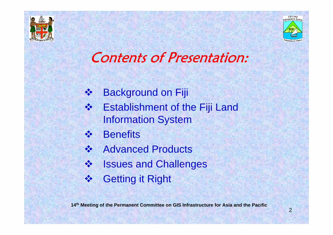
Contents of Presentation:
Background on FijiEstablishment of the Fiji Land Information SystemBenefitsAdvanced ProductsIssues and ChallengesGetting it Right
14th Meeting of the Permanent Committee on GIS Infrastructure for Asia and the Pacific2
14th Meeting of the Permanent Committee on GIS Infrastructure for Asia & the Pacific
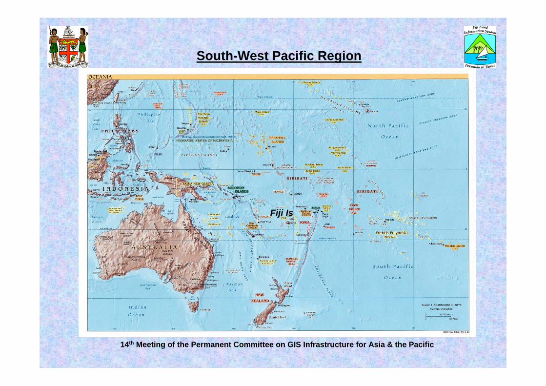
South-West Pacific Region
Fiji Is

Fiji Islands
Viti Levu
Vanua Levu
Suva
NadiLautoka
Savusavu
Kadavu Is.
Labasa
Lau Group
Lomaiviti Group
Taveuni Is.Yasawa
14th Meeting of the Permanent Committee on GIS Infrastructure for Asia and the Pacific

Background on FijiPopulation – more than 800,000Land Area – 18,333 sq km (more than 300 Islands)
Native Land – 88% (Native Land Trust Board)• Native Land Commission Register – 7,000 clans, 10,000 Tokatoka• Native Land Commission Maps (410) – over 13,000 land parcels• ‘Vola ni Kawa Bula’ (Register of Native Fijians) – over 500,000
entriesState Land – 4% (Dept. of Lands & Surveys)
• 380 Imperial Record sheets – 2 chains/4 chains/8 chains/16 chains = 1 inch
• Metric Cadastral Maps – 1:1 000; 1:5 000; 1:10 000• Over 90,000 parcels in CCMS• Over 40,600 approved survey plans
Freehold Land – 8% (Registrar General)• Over 100,000 Registered TitlesEEZ Area – 1,163,272 sq kmHighest Mountain – 4,341 feet (over 900 m)
14th Meeting of the Permanent Committee on GIS Infrastructure for Asia and the Pacific5

Suva City
Ovalau Is.Lautoka City
Nadi
Ba
SigatokaNavua
Nausori
RakirakiTavua
14th Meeting of the Permanent Committee on GIS Infrastructure for Asia and the Pacific

SavusavuTaveuni Is.
LabasaRabi Is.
14th Meeting of the Permanent Committee on GIS Infrastructure for Asia and the Pacific

Establishment of the Fiji Land Information System (FLIS)
February 1991Cabinet Decision No.33 of 1991 endorsed that:
GOF adopt the National LIS Strategy as the prototype for LIS/GIS development in Fiji.Minister of Lands and Mineral Resources be responsible for the programme.FLIC to be established under the Chairmanship of Permanent Secretary for Lands and Mineral Resources
14th Meeting of the Permanent Committee on GIS Infrastructure for Asia and the Pacific 8

Why FLIS?quality of land information in Govt. agencies?fragmented and stand-alone information gathering & storage –cannot combinelack of access to land information – led to duplicationlack of knowledge - technologylack of land information (geospatial) resources available to meet current and future needsno standardisation – cannot talk to each otherlack of appropriately qualified and experience people in Govt. agencies – sustainability and continuity?lack of fundingetc.
Need a CHAMPION to get things done and moving
14th Meeting of the Permanent Committee on GIS Infrastructure for Asia and the Pacific 9

Fiji Land Information Council
FLIS Support Centre
GIS/RS Interest Group
FLIS Organisation Structure
1014th Meeting of the Permanent Committee on GIS Infrastructure for Asia and the Pacific

BenefitsStreamlined processes – titles, lease administration, cadastral and topographic maps, etc.Trained & developing staffSatisfying management and users requirements“Cleaner” & more reliable land recordsLinked systemsImproved accessibility to dataAccelerated cadastral & topographical mapping (imperial to metric)Supporting National Projects – National Election, National Census, etc.“Visible benefits came sooner than expected”
14th Meeting of the Permanent Committee on GIS Infrastructure for Asia and the Pacific 11

Maps
14th Meeting of the Permanent Committee on GIS Infrastructure for Asia and the Pacific 12
Topographical
Cadastral
Native Land Commission

Topographic Map
14th Meeting of the Permanent Committee on GIS Infrastructure for Asia and the Pacific 13
Viti Levu

enlargement
14th Meeting of the Permanent Committee on GIS Infrastructure for Asia and the Pacific 14

Taveuni Island
14th Meeting of the Permanent Committee on GIS Infrastructure for Asia and the Pacific 15
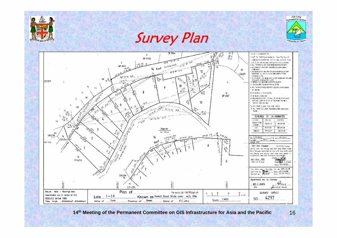
Survey Plan
14th Meeting of the Permanent Committee on GIS Infrastructure for Asia and the Pacific 16
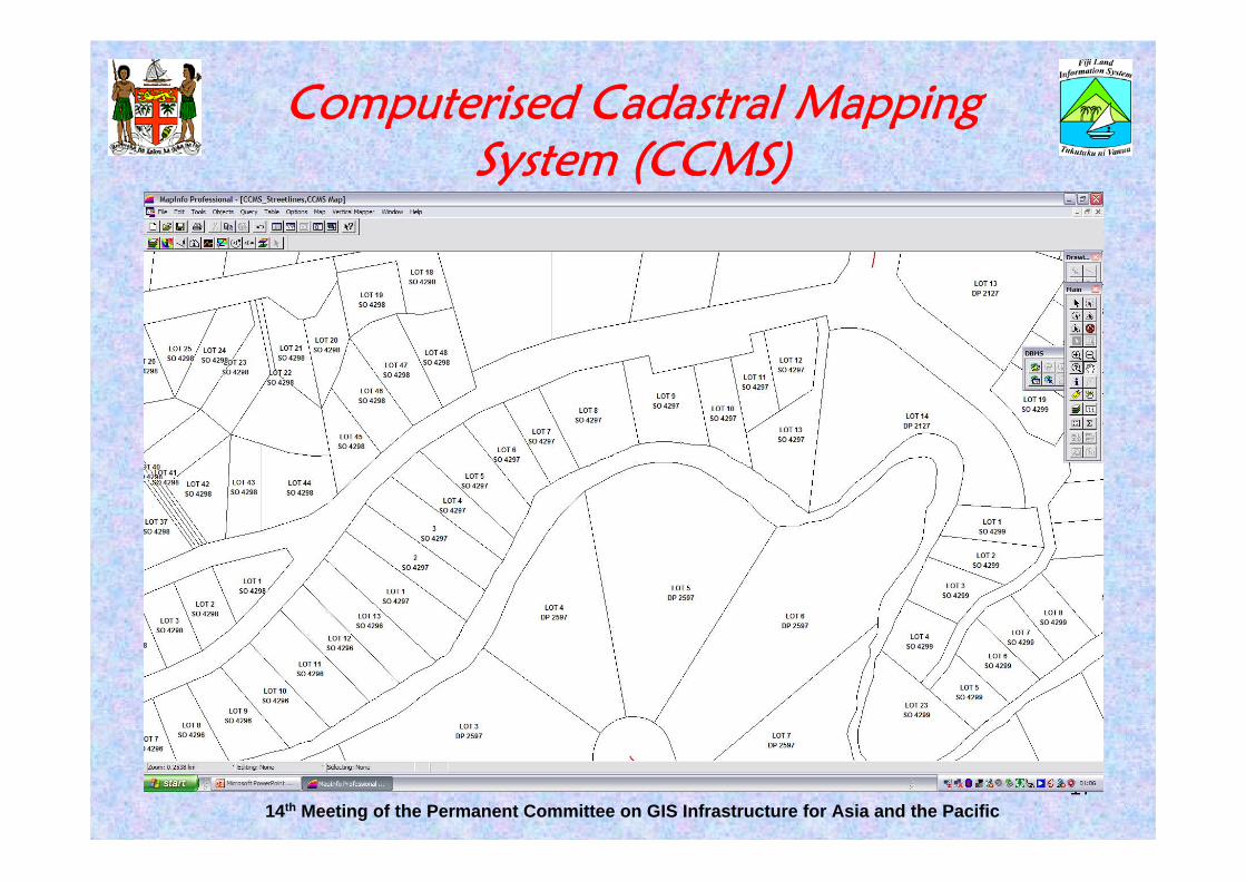
Computerised Cadastral Mapping System (CCMS)
14th Meeting of the Permanent Committee on GIS Infrastructure for Asia and the Pacific17

Native Land Commission (NLC) Map
14th Meeting of the Permanent Committee on GIS Infrastructure for Asia and the Pacific 18
Scanned Image

NLC Map
14th Meeting of the Permanent Committee on GIS Infrastructure for Asia and the Pacific 19

NLC Map (digitised)
14th Meeting of the Permanent Committee on GIS Infrastructure for Asia and the Pacific20

Advanced Products
1. VanuaView Standard – CadastralA seamless viewing package based on Computerised Cadastral
Mapping System (CCMS) data2. VanuaView Standard - TopographicA seamless viewing package based on scanned Topographic maps of
Fiji.3. VanuaView Standard – Native Land Commission MapsA seamless viewing package based on digitized Native Land
Commission maps of Fiji.4. VanuaView CustomisedVanuaview package customized to customers requirements.5. VanuaInfoAn integrated GIS system for analysis, planning and decision making.
2114th Meeting of the Permanent Committee on GIS Infrastructure for Asia and the Pacific

VanuaView
22

VanuaInfo – Integrated GIS
Suva City
Ovalau Is.Lautoka City
Nadi
Ba
SigatokaNavua
Nausori
RakirakiTavua
2414th Meeting of the Permanent Committee on GIS Infrastructure for Asia and the Pacific

VanuaInfo
SavusavuTaveuni Is.
LabasaRabi Is.
14th Meeting of the Permanent Committee on GIS Infrastructure for Asia and the Pacific

VanuaInfo
26

VanuaInfo
27

VanuaInfo
28
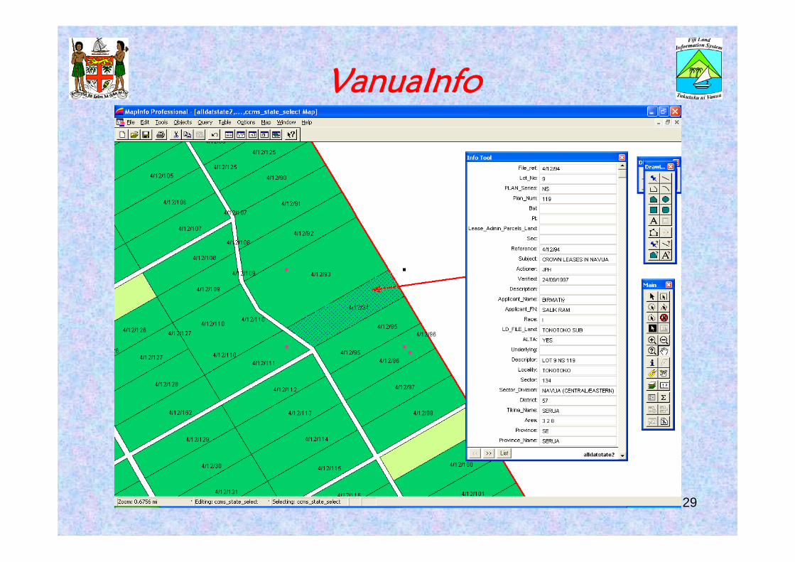
VanuaInfo
29

ScanPlan
30

Integrated Application
SurveyPlan Valuation Lease
Admin Rental Cadastral Topo
NLC
Integrated Databases
Titles
Lands Portal
Users(FLIC Members Agencies, Employees, Customers, etc)
Internal
External
Other Datasets

Survey Plans(Cadastral Lots)
Aerial Photo &Remote Sensing
Cadastral Mapping System
Topographical Mapping
Survey Plan JournalValuationCrown Lease RentalLD file MovementTitles
Vanuaview (different Themes)NLC, Survey, Topo, Special Themes
Native LandCommission
Maps(Mataqali)
Cartography
e Land Information
GOVNET
Integrated DB(Oracle)
Native LandMapping
Integrated land Information
Published Maps
1. Integrated DBS
2 Move to Geomedia Professional
3. Digital Updates
4
5
6

Thank You – ‘VINAKA’