mount pleasant community plan · 4.3 parks and green space 16 4.3 (i ... land use policy and urban...
TRANSCRIPT

APPROVED BY CITY COUNCIL NOVEMBER 18, 2010
Mount Pleasant Community Plan

Contents1.0 Introduction 3 1.1 Study Area 5 1.2 Planning Process 5 2.0 Plan Context: Distinctive Mount Pleasant 7
3.0 Mount Pleasant Community Plan 8 Overarching Principles 3.1 Housing and Population Mix 8 3.2 Economic Development and Revitalization 8 3.3 Built Form and Character 9 3.4 Large Site Development 9 3.5 Parks and Public Realm 10 3.6 ‘Laneways’ 10 3.7 Transportation 11 3.8 Heritage 11 3.9 Culture 12 3.10 Community Services and Development 12 3.11 Public Engagement 13
4.0 Policies to Address Key Issues 14 4.1 Housing 14 4.1 (i) Additional Housing Opportunities 14 4.1 (ii) Non-market Housing 15 4.1 (iii) Building Maintenance 15 4.2 Character 15 4.3 Parks and Green Space 16 4.3 (i) Adding Open Space 16 4.3 (ii) Park Design and Services 16 4.4 Laneways 17 4.5 Services 17 4.5 (i) Homelessness 18 4.5 (ii) Garbage and Recycling 18 4.6 Safety 19 4.7 Walking, Biking, and Parking 19 4.8 Transit 20 4.8 (i) Great Northern Way Campus Transit Station 21 4.9 Heritage 21 4.10 Culture 22
5.0 Shopping Sub-Area Plans and Policies 23 5.1 Uptown Shopping Area 23 5.1 (i) Rize Alliance Development site 25 5.1 (ii) Kingsgate Mall 25 5.1 (iii) IGA Site 26 5.2 Main 2nd to 7th 26 5.3 Broadway West 27 5.4 Broadway East 28
6.0 Plan Implementation 30 6.1 Avenues to Plan Implementation 30 6.2 Steps to Begin Community Plan Implementation 31 6.3 Additional Considerations When Implementing 32 the Community Plan

3
MOUNT PLEASANT COMMUNITY PLAN
3
1.0 Introduction
Council selected Mount Pleasant as the first of several higher density communities with older, out-of-date plans to undertake a new community planning initiative. The Mount Pleasant Community Plan was integrated with many City initiatives, including EcoDensity, Greenest City, the Homeless Action Plan, the Rental Housing Study, the Metro Core Jobs and Economy Study, Vancouver’s Transportation Plan and City Plan, the UBC Rapid Transit Line, the Social Sustainability Policy, the Heritage Register Upgrade Program, and the City of Vancouver Cultural Plan and Cultural Facilities Priorities Plan. Alongside these initiatives were a set of Council priorities – homelessness and affordable housing; building strong, safe, and inclusive communities; environment and sustainability; and creative capital and a growing economy – which provided further guidance to the planning process.
Key planning process principles involved balancing the ‘rights’ and ‘uniqueness’ of the community with its responsibility as part of the City and Region, and that new plans and ensuring policies strive to be consistent with city-wide plans, policies, and initiatives. In recognition of this principle, the Mount Pleasant Community Plan has endeavored to respond to the following questions:
What is distinctive – and highly valued – about Mount Pleasant as a neighbourhood?
• identifying its assets and strengths and how they might be nurtured
How can Mount Pleasant become Vancouver’s greenest, most sustainable neighbourhood?
• promoting a complete community – with a mix of housing types, jobs, schools, daycares, shopping, and recreational opportunities
• increasing density close to public transit hubs, employment centres, and amenities such as shopping streets
• providing additional traffic calming measures, space for pedestrians, connections to greenways and bikeways, and interesting streetscapes
• funding opportunities to further urban agriculture, expanding greenways, improving waste management, and promoting green jobs
How should higher density development be incorporated into Mount Pleasant?
• providing high quality, attractive, more energy efficient, and affordable housing which respects neighbourhood character and lowers the carbon footprint
• creating more opportunities for the development of subsidized and supported housing throughout the City
• providing opportunities for both market and non-market housing development, making available tenures that are more affordable, and preserving, replacing, and expanding Mount Pleasant’s stock of rental housing
How can Mount Pleasant address the needs of homeless people?
• finding additional opportunities to provide its share of housing for the homeless
• delivering support services, projects, and other initiatives to help the homeless
How should we strengthen Mount Pleasant’s neighbourhood centres and shopping areas?
• adding professional and commercial services (including office), increasing the variety and affordability of housing, and promoting urban amenity and sense of place
• promoting the intersection of Broadway and Main as a high-quality pedestrian, transit, and commercial hub
How can we support more walking, biking, and transit use in Mount Pleasant?
• calming traffic in neighbourhoods, while maintaining an efficient network for goods movement

4
MOUNT PLEASANT COMMUNITY PLAN
4
• improving safety at intersections (especially at 7th Ave and Main) • anticipating location(s) for new RT stations, then planning
appropriate residential and commercial development around those stations
How can we preserve and promote Mount Pleasant’s heritage?
• upgrading the Vancouver Heritage Register
• creating more effective planning tool for managing change to Mount Pleasant’s historic places
• promoting heritage through history walking tours and other public space programs
How can we promote arts and culture in Mount Pleasant?
• addressing the gaps, needs, and opportunities for the retention, renovation, restoration, and construction of facilities, spaces, and places for the creation, production, presentation, support and experience and enjoyment of cultural expression in all its forms
How can Mount Pleasant become a socially sustainable community?
• building on its own resources, with resiliency to prevent and/or address problems in the future including supporting vulnerable people and promoting a safe community
• encouraging continuing relationships, networks, and norms that facilitate collective action to improve quality of life and to ensure that such improvements are sustainable
The Mount Pleasant Community Plan responds to these questions with:
• Overarching Principles which set out the overall goals of the community plan – the basis for future plans, policies, actions, and other initiatives;
• Policies Addressing Key Issues – policies, actions, and other initiatives related to housing, transportation, heritage, character, safety, services, and culture; and
• Shopping Sub-area Plans and Policies.
This document concludes with a description of the processes needed to implement the Mount Pleasant Community Plan, including a set of initial steps involving:
• a strategy for revitalizing the area referred to as Broadway East;
• development of a public benefits strategy and public realm plan for all of Mount Pleasant; and
• an investigation of public engagement alternatives for implementing the Mount Pleasant Community Plan, in accordance with Community Plan Directions and in consultation with the local community.
The policy context, together with Council priorities, will continue to evolve over the lifetime of the Mount Pleasant Community Plan, and thus new policies and priorities may come to inform and guide its implementation.
In responding to the policy context – especially in areas of mostly provincial or federal jurisdiction – the community plan recognizes the need for partnerships, particularly the areas of housing, services, and regional transportation. Support from relevant federal and provincial ministries and agencies, regional health authorities, and TransLink would be preconditions for fully implementing community plan policy.
Some community plan policies can be implemented more quickly, closely aligned with existing city policy, priorities, and programs (e.g., traffic calming, business improvement area assistance, park improvements, bikeways, and greenways). Other plan policy may take shape over many years, requiring the assembly of city resources and/or further co-operation with senior levels of government to pursue implementation. The community plan will help to set priorities and to direct funds to programs which achieve policy over time.

5
MOUNT PLEASANT COMMUNITY PLAN
5
The community plan also provides the community with a framework for action and volunteer initiatives. Continued community involvement will be necessary to set priorities and provide leadership over the life of the community plan. Further discussion regarding plan implementation occurs in section 6.0 of this document.
1.1 Study Area
The Mt. Pleasant local area is bounded by Cambie Street to the west, 16th Avenue to the south, Clark Drive to the east, and Great Northern Way/False Creek to the north.
The Community Plan will focus on the area shown in Map 1.
Land use policy and urban design in the remainder of the Mount Pleasant local area is, or will be, addressed through other initiatives:
• South East False Creek: the Olympic Athletes Village and the other lands north of 2nd Avenue will be guided by the recently adopted Official Development Plan;
• Cambie Street: Public realm improvements along Cambie Street within Mt. Pleasant will be constructed as part of the completion of the Canada Line project; land use and urban design issues will be dealt with through future station area planning. Additional planning for the Cambie Street commercial frontage, will be incorporated in future planning (e.g. Metro Core Jobs and Economy Study, and Fairview Community Planning);
• Mount Pleasant Industrial Area: Future land use of this area, generally bounded by Quebec Street, Broadway, Yukon Street and 2nd Avenue, will be addressed in the Metro Core Jobs and Economy Study; and
• Kingsway and Fraser Street: The small commercial node at Kingsway and Fraser Street will be combined with the larger commercial area on Kingsway and Fraser Street to the south of 16th Avenue in a future Neighbourhood Centre Planning program.
1.2 Community Planning Process
The Community Planning process consisted of three main steps, preceded by initial pre-launch preparation. These activities and steps are described below.
Pre-launch/OrganizeInitially staff defined basic community information required for each step in the process. This included demographic, land use, housing stock, social conditions, traffic flows, heritage and neighbourhood character, economic characteristics and other technical information and analysis required to inform the program and participants.
Mount PleasantIndustrial Area
Southeast False CreekCommunity Plan AreaAdministrative BoundarySoutheast False Creek
Mount PleasantIndustrial Area
CLA
RK
KINGSWAY
GREAT NORTHERN WAY
16TH
MA
IN
12TH
BROADWAY
2ND
FRA
SER
CA
MB
IE
YUK
ON
QU
EBEC
Mount Pleasant
Map 1
6
MOUNT PLEASANT COMMUNITY PLAN
6
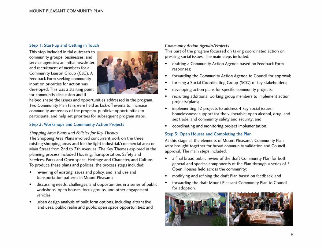
Step 1: Start-up and Getting in Touch
This step included initial outreach to community groups, businesses, and service agencies; an initial newsletter; and recruitment of members for a Community Liaison Group (CLG). A Feedback Form seeking community input on priorities for action was developed. This was a starting point for community discussion and it helped shape the issues and opportunities addressed in the program. Two Community Plan Fairs were held as kick-off events to: increase community awareness of the program, publicize opportunities to participate, and help set priorities for subsequent program steps.
Step 2: Workshops and Community Action Projects
Shopping Area Plans and Policies for Key ThemesThe Shopping Area Plans involved concurrent work on the three existing shopping areas and for the light industrial/commercial area on Main Street from 2nd to 7th Avenues. The Key Themes explored in the planning process included Housing, Transportation, Safety and Services, Parks and Open space, Heritage and Character, and Culture. To produce these plans and policies, the process steps included:
• reviewing of existing issues and policy, and land use and transportation patterns in Mount Pleasant;
• discussing needs, challenges, and opportunities in a series of public workshops, open houses, focus groups, and other engagement vehicles;
• urban design analysis of built form options, including alternative land uses, public realm and public open space opportunities; and
Community Action Agenda/ProjectsThis part of the program focussed on taking coordinated action on pressing social issues. The main steps included:
• drafting a Community Action Agenda based on Feedback Form responses;
• forwarding the Community Action Agenda to Council for approval;
• forming a Social Coordinating Group (SCG) of key stakeholders;
• developing action plans for specific community projects;
• recruiting additional working group members to implement action projects/plans;
• implementing 12 projects to address 4 key social issues: homelessness; support for the vulnerable; open alcohol, drug, and sex trade; and community safety and security; and
• coordinating and monitoring project implementation.
Step 3: Open Houses and Completing the Plan
At this stage all the elements of Mount Pleasant’s Community Plan were brought together for broad community validation and Council approval. The main steps included:
• a final broad public review of the draft Community Plan for both general and specific components of the Plan through a series of 5 Open Houses held across the community;
• modifying and refining the draft Plan based on feedback; and
• forwarding the draft Mount Pleasant Community Plan to Council for adoption.

7
MOUNT PLEASANT COMMUNITY PLAN
7
Mount Pleasant has a number of geographical and historical features that the community wishes to acknowledge and respect as critical in the shaping of the Community Plan, and as contextual factors in development.
Valued assets include:
• the topographical rise from the False Creek Flats up to 16th Avenue where a number of creeks once flowed, including the one which became known as Brewery Creek;
• the traditional Aboriginal pathways that led from fishing grounds to areas of settlement and cultivation;
• the multiple waves of later settlement of this part of the city by Europeans, Americans, Asians, and others who, for example:
- built housing and churches along the 10th Avenue skyline - established the industrial heart of Vancouver with sawmills, metal
fabricating plants, coal yards, breweries and other enterprises - established the city’s first small business, and one of the
province’s first Business Improvement Associations - positioned Mount Pleasant as the first ‘downtown’ of Vancouver
in the early years of the 20th century (with 9th Avenue then renamed Broadway and Westminster Avenue becoming Kingsway), resulting in significant numbers of heritage buildings and features
- built a cycling track; established streetcar lines and created an artists’ enclave with multiple performance sites.
• the community becoming home to a greatly diverse population, including newcomers from all over Canada and the world;
• the reputation of the area as a hub of creative activities and cultural and artistic expression;
• the vibrant mix of small businesses in this community;
• four distinctive shopping quarters within Mount Pleasant, fanning out from the community nexus at Main Street and Broadway Avenue – and the circulation links between these four quarters;
• a large inventory of relatively affordable housing, including rental and social housing; and
• the neighbourhood’s unique location in straddling the west and east sides of the City.
2.0 Plan Context: Distinctive Mount Pleasant

8
MOUNT PLEASANT COMMUNITY PLAN
8
3.0 Mount Pleasant Community Plan Overarching Principles
The Mount Pleasant Community Plan establishes a number of overarching principles which set out the overall goals of the community plan. These principles are intended to inform all future planning and development programs, projects, and other initiatives in Mount Pleasant.
3.1 Housing and Population Mix
Diversity in housing, land uses, businesses and services
Ensure livability for the existing types and sizes of families and households by encouraging the development of housing that addresses a wide range of affordable housing needs–including rental, co-ops, supported housing, and artist live-work housing–while seeking to provide the services and facilities that those families and households need.
Serve a highly diverse population mix with a mix of unit sizes and housing types, a mix of land uses across the neighbourhood and a mix of uses within many individual buildings, a mix of architectural styles, a mix of tenure arrangements (fee-simple, strata, co-op, co-housing, rental, subsidized housing, possibly land trust), and a mix of businesses and community services.
3.2 Economic Development and RevitalizationFour distinctive quarters, each with opportunities for revitalization and new development
In treating Mount Pleasant as a ‘hilltown’ that uniquely straddles the west and east sides of the city of Vancouver, and as a neighbourhood with a single heart (the ‘triangle block’ formed at the intersection of Broadway, Main, and Kingsway), also
recognize four distinct shopping areas in Mount Pleasant. Each of these distinct ‘quarters’ needs an anchor business or multi-service centre, and a mix of other businesses and services.
Treat each of the four separate shopping areas as having a distinct identity, with each of these village nodes serving the whole of Mount Pleasant in different but complementary ways. Routes between these shopping areas are as important as circulation within each of them.
The community has identified needs that are specific to each sub-area, and calls on the City to develop strategy (including added density and height) to attract and encourage development that will respond to these needs, revitalize pockets identified as ‘dead zones’ by residents in Mount Pleasant, and further enhance the vibrancy of Mount Pleasant.
Economic development strategy
Sustain and further encourage a wide variety of independent businesses and professional services that respond to the local needs identified by the community, including niche businesses that will meet the needs of specific communities (for instance, different ethnic groups) within the larger neighbourhood community. Encourage the incubation of new businesses and other creative economy enterprises. Develop without big box stores.
Broadway East
Recognize Broadway East as the highest priority for revitalization and new development, community programming, and land uses designed with the aim of sustaining crime reduction.

9
MOUNT PLEASANT COMMUNITY PLAN
9
3.3 Built Form and Character
‘Hilltown’ identity
Conceive of Mount Pleasant as a distinctive ‘hilltown’ area whose centre is a high-attraction zone for both residents and city visitors. Recognize that its slopes are natural form-makers on which a low profile for residential and commercial properties helps keep the sense of hill intact. Also recognize the historical importance of the ‘hilltown’ identity, reflecting the Victorian-era reference to the location at Main and 8th Ave. as ‘Church Hill’ (where a number of churches were located and made prominent by their church spires).
As a hill town populated by wave after wave of new settlers, each bringing distinctive strengths (e.g., new industry, jazz history, etc.), this neighbourhood warrants ongoing promotion as a heritage area of the city.
Seek to distinguish new development in Mount Pleasant from predominant forms of development in other parts of the City in ways that respond to the unique social, economic, and physical qualities of the neighbourhood.
Welcome ‘future heritage’ too
Keep finding a good way for contemporary design to also fit into the neighbourhood. As an appreciated contrast / complement to preserved heritage, invite and support architectural innovation that creates new legacies (individual sites and/or streetscapes) of which the community is proud. Recognize the need for quality design in new buildings, and the prospect of building “landmark” buildings on important and highly visible sites.
Predominantly low to mid-rise massing
Honour the local preference for a ‘high-low massing rhythm’ across the hill town, but with modest height as the norm: mostly low to mid-rise buildings, high rises only on selected sites. Emphasize infill opportunities in achieving density objectives.
Vibrant streetscapes
Maintain and encourage a safe and active street life by, for example, ‘wrapping’ street landscaping and small commercial activities around street corners, providing space for outdoor seating for cafes and restaurants, greening front entryways with container plantings and window boxes, ensuring the presence of ‘eyes on the street’ from windows and entryways, and ensuring service/retail continuity in commercial areas. With mid- to high-rise buildings, pay particular attention to good design at the street level. There needs to be a rhythm of building and store frontages; these frontages need to be varied and visually engaging to passers-by.
Watson Street
Develop Watson Street as a special site, perceived as unique in history, character and use (similar to the Mole Hill precedent in Vancouver’s West End neighbourhood) and explore improvements for pedestrians and cyclists, especially through redevelopment.
3.4 Large Site Development
As a general guideline for the whole neighbourhood, the community supports greater use of infill opportunities over high-rise development – but the Mount Pleasant community also sees opportunities for some
10
MOUNT PLEASANT COMMUNITY PLAN
10
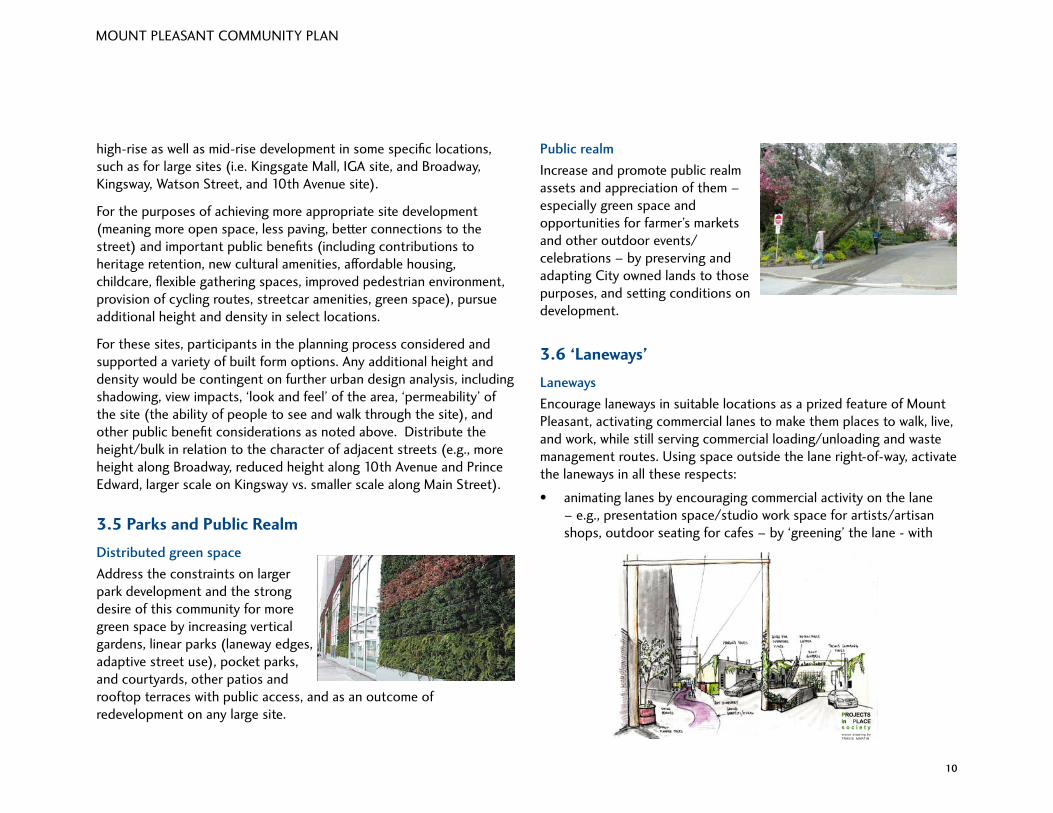
Public realm
Increase and promote public realm assets and appreciation of them –especially green space and opportunities for farmer’s markets and other outdoor events/celebrations – by preserving and adapting City owned lands to those purposes, and setting conditions on development.
3.6 ‘Laneways’
Laneways
Encourage laneways in suitable locations as a prized feature of Mount Pleasant, activating commercial lanes to make them places to walk, live, and work, while still serving commercial loading/unloading and waste management routes. Using space outside the lane right-of-way, activate the laneways in all these respects:
• animating lanes by encouraging commercial activity on the lane – e.g., presentation space/studio work space for artists/artisan shops, outdoor seating for cafes – by ‘greening’ the lane - with
high-rise as well as mid-rise development in some specific locations, such as for large sites (i.e. Kingsgate Mall, IGA site, and Broadway, Kingsway, Watson Street, and 10th Avenue site).
For the purposes of achieving more appropriate site development (meaning more open space, less paving, better connections to the street) and important public benefits (including contributions to heritage retention, new cultural amenities, affordable housing, childcare, flexible gathering spaces, improved pedestrian environment, provision of cycling routes, streetcar amenities, green space), pursue additional height and density in select locations.
For these sites, participants in the planning process considered and supported a variety of built form options. Any additional height and density would be contingent on further urban design analysis, including shadowing, view impacts, ‘look and feel’ of the area, ‘permeability’ of the site (the ability of people to see and walk through the site), and other public benefit considerations as noted above. Distribute the height/bulk in relation to the character of adjacent streets (e.g., more height along Broadway, reduced height along 10th Avenue and Prince Edward, larger scale on Kingsway vs. smaller scale along Main Street).
3.5 Parks and Public Realm
Distributed green space
Address the constraints on larger park development and the strong desire of this community for more green space by increasing vertical gardens, linear parks (laneway edges, adaptive street use), pocket parks, and courtyards, other patios and rooftop terraces with public access, and as an outcome of redevelopment on any large site. PROJECTS
In PLACEs o c i e t yvis ion drawing by TRAVIS MARTIN

11
MOUNT PLEASANT COMMUNITY PLAN
11
Network of routes
Restore/create routes for pedestrians, bicycles, skateboards, rollerblades, and wheelchair/scooters as a high-priority amenity in this neighbourhood. Keep pedestrian and cyclist routes relatively car-free, link the four distinct shopping areas, connect across busy arterials, connect to transit, connect historic sites, and create a continuous green circuit throughout the neighbourhood.
3.8 Heritage
Preserve heritage
Recognize and preserve all heritage buildings. Also find a variety of ways of acknowledging other kinds of heritage throughout the community, including: historic waterways; heritage trees and other aspects of the natural history; settlement and social history; streetscapes as well as individual building sites; industrial history; transportation history; and cultural history (including performance sites).
Ensure that heritage preservation includes the development (programming and promotion) of heritage activities that celebrate this rich settlement, cultural and industrial history. Recognize and celebrate the ‘triangle block’ as representing the historic heart of this community.
trees, landscaping, public art installations (permanent and temporary), and murals – and by creating small courtyard spaces or mini-plazas (as refuge spots or places to hold special events);
• providing a ‘second face’ of Mount Pleasant with expanded opportunities to position architecturally innovative new development along these routes, strengthening the vitality of Mount Pleasant as a business district by promoting dual-entrance options, laneway-facing studios or other small businesses, temporary art installations, and other “back route” enhancements;
• reinforcing Mount Pleasant’s identity as a creative community by increasing the amount of public art in the lanes (permanent and/or temporary installations);
• using laneway margins where possible to support urban agriculture; and
• recognizing Mount Pleasant as a neighbourhood where laneways can be demonstrated and lessons can be learned for application in other parts of the City.
3.7 Transportation
Walking, cycling and public transit
Maintain priority support for walking, cycling and use of public transit as the preferred modes of travel, and mitigate the impacts of traffic and parking on the livability of Mount Pleasant.

12
MOUNT PLEASANT COMMUNITY PLAN
12
Neighbourhood founders acknowledgement
Respect and honour the history, traditions and current presence of Aboriginal peoples and sites; investigate opportunities to deliver tangible support for Aboriginal projects and initiatives, including locations and spaces to mark cultural observances.
3.9 Culture
Strong focus on a creative community
Retain existing – and develop new – gathering, creation, production, presentations, and support spaces (with an emphasis on flexible use) for cultural, social and economic activities, which contribute to the neighbourhood character, reflect its wide-ranging creativity, and also mirror its multicultural identity.
Recognize that Mount Pleasant is a valuable economic development asset to the whole of Vancouver because of its vibrant and creative community which attracts visitors and residents.
3.10 Community Services and Development
Plan for the retention and enhancement of community assets
Build on the past and current strengths of Mount Pleasant, recognizing Mount Pleasant as a resilient and vibrant community already. With new development, keep the neighbourhood context always in mind. Also consider the residents themselves (along with service providers and business operators in Mount Pleasant) as an important asset in the development process.
Social cohesion focus
In all aspects of community planning – i.e., physical building, development of open space, service provision, and community programming – social cohesion is of utmost importance to this community. The Mount Pleasant community wants to: welcome, engage and integrate newcomers; maintain diversity in its population; provide support to residents of all ages through the types of businesses, services, and recreational and volunteer opportunities available in the community; proactively model “best practices” to reduce the risk of crime and social disturbance and to heighten citizen engagement in neighbourhood stability, health and resilience.
Fairness and equity in service provision–city-wide
In the planning and creation of more services for the community (including recreational, health and cultural services), ensure the application of fairness and equity principles, promoting community safety and enhancing opportunities for people to mix with one another in a range of recreational, social and cultural activities across the city.
Integration of at-risk individuals and families
Recognizing Mount Pleasant as a welcoming and inclusive community, ensure that social housing is provided in this neighbourhood with a concurrent increase in support services for at-risk individuals/families who need that housing, including engagement programs for those residents. Integrated community planning must be given precedence over simply meeting housing needs.
Adhering to fairness and equity principles includes distribution of social housing and services for at-risk groups (people who are homeless, have addictions, live with multiple disorders, are chronically unemployed, and/or live with other high-risk conditions) across all neighbourhoods of Vancouver, not concentrating them in eastside neighbourhoods, or any one (or a few) neighbourhoods. Fairness and equity, in practice, also mean not concentrating housing or services for at-risk groups in one sub-area of a given neighbourhood and thereby creating ghettoes.

13
MOUNT PLEASANT COMMUNITY PLAN
13
Inclusivity commitment
Within Mount Pleasant, promote universal design principles and apply them to the greatest extent possible, to make all spaces (whether residential, commercial or public realm) accessible by persons of all ages and abilities/disabilities.
3.11 Public Engagement
Build community capacity
Build or enhance community capacity throughout the planning and development processes, ensuring that the process seeks common ground and reflects the interests of the broad community.
Co-design approach to community development
Create mechanisms – both a governance structure and process mechanisms – that will engage representatives of the Mount Pleasant community, design professionals, and the City together, as an ongoing means of (a) identifying new local needs as well as persistent community needs, and (b) collaboratively ensuring that design solutions and implementation strategies will meet those needs in a way that strengthens and enhances the Mount Pleasant community, while upholding the principles and policies of the Mount Pleasant Community Plan.
Whether in the form of a Neighbourhood Design Panel or Area Council or other structure, the commitment must be integrated into community planning. Physical design challenges and solutions and social needs must be addressed together to ensure a strong community. This body
and related process mechanisms will serve to steward the vision of preserving heritage, sustaining a vibrant and creative place, welcoming architectural innovation, and building fine new legacies here.
The first step in creating the appropriate mechanism(s) will be investigation by City planners into the various models and best practices used in other neighbourhoods and municipalities to achieve similar goals, followed by a report and then further dialogue with community stakeholders to jointly determine the best approach to adopt in Mount Pleasant.

14
MOUNT PLEASANT COMMUNITY PLAN
14
4.0 Policies to Address Key Issues
These policies are largely directed at the City of Vancouver as the most significant policy-maker, regulator, and sometimes funder of projects related to the key issues, and are more focussed (i.e., by location, action, or actor) than the overarching principles discussed above. However, as discussed above, senior levels of government and their agencies have a role to play in the implementation of some of these policies, respecting housing, services, and transportation.
4.1 Housing• Provide more housing and more affordable housing in Mount
Pleasant for low to middle income households, especially for families, seniors, new immigrants, and aboriginal people.
• Seek opportunities to build a greater range of housing types in Mount Pleasant, from SRO’s to row housing, to apartments, to house youth, large and extended families, and seniors (to age in place).
• Seek to reduce barriers to the construction of new market rental housing, and provide more market rental housing in Mount Pleasant, by: having the City provide more land for rental housing; addressing rental restrictions placed on some strata units by Strata Councils; and encouraging retention of rental buildings.
• Apply principles of ‘universal design’ to buildings and environments to make them usable and effective for everyone.
• Seek opportunities and act to reduce parking requirements for housing in order to reduce construction costs (thus reducing housing costs), and to free-up space for alternative uses (e.g., garden space).
4.1 (i) Additional Housing Opportunities• Allow increased housing density in Mount Pleasant near transit
hubs, commercial centres, parks, along arterial streets, and/or streets with linear parks, and with adequate provision or leading to the provision of public services like schools, parks, childcare, community centres, and transit.

15
MOUNT PLEASANT COMMUNITY PLAN
15
• Encourage housing on lanes in Mount Pleasant – both infill and ‘Laneway Housing’- to increase number of units, to increase laneway animation, to provide mortgage-helpers, and to improve housing affordability (with a smaller dwelling unit); fix the existing infill housing policy to enable infill housing to be built on most lots (e.g., 33 foot lots).
• Investigate creating a walkable, shopping and residential hub at Broadway and Clark, encouraging uses like local coffee shops, mini-gardens, grocery stores, restaurants, music venues, galleries.
4.1 (ii) Non-market Housing• The City should seek partnerships with senior levels of government
to provide more affordable housing by providing stable funding for non-market housing, grant support for building and maintaining more affordable housing, and tax incentives for building rental housing.
• Support the distribution of non-market housing throughout the community and the City to retain neighbourhood diversity of population and services.
• Undertake more research by City, shared with the public, on best practices of integrating marginalized at-risk groups into the neighbourhood.
• Help sustain and promote more co-ops and co-housing. Benefits include long-term, secure housing, and contributions to social/economic/family diversity.
• Support housing for the homeless and others with housing needs, by: retaining rental suites through restrictions on redevelopment; providing new non-market housing as part of any large site rezoning and redevelopment; and providing further incentives for the retention of heritage buildings.
• Increase affordable housing along Broadway between Main and Clark.
4.1 (iii) Building Maintenance• Explore strengthening standards and enforcement of standards to
ensure that landlords of low rent units and multi-family buildings are maintaining their buildings, without evicting tenants and significantly increasing rents.
• Consider creating incentives for all residents to maintain their buildings, including the elderly, those on fixed-incomes, or suffering from a lack of health.
4.2 Character• Investigate opportunities to increase the ‘quality’ of new
housing being built (e.g., better scale, materials, detailing, and craftsmanship)
• Explore opportunities to further sustainability and energy efficiency in design including:
- retaining ‘heritage’ buildings with ‘green’ adaptions (e.g., introducing roof gardens, solar panels)
- applying the City’s latest environmental standards to all new development (e.g., LEED or other standards more responsive to local conditions)
- reusing building materials obtained from demolished buildings.

16
MOUNT PLEASANT COMMUNITY PLAN
16
• Investigate opportunities to increase the variety in design of new housing (e.g., discourage ‘cookie-cutter design’) and innovation in building design (e.g., discourage replications of heritage-style architecture or ‘faux heritage’).
• Explore impacts of reducing the height and bulk of new duplexes (including likely impacts on unit size, property values, and carbon footprint).
• Explore opportunities to allow alternative types of building construction (e.g., ‘cob’ or ‘straw bale’ construction)
4.3 Parks and Green Space• Encourage community involvement in the programming and
maintenance of parks (increasing their use, making parks safer).
• Expand urban food growing/education in Mount Pleasant by pro-active policy, active program support, community engagement, and proactive use of underutilized space (e.g., personal garden sharing, cultivating bees, vertical gardens).
• Encourage green roofs for amenity, recreation, and food growing.
• Explore opportunities for daylighting Mount Pleasant’s streams, and creatively and substantially marking the historical course of those streams, encouraging people to think about the neighbourhood as involving a complex ecology.
• Encourage the greening of back lanes in residential areas (e.g., more ‘Country Lanes’).
• Improve open space at Mt. Pleasant Elementary and turn area into special gathering place with hard and soft landscaping.
4.3 (i) Adding Open Space• Pursue creative ways to add park
space in Mount Pleasant, especially in areas without parks nearby, including purchasing corner parks, reusing streets and parking lots for multiple purposes (e.g., slowing traffic and enhancing pedestrian use of the street), setting back buildings (to create small green spaces), and encouraging donations of green space.
• Create one new central neighbourhood square (with covered area) for events like farmers’ markets, festivals, parties, and gatherings.
4.3 (ii) Park Design and Services• Express the welcoming spirit of Mount Pleasant in outdoor space
design by embracing a diverse population including youth, families, different income groups, and aboriginal people.
• Examine opportunities to improve Mount Pleasant’s parks, by:
- adding enhanced lighted recreational space (e.g., for basketball) - continuing to make parks accessible for all users (i.e., ease of
travel to and within parks) - adding additional play equipment, and enclosed and covered
play space for children (especially younger ones) - providing free Wi-Fi connections, with easy universal code, for
way-finding, park or heritage tours - incorporating exercise equipment for adults and seniors
• Provide more space for arts and culture in parks, including rotating art exhibits, public art installations, musical/theatrical shows, and festivals.

17
MOUNT PLEASANT COMMUNITY PLAN
17
• Provide more public washrooms in Mount Pleasant’s parks, and seek partners to accomplish this (e.g., developers and local businesses).
• Examine opportunities to improve Mount Pleasant’s parks by adding a skateboard and bike park and an enclosed off-leash area to Jonathan Rogers Park and Guelph Park.
• Explore ways to increase local residents’ use of “City Hall Park” (e.g., playgrounds, holding community events).
• Make improvements to North China Creek Park, including providing an all-season pathways/running/biking surface, a community garden, enhanced children’s play area, integration with Central Valley greenway, and highlighting the park’s significance in the history of Vancouver.
• Make improvements to South China Creek Park, including addressing safety and cleanliness issues, and providing more play equipment for families and youth (e.g., basketball hoops).
4.4 Laneways• Develop a Laneway Strategy as part of the Public Realm Plan for
Mount Pleasant, and use Mount Pleasant as a pilot area for testing suitable locations for laneway animation, for the benefit of the entire City.
• Encourage cleaner lanes and safer lanes.
• Designate one alley as a ‘graffiti alley’ as a way to engage local artists and trigger dialogue regarding laneways.
4.5 Services• Ensure all of Vancouver’s
neighbourhoods are fairly provided with a range of services to meet resident’s needs (e.g., provision of low cost or free services, services for new immigrants, opening hours, indoor and outdoor recreation, community gardens, library services).
• Continue to provide support for Mount Pleasant’s children and youth, considering:
- more childcare spaces and support for organizations (e.g., churches) willing to provide more childcare spaces
- providing more ‘late-night’ safe activities - mixing recreation with educational and employment training - more children’s programs especially for parents/caregivers and
younger children
• Provide intergenerational support, for example, linking seniors with young families, or seniors with youth; consider integrating seniors programs with other programs offered by Mount Pleasant Neighbourhood House, Community Centre, or local schools.
• Ensure diverse recruitment of public service staff (e.g. library, community centre etc.) to provide language services to all.
• Provide needed and on-going services to immigrants in Mount Pleasant (e.g., tutoring, information on housing and community services), and provide directories of those services.
• Acknowledge and support programs currently housed in non-City facilities such as Mount Pleasant Neighbourhood House, Light and Love Home, and St. Patrick’s Church.

18
MOUNT PLEASANT COMMUNITY PLAN
18
• Examine opportunities for providing medical walk-in services in Mount Pleasant (open evenings and weekends); assess impact of city regulations (e.g., parking requirements).
• Provide adequate space for seniors’ programing in Mount Pleasant (Mount Pleasant Community Centre is too small to house seniors’ programs).
• Identify existing or provide new gathering places where people of diverse backgrounds can freely drop in or participate in activities or events such as multicultural or aboriginal dinners.
4.5 (i) Homelessness• Seek to prevent homelessness
before it happens with the timely provision of support services addressing health and poverty issues, especially for at-risk youth.
• Distribute housing and services for the homeless, addicted, multiple disorder, and other high-risk populations throughout the City, and not concentrated primarily in East Side neighbourhoods, or in any one neighbourhood, or small group of neighbourhoods.
• Continue to support efforts to house the homeless in Mount Pleasant, with consideration given to the long-term effects of this support on well-being of the whole neighbourhood.
• Ensure buildings that house the homeless and other types of supportive housing respond to the character of the neighbourhood in terms of form and scale, or, if applicable, to the anticipated future character of the neighbourhood (as set out in the community plan).
• Ensure the community is engaged by the City, provincial government, and/or other actors when implementing programs for the homeless.
• Examine opportunities to use existing vacant or underused space to accommodate homeless people as a cheaper alternative to building new housing.
4.5 (ii) Garbage and Recycling• Seek compliance of commercial
and residential property owners and occupants with City By-laws requirements regarding management of their solid waste, including clean-ups of major garbage items.
• Ensure air and waste water quality regulations are followed in light industrial areas in Mount Pleasant (e.g., IC-2 and IC-3), including businesses and artist studios.
• Encourage all residential properties and businesses to recycle (especially products that local businesses sell).
• Provide all eligible properties with City run recycling and composting collection services.
• Continue to recognize businesses and non-profit organizations that operate recycling services not provided by the City (e.g. electronics, deposit containers), and inform property owners and occupants of those services.
• Encourage residents to compost using backyard composters or worm bins.
• Direct new developments and redevelopments to provide proper space allocation for solid waste storage facilities.

19
MOUNT PLEASANT COMMUNITY PLAN
19
• Consider introducing lighting in areas frequented by the public at night and considered unsafe by residents (e.g., around Vancouver Community College), with consideration of impact on nearby residences.
• Use graffiti art (e.g., wall murals) to reduce ‘tagging’ of blank walls.
4.7 Walking, Biking, and Parking• Provide more opportunities for using skateboards, roller blades,
and scooters on pathways away from car traffic.
• Address traffic calming issues through the City’s Traffic Calming Program. Streets identified by the community include Scotia, Manitoba and Sophia Streets, and around #1 Kingsway and Francis Xavier School.
• Address road maintenance issues through the City’s Street Maintenance Program. Issues identified by the community include paving on 16th Avenue, sidewalk maintenance on Broadway near Kingsway (sidewalks blocked by bus shelters, buckling sidewalks), and steep sidewalks north of 6th Avenue on Carolina Street, St. George and Fraser Streets; improve methods of reporting maintenance issues (e.g., on-line reporting).
• Explore opportunities for converting streets to bike or pedestrian corridors with slow-moving traffic.
• Provide street improvements to encourage bicycle riding in Mount Pleasant, including possible bike lanes on major streets, providing additional bike routes linking Mount Pleasant to northern destinations through False Creek Flats, adding bike racks for a variety of bikes and bike attachments in commercial areas, and further diverting traffic away from bike routes.
• Provide improvements to encourage walking in Mount Pleasant, (e.g., better east-west connectivity across Main Street from 1st to 5th Avenues, north-south connectivity across Great Northern Way and the railway tracks to Terminal Avenue).
4.6 Safety• Continue the practice of having windows
face onto streets, lanes, sidewalks, and parks for casual surveillance.
• Continue to prune and shape street trees in order to shed maximum levels of lighting on streets and sidewalks; increase the use of 2 levels of lighting incorporating down lighting for pedestrians.
• Strengthen the Mount Pleasant service component of the Renfrew Collingwood Policing Centre (e.g., encourage more volunteers with better and more diverse outreach).
• Increase bike and foot patrols especially in areas considered unsafe by Mount Pleasant residents.
• Support the aims of the City’s Four Pillars Program by:
- improving access to treatment for mental health and drug addiction
- improving safety for the community (e.g., more needle pick-up) - seek ways to mitigate the risk for drug users and sex trade
workers.• Consider measures to promote safety in Mount Pleasant’s parks
and public places, including enlisting ‘pooch patrols’ and providing a fenced dog park or playground to enhance surveillance, providing readily accessible public phones, installing bright lighting in parks and along park edges, and posting information about current safety programs.

20
MOUNT PLEASANT COMMUNITY PLAN
20
• Review the potential of reducing parking requirements – especially for housing – to reduce development costs and reliance on the car; address Traffic Demand Management at the community level to reduce needed car travel.
4.8 Transit
Provide transit improvements to encourage taking transit in Mount Pleasant, including:
• supporting the extension of Skytrain/rapid transit or some other form of technology out to UBC.
• examining the potential of extending Vancouver’s streetcar network up Main Street to 13th Ave. (site of old transit barns).
• supporting the extension of the streetcar from Science World to Chinatown/Gastown/Stanley Park/Yaletown – with connection to Great Northern Way Campus and Vancouver Community College.
As part of the upcoming future Area Transit Plan, consider:
• charging for transit based on distance travelled, not zones.
• increasing bus service on Main Street and at night.
• providing small community shuttle buses to local destinations in Mount Pleasant, especially where walking routes are very steep.
Possible streetcar line on Main Street
Narrowed street (Garden Drive) Carrall Street Greenway

21
MOUNT PLEASANT COMMUNITY PLAN
21
4.8 (i) Great Northern Way Campus Transit StationGreat Northern Way Campus (GNWC) is located on the southern edge of the False Creek Flats, generally bounded by Main Street to the west, Clark Drive to the east, Prior/Venables Streets to the north, and Great Northern Way to the south. It is anticipated that a new transit station will be built on the site as part of the Millenium Line extension to UBC.
• Locate the anticipated transit station on the north side of Great Northern Way, positioned to be integrated with new development including safe pedestrian access and connectivity between the station and other Mount Pleasant destinations.
4.9 Heritage• Apply the broader definition of ‘heritage’ for Mount Pleasant
that goes beyond buildings, and includes streetscape, landscape resources (e.g., trees and parks), and archaeological sites.
• Explore new and diverse ways to understand, display, retain, celebrate, and communicate about Mount Pleasant’s heritage, incorporating aboriginal knowledge and last century’s immigrant’s contributions; using public art, websites, walking tours (with I-phone ‘app’), plaques, cairns, photo exhibits, community events, dates stamped on sidewalks, and information posted in small gathering places, parking lots, and/or commercial sites.
GUELPH PARK
CHINA CREEK NORTH
PARK
WIN
DSO
R S
TE 8TH AVE
E 7TH AVE
CO
TTR
ELL
ST
FOLE
Y S
T
ST.
CA
THE
RIN
ES S
T
PR
INC
E A
LBER
T ST
FRA
SER
ST
CA
RO
LIN
A S
T
GREAT NORTHERN WAY
ST.
GE
OR
GE
ST
GU
ELP
H S
T
BR
UN
SW
ICK
ST
SC
OTI
A S
T
LORNE S
T
SCOTIA S
T
E 1ST AVE
MA
IN S
T
ST FRANCISXAVIER SCHOOL
MT PLEASANTELEMENTARY
SCHOOL
CAROLINAPARK
SAHALLIPARK
possible location of future transit station
Great Northern WayCampus
• Upgrade the heritage register recognizing buildings built since 1940, and other aspects of heritage (e.g., important working class homes, redressing the gender imbalance as part of cultural history). Create a supplemental inventory of new landmark, iconic buildings.
• Enhance Brewery Creek’s historical significance by linking creek daylighting to public education and school programs, finding partners to fund stream daylighting, and making it a priority in line with the City’s new green action plan. Do not give bonus density for new development for symbolizing the creek through artistic design.
• Educate people about heritage in Mount Pleasant. Consider making Mount Pleasant a ‘heritage area’ – providing a detailed description of Mount Pleasant’s heritage assets – as a means to better protect and enhance its heritage resources.
• To discourage demolition of older buildings and development of new duplexes, increase the incentives/regulation relaxations (including zoning and building code) for heritage retention in Mount Pleasant. Allow transfer of density within Mount Pleasant as a heritage retention tool. Recognize that infill housing promotes the retention of heritage.
• Improve guidelines for ‘heritage’ design in Mount Pleasant’s apartment and duplex areas to better complement existing heritage buildings.

22
MOUNT PLEASANT COMMUNITY PLAN
22
4.10 Culture• Provide more opportunities to create and display a diversity of
public art.
• Create indoor cultural facilities and spaces for public meetings and presentations, art gallery showings, artist studios, rehearsals and performances, and make better use of existing public buildings (e.g., schools) and commercial spaces (e.g., cafes) for cultural activities.
• Investigate means to enable artists to better communicate among themselves and with the community, including:
- providing an inventory of multipurpose, common space in buildings
- providing free display spaces; enabling artists to pool equipment; providing information regarding rezonings relevant to artists
- providing a cultural resource liaison between artists and the City - creating maps setting out ‘artists walks’ with public art and artist
studios.
• Acknowledge Mount Pleasant’s history/culture with plaques/cairns, street/building/park names, festivals/events, walking tours, and lighting projects, with creative use of technology.
• Address issues related to City policy respecting arts and culture, including zoning, guidelines, and other policies and enforcement practices.
• Review zoning for artist live-work studios and other related policy, to promote affordability and use by artists.
• Seek to provide diverse and affordable housing options for artists (e.g., live-work, common work space, artist co-ops).
• Promote community engagement and diverse cultural programming of events in Mount Pleasant, such as ‘summer spaces’, block parties, testimonials etc, and provide new opportunities for artists/residents from diverse backgrounds.
• Encourage artists, residents, and the City to work together to make common things art (e.g., benches, bike racks)
• Provide more opportunities in Mount Pleasant for outdoor live events and performances (e.g., ‘Music on Main’, stages in parks)
• Allow existing buildings (including houses) to have artist’s space, or provide more mixed-use buildings accommodating artists
Western Front (artist-run-centre) Heritage walking tour
Graffiti art

23
MOUNT PLEASANT COMMUNITY PLAN
23
5.0 Shopping Sub-Area Plans and Policies
The Mount Pleasant Community Plan contains plans and policies for Mount Pleasant’s three shopping sub-areas – Uptown, Broadway West, and Broadway East - and the light industrial/commercial area located on Main Street from 2nd Avenue to 7th Avenue (see Map 2). The policies establish a framework for more detailed planning (including rezoning) which will occur during plan implementation (see Section 6.0).
Within these sub-areas are locations where additional density and height should be pursued to achieve more appropriate site development and important public benefits. A variety of built form options could be appropriate on these sites; any additional height and density would be contingent on further urban design analysis, including shadowing, view impacts, and the ‘look and feel’ of the area.
It is important to note that additional height (as opposed to density) is a very sensitive issue where there was the least convergence of community opinion during the community plan process. Future development will need to demonstrate how to reach an optimal balance of public benefits, site improvements, and urban design objectives with higher densities in low-, medium-, and, on selected sites, high-rise forms of development.
New residential development should serve, in part, communities with housing needs (e.g., low to middle income families, seniors, artists) by providing a variety of housing types (e.g., more rental, social or artist live-work units, row housing, 3-bedroom units for families, or co-operatives). Large sites are encouraged to expand job space (retail, office professional), provide more services, and locate parking underground. The Plan supports the design of ‘iconic’ (landmark) buildings when granting permission for higher buildings. New development should distinguish itself from predominant forms of development in other parts of the City.
5.1 Uptown Shopping Area
Overall Concept Plan• Retain the existing scale and character of Main Street (from 7th to
11th Avenue).
• Ensure that Main Street be kept more local in scale with smaller frontages. Retain the ‘high and low’ rhythm of building heights along Main Street. Retain older more affordable housing (e.g., 3 storey walk-ups) for low income families and individuals.
• Create an improved pedestrian environment linking important sites along Main (e.g., IGA site, Heritage Hall).
• Allow additional density and height for mixed-use buildings of up to 6 storeys to increase housing opportunities along South Main (12th to 16th Avenues).Map 2
Main(2nd
to 7th)
Broadway WestBroadway East
UpTown
Southeast False Creek
Mount PleasantIndustrial Area
CLA
RK
KINGSWAY
GREAT NORTHERN WAY
16TH
MA
IN
12TH
BROADWAY
2ND
FRA
SER
PRIN
CE
ALB
ERT
CA
MB
IE
YUK
ON
QU
EBEC
ON
TAR
IO
PRIN
CE
EDW
AR
D
SCO
TIA
7TH
Community Plan AreaShopping AreasLarge Sites
Mount Pleasant

24
MOUNT PLEASANT COMMUNITY PLAN
24
• Create a ‘Cultural District’ north of Broadway by preserving and enhancing the heritage ‘heart’ (triangle north of Broadway between Main Street and Kingsway) and the surrounding area at current scale, with retention and creation of spaces accessible to a range of cultural groups for a range of purposes, including artist studios.
• Improve pedestrian link between areas located north and south of Broadway with wider sidewalks and improved pedestrian crossings (e.g. residents have suggested longer crossing times at lights); celebrate the historical importance and physical uniqueness of Watson Street.
• Increase permitted residential (with some commercial space) in locations south of Broadway on Kingsway recognizing Broadway and Main is and will continue to be a busy transit interchange, and that Broadway and Main lie at the ‘summit’ of ‘hilltown’.
• Use contributions from redevelopment sites south of Broadway (e.g., Broadway, Kingsway, 10th Avenue and Watson Street site; Kingsgate Mall) for heritage retention, cultural amenities, and public realm improvements north of Broadway in Mount Pleasant.
‘Cultural District’, north of Broadway, with central gathering place and cultural centre.
Possible redevelopment south of Broadway on Kingsway including the site bounded by Broadway, Kingsway, Watson, and 10th Avenue.

25
MOUNT PLEASANT COMMUNITY PLAN
25
Large Sites
5.1 (i) Rize Alliance Development site (bounded by Broadway, Kingsway, Watson Street, and 10th Avenue)
• Support the design of an ‘iconic’ (landmark) building when granting permission for higher buildings.
• Encourage new development on the site bounded by Broadway, Kingsway, Watson Street, and 10th Avenue: add more housing, expand job space (retail, office professional), provide more services, and locate parking underground. Provide housing off Broadway/Kingsway (very busy intersection), and seek to animate this block with appropriate commercial uses.
5.1 (ii) Kingsgate Mall
• Pursue additional density and height beyond that permitted under the current C-3A zoning
• Retain positive attributes of existing mall to local community: small businesses catering to the needs of the diverse local population, merchant booths, chairs to sit in, local programming/events run out of the mall.
• Turn Kingsgate Mall ‘inside-out’: have entranceways to retail stores on the street; ‘active’ space designed with pedestrian and cyclists in mind; childcare located near green space close to shopping; and an interior courtyard.
• Incorporate a plaza as an ‘inviting’ public space emphasizing pathways through the site to ensure its permeability; consider views from the plaza and provide ready access to and from 10th Avenue Bikeway.
• Explore incorporating outdoor and indoor performance and presentation space in development.
Possible development at Kingsgate Mall.

26
MOUNT PLEASANT COMMUNITY PLAN
26
5.1 (iii) IGA Site
• Pursue additional density and height beyond that permitted under the current C-2C zoning .
• Put entrance of retained grocery store on Main Street; improve the integration of project ‘edges’ with surrounding community; replace surface parking with green space; use green space for a variety of public programming (e.g., artists’ fair, community garden, gathering space). Explore and work with ‘streetcar theme’ reflecting sites history.
5.2 Main 2nd to 7th• Create an urban community along Main Street (2nd to 7th
Avenues) with a mix of residential, office, and retail uses. The retail character should be one of local-serving shops and services with small and varied frontages, along with a grocery store.
• Arts and culture spaces (e.g., studio, performance) should be expanded to serve the larger arts and culture population. Improve the feasibility, longevity, and governance of live-work studios for artists.
• Special care is needed to address the width of Main Street and its attendant traffic; examine opportunities to widen sidewalks and improve pedestrian crossings (e.g. residents have suggested longer crossing times at lights).
Possible options for built form along Main St. at the IGA site. The ‘inside out’ orientation of the IGA site, utilizing retail ‘wrap-around’, improves integration with the street.

27
MOUNT PLEASANT COMMUNITY PLAN
27
• Identify opportunities to create more small public open spaces and plazas (e.g., the community suggested closing-off the street at 3rd Avenue and Lorne Street to create a plaza) that link Main Street together. Opportunities exist to take advantage of the slope for creating an interesting street.
• Link the historical and industrial aesthetics in new development, recognizing the transition from Broadway to Main, and promote and imbed architectural innovation and experimentation.
• Allow up to 6 storeys for mixed-use developments along Main Street from 2nd to 7th Avenues; investigate permitting additional height during plan implementation (see Section 6.1 c.)
5.3 Broadway West
Overall Concept Plan• Respond to Mountain Equipment Coop (MEC) as the anchor
of this shopping area, and reflect the ‘outdoor character’ of the shopping area (e.g., with many bike and outdoor stores). Encourage a greater business mix, meeting daily needs of residents, including a local grocery store. Ensure that Broadway West be kept more local in scale than the Uptown area, with a gradient of retail stores from Cambie (with its ‘big box’ stores) to Main Street (with its small-scale shops).
• Arts and cultural spaces including spaces for individual artists (e.g., studio, support, production, and presentation spaces) should be expanded to serve the large artist population; encourage small storefronts (especially chronically vacant spaces) to be used as galleries/ studios.
• Increase bike access to Broadway: investigate creating a shopping ‘bike path’ by employing a bike parking strategy (e.g., bike lock ups near outdoor cafes, in back lanes).
• Consider creating a significant pedestrian connection leading to Jonathan Rogers Park, with commercial storefronts facing open space, potentially consolidating the block and reorganizing the lane. Use the slope as an advantage for underground parking.
• Retain existing density and height limits on the south side of Broadway (i.e., new buildings usually achieve heights of 6 storeys) to maintain views to the north and existing scale of new development.
Six storey mixed-use
Jonathan Rogers Park
Redeveloped block with improved connections to Jonathan Rogers Park.

28
MOUNT PLEASANT COMMUNITY PLAN
28
• Pursue additional density and height beyond that permitted under the current C-3A zoning for mixed-use developments on the north side of Broadway to achieve a more appropriate built form and contribute to public benefits (e.g., cycling routes, pedestrian environment, open space, affordable housing).
• Allow some mid-rise buildings (e.g., 8 storeys), providing there is no overshadowing of Jonathan Rogers Park, and allow lot consolidation across the lane in blocks with short lots (i.e., north side of Broadway between Yukon and Quebec Streets).
5.4 Broadway East
Overall Concept Plan• Revitalize Broadway East, attracting a mix of business and
residential development, providing more shops and services within walking distance, including provisions for more medical and dental services. Ensure that Broadway East be kept more local in scale than the Uptown area.
• Require ground floor retail to animate the street, with office space and social services located on the second and/or third storey, with residential higher up.
• Arts and cultural spaces, including space for individual artists (e.g., studio, support, production, and presentation spaces) should be expanded to serve the large artist population; encourage small storefronts (especially chronically vacant spaces) to be used as galleries/ studios.
• Seek ‘quality’ in design of new buildings, with good quality materials and interesting detailing, including some inner courtyard designs (e.g., Campbell Court) for new development.
• Retain existing density and height limits up to 4 storeys on the south side of Broadway, maintaining sun access to commercial sidewalks, views to the north, and existing scale of new development.
Six storey mixed-use Eight storey mixed-use
BROADWAY
GU
EL
PH
FR
AS
ER
PR
IN
CE
AL
BE
RT
INVESTIGATE ALLOWING BUILDINGS ABOVE 6 STOREYS
INVESTIGATE ALLOWING BUILDINGS ABOVE 6 STOREYS
PURSUE ADDITIONAL DENSITY AND HEIGHT ON THE NORTH SIDE OF BROADWAY (UP TO 6 STOREYS)
RETAIN EXISTING DENSITY AND HEIGHT LIMITS ON THE SOUTH SIDE OF BROADWAY (I.E. UP TO 4 STOREYS)
PUBLIC REALM IMPROVEMENTS ALONG BROADWAY
SHORT LOTS ALONGNORTH SIDE OFBROADWAY
ALLOW SOME SMALLER-SIZED MID-RISEBUILDINGS (E.G. 8 STOREYS) ON THE NORTHSIDE OF BROADWAY
ALLOW FOR LOT CONSOLIDATIONS ACROSS THE LANE
PUBLIC REALM IMPROVEMENTS ALONG BROADWAY
RETAIN EXISTING DENSITY AND HEIGHT LIMITS ONSOUTH SIDE OF BROADWAY
YU
KO
N
BROADWAY
ON
TAR
IO

29
MOUNT PLEASANT COMMUNITY PLAN
29
• Pursue additional density and height beyond that permitted under the current C-2C zoning for mixed-use developments on the north side of Broadway to increase private investment in the Broadway East shopping area, and contribute to public benefits (e.g., cultural amenities and public realm improvements).
• Allow up to 6 storeys for mixed-use developments along the north side of Broadway between Prince Edward and Prince Albert Streets; investigate permitting additional height during plan implementation (see Section 6.1 c.).
Six storey mixed-use Six storey mixed-use
Four storey mixed-use Courtyard at Capers

30
MOUNT PLEASANT COMMUNITY PLAN
30
6. Plan Implementation
6.1 Avenues to Plan Implementation
Implementing the Mount Pleasant Community Plan will involve a combination of efforts stemming from a number of different initiatives:
Site-Specific rezoning – involving applications from landowners/developers to change the designation of land in accordance with Community Plan principles and policies. The rezoning process – with public engagement – should explore how to reach an optimal balance of public benefits, site improvements, and urban design objectives with higher densities in low-, medium-, and, on selected sites, high-rise forms of development.
On-Going City Programs and Projects – involving the application of staff resources and/or capital funding already dedicated to address key city issues and objectives, like the provision of bike facilities and routes, park improvements, and traffic calming. During the Community Plan process, heritage staff, working with consultants, drafted a Mount Pleasant Heritage Context Statement which can be used in the Heritage Register Upgrade. Combining efforts to achieve outcomes that accomplish a variety of City and neighbourhood goals can also be pursued. An example of such an effort could involve the installation of traffic calming devices which could enable the creation of pockets of green space and/or the provision of bike parking facilities. Collaboration with local businesses and residents can result in a stronger effort in bringing about plan policy.
New Programs and Projects – involving requests for new resources to implement the plan in cases where no resources are currently in place. Staff will report back to Council in instances where this support will be required in order to implement Mount Pleasant’s plans and policies.
An example where a new planning program will be needed is the rezoning of Main 2nd to 7th Avenue. The community supports mixed-use development of up to 6 storeys in this area. They also expressed
concerns about allowing buildings above 6 storeys at the intersections of Main Street with 2nd Avenue and with 7th Avenue. The concern is in recognition of potential impacts on views – especially at Main and 7th Ave. - and overshadowing of adjacent areas, along with changes to the character of the street. There was also strong support for retaining the Main Street view cone, protecting existing views, and restricting development of higher buildings along the east side of Main Street.

31
MOUNT PLEASANT COMMUNITY PLAN
31
Further work to be done on these issues when the Main 2nd to 7th area enters a rezoning process:
• demonstrating how any additional height above 6 storeys at 2nd and 7th Avenues serves to improve site development and street character, and provide public benefits, without compromising the ‘hill town’ urban design concept, important public views, and sun access to the street; and
• clarifying the dimensions of the view cone, and carefully examining potential development in and around the view cone, in consultation with the broader community, demonstrating how altering the view cone will improve site development and street character, and provide public benefits, without compromising important public views.
Once again, the rezoning process – with public engagement – should explore how to reach an optimal balance of public benefits, site improvements, and urban design objectives with higher densities in low-, medium-, and, on selected sites, high-rise forms of development.
In addition, the emerging Homelessness and Housing Strategy is investigating creative approaches to achieving affordable housing (market and non-market), which may inform future rezoning processes.
6.2 Steps to Begin Community Plan Implementation
Staff will begin the process of plan implementation by taking the following steps:
Revitalization Strategy for Broadway East
A revitalization strategy will be devised by staff, working with the community, to address the issues identified in the community plan respecting Broadway East. Along with seeking change along this commercial strip, the community also expressed concerns about allowing buildings above 6 storeys on the north side of Broadway at
the east and west ends of the shopping area (i.e., between Prince Edward and Guelph, and between Fraser and Prince Albert). Concerns were also expressed about closing off the north leg of Fraser at Broadway for purposes of creating Fraser Square (which would incorporate sitting areas, meeting places, and provide a view of and greater connection to Sahalli Park). Concerns about the former relate to potential impacts on views and overshadowing of adjacent areas, along with changes to the character of the street; concerns about the latter relate to impacts on local traffic, and the prospect of the resulting open space being unsafe and unavailable for local residents (subject to use by drug users and sex trade workers).
Further work will be required on these issues when a revitalization strategy is drafted for Broadway East. The strategy must assess how any additional height above 6 storeys serves to trigger redevelopment, and leads to improvements in site development and street character, and provisions of public benefits, without compromising urban design considerations (including overshadowing), and important public views. Further work on Fraser Square will involve reviewing local traffic implications for any partial or full street closing, and addressing the proposed change in light of the full revitalization strategy being drafted for Broadway East.

32
MOUNT PLEASANT COMMUNITY PLAN
32
The revitalization strategy will have physical, economic, and social dimensions – for example, public realm improvements can be brought about through redevelopment, which also can deliver new housing and services to the area, which, in turn, can create a safer environment for local businesses and residents. It will also recognize Broadway East’s economic and development history in deciding on an appropriate response. The strategy will determine the conditions and priorities needed to set revitalization in motion on Broadway East.
Public Benefits and Infrastructure Strategy
A Public Benefits and Infrastructure Strategy will be devised for Mount Pleasant to enable the delivery of multiple public benefits identified in the community plan. This Strategy will identify the capital costs for new public amenities and facilities requested in the community plan (e.g., childcare, parks, engineering infrastructure, cultural spaces including artist studios and live/work, affordable housing, and heritage retention), potential revenue expected from new development and other sources (e.g., DCLs, CACs, Capital Plan), and the allocation of that revenue to support the construction and operation of new amenities and facilities. The Strategy will also seek to ensure that new development on both City and private land pays a fair share towards public benefits needed to meet demands created by the new population.
Public Realm Plan
A Public Realm Plan will be drafted to co-ordinate the public realm improvements identified in the community plan. In general, the public realm plan should address issues of connectivity across Mount Pleasant (e.g., with pathways, bikeways, and Laneways), street vibrancy, provision and design of public spaces, and sustainability (e.g., rainwater management, wildlife habitat, and other ecological considerations). A key consideration will be approaches to daylighting and marking Mount Pleasant’s streams.
Public Engagement Review
The overarching goal of this review is to improve civic decision-making, addressing issues of representativeness, diversity, trust, and creativity in neighbourhood decision-making, while building community capacity to solve problems. It will involve an investigation into creating a governance structure and process mechanism to engage representatives of the Mount Pleasant community, design professionals, and the City to collaborate on design solutions and implementation strategies for the Mount Pleasant Community Plan. As a first step, various models and best practices used in other neighbourhoods and municipalities will be reviewed, including neighbourhood design panels and co-design processes. This would be followed by further dialogue with community stakeholders to jointly determine the best approach to adopt in Mount Pleasant. This review will be co-ordinated with the City’s own on-going review of public engagement practices.
6.3 Additional Considerations When Implementing the Community Plan
Based on comments received during Open Houses evaluating draft policy directions, the following are additional considerations when implementing certain aspects of the Community Plan:
Housing• determine the impact of environmental, heritage and other
regulations/policies on the cost of housing (both short and long term), and seek a balance when in pursuit of competing objectives.
• examine the ‘role’ of new duplexes in providing housing diversity in Mount Pleasant (e.g., unit size, number of bedrooms, etc.)
• Investigate opportunities for sharing space in development (e.g., artist work space, study space) to reduce household housing costs.

33
MOUNT PLEASANT COMMUNITY PLAN
33
Where additional density and height are being considered, examine opportunities and constraints in providing more affordable rental and strata family-sized units (i.e., 3 and 4 bedroom units), more row housing, and creative tenure arrangements including ‘restricted resale housing’.
Character• recognize tradeoffs involved when moving away from designing
buildings reflective of heritage character in favour of variety and innovation:
- should there still be some heritage aspects mandated (e.g., colours, materials)?
- should some heritage buildings be renovated or replicated? - are there some areas within which design should be more tightly
controlled? and - are there some aspects of contemporary design that should be
restricted?
• examine shadow/privacy/character impacts of providing housing on lanes, and assess areas for which it is most suitable.
Culture• examine the impact of noise and hours of operation on nearby
residential areas when seeking opportunities for providing more live performance spaces.
• examine economic viability when providing cultural space in new development; seek to ensure such space remains viable for cultural use for the life of the building.
Services• examine opportunities and constraints in providing more health
services in Mount Pleasant – especially walk-in clinics and constraints posed by city parking regulations.
Parks• examine existing park programming needs (e.g., the kinds of spaces
currently unavailable) when creating additional park space in Mount Pleasant.
• provide a suitable separation from residential areas and quiet areas in parks when finding locations for skateboard and bike parks.
Parking• recognize the importance of short-term street parking to local
merchants (especially in light of revitalization efforts); parking reductions should not result in an increase in demand for on-street parking.
• investigate parking reductions near transit interchanges where travel choices exist beyond the use of a single occupancy vehicle.