overview issue 02 projekti/i-scope... issue january ... typically! created! through! computer!...
TRANSCRIPT
www.iscopeproject.net Issue
January 2013 02
The Consortium Overview
i-‐SCOPE project plans to develop and test technologies for the so-‐called smart ci:es services based on interoperable 3D Urban Informa:on Models (UIMs). Indeed, the latest genera:on of UIMs created from accurate urban-‐scale geospa:al informa:on, can be used to create smart web services based on geometric, seman:c, morphological and structural informa:on at urban scale level, which can be used by local governments to: • Improve decision-‐making on issues related to urban planning,
city management, environmental protec:on and energy consump:on based on urban paJern and its morphology.
• Promote inclusion among various users groups through services which account for barriers at city level.
• Involve ci:zens at wider scale by collec:ng geo-‐referenced informa:on based on loca:on based services at urban scale.
Furthermore, i-‐SCOPE aims at providing a significant contribu:on to standards in the domain of smart city services, through contribu:on to the extension and wider adop:on of CityGML as a key enabling open standard for 3D smart city services. With specific regard to this, i-‐SCOPE has the following goals: • Promo:ng establishment of a common "Urban Informa:on
Model" (UIM). • Accelerate the uptake of CityGML as the reference standard to
support simula:on. • Extending the core CityGML open standard. • Promo:ng a number of awareness ac:vi:es to accelerate the
uptake of CityGML as the reference standard to support urban-‐scale smart services, sustainable planning and simula:ons.
Moreover, i-‐SCOPE will deliver an open plaTorm on top of which to develop three 'smart city' services, which will improve: • Inclusion and personal mobility of aging and diversely able
ci:zens. • Op:miza:on of energy consump:on • Environmental monitoring. Page
1
1. Overview 2. Short descrip:on of project progress 3. Scenarios:
• Energy dispersion & solar energy poten:al assessment • Noise mapping & simula:on • Improved inclusion and personal mobility of aging people
4. System Architecture 5. Project events 6. Project mee:ngs 7. Publica:ons
8. Contact Info
Table of Contents
• i-‐SCOPE, interoperable Smart City services through an Open PlaTorm for urban Ecosystems • i-‐SCOPE is supported by the CIP / ICT Policy Support Programme Pilot Type B of the European Commission
• FrameWork: Compe::veness and Innova:on Framework Programme • ICT PSP Iden:fier: CIP-‐ICT-‐PSP-‐2011-‐5 • Objec:ve Iden:fier 5,1: Open innova:on for Internet-‐enabled services in «smart» ci:es
• Dura:on: 36 months • Project Coordinator Raffaele De Amicis Fondazione GraphiTech | Via Alla Cascata, 56/C -‐ 38123 Trento, Italy E-‐mail: [email protected] Phone: +39 0461 283395 Fax.: +39 0461 283398
Fact & Figures

www.iscopeproject.net
www.iscopeproject.net The Pilot Scenarios
The smart services proposed address the following three scenarios: • Improved inclusion and personal mobility of aging people and diversely able ci:zens; • Energy dispersion & solar energy poten:al assessment; • Noise mapping & simula:on.
The first scenario of i-‐SCOPE project deals with Energy dispersion and solar energy poten:al assessment. In general, this scenario reflects the importance of renewable energies and reflects this in the project. There, it exemplarily handles both aspects, the genera:on of energy with solar panels on building roofs as well as the heat losses on building at a roof level. The integra:ng factor between the two aspects of the scenario is the CityGML based data-‐structure, which allows handling with a 3D city model enriched from both direc:ons with a classifica:on regarding the solar power poten:als of the building roof and a classifica:on of the heat loss too. Both aspects can be evaluated as separated from each other or in an integrated way. Thus, the scenario provides an appropriate knowledge-‐base and a support system for energy related spa:al decisions. For the solar energy poten:al assessment, a 3D city model is generated based on the projects plaTorm infrastructure. This model can then be used: • to assess the solar power poten:al considering the exposi:on and inclina:on of the roof surfaces, • to assume the roof coverage with solar panels and to es:mate the related investments and benefits, or • to simulate the effect of planning to the solar power poten:als. Hea:ng loss is captured based on infra-‐red areal surveys. The informa:on gathered from this sensor is used to perform a classifica:on of the building roofs. It can be used to iden:fy urban areas where energy saving ac:vi:es would be appropriate: star:ng from an image based data capturing process, the scenario will not only allow the storage and use of seman:cs (classifica:on) generated throughout the process, but will also enable using the images themselves as textures to the 3D city model.
Scenario 1: Energy dispersion & solar energy potential assessment
Page 3
The informa:on generated throughout the aforemen:oned processes is managed in a CityGML schema that is currently under development within the project. The informa:on is always managed on a building level; nonetheless, the scenario addresses rather regional decision makers that owners of single buildings. This level defines the requirements towards the data acquisi:on and modeling, the simula:on processes and the final results themselves. While using the system, users will have the chance to access the informa:on stored in the project’s 3D city model database novaFACTORY or to ini:ate the men:oned analyses, simula:ons and processes. Results can enrich the exis:ng dataset, can be used to generate an independent scenario related dataset or handled as a temporarily evalua:on scenario. Decision makers can again access the same database and visualize, evaluate and compare the informa:on. The en:re system is web-‐based and it allows accessing the informa:on and processes from an office, mee:ng facility or mobile client.
This flexible approach allows the user the following processes, for instance: • Example 1 -‐ Establishing the smart city knowledge pool on energy. In order to mo:vate ci:zens to contribuJe to the power genera:on by implemen:ng solar panels or to invest in insula:on to avoid hea:ng losses, city administra:on performs a solar power poten:al assessment and assesses the hea:ng losses based on the i-‐SCOPE technology. This informa:on is published and made available to the ci:zens, who can view the loss and poten:al classifica:on of their own buildings and decide about appropriate ac:vi:es and poten:al investments. • Example 2 -‐ Assessing the affect of a new building to exis>ng and poten>al solar panels. When processing a new building permit, the city administra:on officers can use i-‐SCOPE technology to asses current status of solar poten:als in the surrounding of the new house. By using the i-‐SCOPE technologies, the new house can be inserted as a scenario dataset to the plaTorm and can be used to recalculate the solar power poten:als of the surrounding to es:mate the impact of the new house by comparing the original and the scenario dataset.
www.iscopeproject.net
www.iscopeproject.net
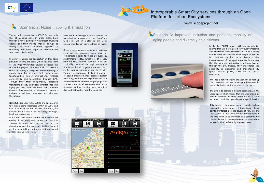
The second scenario that i-‐ SCOPE focuses on is that of mapping noise in urban areas, both through a novel par:cipatory approach involving ci:zens and their mobile phones, as well as through the more standardized approach to simula:ng the most important traffic-‐related sources of noise in a city. In order to assess the distribu:on of this noise pollu:on (in :me and space), the BrusSense team of the Vrije Universiteit Brussel proposes the NoiseTube project. The concept? To facilitate sound measuring at any place and :me through a mobile app that exploits basic smartphone func:onali:es, namely microphone, wireless connec:vity and localisa:on through GPS. Through these three components, NoiseTube transforms already ubiquitous smartphones into highly portable, accessible sound measurement devices, thus enabling all ci:zens to measure ambient sound levels whenever and wherever they please. NoiseTube is a user-‐friendly, free and open source too that is being integrated within i-‐SCOPE, and can be used by ci:zens all over the world, for individual use as well as for measuring campaigns by ci:zen ac:on groups. It is a tool with which ci:zens can es:mate the quality of their daily environment and how it is affected by their behavior, and as such, it provides support for awareness-‐building as well as for undertaking boJom-‐up, ci:zen-‐steered ac:ons to solve local issues.
Next to the mobile app, a second pillar of our par:cipatory approach is the NoiseTube web s i t e , wh i c h c o l l e c t s a l l u s e r measurements and visualises them on maps.
Given enough measurements for a par:cular area, we can construct noise maps of comparable quality to those produced by governments today, which are of a very different kind. Indeed, pollu:on maps are typical ly created through computer simula:ons based on general sta:s:cs, such as the average number of cars in the city. They are backed up only by limited amounts of sound measurements, because current measuring methods are expensive and thus not very scalable. The resul:ng maps give an average but not at all a complete view on the situa:on, en:rely missing local varia:ons due to street works, neighbor noise etc.
Scenario 2: Noise mapping & simulation
Page 4
Lastly, the i-‐SCOPE project will develop inclusive rou:ng that will be targeted for visually impaired and wheelchair users. The results of route planning can be made available for blind people as spoken instruc:ons. Unl ike route planners, the innova:veness of the applica:on lies in the fact that the blind are not guided in a linear fashion through the city. Instead, they are offered the possibility to experience and understand city spaces, streets, places, parks, etc. as spa:al constructs. The idea is not to navigate the user, but to open up the chance for the user to navigate themselves by interac:vely discovering web-‐based city maps. The aim is to provide a holis:c descrip:on of the urban space which means that the user should be able to discover as many aJributes of a street sec:on as possible to get a beJer image of the city. This image – or mental map – should include informa:on about streets, intersec:ons, blocks, points of interest, possible causes of risk, etc. and their spa:al rela:on to each other. The elements of the map need to be described in a seman:c way that is adapted to the requirements of pedestrians, especially blind and visually impaired users.
Scenario 3: Improved inclusion and personal mobility of aging people and diversely able citizens
www.iscopeproject.net
www.iscopeproject.net Key Past Events
A
The main events that i-‐SCOPE Consor:um has aJended in this first year of the project life have been: • CORP Conference (www.corp.at), where i-‐SCOPE submiJed a scien:fic paper
and had a presenta:on.
• Zagreb Energy Week. The 16th of May 2012, dr. Raffaele De Amicis par:cipated to the interna:onal Conference “Local and regional authori:es in the process of Sustainable Energy Development” within the Zagreb Energy Week, with a presenta:on on the project i-‐SCOPE.
• COST Workshop. Carsten Roensdorf from Ordnance Survey presented the i-‐
SCOPE project at the COST ac:on TU 0801 workshop focused on the seman:c enrichment of 3D city models. The mee:ng took place on 13rd April 2012 in Madrid, Spain, aJended by approx. 35 par:cipants from across Europe.
• OGC TC Mee>ng: A presenta:on to the Open Geospa:al Consor:um 3D Informa:on Management Domain Working Group was given to introduce the iSCOPE project, the use cases we will be working on as well as seyng the expecta:on to receive standardisa:on requirements for CityGML in the future. The mee:ng took place on 21st march 2012 in Aus:n, Texas (USA), aJended by approx. 30 experts in geospa:al technical standards with a further 50 experts expected to view the presenta:on on the OGC web portal. Mo r e i n f o rma:on a r e a v a i l a b l e a t t h e e v e n t w eb s i t e : hJp://www.opengeospa:al.org/event/1203tc
• Workshop on ICT Innova>ons. Graphitech joined the Workshop on ICT
Innova:ons (19-‐21 march 2012) with a presenta:on on the i-‐SCOPE project. The :tle has been: "From research to innova6on: a European perspec6ve on Internet of places. Geointelligence for society.“
• INSPIRE Conference 2012. The INSPIRE Conference 2012 took place from
Saturday 23rd – Wednesday 27th June 2012 in Istanbul, Turkey. The theme of this year's edi:on was "Sharing environmental informa:on, sharing innova:on“. Fondazione Graphitech aJended it with a presenta:on of the project: Paving the way to smarter ci:es.
• Fes>val dell’Economia 2012. In the seyng of the Fes:val dell’Economia of
Trento, a conference on “Smart City. How Internet and ICT new technologies change people and genera:ons lifestyles” was held the 2th of June 2012, in the Kessler Room of the Faculty of Sociology, University of Trento, Via Verdi 6 (TN). This event, organized by Informa:ca Tren:na and Fondazione Graphitech within the EU project i-‐SCOPE, has had the aim of “exploring ci:es and territories opportuni:es, outlining the exis:ng changes scenario and ac:va:ng a comparison on how Internet and ICT new technologies can change people and genera:ons lifestyles and rela:onships in a urban seyng and not only”.
Page 6
Events Focus For more Informa>on about Project Events visit the project website: hRp://www.iscopeproject.net/
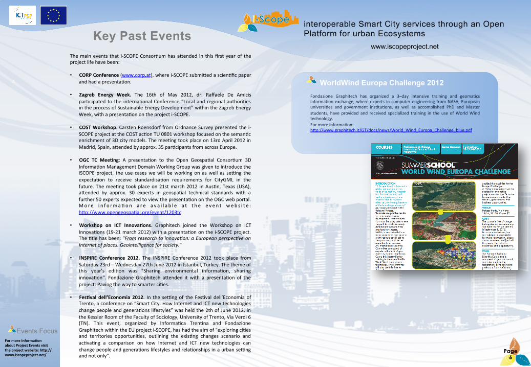
WorldWind Europa Challenge 2012 Fondazione Graphitech has organized a 3–day intensive training and geoma:cs informa:on exchange, where experts in computer engineering from NASA, European universi:es and government ins:tu:ons, as well as accomplished PhD and Master students, have provided and received specialized training in the use of World Wind technology. For more informa:on: hJp://www.graphitech.it/GT/docs/news/World_Wind_Europa_Challenge_blue.pdf
www.iscopeproject.net
www.iscopeproject.net
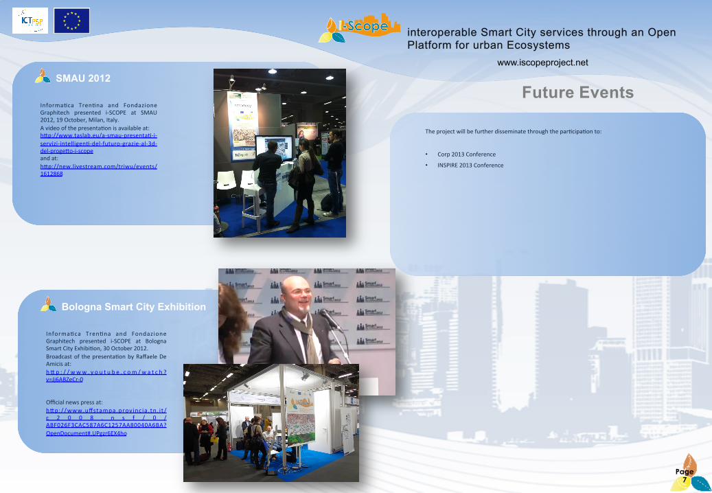
Bologna Smart City Exhibition
Informa:ca Tren:na and Fondazione Graphitech presented i-‐SCOPE at Bologna Smart City Exhibi:on, 30 October 2012. Broadcast of the presenta:on by Raffaele De Amicis at: h J p : / / www . y o u t u b e . c om / w a t c h ?v=Jj6ABZeCr-‐0 Official news press at: hJp://www.uffstampa.provincia.tn. i t/c 2 0 0 8 . n s f / 0 /ABF026F3CAC587A6C1257AA80040A6BA?OpenDocument#.UPgzr6EX4ho
SMAU 2012
Informa:ca Tren:na and Fondazione Graphitech presented i-‐SCOPE at SMAU 2012, 19 October, Milan, Italy. A video of the presenta:on is available at: hJp://www.taslab.eu/a-‐smau-‐presenta:-‐i-‐servizi-‐intelligen:-‐del-‐futuro-‐grazie-‐al-‐3d-‐del-‐progeJo-‐i-‐scope and at: hJp://new.livestream.com/triwu/events/1612868
Future Events
The project will be further disseminate through the par:cipa:on to:
• Corp 2013 Conference
• INSPIRE 2013 Conference
Page 7

www.iscopeproject.net
www.iscopeproject.net Project Meetings
Kick-‐Off Mee>ng
Malta Mee>ng
The first (kick-‐off) project mee:ng was held in Brussels, Belgium, on the premises of the Vrije Universiteit Brussel, from the 23rd to the 25th of January 2012. The purpose of the mee:ng was to introduce the project and its work packages. All consor:um members, EC project officer, advisory group members, related project representa:ves and invited guests aJended the mee:ng. The project was officially introduced by the project coordinator (Raffaele De Amicis -‐ Fondazione GraphiTech), and then followed by the presenta:on of all the partners ins:tu:ons. Next, the agenda of the first day also included presenta:ons of each work packages by the WP leaders, which then con:nued on Day 3. The second day all the partners par:cipated to the CIP, OPEN INNOVATION FOR SMART CITIES CONSTITUENCY BUILDING WORKSHOP organized by the European Commission, while in the 3rd day, a�er the presenta:on of the final WPs, there has been the descrip:on of the project management, with general informa:on concerning project handbook, the appointed The first (kick-‐off) project mee:ng was held in Brussels, Belgium, on the premises of the Vrije Universiteit Brussel, from the 23rd to the 25th of January 2012. The purpose of the mee:ng was to introduce the project and its work packages.
The second project mee:ng was held in St Julians, Malta, from the 12th to the 14th of June 2012. The mee:ng was hosted by the project partner GEOSYS. During the mee:ng the state of the art of the project ac:vi:es was presented. Presenta:ons were given by the work packages leaders, the task leaders and the project coordinator. The third day started by presenta:on regarding the project management issues which was given by the project coordinator, while in the The second project mee:ng was held in St
Julians, Malta, from
the 12th to the 14th of June 2012.
The mee:ng was hosted by the project partner GEOSYS.
Above: Group shot during the Kick-‐off mee>ng
Below: Malta
mee>ng
Review Mee>ng
The first review mee:ng was held in Brussels, Belgium, on the premises of the European Commission, Communica:ons Networks, Content and Technology Directorate-‐General -‐ DG CONNECT, on the 25 October 2012.
Belgrade Mee>ng
The last project mee:ng will be held in Belgrade from the 22nd to the 23rd of January 2013.
Page 8
www.iscopeproject.net
www.iscopeproject.net
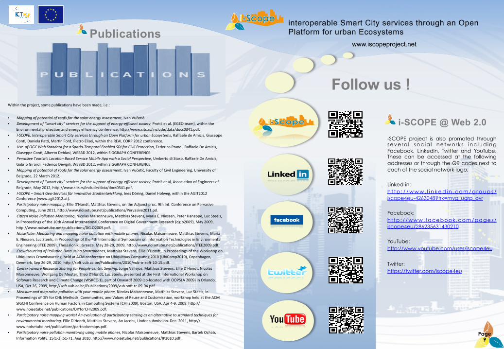
Follow us !
-SCOPE project is also promoted through severa l soc ia l network s inc lud ing Facebook, LinkedIn, Twitter and YouTube. These can be accessed at the following addresses or through the QR codes next to each of the social network logo.
Linked-in: h t t p : / / w w w . l i n k e d i n . c o m / g r o u p s /iscope4eu-4263048?trk=myg_ugrp_ovr
Facebook: h t tp : / /www. facebook .com/pages/iscope4eu/286235631430210
YouTube: http://www.youtube.com/user/iscope4eu
Twitter: https://twitter.com/iscope4eu
Publications
Page 9
Within the project, some publica:ons have been made, i.e.:
• Mapping of poten6al of roofs for the solar energy assessment, Ivan Vuče:ć. • Development of “smart city” services for the support of energy-‐efficient society, Pro:ć et al. (EGEO team), within the
Environmental protec:on and energy efficiency conference, hJp://www.sits.rs/include/data/docs0341.pdf. • I-‐SCOPE. Interoperable Smart City services through an Open PlaGorm for urban Ecosystems, Raffaele de Amicis, Giuseppe
Con:, Daniela Pay, Mar:n Ford, Pietro Elisei, within the REAL CORP 2012 conference. • Use of OGC Web Standard for a Spa6o-‐Temporal Enabled SDI for Civil Protec6on, Federico Prandi, Raffaele De Amicis,
Giuseppe Con:, Alberto Debiasi, WEB3D 2012, within SIGGRAPH CONFERENCE. • Pervasive Touris6c Loca6on Based Service Mobile App with a Social Perspec6ve, Umberto di Staso, Raffaele De Amicis,
Gabrio Girardi, Federico Devigili, WEB3D 2012, within SIGGRAPH CONFERENCE. • Mapping of poten6al of roofs for the solar energy assessment, Ivan Vuče:ć, Faculty of Civil Engineering, University of
Belgrade, 22 March 2012. • Development of “smart city” services for the support of energy-‐efficient society, Pro:ć et al, Associa:on of Engineers of
Belgrade, May 2012, hJp://www.sits.rs/include/data/docs0341.pdf. • I-‐SCOPE – Smart Geo-‐Services für innova6ve Stadtentwicklung, Ines Döring, Daniel Holweg, within the AGIT2012
Conference (www.agit2012.at). • Par6cipatory noise mapping, Ellie D'Hondt, MaJhias Stevens, on the Adjunct proc. 9th Int. Conference on Pervasive
Compu:ng,, June 2011, hJp://www.noisetube.net/publica:ons/Pervasive2011.pd. • Ci6zen Noise Pollu6on Monitoring, Nicolas Maisonneuve, MaJhias Stevens, Maria E. Niessen, Peter Hanappe, Luc Steels,
in Proceedings of the 10th Annual Interna:onal Conference on Digital Government Research (dg.o2009), May 2009, hJp://www.noisetube.net/publica:ons/DG.O2009.pdf.
• NoiseTube: Measuring and mapping noise pollu6on with mobile phones, Nicolas Maisonneuve, MaJhias Stevens, Maria E. Niessen, Luc Steels, in Proceedings of the 4th Interna:onal Symposium on Informa:on Technologies in Environmental Engineering (ITEE 2009), Thessaloniki, Greece. May 28-‐29, 2009, hJp://www.noisetube.net/publica:ons/ITEE2009.pdf.
• Crowdsourcing of Pollu6on Data using Smartphones, MaJhias Stevens, Ellie D'Hondt, in Proceedings of the Workshop on Ubiquitous Crowdsourcing, held at ACM conference on Ubiquitous Compu:ng 2010 (UbiComp2010), Copenhagen, Denmark, Sep 26-‐29, 2010, hJp://so�.vub.ac.be/Publica:ons/2010/vub-‐tr-‐so�-‐10-‐15.pdf.
• Context-‐aware Resource Sharing for People-‐centric Sensing, Jorge Vallejos, MaJhias Stevens, Ellie D'Hondt, Nicolas Maisonneuve, Wolfgang De Meuter, Theo D'Hondt, Luc Steels, presented at the First Interna:onal Workshop on So�ware Research and Climate Change (WSRCC-‐1), part of Onward! 2009 (co-‐located with OOPSLA 2009) in Orlando, USA, Oct 26, 2009, hJp://so�.vub.ac.be/Publica:ons/2009/vub-‐so�-‐tr-‐09-‐04.pdf.
• Measure and map noise pollu6on with your mobile phone, Nicolas Maisonneuve, MaJhias Stevens, Luc Steels, in Proceedings of DIY for CHI: Methods, Communi:es, and Values of Reuse and Customisa:on, workshop held at the ACM SIGCHI Conference on Human Factors in Compu:ng Systems (CHI 2009), Boston, USA, Apr 4-‐9, 2009, hJp://www.noisetube.net/publica:ons/DIYforCHI2009.pdf.
• Par6cipatory noise mapping works! An evalua6on of par6cipatory sensing as an alterna6ve to standard techniques for environmental monitoring, Ellie D'Hondt, MaJhias Stevens, An Jacobs, Under submission. Dec. 2011, hJp://www.noisetube.net/publica:ons/partnoisemaps.pdf.
• Par6cipatory noise pollu6on monitoring using mobile phones, Nicolas Maisonneuve, MaJhias Stevens, Bartek Ochab, Informa:on Polity, 15(1-‐2):51-‐71, Aug 2010, hJp://www.noisetube.net/publica:ons/IP2010.pdf.
i-SCOPE @ Web 2.0