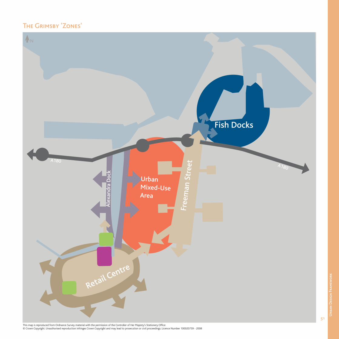
the grimsby 'zones
TRANSCRIPT
51
Urb
an D
esig
n F
ram
ewo
rk
Fre
eman
Str
eet
Ale
xand
ra D
ock
A180
Urban Mixed-Use Area
Retail Centre
Fish Docks
A180
The Grimsby 'Zones'
N
This map is reproduced from Ordnance Survey material with the permission of the Controller of Her Majesty’s Stationery Offi ce© Crown Copyright. Unauthorised reproduction infringes Crown Copyright and may lead to prosecution or civil proceedings. Licence Number 100020759 - 2008
52
Urb
an D
esig
n F
ram
ewo
rk
The ‘zones’ require varying degrees of intervention to ensure the successful rejuvenation and improved legibility of the town centre. This hierarchy sets out the initial ‘benchmark’ against which all developments/projects should be measured. The degree of intervention for the whole Borough (described in Section 2) can be applied to Grimsby and the zones identifi ed within it.
• Remodel and Restructure Areas that lack any distinctive character, have potential poorly located land uses and urban form and can accommodate a high degree of change. The aim of these areas is to create a new identity and foundation for new development.
• Repair and RecoveryAreas that have elements of distinctive character and/or street pattern that need varying degrees of intervention to reinstate the urban context.
• Retain and RestoreAreas that have a reasonably intact and robust urban form, often fall within conservation areas and have a large number of high quality or listed buildings. Here new development should respect existing urban form, street pattern and character, and the existing townscape should be managed in a sensitive and considered manner.
• The Fish Docks - Remodel and Restructure
• The A180 Corridor - Repair and Recovery
• Alexandra Dock - Remodel and Restructure
• Retail Core - Retain and Restore
• Retail Fringe - Repair and Recovery
• Freeman Street - Remodel and Restructure, and Repair and Recovery
• Urban Mixed-Use Area - Remodel and Restructure
Grimsby - Types of Intervention
53
Urb
an D
esig
n F
ram
ewo
rk
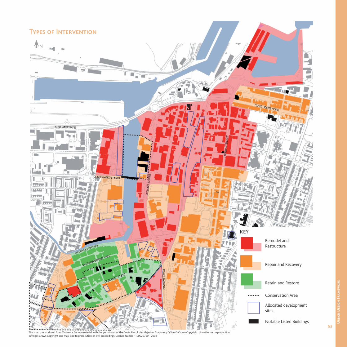
Remodel and Restructure
Repair and Recovery
Retain and Restore
Conservation Area
Allocated development sites
Notable Listed Buildings
KEY
FREDERICK WARD WAY
VICT
ORI
A ST
REET
FREE
MAN
STR
EET
CLEETHORPE ROAD
A180 WESTGATE
CORPORATION ROAD
OSBORNE STREET
VICTORIA STREET WEST
PEAKS PARKWAY
Types of Intervention
N
This map is reproduced from Ordnance Survey material with the permission of the Controller of Her Majesty’s Stationery Offi ce © Crown Copyright. Unauthorised reproduction infringes Crown Copyright and may lead to prosecution or civil proceedings. Licence Number 100020759 - 2008
54
Urb
an D
esig
n F
ram
ewo
rk
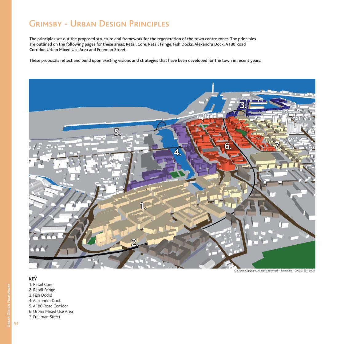
The principles set out the proposed structure and framework for the regeneration of the town centre zones. The principles are outlined on the following pages for these areas: Retail Core, Retail Fringe, Fish Docks, Alexandra Dock, A180 Road Corridor, Urban Mixed Use Area and Freeman Street.
These proposals refl ect and build upon existing visions and strategies that have been developed for the town in recent years.
Grimsby - Urban Design Principles
1.1.
KEY1. Retail Core2. Retail Fringe3. Fish Docks4. Alexandra Dock5. A180 Road Corridor6. Urban Mixed Use Area 7. Freeman Street
2.2.
3.3.
4.4.
5.5.
6.6. 7.7.
© Crown Copyright. All rights reserved – licence no. 100020759 - 2008
55
Urb
an D
esig
n F
ram
ewo
rk
Urban Design Principles
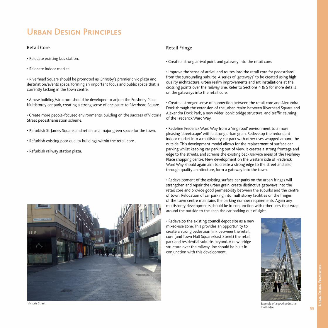
Retail Core
• Relocate existing bus station.
• Relocate indoor market.
• Riverhead Square should be promoted as Grimsby's premier civic plaza and destination/events space, forming an important focus and public space that is currently lacking in the town centre.
• A new building/structure should be developed to adjoin the Freshney Place Multistorey car park, creating a strong sense of enclosure to Riverhead Square.
• Create more people-focused environments, building on the success of Victoria Street pedestrianisation scheme.
• Refurbish St James Square, and retain as a major green space for the town.
• Refurbish existing poor quality buildings within the retail core .
• Refurbish railway station plaza.
Retail Fringe
• Create a strong arrival point and gateway into the retail core.
• Improve the sense of arrival and routes into the retail core for pedestrians from the surrounding suburbs. A series of 'gateways' to be created using high quality architecture, urban realm improvements and art installations at the crossing points over the railway line. Refer to Sections 4 & 5 for more details on the gateways into the retail core.
• Create a stronger sense of connection between the retail core and Alexandra Dock through the extension of the urban realm between Riverhead Square and Alexandra Dock Park, a new wider iconic bridge structure, and traffi c calming of the Frederick Ward Way.
• Redefi ne Frederick Ward Way from a ‘ring road’ environment to a more pleasing ‘streetscape’ with a strong urban grain. Redevelop the redundant indoor market into a multistorey car park with other uses wrapped around the outside. This development model allows for the replacement of surface car parking whilst keeping car parking out of view. It creates a strong frontage and edge to the streets, and screens the existing back/service areas of the Freshney Place shopping centre. New development on the western side of Frederick Ward Way should again aim to create a strong edge to the street and also, through quality architecture, form a gateway into the town.
• Redevelopment of the existing surface car parks on the urban fringes will strengthen and repair the urban grain, create distinctive gateways into the retail core and provide good permeability between the suburbs and the centre of town. Relocation of car parking into multistorey facilities on the fringes of the town centre maintains the parking number requirements. Again any multistorey developments should be in conjunction with other uses that wrap around the outside to the keep the car parking out of sight.
• Redevelop the existing council depot site as a new mixed-use zone. This provides an opportunity to create a strong pedestrian link between the retail core (and Town Hall Square/East Street) the retail park and residential suburbs beyond. A new bridge structure over the railway line should be built in conjunction with this development.
Victoria Street Example of a good pedestrian footbridge
56
Urb
an D
esig
n F
ram
ewo
rk
Urban Design Principles
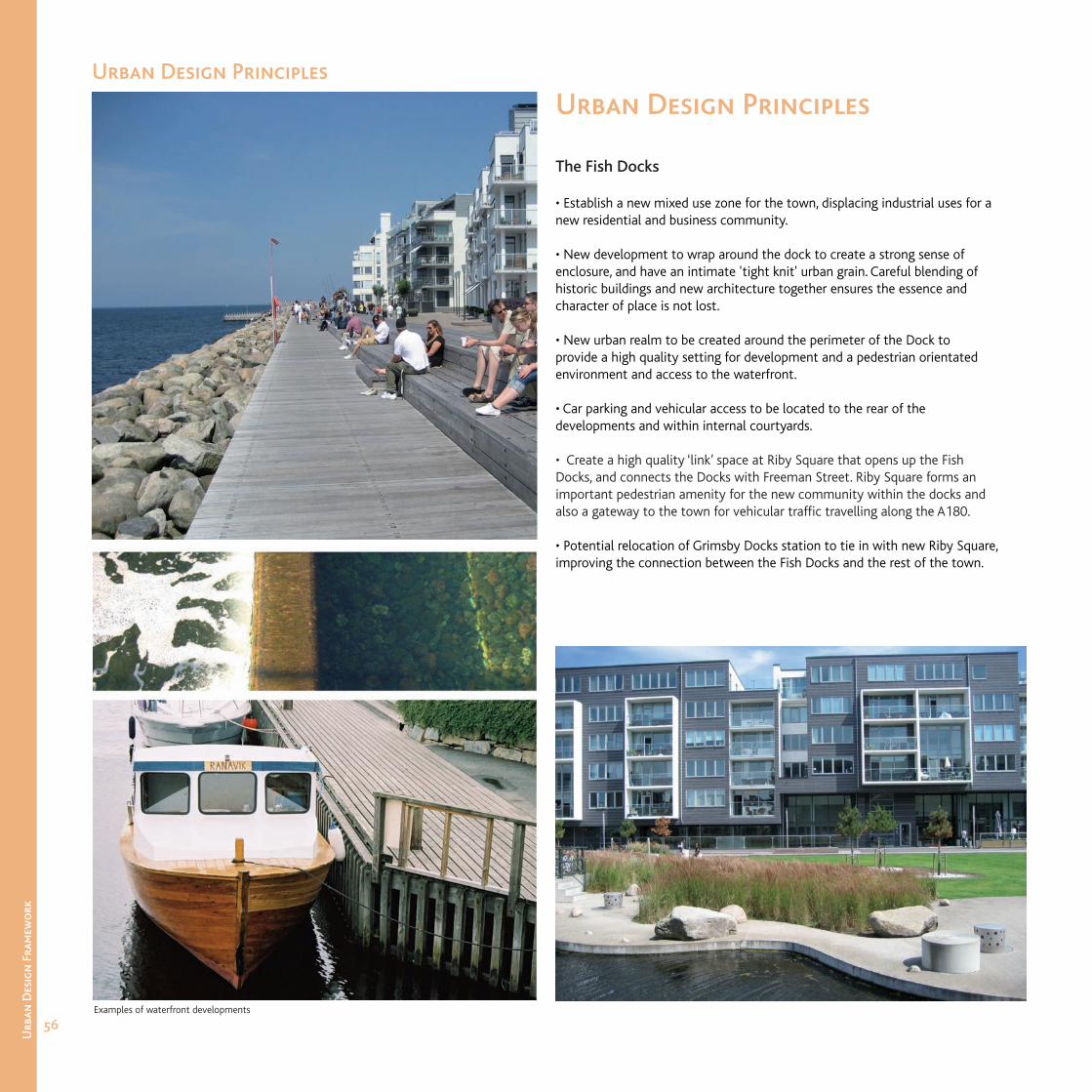
The Fish Docks
• Establish a new mixed use zone for the town, displacing industrial uses for a new residential and business community.
• New development to wrap around the dock to create a strong sense of enclosure, and have an intimate 'tight knit' urban grain. Careful blending of historic buildings and new architecture together ensures the essence and character of place is not lost.
• New urban realm to be created around the perimeter of the Dock to provide a high quality setting for development and a pedestrian orientated environment and access to the waterfront.
• Car parking and vehicular access to be located to the rear of the developments and within internal courtyards.
• Create a high quality ‘link’ space at Riby Square that opens up the Fish Docks, and connects the Docks with Freeman Street. Riby Square forms an important pedestrian amenity for the new community within the docks and also a gateway to the town for vehicular traffi c travelling along the A180.
• Potential relocation of Grimsby Docks station to tie in with new Riby Square, improving the connection between the Fish Docks and the rest of the town.
Examples of waterfront developments
Urban Design Principles

57
Urb
an D
esig
n F
ram
ewo
rk
Alexandra Dock
• Establish Alexandra Dock as a new quarter and destination for the town centre through the development of a high quality mixed use residential and leisure community.
• New development will face onto the dock, creating a strong sense of enclosure and bringing activity and life to the edges.
• New development should be permeable and allow for strong east-west links between the Dock and the new mixed use area to make the Dock accessible. There is an opportunity for the introduction of a number of tall landmark buildings along the Dock that would compliment the existing Victoria Flour Mill.
• A high quality urban realm is to be created in association with the new development. This urban realm should form a continuous loop around the perimeter of the Dock that acts as a valuable resource for the community and facilitates pedestrian access to other part of the town.
• Extend and refurbish Alexandra Dock Park as a second major green space for the town centre. New development at the head of the Dock will frame and defi ne the extents of the new Park and have active frontage uses that spill out onto it. The park forms an important focal point at the head of the Dock and a vital link space between the retail core and the rest of Alexandra Dock.
• To the north western part of the dock a new linear park is proposed as part of the network of spaces that wrap around the Dock. Located in the blast zone for the ‘working’ parts of the dock, development is restricted and the park would be subject to HSE approval. A new pedestrian bridge is proposed that makes this park more accessible from the east.
Examples of waterfront developments
Urban Design Principles
58
Urb
an D
esig
n F
ram
ewo
rk
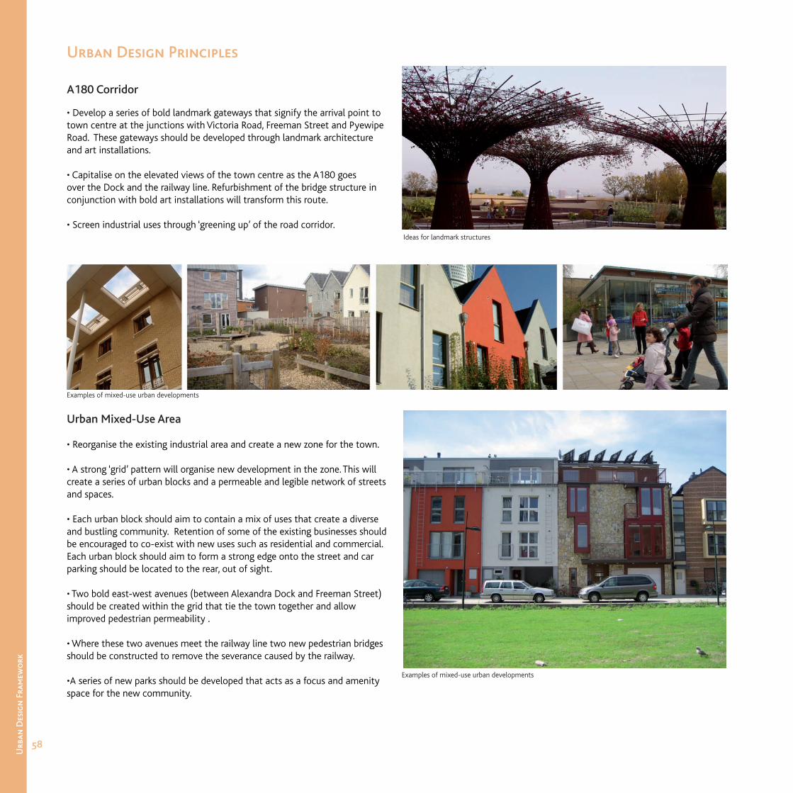
A180 Corridor
• Develop a series of bold landmark gateways that signify the arrival point to town centre at the junctions with Victoria Road, Freeman Street and Pyewipe Road. These gateways should be developed through landmark architecture and art installations.
• Capitalise on the elevated views of the town centre as the A180 goes over the Dock and the railway line. Refurbishment of the bridge structure in conjunction with bold art installations will transform this route.
• Screen industrial uses through ‘greening up’ of the road corridor.
Urban Mixed-Use Area
• Reorganise the existing industrial area and create a new zone for the town.
• A strong ‘grid’ pattern will organise new development in the zone. This will create a series of urban blocks and a permeable and legible network of streets and spaces.
• Each urban block should aim to contain a mix of uses that create a diverse and bustling community. Retention of some of the existing businesses should be encouraged to co-exist with new uses such as residential and commercial. Each urban block should aim to form a strong edge onto the street and car parking should be located to the rear, out of sight.
• Two bold east-west avenues (between Alexandra Dock and Freeman Street) should be created within the grid that tie the town together and allow improved pedestrian permeability .
• Where these two avenues meet the railway line two new pedestrian bridges should be constructed to remove the severance caused by the railway.
•A series of new parks should be developed that acts as a focus and amenity space for the new community.
Ideas for landmark structures
Examples of mixed-use urban developments
Examples of mixed-use urban developments
Urban Design Principles
59
Urb
an D
esig
n F
ram
ewo
rk
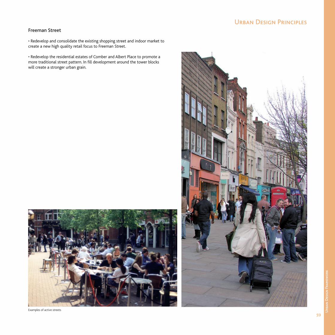
Freeman Street
• Redevelop and consolidate the existing shopping street and indoor market to create a new high quality retail focus to Freeman Street.
• Redevelop the residential estates of Comber and Albert Place to promote a more traditional street pattern. In fi ll development around the tower blocks will create a stronger urban grain.
Examples of active streets
Urban Design Principles