fargo-moorhead metropolitan flood risk lqnusujo presentations/2013/12.2013/4b - 131219... · flood...
TRANSCRIPT
BUILDING STRONG®
Lqnusujo
September 2012
1
Fargo-Moorhead Metropolitan Flood Risk
Management Project
US Army Corps of Engineers
BUILDING STRONG®
Flood Diversion Board of Authority meeting
December 19, 2013
Fargo-Moorhead Metropolitan Flood Risk
Management Project
BUILDING STRONG®
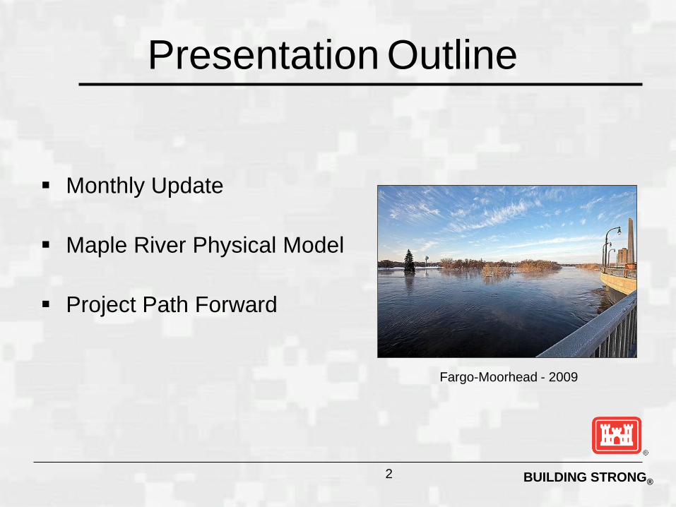
Monthly Update
Maple River Physical Model
Project Path Forward
2
Fargo-Moorhead - 2009
Presentation Outline
BUILDING STRONG®
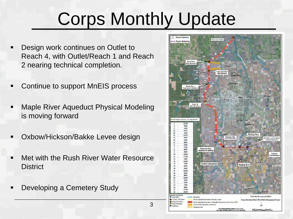
Corps Monthly Update
Design work continues on Outlet to
Reach 4, with Outlet/Reach 1 and Reach
2 nearing technical completion.
Continue to support MnEIS process
Maple River Aqueduct Physical Modeling
is moving forward
Oxbow/Hickson/Bakke Levee design
Met with the Rush River Water Resource
District
Developing a Cemetery Study
3
BUILDING STRONG®
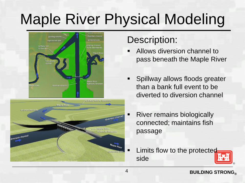
Maple River Physical Modeling
Description: Allows diversion channel to
pass beneath the Maple River
Spillway allows floods greater
than a bank full event to be
diverted to diversion channel
River remains biologically
connected; maintains fish
passage
Limits flow to the protected
side
4
BUILDING STRONG®
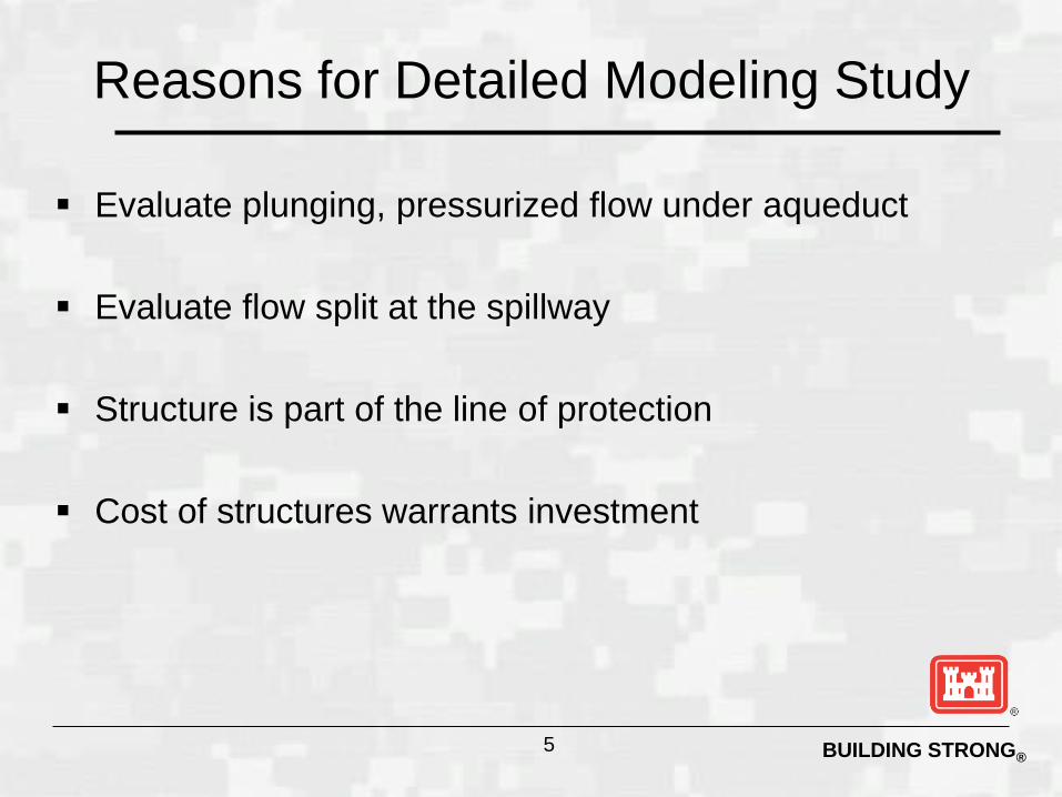
Reasons for Detailed Modeling Study
Evaluate plunging, pressurized flow under aqueduct
Evaluate flow split at the spillway
Structure is part of the line of protection
Cost of structures warrants investment
5
BUILDING STRONG®
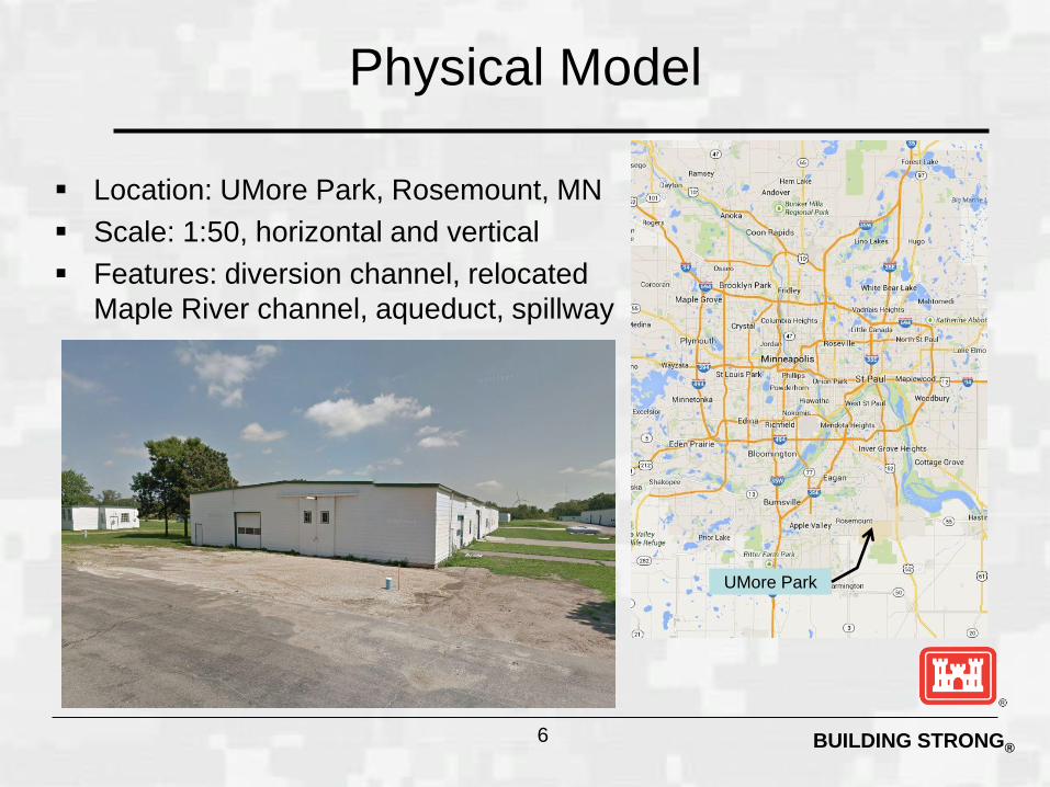
Physical Model
Location: UMore Park, Rosemount, MN
Scale: 1:50, horizontal and vertical
Features: diversion channel, relocated
Maple River channel, aqueduct, spillway
6
UMore Park

BUILDING STRONG® 7
North Extent – Diversion, 300 feet upstream of 40th Avenue North
South Extent – Diversion, 100 feet downstream of diversion curvature
East extent – Maple River, 50 feet downstream of the downstream extent of the engineered channel
West extent – Maple River, 610 feet upstream of spillway mouth
BUILDING STRONG® 8
BUILDING STRONG®
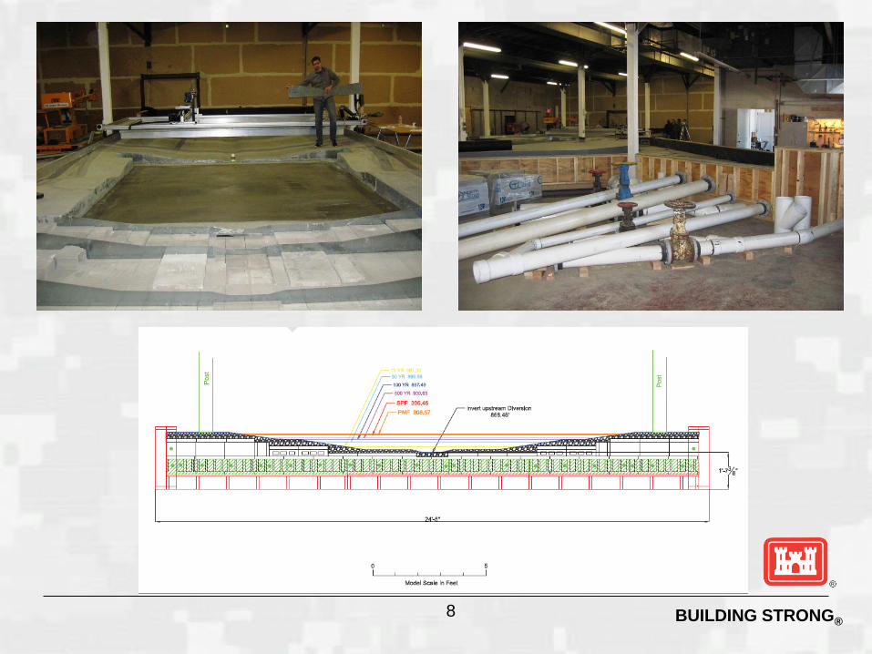
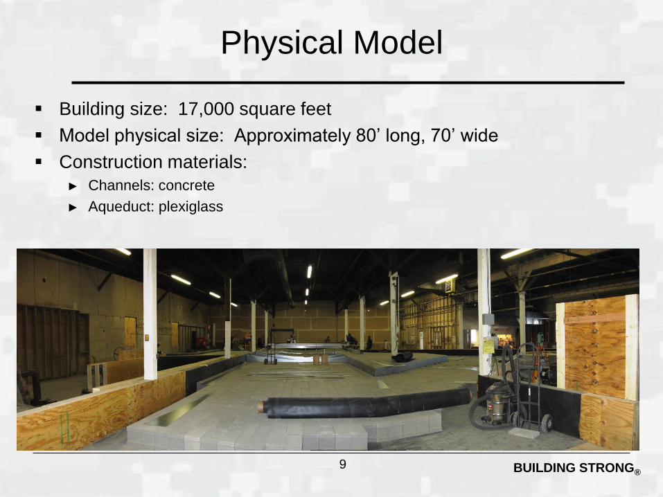
Physical Model
Building size: 17,000 square feet
Model physical size: Approximately 80’ long, 70’ wide
Construction materials:
► Channels: concrete
► Aqueduct: plexiglass
9
BUILDING STRONG® 10
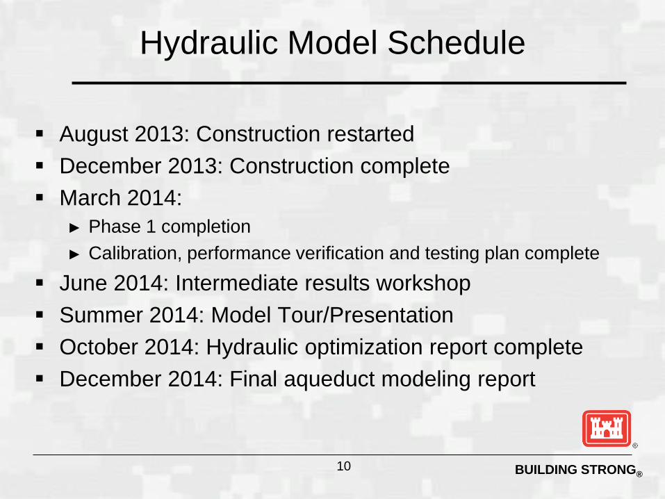
Hydraulic Model Schedule
August 2013: Construction restarted
December 2013: Construction complete
March 2014:
► Phase 1 completion
► Calibration, performance verification and testing plan complete
June 2014: Intermediate results workshop
Summer 2014: Model Tour/Presentation
October 2014: Hydraulic optimization report complete
December 2014: Final aqueduct modeling report
BUILDING STRONG®
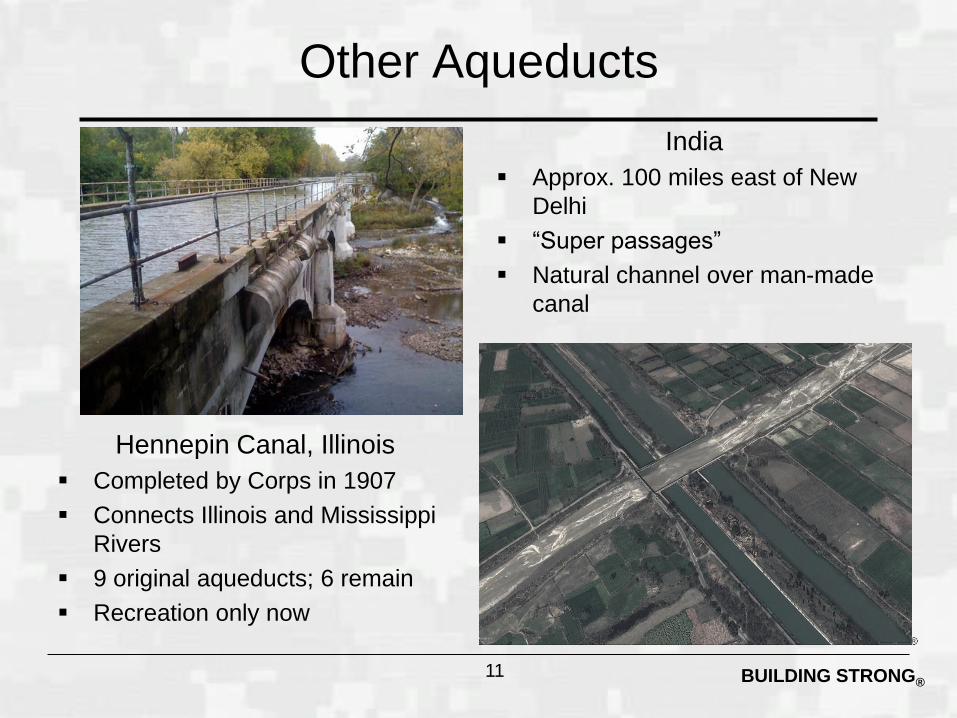
Other Aqueducts
11
Hennepin Canal, Illinois
Completed by Corps in 1907
Connects Illinois and Mississippi
Rivers
9 original aqueducts; 6 remain
Recreation only now
India
Approx. 100 miles east of New
Delhi
“Super passages”
Natural channel over man-made
canal
BUILDING STRONG®
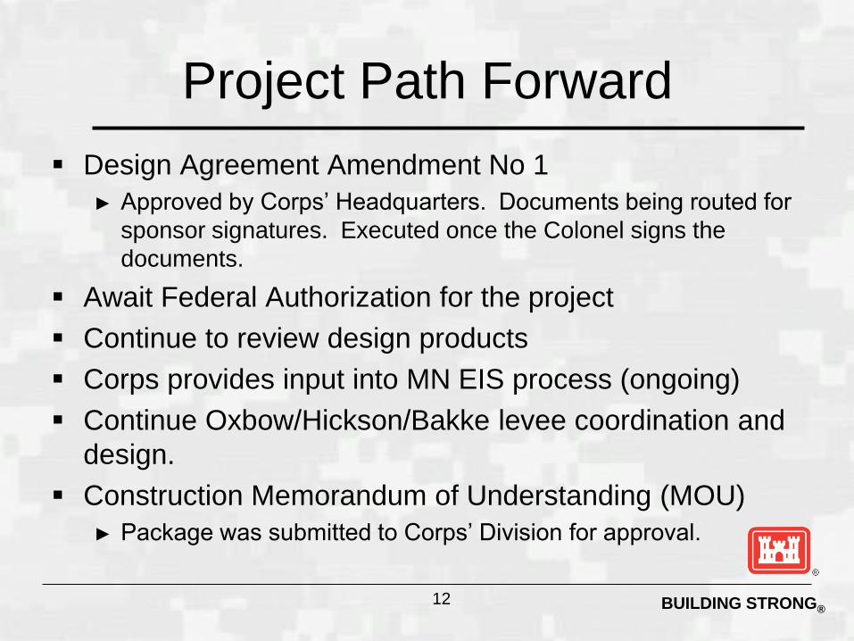
Project Path Forward
Design Agreement Amendment No 1
► Approved by Corps’ Headquarters. Documents being routed for
sponsor signatures. Executed once the Colonel signs the
documents.
Await Federal Authorization for the project
Continue to review design products
Corps provides input into MN EIS process (ongoing)
Continue Oxbow/Hickson/Bakke levee coordination and
design.
Construction Memorandum of Understanding (MOU)
► Package was submitted to Corps’ Division for approval.
12
BUILDING STRONG®
Next
Administrative/Legal
Design Contracts / Task Orders
13