policy brief - senate of the philippines 2013-01 - nalua.pdf · 2013-01-21 · policy brief 1....
TRANSCRIPT

1
Breaking New Ground: Enacting a National Land Use Policy
Policy Brief
1. Introduction
One of the priority legislative measures in the current 15th
Congress is the proposed National Land Use Act (NaLUA). It is
meant to optimize the use of land based on best uses and the
need to balance economic, environmental and social
development objectives. Basically, it tries to address the issue of
how the Philippines as a society allocates a very scarce and
important resource –land – to meet the requirements of Filipinos
for food, housing, employment, and the need to protect the
environment in general in view of the requirements of future
generations.
The first bill on NaLUA was filed in late 1995 during the
10thCongress. However, the bill did not prosper further and was
not passed. In the current Congress, 12 versions of the bill were
filed—eight bills in the House of Representatives and five in the
Senate. After extensive discussions and consultations with
stakeholders, the Senate Committee on Environment and Natural
Resources joint with the Committees on Urban Planning, Housing
and Resettlement, and Finance, filed on 16 January 2012, Senate
Bill (SB) 3091 which consolidated the chamber’s various bills on
NaLUA. Having gone through the periods of debate and
committee amendments in the plenary, SB 3091 is now awaiting
approval on second reading, subject to individual amendments.1
On the other hand, House Bill (HB) 6545, the substitute bill on
NaLUA which was endorsed by the House Special Committee on
Land Use, has already been approved on third and final reading by
the House of Representatives.
To better appreciate the policy decision-making process on the
proposed NaLUA, this paper will (1) revisit existing land use
policies, policy gaps, and responsibilities of policy actors and
institutions; (2) analyze the salient features of SB 3091 and
suggest policy options that may enhance it in addressing the land
use policy gaps; and (3) conclude with policy tradeoffs and
considerations.
1 Parliamentary status of SB 3091 as of January 17, 2013.
SENATE ECONOMIC PLANNING OFFICE
January 2013 PB-13-01
With only a total land area of 30 million hectares and a population of 92.3 million growing at an average rate of 2.12 percent, how should the Philippines allocate a very scarce and important resource—land—to meet the various needs of Filipinos? The Senate proposes a national land use policy to address this fundamental issue.
The SEPO Policy Brief, a publication of the Senate Economic Planning Office, provides analysis and discussion on important socio-economic issues as inputs to the work of Senators and Senate Officials. The SEPO Policy Brief is also available at www.senate.gov.ph.

2
2. Land Use Policy Gaps
The Philippines has a total land area of 30 million hectares, 15.8
million of which are classified as forestlands and 14.2 million are
alienable and disposable lands (Table 1). Given the limited supply
of land and increasing population growth, land use conflicts have
been increasing and are expected to intensify (NEDA, 2011).
While currently, there are various land use policies in the
Philippines, these policies are contained in separate national laws,
and their coverage is limited to specific sectors such as
agriculture, housing, environmental protection and several
others. Since these sectors oftentimes have conflicting interests
(i.e., they compete for a limited supply of land, among other
resources), as well as differing views on current land use policies,
the sector-specific laws do not address cross-cutting land use
issues that usually crop up during policy implementation.
The adoption of a national land use policy is thus necessary to
address policy gaps, harmonize existing land use policies, and
address competing uses of limited land resources. This section will
briefly discuss the major policy gaps or inconsistent land use
policies, and their implications on policy implementation. It will
mainly focus on the land use policy provisions under major
Republic Acts (RA) and executive issuances relating to the
following areas of concern: (1) food security and rice self-
sufficiency; (2) housing and urban development; and (3)
environmental protection and natural resource development.
2.1. Food Security and Rice Self-Sufficiency
Food is the most basic commodity and food production is one of
the primary uses of land. Rice, in particular, is considered as the
“single most politically important commodity” in the Philippines
and its production covers about 4 million hectares or
approximately one-third of the country’s total crop land of 13
million hectares (Piadozo 2012, 1).
Land use policies affecting food security and rice self-sufficiency
are those involving the conversion and reclassification of
agricultural lands to non-agricultural use (i.e. residential,
commercial and industrial). Under RA 8435 or the Agricultural and
Fisheries Modernization Act (AFMA) of 1997, it is government’s
policy to promote food security, including sufficiency in staple
food, particularly rice. In terms of land use, AFMA provides for the
protection or non-conversion of all irrigated or irrigable
agricultural lands,2 at least, among the network of protected
areas for agricultural and agro-industrial development (NPAAAD)
that was supposed to be identified by the Department of
Agriculture (DA).
2 Specifically referring to “all irrigated lands, irrigable lands already covered by irrigation projects with firm funding
commitments, and lands with existing or having the potential for growing high-value crops delineated and included within the Strategic Agriculture and Fisheries Development Zones”.
Table 1. Land Classification by Region: 2009 (‘000 hectares)
REGION Total
Area
Certified
A&D
Forest land
Philippines 30,000.00 14,194.68 15,805.33
NCR 63.60 48.23 15.37
CAR 1,829.37 342.35 1,487.02
I 1,284.02 810.92 473.10
II 2,687.52 972.82 1,714.70
III 2,147.04 1,204.65 942.39
IV-A 1,622.86 1,051.95 570.91
IV-B 2,745.60 998.56 1,747.04
V 1,763.25 1,222.06 541.19
VI 2,022.31 1,417.98 604.33
VII 1,489.08 964.17 524.91
VIII 2,143.17 1,024.96 1,118.21
IX 1,599.73 762.46 837.27
X 1,714.80 817.67 897.13
XI 1,967.18 737.63 1,229.55
XII 1,874.95 730.55 1,144.40
CARAGA 1,884.70 544.90 1,339.80
ARMM 1,160.83 542.83 618.00
Source: Status of Land Classification by Province (2009),
NAMRIA
-
2,000
4,000
6,000
8,000
10,000
12,000
14,000
20002001200220032004200520062007200820092010
Total utilization
Rice Production
Rice Imports
Source: BAS
Chart 1. Rice Supply and Utilization, (‘000 MT)

3
However, the non-conversion of the irrigated and irrigable lands
was only limited for a period of five years from the effectivity of
AFMA, or for the period starting 10 February 1998 to 9 February
2003. In addition, the said law does not provide for the non-
conversion of the other agricultural lands under the NPAAAD. The
conversion of irrigated and irrigable agricultural lands was
allowed on a case-to-case basis, subject to existing laws and
issuances governing land use conversion; and in case of
conversion, the land owners or developers were required to
compensate the government for the expenditure it has made on
the land (e.g., cost of irrigation projects).
Similarly, RA 6657 or the Comprehensive Agrarian Reform Law
(CARL) of 1988 allows the conversion or reclassification of
agricultural lands that were distributed to agrarian reform
beneficiaries (ARBs). After the lapse of five years from its award,
lands may be converted or reclassified if (1) the land has ceased
to be economically feasible and sound for agricultural purposes;
or (2) the land will have substantially greater economic value for
residential, commercial or industrial purposes as determined by
the local legislative body concerned.
Then again, industrial and housing developments are generally
perceived as more viable investments than agriculture, thus most
landowners or local government units (LGUs) expecting higher
returns would rather use land for non-agricultural purposes
(Placino 2010, 7). Furthermore, all lands that were already
reclassified by LGUs as commercial, industrial or residential
before the effectivity of the CARL (15 June 1988) did not need any
conversion clearance from the Department of Agrarian Reform
(DAR).3 Personal or local preferences not in favor of agriculture or
agrarian reform contributed to the massive conversion of
agricultural lands during the 1990s.
Lands must first be reclassified before land conversion from
agricultural to other uses can take place. Section 20 of RA 7160 or
the Local Government Code (LGC) of 1991 provides that LGUs,
through the passage of an ordinance, may reclassify agricultural
lands using the same criteria set under CARL. Reclassification is
only limited to a certain percentage4 of the total agricultural land
of a city or municipality at the time of the passage of the
ordinance.
3 Department of Justice (DOJ) Opinion No. 44 Series of 1990.
4 Highly urbanized and independent component cities may reclassify fifteen percent (15%); component cities and first to
third class municipalities may reclassify ten percent (10%); and fourth to sixth class municipalities may reclassify five percent (5%).
Table 2. Summary of Land Use Conversion Applications as of June 2011
REGION Total Area (in hectares)
Approved Disapproved
Philippines 63,536 9,358
NCR 114 2
CAR 280 101
I 2,174 29
II 361 -
III 9,571 1,127
IV-A 29,046 3,784
IV-B 723 150
V 3,333 419
VI 3,791 795
VII 1,007 558
VIII 1,175 617
IX 128 23
X 3,270 277
XI 5,433 1,061
XII 2,788 256
CARAGA 343 158
Source: CLUPPI Secretariat Report (as of June 2011) and
MIS Report (as of December 2010), DAR
Source: CLUPPI, DAR In SEPO 2005
0
1000
2000
3000
4000
5000
6000
7000Area (has.)
Chart 2. Land Use Conversion, 1990s
4
Though the LGC was enacted before the AFMA, food security and
rice self-sufficiency were already of national interest at that time
and thus executive issuances5 were issued to exclude irrigated
and irrigable lands from LGU reclassification. After AFMA’s five-
year moratorium on land use conversion, executive issuances
were also issued to protect irrigated and irrigable lands, the latest
of which was Presidential Administrative Order No. 226-A issued
on 14 July 2008. This suspended for two years the processing and
approval of all land conversion applications which would affect
prime agricultural rice lands.
With RA 9700 or the Comprehensive Agrarian Reform Program
Extension with Reform (CARPER) Law of 2009, the importance of
irrigated and irrigable lands in achieving food security and self-
sufficiency was once more recognized by excluding such lands
from land use conversion. Before this however, various issuances
relating to an unfavorable reclassification or conversion of
agricultural lands have been questioned or challenged by various
sectors, particularly those involved in housing and urban
development.
2.2. Housing and Urban Development
Among the main types of land use, housing or shelter purposes is
the more recognizable requirement. Although food is absolutely
necessary, most people do not have to use land to personally
produce food and may even avail of those not produced locally.
Majority, however, are in need of housing, preferably near
locations where there is access to better employment
opportunities, specifically in urban areas and centers where most
jobs are generated.
In the Philippines, rapid urbanization brought about by a
continuously growing population and rural-urban migration has
worsened the housing problem. Largely an urban phenomenon,
the housing problem is clearly manifested with the proliferation
of informal settlements, which are often found in unsafe areas
and characterized by unsanitary conditions, congestion, and
limited access to basic services, e.g., health centers, schools,
waste disposal, safe water supply (HUDCC and PIDS 2009, 27). In
Metro Manila, many informal settlers reside in waterways
easements and in right-of-way areas of government facilities. This
situation poses a risk to public safety and hampers the
implementation of infrastructure projects.
Providing socialized or affordable housing remains to be a big
challenge for the government. By 2016, it is estimated that the
5 Presidential Administrative Order Nos. 20 and 363, Memorandum Circular No. 54, and Executive Order No. 124.
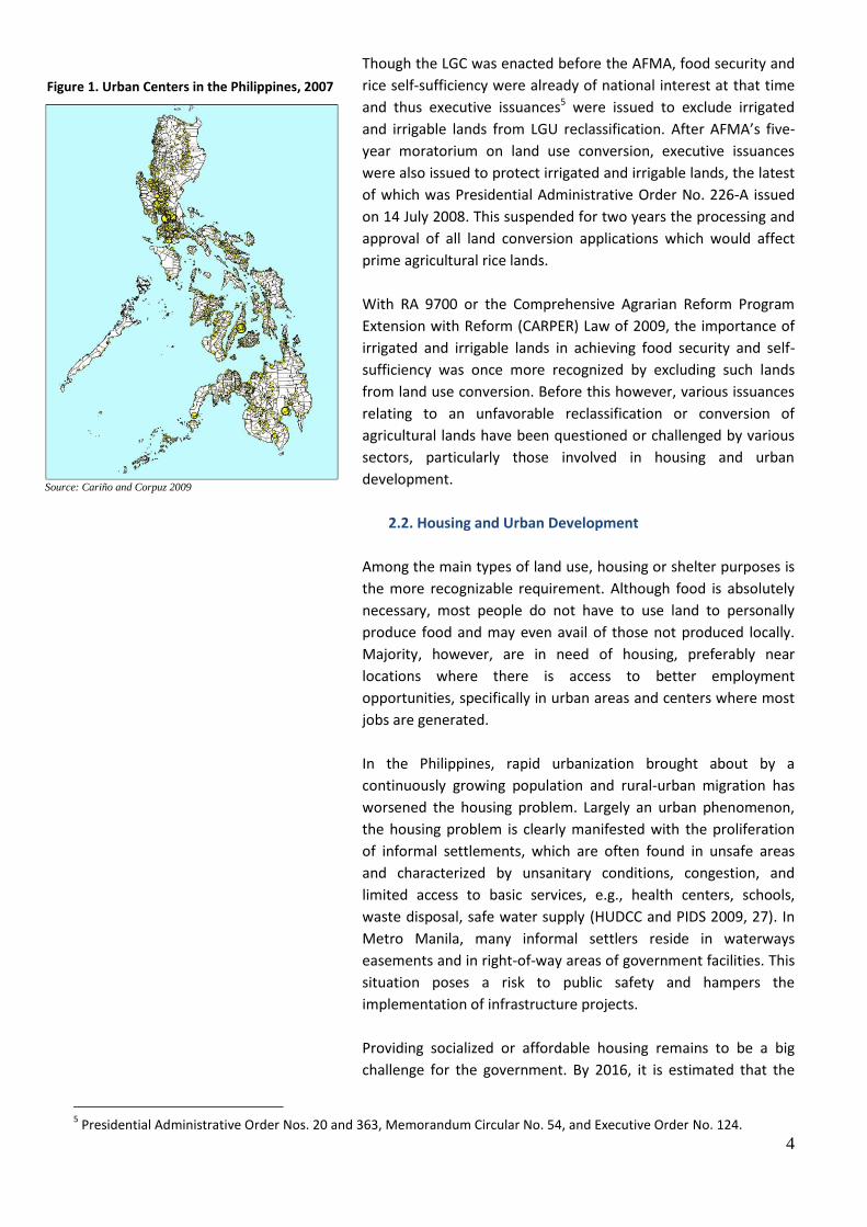
Figure 1. Urban Centers in the Philippines, 2007
Source: Cariño and Corpuz 2009

5
total housing need, which includes housing backlog and housing
for new households, will reach about 5.7 million (Table 3). Metro
Manila alone will require 1.7 million housing units. This figure
would translate to roughly about 10,000 hectares of land for
detached housing units (HUDCC and PIDS 2009, 25; Cariño and
Corpuz 2009, 14).
Aside from the policies that would restrict built-up or urban areas
from encroaching in protected areas, including selected
agricultural areas discussed in the previous subsection, policies
affecting land use on housing and urban development are
generally provided by RA 7279 or the Urban Development and
Housing Act (UDHA) of 1992. Under the UDHA, it is government’s
policy to “uplift the conditions of the underprivileged and
homeless citizens in urban areas and in resettlement areas by
making available to them decent housing at affordable cost, basic
services, and employment opportunities”. The urban
development and housing program under UDHA covers all lands
in urban and urbanizable areas, including areas that may be
identified by the LGUs as suitable for socialized housing.
Since UDHA was enacted in 1992, it only exempted agrarian
reform lands and did not specifically exclude from its coverage
the lands that were protected under AFMA, i.e., irrigated and
irrigable lands. Public socialized housing projects and urban
development in general have thus been dispersed in the regions
(Ramos 2000, 6), particularly those which were predominantly
agricultural areas around Metro Manila and similar urban centers.
On one hand, this may reflect the policy rhetoric of government
on urban dispersal, deconcentration and decongestion. On the
other hand, it has increasingly led to the process of
suburbanization which allows the proliferation of housing
subdivisions or the expansion of low-density development in
general on the fringes of major cities; and this mainly
characterizes urban sprawl, which consumes much more land and
simply does not maximize the use and productivity of a very
scarce resource.
A higher density housing and urban development strategy is
needed to effectively address the housing deficit and provide
better access to employment without compromising national
food security and environmental integrity. Overall, it is necessary
to promote pro-urban strategies that recognizes the role of a city
as a prime generator of wealth and acknowledges the fact that a
city can more efficiently function as such through the
concentration of people, capital, infrastructure and other
resources (Ramos 2000, 6). This would contain urban
development patterns from encroaching into protected areas.
Table 3. Housing Need per Region, 2011-2016
REGION Annual
Average
Total
Philippines 955,409 5,732,454
NCR 289,507 1,737,039
CAR 6,945 41,669
I 33,442 200,653
II 20,473 122,834
III 77,978 467,865
IV-A 109,845 659,071
IV-B 19,167 115,003
V 45,888 275,329
VI 62,362 374,171
VII 54,627 327,761
VIII 30,976 185,854
IX 20,899 125,396
X 37,680 226,078
XI 46,998 281,989
XII 32,728 196,368
CARAGA 26,315 157,893
ARMM 39,579 237,476
Source: HUDCC In PDP 2011-2016

6
2.3. Environmental Protection and Natural Resource
Development
Policies on land use also recognize the need to protect the
environment and its natural resources in view of the
requirements of future generations. These are generally provided
by (1) Presidential Decree 705 or the Revised Forestry Code of the
Philippines (RFCP);6 and (2) RA 7586 or the National Integrated
Protected Areas System (NIPAS) Act of 1992. The RFCP generally
provides for the protection, rehabilitation and development of
forestlands. Similarly, the NIPAS Law seeks the establishment of a
comprehensive system of integrated protected areas (i.e.,
biologically important public lands including forest areas) ranging
from large natural parks, to landscapes and seascapes, to wildlife
sanctuaries and small watersheds, among others (Senga 2001,
56).
The increasing demand for human settlement and other non‐
agricultural purposes has led to the indiscriminate conversion of
productive agricultural lands and this, in turn, resulted in the
opening of ecologically fragile lands or protected areas. Farmers,
for example, encroach into vulnerable and marginal upland areas,
including forestlands, for subsistence farming among others in
order to augment the demand for food supply and increase
income.
Among the factors that affect the sustainable management of
forest resources is the absence of forest boundaries, which serve
as the starting point towards the resolution of many land use
conflicts. While the RFCP already provides for the establishment
of forestland boundaries, such delineation and demarcation have
not been fully completed. With the various competing land uses,
the incomplete delineation of forest boundaries has made the
unwarranted encroachment of forestlands inevitable.
Apart from agricultural use, these forestlands and protected areas
are also subject to land use for other productive purposes,
particularly for the development of a very important natural
resource—minerals.
The Philippines is a mineral-rich country with 30 percent of the
country’s total land area having high mineral potential. The
government identifies mining as one of the priority sectors that
can contribute to inducing economic growth, attracting
investments, and reducing poverty in rural areas. RA 7942 or the
6 Presidential Decree No. 705, as amended by PD No. 1559, PD No. 865, PD No. 1775, Batas Pambansa (BP) Blg. 701, BP
Blg. 83, RA No. 7161, Executive Order No. 277 and 83, O.G. No. 31.
Table 4. Forestland and Forest Cover by Region (in ‘000 Hectare)
REGION Classified
Forestland
Unclassified
Forestland
Forestland
With
Forest
Cover
Philippines 15,050.32 755.01 6,431.63
NCR 0.63 14.74 2.06
CAR 1,478.48 8.55 639.40
I 442.83 30.27 155.49
II 1,669.59 45.11 1,054.78
III 915.12 27.27 512.88
IV-A 549.88 21.03 224.63
IV-B 1,691.90 55.14 1,068.42
V 511.32 29.87 110.42
VI 602.81 1.52 214.29
VII 459.27 65.64 51.60
VIII 1,076.44 41.77 481.15
IX 810.61 26.66 168.03
X 844.53 52.60 313.69
XI 1,215.17 14.38 416.30
XII 926.40 218.00 329.58
CARAGA 1,332.01 7.79 479.83
ARMM 523.33 94.67 209.09
Source: Status of Land Classification by Province (2009),
NAMRIA and Forest Cover of the Philippines (2003), FMB.
Note: Total Classified Forestlands comprise of forest reserves
(22%), timberland (67%), and national parks (9%), among
others
Approximately, 9 million hectares of land have high mineral potential and 12.66 percent of these are covered by mining tenements as of January 2012.
7
Philippine Mining Act of 1995 provides the legal framework on
the use of mineral lands and promotes the rational exploration,
development, utilization of mineral resources.
The Mining Act identifies the areas that are open to mining
operations, which includes timber or forest lands, among others.
Since it was enacted in 1995, it recognizes some areas that are
closed to mining, particularly those expressly prohibited under
the NIPAS Law. However, under the NIPAS Law, a particular area
can only be considered a protected area if it has been declared by
Congress or at least initially designated by the President as such.
The Mining Act, on the other hand, provides a self-executing
provision that does not need any further act of Congress by
basically stating that “all mineral resources in public or private
lands, including timber or forestlands” are open to mining
operations (DENR 2011, 38). This, however, may be resolved
internally within the Department of Environment and Natural
Resources (DENR), the lead government agency in implementing
both the NIPAS Law and the Mining Act. Unlike in the case of
prioritizing land for either food security or settlements
development which involves various policy actors, the DENR has
the sole authority to promulgate rules and regulations to
implement the intent of both the NIPAS Law and the Mining Act.
Moreover, the DENR issues the necessary permits and clearances
for mining operations and should be able to exempt areas it is
also mandated to protect.
3. Changing the Status Quo: Salient Features of SB 3091
Given the major policy gaps or inconsistent land use policies, the
government finds itself in a “policy bind” (Llanto and Ballesteros
2003, 6), wherein government, for example, supports sectors that
prefer agricultural use over urban use at some instances; and on
other times, favor those sectors that need land for housing,
business and other non-agricultural uses. The adoption of a
national land use policy is thus necessary to harmonize existing
land use policies and guide the resolution of land use conflicts.
This section analyzes the salient features of SB 3091 and suggests
other options that may further enhance the bill in effecting a
change in the status quo, i.e., bridging the major land use policy
gaps discussed in the previous section. Specifically, SB 3091 may
do this by (1) striking a balance between allocating sufficient land
for food production and maximize space for settlement areas; (2)
addressing poor land use in urban areas which is manifested by
informal settlements, urban sprawl, traffic congestion, and
pollution; and (3) promoting the proper management of land use
conflicts within protected areas.
To change the status quo, SB 3091 should bridge the major land use policy gaps.
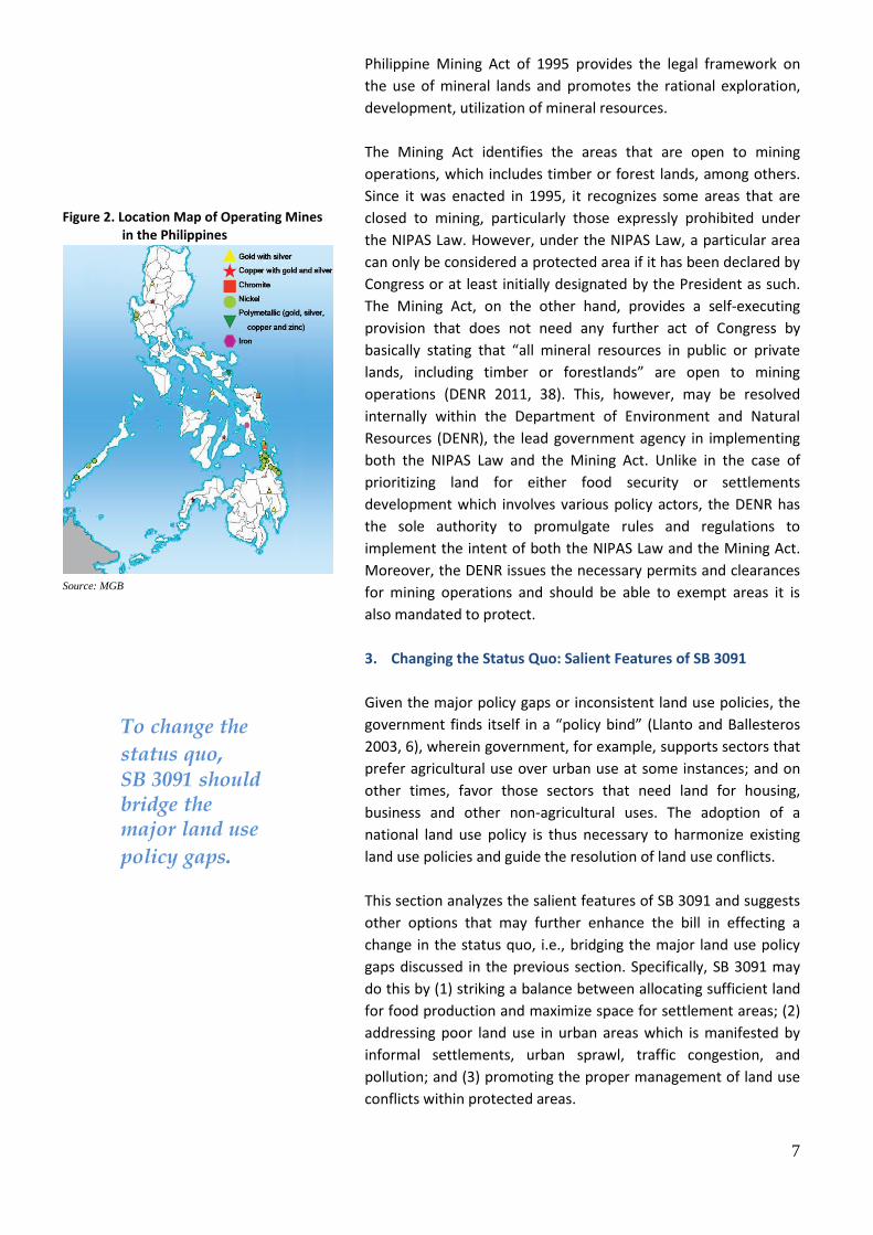
Figure 2. Location Map of Operating Mines in the Philippines
Source: MGB

8
3.1. Protecting Prime Agricultural Lands
To address food security and rice self-sufficiency,
Sections 31 and 32 of SB 3091 respectively prohibit
the conversion and reclassification of all prime
agricultural lands and those covered by CARL
pending redistribution. Though not originally used in
AFMA, prime agricultural land is defined under SB
3091 as those lands basically covered under the
NPAAAD as defined in AFMA. In addition, while the
AFMA and the CARPER Law provided the non-
conversion of irrigated and irrigable lands, SB 3091
fully protects all prime agricultural lands, which
include irrigated and irrigable lands, from
conversion. Further, agricultural lands are deemed
converted only upon approval of the DAR.
In the case of other agricultural lands, SB 3091
mainly specifies that Section 22 of the CARPER Law
will apply as conditions when conversion is allowed,
since all other agricultural lands are basically
covered by CARPER. Pending the expiration of the
CARPER Law by 2014 however, SB 3091 may include
a provision reiterating the conditions for conversion,
that is, (1) when the land ceases to be economically
feasible and sound for agricultural purposes; or (2)
when the locality has become urbanized and the
land will have a greater economic value for other
purposes.
Further firming up of the said conditions may be
necessary considering the implications of the
following: (1) urban areas under UDHA refer to all
cities, and municipalities with a population density
of at least 500 persons per square kilometre; (2) the
LGC adopts a criteria for cityhood that tends to
increase the number of localities considered as
cities; (3) land will naturally have a greater economic
value for non-agricultural purposes; and (4) the
program of providing land for the tillers is based on
concepts of welfare and social justice and not on
overall economic benefits that may be derived from
the utilization of such land.
On the reclassification of agricultural lands by LGUs,
SB 3091 may include a provision specifically stating
that the DA shall first certify that agricultural lands
to be reclassified into non-agricultural uses are not
prime agricultural lands and therefore, eligible for
reclassification.
Lastly, SB 3091 may also make clearer the definition
of prime agricultural lands and exclude or modify the
phrase “all rain-fed areas planted to rice and other
crops” as it basically refers to all agricultural lands
and defeats the purpose of distinguishing prime
agricultural lands from other agricultural lands.
3.2 Improving Settlements Development
Chapter 7 of SB 3091 provides for the zoning of
settlement areas guided by urban zoning standards
designed to maximize existing urban spaces. It limits
the establishment of settlement areas on alienable
and disposable lands in order to avoid further
degradation of forestlands. It also allows settlements
in geo-hazard areas subject to the implementation
of mitigation measures; and provides for the
designation of socialized housing zones, sanitary
landfill, and urban forest or green space in each city
or municipality. Section 46 of SB 3091 essentially
reinforces the provisions of UDHA (Section 8) on
socialized housing while in Section 45 the provisions
of RA 9003 or the Ecological Solid Waste
Management Act of 2000 are primarily reiterated.
Aside from limiting settlement areas in alienable
and disposable (A&D) lands, SB 3091 may
comprehensively provide criteria for identifying
settlement areas. Typically, areas that may be
considered suitable for human settlement are those
that are: (1) within A&D lands but not in
environmentally-critical, geo-hazard or other
protection areas; (2) along established urban growth
directions; (3) with or can be provided with basic
services and utilities; (4) ideally within the zero to
eight percent (0-8%) slope range; and (5) reasonably
accessible from existing built-up areas and other
employment centers through existing or proposed
roads and other transportation facilities (NEDA
2007,98).
Furthermore, SB 3091’s proposal to exempt housing
projects within residential zones from securing
Environmental Compliance Certificate (ECC) and
Engineering Geological and Geo-hazard Assessment
Report (EGGAR) should be reconsidered. Since the

9
bill allows new housing projects or new
developments in general within geo-hazard areas, it
should still require the submission of the ECC and
the EGGAR regardless if such area has been
designated as residential zones in land use plans. It
may also include a provision that promotes
sustainable communities that are transit-oriented,
pedestrian-biased, multiple use, and with systems
and practices that promote water use efficiency,
energy efficiency, waste segregation and recycling.
To maximize existing urban spaces and contain
urban development patterns from encroaching into
protected areas, SB 3091 may include a specific
provision that will (1) discourage urban sprawl; (2)
encourage higher density housing or built-up areas
before expanding to new settlement areas; and (3)
acknowledge the economic efficiency of
concentrating people, capital, and resources in key
urban centers or cities.
To accommodate the concentration of people in
denser urban centers, SB 3091 may likewise include
provisions for the establishment of strategic
multimodal transport network and other
infrastructure facilities. This will also influence a
more rational pattern of development and will
enhance the physical connectivity among rural areas,
urban centers, key cities and municipalities,
production hubs, and distribution centers and
markets.
3.3 Protecting Critical Areas through
Sustainable Development
Sections 32 to 34 of SB 3091 provide for the
reversion of alienable and disposable lands to
forestlands; the identification and delineation of
critical watershed areas; and the formulation and
implementation of integrated watershed
management plans. While SB 3091 also enumerates
key prerequisites necessary for the rational
allocation of these lands (e.g., implementation of a
National Base Mapping Program in Sections 25), it
does not provide for the delineation of forestland
boundaries which is the first step in the
management of the forest areas. Pursuant to the
RFCP, SB 3091 may reiterate that the DENR complete
the delineation of forestland boundaries on the
ground, within a reasonable period or at least within
five years from the effectivity of the NaLUA.
Boundary surveys once completed and ready for
legislation will essentially set the specific areas
where no other land use may prevail.
In addition, SB 3091 may also include a provision on
the establishment and management of national
parks, which shall include all areas under the NIPAS.
This would practically proclaim as protected areas
those that were already designated by the President
as such pending Congressional proclamation, and
those identified as initial component of the NIPAS.
On sustainable mining, Sections 39 and 40 of SB
3091 provide the criteria for the utilization and
allocation of land for mining purposes and the
reversion of mineral lands, respectively. SB 3091
reiterates in Section 39 that protected forestlands
and agricultural lands are exempted from any mining
activities. This basically reiterates the major points of
the Mining Act in relation to land use.
SB 3091 also has provisions for other areas such as
industrial development areas (Sec. 48) and tourism
and heritage areas (Sec. 49). The latter was made
consistent with the provisions of recently passed
laws: that (1) Tourism Enterprise Zones shall be
established in line with RA 9593 or the Tourism Act
of 2009; and that (2) Heritage zones shall be
established to protect the historical and cultural
integrity of an area in line with RA 10066 or the
National Cultural Heritage Act of 2009.
3.4 Imposing Stricter Sanctions and Penalties
SB 3091 provides for stricter sanctions and penalties,
the most notable of which are as follows:
(1) Imposition of fines ranging from 6 to 50 percent
of the zonal value of the subject land and full or
partial revocation of conversion order for failure to
commence development after one year upon
issuance of approved Conversion Order or complete
development within a specified time frame;
(2) Forfeiture of salaries and allowances and
suspension for LGU officials or employees
responsible for the failure of formulating/updating,

10
enforcing, and/or implementing the Comprehensive
Land Use Plan (CLUP);
(3) Imprisonment of 7 to 12 years or a fine not lower
than PhP100,000.00, or both, at the discretion of the
court, for illegal or premature conversion of
agricultural lands. If the offender is a public official
or employee, the penalty shall include dismissal
through permanent separation from the service and
forfeiture of all benefits and entitlements accruing to
the public position and perpetual disqualification to
run or apply for any elective or appointive public
office. If the offender is a juridical person,
imprisonment shall be imposed on all board
members and officers and the fine shall be
equivalent to the zonal value of the land or 40
percent of the stockholders’ or partners’ equity.
3.5 Institutionalizing Planning and
Implementing Mechanisms
Aside from imposing stricter penalties, SB 3091 goes
through great lengths of ensuring its proper
implementation by emphasizing the importance of
planning. It reiterates the hierarchy of land use and
physical framework plans7 currently prepared by
development councils at the national, regional, and
local level (i.e., the National Economic and
Development Authority Board, and the
Regional/Local Development Councils). This
recognizes that the issue on the allocation of land to
various uses is both location-specific and sector-
specific and therefore should be addressed by LGUs
and national government agencies (NGAs) through
an iterative process of a combined bottom-up and
top-down approach in planning.
Planning in such context, however, emanates from
overall state policy and thus a part of policy
implementation, not formulation. Since a national
land use policy will harmonize existing land use
policies, there is not so much need to include in SB
3091 the vast elaboration of planning
considerations, plan document descriptions,
planning body responsibilities, and plan
7 i.e., National Physical Framework Plan (NPFP), Regional
Physical Framework Plans (RPFP), Provincial Development and Physical Framework Plans (PDPFP), Comprehensive Land Use Plans (CLUPs).
implementation strategies, all of which are already
institutionalized and/or highly recognized. Again, the
problem is not so much on planning per se but
rather on (1) the capacity of the planning bodies,
particularly at the local level; (2) the inadequacy of
national government agencies in providing a unified
long-term strategic direction; and (3) the difficulty of
translating land use policies that are “unclear and
inconsistent” into coherent plans and programs.
Nonetheless, SB 3091 in Chapter 5 reiterates a
familiar structure and mechanism that would
facilitate the implementation of the national land
use policy primarily through the preparation of land
use and physical framework plans indicated in
Chapter 3. For the most part, SB 3091 in Sections 20
and 21 utilize existing government structures
particularly the development councils or planning
bodies at the local level in accordance with the LGC.
At the national level however, Section 14 of SB 3091
creates under the Office of the President a National
Land Use Commission (OP-NLUC). It will be chaired
by the President, with the NEDA Director General
and the DENR Secretary as the Vice Chairpersons,
and will be comprised of concerned Cabinet
Secretaries and selected sectoral representatives as
members. Among its major functions are on (1)
planning, i.e., to formulate the National Physical
Framework Plan (NPFP); and (2) conflict resolution,
i.e., to resolve land use policy conflicts between or
among agencies, branches, or levels of government.
While the intention of creating a Commission under
the Office of the President is to ensure policy and
plan implementation and guarantee the highest
degree of accountability, a closer analysis of the
related provisions may reveal some inherent
problems on the creation of the proposed
Commission vis-à-vis the current government system
on policy coordination and planning.
First, is on the existence of an institution with similar
composition and function—the NEDA Board. The
NEDA Board, also headed by the President and
composed of most Cabinet Secretaries as members,
has a Constitutional mandate to act as the country's
premier social, and economic development planning
and policy coordinating body. The NEDA Board is
11
primarily responsible for “formulating continuing,
coordinated and fully integrated social and economic
policies, plans and programs”. This is why it is tasked
to prepare plans such as the Medium-Term
Philippine Development Plan (MTPDP) in
coordination with all concerned government
agencies. Given that the National Physical
Framework Plan (NPFP) is a spatial integration of
social and economic development objectives of all
development sectors, it is practically a long-term
Philippine Development Plan (PDP) and thus
rightfully under the mandate of the NEDA Board.
The NEDA Board itself, not just a committee or even
a council under it, should have the primary
responsibility and accountability for the NPFP, much
like how it is responsible and accountable for the
MTPDP (i.e., currently the PDP 2011-2016). Similarly,
other development councils (i.e., regional and local)
should be responsible and accountable for their
respective physical framework or land use plans.
Second, the concept of a functional or viable
secretariat support for OP-NLUC is not provided. Per
SB 3091, the OP-NLUC Technical Secretariat will only
be composed of representatives of member agencies
with a rank not lower than Director level. While the
Policy and Planning Unit of HLURB is assigned as the
core secretariat, it is not clear whether this would be
on a permanent basis given that HLURB has other
functions pursuant to its mandate. This arrangement
might also present a conflict of interest since HLURB
is a sectoral agency.
Lastly, it is unclear why or how the OP-NLUC will (1)
resolve land use policy conflicts between or among
branches of government, much like a Supreme
Court; and (2) act as the “highest policy making body
on land use”, much like Congress.
To avoid the unnecessary duplication of agency
functions and responsibilities, SB 3091 may
recognize that the overall land use and physical
planning function is properly lodged under the NEDA
Board, which has at its disposal the entire NEDA
Secretariat for research and technical support in the
preparation of an NPFP.
4. Conclusion: Deciding on the NaLUA
Land use conflicts are unavoidable, and are likely to
intensify as population increases. The issue of how
to allocate land to competing uses goes beyond
enforcing existing policies. The land use policy and
implementation gaps reflect the lack of a common
appreciation by various policy actors and sector
stakeholders on the trade-offs involved in the
current policy thrusts (Corpuz 2011, 6). There is a
need to understand, for example, that implementing
food self-sufficiency and corresponding prohibitions
on agricultural land conversion may have
consequences on economic growth and employment
generation, given that this affect the expansion of
urban areas where most jobs are generated. In the
same respect, not containing urban development
patterns may also have consequences on poverty
reduction, given that this leads to continued
agricultural land conversion that will affect the lives
of most of the poor which rely on agriculture for
their livelihood.
In resolving land use conflicts, policymakers should
decide to enact a national land use policy that will
address policy gaps and harmonize existing land use
policies. Greater consideration should, however, be
given to policies on the (1) protection or
sustainability of key production areas or
employment activities particularly those in the rural
areas which would greatly contribute to achieving
poverty reduction, social welfare, social justice and
inclusive growth; (2) promotion of denser,
integrated and connected urban areas, with
affordable higher density housing, and conducive to
commercial and industrial activities; and (3)
protection of critical areas and other vital natural
resources.
This Policy Brief was principally prepared by Mr. Paolo Neil S. Navata with inputs from Microeconomics
Sector Head Peter Anthony S. Turingan under the supervision of SEPO Directors and the overall guidance of
its Director General.
The views and opinions expressed herein are those of the SEPO and do not necessarily reflect those of
the Senate, of its leadership, or of its individual members. For comments and suggestions, please e-mail us at

12
References:
Ballesteros, Marife M. (2002): Rethinking Institutional Reforms in the Philippine Housing Sector Discussion
Paper Series No. 2002-16
Cardenas, Danilo C. (n.d.) Effects of Land-Use Conversion on Local Agriculture: The Case of Cavite, Philippines.
Food and Agriculture Organization.
Cariño, Benjamin and Arturo Corpuz (2009): Toward a Strategic Urban Development and Housing Policy for
the Philippines. Discussion Paper Series No. 2009-21, July 2009. Philippine Institute for Development
Studies.
Corpuz, Arturo G. (2011): Draft Preparatory Study on the Current NFPP with Recommendations on a
Proposed NPFP. NEDA.
Cruz, Marian (2007): A Systematized Land Use Planning Process: Towards Consistency Across Plans at the
Different Levels. Final Paper. Technische Universitaet Dresden, Germany: CIPSEM.
Department of Environment and Natural (2011): An In-Depth Review of the NIPAS Law and Related Statutes
on the Establishment and Management of Protected Areas in the Philippines: A Final Report, August
31, 2011.
Housing and Urban Development Coordinating Council and Philippine Institute for Development Studies
(2009): National Urban Development Housing Framework (2009-2016), August 2009.
Howlett, Michael and M. Ramesh (2003): Studying Public Policy: Policy Cycles and Subsystems. Second
Edition, Oxford University Press.
Llanto, Gilberto and Marife Ballesteros (2003): Land Issues in Poverty Reduction Strategies and the
Development Agenda: Philippines. Discussion Paper Series No. 2003-03. Philippine Institute for
Development Studies.
National Economic and Development Authority (1995): Guidelines for the Preparation of Regional Physical
Framework Plan. NEDA.
National Economic and Development Authority (2002): National Framework for Physical Planning, 2001-2030.
NEDA.
National Economic and Development Authority (2007a): Volume 1: The Integrated Framework (PLPEM
Guidelines), NEDA and ADB, Manila
National Economic and Development Authority (2007b): Volume 2: Provincial Development and Physical
Framework Plan (PLPEM Guidelines), NEDA and ADB, Manila
National Economic and Development Authority (2011a): Briefer on the NEDA Board - National Land Use
Committee.
National Economic and Development Authority (2011b): Comparison of Senate Bills on NaLUA
National Economic and Development Authority (2011c): NaLUA Milestones
National Economic and Development Authority (2011d): National Land Use Act (Executive Branch’s Position).
In Presentation delivered during the NaLUA Senate TWG Meeting.
National Economic and Development Authority (2011e): Salient Features of the NaLUA by the NEDA Board -
National Land Use Committee.
Placino, Pryor Aldous A. (2010): Rural Urbanization, Agricultural Modernization and Land-Use Conversions:
Changing Political Ecologies of Coconut Farming and the Voices from the Margins in Lucena, Quezon.
RCSD International Conference, Chiang Mai, Thailand, 13-15 May 2010.
Ramos, Grace C. (2000): The Urban Development and Housing Act (UDHA) of 1992: A Philippine Housing
Framework. Lund University
Senate Bill 3091, “An Act Instituting A National Land Use Policy, Providing The Implementing Mechanisms
Therefor, and for Other Purposes”
Senate Economic Planning Office (2005): Requisites of A Land Use Policy. Policy Insights. Senate of the
Philippines.
Serote, Ernesto (2002): A Model of Local Planning and Development in the Philippines: A Concise Planning
Guidebook. University of the Philippines School of Urban and Regional Planning.