(f. c. truter, m.a., ph.d.) - the-eis.com review of volcanism in the... · a review of volcanism in...
TRANSCRIPT

ANNIVERSARY ADDRESS BY THE PRESIDENT
ANNIVERSARY ADDRESS BY THE PRESIDENT
(F. C. Truter, M.A., Ph.D.)
xxix
A REVIEW OF VOLCANISM IN THE GEOLOGICAL HISTORY OF SOUTH AFRICA.
CONTENTS.
1. INTRODUCTION .. II. ROCKS AS RECORDS OF EARTH HISTORY
III. VOLCANOES AND THEIR RECORDS IV. VOLCANISM DURING THE ARCHAEOZOIC ERA
A. THE SWAZILAND OR KHEIS SYSTEM B. THE GARIEP OR MOODIES SYSTEM ..
V. VOLCANICITY DURING THE PROTEROZOIC ERA A. THE DOMINION REEF SYSTEM B. THE WITWATERSRAND SYSTEM C. THE WOLKBERG SYSTEM D. THE ZOETLIEF SYSTEM E. THE VENTERSDORP SYSTEM F. THE TRANSVAAL SYSTEM G. THE LosKOP SYSTEM .. H. THE WATERBERG SYSTEM I. VOLCANISM OF POST-WATERBERG AND PRE-NAMA AGE
1. The Pilansberg Eruptives .. 2. Eruptives of the Franspoort Line 3. The Alkaline Stocks Near Parys .. 4. The Volcanic Neck on Spitskop 171 5. The Volcanic Neck on Loole 199 ..
VI. THE PALAEOZOIC ERA A. THE NAMA SYSTEM B. THE CAPE SYSTEM C. THE LOWER DIVISION OF THE KARROO SYSTEM
VII. THE MESOZOIC ERA A. THE UPPER DIVISION OF THE KARROO SYSTEl\<f B. THE CRETACEOUS SYSTEM ~.
VIII. VOLCANIC VENTS OF UNCERTAIN AND POSSIBLY VARYING AGE 1. The Van Rhynsdorp District 2. The Sutherland District 3. The Prieska District 4. The Klinghardt Area 5. The Keetmanshoop District 6. The Rehoboth-Windhoek Area 7. The Marico District 8. The Rustenburg District 9. The Pretoria District
(a) The Zoutpan Volcano (b) Volcanic Necks North-East of Pretoria
10. Sekukuniland 11. The Vent on J ongmans Spruit 36
SUMMARY BIBLIOGRAPHY ..
Page xxx
xxxi xxxvii
xlv xlvi
I Iii Iii Iv
lvii lix Ix
lxii lxvi
lxvii lxix lxx lxx
lxxi lxxi lxxi
lxxii lxxiii lxxiii lxxiv lxxv lxxv
lxxvii
lxxix lxxix lxxx lxxx
lxxxi lxxxi lxxxi
lxxxii lxxxiii lxxxiii lxxxiii lxxxiv lxxxv lxxxv
lxxxvi lxxxviii
XXX PROCEEDINGS OF THE GEOLOGICAL SOCIETY OF SOUTH AFRICA
1. INTRODUCTION.
In recent years the utilisation of geological knowledge, in times of peace as well as of war, has been so varied f;md extensive as to force the conclusion that the practical value and importance of the science of geology are at last becoming to be fully appreciated. This development is not without significance fQr the future of the geological profession, for, having regard to the known resources of the world and the future needs of mankind, it can only be interpreted as foreshadowing the ultimate status of geology in industry. With few exceptions perhaps, the time is now past forever when in South Africa, as in other countries, exploitable mineral deposits can be discovered by traversing an area with oldtime tools of hammer, lens and prospecting pan, and when anyone can select a borehole site from surface indications by hit-and-miss methods or give advice on engineering projects after a casual examination of the terrain. For its ever expanding needs the nation will require ever larger supplies of water and economic rocks and minerals, and it will have to undertake with ever increasing tempo defence schemes and the construction of harbours, dams, bridges, canals, etc. In the proportion that construction enterprises become more complex and the location of new mineral deposits at depth becomes more difficult, there will be an increasing demand for men who command a sound scientific knowledge of the structure of the earth's crust and of rocks, their composition and properties.
We have, therefore, every reason to feel optimistic about the future of our profession, and I would even hazard the prediction that in the very near future geology will be properly integrated with industry and geologists will be called upon more and more to take a share in supplying the essential and vital requirements of the country. May I, however, appeal to members of my profession to be thoroughly equipped and fully prepared for any task we may be called upon to undertake when that happy day dawns. The best advertisement for our profession is our own achievements, and what we shall be capable of achieving will naturally depend not only on how much we know about geological principles and processcs, the structure, constitution and history of the earth, but also on our ability to apply this knowledge.
In the address that I have the honour to deliver to you to-night I have therefore refrained from expatiating on the purely utilitarian aspect of geology, and have instead deliberately selected a topic the discussion of which furnishes an excellent illustration of some of the methods of geological investigation, and at the same time conforms more strictly to the fundamental aim of the science of geology, namely, the deciphering of the evolutionary history of the earth's crust. However, as the earth has existed as a planet for at least 2,000 nlillion yeals and has an area of nearly 200 million square miles, its complete history is obviously too vast a theme to be condensed into an address for an occasion like this, and I have perforce to confine myself to an almost infinitesimally small portion of its surface and deal with only one aspect of its history. The area that I have very naturally chosen is the Union of South Africa and its Mandated Territory of South-VVTest .Airica, and the subject that I have selected for discussion is the role that volcanoes have played in the evolution of this part of the African sub-continent.

ANNIVERSARY ADDRESS BY THE PRESIDENT xxxi
In the selection of this topic I have been prompted by the consideration that, whilst a wealth of information on volcanism in this country has been collected by past and present investigators, no one has yet composed a connected account of the whole progress of volcanic action from the earliest geological periods down to the time when the last eruptions ceased. .As science aims not only at collecting but also at systematising and co-ordinating facts, I would now like to supply this deficiency. Within the limits permissibJe to do this, I shall not be able to give more than a mere outline of the highly specialised science of volcanism, and I shall have to concern myself with the historical and stratigraphical aspects rather than with the nature and origin of volcanoes or the physical and chemical phenomena that attend eruptions. In view of the fragmentary nature of our geological records and the consequent uncertainties that prevail in regard to correlation, the stratigraphical approach is undoubtedly the most difficult, and a certain amount of speculation is inevitable. This criticism can also be levelled at the order in which I have here arranged the several volcanic events and which, I may say, reflects entirely my own personal views on the matter. On the score that this may evoke fresh interest in and stimulate further research on this perplexing problem I trust, however, that I shall be pardoned for thus abusing my Presidential privilege.
II. ROOKS AS REOORDS OF EARTH HISTORY.
Nothing has a more enduring influence on the mind and appeals more to the imagination of man than phenomena that he cannot comprehend and forces that he cannot control. Not only because of the stupendous power and the superb grandeur of violent eruptions but also because of the devastating effect on life and property, volcanoes rank in the popular mind as among the most real and awe-inspiring of all geological manifestations. It is no wonder, therefore, that, labouring Ullder the entirely erroneous impression that volcanoes are necessarily mountains, so many people in this country who are uninitiated in the science of geology have long been prone to see signs of volcanic action in the conical or table-topped hills that stud the Karroo; in the peculiarly shaped monadnocks that project in inselberg· fashion from the arid, sand-covered regions in the west; in that magnificent outlier of Table Mountain sandstone known as Lion's Head in the Cape Peninsula; and, in fact, in so many other geomorphological features, which are scattered all over the country and have obviously resulted from denudation by superficial agencies. On the other hand, these same people can detect no vestige of past volcanic action where the trained eye of the geologist can see abundant evidence of it. Nowhere is this contrast more conspicuous than in a country like ours, which, in the living memory of man, has been singularly free of volcanism and its afflictions.
If then mountains are not necessarily old volcanoes, and not even the shape of a hill is a criterion of its volcanic origin, it may well be inquired whether volcanicity has had any share in the geological development of our country, and if so, when and to what extent, and whether we have absolutely indisputable proof of this. To be able to supply intelligent answers to these questions we

xxxii PROOEEDINGS OF THE GEOLOGIOAL SOOIETY OF SOUTH AFRICA
have to know the language of rocks. This, in turn, implies an intimate acquaintance with all the processes by which rocks are formed and all the changes that rocks undergo. This knowledge can only be acquired by adopting the method suggested by Hutton when he declared: "The present is the key to the past." When due cognisance is taken of the present the realisation is forced upon us that eaI'th features are not permanent, but that significant changes are taking place around us all the time. Along the rocky stretches of our shore we obseI've how the waves eat incessantly into the land, partly by the solution of some of the rock constituents and the consequent formation of corrosion caves, but more especially through their powerful hydrostatic pressure, which, by forcing water and air into joints, crevices and caverns, dislodges blocks of rock and hurls these with destructive violence against the newly exposed faces of coastal cliffs. On land we see how hills and mountains are slowly but relentlessly being worn away by glaciers and headward eroding streams, which, by undercutting and lubricating the foundations, cause gigantic landslides and rock-avalanches. We note how rocks are shattered by alternate freezing and thawing of water and by differential expansion and contraction due to extreme and rapid variation of diurnal temperature; how they crumble and decay in consequence of the processes of oxidation, hydration and selective solution induced by surface and subsurface waters charged with oxygen and carbon dioxide; how they are crumpled and folded as a result of chemical and physical processes involving expansion in volume; how they are scoured, corroded and polished by glaciers, water and wind assisted by abrading material, boulders, pebbles and sand, which they transport; how, through the chemical corrosion of carbonated waters, underground caves and caverns are formed and under the action of gravity subsidence of the unsupported roof into these takes place and sinkholes come into existence; and how, as a result of the combined operations of all these unceasing processes, sculpturing of the land goes on continually and gives rise to that endless variety of magnificent, because highly contrasted, topographical forms that we term scenery. It is this truth about the ceaseless destruction of the land that Tennyson so forcibly brought home to us when he wrote :-
" The hills are shadows, and they flow From form to form and nothing stands; They melt like mist, the solid lands, Like clouds they shape thenlselves and go."
We observe further that the work of destruction is but a single phase of a series of changes that are in progress everywhere. The waste or debris that results from the physical disintegration and chemical decomposition of existing rocks is swept away by the wind and piled up in dunes, or is transported by streams and deposited in pans, marshes, lakes, epicontinental seas and in the ocean. In the last it becomes admixed with nlarine shells and is scattered far and wide on the continental shelf by tidal and wind currents. We examine the material so transported and we find that it has been sorted in transit into fractions with differing coarseness of grain or effective specific gravity; that the finer and lighter fraction has invariably been carried much farther than the coarser and heavier residue, which is deposited much nearer to the source;

ANNIVERSARY ADDRESS BY THE PRESIDENT xxxiii
and that in the aeolian or wind-hlown deposits stratification is either lacking or confused, whereas the water-horne material is arranged in well-defined, horizontal to suhhorizontal layers, which show ripple-marking where formed in quiet water agitated only hy wave action, and are cross or current hedded where the transporting currents were suhject to rapid variation in direction and velocity. Closer examination of the last two features reveals that in these undisturbed sediments ripple-marks are constituted of broad, round troughs and narrow, sharp crests and that the cross or current beds invariably curve into and merge with the main stratification below but are sharply truncated by it above.
We extend our investigation farther afield and observe how beds of rock salt are intermittently precipitated by the evaporation of saline water in arid regions and how these are as frequently buried under mud, sand or gravel brought in during torrential downpours. We see how by the recurrent ingress of water-borne debris the luxuriant growth of marshes and swamps is choked and converted into layers of pe~Jt; how the bones and skeletons of terrestrial animals are swept by raging torrents into lagoons, lakes and other impounded bodies of water and are there preserved by instant burial under thick deposits of rock waste; and how in the mud of pans and flood pJains the craterlike marks left by rain or hail and the polygonal cracks caused by shrinkage due to desiccation are perpetuated as fossil rain prints and sun cracks respectively by heing filled up with wind-hlown sand before the next layer is deposited. Further exploration brings to light deposits with identical peculiarities, structure and composition to these just described but which, instead of being soft and incoherent, are now hard and consolidated. We notice further that these latter deposits rest on still older and harder formations, and that the relation between all three is an unconformity or a break or hiatus in the stratification marked by a discordance or non-parallelism in the attitude of the beds on opposite sides of the line of contact, and by the fact that the upper groups of deposits repose on the eroded and truncated strata of the lower.
Our study has thus f'ClJr taught us that rock degradation goes hand in hand with the transportation of rock waste, its deposition in basins and its subsequent consolidation. We have, in fact; witnessed the formation of a very important and wide-spread group of rocks, the clastic or sedimentary rocks, and we have ascertained that, far from being lnere aggregates of minerals, these are the records of earth processes and, as such, are important historical documents. Furthermore, we have learned the language in which these records are written and are at last in a position to interpret these documents intelligently. In the polished and striated rock surfaces we can now read the story of the work of former glaciers; coal seams now become evidence of the former existence on land of vast swamps supporting a luxuriant, aquatic vegetation; joints, normal displacements and dykes are proof of the former prevalence of tensional conditions, whilst overthrusts ard complicated folds testify to the operation in the past of stupendous compressional forces tha~ locally shortened the crust and thus formed gigantic fold mountains, which were subsequently effaced by denudation. In the extreme diversity of rocks of terrestrial origin there is evidence of conspicuous changes of climate ranging from tropical to glacial on the one hand and from arid to pluvial on the other. The whole range of

xxxiv PROCEEDINGS OF THE GEOLOGICAL SOCIETY OF SOUTH AFRICA
fossils, traceable through the entire sequence of formations from the oldest to the youngest, bears testimony to the gradual evolution of life that culminated at last in man. Frequent fluctuations of sea-level relative to the land are indicated by the numerous raised beaches along our coast as well as by the rapid alternation of beds of marine and terrestrial origin. The almost ubiquitous presence on all continents of stratified, waterborne deposits of different ages affords ample proof of the fact that in the past the pres~nt land surfaces have repeatedly been submerged and loaded with sediments, and have as frequently been elevated above the inundating waters. This truth finds apt expression in the following well-known stanza of Tennyson :-
" There rolls the deep where grew the tree. 0, earth, what changes hast thou seen! There where the long street roars, hath been The stillness of the central sea."
We have established that ceaseless cycles of changes have taken place in the past, as they do to-day, and we have learned to recognise from a study of their texture, composition and other characteristics how and where particular sedimentary rocks have been formed, and what the nature of the rocks has been from which they have been derived. Human curiosity and inquiry know no bounds, however, and our story will seem incredible and far from complete if we have to profess entire ignorance about the time when the various changes were effected and the several rock groups came into existence. Fortunately the records contained in the rocks enable us to decipher the age of a particular formation, if not in absolute time then at least in relation to other formations or to a major geological event. There are several important criteria by which such a determination may be made. In the first place we utilise our knowledge of current bedding and ripple-marks to ascertain whether the strata are inverted or occur in the normal order of deposition. In the second place we employ the self-evident principle of the order of superposition of strat,a. We have seen that stratified rocks result from the accumulation of layer upon layer of sediments. In an uninterrupted succession of normally disposed beds it is thus quite obvious that the lowest beds must have been deposited first and are therefore the oldest. In the third place we are guided by the relationship that is found to exist between intrusive igneous rocks and sedimentary formations. Thus, if a granite nlass, for instance, is intrusive into a formation.A but forms the sedimentary basement of formation B, then A is obviously older than B. Fourthly, we make use of the commonsense principle that if a formation X encloses easily recognisable and undoubted fragments of a formation Y, then X must be younger than Y. Fifthly, we utilise the evidence of structure of contiguous formations. Thus, if a formation P, which is affected by complex folding and faulting, occurs in juxtaposition to a formation Q, which reflects no such disturbance, then Q must obviously have come into existence after the diastrophic event and is therefore younger than P.
In practice it is found that the criteria enumerated are not always entirely adequate for the assessment of relative age and therefore for the determination of the position of a particular formation in the stratigraphical column. In some formations, especially those of abysmal origin, current bedding and

PROCEEDINGS OF THE GEOLOGICAL SOCIETY OF SOUTH AFRICA xxv
be a member of a new nickel-bismuth-sulphide and nickel-lead-sulphide mineral series, and the latter identical with the platinum stannide, PtSn. In his review of this paper in the journal Economic Geology the eminent American mineralogist Professor G. M. Schwartz states that" it is an important contribution to ores of the Sudbury type, and because of the detailed work on many intergrowths of ore minerals should be available for reference in any laboratory where microscopic research on ores is carried on."
Able to combine theoretical knowledge with the requirements of the mineral industry, Dr. Scholtz's services and advice on mineral deposits have often been called upon. His findings in the field of economic geology are unfortunately for the greatest part contained in confidential reports. During 1943 to 1945 he organised and supervised the survey of the fore-land of the TulbaghSwellendam mountain region on behalf of the Planning Council. The research led to the discovery of a deposit of pure pyrophyllite, hitherto unknown bodies of high grade limestone and extensive deposits of dolomite, one of which is now being successfully exploited near Langvlei. The results of the investigation are awaiting publication.
Explicit in his lectures and always conversant with the latest literature. developments, and techniques in geology, ever courteous and obliging, he has proved himself an able teacher, popular alike with his colleagues and students, He contributed in no small manner to the building up of the department of geology at the Pretoria University, and he planned the new department of geology at the University of Stellenbosch. He created local interest in optical mineralogy, particularly as far as the application of the universal stage is concerned, mineragraphy, and structural geology. An enthusiastic worker in the field, he is an adept in organising and stimulating interest in geological excursions. On such expeditions he combines a profound knowledge of the culinary art with that of the methods of geological observation in the field.
While regretting that in South African universities the instruction of undergraduates and the training of research workers leaves the staff so little time for research, he considers that the real criterion of the activity of any university in this country is the quality, quantity, and range of the research produced by the graduate students of its geological department. His inspiration of his students in the field of geological research is reflected in their many valuable contributions published in the Transactions of this Society, in the Annals of the University of Stellenbosch, and in other scientific journals.
Professor Scholtz, in handing this medal to you, the Society looks forward with confidence to further distinguished work from you and your department of geology at the University of Stellenbosch."
Dr. Scholtz, in accepting the Medal, made the following remarks :
Mr. President, Ladies and Gentlemen,
I was astounded to learn from the Secretary of the Geological Society that I had been singled out for the 1949 award of the Draper Memorial Medal. To be thus prematurely ranked amongst a small group of distinguished South African geologists is indeed embarrassing. I assure you I am deeply conscious of, and very grateful for the great honour which you have bestowed on me.
xxvi PROCEEDINGS OF THE GEOLOGICAL SOCIETY OF SOUTH AFRICA
When I entered university almost 30 years ago I was indeed fortunate to be a student of Professor S. J. Shand-the "Father of South African Petrology"-to whom so many of us here to-night owe so much. I shall not forget how, at a time when I was especially keen on the study of the palaeontology of the Karroo Reptiles, he redirected my interest to the domain of petrology with the remark: "Why, that stuff is as dryas the old bones themselves! " The meticulous care he lavished on the condition of apparatus and his department in general, must forever be an inspiration to some, and a source of irritation to others. I can recollect how Dr. A. L. Hall after delivering a lecture on the Bushveld Complex deliberately scattered the wrapping paper of his specimens about him, saying: "This place is much too clean for a geological laboratory ! "
I also consider myself extremely fortunate to have been able to conduct research under the inspiring and versatile guidance of Professor P. Niggli, of Zucich. If I have achieved a small measure of success in my subject I feel I merely share it with those inspiring men who taught me, to my colleagues, and to many of myoId enthusiastic students whom I to-day regard as some of my best friends.
In view of the fact that my principal sphere of activity in geology during the past has been primarily of an academic nature, you will no doubt pardon me if I make a few relevant remarks which I believe fitting and opportune on this occasion.
Owing to our small population our Universities are comparatively speaking small, and the number of students limited. In general our geological departments have neither the funds nor the staff to permit intensive specialisation in one or other branch of a composite science like geology, unless, of course, we are prepared to do so at the expense of other equally essential branches of the subject. Hence it is clear that the principal duty of the South African professor or lecturer must necessarily be the instruction of undergraduates and the training of research workers. Research on the part of the staff is therefore relegated to a secondary position, otherwise tuition suffers, and if it does adverse reflection will not fail to illunlinate the institution. Every department should aim at providing a thorough, well balanced undergraduate and masters' courses in the fundamental principles of the subject, upon which foundation the postgraduate student wHI be in a position to conduct geological investigations or research. The research student should be induced to think through his problem before committing his thoughts to paper. A short, well reasoned paper is worth more than ten long-winded treatises in which the facts and inferences are often so inextricably interlaced as to be practically indecipherable to the author, let alone the reader. Only too often the text of an otherwise good paper discloses evidence of loose reasoning, limited thought in the field, while field descriptions are suggestive of limited or narrow vision. It is seldom realised that the solution of a given geological problem has more often than not to be sought far beyond its immediate confines, and the young research worker should be encouraged to visualise his problem in its proper geological setting. Deductions, too, in many instances are not carried to their logical and ultimate conclusions. In the study of the phenomenon of replacement, for example, no description can be considered satisfactory unless the research worker can give some indication of what has become of the products released by the process.
PROCEEDIN GS OF THE GEOLOGICAL SOCIETY OF SOUTH AFRICA xxvii
A word of caution should also be directed to those who, their prudence swamped by their enthusiasm, rush into print to clutter up the already prolific geological literature with junk, serving no purpose other than to confuse the unfortunate undiscerning student of geology, following in their wake. It is not uncommon to find that many of the so-called " new theories" or " modern views" are in reality feeble and poorly evidenced versions of conclusions originally based on far sounder data, at a time when present-day research technique had not been developed and fewer facilities were available.
After these few remarks it only remains for me to express once again my very sincere appreciation of the great honour which you have done me.
JUBILEE MEDAL.
The President presented the Jubilee Medal for the year 1948 to Dr. J. U. Swiegers for his paper entitled " The Gold Deposits of the Pilgrim's Rest Gold Mining District, Transvaal."
Dr. Swiegers expressed his appreciation of the honour conferred upon him.
CORSTORPHINE MEDAL AND STUDENTS' PRIZE COMPETITION.
The Corstorphine Medal was presented by the President to Mr. D. A. Pretorius for his paper entitled " The Geology of the Southernmost Extension of the Barberton Mountain Land," which had been awarded the First Prize and the Medal.
ELECTION OF COUNCIL AND OFFICE BEARERS.
The President announced that the following Office Bearers had been elected for the year 1949 :-
President.-J. H. Taylor.
Vice-Presidents.-A. M. Macgregor, F. A. Venter, F. Walker.
Honorary Secretary and Treasurer.-E. Mendelssohn.
In accordance with Clause 4, Section X of the Constitution, the three Immediate Past Presidents, Dr. L. C. King, Mr. A. Frost and Dr. F. C. Truter, were ipso facto members of Council.
It was announced that the postal ballot for members of Council for the year 1949 had resulted in the following being elected:-
R. Borchers, R. J. Bridges, W. P. de Kock, J. F. Enslin, H. F. Frommurze, T. W. Gevers, G. N. G. Hamilton, S. H. Haughton, B. V. Lombaard, E. F. Marland, E. D. Mountain, L. T. Nel, R. A. Pelletier, D. L. Scholtz, C. M. Schwellnus, O. R. van Eeden, D. J. L. Visser, G. A. Watermeyer and J. Willemse.
xxviii PROCEEDINGS OF THE GEOLOGICAL SOCIETY OF SOUTH AFRICA
ELECTION OF AUDITORS.
On the motion of Mr. E. Mendelssohn, seconded by Dr. J. F. Enslin, Messrs. Roberts, Allsworth, Cooper Brothers and Company were re-elected Auditors for the Society for the year 1949, and their remuneration for the past audit was left in the hands of the Council.
INDUCTION OF INCOMING PRESIDENT.
The President welcomed Mr. J. H. Taylor as the Incoming President for the year 1949, and gave the following brief account of his career.
"James Hayworth Taylor has had a distinguished scholastic career. As Royal Scholar of the Imperial College of Science and Technology, London, he obtained the Associateship of the Royal College of Science (A.R.C.Sc.) in 1923 and the Diploma of the Imperial College (D.I.C.), Associate Membership of the London Institution of Mining and Metallurgy (A.I.M.M.), and B.Sc. with a first class in geology at the London University in 1924.
During the first World War he served in the Royal Engineers.
Since leaving College he has been engaged mostly in mining geology, mine examination, gold refining, and, in the early days of the Rhodesian Copper Fields, was one of the first to apply electrical prospecting.
Mr. Taylor is well suited for the high office of President of this Society, and I have great pleasure in welcoming him and in wishing him a very successful year of office."
Mr. Taylor expressed his appreciation for the honour conferred upon him in electing him President of the Society.
The President, Mr. J. H. Taylor, then called upon the retiring President, Dr. F. C. Truter, to deliver his Anniversary Address entitled" A Review of Volcanism in the Geological History of South Africa."

xxxiv PROCEEDINGS OF THE GEOLOGICAL SOCIETY OF SOUTH AFRICA
fossils, traceable through the entire sequence of formations from the oldest to the youngest, bears testimony to the gradual evolution of life that culminated at last in man. Frequent fluctuations of sea-level relative to the land are indicated by the numerous raised beaches along our coast as well as by the rapid alternation of beds of marine and terrestrial origin. The almost ubiquitous presence on all continents of stratified, waterborne deposits of different ages affords ample proof of the fact that in the past the pres~nt land surfaces have repeatedly been submerged and loaded with sediments, and have as frequently been elevated above the inundating waters. This truth finds apt expression in the following well-known stanza of Tennyson :-
" There rolls the deep where grew the tree. 0, earth, what changes hast thou seen! There where the long street roars, hath been The stillness of the central sea."
We have established that ceaseless cycles of changes have taken place in the past, as they do to-day, and we have learned to recognise from a study of their texture, composition and other characteristics how and where particular sedimentary rocks have been formed, and what the nature of the rocks has been from which they have been derived. Human curiosity and inquiry know no bounds, however, and our story will seem incredible and far from complete if we have to profess entire ignorance about the time when the various changes were effected and the several rock groups came into existence. Fortunately the records contained in the rocks enable us to decipher the age of a particular formation, if not in absolute time then at least in relation to other formations or to a major geological event. There are several important criteria by which such a determination may be made. In the first place we utilise our knowledge of current bedding and ripple-marks to ascertain whether the strata are inverted or occur in the normal order of deposition. In the second place we employ the self-evident principle of the order of superposition of strat,a. We have seen that stratified rocks result from the accumulation of layer upon layer of sediments. In an uninterrupted succession of normally disposed beds it is thus quite obvious that the lowest beds must have been deposited first and are therefore the oldest. In the third place we are guided by the relationship that is found to exist between intrusive igneous rocks and sedimentary formations. Thus, if a granite nlass, for instance, is intrusive into a formation.A but forms the sedimentary basement of formation B, then A is obviously older than B. Fourthly, we make use of the commonsense principle that if a formation X encloses easily recognisable and undoubted fragments of a formation Y, then X must be younger than Y. Fifthly, we utilise the evidence of structure of contiguous formations. Thus, if a formation P, which is affected by complex folding and faulting, occurs in juxtaposition to a formation Q, which reflects no such disturbance, then Q must obviously have come into existence after the diastrophic event and is therefore younger than P.
In practice it is found that the criteria enumerated are not always entirely adequate for the assessment of relative age and therefore for the determination of the position of a particular formation in the stratigraphical column. In some formations, especially those of abysmal origin, current bedding and

ANNIVERSARY ADDRESS BY THE PRESIDENT xxxv
ripple-marking are never developed. In others, where these features have originally been present, their evidential value has sometimes been destroyed by their deformation or even complete obliteration by shearing or plastic flow consequent upon intense folding, deep burial, or magmatic invasion. In some cases this criterion is, therefore, valueless as a means of distinguishing between the top and bottom of a succession. As the entire assemblage of stratified rocks is nowhere represented in a continuous sequence, the method of age determination based on the order of superposition of strata is not always very helpful either. The problem is complicated in many other ways. Strata are known to undergo change in facies from point to point, conglomerates being deposited at one place while shales are accumulating simultaneously at another. The disturbances caused by folding and faulting of one period may be superimposed on those of another, and the cumulative effect may be such as to obscule the true relationships of older and younger formations completely. Furthermore, the same formation may be deformed intensely in one part of the country and remain altogether undisturbed in another. The determination of the relative age of rocks by means of igneous intrusions has likewise only comparatively local application, in view of the fact that the age of the intrusions themselves can be established only in relation to the formations which they intrude or with which they are in sedimentary relationship.
Fortunately, through the untiring labours and immortal achievement of William Smith, generally known as "the Father of English Geology," these difficulties have been largely overcome, and yet another lnethod has been evolved to solve the problem of geological chronology. Unlike the aforementioned methods, which are founded on features that result directly from the operation of geological processes, mostly of a cyclic nature, Smith's method is based on the fossil content of the strata. The full significance of this principle can be best appreciated if it is considered in relation to the fact that organisms have inhabited the earth for many millions of years, that through all the aeons of geological time progressively higher and more diversified types have gradually been evolved from lower and more primitive forms, and that the remains or impressions of species living during any particular period are preserved as fossils in the rocks forming at the time. .Accepting biological evolution as an· established fact, it follows that strata that have been formed in widely separated times will contain notably different assemblages of fossils, whereas sediments that have accumulated more or less contemporaneously will hold either similar or closely comparable fossils. Expressed more concisely, this means that any formation or rock group that represents the product of sedimentation of a single geological cycle has a suite of fossils peculiar only to itself. .A.s organic evolution is a universal phenomenon, this evidence enables us to bridge the stratigraphical gaps represented by unconformities and to compare and correlate rocks from all the continents . .As a prerequisite for this a knowledge of the normal arrangement of the strata in order of age is, however,.essential, and in practice a geological chronology is constructed by determining the chronological sequence of the fossils from the order of superposition of the strata in which they occur, and using the succession so established as a general standard.
By the employment of the several methods outlined the scattered and fragmentary records have been pieced together, geological events have been

xxxvi PROOEEDINGS OF THE GEOLOGIOAL SOOIETY OF SOUTH AFRICA
arranged in chronological ord~r, and the book of earth history has at last been compiled. However, as geological time extends over thousands of millions of years and the stratified rocks of the earth have an aggregate thickness of the order of 200,000 feet or approximately 38 miles, it has been found necessary to classify both into convenient subdivisions. The major subdivision in the time scale is called an era and is founded on the ascendency of great groups of plants and animals. Eras are in turn subdivided into successively smaller time intervals, periods, epochs, and ages, each of which is based on less striking changes or more detailed differences in the organisms. The subdivisions of the strata corresponding to the time intervals that they represent are, in descending order of magnitude, referred to as groups, systems, series, and stages, the last being further subdivided into substages, zones, subzones and beds or strata, as follows :-
Time Scale. Era Period Epoch Age
Rock Scale. Group System Series Stage Substage Zone Subzone Stratum or bed
For facility of reference, the most important divisions of geological time, as adopted internationally, are tabulated below. It should be noted that the names used are the same for both scales, so that we can speak of the Palaeozoic era if we allude to the time interval or of the Palaeozoic group if we refer to the strata of that age.
MAJOR GEOLOGICAL DIVISIONS.
Eras or Groups. Periods or Systems. Epochs or Series.
Holocene Quaternary Pleistocene
Cainozoic Pliocene (Modern Life) Tertiary Miocene
Oligocene Eocene
Mesozoic Cretaceous (Mediaeval Life) Jurassic
Triassic --
Permian Carboniferous
Palaeozoic Devonian (Ancient Life) Silurian
Ordovician Cambrian
- -Proterozoic Upper Pre-Cambrian
(Earlier Life) Middle Pre-Cambrian
Archaeozoic Lower Pre-Cambrian (Primaeval Life)

ANNIVERSARY ADDRESS BY THE PRESIDENT xxxvii
In the foregoing paragraphs I have attempted to show how the relative age of geological events is determined. I still have to supply an answer to the question, raised before, whether volcanic action has played as part in the geological development of this country and, if so, what proof we have of this. The answer can best be given if we first acquaint ourselves with volcanic phenomena as illustrated by modern volcanoes and then apply this knowledge in a search for evidence of past volcanicity.
III. VOLCANOES AND THEIR RECORDS.
Thanks to the supersession of the mythological interpretation of natural phenomena by the spirit of scientific inquiry, we have now advanced well beyond the stage when volcanic manifestations were considered to be the expression of the wrath of a host of malicious and whimsical spirits, demons, and monsters of the underworld, as has been described so vividly and prolifically in classical mythology, or when, under the influence of the Wernerian school of thought, volcanoes were thought to be mere accidents due to the combustion of subterranean beds of coal set alight fortuit 0"0, sly by lightning or by the decomposition of iron pyrites. Even so, very erroneous ideas on the subject are entertained even to the present day, and volcanoes are still not infrequently defined in some such terms as burning mountains that belch forth flames and smoke from their summits.
Although not strictly in confOlmity with pedagogical principles, it is nevertheless necessary to dispel such misconceptions before we proc.eed to show what volcanoes really are. In the first instance, volcanic action is not one of burning or combustion and is, indeed, wholly unrelated. to that well-known process. What is emitted by volcanoes is not fire but rock-forming material in a molten, incandescent state, and if combustion takes place at all, it is entirely incidental to the process of eruption. In the second place it must be pointed out that eruptions are not confined to the summits of mountains, when these exist, but that they occur as frequently along their sides or at their base. Thirdly, what is popularly regarded as " smoke" is really only condensing steam and other vapours mixed with material that is finely comminuted and blown out as "ash" during violent explosions. The raging" flames" are merely the reflection from the vapoury clouds above of the glow of the red-hot material below. Lastly, it is to be emphasised that volcanoes are not necessarily hills or mountains at all but essentially the reverse, nanlely, openings in the crust of the earth through which material in a solid, molten, or gaseous state is ejected. Whilst it is true that this material commonly piles up into conical hills or mounds, it just as often builds fairly flat and even land surfaces and not infrequently sinks back the way it came and thus leaves a conspicuous depression.
Through the devoted research of such pioneers in this field as Guettard and Desmarest of France, De Ie Beche, Murchison, Sedgwick, S.crope, Judd and Geikie of England, Russell of America, and von Buch of Germany, it is now established beyond any doubt that volcanic activity is merely the surface

xxxviii PROCEEDINGS OF THE GEOLOGICAL SOCIETY OF SOUTH A.FRICA.
manifestation of the earth's internal forces and is causally related to the movements of magma generated at variable depths within the earth. Magma is molten rock-forming material heavily charged with gases. Under the colossal confining pressure that obtains at considerable depths the gases and other volatile constituents remain in solution in the magma, and if the latter solidifies under these conditions of temperature and pressure, it forms what is known as intrusive rocks. On the other hand, if for any reason the magma succeeds in ascending to higher positions in the crust, the diminution in both temperature and pressure causes the gaseous constituents to be liberated from it, sometimes explosively, and in this way hydrostatic pressure of such enormous magnitude is developed that under favourable circumstances the superincumbent rocks are disrupted and hurled into the air ·with terrific violence. In the wake of the gushing gases follows Inolten material in a frothing, effervescent, and therefore highly buoyant condition, as well as fragments of such material and blocks and splinters torn from the ruptured rocks. A volcano has, in fact, been born .. In contrast with the magma from which it is derived the molten material emitted has a much lower gas content and is termed lava or effusive rock. The fragmental material ejected is collectively known as pyroclasts or pyroclastic rocks. Considered as a group the lava and pyroclasts together constitute the so-called extrusive rocks.
In regions subjected to horizontal crustal tension the magma takes advantage of fissures or sets of fissures that develop in a direction perpendicular to that of the tensional stresses, and in this way eruptions of the linear or jiS8'llre type result. Explosions and the consequent ejeetion of pyroclasts take plaee dming the opening of the fissure in the initial stages of the eruption and also intermittently during intervals of diminished aetivity or in the waning stages of eruption at points where the fissure is not choked by solidifying lava. Such points on the fissure are then marked by conelets that, by coalescence, give rise to elongate ridges or mounds. As a rule, however, the emission of the lava takes place quietly and is not attended by paroxysmal eruptions. Being for the greatest part highly mobile and issuing from a series of relatively elosely spaced fissures, the lava is piled up in a succession of horizontal or subhorizontal sheets, which may average thousands of feet in thickness and cover hundreds of thousands of square miles, thus forming what are known as lava plains or platea1Jx. The greatest eruption of this type in modern times took place in 1783 at Laki in Iceland, where between the 8th of June and the 2Hth of October an area of about 218 square miles of country was buried under some 3 cubic miles of lava poured out from a fissure 19 Iniles long.
In regions not affected by predominantly tensile stresses magma gains access to the surface by drilling roughly circular holes through the superincumbent rocks. This is achieved either by the mere force of the pent-up, magmatic gases, by subterranean explosions resulting from the sudden liberation of gases from the magma, or by the mechanism of gas fluxing. As soon as a channel of communication between the magma chamber and the surface has thus been created, vo!~anic material is ejected effusively or explosively through this conduit and is piled up more or less symmetrically at the surface in a conical or domical hill or mountain. At the same time the orifice of the conduit or

ANNIVERSARY ADDRESS BY THE PRESIDENT xxxix
pipe is widened by plucking and corrasion into a bowl-shaped depression called a crater. As the eruption is confined to local and sparsely spaced centres, volcanoes of this nature are said to be of the central type. Most modern volcanoes are of this kind, and from their distribution it is clear that they are characteristic of areas that are subjected to shearing stresses consequent upon crustal movement of an epeirogenic as well as orogenic nature.
Unlike emissions from fissures, eruptions of the centr?oIl type vary widely in character according to the volume and pressure of gas, the nature of the lava from which it is liberated, and the depth and volume of the magma chanlber. At the one extreme are the eruptions of the Hawaiian type, which are characterised by the quiet liberation of gas, the dominant effusion of mobile lava, and the presence of lava pools or lakes. .At the other extreme are the eruptions of the Pelean type, which are caused by lava of extreme viscosity and explosiveness intermittently forming an obstructive plug in or above the pipe, in consequence of which highly compressed and gas-charged magma forces its way through lateral cracks and at terrific speed rolls down the slopes as a bhzing, self-exploding avalanche or nuee ardente, a classical exalnple of which wiped out the town of St. Pierre on Martinique in 1902, killing its entire population of 30,000 in a few seconds. Intermediate between these two extreme types are, in serial order, the Strombolian, Vulcanian, Vesuvian, and Plinian types, which for our purpose need not be considered here. Because of their diagnostic value the structure and topographic forms that result from volcanism are of far greater importance from our point of view, and these will be discussed next in brief outline .
.l\iention has previously been made of the fact that the essential part of a volcano is an opening in the earth's crust that serves as a passage through which the lava and pyroclasts are emitted. In active volcanoes this can, of course, not be observed, but when the superstructure is removed by erosion, its shape and filling can be studied and information that can be utilised as evidence of past volcanism can thus be obtained. Such an investigation reveals that the fissures that have fed linea·r eruptions are filled at depth with igneous rocks corresponding in composition to the lava ejected and are therefore nothing but dykes. On the other h'1nd, the conduits or pipes of old volcanoes of the central type are marked by masses of igneous rock or fragmental material roughly circuhr in plan, seldom more than a few hundred or thousand feet in diameter, and completely surrounded with country rocks that are often disturbed or fragmented. ~Iasses of igneous rocks representing pipe fillings are called vents, necks, or pl'ttgs, and pipes filled with pyroclastic locks are known as diatremes.
The surface structures and geomorphic forms caused by volcanoes are of even more varied character. Thus eruptions of the linear type give rise to lava plains or plateaux the more or less even surfaces of which may be interrupted by circular or elliptical collapse depressions, which result from the collapse of the roofs of lava tunnels; by low, domical hills known as lava blisters, which are produced by steam generated from ground-water; by small excrescences or squeeze-ups formed by the extrusion of viscous lava through openings in the solidified crust; by long, sharp ridges referred to as pressure ridges; by steepsided mounds called driblet or spatter cones, which mark the sites of emergence
JJ
xl PROCEEDINGS OF THE GEOLOGICAL SOCIETY OF SOUTH AFRICA
of freely effervescing lava; and by volcanic -rifts, which are formed as a result of tension in the crust of a lava flow. In sharp contrast with these topographic elements are the superstructures of volcanoes of the central type, which are characterised by cones and craters. But even these more familhn features vary within wide limits depending on the nature, quantity, and proport.ion of the lavas and pyroclasts erupted from any single conduit. Thus, whilst craters are highly characteristic of volcanoes of the explosive type, even to the extent that some of them, like the maars or embryonic volcanoes, sometimes consist of nothing else, they are almost or completely lacking in the Hawaiian or highly effusive types. But fluidity of the emitted lava is not the only factor responsible for the absence of craters, for craterless cones are frequently the product of the explosive type of eruptions. Such cones are, however, characterised by gigantic depressions known as calderas, which closely resemble craters but are of considerably greater dimensions. They are caused either by eruptions of catastrophie violence blasting away the summit of the cone. or by collapse of the superstructure as a result of the removal of the underlying support following upon the temporary lowering of the magma level in the main reservoir by rapid eruption due to frothing, or by diversion of the magma into fissures at levels well below the crater floor. The former cause produces explosion craters and the latter sunken calderas or calderas of subsidence.
Volcanic cones manifest even greater variability not only in regard to shape but also in respect of structure and the nature of the material that constitutes them. On the basis of constitution they admit of a threefold subdivision, namely, cones of fragmental or pyroclastic material, lava domes, and composite cones composed of both lavas and pyroclasts.
Oones of fragmental material, known as ash or cinder cones are built up by the accumulation of fine or medium-sized fragments ejected by non-paroxysmal eruptions of the Vulcanian type. The slopes of the cone have angles ranging from 30° to 40° or more, depending on the grade of the debris.
The shape of volcanic structures composed entirely or predominantly of lava is dependent on the mobility of the lava emitted. Very fluid lava builds what are commonly known as shield volcanoes, that is, very broad cones with almost imperceptible angles of slope. Viscous lava, on the other hand, builds steep-sided, bulbous masses known as volcanic domes. Growth usually takes place externally, as in the so-called exogenous domes, but sometimes the viscosity of the lava is so high that the dome can only grow from within and is then known as an endogenous dome.
Composite cones, also referred to as strato-volcanoes, are built of layers of pyroclastic material alternating irregularly with lava flows. The pyroclastic material is blown out of the crater and settles on the slopes of the mountain, whilst the lava either pours over the rim of the crater as overflows or issues from fissures along the flanks, where it frequently causes subsidiary eruptions and builds what are known as adventive or parasitic cones.
In a geological sense the superficial manifestations and external structures of volcanoes are but of an ephemeral nature. By ceaseless decay and relentless degradation a region is stripped step by step of every trace of its original volcanic surface, and in the course of time all th'1t eruptions have done to change the

ANNIVERSARY ADDRESS BY THE PRESIDENT xli
landscape is completely effaced. Cones, craters, calderas, and domes are gradually worn down until nothing of them remains, and if we had to rely solely on these features for proof of past volcanicity, our evidence would indeed have been very meagre and refer only to eruptions of comparatively recent times. Fortunately the materials brought up by volcanic action have certain characteristics that serye to distinguish them from all other constituent,s of the earth's crust, and the occurrence of such mateTials affords unequiyocal eyidence of past eruptions eyen where all external traces of former yolcanoes have been entirely obliterated. In fact, we have again to turn to the records of rocks for positive proof, and these we shall consider next.
We have already been introduced to two kinds of yolcanic products, namely, lavas and pyroclasts. To these may be added a third, namely, the voluminous gases liberated during eruptons. As these consist predominantly of steam and of carbon dioxide and other gases to a smaller extent they leave no enduring records, however, and for our purpose may conveniently be ignored. Only the first two kinds then remain, and I propose to deal with them in the order given.
LAVAS.
As we have seen, lavas are the volcanic products that are emitted in a molten condition during eruptions. Whilst fluidity varies considerably in different kinds, a truly liquid state is rarely attained, and more commonly lavas consist to a larger or smaller extent of crystals embedded in a pasty mass charged with steam and other gases in variable quantities. They are usually cla,ssed in four divisions on the basis of silica content. The first class consists of the acid lavas, which have a silica content in excess of 66 per cent. and are represented mainly by rhyolite and dacite. The second class is constituted of the intermediate lavas, which have a silica content of between 66 per cent. and 52 per cent. and are characterised chiefly by trachyte and andesite. The third class includes the basic lavas with :-t silica content of between 52 per cent. and 40 per cent. and consisting essentially of basalt. To the fourth and last class belong the ultrabasic lavas, which have a silica content of less than 40 per cent. and include the type known as limburgite.
The most distinctive characters of lavas are, however, to be found not so much in the chemical com position as in their structure and texture, and to these we forthwith devote some attentioD, under the following heads: (i) vesicular nature; (ii) glassy habit; (iii) flow structure; and (iv) sheet-like rlisposition.
(i) Vesicular N ature.-Upon emission lavas are usua.lly charged in variable degree with stea,m and other gases. Under surface conditions of falling temperature and reduced pressure these imprisoned volatiles can no longer be held in solution by the lava, and as they are liberated, their expansion and aggregation cause the lava to become frothy or vesiculated like rising dough. In this condition the lava stiffens and hardens, and the cavities or vesicles occupied by the gas bubbles are thus preserved. The vesicles may be of microscopic dimensions but are usually plainly visible to the naked eye and often large and conspicuous.

xlii PROCEEDINGS OF THE GEOLOGICAL SOCIETY OF SOUTH AFRICA
Rocks containing cavities caused by vesiculation are said to be vesicular. The vesicularity of lavas varies within wide limits and in extreme cases, as in pumice, may be so high thu,t the rock floats in water and is then said to have a pumiceous structure. The shape and size of the vesicles are mostly very irregular in lavas, and when they present an irregularly vesicular character, the lavas are referred to as slaggy. On the other hand, when lava contains a high concentration of vesicles of all sizes up to large cavernous spaces, as is often the case in the upper part of a surface flow, then it is said to be scoriaceous, and ejectamenta or pyroclasts of such a nature are termed scoriae. Through the agency of attenuated aqueous solutions or hot vapours emitted after the extrusion of lava the vesicles are frequently filled by the deposition in them 0f such mineral substances as calcite, quartz, agate, and zeolites. The resulting vesicle-fillings or kernels are often flattened or almond-shaped and are known as amygdales, whilst the rocks containing them are called amygdaloids and are said to have an amygdaloidal structure.
(ii) Glassy Habit.-As a result of rapid chilling following upon extrusion lavas frequently have no time to crystallise and therefore solidify as glass. In extreme cases, exemplified by. obsidian and pitchstone, the rock may consist wholly of glass. In other cases, where some crystallisation has taken place before extrusion, the rock may be made up either of an assemblage of crystals with interstitial glass or of glass enclosing scattered crystals. In the latter case the crystals, which usually show unlnistakable signs of corrosion or resorption by the glassy matrix, are known as phenocrysts, and the rock containing them is called a porphyry and is said to be of porphyritic texture.
The preceding passages are in no way meant to imply that glass is an essential and constant constituent of lavas. There are, in f'1ct, lavas that contain no glass at all, but such are to be found only amongst the more b2Jsic types or in the lower parts of thick flows. In general it can be said, however, that glass is very characteristic of lavas. Indeed, many lavas in which no trace of glass now remains furnish striking evidence of its former existence. Being a supercooled liquid, glass tends to pass into the crystalline state or to devitrify in t,he course of time. The process of devitrification reveals itself in chq,nges that may be visible to the naked eye or 3,re detectable only with the aid of a microscope. Macroscopic changes include the passage of tlansparent or translucent glass into a flinty or stony, opaque mass and the formation of the so-called sphcrulitic structure induced by the development of irregularly spaced, semi-crystalline globules or spherules, usually different in colour to the glass in which they grow. J\:Iicroscopic changes include, firstly, the conversion of glass into stony or felsitic rock by the spontaneous growth in it of micro-crystals or microlitcs, and, secondly, the formation of minute curved or straight cracks known as perlitic 'cracks, which result from contraction due to incipient crystallisation.
(iii) Plow 8truct'ure.-When lavas are extruded, they are never quite homogeneous but usually exhibit slight differences in composition, viscosity, gas content and degree of crystallinity. These differences tend to be accentuated by the migration and escape of gas and by diffeTential solidification and crystallisation, and when such a pasty, three-phase mass is set in motion by gravity, certain characteristic features are developed, which are collectively known as flow structures. In the interior of a lava flow gas vesicles become

ANNIVERSARY ADDRESS BY THE PRESIDENT xliii
elongated, and layers and patches of different composition and colour are drawn out into parallel streaks, lenticles, bands, and lines. A.t the same time suspended inclusions, crystals, and nlicrolites are oriented in such a way that their hugest surface or faces are in parallel or subparallel alignment (platy or planar flow structure) and that their longest axes are parallel to the direction of flow (linear flow structure). The planar surfaces in the former may be more 01 less even or extremely billowy in the same way as the stream lines revealed by linear parallelism may be straight or highly tortuous. Both types of directive arrangement attain their greatest perfection in the acid and sub-acid lavas and are best exemplified by the strea,m lines in rhyolite and theparalleJ. disposition of prismatic crystals (trachytic texture) in trachyte.
The surface effects of flow are even more fantastic and are revealed by two highly contrasted types of structures. In lavas that are erupted at fairly low tenlperatures and whose fluidity is maintained solely by their high gas content surface congelation accomp<;tnied by brisk vesiculation takes place rapidly after extrusion. Continued movement of the uncongealed portion below them has the effect of breaking up the crust into a weird assemblage of rough, angular, scoriaceous blocks, thus giving rise to the so-called aa or block lava. In the very mobile lavas, on the other hand, vesiculation takes place much more slowly, and in consequence fluidity is maintained much longer. These therefore solidify with much smoother surfaces, which are, however, wrinkled into corded and ropy forms such as are displayed by flowing pitch. Lava exhibiting this structure is aptly designated dermolithic or ropy lava but is internationally known by the Hawaiian name of pahoehoe. A. modification of the dermolithic structure is to be found in the so-called pillow lavas, which form when lava of the pahoehoe type flows over the floor of the sea or other body of water and as a result solidifies there in bulbous, ellipsoidal forms resembling bolsters, sacks, or pillows.
(iv) Hheet-like Disposition.-In contrast with sills of intrusive rocks lavas frequently display a distinctly bedded character. This results from the fact that the outpouring of lava is intermittent, that each successive outflow is piled on the solidified crust of a previous one, and that the upper and lower portions of flows are usually quite different in physical characters. The sheet-like appearance of the individual flows may further be enhanced by the separation of any two of them by fragmental material ejected in the interval between two successive outpourings of lava, as well as by an incongruity of columna,r jointing, which may affect either one or both of two superimposed flows.
PYROCLASTS.
The fragmental material ejected by volcanoes partakes of the characters of both the rocks intersected by the volcanic vent and the molten material extruded during eruptions. Some fragments consist of lava that has been blown into the air and by rapid chilling has solidified as glass before reaching the ground.
Other fragments are individual crystals, which, before expulsion, may have floated in molten magma or have constituted phenocrysts of an already solidified

xliv PROCEEDINGS OF THE GEOLOGICAL SOCIETY OF SOUTH AFRICA
lava, or of a wall rock of the pipe. Still other foragments may consist of country rocks pierced by the pipe or of solidifying volcanic Tocks torn from the sides of a volcano or expelled from its choked conduit.
On the basis of size and origin the uncemented pyroclastic materia,l is classified into dust, ash, lapilli, and blocks.
Volcanic dust consists of particles less than 0·25 mm. in diameter, and volcanic ash is composed of fragments ranging from 0 ·25 mm. to 4·0 mm. in diameter. When consolidated, material of these two grades constitutes what is known as tuff. After they have been blown into the air during an eruption, the fine fragments of dust and ash shower down very slowly and usually remain where they settle. This may take place on land or in standing water. In both instances these fragments form stratified deposits, which on consolidation become bedded or laminated tuff. The latter is very similar to ordinary shales and is usually distinguishable from them only by the so-called vitroclastic texture, which results from the presence of finely comminuted fragments of glass. Sometimes the particles of dust and ash are transported long distances by running water. In the process contamination with material of non-volcanic origin takes place, and stratified deposits of a mixed character known as tuffy or tuffaceous sediments are formed.
Fragments ranging from 4 mm. to 32 mm. in diameter are designated by the gener~l term lapilli. If they are glassy or vesicular, however, they are known as cinders; and if they have acquired a spindle shape during flight, they are referred to as bombs. The material is stratified if it is precipitated from the air or has been accumulated under water, and is unstratified if it is of nuee ardente origin or has been transported as a mud flow. When consolidated, deposits of this grade are called volcanic breccia.
Fragments exceeding 32 mm. in diameter are known as blocks and are usually angular or subangular and admixed with material of finer grade. Consolidated deposits of this nature are referred to as agglomerate if they form part of a volcanic cone and vent agglomerate if they are confined to its conduit. Deposits formed of blocks that have been transported by water and that have been rounded in consequence are called volcanic conglomerate.
We are now thoroughly familiar with most of the diagnostic features of volcanoes and their products. Equipped with this knowledge we are at last in a position to explore the vast expanses of our country systematically for evidence of past volcanicity. Our search is not in vain, for in the most unexpected places, where perhaps the playgrounds of our childhood days have been, or where up till now we have wandered back and forth in happy ignorance of what has been the history of the ground beneath our feet, we now find abundant proof of past volcanism.
Thrilled with these surprising discoveries we naturally proceed to inquire into the age of the volcanic events, the products of which it is our privilege first to disclose and study. Here we encounter some difficulty, for the structures and materials of volcanic origin do not in themselves contain any exact or reliable evidence of the geological period when they were formed or accumulated. Whilst the state of preservation of volcanic forms and structures may enable us to obtain some idea as to their relative age, this criterion is by no means
ANNIVERSARY ADDRESS BY THE PRESIDENT xlv
infallible nor always applicable, and we shall soon learn from experience that lavas poured out during the Cainozoic era may show no appreciable differences from those erupted during the Palaeozoic. But even though extrusive rocks themselves afford no trustworthy clue to their age, they nevertheless display definite and determinable relationships to stratified formations, the relative age and stratigraphic position of which can be ascertained by nlethods previously outlined. By the application of these principles it is possible to assign the several volcanic events themselves to their exact place in the geological chronology. Working along these lines our predecessors and contemporaries have proved that our sub-continent was affected by volcanism during practically all successive periods from the dawn of geological history to geologically recent times, and that the sequence of the several volcanic episodes is approximately as will be set out in the following paragraphs.
IV. VOLOANISM DURING THE AROHAEOZOIO ERA .
.As is the case the world over, our oldest known stratified formations are extremely fragmentary in their distribution and of very complex structure and composition. .As a result of extensive and repeated permeation and invasion by igneous material they almost invariably display intense thermal and dynalnic metamorphism and have not infrequently been reconstituted so completely as to be indistinguishable from truly igneous types. They are, therefore, nowhere preserved in their entirety but are always represented by mere remnants that " float" in igneous or seemingly igneous rocks younger than themselves. These latter rocks are chiefly of granitic character and composition, and for this reason they are known in this country as Older gneissic granite or simply as Older granite. Significantly enough they constitute the predominant basement of' all the continents and therefore afford a convenient basis of classifieation of the Pre-Cambrian stratified formations into two groups, namely, those older and those younger than the Older granite. The former is ealled the Primitive, .Arehaeozoie, or .Archaean group and the latter the Proterozoic group.
In consequence of their fragmentary distribution and their highly deformed and metamorphosed condition the correlation of the .Archaeozoic rocks is one of the most difficult problems in historical geology. This is illustrated very vividly by the number of different names by which the various scattered occurrences have in the past been designated in this country. .As a result of intensive field investigations carried out on a regional scale, more especially during the last ten years or so, it has been found that the several isolated masses have, indeed, something in common with one another, and that rock assemblages previously regarded as a stratigraphic unit are, in fact, composed of two distinct formations separated by a marked unconformity of continental extent. By utilising this criterion of age relationships in conjunction with lithological resemblances and stratigraphic comparability it has been possible to subdivide the .Archaean group of rocks into two systems. The oldest of these will here be referred to as the Swaziland or Kheis system and includes the so-called Kraaipan series and .Abelskop beds of British Beehuanaland and the western Transvaal,

xlvi PROCEEDINGS OF THE GEOLOGICAL SOCIETY OF SOUTH AFRICA
the Messina formation in the northern Transvaal, and the Tugela, Mfongosi and Nondweni series in Natal. For reasons advanced in the sequel I am of the opinion that the French Hoek beds are also to be correlated with it. The younger rocks of the group will here be classed under the Gariep or Moodies system. Recent work seems to indicate that the Abbabis system of South-West Africa properly belongs here, and for reasons to be given subsequently, the so-called Malmes bury series and the Oango beds are likewise considered to be of the same age.
A. THE SWAZILAND OR KREIS SYSTEM.
The rocks refeITed to as the Swaziland system are best preserved around Barberton and in the Protectorate of Swaziland, hence the name. They have been mapped and described prior to 1918 by Hall (1) and have more recently been re-mapped by O. R. van Eeden and other members of the Geological Survey staff. During this last survey the system was subdivided into a lower or Onverwacht series and an upper or Figtree series. Both series have been extensively invaded first by rocks of the Jamestown igneous complex, which ranges from hornblende granite (Kaap granite) to basic and ultrabasic rocks now mostly represented by serpentinite and talcose and carbonate rocks, and later by the Older granite. Proof of volcanicity during the sedimentation of the system is afforded by lavas and pyroclasts that occur in 'the lower and to a smaller extent also in the upper series.
The lower or Onverwacht series is composed predominantly of volcanics with which shale, chert, and possibly some fragmental material are sparsely intercalated. The lower portion consists mainly of basic lava, mostly altered to greenstone or even to carbonate and talcose schists. The lavas still display amygdaloidal structure in part and are occasionally spherulitic. The greenstones are massive rocks, frequently characterised by nodular structure. The upper portion comprises mainly quartz porphyries and other acid volcanics with which, in addition to shale and chert, bands of basic lavas are interspersed. The porphyries are medium- to fine-grained rocks in which phenocrysts of quartz, and sometimes of orthoclase, are visible to the naked eye.
The Figtree series consists entirely of sediments. Immediately overlying it in some parts of the area, however, is a band of felspar porphyry (soda trachyte) with some agglomerate, succeeded by the basal rocks of the ~foodies system. The exact stratigraphic position of these volcanics is not quite certain, but the bulk of the evidence suggests their correlation with the Figtree series.
Some years ago van Eeden and others (2) mapped and described rocks of the ~furchison range, which are lithologically almost the exact equivalent of the Onverwacht series in Barberton and which bear a similar relationship to both the Older granite and rocks of the Jamestown igneous complex (here called the Rooiwater igneous complex). These rocks have unhesitatingly been correlated by the authors with the Swaziland system. They consist from below upwards of quartz porphyry and basic lavas. Both have undergone intense mechanical and chemical alteration, so that the former is now mostly represented
ANNIVERSARY ADDRESS BY THE PRESIDENT xlvii
by quartz phyllite or schist and the latter by carbonate and talcose schists. Intercalated with the porphyry are layers of schistose rocks, some of which are undoubtedly tuffs.
vVillemse (3) has mapped and described a stlip of country between l\farabastad and Uitloop siding north -east of Potgietersrust, which is occupied mainly by greenstones and subordinate qU3,rtz porphyry. The presence of amygdales in the greenstones indicates that they are altered lavas. The rock components of the strip are enclosed and invaded by Older granite, and there can thus be no doubt about their correlation with the Swaziland system, as suggested by Willemse.
H. N. Visser, of the Geological Survey, has recently nlapped a narrow strip immediately north of the Koedoesrand and extending from there westwards across the Palala river. This strip is occupied by cleaved and somewhat schistose acid lavas containing small phenocrysts and overlain uncomformably by sediments known as the Koedoesrand formation. South of the acid lavas and west of the river occurs a narrow belt of green, schistose rocks, which are possibly altered basic lavas. The relation to the Older granite slightly farther northwards is unfortunately obscured by a younger granite intrusive into both the acid lavas and the Older granite. However, as this younger granite a,lso intrudes the Koedoesrand rocks and is undoubtedly of the type that cuts the Dominion Reef rocks near Derdepoort along the Marico river, there is little room for doubting that the Koedoesrand formation is the equivalent of the Dominion Reef and that the acid lavas, and possibly the amphibole schists are therefore to be correlated with the Onverwacht series of the Swaziland system.
Between Schots 488 and Derdepoort 39 on the Marico river and extending from there westwards in the Bechuanaland Protectorate is a strip of country, about I! miles wide, occupied by rocks with a southerly dip and consisting of a lower zone of amygdaloidal and massive andesites and an upper zone of quartz porphyry and cleaved acid lavas followed by some shale or tuff, which is, in turn, succeeded by conglomerate. The -succession is overlain unconformably in the south by the basal members of rocks correlated with the Dominion Reef formation and bounded in the north by Older granite. On Elandsfontein 258 and the adjoining portions of Hartebeestdoorns and Buffelshoek south -west of Thabazimbi occur rocks that are lithologically and stratigraphically identical with those at Derdepoort and like them are succeeded unconformably by the basal rocks of the Dominion Reef. The relation to the Older granite is obscured at both localities. However, at Elandsfontein the Older granite henlS in the volcanics in a way which suggests that it is in cross-cutting relation thereto. This suggestion is supported by the fact that on Hampton 768, west of Thabazimbi, the Older granite is in juxtaposition to the uppermost acid lavas and tuffs, which here are highly altered and cleaved and are again overlain by Dominion Reef rocks. There can therefore be little doubt that these isolated occurrences of volcanics belong to the Onverwacht series and not to the Ventersdorp system, with which they have been correlated in the past.
In the south -eastern Transvaal locks assigned to the Swaziland system occur in isolated patches in the Older granite at several places south, west, and north -west of Piet Retief. Where they are best preserved, as along the Moord

xlviii PROCEEDINGS OF THE GEOLOGICAL SOCIETY OF SOUTH AFRICA
spruit and the Isihlele river north-west of Piet Retief they are seen to consist of agglomerate, lithic and vitric tuff, and massive to slightly schistose, andesitic lavas frequently displaying amygdaloidal structures (4).
South of Nkandhla and east of the confluence of the Tugela and the Buffalo river, du Toit has mapped an east-west strip of country occupied almost uninterruptedly by rocks that he has subdivided into Tugela, Mjongosi, and N ondweni series (5). Similar rocks occur at N ondweni in the N qutu district. Both the Mfongosi and Nondweni series contain tuffs and basic lavas that grade laterally into greenstones and chlorite and hornblende schists. Farther down the Tugela river these are extensively invaded by Older granite and are so intimately impregnated or intelleaved with material emanating from it that they pass over into amphibolites, hornblende granulite and hornblende gneiss, which collectively constitute what is known as the Tugela series. But for their intense nletamorphism the rocks of the three series show a striking similarity to the lower portion of the Onverwacht scries, and this correlation is now generally accepted.
The rocks of the so-called Kraaipan series are more or less confined to the Mafeking district. However, rocks of identical character occur also in the Schweizer Beneke district, where they have been referred to as Abelskop beds. In the Mafeking district they are distributed in three narrow belts flanked by Older granite and trending approximately north-south. One belt passes through Mosita, another through Pitsani and Kraaipan, and the third through Madibi. All three are conlposed of volcanic rocks alternating with banded ironstones, calcareous schists, and chert or banded jasper. The volcanics in some places form as much as two-thirds of the succession as now preserved and comprise lavas, volcanic breccias, and tuffs. .As a result of intense metamorphism all these have frequently been converted into chlorite and hornblende schists. Basic types predominate among the lavas, but quartz porphyry and rhyolite have also been encountered in two parallel st,rips. A feature of the basic .lavas is that they sometimes display pillow structures. In general the rocks of the formation as a whole are strikingly similar to those between Pietersburg and Potgietersrust, and as the Older granite has in recent years been proved to be intrusive into them, their correlation with the Swaziland system is now beyond any doubt.
The name Kheis system, as now understood, was originally applied to a suitc of highly deformed and metamorphosed rocks, which in conformity with their regional north-north-westerly strike are distributed between Prieska and Upington in the form of a broad, complex, and often isoclinally folded synclinorium flanked and invaded by Older granite. Subsequent work has shown that larger and smaller belts of the same rocks, in similar relationship to the Older granite, occur frequently farther westwards up to east longitude 17°01. and northwards as far as the Great Kharas mountains in South-West Africa, and, in fact, that the whole of the Older granite terrain as far south as Nuwerus is characterised at intervals by isolated and more or less digested remnants of these rocks. In the type locality Rogers (6) has originally proposed a triple subdivision of the system into lower or Marydale beds, middle or Kaaien beds, and upper or Wilgenhoutdr~ft beds, and this classification has been confirmed

ANNIVERSARY ADDRESS BY THE PRESIDENT xlix
and adhered to by subsequent investigators, with the exception that the stratigraphic rank of the units of subdivision has been changed from beds to series. Of the three series the Kaaien is entirely of sedimentary origin and consists of quartzites and subordinate schists and conglomerate. In the Richtersveld a thin band of t,illite has also been encountered (7). The other two series comprise both sedimentary and volcanic material but in variable proportions.
In the Richtersveld the Marydale series consists exclusively of lavas and some agglomerates. In the Marydale area, however, the series also includes some limestones, banded ironstones, quartzites, and arkoses as well as slaty rocks of various kinds, some of which have been shown to be altered tuff. The arenaceous rocks are in general confined to the zone below the lav~s. The latter consist of basic as well as acid varieties, which frequently alternate with each other, the basic usually predominating and often showing well preserved amygdaloidal structure. In general, however, both types have been subjected to intense metamorphism, as a result of which they have been converted into schists, granulites, or gneisses of various kinds. I-lithologically, at any rate, the Marydale rocks correspond very closely to those of the Onverwacht series in the eastern Transvaal.
Although composed overwhelmingly of volcanics the Wilgenhoutdrift series also contains some limestones, quartzites, conglomerates, and slates, the last being probably to a large extent of the nature of sheared tuffs. The volcanics include some quartz porphyries, most probably extrusive, but are for the greatest part composed of basic lavas and SOllle agglomerate and volcanic breccia. Whilst they are often very highly sheared, they usually do not exhibit the intense thermal metamorphism characteristic of the Marydale series.
The name French Hoek beds was proposed by Rogers and du Toit towards the beginning of this century for a suite of sedimentary and volcanic rocks which occur in the French Hoek valley and which have since been observed in the Wemmershoek and J onkershoek valleys. The sedimentaries comprise shales or slates, felspathic quartzites and grits, arkoses, and conglomerates, the last often containing pebbles of quartz porphyry. The volcanics consist of tuffs, felspathic rhyolites and several bands of amygdaloidal andesites. In addition there are numerous occurrences of quartz porphyry that appear to form an integral part of the succession. All rock-types are in the main intensely sheared and antedate the Oape granite, by which they are frequently intruded. The structure, stratigraphic sequence, and for that matter the relationship to some of the contiguous rock systems have unfortunately not been ascertained beyond reasonable doubt, consequently the exact position of the formation in the geological column is still largely conjectural. The personal opinion of the author is that the rocks in question belong to the early Archaeozoic, and his reasons for this conclusion are briefly as follows. In the first place the structure of the formation as a whole appears to be that of a complex anticline or anticlinorium, or alternately of a series of anticlines and synclines with axes pitching NNW below the Malmesbury rocks. In the second place the deformation of the rock components is generally more intense than in the adjoining Malmesbury beds, a fact that suggests posteriority of the latter with respect to the former. Lastly, it is to be noted that except along lines of disturbances, which

PROCEEDINGS OF THE GEOLOGICAL SOCIETY OF SOUTH AFRICA
in many cases can be correlated with post-Cretaceous movements, the quartz porphyries cutting the Malmesbury rocks are undeformed whereas those associated with the felsites of the French Hoek beds are highly sheared. This absence of regionally deformed quartz porphyries in the Malmesbury beds Gan only be interpreted to indicate that the deformation of the acid extrusives of the French Hoek rocks preceded the Malmesbury sedimentation and has no causal connection with either the emplacement of the Cape granite or the injection of the post-Malmesbury porphyries. The bulk of the evidence therefore favours the conclusion that the :French Hoek beds antedate the Malmesbury formation, which, as will be shown in the next section, is most probably of Gariep age and therefore Archaean.
B. THE GARIEP OR MOODIES SYSTEM.
Overlying the Figtree series unconformably in the Barberton area and commencing usually with a basal conglomerate or boulder beds representing the detritus of the older rocks is a predominantly quartzitic formation known as the M oodies system. As now understood this formation consists, from the basal conglomerates upwards, of sandy, gritty, and conglomeratic quartzites with which sandy and Inagnetic shales, in places containing thin bands of jasper and quartzite, are intermittently intercalated. Evidence of volcanism during sedimentation is afforded by the occurrence, fairly high above the base, of a thin band of amygdaloidal lava.
In- the Murchison range a succession of rocks correlated with the Moodies system follows immediately on Onverwacht volcanics, thus indicating the existence of a large unconformity at their base. The lower, sedimentary portion of the succession consists of grits, quartzites, shaly rocks, phyllites and various kinds of schists. Above these follow highly altered rocks, mainly of extrusive origin and, where least altered, determinable as andesitic lavas.
In a paper on the Richtersveld, Sohnge and de Villiers (7) have under the designation Gariep system, described a succession of westward-dipping rocks overlying the Kheis system unconformably and intruded by the Older granite. This succession they subdivided into a lower or Black Hills series of tillite and marble, a middle or Hilda series of arkose, schist, and marble, and an upper or Holgat series consisting of "arkoses" and schists, some quartzites, a tillite, and a band of marble at Buchuberg along the coast south of Alexander Bay. To the north-west of the rocks of the Holgat series and separated from them by a fault with north-easterly trend is a wide strip of country occupied by rocks to which they have applied the term Grootderm series. Originally they very tentatively correlated this with the Wilgenhoutdrift series, but in the light of more detailed information about regional relationships they have now come to regard it as being the uppermost series of the Gariep systenl. It consists of a lower zone of sheared basic lavas and an upper zone of sheared sediments, mostly graywackes, grits, schists, and thin quartzites.
The rocks to which the name Malmesbury beds has been applied occupy the largest part of the coastal peneplain to the west of the Drakenstein and Olifants River mountains as well as parts of the Van Rhynsdorp, Tulbagh,

ANNIVERSARY ADDRESS BY THE PRESIDENT Ii
Worcester, and Robertson districts. On the whole they are markedly folded and conspicuously cleaved and consist of felspathic and non-felspathic quartzites, sandy shales, phyllites, slates and crystalline limestones. Proof of contemporaneous volcanicity has been furnished by the discovery of sheared amygdaloidal lava and some agglomerate at Blaauwberg Strand some years ago (8). More recently still L. P. Rabie* has encountered a strip of basic lavas that extends from near Heuningberg in the direction of Vogelvlei near Gouda.
The Malmesbury beds have in the past been regarded as the stratigraphic equivalent of the Transvaal system. Indeed all the stratified formations between van Rhynsdorp and the Orange river, except the undoubted Kheis rocks, have until recently been correlated with that system. These formations include the Stinkfont.ein series, the Kaigas series, the Numees series, the whole of the Nama system as now understood, and the rocks that have been described before under the name Gariep system. Recent detailed mapping by Sohnge and de Villiers (7) in the Richtersveld has now proved very convincingly that all these formations, except the so-called Kaigas and N umees series, are either older or younger than the Transvaal system. The question therefore arises: where do the Malmesbury beds fit into the stratigraphic column? The results of work done in 1947 by the author and J. de Villiers appear to throw some light on this question. During an investigation of the Nama beds north of Van Rhynsdorp they found that, far from being a younger pluton corresponding in age to the Cape or Bushveld granite, as it was previously considered to be, the granite north of the HoI river is, indeed, a typically Older gneissic granite and is intrusive into rocks which are definitely not the equivalent of either the Kaigas or the Nama beds and which have been named the Hol River beds (9). They consist mainly of marbles and some quartzites and schists and are lithologically identical with the so-called Aties beds south of Van Rhynsdorp, whose correlation with the Malmesbury rocks has never been questioned and appears to be fairly certain. In addition to this evidence, suggesting an Archaean age, the following facts likewise support this conclusion. The Malmesbury beds are lithologically and stratigraphically almost the exact counterpar't of the higher series of the Gariep system but are quite unlike the Kaigas formation, which is now accepted to be the equivalent of the Transvaal system. McIntyre (10) subdivided the so-called Cango beds along the Grobbelaars river north of Oudtshoorn into an older and a younger series separated by an unconformity, and he found that a granite is intrusive into the former. During a somewhat careful examination of the Pre-Cape terrain as a whole in 1948 the author and Dr. J. de Villiers confirmed the existence of the granite and found it to be of a granodioritic type quite unlike any of the Younger granites. Contrary to McIntyre's conclusion, however, they found that the pre-Cape rocks represent a single, uninterrupted succession and that the upper part of this, at least, matches remarkably well with the l\falmesbury and Gariep formations. All these considerations prompt the conclusion, although very tentative, that the Malmesbury beds are Archaean and the stratigraphic equivalent of the Gariep system.
* Verbal communication.

Iii PROCEEDINGS OF THE GEOLOGICAL SOCIETY OF SOUTH AFRICA
V. VOLCANICITY DURING THE PROTEROZOIC ERA.
According to the scheme of classification followed here the Proterozoic era is the interval between the intrusion of the Older granites and the advent of the Palaeozoic marked by the appearance of Cambrian fossils. In order of age the various volcanic events of this interval cOlTespond to the following rock systems, which will be treated in order, namely: the Dominion Reef system, the Witwatersrand system, the Wolkberg system, the Zoetlief system, the Ventersdorp system, the Transvaal system, the Loskop system, and the Waterberg system.
A. THE DOMINION REEF SYSTEM.
The name Dominion Reef series was first proposed by Molengraaf'f (11) for conglomerates and quartzites resting on Older granite at the old Dominion mine south of the village of Hartebeestfontein. Subsequently Nel (12) extended the designation to embrace all the rocks that intervene between the Hospital Hill series and the Older granite from Ventersdorp to Syferfontein 47 south-west of Hartebeestfontein, where they disappear under rocks of the Ventersdorp system. Since then other formations in many part.s of the Transvaal have come to be regarded as their stratigraphic equivalents, and as these sometimes attain phenomenal thicknesses and a.re overlain unconformably by rocks thought to be of Witwa.tersrand age, it seems justifiable to give the Dominion Reef rocks the independent status of a system.
In the type area to the west and north -east of the Dominion Reef mine the system is fronl two to three thousand feet thick and is mainly composed of volcanic rocks that either rest directly on the Older granite or are separated from it by basal sediments. These have a maximum thickness of about 200 feet and consist of medium to coarse, micaceous quartzites with erratic bands of grit and conglomerate, and one or more thin intercalations of lava, the last having been disclosed by development in the Dominion Reef mine. * The volcanics consist of greenish-gray amygdaloidal lava followed by inconstant flows of porphyritic felsites and cherty amygdaloidal lavas with the former of which shaly, tuff-like, schistose rocks are locally interspersed. The cherty lavas appear to be silicified rhyolites, and the felsitic lavas are possibly soda-rhyolites.
Nel (13) has correlated rocks on Gestoptefontein 145 north of Ottosdal with the Dominion Reef formation. The lowest zone in the succession rests on Older granite and comprises some 300 feet of quartzites with grit and conglomerate washes and possibly thin intercalations of lavas. This is followed by a great thickness of porphyritic and amygdaloidal, acid lavas with which inlpersistent bands of tuff and wonderstone, which is probably altered volcanic ash, are intercalated.
In the Vredefort area rocks correlated with the Dominion Reef system occupy a narrow, arcuate strip of country extending from a point north-east of Parys to the Riet sprnit, where they disappear under rocks of the Karroo system. They rest on Older granite and are overlain by Orange Grove quartzites
* Information communicated by Mr. J. W. von Backstrom of the Geological Survey.
ANNIVERSARY ADDRESS BY THE PRESIDENT liii
of the Witwatersrand system, and they consist mainly of amygdaloidal lava with a maximum thickness of about 800 feet and altered thermally to hornblende granulite.
West of Amsterdam in the south-eastern Transv2Jal, occurs a group of rocks that the author (4) has tentatively assigned to the Dominion Reef formation. Known locally as the I nsuzi or Lower Pongola series this succession strikes in a north-westerly direction and forms the western limb of a syncline with its easter-n limb immediately east of Amsterdam. It is between 7,000 and 9,000 feet thick and comprises a lower, predominantly sedimentary stage and an upper, essentially volcanic stage. The lower stage is from 1,000 to 1,300 feet thick and consists of well-bedded, saccharoidal quartzites and subordinate shales and conglomerates with which one thin, impersistent band of amygdaloidal andesite is intercalated about half-way in the succession. The basal rocks rest with a sedimentary contact either on Older granite or on a gabbro and an associated porphyritic granite intrusive into it. The sediments are succeeded by a thick assemblage of lavas with which a thin band of tuff-like rock is interbedded. The lower lavas are amygdaloidal and diabasic andesites. Higher up these pass into more acid, amygdaloidal and non-amygdaloidal porphyries with some andesite flows. Intrusive into both stages, to the east as well as to the west of Amsterdam, is an igneous complex composed of gabbro, gabbro-porphyry, microgranite, and granophyre. The entire assemblage of sedimentary, extrusive, . and younger intrusive rocks is overlain unconformably by the rocks of the so-called Mozaan or Upper Pongola series, which is regarded as the equivalent of the Witwatersrand system. South of Amsterdam this series transgresses across and covers up the rocks composing the eastern limb of the aforementioned syncline. The western limb, however, persists uninterruptedly to the south-east nearly as far as Vryheid. In this direction the lavas become interspersed with five zones or bands of quartzites and some phyllites, and all the rock units become considerably thicker, the succession accOIding to Krige (14) attaining the phenomenal thickness of about 20,000 feet.
Along the escarpment between Kaapsche Hoop and Kowyn's pass and in the lower parts of the valleys intersecting it are intermittent occurrences of rocks that bear a striking resemblance to the Insuzi series and are almost certainly to be correlated with the Dominion Reef system. To these rocks the name Godwan beds have been applied by Dr. J. S. van Zyl, formerly a geologist on the staff of the Geological Survey. Preserved only in the troughs of synclines they intervene unconformably between Archaean rocks below and rocks of the Transvaal system above and consist of a lower and an upper stage of sedimentary rocks and an intermediate stage of predominantly volcanic rocks. The lower stage is composed of shales below which may be quartzites, arkoses or conconglomerates. The middle stage consists of basic to somewhat acid, amygdaloidal and non-amygdaloidal lavas, which alternate with thin bands of agglomerate, quartzite, tuff, and conglomerate. The upper stage comprises felspathic and somewhat gritty sandstones or quartzites and shale or tuff. The rocks above the lavas may belong to a younger formation such as is encountered north along the escarpment. Lack of continuous exposures renders it impossible to reach finality on this point.
liv PROCEEDINGS OF THE GEOLOGICAL SOCIETY OF SOUTH AFRICA
Between Denilton and Groblersdal lies a roughly circular area occupied by rocks that have in the past been assigned partly to the Black Reef series and partly to the Rooiberg series of the Transvaal system. A careful examination of these rocks towards the end of 1948 has led the author to conclude, however, that they are most probably the equivalent of the Dominion Reef system as developed west of Thabazimbi. The succession is disposed in the form of an arc convex to the south, in which direction it dips beneath the lower series of the Transvaal system arranged concentrically around it. The rocks in juxtaposition to the Transvaal system consist of quartzites and some conglomerates, which alternate rapidly with sandy shales and calcareous flagstones, the combined thickness being about 2,500 feet. On the northern or up-dip side of these is a broad strip occupied by altered, schistose shales and calcareous flagstones, some 3,000 feet thick, interrupted by amygdaloidal andesites and cut by a sheet of intrusive diabase that is older than the enveloping Bushveld granite. North of this strip occurs a thick assemblage of felsitic and porphyritic rhyolites with an intercalated band of tuff and agglomerate whose southward dip clearly proves that the acid volcanics now underlie the rocks farther to the south. The rhyolites are in all respects identical to the acid lavas of the Dominion Reef formation in the Western Transvaal, and taken in the reverse order, the succession is typically that of the Dominion Reef system as developed west of Thabazimbi. This correlation is further supported by the fact th~t these rocks definitely underlie the Transvaal system and that acid lavas of this type are not encountered in pre-Transvaal and post-Archaean formations other than the Dominion Reef system.
From Crocodile Pools eastwards to Holfontein 593 and from there northeastwards to beyond Thabazimbi lies a stretch of country occupied by rocks that, for reasons to be given, are considered by the author to be the equivalent of the Dominion Reef system. Along this entire area they rest either on Older granite or on rocks that have in a previous section been assigned to the Onverwacht series. Ijithologically they are divisible into a lower, purely sedimentary stage and an upper, mainly volcanic stage. The former comprises conglomerates, grits, quartzites, and tuffy and calcareous shales and flagstones. On Elandsfontein 258 this assemblage is probably more than 1,000 feet thick. Westwards, however, it rapidly thins and eventually pinches out. The volcanic stage consists of a lower zone of amygdaloidal to diabasic and porphyritic andesites and an upper zone of felsitic and porphyritic rhyolites and quartz keratophyres, frequently with spherulitic structure, and intercalated tuffs, agglomerate and volcanic breccias. The succession is for the greater part overlain unconformably by the basal rocks of the Transvaal system, but on Alwynkop 94, between Hartebeestfontein 195 and Slalaagte 175, and again between Zuni-Zuni 290 and Tweedepoort 146 it is succeeded unconformably by rocks of pre-Transvaal and post-Dominion Reef age. At the last locality these consist of an older group considered to be the equivalent of the Uitkyk formation north-east of Potgietersrust and a younger group referable to the W olkberg system, which will be described subsequently. Both east and west of the Marico river the pre-Uitkyk succession is intruded by an igneous complex consisting of pyroxenite, gabbro, and granite. The last is granophyric in places, and like the younger granite along the Palala river, it is frequently characterised by the presence of microcline.

ANNIVERSARY ADDRESS BY THE PRESIDENT Iv
Whilst it is often very similar to the Bushveld granite it may frequently be distinguished by its distinctly foliated nature. Its pre-Bushveld age is indicated by the fact that the basal rocks of the Transvaal system rest on it with a sedimentary contact.
South of Lobatsi the Dominion Reef rocks re-enter the Union from the Protectorate side of the border and extend from there to the Ramathlabama spruit, where they are again intruded by a red granophyric granite of the type that occurs along the Marico river. Along this stretch the basal sediments are absent and the basic lavas only thinly developed, so that the succession now consists almost entirely of acid lavas, tuffs, and breccias resting on Older granite in the west and overlain unconformably by Ventersdorp lavas in the east. South of the Ramathlabama spruit the same rocks project intermittently through a thin cover of Ventersdorp lavas as hillocks and ridges as far south as Buhrmansdrift on the road between Zeerust and Mafeking.
B. THE WITWATERSRAND SYSTEM.
In contrast with the copious and voluminous extrusions during the Dominion Reef period the volcanicity during the succeeding Witwatersrand period was comparatively mild, although apparently extensive, and the rock assemblage that accumulated and is known as the Witwatersrand system is in consequence composed essentially of detrital material. Discovered first on the "Rand" the system in the type area has now been shown to outcrop to beyond Hartebeestfontein village in the west, Greylingstad in the east, and the Rhenoster river in the Free State. Drilling has, however, revealed a much wider subsurface distribution-eastwards well towards Bethal, southwards to near Frankfort, and southwestwards to beyond Odendaalsrus.
Although appreciably thinner towards the south-east and south-west, it is fully 25,000 feet thick on the Central Rand and because of this colossal thickness has conveniently been subdivided into five series, the first three of which are predominantly argillaceous and are referred to as the Lower division, whilst the remaining two are chiefly arenaceous and are known as the Upper division. The Lower division comprises, from below upwards, the Hospital Hill series composed alternately of quartzites and shales; the Government Reef series consisting of shales, quartzites, grits, and occasional conglomerates; and the J eppestown series containing shales, sandy shales, and quartzites. The Upper division includes, in order of age, the Main-Bird series, which consists of conglomerates, grits, and quartzites, and the Kimberley-Elsburg series composed of conglomerates, grits, quartzites, and shales. The accumulation of this assemblage was interrupted twice by volcanic eruptions, the first time during the Jeppestown epoch and subsequently during th~ Main-Bird epoch.
Proof of volcanicity during the J eppestown epoch was first furnished by the discovery in the Heidelberg area of agglomerate and overlying lava with a combined thickness of some 100 feet about half-way up in the succession of the Jeppestown series (15). Since then it has also been found on Elandsheuvel 54 and Palmietfontein 29 near Klerksdorp, where it is 200 to 300 feet thick, and KK

lvi PROCEEDINGS OF THE GEOLOGICAL SOCIETY OF SOUTH AFRICA
it has been struck in some deep drill-holes on the East Rand, near Randfontein, on Luipaardsvlei, and in the West Witwatersrand areas. Its impersistent nature is, however, evident from its absence on the Oentral Rand and in the Vredefort area.
Volcanic extrusions contemporaneous with the sedimentation of the MainBird series are indicated by the occurrence near the top of that series of amygdaloidallavas and some volcanic breccias varying in thickness from 180 to 350 feet and known as the Bird amygdaloid. Although absent on the Oentral Rand and in the Klerksdorp area it persists throughout the East Rand, Far East Rand, Heidelberg, and Vredefort areas and has also been reported from Luipaardsvlei (16).
Outside the type area are three formations that are possibly of Witwatersrand age. These are the Mozaan or Upper Pongola series in the eastern Transvaal and northern Natal, the Uitkyk formation north-east of Potgietersrust, and the Stinkfontein formation in the Richtersveld.
The rocks of the M ozaan series extend from Amsterdam in a south -easterly direction past Piet Retief into Swaziland and to beyond Louwsburg in Natal. In the east and south-east they rest on Older granite, whilst in the west and north-west they lie unconformably on the rocks of the Insuzi series. The succession is about 16,000 feet thick and consists of shales and phyllites that alternate rapidly with rather subordinate bands of quartzites containing thin beds of conglomerate in places. About 1,000 feet from the top is a zone of amygdaloidal lava about 500 feet thick. Inasmuch as the succession, both lithologically and stratigraphically, is remarkably similar to the Lower division of the Witwatersrand system, this lava may very well be the stratigraphic equivalent of the J eppestown amygdaloid .
. Under the designation Uitkyk formation van Rooyen (17) described a group of rocks resting with a sedimentary contact on the Onverwacht series and the Older granite north-east of Potgietersrust and overlain unconformably by the basal rocks of the Transvaal system. This group consists of an assemblage of greenish, more or less felspathic quartzites with frequent beds of conglomerate and one band of shale about 15 feet thick. On Uitkyk 854 the rocks are intensely folded and overfolded from the south-east, but on Weenen 253 they are only gently inclined to the south. On the latter farm the succession includes a band of amygdaloidal andesite about 20 feet thick and located near the base. The lava is apparently impersistent, as it has not been encountered elsewhere in the immediate vicinity.
Similar sediments occur north of Yzerberg, and on Mount Mare, and recently the author and Mr. D. P. van Rooyen found their southerly extension along the escarpment west and south of Button kop. There they dip between 8° and 12° to the south-west and are succeeded unconformably by the rocks of the Wolkberg system. An amygdaloidal lava up to 100 feet thick (3) occurs just above the base.
Van Rooyen tentatively assigned the rocks of the Uitkyk formation to the Witwatersrand system. This correlation is based not only on lithological resemblance but also on the relationship of these rocks to older and younger formations. Significant in this respect is the fact that they rest with a sedimentary

ANNIVERSARY ADDRESS BY THE PRESIDENT lvii
contact on a younger granite of a type that along the Marico river and in the Ramathlabama spruit is intrusive into the Dominion Reef rocks. Being dominantly arenaceous in character the succession corresponds more closely with the Upper division of the Witwatersrand system, and the band of lava is therefore in all probability to be correlated with the Bird amygdaloid.
Rocks that are the undoubted equivalent of the Uitkyk formation overlie the basic lavas of the Dominion Reef system unconformably between Zuni-Zuni 290 and Leeuwenhoek 153 about 8 nliles south of Derdepoort on the road to Zeerust. They are disposed in the form of an asymmetrical syncline with northsouth axis and are overlain, apparently unconformably, by rocks correlated with the Wolkberg system. The lowest members are shaly rocks that sometimes have the character of volcanic ash or fine-grained tuff. Intercalated with these are two bands of coarse agglomerate on the eastern part of Zuni-Zuni. The shaly rocks are succeeded by conglomerates and boulder beds, and these by gritty, felspathic quartzites and conglomerate. It, is just possible that the zone of tuffy and agglomeratic rocks may correspond stratigraphically with the lava band near Potgietersrust.
Under the name Btinkfontein series Sohnge and de Villiers (7) described an assemblage of westward-dipping rocks that occur in the Richtersveld as a comparative narrow strip extending from near Sendelingsdrif southwards. In the east they rest on Kaaien quartzites and gray granite gneiss or are downfaulted against these. In the west they are covered by Kaigas rocks or bounded by meridional faults with upthrow to the west. The succession comprises basal conglomerates, a lower zone of sandstones and quartzites, a second zone of conglomerates, and an upper zone of sandstones and quartzites. The conglomerates are coarse and the sandstones gritty, occasionally felspa,thic, and cross-bedded in all instances. Interbedded with the sediments are numerous bands of lava, tuff, and agglomerate, which, although occasionally continuous over considerable distances, are mostly impersistent and only locally developed. The lavas are trachytic to andesitic.
The Stinkfontein formation is almost certainly of deltaic origin. This is suggested not only by its considerable thickness of about 25,000 feet but also by the conspicuous cross-bedding and the general coarseness and phenomenal thickness of its conglomerates. These facts at once suggest its correlation with the Witwatersrand system. Positive proof of this is, however, entirely lacking and in view of its restricted distribution will probably never be obtained by ordinary stratigraphic methods. All that can at this stage be said about its age relationships is that it is post-Older granite and pre-Transvaal, and that lithologically it corresponds most closely with the Witwatersrand system.
c. THE WOLKBERG SYSTEM.
The name W olkberg system is here proposed for the succession of sediments and intercalated lava bands which form the major part of the escarpment between Kowyn's pass and Potgietersrust and which intervene unconformably between the Transvaal system above and the Uitkyk and older formations below. The detailed succession has not yet been worked out and appears, indeed,

lvili PROCEEDINGS OF THE GEOLOGICAL SOCIETY OF SOUTH AFRICA
to be somewhat variable due to facies changes and the irregular representation and lateral impersistence of the individual lava flows. The following table, compiled by the author, Mr. D. P. van Rooyen, and Dr. J. de Villiers from sections studied at various localities along the escarpment, illustrates the general sequence :-
T~~~::l { ........................................................... .
Wolkberg System
Unconformity
Upper zone of volcanics-Basic lava (andesite) Upper quartzite zone-Main quartzite Upper shale zone - Shale with interbedded
quartzites and conglomerates Middle quartzite zone-Middle quartzite, some
times conglomeratic at base ... Lower shale zone - Shale with interbedded
quartzites and one or two bands of andesitic lava (up to 400 ft.)
Basal quartzite zone-Quartzites, conglomerate, often felspathic to arkosic, and minor shales
up to 700 feet
± 1,200 "
± 70 "
± 750 "
± 100 "
± 2,820 feet
The outstanding features of the system may be summarised thus :-(1) the succession is overwhelmingly sedimentary; (2) excepting locally, as along the Selati river where the shale zones attain great thicknesses, the system is dominantly quartzitic; and (3) the lavas are mostly thin and seemingly impersistent and are always andesitic. Over long distances the succession shows no apparent unconformity with the overlying rocks of the Transvaal system. This is for instance the case in the valley of the Olifants river, where Brandt and Ie Roex (18) could not detect an unconformable relation and therefore correlated these rocks with the Transvaal system. At many places along the escarpment an unconformity is, however, revealed very conspicuously by the fact that the W olkberg system has undergone intense folding and overfolding, in which the Transvaal system has not participated. Even stronger proof of an unconformity is to be found north-west of Button kop, where the Transvaal system rests on an erosion surface that transgresses from strata of the Wolkberg system on to rocks of the Uitkyk formation and finally to Older granite. This transgressive relationship also provides unmistakab1e evidence of the existence of a major stratigraphic gap between the last two formations.
West of the Marico river rocks assignable to the Wolkberg system are encountered between Zuni-Zuni 290 and Tweedepoort 146. They are represented by quartzites, shales, and a band of andesitic lava. These dip southwards, seemingly conformably, below the Transvaal system and in the north rest unconformably on rocks of the Uitkyk formation and the Dominion Reef system.
ANNIVERSARY ADDRESS BY THE PRESIDENT lix
Between W olmaransstad and Ottosdal there is a broad, longitudinal strip of eastward-dipping rocks, which in lithological characters and stratigraphic sequence are strikingly similar to and in the opinion of the author are to be correlated with the Wolkberg system. The base of the succession is formed of felspathic quartzites and impersistent grit and conglomerate bands and shaly intercalations. These are succeeded by red, somewhat ferruginous shales with one or more thin bands of andesitic lava. Above these follow white and reddish quartzites and a zone of sandy and rather schistose shales. Then comes a persistent zone of rather massive quartzite with subordinate shales. The next zone includes quartzites and shales or shaly sandstones, which alternate rapidly. Above this follows a zone of red shales, which are often highly ferruginous and magnetic. This zone is overlain unconformably by either quartz porphyries or by lavas and tuffs of the Ventersdorp system, by which the succession is also bounded on the western or up-dip side. The whole sedimentary assemblage pitches to the south and from structural considerations is inferred to overlie the Dominion Reef rocks in the neighbourhood of Gestoptefontein in the north unconforma bly.
From what has been said about the relations of the formations discussed so far there would appear to be reasonable justification for believing that the so-called Gold Estate Reefs are also to be correlated with the Wolkberg system.
D. THE ZOETLIEF SYSTEM.
In contradistinction to the mild volcanicity of the Wolkberg period the succeeding Zoetlief period was characterised by frequent and extensive outpourings of lava, often on a stupendous scale. This is clearly indicated by the dominantly volcanic nature of the rocks that accumulated during this interval and form the Zoetlief system. Projecting intermittently through the cover of younger formation the rocks of this system have been traced over a strip that extends from the type locality of Zoetlief, north of Vryburg, past Taungs and Kimberley to the T'Kuip hills near Britstown. North-west of Prieska patches of them are preserved between Marydale and the Buchuberg dam and at Karos near Upington, where they are referred to as the Koras series. From Kunjas northwards to beyond the Sinclair mine in South-West Africa occur rocks considered to be the equivalent of this system, and these have been described under the names Kunjas and Sinclair series. The quartz porphyries that project through the Karroo sediments north-east of Kimberley and through the Ventersdorp lavas north and north-east of Maquassi are also assumed to belong to this system.
In consequence of the frequent interruption of sedimentation by extravasation of lavas at irregular intervals the succession varies between wide limits from one locality to another, as is clearly illustrated by the account of van Eeden (19) dealing with occurrences in the Schweizer Reneke district, the paper by Truter and Strauss (20) on the Pre-Transvaal rocks at Taungs, and the report by Truter and de Villiers (9) on the Zoetlief succession in the T'Kuip hills and at the Buchuberg dam. From observations made at a number of widely spaced localities the general characters of the system may be briefly summarised

Ix PROCEEDINGS OF THE GEOLOGICAL SOCIETY OF SOUTH AFRICA
as follows :-it is composed of both sediments and volcanics, which occur, however, in widely varying proportions. The sediments include shales and some limestones but in the main consist overwhelmingly of coarse, felspathic rocks among which conglomerates and boulder beds containing rounded pebbles or angular blocks typical of terrestrial deposits figure prominently. These are usually encountered at the base but are as frequently intercalated intermittently throughout the whole sequence of overlying volcanics. The latter consist of pyroclasts and lavas of acid and intermediate composition. The basic lavas are indistinguishable from the usual types in the Ventersdorp system. The acid lavas, which are so highly characteristic of the system, comprise aphanitic and amygdaloidal rhyolites and fine- to coarse-grained quartz and quartzfelspar porphyries, the former usually predominating. Except locally, as at Karos, the porphyries have usually been extruded first, and in some localities the volcanic components of the system are composed almost exclusively of them. In some areas they lie directly on Archaean rocks, whereas in others there is a considerable thickness of contemporaneous sediments, with or without andesite flows, below them. Rather frequently they form enormous masses, which obviously represent lava domes of internal growth (endogenous domes).
East of a line between W olmaransstad and Ottosdal porphyries considered to belong to the Zoetlief system lie unconformably on rocks of the Wolkberg system. Farther westwards the system rests everywhere on Older granite or Kraaipan beds. Truter and Strauss (20) observed that the rocks of the Ventersdorp system in the Taungs area have been deposited on an erosion surface cut in strongly folded Zoetlief strata. There can thus be little doubt that the latter are younger than the W olkberg system and older than the Ventersdorp system.
E. THE VENTERSDORP SYSTEM.
After the Zoetlief rocks had been folded and had locally been removed completely by erosion, thus exposing older formations, intense and widespread volcanicity followed once again over a protracted period and gave rise to that dominantly volcanic assemblage of rocks referred to as the Ventersdorp system.
From surface exposures and deep drill-holes the rocks of this system are now known to occur over some 60,000 square miles of country extending from the T'Kuip hills near Britstown in the south to the Bechuanaland border near Lobatsi in the north and from ]V[otiton near Kuruman in the west to Leslie and Hex River in the east. Over the greater part of this region the system is represented by bluish-green andesites with which some acid porphyries are associated south-east of Vereeniging and on Platberg north of Klerksdorp. The basic lavas are usually diabasic or amygdaloidal, but on the Oentral Rand and in the Heidelberg and Parys areas there is also a beautiful porphyritic variety, which contains abundant plagioclase crystals up to 4 inches long and occupies a zone, 30 to 250 feet thick, located from 300 to 900 feet above the base of the succession.
ANNIVERSARY ADDRESS BY THE PRESIDENT !xi
In the Oape Province and more especially south and east of the Rand the lavas contain a minimum of pyroclastic material and intercalated detrital sediments. From this can be inferred that in these sectors the eruptions were mainly of the effusive, non -explosive type and that the lavas were piled up more or less uninterruptedly in successive, highly mobile flows building typical lava plains or plateaux. North of Parys the combined thickness of the flows is estimated at between 11,000 and 14,000 feet.
In a broad, approximately meridional strip between Potchefstroom and Delareyville conditions were entirely different. This is indicated not only by the occurrence of numerous breccia- and agglomerate-filled pipes or diatremes but also by the fact that the lavas are frequently interspersed withimpersistent, lenticular deposits of fine to course pyroclasts or volcanic conglomerate and beds of clastic sediments that in places show distinctly unconformable relations to the volcanics. These facts prove conclusively that in this area the eruptions were partly of the effusive and partly of the explosive type and that there were long intervals of quiescence during which active erosion in some localities proceeded simultaneously with rapid accumulation in others. The distribution of some of the diatremes and the alignment of certain elongate strips of pyroclasts correspond rather closely with normal faults known to affect the pre-Ventersdorp formations as well as the lower zones of the Ventersdorp system itself, and justify the conclusion that the eruptions were causally connected with tensional features and were therefore mainly of the fissure type.
The sedimentary phase of the system, as represented west of Potchefstroom, includes normal clastic rocks, stratified pyroclasts with subordinate limestones, tuffaceous shaly and sandy sediments, and volcanic conglomerates. These rocks overlap with one another and with the lava flows and are, furthermore, not restricted to any particular horizon. The stratigraphic succession varies therefore from place to place. The pyroclasts comprise tuffs, breccias, and agglomerates. The tuffs are represented by lithic, vitric, and crystal types or mixtures of these, and are for the greatest part calcareous and frequently silicified to cherty rocks. Their frequently ripple-marked character indicates that they have mostly accumulated subaqueously. The breccias and agglomerates are partly vent-fillings and in part possibly of nuee ardente origin. The volcanic conglomerates represent the coarser agglomeratic ejectamenta which have been subjected to sorting and attrition during subsequent transportation by water. The limestones appear to be of the nature of calcareous sinter and are therefore suggestive of fumarolic action during intervals of quiescence or even of dormancy. The purely clastic rocks vary in character according to their stratigraphic position. In the Oape Province and the western Transvaal they often form the base of the succession and are then fine- to medium-grained or gritty quartzites of a whitish or greyish colour and contain isolated pebbles or lenticular pebblewashes, which may locally develop into impersistent basal conglomerates. Where they are intercalated in the volcanics, they vary mostly between dirty gray, coarse, felspathic grits and boulder conglomerates almost indistinguishable and probably for the greatest part derived from volcanic conglomerates.
South and east of Johannesburg the rocks of the Ventersdorp system appear to overlie the uppermost members of the Witwatersrand system conformably. That this relationship is actually an unconformity, is however,

lxii PROOEEDINGS OF THE GEOLOGIOAL SOOIETY OF SOUTH AFRIOA
proved by the fact that in the direction of Kempton Park the base of the Ventersdorp system transgresses across successively lower strata of the Witwatersrand system on to Older granite. Further confirmation of this regional unconformity is obtained in the area west of Potchefstroom, where the basal rocks of the Ventersdorp system overlap all the older formations, including the Kraaipan beds and Older granite.
F. THE TRANSVAAL SYSTEM.
Lying unconformably on the rocks of the Ventersdorp system in the southern and western Transvaal as well as between Vryburg and Douglas and overlapping on to older formations farther north-eastwards and south-westwards is an assemblage of dominantly sedimentary rocks, fully 17,000 feet thick, known as the Transvaal system. On the basis of lithological distinctiveness this rock group has been divided into a lower or Black Reef series of quartzites, conglomerates, and minor shales, a middle or Dolomite series of dolomitic limestones, shales, chert, and accessory quartzites, and an upper or Pretoria series comprising shales, quartzites, subordinate limestones, and an impersistent tillite. The occurrence of three very prominent and persistent quartzite zones has made possible a further subdivision of the Pretoria series into a lower or Timeball Hill stage, a middle or Daspoort stage, and an upper or Magaliesberg stage. A fourth division, the so-called Rooiberg series, has now fairly well been proved to be the equivalent of the Magaliesberg stage. In Griqualand West the sedimentary portion of the Pretoria series is largely represented by banded ironstones and jaspers, which together with some shales, quartzites, and limestones are locally known as the Griquatown beds.
Rocks which are undoubtedly to be correlated with the Transvaal system occur in the Richtersveld, where they overlie the Stinkfontein formation unconformably and have been subdivided into two series referred to locally as the Kaigas series and the Numees series (7). The former is the older, and as it is to a very large extent composed of limestones and calcareous slates, it is considered to be the counterpart of the Dolomite series. In addition to the calcareous constituents it also comprises arenaceous and argillaceous rocks as well as three more or less impersistent bands of tillite, one of which is present at the base. The Numees series, composed of a basal tillite, arkoses, and some limestones, is separated from the Kaigas series by an unconformity and presumably corresponds with the Pretoria series.
Lithologically as well as stratigraphically the rocks of the Otavi formation in South -West Africa are so strikingly similar to those of the Transvaal system that their correlation with that system is now generally accepted. Like its counterpart in the Transvaal the Otavi formation admits of a threefold subdivision into a lower or N osib series of quartzites, grits, and conglomerates, a middle or Dolomite series of dolomite, limestone, shale, and a tillite zone, and an upper or Quartzite series comprising quartzites, grits, and overlying shales.
Recently Dr. H. Martin* of the Geological Survey has proved convincingly that the rocks of the Otavi formation pass gradationally into and are therefore the undoubted. equivalent. of the highly deformed and metamorphosed rocks
* Verbal communication.

ANNIVERSARY ADDRESS BY THE PRESIDENT lxiii
that have formerly been grouped under the name Damara system. This formation has been subdivided into three series, namely, a lower or Quartzite series of quartzites and conglomerates, a middle or Marble series composed of crystalline limestones and dolomite with phyllite, biotite schist, amphibolite, and a tillite, (the Ohuos tillite), and an upper or Khomas series constituted of mica, chlorite amphibole-, and garnet-schists and accessory quartzites, graywackes, grits, and marbles.
The following table summarises the views now held with regard to the correlation of the subdivisions of the Transvaal system and stratigraphically equivalent formations in different parts of the country.
Transvaal and
Locality. Northern Richtersveld. South-West Africa. Cape.
Kaigas Otavi Damara Formation. Formation. Formation.
Pretoria N umees Series Quartzite Khomas Series Series Series
Transvaal \ small un- unconformity
System conformity
J Dolomite Kaigas Series Dolomite Marble
Series Series Series
I Black Reef -- N osib Series Quartzite Series Series
\
No volcanic rocks are known to occur in the Kaigas, Otavi, and Damara formations, and it would therefore appear that the western part of the subcontinent was free of volcanism during the Transvaal period. East of longtitude 22°, however, volcanic extrusions occurred intermittently, first during the Black Reef epoch and later, on an appreciably larger scale, during the Pretoria epoch.
The volcanic activity that coincided with the sedimentation of the Black Reef series was of an ephemeral nature and was restricted to the vicinity of Vryburg. Proof of this is afforded by the occurrence in that locality of two bands of contemporaneous andesites and associated pyroclasts intercalated in the Black Reef sediments. The lower band is traceable only for a short distance in a roughly south-easterly direction from Vryburg to Rosendal and Waterloo on the Dry Harts river. Above and below it are flaggy shales, which may in part be tuffs. The upper and more persistent band is about 100 feet thick, and together with the tuffy shales above and below it forms the highest member of the Black Reef series. South-westwards from Vryburg it thins out towards Motiton, but it has been traced for some 14 miles as far as Lochnagar. In an easterly direction it extends as far as Hartebeestpoort, where it swings southwards to disappear under Karroo and Recent beds immediately east of Dry Harts siding. Amygdaloidal structures are often encountered in both bands
lxiv PROCEEDINGS OF THE GEOLOGICAL SOCIETY OF SOUTH AFRICA
but are especially characteristic of the upper, which, in addition, is mostly very scoriaceous at the top, the vesicles being frequently filled with contemporaneously deposited dolomite or limestone. Flow breccias ar.e common, and included fragments are sometimes so abundant that the rock becomes agglomeratic.
During the Pretoria epoch immense volumes of lava were emitted over extensive areas, and the eruptions were frequently repeated with varying intensity and usually with long intervals of quiescence in between. From their stratigraphic positions it is evident that the extrusives belong to two distinct ages, namely, those that were erupted contemporaneously with the sedimentation of the Daspoort stage and those that were extruded during the formation of the Magaliesberg stage.
The volcanicity of Daspoort age has given rise to a thick succession of lavas and subordinate pyroclasts known as the Ongeluk volcanics. Despite its variability in thickness this assemblage of volcanic rocks is remarkably persistent and, except south of Potgietersrust, has been found wherever rocks of the Daspoort stage are exposed. In the eastern Transvaal it extends in a continuous strip from the Olifants river to south of Belfast, where it disappears under Karroo beds. On the Wilge river south of Witbank it emerges again and extends westwards past Pretoria, Koster, and Zeerust to the Bechuanaland border. South of Crocodile Pools it again crosses the border into the Union and extends eastwards to a point north of Pilansberg, where it is cut out by the Bushveld igneous complex. South of Johannesburg it is represented continually and is often duplicated by folding and faulting in both limbs of the synclinorium extending from Vereeniging past Potchefstroom to the Vaal river south of Klerksdorp. In Griqualand West it occurs repeatedly in overthrust masses and synclinal troughs between Madebing on the Mashowing river and the Doornberg south of the Orange river.
The volcanics consist chiefly of dense, fine-grained andesites of a bluish to greenish-blue colour and exhibiting a pilotaxitic or hyalopilitic texture under the microscope. Amygdaloidal structures are not as frequent as in the older lavas, and the amygdales are principally of quartz or chalcedony. Pillowstructures indicating subaqueous extrusion have been observed in some localities in Griqualand West. Beds of agglomerate and tuff, in places up to 100 feet thick, are locally developed at or near the base of the lavas, as in Pretoria and environs and north of Marico. In Griqualand West and near Zeerust the lavas also include some thin, intercalated sediments, which are usually well baked. The entire succession varies in thickness from a maximum of 800 feet in the eastern Transvaal to about 1,500 feet south of Johannesburg and 5,000 feet in the Marico district. In Griqualand West thicknesses up to 3,600 feet have been measured.
During the Magaliesberg age volcanic activity was of an intermittent character and culminated finally with the extrusion of the so-called Rooiberg felsites. Prior to this there were two brief volcanic interludes exemplified by the local ejection of the Machadadorp tuffs and the more wide-spread emission of the Dullstroom volcanics.

ANNIVERSARY ADDRESS BY THE PRESIDENT lxv
The M achadodorp volcanics follow immediately upon the Daspoort quartzites and occur in two isolated strips, one extending a distance of about 25 miles between Carolina and Machadodorp and the other about 33 miles between the Olifants and Steelpoort rivers. The strips are up to 4 miles wide in places, and the volcanics attain a maximum thickness of 600 feet. The rocks are hard, compact, and bluish-green in colour. They contain abundant fragments and range from tuffs to agglomerates. The fragments vary in size from mere specks to angular or somewhat rounded blocks up to 12 inches in diameter, and consist of hornfelsic shales, altered quartzites, and diabase-like igneous rocks. These are set in a dark bluish-green matrix containing elongated vesicles and brownish glass, which is sometimes devitrified. All the evidence thus points to intense but short-lived eruptions of the explosive type. The distribution in a comparatively narrow strip suggests furthermore that extrusion had taken place along a fissure. In this connection it is significant that the alignment of the southern strip is parallel to the Great Dyke in Southern Rhodesia.
The Dullstroom volcanics occur between the Bushveld gabbro a,nd uppermost Magaliesberg quartzites and occupy a strip of country up to 5 miles wide and extending southwards along the western side of the Steenkampsberg from Tonteldoos to beyond the railway between l\iiddelburg and Belfast, where they ~isappear under Karroo beds. They consist chiefly of fine-grained, greenish andesites showing flow-structure and containing an abundance of vesicles filled with quartz. The vesicles sometimes show a layered arrangement and are commonly drawn out in a manner charactcristic of highly fluidal lavas. Some agglomerates are locally associated with them.
In the Rooiberg and Stavoren areas and on Roodeplaat 314 along the Pienaars river north-east of Pretorh, occur thin bands of volcanics that lnay very well correspond stratigraphically wit,h the Dullstroonl lavas of the eastern Tr.]'nsvaal. At all these localities they are interstJatified with sediments of the so-called Rooiberg series :1 short distance below the felsites. In the Stavoren area occurs a single b9,nd of lava, which according to Wagnel' (21) is trachyandesiHc in composition. At a cOlnparable distance below thefelsites in the Rooiberg area Boardman (22) has found three to four andesite bands interbedded with sediments. Near the Leeuwpoort Tin Mine, where they have been mapped by Dr. J. Willemse, some of them are represented by tuff and agglomerate. North-east of Pretoria the 3.uthor and Dr. Boardman h'1.ve found fOUl or five andesite bands iptercalated itJ the sediments below the felsites.
Towards the close of the Transvaal period of sedimentation immense volumes of lavas, collectively known as Rooiberg jelsites, were poured out over a comparatively small area. The eruptions were related to the emplacement of the Bushveld granite, of which the lavas are the extrusive equivalents and with which they correspond closely in their present areal distribution. In view of the fact that the extrusives include several types of lavas and pyroclastic rocks, it would be more appropriate to refer to the assemblage as the Rooiberg volcanics. The effusive rocks consist mainly of reddish, exceedingly fine-grained rocks of rhyolitic character and composition. In addition to these there are quartz and felspar porphyries and more basic types possibly allied to andesites or dacites. Pseudospherulitic and flow-structures are common in the acid lavas,

lxvi PROCEEDINGS OF THE GEOLOGICAL SOCIETY OF SOUTH AFRICA
whereas amygdaloidal characters are more or less restricted to the basic varieties. The pyroclasts range from coarse agglomerate to tuff and ash. These occur over irregular and somewhat limited areas at all horizons and no doubt represent local eruptive centres. .A more persistent band of this material occurs on the Sterk river west of Zaaiplaats, from where it extends continuously to the vicinity of Nylstroom, and again from Warmbaths to the old Oentury Tin Mine north of Rooiberg. It is an important horizon marker and consists of a basal agglomerate, flow-breccia and scoriaceous lava overlain by well-bedded, flaggy tuffs, which in turn are succeeded by quartzites and sandy, micaceous shales. Below and above this band the felsites are generally characterised by abundant inclusions consisting for the greatest part of quartzites, sometimes in blocks of considerable size.
The volcanics are intruded everywhere by Bushveld granite. Oonsequently they are nowhere represented in their entirety, and except along the southern rim of the Bushveld igneous complex near Pretoria, and in the roof pendants of Rooiberg and Stavoren, their base is nowhere preserved. For these reasons it has been impossible to determine the thickness of the succession. .A rough approximation of this may, however, be obtained from the following data. In the Rooiberg area, where the marker band has been eroded away, Boardman (22) has found the felsites above the sediments to be 1,200 feet thick. West of Zaaiplaats, where they are intruded by granite and their base is not preserved, the felsites below the tuff band are 1,300 feet thick, and those above exceed 1,500 feet in thickness. The tuff band is here about 500 feet thick, so that the minimum thickness of the volcanics is 3,300 feet.
The volcanics seem to have been erupted through fissures and through vents of the central type. Evidence of the former is afforded by the occurrence of several felsite dykes in the Rooiberg area, whereas localised bodies of agglomerate and the necks of felsite in the Stavoren and Premier Mine areas testify to the latter.
G. THE LOSKOP SYSTEM.
The name Loskop system is here proposed for a succession of sediments that has thus far been included partly in the Transvaal system and partly in the Waterberg system but that has recently been found to constitute a distinct formation intervening unconformably between these systems. The type locality is in the vicinity of the Loskop dam, whence the name. There the system comprises gray to purplish, rarely whitish quartzites and grits, red shales, conglomerates, and boulder beds, the last being conspicuously developed at Rhenosterkop. The conglomerates are composed chiefly of rounded or subangular pebbles and boulders of Bushveld felsites, but inclusions of white quartzite similar to rocks of the Magaliesberg stage are occasionally found. The lava pebbles include fresh felsite as well as felsite displaying all stages of hydrothermal alteration by the Bushveld granite.

ANNIVERSARY ADDRESS BY THE PRESIDENT lxvii
Sandwiched between the Bushveld volcanics below and Waterberg rocks above, the system appears immediately west of Rhenosterkop, from where it extends in an almost continuous strip right round the Middelburg basin, and disappears in the neighbourhood of Balmoral. Along the major part of this stretch, as far as Witbank at least, it rests on Rooiberg volcanics. Between Witbank and Balmoral, however, it transgresses on to Magaliesberg rocks. Its unconformable relation to the Waterberg system is well illustrated west of the Loskop dam, where it is thrown into a conspicuous anticline with north-south axis and where undisturbed Waterberg sediments with east-west strike and low southerly dips rest on an erosion surface that truncates the upturned strata and transgress from these on to Bushveld volcanics forming the core of the anticline.
Rocks lithologically identical with those just described and occupying a similar stratigraphic position relative to the Transvaal and Waterberg systems occur in the centro cline on Roodeplaat 314 and Buffelsdrift 337 north-east of Pretoria, on Kromdraai 58 south of Rust-Der-Winter, on Buffelshoek 1314 and Donkerpoort 1315 north of Rooiberg, on Roodepoort 1125 at Warmbaths, and on Leeuwdoorns 1182 between N ylstroom and Tuinplaats. North of Rooiberg they transgress from Bushveld felsites in the east on to Bushveld granite west of Gatkop. The occurrences along this northern belt are invariably highly folded and overfolded from the south and are thus in distinct contrast with the lithologically rather similar rocks of the Waterberg system that here are always very gently inclined to the north.
Between the Magalakwin river and the Blouberg in northern Transvaal Dr. J. Willemse some years ago observed a succession of conglomerates, grits, quartzites, and minor shales resting on Older granite and overlain by the Waterberg system with a very pronounced unconformity. In 1947 the author had the opportunity of examining these rocks and could fortunately establish that they are younger than the Bushveld igneous complex. They can therefore be correlated only with the Loskop system, with which they agree remarkably well lithologically.
From the absence of contemporaneous volcanics in the system may be inferred that the period of its' formation was free of volcanicity.
H. THE W ATERBERG SYSTEM.
This dominantly arenaceous formation occurs over large parts of the country in the Transvaal and the northern Cape and is also represented in SouthWest Africa, in the Western Province, and possibly in Natal, where du Toit (5) has encountered rocks, his so-called Ntingwe series, that are considered by him to be probably of 'Vaterberg age.
In the northern Transvaal the system occupies a tract of country that, but for a short gap at Vivo, extends continuously from near the confluence of the Pafuri and Limpopo rivers to the Blouberg and thence to Warmbaths, Thabazimbi, and the Bechuanaland border at the confluence of the Matlabas
lxviii PROCEEDINGS OF THE GEOLOGICAL SOCIETY OF SOUTH AFRICA
and Orocodile rivers. Another large tract extends from near Hammanskraal to Middelburg. In both sectors folding is very mild, and the system rests unconformably on rocks of the Loskop and Transvaal systems, on Bushveld granite, or on Older granite.
Between the Kuruman river and Marydale in the northern Oape the system is intermittently exposed from underneath a blanket of Kalahari sand and builds, from north to south, the Korannaberg, the Ijangeberg, and the Ezelrand. In this sector it rests on the Transvaal system in the north and on the Zoetlief system from the Buchuberg dam southwards. Locally it h~s been subdivided into a lower or Gamagara series and an upper or Matsap series. The latter has been further subdivided into a Lower Matsap stage, a Middle or Hartley Hill stage, and an Upper Matsap stage (23). The entire succession has been subjected to intense folding, overfolding and overthrusting from the west, in which direction the system terminates against overthrust Kheis rocks.
In the Western Province rocks referable to this system occur between Kalabaskraal and Klapmuts and on Heuningberg between Piquetberg and Gouda. They rest on Malmesbury beds or on Oape granite and are unfolded.
In South-West Africa rocks correlated with this system are found between Helmeringhausen and the Sinclair Mine, as well as in a strip of country extending from Tsumis north-eastwards past Gobabis. In the latter locality they rest on rocks of the Damara system and although not particularly folded are mostly well cleaved. At the former locality, where they are known as the Attborus series, they unconformably overlie the rocks of the so-called Sinclair series, which is considered to correspond to the Zoetlief system, and are in turn overlain with a distinct unconformity by the basal rocks of the Nama system. Folding is in evidence but is never intense.
The system is composed of a great thickness of quartzites with conglomerates, shales, and, more rarely, limestones. The shales are grayish, sandy, and sericitic. The conglomerates occur as isolated, lenticular pebble-washes and as distinct and persistent bands usually packed with well-rounded pebbles. While grayish to whitish, felspathic types also occur, as in the Lower Matsap stage, the quartzites are in general characterised by a pinkish to purplish and lilac colour. Varieties containing scattered pebbles and grading into local conglomerates are found at all horizons.
Evidence of contemporaneous volcanic activity is furnished by the occurrence of interstratified volcanics of more or less limited dimensions in a few isolated localities. One of these is the Zoutpansberg district, where from the Blouberg eastwards past Louis Trichardt the base of the system is formed by andesitic lavas with which two to three quartzite bands are intercalated. North of Louis Trichardt the volcanics are repeatedly exposed along east-west faults and are thus known to persist at least as far as the northern limits of the system in the Zoutpansberg range. Westwards, however, the lavas thin rapidly and are not encotlntered again west of the Blouberg.
The second area in which volcanics are developed is in the Langebergen in the Kuruman and Hay districts (23). There they occur between the Lower and Upper Matsap stages and compose what is known as the Middle or Hartley Hill stage. They are best exposed at the village of Oliphantshoek, from where

ANNIVERSARY ADDRESS BY THE PRESIDENT lxix
they extend northwards and southwards over a total distance of about 60 miles. They attain a maximum thickness of about 4,000 feet and consist of greenish, amygdaloidal lavas, volcanic breccias, and gray tuffs with which one or more bands of purplish quartzites with a total thickness of about 300 feet are interbedded. In a southerly direction they thin rapidly and eventually die out. Their northern limits are not known, as they are covered by sand.
Last year proof was also obtained of volcanic activity in the Waterberg of the Middelburg area. The evidence is furnished by the occurrence on Doornkop 506 along the Little Olifants river, of an intraformational diatreme. Only its northern quadrant is exposed along an escarpment forming the bank of the river, and its full dimensions are therefore not ascertainable. In the exposed portion the vent-filling is composed entirely of fragmental material ranging from fair-sized blocks to particles of dust grade. The fragments are preponderantly of Waterberg rocks but appear to include felsitic nlaterial as well. On the north-western edge of the vent and aligned more or less tangentially to it is a fissure, about 20 feet wide, filled with amygdaloidallava. Over an area of about 2 square miles around the vent the Waterberg rocks pierced by it are intensely disturbed and intricately folded. Overlying the deformed strata and the diatreme, apparently along an erosion surface truncating them, are Waterberg sediments that show no sign of disturbance.
In South-West Africa volcanics are again represented in the Waterberg system in the area between Tsumis and Gobabis. At present very little is known of the area, but it would appear that there are two and possibly more lava zones. The lower zone is composed of the acid lavas, which have recently been described by Visser (24) as occurring near Lekkerwater siding· According to Dr. H. Martin* these are located about 1,000 feet above the base of the system. According to the same informant there is at least one and possibly more zones of basic lavas higher up in the succession.
I. VOLCANISM OF POST-WATERBERG AND PRE-NAMA AGE.
After the Waterberg period of sedimentation there was a recrudescence of igneous activity, which resulted in the injection and local effusion of rocks chiefly of alkaline composition but including also diabasic and dioritic types and acid porphyries now represented by dykes and sills in the Waterberg system. The age of this magmatic event, to which most of the occurrences of alkaline rocks in the Transvaal appear to belong, can only be gauged approximately from the following considerations. On Zeekoegat 287 north-east of Pretoria syenites of the Franspoort line have recently been found to be intrusive into the basal rocks of the Waterberg system. On Leeuwkraal 396 north-north-west of Hammanskraal the basal beds of the Karroo system rest with a sedimentary contact on alkali rocks, including effusives, forming the nOI'th-westerly extension of the Franspoort line of intrusives. The age of the latter is therefore postWaterberg and pre-Karroo. The Nama and Cape periods, which intervened between the Waterberg and Karroo periods, were singularly free of volcanism.
* Verbal communication.

lxx PROCEEDINGS OF THE GEOLOGICAL SOCIETY OF SOUTH AFRICA
The volcanics and associated hypabyssals here to be described are therefore inferred to be of pre-Nama age. The effusive and associated hypabyssal rocks of the Pilansberg and the Franspoort line, the stocks of alkali rocks near Parys, and the volcanic necks of Spitskop 171 and Loole 199 are included in this category. Possibly belonging to the· same period of igneous activity are the syenite bodies of the Granitberg, etc., near Pomona in South-West Africa, but about the precise age of these there is as yet no certainty.
1. The Pilansberg Eruptives.
This old eruptive centre is situated about 25 miles N.N.W. of Rustenburg and is marked by a nearly circular, highly dissected mass that rises monadnocklike to between 1,000 and 2,000 feet above the surrounding plain of Bushveld gabbro and granite. Oovering an area of about 200 square miles it is 17 miles in diameter and is composed of hypabyssal rocks and two main groups of plutonic rocks, each with its effusive and pyroclastic equivalents. The plutonic rocks comprise syenite and nepheline syenite (foyaite). These together with their effusive equivalents trachyte and phonolite respectively, and pyroclastics constituted of tuff and volcanic breccia occur in five concentric zones, which, from the centre outwards, are characterised by red foyaite, white foyaite, green foyaite, white foyaite, and red syenite (25). The volcanic breccias, especially prevalent in the eastern quadrant, contain boulders of Bushveld granite, foyaite, syenite, and quartzite and conglomerate tentatively correlated with the Waterberg system. On Kaffirskraal 890 are large xenolithic masses of shattered gabbroic rocks considered to have been ejected from the vent. The hypabyssal rocks are represented by tinguaite which cuts the mass as sheet-like bodies and, in the south-eastern arc, as a crescent-shaped dyke that is possibly of the nature of a ring-dyke. The lavas and pyroclastics of the different zones have centroclinal dips of about 30°, and the pattern as a whole indicates that the building of successive cones of lava and tuff was accompanied by central subsidence and the injection of plutonic rocks along ring fractures. Structurally the mass is therefore a sunken caldera.
2. Eruptives of the Franspoort Line.
The name Franspoort line has been given by Shand (26) to four plugs of alkali rocks located respectively on Franspoort 426 east of Pretoria, Leeuwfontein 420, Walmansthall16, and Leeuwkraal 396 N.N.W. of Hammanskraal. In addition to these, three other occurrences are now known on the farms Zeekoegat 287, Paardefontein 338, and Kromdraai 577.
Whereas the individual plugs vary greatly in size, they are all of alkaline character arid consist of either foyaite or syenite or both. The Franspoort plug is accompanied by dykes of camptonite and monchiquite, whereas the occurrence on Leeuwfontein is cut by bostonite. The syenite on Zeekoegat is associated with an unidentified basic rock and is traversed in one locality on the Pienaars river by a yellowish carbonate containing stringers of fluorspar. All of them appear to be of the nature of volcanic necks. This is suggested by the fact that from two of them at least, viz., the plugs on Leeuwfontein and Leeuwkraal, soda-trachytes and phonolites respectively have been emitted.

ANNIVERSARY ADDRESS BY THE PRESIDENT lxxi
3. The Alkaline Stocks near Parys.
North-west of Parys the rocks of the Witwatersrand system have been pierced by two stock-like bodies of alkali granite on the farms Schurwedraai 382 and Baviaans Krantz 435 (27). A third stock of alkali granite, intimately associated with the olivine-bearing gabbro, is intrusive into rocks of the Ventersdorp and Transvaal systems on the farms Rietfontein 54 and Rietfontein 163.
Ohemically as well as mineralogically these granites are quite unlike those of the Bushveld igneous complex but show distinct affinities with the Pilansberg intrusives, especially with the plug on Kromdraai 577 near Hammanskraal. This correlation is supported by the fact that the emplacement of these stocks postdates the folding and faulting that are considered to be of post-Waterberg age. Further confirmation is furnished by the occurrence of dykes of quartz porphyry in the Waterberg system in some parts of the country, as south of Rust-Der-Winter, and by the presence in the area between Potchefstroom and Heidelberg of numerous alkaline to acid dykes correlated with the Pilansberg intrusives. There can thus be very little doubt that they are of post-Waterberg age. Whether or not they represent channels of communication between the magma chamber and the surface is not known, but by analogy with the plugs of the Franspoort line this is within the bounds of possibility.
4. The Volcanic Neck on Spitskop 171.
On Spitskop and the adjoining farms Eenzaam 170 and Rietfontein 168 in Sekukuniland the Bushveld granite and associated granophyre are pierced by an almost circular, plug-like body with a mean diameter of about 31 miles and composed essentially of ijolite, urtite, foyaite, canadite, and some gabbro and pyroxenite. Situated slightly eccentrically in this mass is a large body of carbonate covering an area of about half a square mile in extent. The author and Dr. O. A. Strauss have recently studied this composite body in great detail, and it is hoped that the results of the investigation will shortly be available for publication. Until then it must suffice to state only the most salient conclusions arrived at. These are: (1) that the foyaites occupy ring-dykes; (2) that the carbonates are of magmatic origin and are actually the youngest rocks; and (3) that the complex represents a volcanic neck.
Although this neck is grouped with the Franspoort line of intrusives, it must be emphasised that nothing definite is known about its age beyond the fact that it is post-Bushveld. Similar complexes piercing the Older granite at Shawa and Dorowa in Southern Rhodesia are correlated with glanophyric granite known to be intrusive into Karroo beds (28). The Spitskop occurrences may therefore be post-Karron, but in view of the fact that in the Union the Karroo system is nowhere known to be intruded by acid and alkaline rocks this would seem to be unlikely.
5. The Volcanic Neck on Loole 199.
On Loole and the adjoining farms Laaste 198 and Wegsteek 494 east of Leydsdorp the Older granite is interrupted by an elongate and somewhat irregular mass, roughly 5 miles by 2 miles in extent, c0mposed of marble, LL
lxxii PROCEEDINGS OF THE GEOLOGICAL SOCIETY OF SOUTH AFRICA
pyroxenite, shonkinite, and syenite. The marble, which is rich in magnetite and apatite, is located approximately in the centre of this complex and is almost completely surrounded by a zone of pyroxenite that is serpentenised in part and carries vermiculite in varying concentrations. The pyroxenite is in turn surrounded by a zone of shonkinite, and this by syenite, which also occurs as a series of plug-like masses arranged in a ring about the central complex.
The view has previously been held that the core of marble is of sedimentary parentage, representing a metamorphosed limestone of the Swaziland system, that the enclosing ring of pyroxenite has resulted from the metamorphism of the limestone by the surrounding granite, and that the syenites are syntectic products that have resulted from the desilication of the invading granite by the dolomitic country rock. This interpretation is untenable for various reasons. In the Swaziland system as represented in the Murchison range there are no sedimentary limestones from which the marbles could have been derived. The syenites have a wide distribution in this area, are nowhere associated with sedimentary limestones, and are everywhere indisputably in intrusive relation to the country rock of Older granite, as is clearly proved by the occurrence of injection breccias along their contacts. Where the relations are observable, the marginal rocks of the complex cut across the foliation of the surrounding granite, which is distinctly shattered along the contact. The carbonate in dykes and veins cuts both the pyroxenite and the syenite and is therefore the youngest rock. The complex is thus very clearly a plug-like body intrusive into the enveloping Older granite and is structurally almost identical to and lithologically closely comparable with the alkaline mass at Spitskop in Sekukuniland. For this reason the complex is likewise considered to be an old volcanic neck . ..As it i_s traversed by numerous dolerite dykes, it is almost certainly of pre-Karroo age and is tentatively correlated with the post-Waterberg cycle of igneous activity.
VI. THE PALAEOZOIC ERA.
The Palaeozoic era is the oldest of the three main groups into which the normal fossiliferous strata are divided . ..According to the scheme of classification here adopted this group is represented in South ..Africa by the Nama system, the Oape system, and the lower half of the Karroo system. The dating of the first is still somewhat doubtful, some investigators inclining to the view that it is late pre-Oambrian and others considering that it is early Oambrian. The latter alternative is here adopted merely as a matter of convenience. The Oape system is definitely Palaeozoic and embraces the interval between the Upper Silurian and the Lower Oarboniferous. The Karroo system coincides with the interval between late Oarboniferous and late Triassic or early Jurassic and thus forms part of two groups. For this reason it is here divided into a Lower division corresponding to the Permo-Oarboniferous period of the Palaeozoic era and an Upper division corresponding to the Triassic period of the Mesozoic era. It is to be emphasised, however, that no stratigraphic gap exists between the two divisions and that the subdivision is made merely to conform· to the international time scale.
ANNIVERSARY ADDRESS BY THE PRESIDENT lxxiii
During the Palaeozoic era South Africa was singularly free of volcanism, and the following brief outline of the rocks formed during that interval is therefore given only to illustrate the general stratigraphic sequence in the country, in other words for the sake of completeness of the geological record.
A. THE NAMA SYSTEM.
The rocks of this system occur intermittently from Upington westwards and from Van Rhynsdorp northwards nearly as far as Rehoboth in South-West Africa. They overlap most of the older formations from the Older granite upwards and are overlain, apparently disconformably, by the basal members of the Cape System east and north-east of Van Rhynsdorp. Except locally folding in them is always mild and of an undulating character. The system has been divided into four series. From below upwards these are: (1) the Kuibis series, which consists in general of quartzites, conglomerates, and arkoses. With this is grouped the so-called Nieuwerust beds north of Van Rhynsdorp. At Nabas, on the Orange river, the Kuibis series proper is underlain conformably by a succession of shales, quartzites, conglomerates, limestones, limestoneconglomerates, and a tillite. The name N abas series has been proposed for it (7). (2) Following on the Kuibis, is the Schwarzkalk series comprising mainly limestones with subsidiary shales, quartzites, chert, arkose, and conglomerate. (3) These are succeeded by the Schwarzrand series consisting mainly of shales with quartzites and thin limestones. Probably to be correlated with it is the Ibiquas series, which to the north of Van Rhynsdorp includes shales or phyllites, felspathic quartzites, grits, arkoses, and locally a conglomerate (9). (4) The Schwarzrand rocks are overlain by the Fish River series consisting of sandstones, shales, and flagstones of a pinkish to purplish colour.
B. THE CAPE SYSTEM.
The rocks of this system have their greatest distribution in the southwestern and southern parts of the Cape Province, where they occupy a broad strip of country extending from the Doorn river, N.N.E. of Van Rhynsdorp to the Cape Peninsula and Cape Agulhas in the south and from there eastwards to near the mouth of the Keiskama river. Resting on rocks of the Nama system in the north, they overlap on to Cape granite and rocks of the Malmesbury, French Hoek, Klipheuvel, and Cango beds farther southwards and eastwards and are overlain by rocks of the Karroo, Cretaceous, and later systems. Over this stretch they have mostly been subjected to intense folding and const,itute the greatest part of what is known as the Cape Fold belt. In the east they reappear at Port St. Johns and continue through the coast belt of Natal to beyond Hlabisa.
The system is subdivided into three series. The lower or Table M ounta,in series consists predominantly of unfossiliferous sandstones interrupted by two shale bands, the upper of which is locally accompanied by a basal tillite. The middle or Bokkeveld series comprises five zones of shales that alternate with four zones of sandstones. The lower three-fifths of this succession usually contains
lxxiv PROOEEDINGS OF THE GEOLOGICAL SOOIETY OF SOUTH AFRICA
marine fossils corresponding to the Lower and Middle Devonian of Europe and America. The upper or W itteberg series is composed of quartzites that alternate with subordinate shales and flagstones. Fragmentary remains of plants are sparsely represented. These indicate an age for the series ranging from Middle Devonian to Lower Oarboniferous.
C. THE LOWER DIVISION OF THE KARROO SYSTEM.
Taken as a whole the Karroo system has a very wide distribution in Southern Africa and covers at least half of the Union. It occupies the whole of the central part of the Oape Province, practically the whole of the Orange Free State the south-eastern part of the Transvaal, and extensive areas in NataL Large tracts of country are furthermore covered by it between Pretoria and Potgietersrust, north of the Waterberg and Zoutpansberg ranges, and all along the Portuguese border from the Limpopo river down to Swaziland. In South-West Africa it occupies extensive terrain in the Kaokoveld and in the triangular area between Stampried in the north and Vioolsdrift and Upington on the Orange river. Along the Oape Fold belt it lies more or less conformably on the upper series of the Oape system. Northwards, however, it transgresses across all the older formations down to the Older granite and Archaean systems.
The rocks comprising the Karroo system attain a maximum thickness of at least 25,000 feet and on the basis of fossil content permit of a two-fold classification into a Lower division that corresponds to the Permo-Oarboniferous period of the Palaeozoic era and an Upper division that coincides with the Triassic period of the Mesozoic era. The rocks of the latter division follow conformably on those of the Lower division in the south and are described in a subsequent section. The rocks of the Lower division are entirely of sedimentary origin and are divisible into a lower or Dwyka series and an upper or Ecca series.
The Dwy ka series is characterised by a tillite and in large parts of the country consists of nothing else. In the southern Karroo, however, basal shales and subsidiary sandstones grouped with this series occur both above and below the tillite, which attains a maximum thickness of about 1,400 feet in the south but thins out rapidly northwards and is completely absent in the northern TransvaaL
The Ecca series follows conformably on the Dwyka succession in the Oape and Natal and consists of shales and sandstones with a maximum thickness of about 9,000 feet. Northwards this assemblage thins out, becomes more arenaceous and coal-bearing, and overlaps on to the pre-Karroo floor. The beds are characterised by fossil flora of the genera Glossopteris and Gangamopteris and, except in a part of South-West Africa, bear no evidence of ITlarine conditions having obtained during their deposition.

ANNIVERSARY ADDRESS BY THE PRESIDENT lxxv
VII. THE MESOZOIC ERA.
The Mesozoic era constitutes the second youngest of the three main groups into which fossiliferous strata are divided, and in South Africa it is represented by the Upper division of the Karroo system and by the Cretaceous system.
A. THE UPPER DIVISION OF THE KARROO SYSTEM.
As here conceived the Upper Division of the Karroo system corresponds mainly with the rrriassic period but embraces also part of the Upper Permian and possibly extends into the Lias of the Lower Jurassic. On the basis of lithology and fossil content it has been divided into a lower or Beaufort series and an upper or Stormberg series. The former is entirely sedimentary, whereas the latter includes contemporaneous volcanics.
The Beaufort series succeeds the Ecca beds conformably in the south and consists of sandstones, shales, mudstones, and some limestones with an aggregate thickness of about 8,000 feet. Northwards this succession thins out and may be completely absent in the northern areas. It is characterised by an abundance of reptilian fossils of an astounding variety. With these are found amphibians, fish, and fresh-water lamellibranchs.
The Stormberg series overlies the Beaufort beds conformably south of latitude 28° and consists of some 5,000 feet of sediments and overlying volcanics. Lithologically this succession has been subdivided into a lower or Molteno stage, a Red Bed stage, a Gave Sandstone stage, and an upper Drakensberg or Volcanic stage.
The Molteno beds consist of sandstones and shales and contain the remains of plants with definite Triassic affinities. The Red beds comprise reddish shales and sandstones containing the remains of reptiles and fish. Both these stages thin out northwards and may disappear altogether, so that Beaufort beds or, in their absence, Ecca beds are. succeeded directly by the Cave Sandstone stage. This stage, known also as the Bushveld Sandstone stage, is composed mainly of thick-bedded sandstones, largely aeolian in origin and containing occasiona.lly silicified wood, the remains of dinosaurs, small crustacea, and fish.
Normally the Cave or Bushveld sandstones are succeeded by rocks of the Drakensberg or Volcanic stage, which consists of lavas with subordinate tuff and agglomerate and thin sandstone intercalations. Locally the succession attains a thickness of at least 4,500 feet and is distributed intermittently over the area between the Lebombo range on the Portuguese border, the Zuurberg near Port Elizabeth, and Ouhandjo in the Kaokoveld. In the south they rest conformably on and are sometimes intercalated with the uppermost strata of the Cave Sandstone stage, but elsewhere they lie on eroded surfaces of it. The lavas consist principally of basalts, but in the Lebombo range, as in the Kaokoveld, these are interspersed with thick flows of rhyolites and acid porphyries. North of Warmbaths again the base of the succession is constituted of limburgites, and north-east of Louis Trichardt these are associated with nepheline basalts. The lavas were emitted mainly fronl anastomosing and intersecting fissures that now occur as numerous dolerite dykes, some of them cutting the volcanics to heights of 3,000 feet above their base. Pipe-amygdales and other- features

lxxvi PROCEEDINGS OF THE GEOLOGICAL SOCIETY OF SOUTH AFRICA
indicate that the lavas were extruded as a number of flows varying from 100 to 150 feet in thickness. The fact that individual flows sometimes cover areas of over 200 square miles proves that the lavas were highly mobile. Lack of weathering of the surfaces of sheets suggests that in general the lavas were poured out in quick succession, with only short intervals separating one flow from another. The presence of occasionalinterbedded sediments proves, however, that locally at least the intervals of quiescence were long enough for thin sediments to accumulate and, incidentally, that sedimentation was still taking place on a small scale.
While there can thus be no doubt that the volcanicity was principally of the quiet, non-explosive type and that the effusives forming lava plains of such colossal extent were extruded mainly from close-spaced fissures, there is abundant evidence to the effect that central eruptions of the explosive type had also occurred and, in fact, that they had ushered in what is doubtlessly one of the major volcanic events in the geological history of South Africa, if not of the southern hemisphere. This is demonstrated conclusively not only by the occurrence of tuff and agglomerate interbedded with the lavas but also by the presence of numerous volcanic necks in certain parts of the country. As may be expected the pyroclasts are closely associated with the vents, which in the Union are more or less restricted to an area 330 miles by 160 miles in extent and stretching from near Steynsburg to Memel, and from Matatiele to Modderpoort junction. In this area a hundred and seventy vents have already been discovered. They may occur singly or in clusters. Their distribution in either case is quite irregular and conforms to no pre-existing tectonic lines.
In regard to shape and size the necks show great variability. The smaller ones are often circular in outline, whereas the larger varieties are mostly elongate and somewhat irregular. The smallest vent recorded is only 2 to 3 yards across (29), but the majority exceed 100 yards in diameter, and several are at least a mile wide (16). The Modderfontein volcano near Jamestown has an area of nearly 5 square miles. Gevers (29) found an even larger eruption area on the farms Roodepoort and Zwartfontein east of Molteno. This is approximately 8 miles long and represents the largest volcano of Stormberg age yet discovered.
According to their mode of formation and history the vents have been classified by du Toit (30) and Gevers (29) into two main groups, viz., brecciafilled vents or diatremes from which lavas were never poured out and vents into which magmatic material was injected or through which lavas were emitted at intervals. The vent agglomerate may be purely of igneous or entirely of sedimentary origin or may consist of a mixture of these two types of material. Some vents are filled entirely with post-eruption sandstone and others with volcanic mud or doleritic or basaltic lava. Significantly enough, the purely basaltic necks are commonest at the lowest stratigraphical horizons. While the smaller vents are simple, gas-drilled perforations, the larger eruptive centres usually display structural complexities characteristic of calderas. Thus the area around the Belmore volcano between Barkly East and Rhodes subsided after the initial eruptions and the depression so produced was subsequently filled with tuff and lava. Likewise the agglomerate of the Modderfontein volcano contains masses of the surrounding strata up to half a mile in length.

ANNIVERSARY ADDRESS BY THE PRESIDENT lxxvii
Although some of the vents are known to pierce the lavas to a height of about 1,000 feet above their base, they have their maximum concentration in the Cave sandstones and Red beds. Farther downwards in the succession they decrease both in size and in number and are completely absent below the Molteno beds. This proves convincingly that the pipes are not deep-rooted and that the gases that drilled them were of comparatively shallow origin.
Like the uppermost limits of the vents the pyroclasts are limited to the first thousand feet of the volcanics. They consist of material ranging from the finest dust to blocks up to a ton or more in weight and occur as vent-fillings or form beds, sometimes hundreds of feet thick, interbedded in the lavas. Normally the volcanics overlie the Cave sandstones. Locally, however, volcanic eruptions must have occurred during the deposition of the sandstones, as is evidenced by the presence of lava flows and ash beds intercalated in them. Elsewhere, as at Tentkop in the Maclear division, lavas and ashes actually underlie the Cave sandstones, indicating that volcanic outbursts had locally commenced at the close of the Red Bed age.
North-north-east of Cape Cross in South-West Africa are two eruptive centres referred to as the Messum volcano and the Doros crater. According to Dr. H. Martin * the former is a typical caldera of subsidence and is composed of plutonic and extrusive rocks ranging from ultrabasic to acid and alkaline types. Some investigators incline to the view that these eruptives are post-Stormberg in age. Dr. Martin, on the other hand, believes that they represent a late phase of" the Stormberg volcanicity, and he bases his opinion on the fact that in the Brandberg pyroclasts are intruded by granite of the Erongo type. In view of Gevers' discovery of alkali rocks piercing Stormberg basalts at Cape Cross (31) the possibility is not excluded that the Doros and Messum eruptions are also of post-Stormberg age. All that is definitely known at this stage, however, is that they postdate Karroo sediments.
B. THE CRETACEOUS SYSTEM.
During the greatest part of the Jurassic the sub-continent was subjected to active erosion following on intense folding and mountain-building from late Triassic onwards. No sedimentation therefore occurred during that period, and rocks deposited during the Cretaceous thus rest everywhere with a strong unconformity upon older formations, mostly strata of the Cape and Karroo systems.
With the possible exception of the Turonian all the series of the Cretaceous system from the N eocomian to the Danian are represented, but as a result of subsequent faulting their distribution is very fragmentary. The lowest beds, referred to as the U itenhage series, consist of lower conglomerates and sandstones of the Enon stage, followed by plant-bearing shales of the Wood Bed stage, which is in turn succeeded by the Sunday's River stage of shales and limestones with marine fossils. Rocks of this series are preserved intermittently between the Sundays river and Worcester in areas faulted down against older rocks to the north. The higher series of the system, ranging from the Aptian to the Danian
* Personal communication.

lxxviii PROCEEDINGS OF THE GEOLOGICAL SOCIETY OF SOUTH AFRICA
and comprising limestones, shales, and sandstones, are found chiefly to the east of the Lebombo range and from the Portuguese border southwards to the vicinity of Em pangeni.
Possibly as a result of the Mid-Cretaceous fracturing and attendant epeirogenic uplift the crust was perforated by numerous volcanoes distributed over a very large area in the Union. The eruptions were all of the central type and are represented by the scattered occurrences of melilite basalt and kimberlite, mostly as pipes or necks but also as dykes and sills.
The kimberlite occurrences are restricted to an area north of a line between Sutherland, Victoria West, Aliwal North, and Mount Fletcher and are most abundant in a roughly oval area extending from Carnarvon and Van Wyksvlei in the south-west to Pretoria in the north-east. Outside this area kimberlite occurs fairly frequently in East Griqualand and along the Free State-Basutoland border and somewhat sparsely north-east of Sutherland, in the Gordonia district, and in the Keetmanshoop and Gibeon districts in South -West Africa. Owing to the vast amount of erosion subsequent to the eruptions no trace of the original craters remains, and the occurrences are dominantly represented by pipes or necks, and less frequently by dykes or so-called" fissures."
Although the dykes are usually very narrow, they are sometimes very persistent and are traceable over long distances. This is exemplified by the kimberlite "fissure" north of Zwartruggens. Locally dykes may swell out considerably, and many instances are known where they pass into pipes or where pipes are located on them, thus illustrating the intimate relation between the two features. A case in point is the occurrence near Theunissen, where five small pipes are strung on a dyke 9 miles long.
The pipes vary in diameter from less than 50 feet to over half a mile, as in the case of the Premier Mine pipe near Pretoria. They are more or less circular or oval in outline but may be subject to considerable variation in shape and size from the surface downwards. Likewise they may be straight and vertical or have a sinuous course. They frequently show a tendency to occur in clusters, as in the vicinity of Kimberley, in Griqualand West, near Pretoria, and elsewhere. N either the individual pipes nor the clusters of pipes display any visible relation to known tectonic lines. They tend, however, to run in belts aligned roughly parallel to the grain of the Archaean formations. This fact suggests that their distribution is determined by deep-seated fractures in the earth's crust.
The ultra-basic rock known as kimberlite comprises basaltic and micaceous varieties. The former and by far the commonest type is characteristic of most pipes whereas the latter is best represented among the dykes. Both types usually contain abundant inclusions of a cognate as well as of an accidental nature. The cognate inclusions comprise lherzolite, harzburgite, and griquaite. The nature of the accidental inclusions depends on the strata pierced by the pipe. Interesting in this connection is the fact that in Griqualand West, where the Karroo system has been denuded more or less completely, the kimberlite contains occasional xenoliths of Cave sandstone and Drakensberg basalts, indicating that at the time of the eruptions, the Stormberg series must still have extended over that part of the country. This, incidentally, also reflects the amount of erosion that has taken place since the Cretaceous period.

ANNIVERSARY ADDRESS BY THE PRESIDENT lxxix
The occurrences of melilite basalt are confined to the area that extends from the Heidelberg and Robertson districts past Sutherland to Gamoep on the western edge of the Bushmanland plateau. In the Heidelberg district melilite basalt occurs as plug-like bodies piercing Enon conglomerate on the farms Spiegel River and Kruis River. The occurrence on Spiegel River is roughly pear-shaped and occupies an area some 220 yards by 200 yards in extent (33). In the Robertson district melilite basalt has been recorded from th~ farms Goedvertrouw and Goedemoed Annexe. On the former farm it pierces rocks of the Witteberg series and occurs as a triangular mass some 8,000 square yards in extent.
In the Sutherland district melilite basalt occurs on the Sutherland Commonage and on Roggekloof and Tonteldoosfontein some 12 miles to the south-east. At all these localities it pierces Beaufort beds. According to Taljaard (32) the occurrences on the Commonage are sill-like, whereas that on Roggekloof and on the neighbourhing farm Matjesfontein is of the nature of an "aar." On Tonteldoosfontein the basalt contains nepheline in addition to melilite.
Numerous bodies of melilite basalt pierce the Older granite around Gamoep east of the Kamiesberg. All of them are nepheline-bearing, and they tend to be arranged in clusters distributed approximately along a meridional direction. Taljaard (32) suggests that they occupy the sites of old feeding channels whence they have spread out in the form of sills under a cover of basal Karroo beds.
In 1907 du Toit (33) concluded that" kimberlite has been produced by the shattering of various holocrystalline basic and ultra-basic rocks and the incorporation of this material by a magma of ultra-basic character." The work of Holmes (34) tends to show that the" magma of ultra-basic character" can be regarded as the chemical equivalent of the melilite basalt. The helium-ratio of kimberlite is of the same order as that of melilite basalt and is consistent with a late Cretaceous age.
VIII. VOLCANIC VENTS OF UNCERTAIN AND POSSIBLY VARYING AGE.
Brief reference has still to be made to a number of volcanic vents, which are of uncertain age and are distributed over widely spaced areas in the Union and South-West Africa. Although possibly of varying age they will here be treated as a group, firstly because they have certain distinctive features in common and secondly because they are apparently all fairly recent, some of them being almost certainly of Tertiary age. The occurrences are far too numerous to be described individually and are therefore grouped as below.
1. The Van Rhynsdorp District.
North-east of Van Rhynsdorp an agglomerate-filled neck is found to penetrate Malmesbury beds in the Kobe river on the farm Keerom. It measures 460 yards in a north-south direction and 600 yards in an east-west direction. The agglomerate comprises fragments of granite, gneiss, quartzite, crystalline limestone, and slate, up to 8 feet in diameter, scattered through a dark red matrix. In the opinion of Rogers (35) the neck is similar to that at Saltpetre kop.
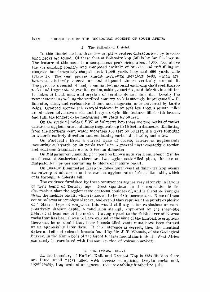
lxxx PROCEEDINGS OF THE GEOLOGICAL SOCIETY OF SOUTH AFRICA
2. The Sutherland District.
In this district no less than five eruptive centres characterised by brecciafilled necks are found. Of these that at Saltpetre kop (36) is by far the largest. The feature of this name is a conspicuous peak rising about 1,000 feet above the surrounding country and composed entirely of breccia and tuff filling an elongate but irregularly-shaped neck 1,000 yards long and 600 yards wide (Plate I). The vent pierces almost horizontal Beaufort beds, which are, however, distinctly domed up and disposed almost vertically around it. The pyroclasts consist of finely comminuted material enclosing shattered Karroo rocks and fragments of granite, gneiss, schist, quartzite, and dolerite in addition to flakes of black mica and crystals of hornblende and ilmenite. Locally the vent material as well as the uptilted country rock is strongly impregnated with limonite, silica, and carbonates of lime and magnesia, or is traversed by barite veins. Grouped around this central volcano in an area less than 3 square miles are nineteen adventive necks and forty-six dyke-like features filled with breccia and tuff, the longest dyke measuring 700 yards by 50 feet.
On De Vrede 2t miles S.S.W. of Saltpetre kop there are two necks of rather calcareous agglomerate containing fragments up to 10 feet in diameter. Radiating from the northern vent, which measures 150 feet by 60 feet, is a dyke trending in a north-easterly direction and containing carbonate, barite, and mica.
On Portugal's River a curved dyke of coarse, calcareous agglomerate measuring 500 yards by 50 yards trends in a general north-westerly direction and contains fr-agments up to 5 feet in diameter.
On Matjesfontein, including the portion known as Silver Dam, about 12 miles south-east of Sutherland, there are two agglomerate-filled pipes, the one on Matjesfontein proper containing boulders of melilite basalt.
On Blaauw Blommetjes Keep 2t miles north-west of Saltpetre kop occurs an outcrop of micaceous and calcareous agglomerate of sheet-like habit, which cuts through a dolerite sill.
The evidence furnished by these occurrences argues very strongly in favour of their being of Tertiary age. Most significant in this connection is the observation that the agglomerate contains boulders of, and is therefore younger than, the melilite basalt, which is known to be of Cretaceous age. None of them contains lavas or hypabyssal rocks, and even if they represent the purely explosive or "Maar" type of eruptions this would still argue for explosions at comparatively shallow depth, a conclusion strongly supported by the sheet-like habit of at least one of the necks. Having regard to the thick cover of Karroo rocks that has been shown to have existed at the time of the kimberlite eruptions there can be no doubt that these breccia-filled vents must have been formed at an appreciably later date. If this inference is correct, then the identical dykes and sills of volcanic breccia found by Mr. J. T. Wessels, of the Geological Survey, in the Nama beds of the Great Kharas mountains in South-West Africa can safely be correlated with the same period of volcanic activity.
3. The Prieska District.
On the boundary of Kaffir's Kolk and Grenaat Kop in this division there are three small necks filled with breccia comprising Dwyka rocks and, significantly, fragments of an igneous rock resembling kimberlite (16).

ANNIVERSARY ADDRESS BY THE PRESIDENT lxxxi
4. The Klinghardt Area.
Phonolitic lavas and a tuff-filled pipe alleged to be younger than Cretaceous and Tertiary beds as represented at Pomona (16) occur east of Bogenfels and in the strip of country that includes the Klinghardt mountains.
5. The Keetmanshoop District.
About 8 miles north of Berseba the conspicuous monadnock known as Geitsi Gubib or Gross Brukaros (37) rises abruptly to a height of 1,800 feet above the surrounding plain of Fish River beds (Plate II) The summit of the mountain is craterlike and consists of a roughly circular area of fragmental rocks, which occupy a " pipe" about 2 miles in diameter. For about a mile or more away from the vent the Fish River beds pierced by it are arched up all around, first very gently and then progressively more steeply farther inwards. About 300 yards away from the edge of the pipe the dip is reversed and the beds are inclined radially inwards at an appreciable angle, their contact with the core of fragmental material being vertical or nearly so. The neck projects well above the enveloping country rocks and is composed entirely of reddish or brownish tuff and agglomerate that are rudely stratified and dip inwards at angles ranging from 30° to 50°. They build an annular, rim-like ridge, which encloses a central, craterli~e depression composed of the same material and located some 1,500 feet below the crest of the" rim." The agglomerate comprises fragments of shale and sandstone derived from the Nama beds together with quartzite, diabase, and gabbro. Recently Dr. H. Martin * also found inclusions of unmistakable Karroo rocks. Silicification is common, and the rocks are usually impregnated with lime and traversed by barite and fluorite veins. In the immediate vicinity of the volcano there are five, and possibly seven, satillitic necks and three dykes filled with volcanic breccia of a similar nature to but usually coarser and containing more barite and carbonate of lime than the pyroclasts of the main vent. The largest of the adventive necks has a diameter of 400 feet. In one of them fragments of granite are also present.
Structurally the Brukaros volcano has all the characteristics of a sunken caldera. In regard to its age nothing definite is known beyond the fact that it is post-Karroo. In general appearance the breccias and tuffs are, however, so remarkably similar to the fragmental material filling the vents at Saltpetre kop, Grenaatkop, and Kobe that there can be very little doubt, that they are of the same age.
6. The Rehoboth-Windhoek Area.
In the vicinity of Duruchaus in the Rehoboth district de Kock (38) found thirteen outcrops of phonolites and trachytes occurring as dykes, sills, plug-like bodies, and flows. In the area around Moltke Blick in the Auas mountains, 9 miles south of Windhoek, Rennie (39) observed eight necks and associated dykes of trachyte with tuff and breccia. In the same area Gevers (40) more
* Personal communication.

lxxxii PROCEEDINGS OF THE GEOLOGICAL SOCIETY OF SOUTH AFRICA
recently found a considerable number of plugs, dykes, and sills of trachyte, sills and dykes of phonolite, and plugs and dykes of breccia. In addition he discovered on Regenstein an enormous volcanic vent measuring Ii- miles by five-eights of a mile, filled with tuffs, agglomerates, and breccias and also containing shonkinite and limburgite, phonolite and analcitised phonolite, and trachyte injected in this order. The vent pierces Damara quartzites, which are highly shattered and even brecciated along the contact. Radiating from the vent are shatter zones, breccia dykes, and zones impregnated with silica.
There can be but little doubt that all these occurrences of alkali rocks and associated tuffs and agglomerates belong to the same period of igneous activity. With these Gevers also groups the alkali rocks of Cape Cross and expresses the opinion that they are post-Karroo or Cretaceous. Lithologically, however, they are entirely different from the eruptives characterising the Cretaceous period. For the same reason and in view of the fact that the alkali-rocks at Cape Cross are intrusive into Stormberg volcanics a Triassic age seems likewise to be excluded. It is therefore not at all unlikely that they are of post-Cretaceous age.
7. The Marico District.
In 1942 Mr. D. P. van Rooyen, of the Geological Survey, discovered an interesting occurrence of breccias and associated limestones on the farm Goudini 177 some 30 miles north of Zeerust on the road to Derde Poort. Last year the author had the opportunity of examining this occurrence in the company of Mr. van Rooyen and Dr. J. de Villiers, and on that occasion information was obtained that proves very convincingly that the breccias are ventagglomerates and that the limestones are not sedimentary xenoliths, as was previously thought, but of metasomatic and almost certainly of hydrothermal origin and genetically related to the volcanic activity. As far as can be seen the vent is roughly circular in outline or elliptical along an east-west axis and fully half a mile in dianleter. It is occupied preponderantly by tuff and agglomerate of varying coarseness. These show a rude stratification, which in the southern quadrant is inclined northwards, that is towards the centre. As a result of intense calcification the ejectamenta are not readily recognisable. However, near the southern edge undoubted amygdaloidal lava was found. It appears to be squeezed in between the coarser pyroclastic material but may possibly also be of the nature of blocks ejected whilst still in a plastic state. From the outer margin of the vent calcification increases progressively inwards, so that in some places the core is composed of more or less pure limestone containing only scattered and insignificant inclusions. Locally, as near the southern edge, the process was evidently not always of a metasomatic nature, as the limestone appears actually to have been injected as veins and thin dykes.
Regarding the age of the vent nothing more definite can be said than that it postdates the basic rocks of the Bushveld igneous complex, which it pierces. The stratification of the pyroclasts indicates, however, that at the time of the eruption the orifice of the pipe could not have been much above the present surface, unless contemporaneous subsidence has taken place. For this there is no evidence, and it is therefore inferred that the volcanic activity is geologically of fairly recent date.

ANNIVERSARY ADDRESS BY THE PRESIDENT lxxxiii
8. The Rustenburg District.
Situated on the farms Kruidfontein 147, Boschkop 554, and Elandsfontein 810 some 25 miles east of Pilansberg is a roughly circular volcanic vent with a diameter of about 3 miles and filled with a large variety of ejected material and intrusive rocks of alkaline character. This vent has recently been studied in detail by Messrs. R. A. P. Fockema and D. Groeneveld and now forms the subject matter of a paper presented to this Society. For this reason the feature will here be discussed only from the point of view of its age relationship. Very significant in this connection is the discovery that Ecca grits, either as ejected blocks or as subsided masses, constitute part of the fragmental material. The vent must thus be of post-Karroo age and cannot be related magmatically to the Pilansberg eruptives. The work of Groeneveld further tends to show that the vent interrupts a post-Karroo fault. Should this prove to be the case, then the vent must be either Cretaceous or post-Cretaceous, as tension-faulting involving Karroo beds dates from the Cretaceous onwards. A Cretaceous age for the volcanicity seems to be excluded in view of the fact that the material erupted has no affinities whatsoever with the kimberlite and melilite basalt.
9. The Pretoria District. According to the .evidence at hand volcanic activity must have been fairly
intense in the neighbourhood of Pretoria in the not very remote past. The principal eruptive centres were north-west of Pretoria on the farm Zoutpan 467 and north-east of the city on the farms Roodeplaat 314, Buffelsdrift 337, Kameeldrift 521, and Derdepoort 469.
(a) The Zoutpan V o1cano.
On the farm Zoutpan 25 miles north-west of Pretoria occurs a remarkable, almost funnel-shaped depression that marks the site of an old volcano drilled through Bushveld granite. The hollow is surrounded by an annular ridge of pyroclasts rising about 100 feet above the general level of the surrounding area. The outer slopes of the ridge are gentle and merge almost imperceptibly with the surrounding flats. The inner slopes exposing the granite wall of the vent descend steeply and, locally, precipitously to the floor of the depression 400 feet below the crest of the ridge. The diameter of the hollow, which is approximately circular in outline, is two-thirds of a mile measured from rim to rim. The floor is irregular in outline and has a mean diameter of about a quarter of a mile. It is occupied essentially by brine-impregnated mud, which has been proved to extend to a depth of more than 234 feet.
The annular ridge of pyroclastic material represents the original crater rim and is built up chiefly of an unsorted assemblage of fragments and blocks of Bushveld granite expelled from the vent. Between this breccia and the solid granite basement a thin layer of Ecca grits intervenes in places, indicating the land-surface at the time of the eruption. Along the steep inner walls of the crater Wagner (41), who made a careful study of the feature, found evidence of contemporaneous subsidence along a ring-shaped fault and consequently referred to the structure as a sunken caldera. He also adduced reasons for concluding that it is certainly of post-Cretaceous and probably of Quaternary age.

lxxxiv PROCEEDINGS OF THE GEOLOGICAL SOCIETY OF SOUTH AFRICA
(b) Volcanic Necks North-East of Pretoria.
In this area at least nine necks and three dykes of volcanic breccia are found distributed over Derdepoort 469, Kameeldrift 521, Roodepoort 314, and the adjoining farms Buffelsdrift 337 and Zeekoegat 287.
Three plug-like necks and two breccia dykes occur on Roodeplaat. The largest dyke is approximately 1i miles long by 250 yards wide and runs in an approximately east-west direction across the Pienaars river a short distance upstream from its confluence with the spruit that has its source at Premier Mine. The largest neck occurs nearly a mile south of the dyke and about half a mile west of the Pienaars river. It is roughly 300 yards in an east-west direction and 100 yards across. A very prominent, arcuate breccia-dyke, which is convex to the south-west, extends for approximately 6i miles from Buffelsdrift over Zeekoegat to the" confluence of the Pienaars river and the Leeuwfontein spruit. Two oval-shaped necks occur on Kameeldrift, one west and the other east of the Hartebeestspruit.
The fragmental material filling the pipes and fissures on the abovementioned farms consists mainly of volcanic breccia and some tuff. The breccia is composed of angular, sub-angular to rounded fragments of monchiquite, felsite, syenite, trachyte, and quartzite. On Buffelsdrift and Kameeldrift inclusions of granophyre and Bushveld granite respectively are also found. The fragments are of variable size and may be up to a foot or more in diameter. The matrix is usually calcareous to a variable extent.
The volcanic vent on Derdepoort is a much more interesting feature inasmuch as it possesses certain characters in common with the necks on Goudini and Kruidfontein. It pierces Magaliesberg quartzites and underlying shales and has a somewhat oval cross-section with an east-west diameter of 550 yards and north-south diameter of 450 yards (42). Its relation to the country rocks can only be seen along its northern edge, where l\iagaliesberg quartzites are intensely shattered and veined by volcanic material. The exposed part of the vent is composed mail).ly of red and white limestone. This forms a knoll about 50 feet high between the Hartebeestspruit in the east and a small tributary spruit farther westwards. Apart from specks and flakes of specularite the limestone in the central part of the neck is quite pure, and except that it is crystalline and unbedded it is indistinguishable from material of sedimentary OrIgIn. Nearer the edge, however, small chert fragments and schlieren-like inclusions of serpentinous material make their appearance in the limestone. These increase progressively outwards until the rock becomes a typical breccia with the limestone forming the cementing material. At the same time fragments of other rock types begin to appear, chiefly quartzite, syenite, and Bushveld granite, and the rock assumes the character of a vent-agglomerate, fragments of all kinds and sizes being distributed indiscriminately through a tuffy, calcareous matrix containing flakes of phlogopite and chlorite, crystals of hornblende, and chips of quartz and felspar. This assemblage is traversed in all directions by veins and dykes of limestone usually crowded with crystals of specularite and proving beyond any doubt that the carbonate is not xenolithic but actually the youngest rock in the vent.

ANNIVERSARY ADDRESS BY THE PRESIDENT lxxxv
From the nature of the inclusions in the vents as a group it is possible to deduce that the volcanicity postdated the emplacement of the alkali rocks of the Franspoort line and that it is thus of post-Waterberg age. The relation of the vents to post-Waterberg formations has not yet been established, as they are nowhere in contact. Lithologically the necks are, however, so similar to those previously described, and particularly to those at Kruidfontein and Goudini, that one is tempted to concl.ude that they are of the same age.
10. Sekukuniland.
During the last few years the author has discovered no less than four breccia-necks or diatremes at Magnet Heights in Sekukuniland, and in 1947 Dr. O. A.. Strauss found a fairly big volcanic neck on Spitskop 171 ncar the southern edge of the plug of alkali rocks. These occurrences are now being investigated, and a full account of them will be published in the near future. For this reason only the question of their possible age is considered here.
The vents at Magnet Heights pierce Bushveld gabbro, and the neck on Spitskop penetrate Bushveld granite. They are therefore certain~y of postBushveld age. The breccia-neck on Spitskop is composed of rocks represented in the alkali plug nearby and considered to be of Pilansberg age. The neck is therefore younger than the plug. The occurrences at Magnet Heights are aligned on a fissure marked by a vein of sideritic limestone that cuts the vents as well as a small body of alkali rocks in close proximity to them, and correlated tentatively with the Pilansberg volcanics. Situated close to the carbonate fissure and the plug of alkali rocks is a small, circular neck of ultrabasic rocks entirely devoid of pyroclastics and thought to be allied to the kimberlites. If this correlation is correct, then the breccia-filled vents are probably postOretaceous, as they are almost certainly younger than the ultrabasic rocks. There is, however, no certainty on these points, and for the time being the question of the age of the Sekukuniland vents must remain open.
11. The Vent on J ongmans Spruit 36.
Brandt and Ie Roex (16) recorded the occurrence of a breccia-filled neck situated on the farm Jongmans Spruit, roughly a mile west of the Blyde river and 3 miles east of the base of the Drakensberg escarpment. The vent pierces Older granite, and the neck forms a conical peak rising about 100 feet above the surrounding plain. It is composed of a jumbled assemblage of angular to subangular fragments of granite and gneiss, altered limestone, and amygdaloidal lava, the granitic material predominating. These are cut by two basic dykes. As the neck is not in contact with rocks younger than the Older granite, it is impossible to determine its age. The absence in it of "horses" of sediments building the escarpment to the west suggests either that it is older than these and therefore than the W olkberg system, or that it came into existence after their denudation. The latter alternative seems to be the most likely. This would imply a post-Oretaceous age.

lxxxvi PROCEEDINGS OF THE GEOLOGICAL SOCIETY OF SOUTH AFRICA
SUMMARY.
From the foregoing it is evident that the part of the earth's crust known as South Africa has been repeatedly affected by volcanism and that the several volcanic episodes may be arranged in chronological order as in the table below.
Era Period Epoch Age Volcanic Products or or or or or
Group. System. Series. Stage. Features.
Quaternary * (?) Zoutpan volcano Cainozoic ------
Tertiary (?) Various breccia-filled necks
Plugs of melilite Cretaceous basalt and necks
of kimberlite
r {FlOWS of ba.salt,
rhyolite, and Drakens- limburgite, and
berg volcanic necks Mesozoic --
Stormberg
1 Cave Sandstone
Karroo -< Red Bed I
l Molteno
Beaufort
Ecca
l Dwyka
I Witteberg
Cape Bokkeveld
Palaeozoic I Table Il Mountain
r Fish River
Schwarzrand Nama
1 Schwarzkalk -
t Kuibis-Nabas
Pilansberg I .................. ............. . ........... .
I
volcanicity (
Upper
I I Waterberg, Matsap
including I Matsap Hartley Hill Andesite and Klipheuvel and
1 pyroclasts
Auborus Beds Lower
Matsap
I Gamagara
Loskop
* Bold type mdlCates volcanic conditions.

Era Period Epoch Age Volcanic Products or or or or or
Group. System. Series. Stage. Features. --
f {ROOiberg felsites
and pyroclasts Magalies- Dullstroom berg andesites
Machadodorp pyroclasts
Proterozoic Transvaal, Pretoria I including Daspoort Ongeluk andesites
Otavi and l Damara Timeball Formations Hill
l Dolomite
Black Reef Andesite and pyroclasts (only in Vryburg area)
Andesite, acid Ventersdorp porphyry, pyro-
clasts, volcanic necks
Z'Jetlief Andesite, acid including Koras, porphyry, and Kunjas, and pyroclasts Sinclair Formations
Wolkberg Andesite
Kimberley-Elsburg
Witwatersrand Main Bird Andesite and including volcanic breccia Mozaan, Uitkyk and Jeppestown Andesite and Stinkfontein agglomerate Formations
I Government Reef
l - --
-I Hospital Hill
Dominion Reef Basic and acid I including Insuzi lavas and pyro-
t and Godwan clasts Formations
Gariep, including Grootderm I Andesite Moodies, --
I Nkandhla, Holgat Malmesbury (?), Cango (?), and Hilda Abbabis Forma- -
ions and Black Hills Duruchaus and Marienhof Beds
Wilgenhout- Basic lavas, pyro-drift clasts and some
Archaeozoic Kheis or including acid lava Swaziland Figtree,
Kraaipan, and Abelskop
* Bold type indicates volcanic conditions. MM

lxxxv-iii PROCEEDINGS OF THE GEOLOGICAL SOCIETY OF SOUTH AFRICA
Era Period Epoch Age V olcanic Products or or or or or
Group System Series Stage, Features
Kaaien
Kheis or Marydale Basic and acid Archaeozoic Swaziland including lavas and
(1)
(2)
(3)
(4)
(5)
(6) (7)
(8)
(9) (10)
(11)
(12)
(13)
(14)
(15)
(16)
(17)
(18)
Onverwacht, pyroclasts (continued) Nondweni,
M'fongosi, Tugela, Messina and French Hoek (?)
* Bold type indicates volcanic conditions.
BIBLIOGRAPHY.
HALL, A. L. "The Geology of the Barberton Gold Mining District." Mem. geol. Surv. S. Afr., 9, 1918. VAN EEDEN, O. R., PARTRIDGE, F. C., KENT, L. E., and BRANDT, J. W. "The Mineral Deposits of the Murchison Range East of Leydsdorp." Mem. geol. Surv. S. Afr., 36, 1939. WILLEMSE, J. "The Gold Occurrences South-West of Pietersburg." Bull. geol. Surv. S. Afr., 12, 1938. ViSSER, H. N., KRIGE, L. J .. , and TRUTER, F. C. "The Geology of the Country South of Ermelo." Expl. Sheet 64, Geol. Surv. S. Afr., 1947. DU TOIT, A. L. "The Geology of the Country Surrounding Nkandhla. Natal." Expl. Sheet 109 Geol. Surv. S. Afr., 1931. ROGERS, A. W., and SCHWARZ, E. H. L. Ann. Rep. geol. Comm. C.G.H., 1899. SOHNGE, P. G., and DE VILLIERS, JOHN. " Resume of the Geology of the Richtersveld and the Easterri Sperrgebiet." Trans. geol. Soc. S. Afr., XLIX, 1946. HAUGHTON, S. H. "The Geology of Cape Town and Adjoining Country." Expl. Sheet 247, Geol. Surv. S. Afr., 1933. TRUTER, F. C., and DE VILLIERS, J. Ann. Rep. geol. Surv. S. Afr., 1947. (In press.) McINTYRE, R. C. "The Geology of the Cango Beds." Trans. geol. Soc. S. Afr., XXXV, 1933. MOLENGRAAFF, G. A. F. "Note on the Geology of a Portion of the Klerksdorp District with Special Reference to the Development of the Lower Witwatersrand Beds." Trans. geol. Soc. of S. Afr., VIII, 1905. NEL, L. T. "The Geology of the Klerksdorp-Ventersdorp Area." Expl. Sheet, Geol. Surv. S. Afr., 1935. NEL, L. T., JACOBS, H., ALLAN, J. T., and BOZZOLI, G. R. " Wonderstone." Bull. geol. Surv. S. Afr., 8, 1937. HUMPHREY, W. A., and KRIGE, L. J. "The Geology of the Country Surrounding Vryheid." Expl. Sheet 102, Geol. Surv. S. Afr., 1932. ROGERS, A. W. "The Geology of the Country Around Heidelberg." Expl. Sheet, Geol. Surv. S. Afr., 1922. DU TOIT, A. L. "The Geology of South Africa." Oliver and Boyd, Edinburgh and London, 1939. VAN ROOYEN, D. P. "Sekere Pre-Transvaal Rotse Noord-oos van Potgietersrus." Trans. geol. Soc. S. Afr., L, 1947. BRANDT, J. W., and LE ROEx, H. D. "The Basal Beds of the Transvaal System at Olifants River Poort, North East Transvaal." Trans. geol. Soc. S. Afr., XLVII, 1944.
(19) VAN EEDEN, O. R. "Die Korrelasi.e van Sekere Voor-Transvaal-Gesteentes in die Distrik Schweizer Reneke." Trans. geol. Soc. S. Afr., XLIX, 1946.
(20) TRUTER, F. C., and STRAUSS, C. A. "The Pre-Transvaal Rocks at Taungs, Cape Province." Trans. geol. Soc. S. Afr., XLIV, 1941.

PROC. GEOL. soc. S.A.., VOL. L.1I. PLATE 1.
Main diatreme, Saltpetrekop, showing adventive necks in the foreground. [Photo: J .. de Villiers.

Gross Brukaros volcano, north of Berseba, S.W.A.; view looking north. [Photo: J. de V illiers.
~ Q
~ ~ o ~ VJ o SJ VJ ~
-..::j o ~ ~ ....., ~
~ ~ ~ ~ t.::::l
~
~

(21)
(22)
(23)
(24)
(25)
(26)
(27)
(28)
(29)
(30) (31)
(32)
(33)
(34)
(35) (36) (37)
(38)
(39)
(40)
(41)
(42)
ANNIVERSARY ADDRESS BY THE PRESIDENT lxxxix
WAGNER, P. A. " The Mutue Fides-Stavoren Tinfields." Mem. geol. Surv. S. Afr., 16, 1921. BOARDMAN, L. G. "The Geology of a Portion of the Rooiberg Tinfields." Trans. geol. Soc. S. Afr., XLIX, 1946. TRUTER, F. C:, WASSERSTEIN, B., BOTHA, P. R., VISSER, D. J. L., BOARDMAN, L. G., and PAVER, G. L. "The Geology and Mineral Deposits of the Oliphantshoek Area, Cape Province." Expl. Sheet 173, Geol. Surv. S. Afr., 1938. VISSER, D. J. L. "Acid Lavas from the Neighbourhood of Lekkerwater Siding, South-West Africa." Trans. geol. Soc. S. Afr., L, 1947. SHAND, S. J. "The Geology ofPilansberg (Pilaan's Berg) in the Western Transvaal: A Study of the Alkaline Rocks and Ring-Intrusions." Trans. geol. Soc. S. Afr., XXXI, 1929. SHAN:D, S. J. "The Alkaline Rocks of the Franspoort Line, Pretoria District." Trans. geol. Soc. S. Afr., XXV, 1923. NEL, L. T., TRUTER, F. C., and WILLEMSE, J. "The Geology of the Country around Potchefstroom and Klerksdorp." Expl. Sheet 61, Geol. Surv. S. Afr., 1939. MACGREGOR, A. M. "An Outline of the Geological History of Southern Rhodesia." Bull. geol. Surv. S. Rhod., 38, 1947. GEVERS, '1'. W. "The Volcanic Vents of the Western Stormberg." Trans. geol. Soc. S. Afr., XXXI, 1928. DU TOIT, A. L. Ann. Rep. geol. Comm. C.G.H., 1904. GEVERS, T. W. "Kaoko-Eruptives and Alkali-Rocks at Cape Cross." Trans. geol. Soc. S. Afr., XXXV, 1932. TALJAARD, M. S. "South African Melilite Basalts and their Relations." Trans. geol. Soc. S. Afr., XXXIX, 1936. DU TOIT, A. L. "Geological Survey of the Eastern Part of Griqualand West." Ann. Rep. geol. Comm. C.G.H., 1906. HOLMES, A. "A Contribution to the Petrology of Kimberlite and its Inclusions." Trans. geol. Soc. S. Afr., XXXIX, 1936. ROGERS, A. W. Ann. Rep. geol. Comm. C.G.H., 1904. ROGERS, A. W., and DU TOIT, A. L. Ann. Rep. geol. Comm. C.G.H., 1903. ROGERS, A. W. "Geitsi Gubib, an old Volcano." Trans. roy. Soc. S. Afr., V, 3, 1915. DE KOCK, W. P. "The Geology of the Western Rehoboth." ;.l1em. geol. Sun-. S.W.A., 1, 1934. RENNIE, J. V. L. "On a Group of Trachyte Necks in the Auas Mountains, near Windhoek, S.W. Africa." Trans. geol. Soc. S. Afr., XXIX, 1926. GEVERS, T. W. "Alkali-Rocks in the Auas Mountains, South of Windhoek, S.W.A." Trans. geol. Soc. S. Afr., XXXVI, 1933. WAGNER, P. A. "The Pretoria Salt-Pan, a Soda Caldera." ~vIem. geol. Surl'. S. Afr., 20, 1922. VENTER, F. A. "Breccias and Associated Rocks occurring North-East of Pretoria." Trans. geol. Soc. S. Afr., XXXVI, 1933.
GEOLOGICAL SURVEY OF THE UNION OF SOUTH AFRICA,
P.O. Box 401, PRETORIA.
XC PROCEEDINGS OF THE GEOLOGICAL SOCIETY OF SOUTH AFRICA
Dr. S. H. Haughton, in proposing a vote of thanks to Dr. Truter for his Address, said:-
The retiring President has discoursed this evening on a subject which has, I think, received but scant attention hitherto in the Society, the subject of volcanism. The address to which we have listened is but a part of the somewhat extensive paper which he has written, a paper in which 2Jre set forth all the known fants concerning volcanic activity in South Africa during geologic time and in which Dr. Truter has utilised the evidence of lavas, tuffs and other volcanic material in an endeavour to arrive at a solution to the troublesome problem of correlation among our many series of non-fctsilifErous strata.
Volcanoes in antion have always had a powerful effect upon the human mind. To the primitive mind, these violent upheavals with Hleir awe-inspiring accompaniments of fire and flame were the visible and outward signs of the wrath of the gods of the nether regions; Vulcan, Lucifier, Satan-call these gods what you may-were directly responsible for the devastation and ruin directly caused by volcanic outbursts. To the scientifically n1indEd enquiries these same phenomena are matters for intensive study, a study made in the hope that it may throw some light on the conditions which exist, and have existed, in those same nether regions. Thus we have to-day volcanological studies or laboratories at Vesuvius and on Hawaii, and scientists rush to study every new outburst as soon as they can reach it. Geologists fortunate enough to see and to photograph a volcano in action are considEred fortunate among their fellows; and those of us who have not their good fortune listen with rapt attention and look with eager eyes when they relate to us and show us pictori2Jlly the things that they have seen at first hand. Probably the most popu12Jr features of the Geological Congress held in London last YE2"r were the two films of active volcanoes th2Jt were shown. The one was of the birth 2Jnd adolescence of the ~fexican volcano Paricutin, which suddenly appeared in a poor Indian's me2,liepatch; the other was of the newly-awakened volcano in the Belgian Congo, of whose features Dr. Gevers showed a fascinating film.
Statistics tell us that the eruption of Mt. K~tmai in Alaska in June, 1912, threw 24 billion cubic yards of dust into the air, dust which reduced the 2Jmount of solar heat in the area by as n1uch as 20 per cent. and whose retention in the atmosphere lasted at le2Jst two years. Vesuvius overwhelmed Herculaneum and Pompeii. An eruption in 1902 wiped out the town of St. Pierre in Martinique, killing 30,000 people.
These things loom large in the human scale; but to-day the earth is relatively quiescent and present-day volcanism is insignificant when compared with some of the manifestations with which Dr. Truter has de2Jlt to-night in his journey through geologic time. There are insufficient d2Jt2J to er:able us to calculate how much lnolten material was brought from the bowels of the Earth to be poured out over the surfane of southern Africa in Stor-mberg times. Probably most of the lava which it formed has disappeared from our ken, eroded frem the surface of the land and washed into the oceans; but in Basutoland there still remains a thickness of 4,000 feet formed by a couple of hundred of distinct but successive flows, and remn2Jnts of flows of the same age are found in places as remote from Basutoland as the north of Southern Rhodesia and the Kaokveld

PROCEEDINGS OF THE GEOLOGICAL SOCIETY OF SOUTH AFRICA xci
of South-West Africa. This colossal amount of material came to the surface from the basaltic substratum. It is almost staggering to contemplate the forces that must have been in action to have resulted in such an outburst-which at that period of earth history was experienced not only in Southern Africa.
In his address Dr. Truter has made notable contributions to our knowledge of volcanic occurrences and has included a considerable amount of unpublished information. He has also drawn. certain conclusions from his survey which he admits to be personal conclusions and which, I feel certain, may prove unacceptable to some of his colleagues. At another time an opportunity may arise for those who disagree with him on one point or another to seek to argue with him or to dispute the accuracy of his conclusions. But even should I desire to be one of those who desire to break a lance with him, this is neither the time nor the place to do so. The address of a retiring President of this Society is more or less a sacrosanct, e.re cathedra statement, 3Jbout which no argument is possible-at least until a decent time has elapsed. And I feel certain that there can be no argument about the interest of the subject which Dr. Truter has put before us, none about the able way in which he has dealt with that subject, nor any about the warmness of the thanks which we both owe and give to him, not only for this address, but for the ability and assiduity with which he has presided over our affairs during the past year.
Dr. John de Villiers seconded the vote of thanks with the following remarks:
Mr. Ohairman, ladies and gentlemen, it is indeed a privilege and an honour to second, on your behalf, the vote of thanks to our retiring President for his very interesting address.
Dr. Truter's choice of subject has been fortunate, for he has given us not only a very interesting evening, but also a work of reference that will frequently be consulted in the future. It will be the vade mecum of all those interested in evidence of past volcanicity in the Union: in addition, his address constitutes a valuable resume of our present views on the correlation of the Union's strata. As he ha.s pointed out, much of this correlation is still tentative, but he has provided us with a useful working hypothesis. Then, too, Dr. Truter has presented us with a wealth of new material, not only in connection with known occurrences but also as regards hitherto unknown or undescribed volcanic phenomena. This is especially noticeable in the sections dealing with the post-Wa.terberg and post-Oretaceous evidences of volcanism, but is discernible throughout the address.
It therefore gives me great pleasure, ThIr. Ohairman, to second this very hearty vote of thanks to Dr. Truter for his most competent address.
Dr. Truter expressed his th[mks to Dr. Haughton, Dr. John de Villiers and the members present for their appreciation of the Address.

xcii PROCEEDINGS OF THE GEOLOGICAL SOCIETY OF SOUTH AFRICA
Minutes of the Ordinary General Meeting of the Society, held In the Voortrekker Gedenksaal, Pretoria, on the 25th February, 1949, at 8 p.m., Dr. F. C. Truter, President, in the Chair.
The Chairman announced with regret the death of Mr. G. Carleton Jones, who had been President of the Society for the year 1935.
The Minutes of the Meeting held on the 2')rd November, 1948, were confirmed.
The following were elected Members of the Society:-H. Fletcher, C. B. Forgan, C. V. Joubert, E. C. Levey, C. W. Pegg, C. L. Pike, A. Poldevaart and D. H. van der Merwe.
The following Student Member, D. R. Antrobus, was elected a Member of the Society.
The Chairman announced that H. Truter had been admitted as a Student MeInber of the Society.
Dr. H. J. Nel gave a lecture on "Some Observations on the Lithiumbearing Pegmatites and Marble Deposits of Karibib, South West Africa," which was illustrated by lantern slides, and specimens from the ar(;a.
Dr. S. H. Haughton gave an address on the Eighteenth International Geologic91 Congress; Dr. L. T. Nel also spoke on this subject, the remarks of both speakers being illustrated by means of the epidiascope and lantern slides.
Minutes of Ordinary General Meetings of the Society, held in the Main Hall, Kelvin House, 75, Marshall Street, Johannesburg,
26th April, 1949, at 8 p.m.
l\Ir. F. A. Venter, Vice-President, in the Chair.
The Chairman announced with regret the death of Professor R. B. Young, who had been President of the Society in 1910 and 1926.
The Minutes of the Meeting held on the 25th February, 1949, were confirmed.
The following were elected Members of the Society :-G. W. S. Baumbach and V. W. Werdmuller.
The following Student Members, L. l\f. Bear, R. G. Jeffery, J. L. Matthysen and L. G. Murray, were elected Members of the Society.
The Chairman announced that the Council had admitted the following Student Members :-S. A. Hiemstr~s, N. l\iusgrave, I. T. Ralston, W. J. van Biljon.
The following paper was presented :-
"The Transformation of the Pretoria Series in the Bushveld Complex," by S. van Biljon.

PROCEEDINGS OF THE GEOLOGICAL SOCIETY OF SOUTH AFRICA xciii
30th May, 1949, at 8 p.m.
Mr. J. H. Taylor, President, in the Ohair.
The Minutes of the Meeting held on the 26th April, 1949, were confirmed.
Dr. G. B. Barbour was elected a Member of the Society.
The following Student Members were elected Members of the Society :F. W. Oornwall, R. B. Hargraves, L. L. Hindson, P. Joubert, A. Kemack, H. E. Lange, R. P. Plewman and J. S. 1. Schwellnus.
The Ohairman announced that R. G. Dodson andRe O. Schmidt had been admitted as Student Members of the Society.
The following papers were presented :-
" The Occurrence of Pumice on the Beaches of the Oape Province," by F. Walker.
" Note on Unusual Mudcracks in a Pan on the Farm Oxford, Odendaalsrus, O.F.S.," by A. A. Snyman.
"An Occurrence of Alkaline and Acid La va s and Volcanic Breccias on the Farm Kruidfontein 147, Rustenburg District," by R. A. P. Fockema.
" The Thermal Waters of the Union of South Africa and South West Africa," by L. E. Kent.
28th June, 1949, at 8 p.m.
Mr. J. H. Taylor, President, in the Ohair.
The Ohairman announced with regret the death of Mr. A. D. Oombe, Life Member of the Society.
The Minutes of the Meeting held on the 30th May, 1949, were confirmed.
The following were elected Members of the Society:-J. O. Ferguson and H. Heystek.
The following Student Member, J. F. Botha, was elected a Member of the Society.
The Ohairman announced that M. J. McOarthy, R. Shagam and O. J. van Straten had been admitted as Student Members of the Society.
The following papers were presented:-
"The Economic Auriferous Bankets of the Uppm Witwatersrand Beds and Their Relationship to Sedimentation Features," by J. W. N. Sharpe.
" The Geology of the Odenda.alsrus Goldfield in Relation to that of the Klerksdorp District and Notes on the Oorrelation of the Upper Division of the Witwatersrand System," by Vivian Baines.

xciv PROCEEDINGS OF THE GEOLOGICAL SOCIETY OF SOUTH AFRICA
30th August, 1949, at 8 p.m.
Mr. J. H. Taylor, President, in the Chair.
The Minutes of the Meeting held on the 28th June, 1949, were confirmed.
The following were elected Members of the Society:-S. A. Gill, F. L. Greyling, A. Kriek, C. H. Sa2Jyman, H. C. J. v. R. Strydom, P. M. Strydom and M. J. Weldon.
The Chairman announced th~t R. R. Bell had been admitted as a Student Member of the Society.
The following papers were presented :-
"Studies on K2Jrroo Dolerites-5. Notes on Further Occurrences of Younger Olivine Basaltic Dolerites," by J. J. Frankel.
"Die Geologie van die Bosveldkompleks Langs Bloedrivier," by A. F. Lombaard.
" The Geology of Dassen Island," by G. R. McLachlan.
" Notes on 9 GeologicPJI Reconnaissance of the Country East of Beitbridge, Southern Rhodesi2J," by R. Tyndale-Biscoe.
"Differential Thermal Analysis of Some South African FireclpJYs and other Ceramic Materi2Jls," by J. M. Warde 2Jnd J. H. Denysschen.
22nd November, 1949, at 8 p.m.
Mr . . T. H. Taylor, President, in the Chair.
The Minutes of the Meeting held on the 30th August, 1949, were confirmed.
The following were elected Members of the Society:-P. C. Bennedict, R. R. Blumenthal, L. F. Daume, E. W. D. Pritchard-Davies [md D. S. Theron.
The ChairmPJn announced th9t the following had been admitted as Student Members of the Society:-C. Boocock, S. C. Maree and J. P. McMagh.
The following p2Jpers were presented :-
"Die Fosfaat-afsetting op Zoetend2Jlesvley 889, Potgietersruste Distrik," by J. Willemse.
" A Study of an Area 9t KakamPJs (Cape Province)," by Arie Poldervaart and Johan W. von BackstronL

PROCEEDINGS OF THE GEOLOGICAL SOCIETY OF SOUTH AFRICA XCV
Minutes of a Joint Meeting with the South African Association for the Advancement of Science, and the South African Geographical Society held in the Main Hall, I(elvin House, 75, Marshall Street, Johannesburg, on the 19th October, 1949, at 8 p.m. Mr. J. H. Taylor, President, in the Chair.
The first lecture in the Alex. L. du Toit Memorial Series of lectures W2JS delivered by Professor T. W. Gevers and W2IS entitled" The Life 2Ind 'Vork of Alex. L. du Toit."
Professor C. van Riet Lowe, President of the South Afric2Jn Associ2Jtion for the Adv2Jncement of Science proposed 21 vote of th2lnks to the lecturer, which W2JS seconded by Dr. H. B. S. Cooke, President of the South Afric2Jn Geogr2Jphic2J1 Society.