icao gnss rfi mitigation plan - unoosa (doc 9849) • 5.1.5 state regulators and ans providers can...
TRANSCRIPT
The European Organisation for the Safety of Air Navigation
ICAO GNSS RFI Mitigation Plan and associated EUROCONTROL Efforts
Gerhard BERZ
Focal Point Navigation Infrastructure
ATM Directorate, Research & SESAR Division, NAV & CNS Unit
UN ICG
Sochi, Russia, 8 November 2016
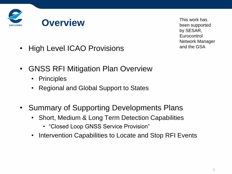
Overview
• High Level ICAO Provisions
• GNSS RFI Mitigation Plan Overview
• Principles
• Regional and Global Support to States
• Summary of Supporting Developments Plans
• Short, Medium & Long Term Detection Capabilities
• “Closed Loop GNSS Service Provision”
• Intervention Capabilities to Locate and Stop RFI Events
2
This work has
been supported
by SESAR,
Eurocontrol
Network Manager
and the GSA
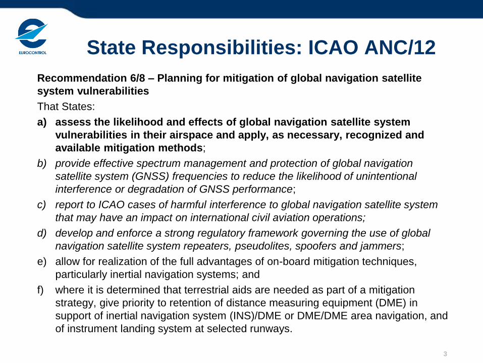
State Responsibilities: ICAO ANC/12
Recommendation 6/8 – Planning for mitigation of global navigation satellite
system vulnerabilities
That States:
a) assess the likelihood and effects of global navigation satellite system
vulnerabilities in their airspace and apply, as necessary, recognized and
available mitigation methods;
b) provide effective spectrum management and protection of global navigation
satellite system (GNSS) frequencies to reduce the likelihood of unintentional
interference or degradation of GNSS performance;
c) report to ICAO cases of harmful interference to global navigation satellite system
that may have an impact on international civil aviation operations;
d) develop and enforce a strong regulatory framework governing the use of global
navigation satellite system repeaters, pseudolites, spoofers and jammers;
e) allow for realization of the full advantages of on-board mitigation techniques,
particularly inertial navigation systems; and
f) where it is determined that terrestrial aids are needed as part of a mitigation
strategy, give priority to retention of distance measuring equipment (DME) in
support of inertial navigation system (INS)/DME or DME/DME area navigation, and
of instrument landing system at selected runways.
3
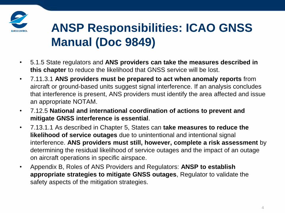
ANSP Responsibilities: ICAO GNSS
Manual (Doc 9849)
• 5.1.5 State regulators and ANS providers can take the measures described in
this chapter to reduce the likelihood that GNSS service will be lost.
• 7.11.3.1 ANS providers must be prepared to act when anomaly reports from
aircraft or ground-based units suggest signal interference. If an analysis concludes
that interference is present, ANS providers must identify the area affected and issue
an appropriate NOTAM.
• 7.12.5 National and international coordination of actions to prevent and
mitigate GNSS interference is essential.
• 7.13.1.1 As described in Chapter 5, States can take measures to reduce the
likelihood of service outages due to unintentional and intentional signal
interference. ANS providers must still, however, complete a risk assessment by
determining the residual likelihood of service outages and the impact of an outage
on aircraft operations in specific airspace.
• Appendix B, Roles of ANS Providers and Regulators: ANSP to establish
appropriate strategies to mitigate GNSS outages, Regulator to validate the
safety aspects of the mitigation strategies.
4
Introduction to RFI Mitigation Plan
• GNSS RFI Mitigation Plan History & Context
• Initiated by Spring 2013 Workshop at Eurocontrol Navigation
Steering Group Meeting
• State / ANSP contributions on best practices
• Guidance developed through ICAO Navigation Systems Panel
• In response to ICAO 12th Air Navigation Conference Job Card
• Inclusion in GNSS Manual, ICAO DOC 9849
• Completed Navigation Systems Panel review, final review and
adoption planned for NSP/3 in DEC 2016
• Strongly supported by Airlines (ICAO Assembly Paper)
• Scope
• Limited to threats requiring radio frequency propagation
• Not dealing with corruption of position once it has left receiver
5
Moving from Vulnerability to Mitigation
• Objective of RFI Mitigation Plan • Define set of activities for States to ensure that risks to aviation
from GNSS RFI are sufficiently mitigated
• Checklists of set of activities to be considered
• Much is already in place, State to decide depending on local
environment
• Not intended to impose a significant workload or investment
• To enable reliance on GNSS and associated aviation benefits
• Focused on States • Spectrum a sovereign responsibility
• Regulation and enforcement part of national oversight
• Framework to encourage coordination and exchange of best
practices
• Supported by regional and global mechanisms due to system nature
6
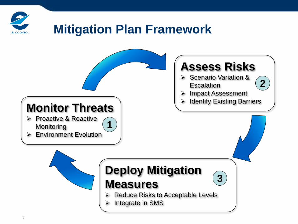
Mitigation Plan Framework
7
Monitor Threats Proactive & Reactive
Monitoring
Environment Evolution
1
Assess Risks Scenario Variation &
Escalation
Impact Assessment
Identify Existing Barriers
2
Deploy Mitigation
Measures Reduce Risks to Acceptable Levels
Integrate in SMS
3
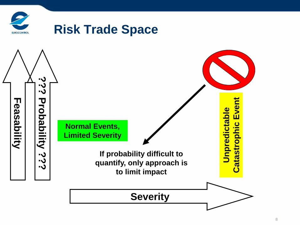
Risk Trade Space
??
? P
rob
ab
ility ?
??
Severity
Normal Events,
Limited Severity
Un
pre
dic
tab
le
Cata
str
op
hic
Even
t
If probability difficult to
quantify, only approach is
to limit impact
Feasab
ility
8
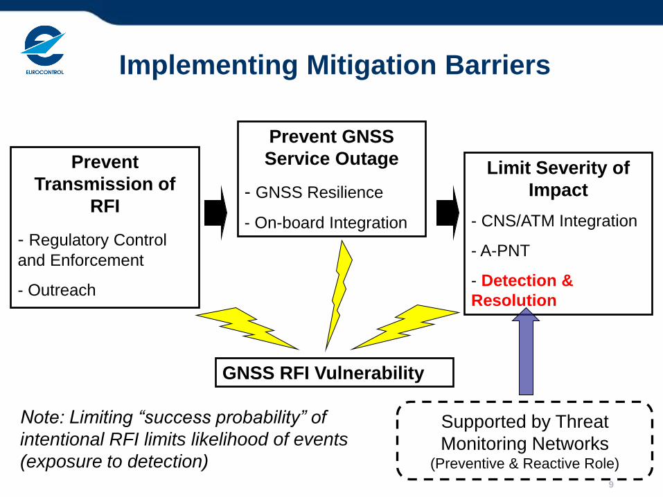
Implementing Mitigation Barriers
Prevent
Transmission of
RFI
- Regulatory Control
and Enforcement
- Outreach
GNSS RFI Vulnerability
Limit Severity of
Impact
- CNS/ATM Integration
- A-PNT
- Detection &
Resolution
Prevent GNSS
Service Outage
- GNSS Resilience
- On-board Integration
Supported by Threat
Monitoring Networks (Preventive & Reactive Role)
9
Note: Limiting “success probability” of
intentional RFI limits likelihood of events
(exposure to detection)
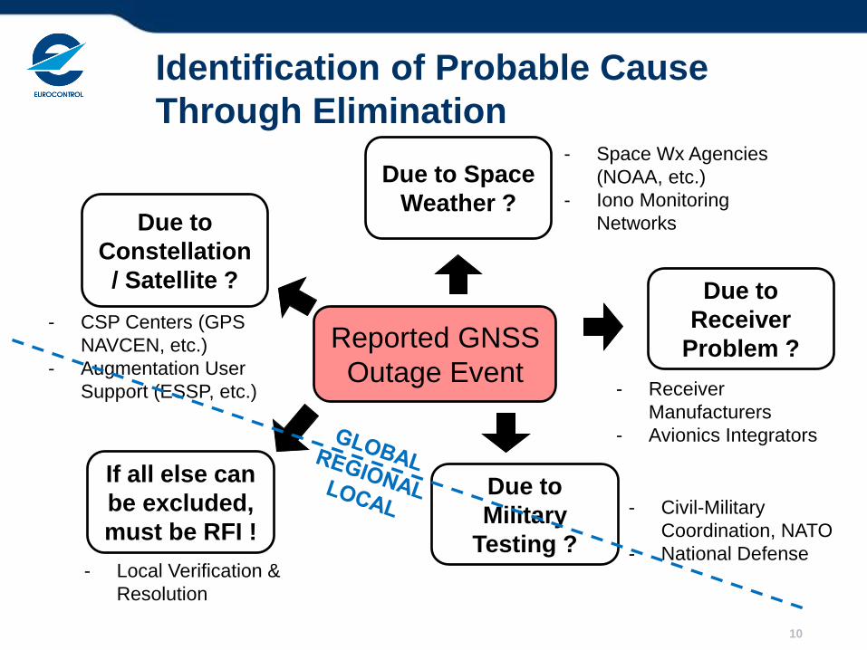
Identification of Probable Cause
Through Elimination
10
Reported GNSS
Outage Event
Due to
Constellation
/ Satellite ?
- CSP Centers (GPS
NAVCEN, etc.)
- Augmentation User
Support (ESSP, etc.)
- Space Wx Agencies
(NOAA, etc.)
- Iono Monitoring
Networks
- Receiver
Manufacturers
- Avionics Integrators
- Civil-Military
Coordination, NATO
- National Defense - Local Verification &
Resolution
Due to
Receiver
Problem ?
Due to Space
Weather ?
If all else can
be excluded,
must be RFI !
Due to
Military
Testing ?
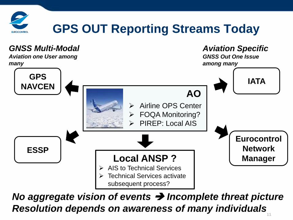
GPS OUT Reporting Streams Today
11
Airline OPS Center
FOQA Monitoring?
PIREP: Local AIS
AO
Local ANSP ? AIS to Technical Services
Technical Services activate
subsequent process?
ESSP
GPS
NAVCEN
GNSS Multi-Modal Aviation one User among
many
IATA
Eurocontrol
Network
Manager
Aviation Specific GNSS Out One Issue
among many
No aggregate vision of events Incomplete threat picture
Resolution depends on awareness of many individuals
Meeting “Stated ATCO Requirement”
• Budapest GPS Outage Simulations:
• “Tell me when event starts, when it ends, and how many
sectors are affected”
• No simple technical solutions exist today
• Allows contingency planning through planner ATCO
• Best to monitor at the impact source: aircraft receiver
• Currently, only pilot can observe receiver outage
• Subsequent reporting requires support at regional and global level to
determine probable cause (only RFI is local problem)
• Provides essential risk assessment link on operational impact
12
ATCO = Air Traffic Control Officer
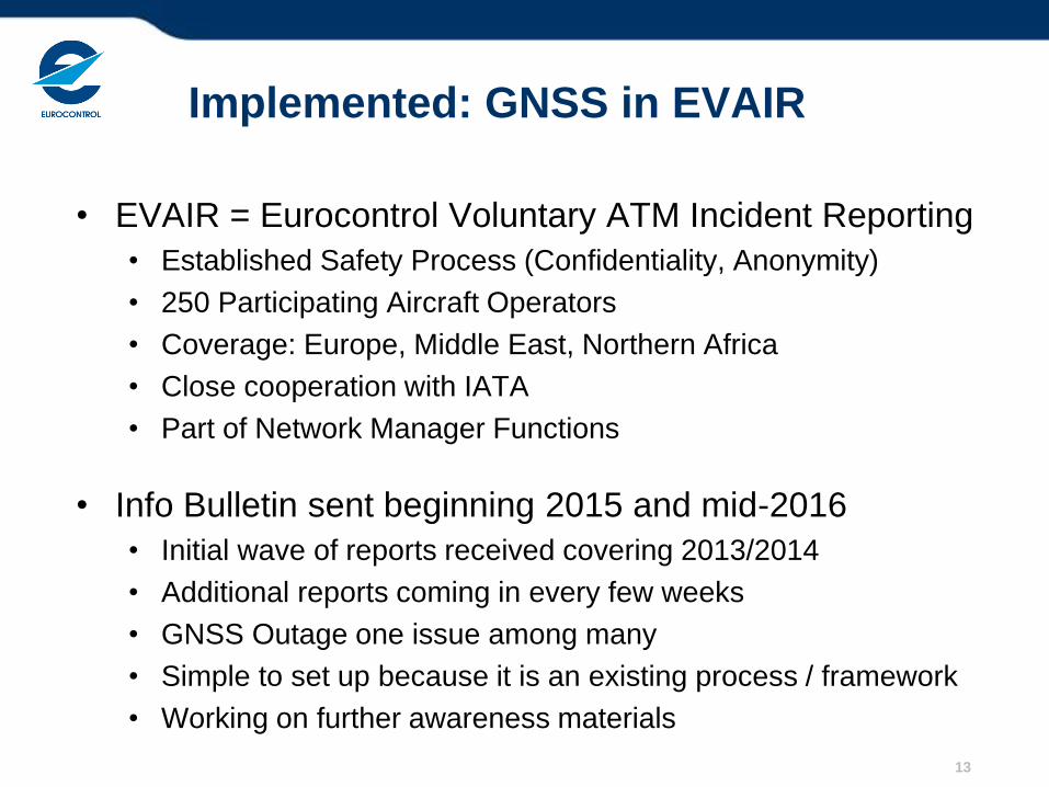
Implemented: GNSS in EVAIR
• EVAIR = Eurocontrol Voluntary ATM Incident Reporting
• Established Safety Process (Confidentiality, Anonymity)
• 250 Participating Aircraft Operators
• Coverage: Europe, Middle East, Northern Africa
• Close cooperation with IATA
• Part of Network Manager Functions
• Info Bulletin sent beginning 2015 and mid-2016
• Initial wave of reports received covering 2013/2014
• Additional reports coming in every few weeks
• GNSS Outage one issue among many
• Simple to set up because it is an existing process / framework
• Working on further awareness materials
13
14
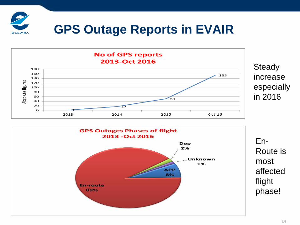
GPS Outage Reports in EVAIR
En-
Route is
most
affected
flight
phase!
Steady
increase
especially
in 2016
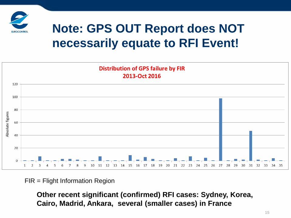
Note: GPS OUT Report does NOT
necessarily equate to RFI Event!
15
FIR = Flight Information Region
Other recent significant (confirmed) RFI cases: Sydney, Korea,
Cairo, Madrid, Ankara, several (smaller cases) in France
16
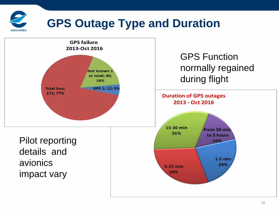
GPS Outage Type and Duration
Pilot reporting
details and
avionics
impact vary
GPS Function
normally regained
during flight
17
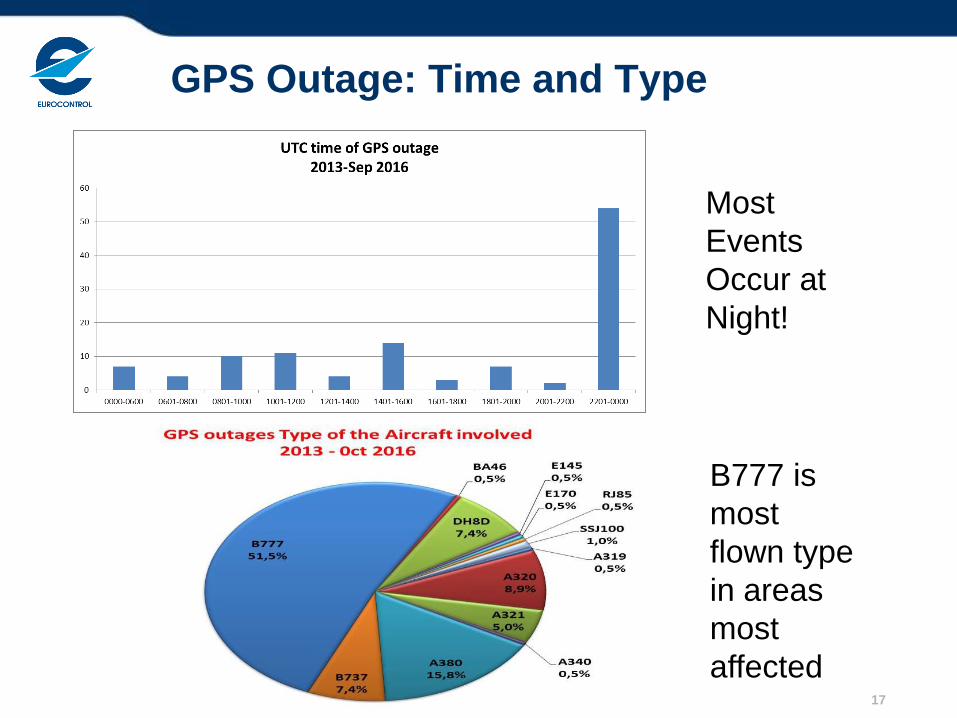
GPS Outage: Time and Type
Most
Events
Occur at
Night!
B777 is
most
flown type
in areas
most
affected
18 ECAC = European Civil Aviation Conference
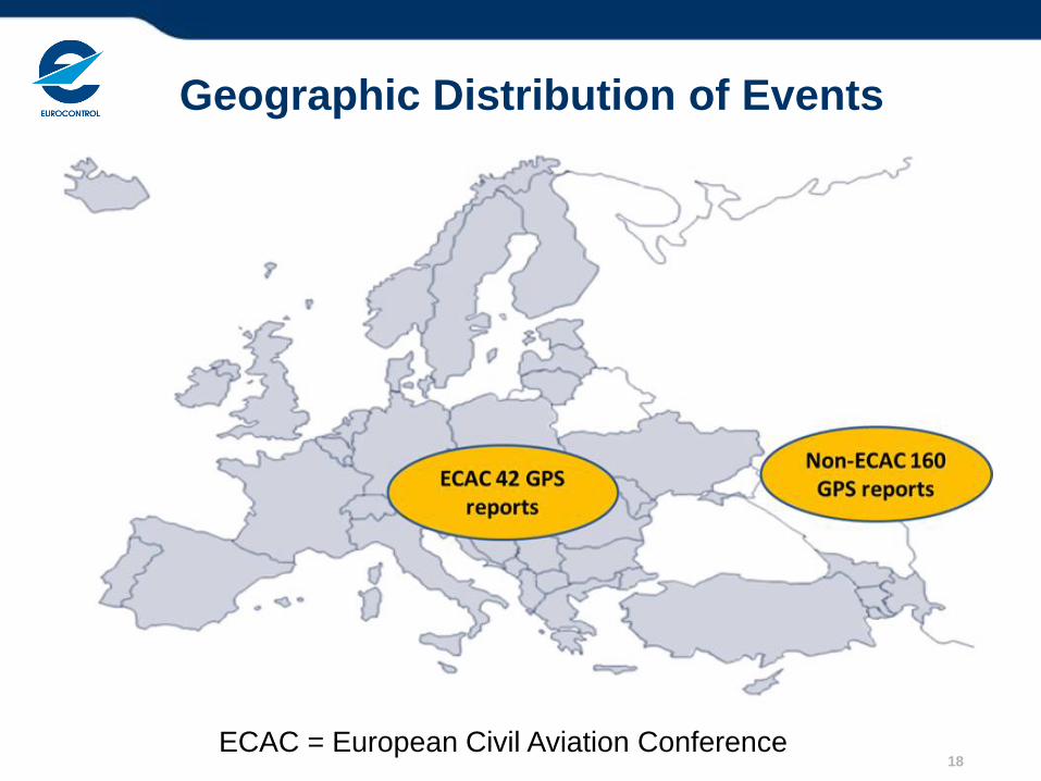
Geographic Distribution of Events
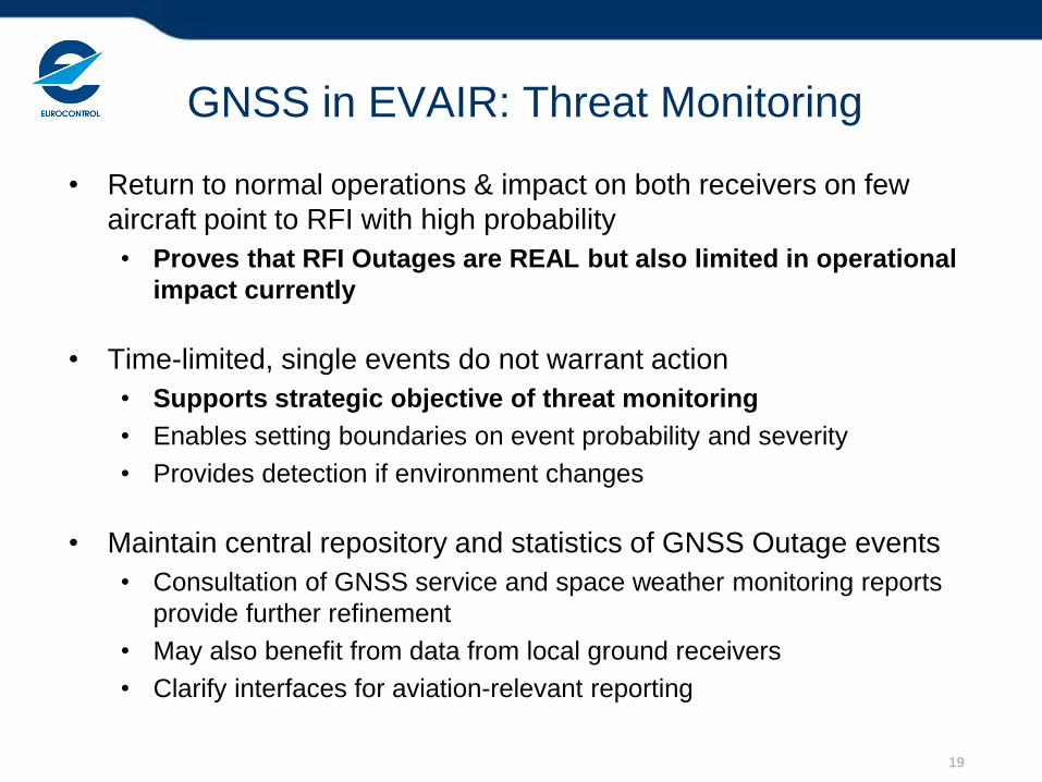
GNSS in EVAIR: Threat Monitoring
• Return to normal operations & impact on both receivers on few
aircraft point to RFI with high probability
• Proves that RFI Outages are REAL but also limited in operational
impact currently
• Time-limited, single events do not warrant action
• Supports strategic objective of threat monitoring
• Enables setting boundaries on event probability and severity
• Provides detection if environment changes
• Maintain central repository and statistics of GNSS Outage events
• Consultation of GNSS service and space weather monitoring reports
provide further refinement
• May also benefit from data from local ground receivers
• Clarify interfaces for aviation-relevant reporting
19
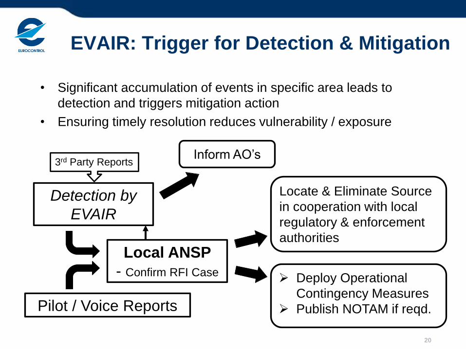
EVAIR: Trigger for Detection & Mitigation
• Significant accumulation of events in specific area leads to
detection and triggers mitigation action
• Ensuring timely resolution reduces vulnerability / exposure
20
Detection by
EVAIR
Local ANSP
- Confirm RFI Case
Pilot / Voice Reports
3rd Party Reports
Deploy Operational
Contingency Measures
Publish NOTAM if reqd.
Locate & Eliminate Source
in cooperation with local
regulatory & enforcement
authorities
Inform AO’s
Interfaces with GNSS System
Operators (GSO)
• Currently, mainly GPS NAVCEN and ESSP
• Multi-constellation: GLONASS, Galileo, Beidou Service Centers
• Regional SBAS User Support Centers (GBAS with local ANSP)
• Case 1: Strategic Long Term Threat Monitoring
• Info from GSO to Aviation: Ensure comprehensive view of all
aviation-relevant cases
• Case 2: Tactical Mitigation: Actual Significant Outage Event
• Request from Aviation to GSO: Support in identifying
probable cause
• Benefit from established links (receiver issues, ionosphere,
RFI testing)
21
Further Efforts & Ongoing Developments
• Medium Term
• Use of ADS-B Position Integrity Category (PIC) Reports
• Initial studies conducted, various issues
• Derive independently on ATC side large area RFI event
• Use of aerial work aircraft to quickly locate RFI sources
• In cooperation with ground based resources
• Studied use of Controlled Radiation Pattern Antenna
• Significant increase in esp. broadband RFI localization
sensitivity
• Long Term
• Nest generation GNSS receivers: detect RFI and provide
information to ATC
22
Summary
ICAO GNSS RFI Mitigation Plan
• Mature and available to States
• Hope to learn from feedback from local implementation
Regional and Global Support Process being put in place
• EVAIR Data and Network Manager Process
• Continuing work on appropriate airborne monitoring capabilities
• Continuing work on increased intervention capabilities
• ATCO training can mitigate until next generation capabilities in place
A lot can be done with relatively simple means
• So far, GNSS RFI threats have not lead to significant risks to aviation
operations
• Continued cooperation and development of RFI vulnerability mitigation
capabilities can ensure that this remains the case
• To enable full exploitation of Operational GNSS Benefits
23
Requests to UN ICG
• Support information exchange for aviation with GNSS system
operators
• For both threat monitoring and significant event mitigation
• Help to identify non-RFI causes
• Forward aviation relevant reports to relevant entities (States,
Regional Organizations)
• REF Slide 10 and 21
24
Back-Up
• Mitigation Plan Details
• Further EVAIR Details
• ADS-B based Monitoring
• CRPA Project Results
25
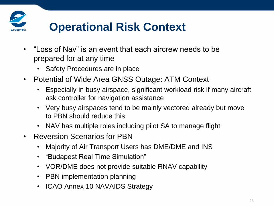
Operational Risk Context
• “Loss of Nav” is an event that each aircrew needs to be
prepared for at any time
• Safety Procedures are in place
• Potential of Wide Area GNSS Outage: ATM Context
• Especially in busy airspace, significant workload risk if many aircraft
ask controller for navigation assistance
• Very busy airspaces tend to be mainly vectored already but move
to PBN should reduce this
• NAV has multiple roles including pilot SA to manage flight
• Reversion Scenarios for PBN
• Majority of Air Transport Users has DME/DME and INS
• “Budapest Real Time Simulation”
• VOR/DME does not provide suitable RNAV capability
• PBN implementation planning
• ICAO Annex 10 NAVAIDS Strategy
26
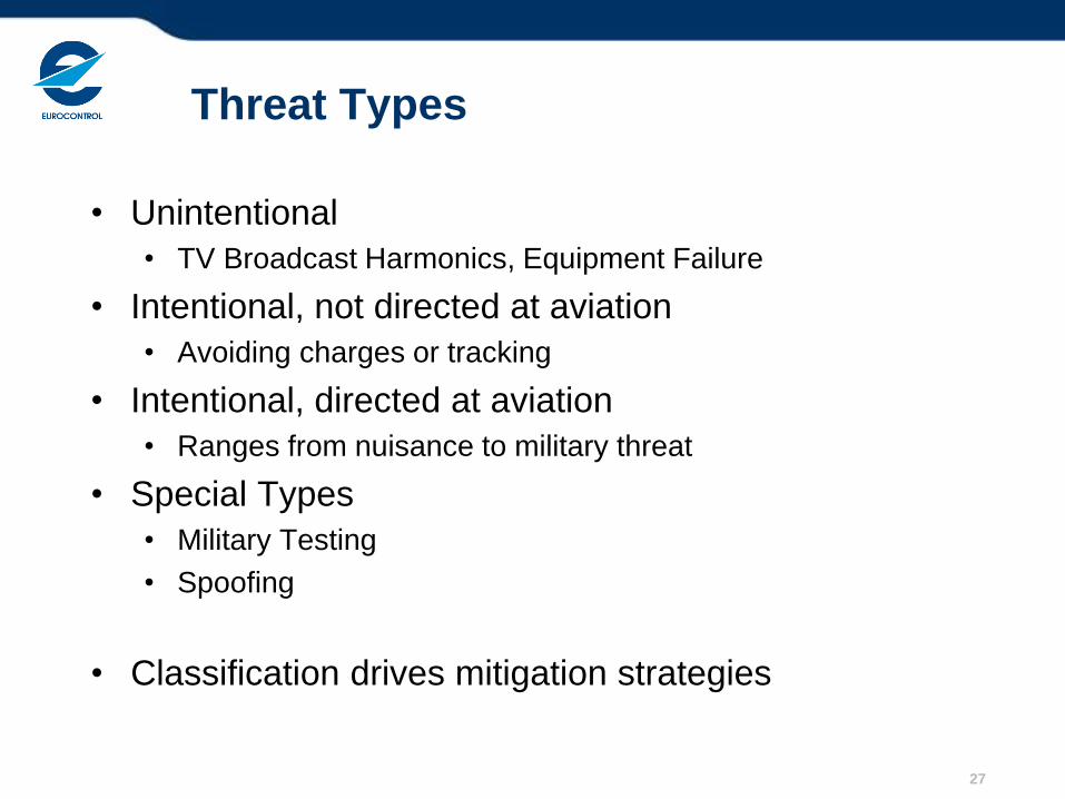
Threat Types
• Unintentional
• TV Broadcast Harmonics, Equipment Failure
• Intentional, not directed at aviation
• Avoiding charges or tracking
• Intentional, directed at aviation
• Ranges from nuisance to military threat
• Special Types
• Military Testing
• Spoofing
• Classification drives mitigation strategies
27
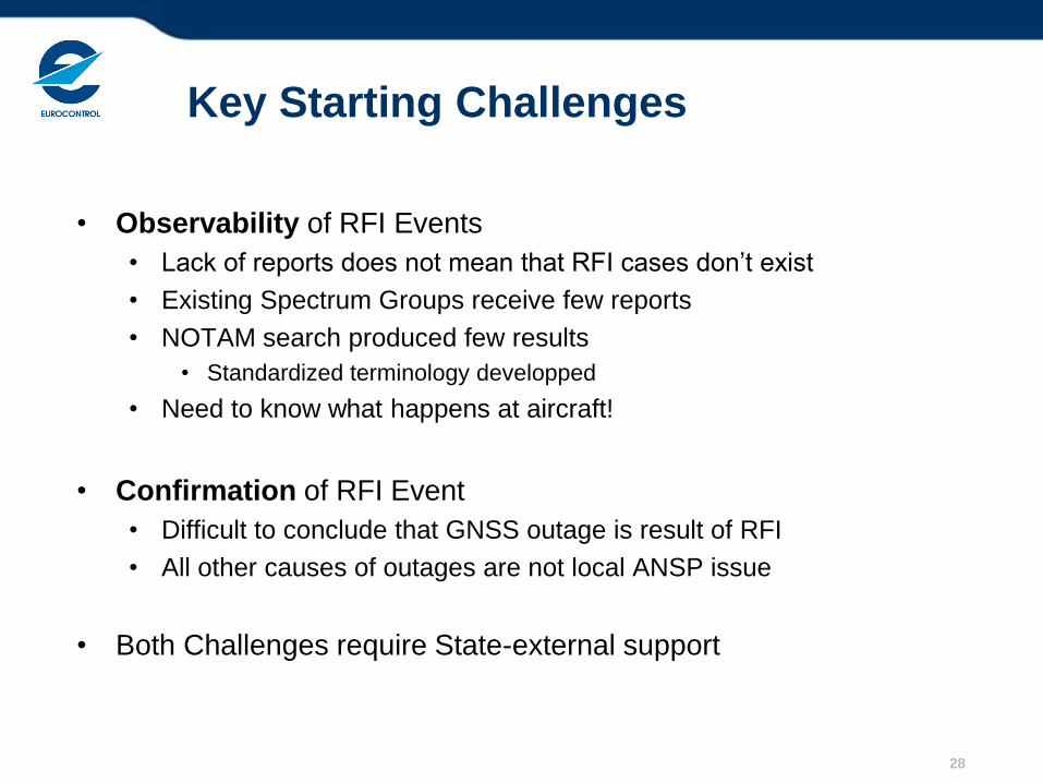
Key Starting Challenges
• Observability of RFI Events
• Lack of reports does not mean that RFI cases don’t exist
• Existing Spectrum Groups receive few reports
• NOTAM search produced few results
• Standardized terminology developped
• Need to know what happens at aircraft!
• Confirmation of RFI Event
• Difficult to conclude that GNSS outage is result of RFI
• All other causes of outages are not local ANSP issue
• Both Challenges require State-external support
28
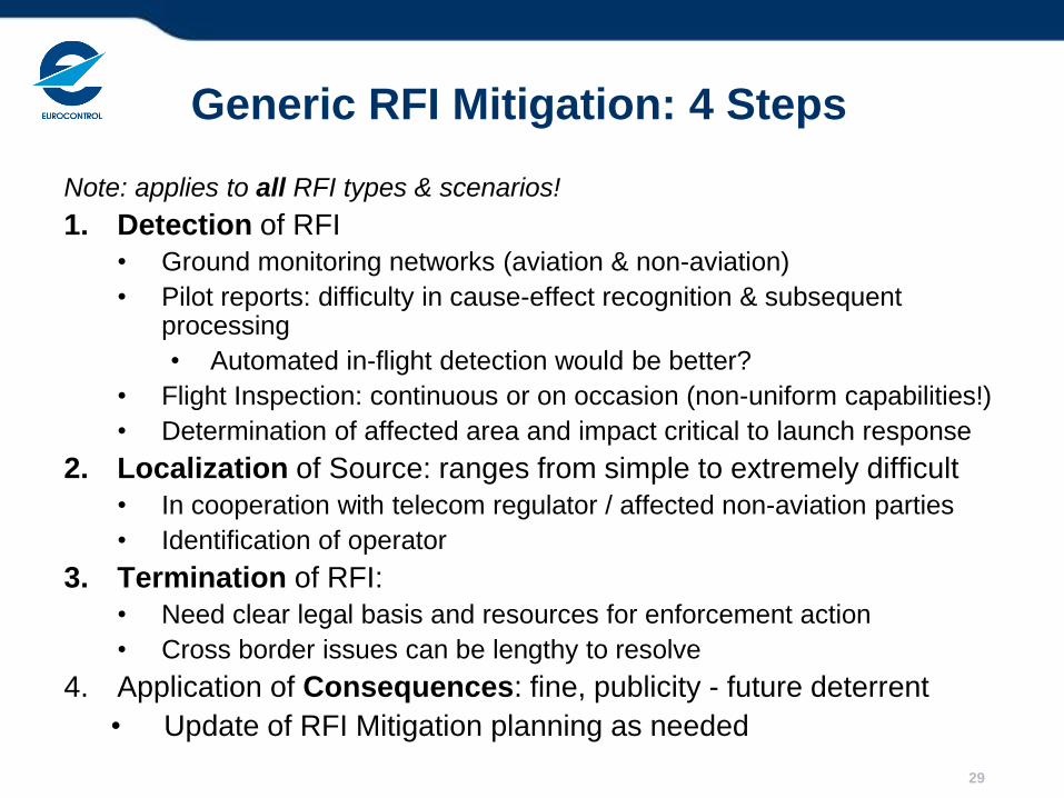
Generic RFI Mitigation: 4 Steps
Note: applies to all RFI types & scenarios!
1. Detection of RFI
• Ground monitoring networks (aviation & non-aviation)
• Pilot reports: difficulty in cause-effect recognition & subsequent processing
• Automated in-flight detection would be better?
• Flight Inspection: continuous or on occasion (non-uniform capabilities!)
• Determination of affected area and impact critical to launch response
2. Localization of Source: ranges from simple to extremely difficult
• In cooperation with telecom regulator / affected non-aviation parties
• Identification of operator
3. Termination of RFI:
• Need clear legal basis and resources for enforcement action
• Cross border issues can be lengthy to resolve
4. Application of Consequences: fine, publicity - future deterrent
• Update of RFI Mitigation planning as needed
29
EVAIR GPS Mitigation Information Flow
30
EVAIR-
GPS
focal
point
Review
(SAF, NAV,
AOLC)
Yes, potential
issue
“GPS
Group”
Review &
Next Step
Heads-up to
AO’s
Notify
ANSP(s)
No Action (await more reports)
NM
Coordination
EASA
No
iss
ues
Inform if important
No
iss
ues
Heads-up to
Other SH
ECTL NM internal
Determine probable
cause through
consultation with GNSS
channels
31
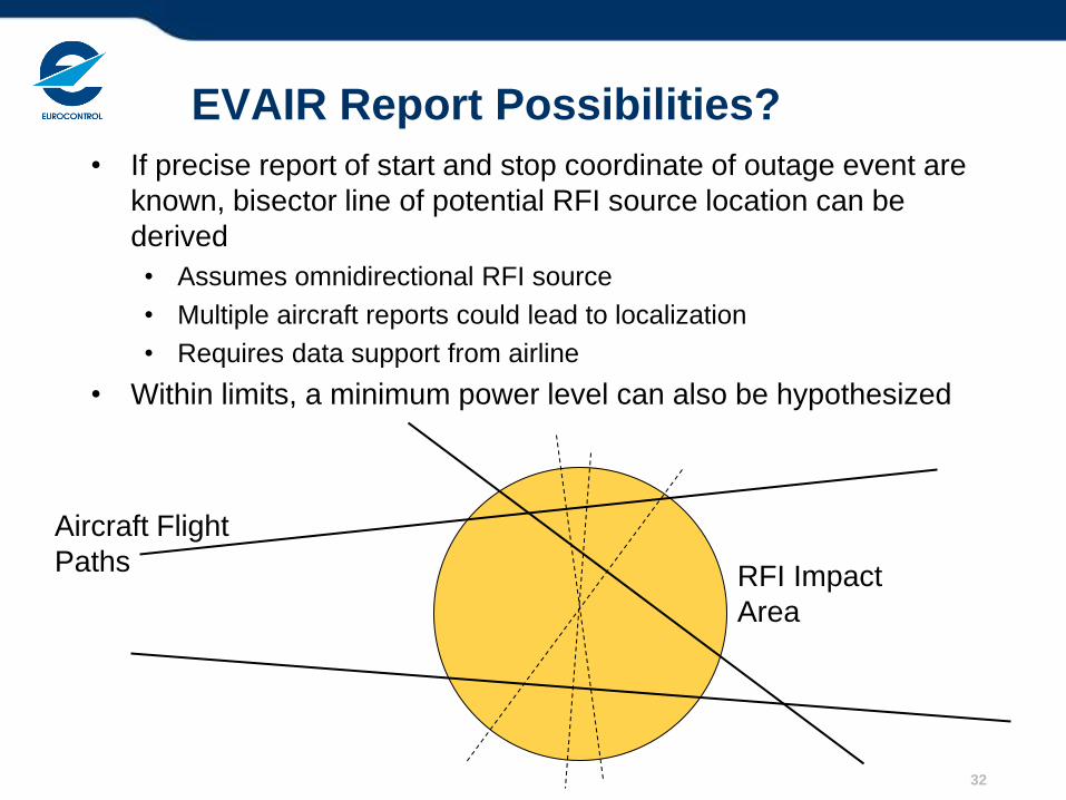
EVAIR Report Possibilities?
• If precise report of start and stop coordinate of outage event are
known, bisector line of potential RFI source location can be
derived
• Assumes omnidirectional RFI source
• Multiple aircraft reports could lead to localization
• Requires data support from airline
• Within limits, a minimum power level can also be hypothesized
32
Aircraft Flight
Paths RFI Impact
Area
Medium Term Improvements (1 of 2)
• Not really Pilot’s job to determine cause of GPS outage or to report
signal in space issues
• In the age of SWIM, should be automated
• RFI detection standard feature in many commercial receivers
• CNS Idea: Reporting through ADS-B Figure of Merit
• Part of ongoing investigations
• Feasibility demonstration: Australia
• Demonstrated benefit of air-ground cooperative approach
• Need to test and build experience in how to integrate information
• Some guessing remains with respect to probable cause
• Especially for wide-area outage where resolution should be fast
• Serendipitous capability, but not ideal
33
34
ADS-B PIC Use for GNSS Monitoring
• ADS-B:
• Different versions of the ADS-B Out MOPS in use
• Different ways to encode integrity
• Not all aircraft are “proper” ADS-B Out:
• Version 0 implemented on voluntary basis (along with Mode
S mandates, ADS-B only certified on a non-interference
basis)
• Later AMC 20-24 certification only applies to subset of fleet
• Not necessarily using GNSS as position source
• Some known avionics issues with version 0
• GNSS:
• Different levels of performance
• Limited information about the position source (SA On/Off,
SBAS etc.)
35
ADS-B based GNSS Monitoring: Issues
• Difficult Capability to Test without significant RFI Event • Study tried to correlate ADS-B Position Integrity Category with events:
• Known RFI Events
• Predicted RAIM Outages
• Iono Events
• None of the investigated events produced reliable correlation
• But learned about use of ADS-B data • Careful filtering of reliable data – establish white list?
• On-board issues usually result in a certain NUCp/NIC behaviour • not so common – can be filtered out
• Most of the fleet has stable quality indicators
• SPI IR implementation of ADS-B Out version 2 (ED-102A / DO-260B)
expected to further improve the picture
• Still think that method has promise at least for “massive” RFI events
Sydney Case: ADS-B Lessons Learned
• ADS-B reports key to identifying probable source location:
Aerospace Industrial Park
• “Search” proved sufficient to terminate 3h event
• Most Ground Monitor Stations didn’t see RFI
• Some outages on WAM network, but difficult to locate
• Need to evaluate line of sight
• Lessons Learned
• Aircraft with INS didn’t lose NAV
• Contingency procedures worked
• Some aircraft GPS receivers didn’t recover (even on turnaround!)
• Air Services Australia recommends recording of GPS status on QAR
• Ground and aircraft based localization must work in complement
• Implementation simplest if within existing processes & infrastructure
36
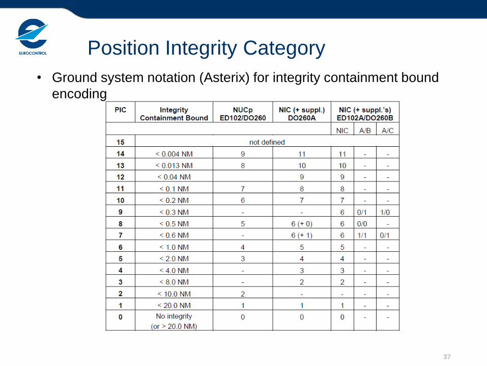
Position Integrity Category
37
• Ground system notation (Asterix) for integrity containment bound
encoding
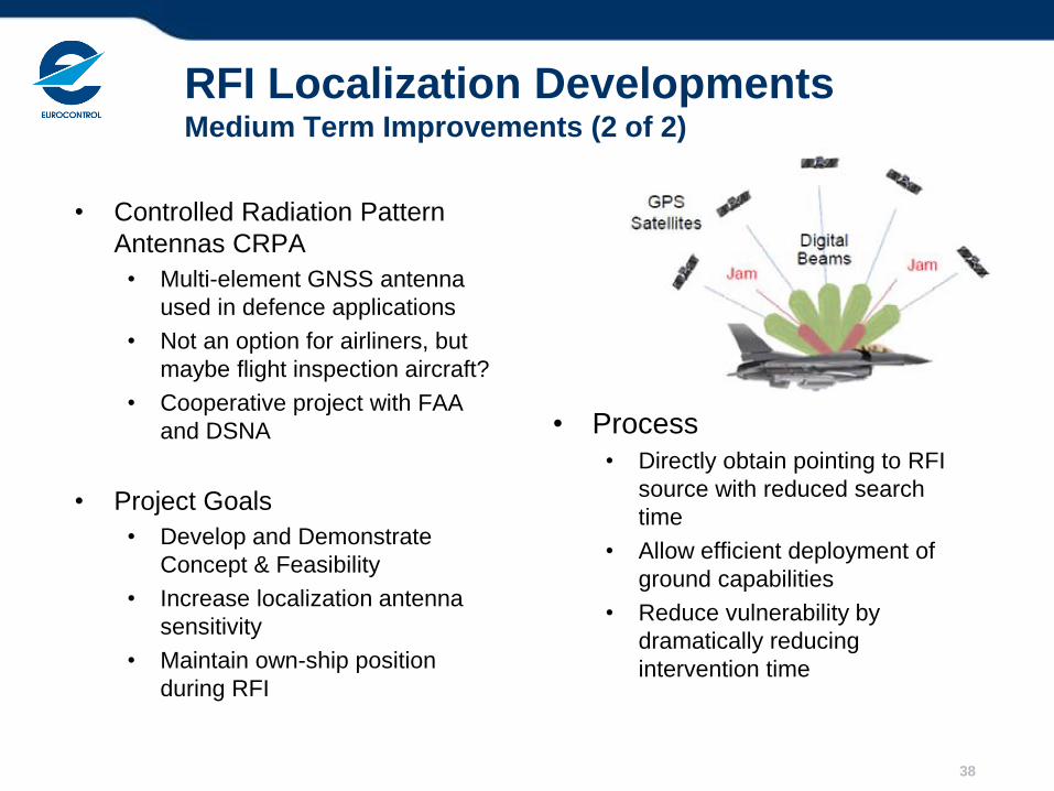
RFI Localization Developments Medium Term Improvements (2 of 2)
• Controlled Radiation Pattern
Antennas CRPA
• Multi-element GNSS antenna
used in defence applications
• Not an option for airliners, but
maybe flight inspection aircraft?
• Cooperative project with FAA
and DSNA
• Project Goals
• Develop and Demonstrate
Concept & Feasibility
• Increase localization antenna
sensitivity
• Maintain own-ship position
during RFI
• Process
• Directly obtain pointing to RFI
source with reduced search
time
• Allow efficient deployment of
ground capabilities
• Reduce vulnerability by
dramatically reducing
intervention time
38
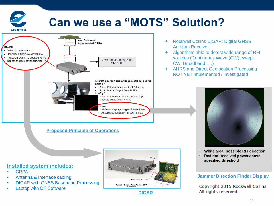
Proposed Principle of Operations
Rockwell Collins DIGAR: Digital GNSS
Anti-jam Receiver
Algorithms able to detect wide range of RFI
sources (Continuous Wave (CW), swept
CW, Broadband, …)
AHRS and Direct Geolocation Processing
NOT YET implemented / investigated
Installed system includes: • CRPA
• Antenna & interface cabling
• DIGAR with GNSS Baseband Processing
• Laptop with DF Software
• White area: possible RFI direction
• Red dot: received power above
specified threshold
Jammer Direction Finder Display
DIGAR
Can we use a “MOTS” Solution?
39
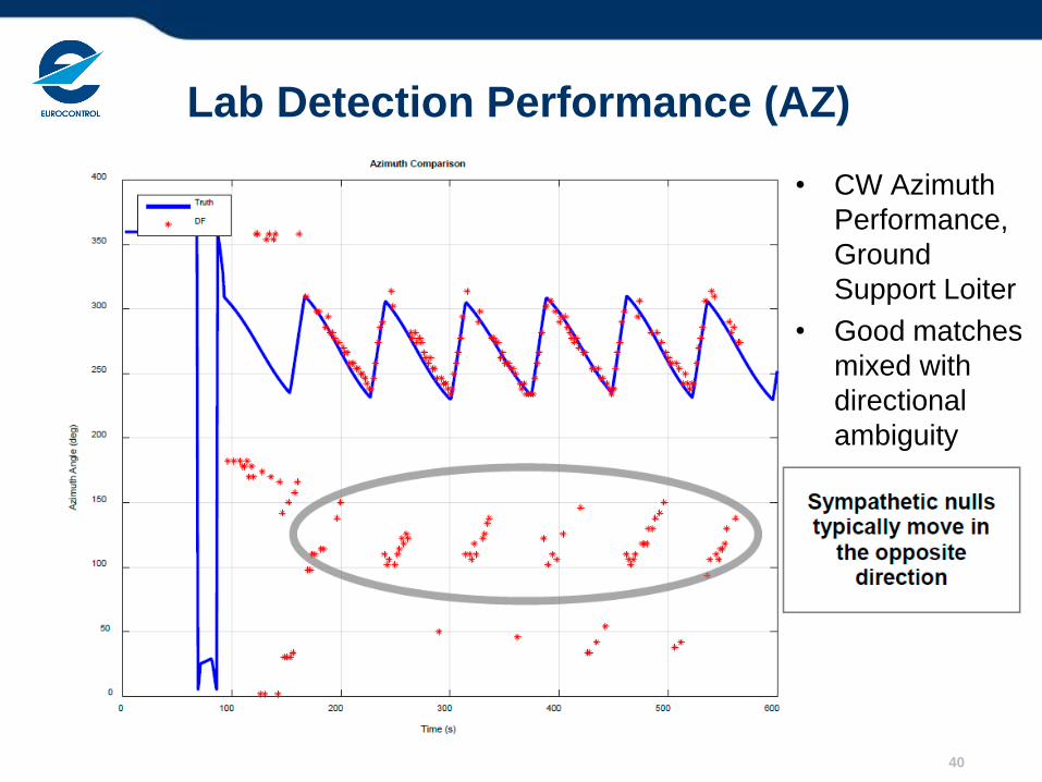
Lab Detection Performance (AZ)
• CW Azimuth
Performance,
Ground
Support Loiter
• Good matches
mixed with
directional
ambiguity
40

Lab Detection Performance Histogram
41
Test Results
• Trigger and Hunt search strategy not ideal
• Figure 8 probably best
• Elevation information generally not useful with top mount CRPA
• Consider extending DF processing to negative elevation angles
• Azimuth pointing better than ±10 degrees
• Also when subject to ground multipath
• Banking helps, but not dramatically
• Detection performance not sensitive to signal type
• Need to develop smoothing filter to eliminate sympathetic nulls
• Investigate algorithm with variable probability of false detection
• Overall results promising
• Good match between wavefront simulator and van tests
• AHRS and RF Calibration requirements acceptable for FI Orgs
• Flight tests with fully integrated prototype would be useful
42
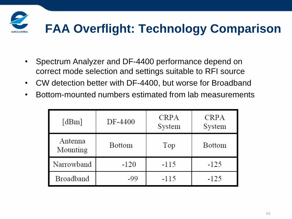
FAA Overflight: Technology Comparison
• Spectrum Analyzer and DF-4400 performance depend on
correct mode selection and settings suitable to RFI source
• CW detection better with DF-4400, but worse for Broadband
• Bottom-mounted numbers estimated from lab measurements
43
Conclusions of CRPA Project
• FAA and DSNA both prefer bottom-mount option to improve
detection performance
• Loss of ownship position not a significant concern when chasing weak
RFI signal sources
• FI A/C have alternate positioning capabilities
• CRPA-based system has higher detection performance
• Especially for Broadband signals
• Most PPD Signals are broadband
• Estimated 25dB Improvement very significant
• Not dependent on operator settings
• Does come at an increased price
• FI Organizations and Industry encouraged to further develop
GNSS RFI Geolocation Capabilities
• Technical, Operational and Human Factors
• Complementary role in overall RFI Mitigation Plan
44
Long Term RFI Mitigation Improvements
• A lot can be done with current capabilities at reasonable cost
• EVAIR is available now
• Mostly a matter of setting up interfaces and data integration
• ADS-B FOM Monitoring excellent example of CNS synergy use
without introducing additional complexity
• Still want to reduce guesswork in future equipment
• Next Generation MC GNSS Avionics
• ICAO NSP requested implementation of reasonable mitigation
capabilities from RTCA / EUROCAE
• Must be careful to not impact continuity of service
• Detection capability seen as a feasible minimum
• Permit aircraft to switch to “A-PNT capability”
• Information must reach ANSP
• Quick Access Recorder, Flight Operations Quality Monitoring
• Future: SUR Downlink Aircraft Parameters (DAP) ??
45