manasota key north 10-yr beach management plan · post-hurricane irma update november 6, 2017...
TRANSCRIPT
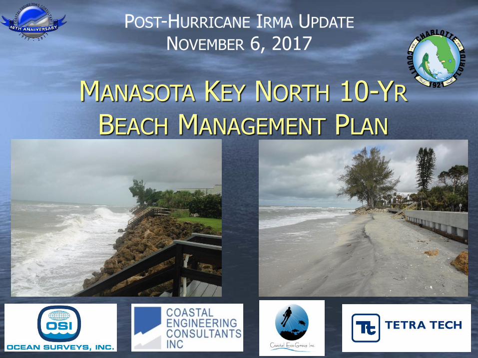
POST-HURRICANE IRMA UPDATE
NOVEMBER 6, 2017
MANASOTA KEY NORTH 10-YR
BEACH MANAGEMENT PLAN
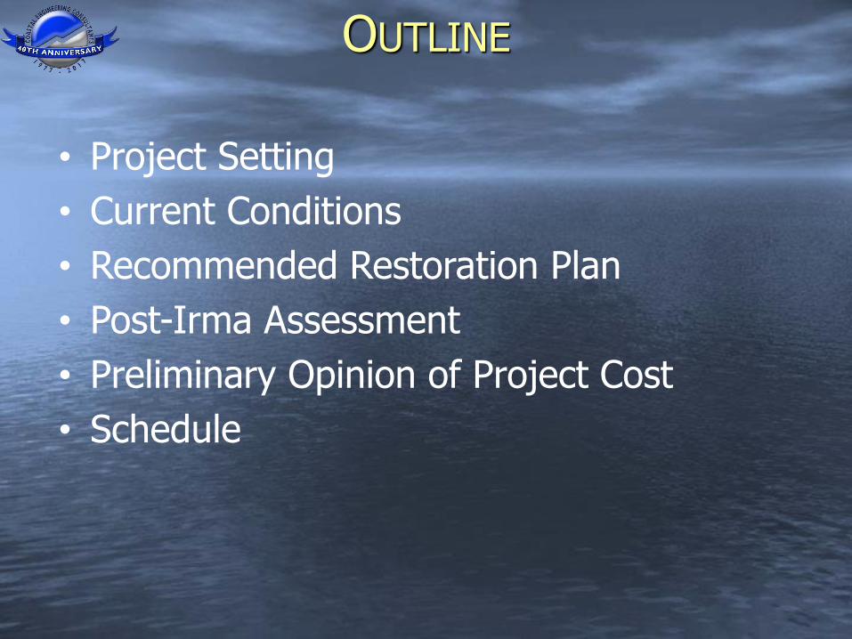
• Project Setting
• Current Conditions
• Recommended Restoration Plan
• Post-Irma Assessment
• Preliminary Opinion of Project Cost
• Schedule
OUTLINE

MKN PROJECT AREA
• Sarasota-Charlotte County Line to Stump Pass Beach State Park (R-1 to R15.4)
• Overlaps With County’s Existing Erosion Control Project from Englewood Beach Park to State Park (R-9 to R15.4)
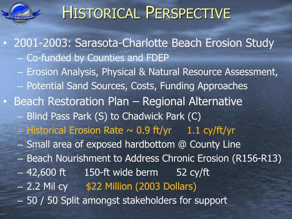
• 2001-2003: Sarasota-Charlotte Beach Erosion Study
– Co-funded by Counties and FDEP
– Erosion Analysis, Physical & Natural Resource Assessment,
– Potential Sand Sources, Costs, Funding Approaches
• Beach Restoration Plan – Regional Alternative
– Blind Pass Park (S) to Chadwick Park (C)
– Historical Erosion Rate ~ 0.9 ft/yr 1.1 cy/ft/yr
– Small area of exposed hardbottom @ County Line
– Beach Nourishment to Address Chronic Erosion (R156-R13)
– 42,600 ft 150-ft wide berm 52 cy/ft
– 2.2 Mil cy $22 Million (2003 Dollars)
– 50 / 50 Split amongst stakeholders for support
HISTORICAL PERSPECTIVE
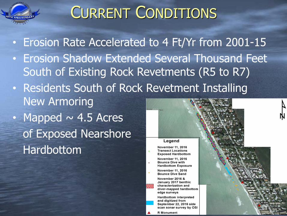
CURRENT CONDITIONS
• Erosion Rate Accelerated to 4 Ft/Yr from 2001-15
• Erosion Shadow Extended Several Thousand Feet South of Existing Rock Revetments (R5 to R7)
• Residents South of Rock Revetment Installing New Armoring
• Mapped ~ 4.5 Acres
of Exposed Nearshore
Hardbottom
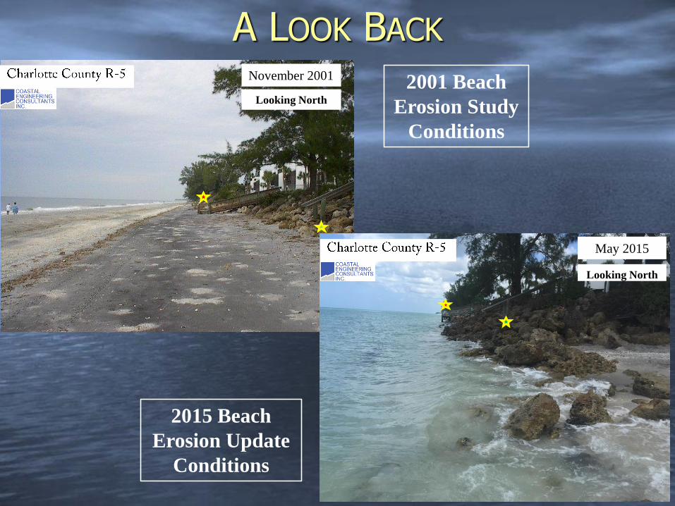
A LOOK BACK
November 2001
Looking North
May 2015
Looking North
2001 Beach
Erosion Study
Conditions
2015 Beach
Erosion Update
Conditions
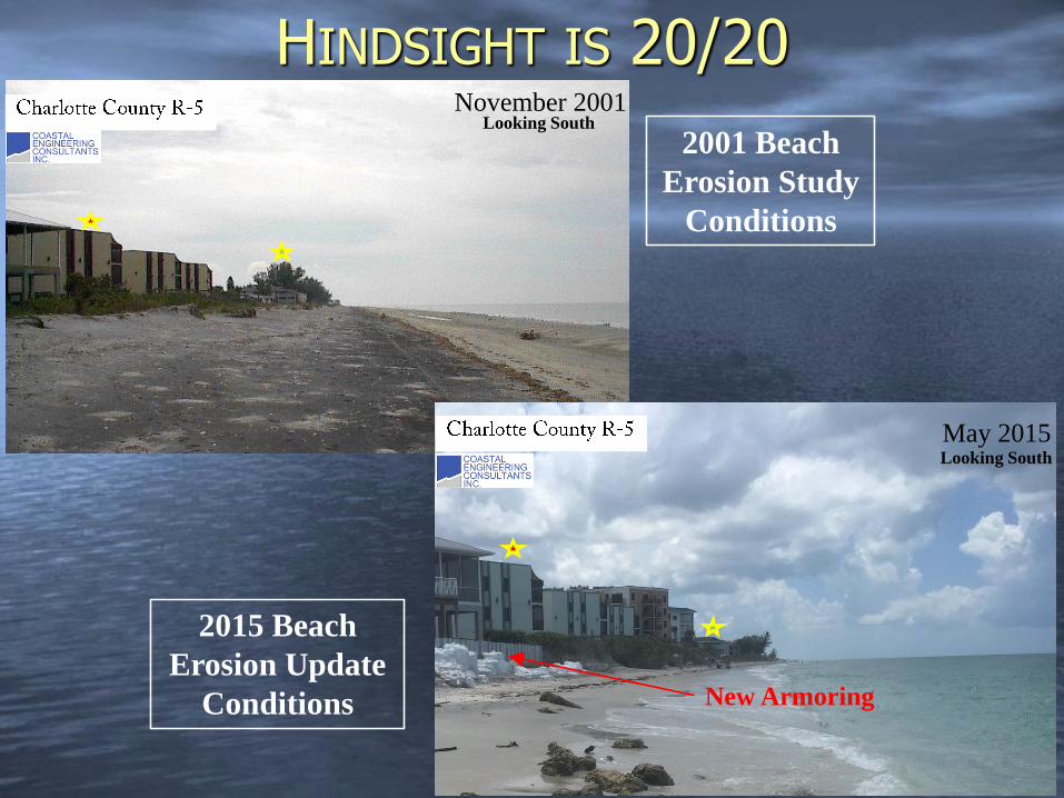
HINDSIGHT IS 20/20November 2001
Looking South
May 2015Looking South
New Armoring
2001 Beach
Erosion Study
Conditions
2015 Beach
Erosion Update
Conditions
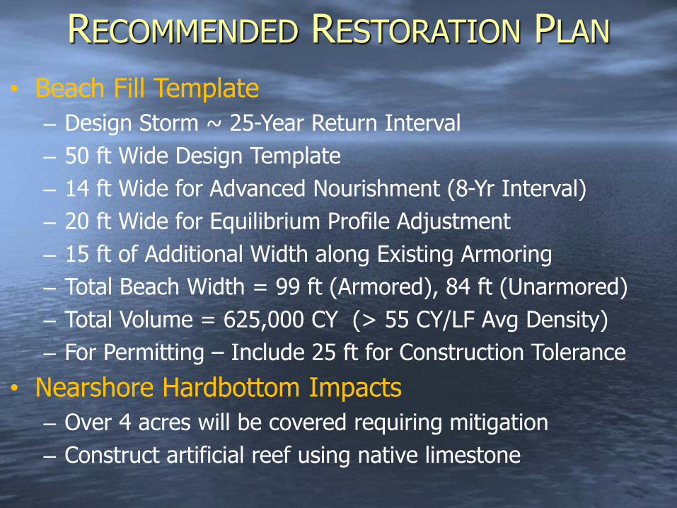
RECOMMENDED RESTORATION PLAN
• Beach Fill Template
– Design Storm ~ 25-Year Return Interval
– 50 ft Wide Design Template
– 14 ft Wide for Advanced Nourishment (8-Yr Interval)
– 20 ft Wide for Equilibrium Profile Adjustment
– 15 ft of Additional Width along Existing Armoring
– Total Beach Width = 99 ft (Armored), 84 ft (Unarmored)
– Total Volume = 625,000 CY (> 55 CY/LF Avg Density)
– For Permitting – Include 25 ft for Construction Tolerance
• Nearshore Hardbottom Impacts
– Over 4 acres will be covered requiring mitigation
– Construct artificial reef using native limestone

DESIGN
PLAN

DESIGN TEMPLATES
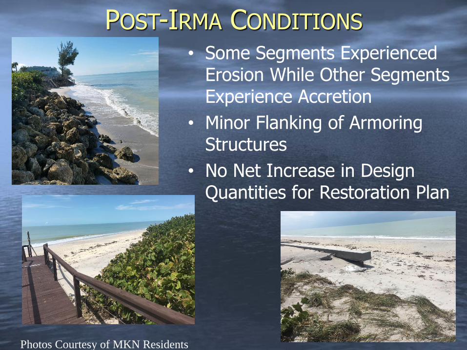
POST-IRMA CONDITIONS
• Some Segments Experienced Erosion While Other Segments Experience Accretion
• Minor Flanking of Armoring Structures
• No Net Increase in Design Quantities for Restoration Plan
Photos Courtesy of MKN Residents
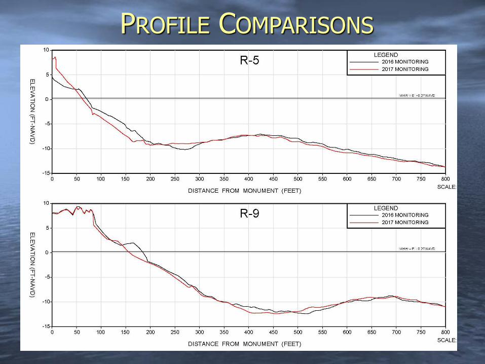
PROFILE COMPARISONS
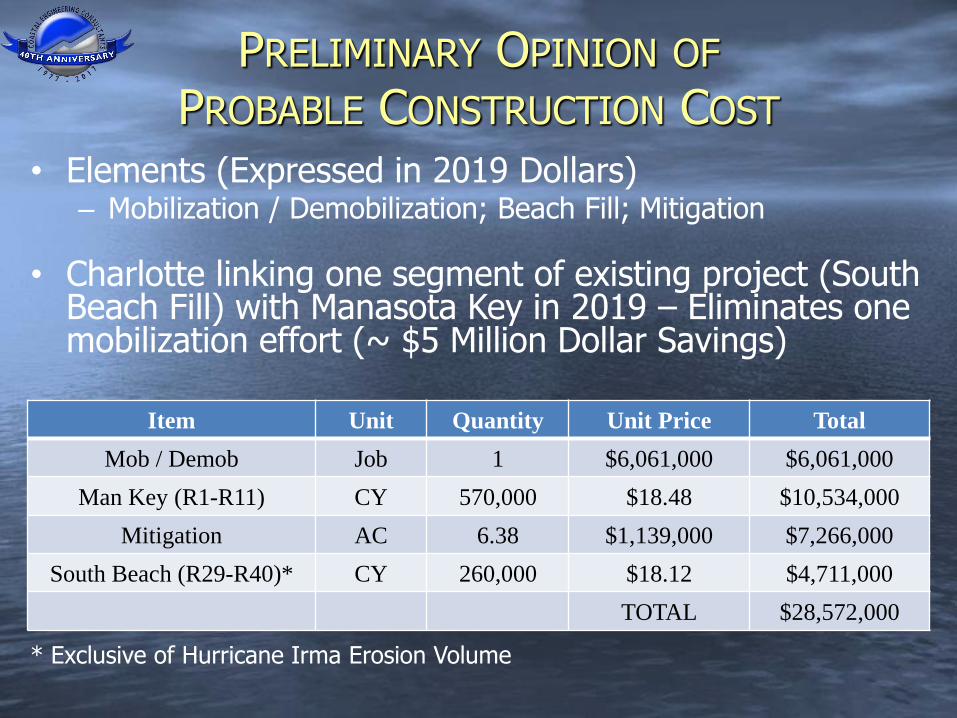
PRELIMINARY OPINION OF
PROBABLE CONSTRUCTION COST
• Elements (Expressed in 2019 Dollars)– Mobilization / Demobilization; Beach Fill; Mitigation
• Charlotte linking one segment of existing project (South Beach Fill) with Manasota Key in 2019 – Eliminates one mobilization effort (~ $5 Million Dollar Savings)
Item Unit Quantity Unit Price Total
Mob / Demob Job 1 $6,061,000 $6,061,000
Man Key (R1-R11) CY 570,000 $18.48 $10,534,000
Mitigation AC 6.38 $1,139,000 $7,266,000
South Beach (R29-R40)* CY 260,000 $18.12 $4,711,000
TOTAL $28,572,000
* Exclusive of Hurricane Irma Erosion Volume
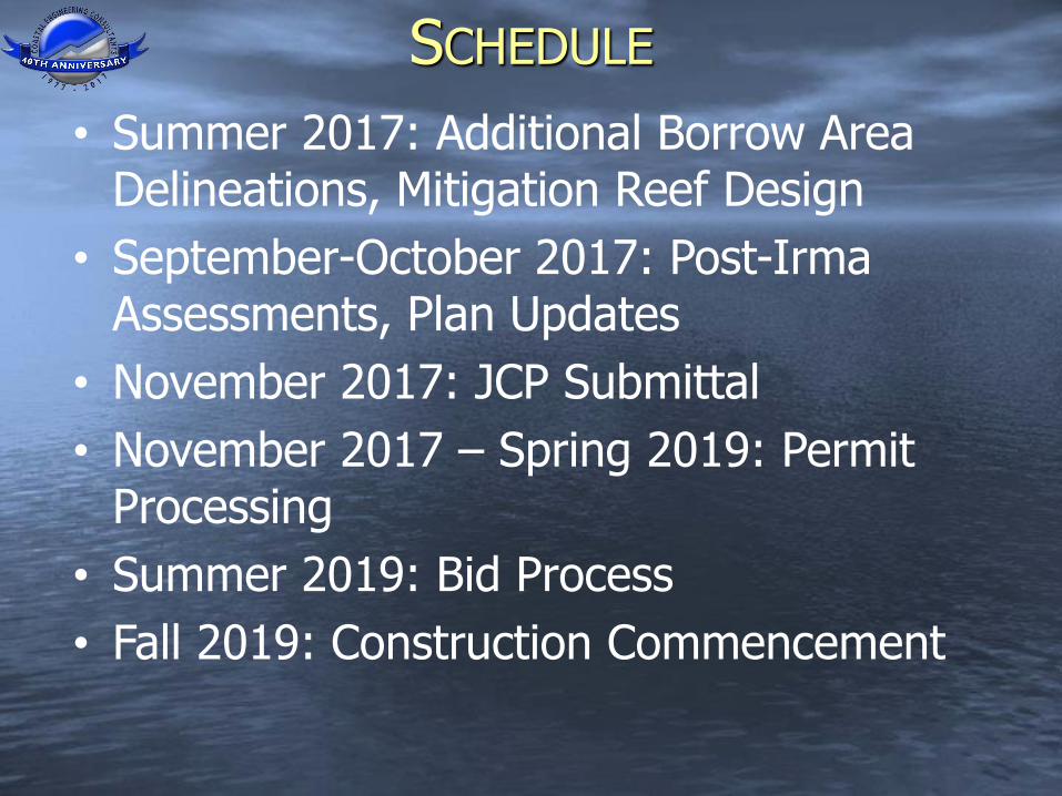
• Summer 2017: Additional Borrow Area Delineations, Mitigation Reef Design
• September-October 2017: Post-Irma Assessments, Plan Updates
• November 2017: JCP Submittal
• November 2017 – Spring 2019: Permit Processing
• Summer 2019: Bid Process
• Fall 2019: Construction Commencement
SCHEDULE