statement of qualifications - nag, inc · statement of qualifications 1991-2010 ... aqua water inc....
TRANSCRIPT

Statement of Qualifications
1991-2010
Nag, Inc. d.b.a. Engineering Systems
Headquarters: Wells Fargo Center, 25th Floor
333 South Grand Avenue, Suite 2500, Los Angeles, California 90071 Phone: (213) 625-7636 Fax: (213) 928-6522
Branch: Washington DC
1701 Pennsylvania Avenue, NW, Suite 300, Washington, DC 20006 Phone: (202) 569-8722 Fax: (253) 830-1583
www.engineeringsys.com

Page 2
Nag, Inc. d.b.a. Engineering Systems
(References Available on Request)
PROJECT EXPERIENCE:
State of Louisiana,
Governor's Office of Homeland Security and Emergency
Preparedness (GOHSEP) (2009 – present)
State-wide government and public
Enterprise server with ArcGIS Server
pushed via a customized desktop client
thin client. Solution integration
ArcSDE printing, and analysis capabilities fused with the
earth enterprise client. distance analysis integr
integration, server configuration and set
Federal Aviation Administration (2009
Development and deployment a customize
Enterprise interface for Emergency Operations
EON Earth. Work includes: server upgrades; client deployment
using LandDesk; Linux server storage management and upgrades;
design and develop geospatial web prototypes; con
application development (JAD) sessions (on Washington D.C. (2008 – Present)
Deployment of Google Earth Enterprise
Google (Earth) DC to Public and all internal
District of Columbia. Google Earth & Google Maps application
Development, ArcGIS server feed integrati
Spatial live feeds, Data Conversion/Live Data Feeds, IP Camera
tie-up in Google, GPS (i.e. Fleet Management, Asset Tracking),
Google Gadget/Apps/Charts/Map Mash
ArcGIS SDE / Google Fusion Sync, Training
migration and maintenance of all (over 300 layers) enterprise
ESRI layers to 3D GEE platform within the city intranet.
Additionally, was in charge of deploying secure feeds for use in
Google Earth and Google Earth Enterprise to all local and federal
agencies during the 2009 Presidential Inauguration. http://www.engineeringsys.com/presentations.html
(References Available on Request)
EXPERIENCE:
Governor's Office of Homeland Security and Emergency
present)
government and public deployment of Google Earth
Server backend. Applications
client, and a web-browser plug-in
includes Arc-GIS server /
and analysis capabilities fused with the Google
analysis integration, data query
erver configuration and set-up.
2009 – present)
Development and deployment a customized Google Earth
gency Operations Division called
EON Earth. Work includes: server upgrades; client deployment
using LandDesk; Linux server storage management and upgrades;
design and develop geospatial web prototypes; conduct joint
lopment (JAD) sessions (on-site & off-site).
ployment of Google Earth Enterprise customized and deployed
internal departments in the
Google Earth & Google Maps application
integration, Oracle & Oracle
Data Conversion/Live Data Feeds, IP Camera
anagement, Asset Tracking),
Google Gadget/Apps/Charts/Map Mash-ups, sketch-up models,
/ Google Fusion Sync, Training. Effort involved
igration and maintenance of all (over 300 layers) enterprise
ESRI layers to 3D GEE platform within the city intranet.
Additionally, was in charge of deploying secure feeds for use in
Google Earth and Google Earth Enterprise to all local and federal
agencies during the 2009 Presidential Inauguration. http://www.engineeringsys.com/presentations.htmlagencies during the 2009 Presidential Inauguration. http://www.engineeringsys.com/presentations.html

Page 3
Nag, Inc. d.b.a. Engineering Systems
Aqua Water Inc. Bastrop, TX (2008)
Requirements Assessment study to Plan, design, develop and maintain an Ent
GIS platform to meet the Organization
Elk Grove Water District, CA – on H2O Group Team Linking the District’s GIS parcel base data to it’
Application; planning, design, develop
platform to meet its organizational needs.
support to the District’s Infrastructure Replacement Program.
City of Santa Clarita, CA (2007 - 2009
Providing GIS, Remote Sensing and Image Analysis ser
purposes to enforce the City’s Oak Tree Ordinance. The project utilizes digital
ortho- and near infrared aerial photography provided by the City. The high 4”
resolution and other parameters require considerable innovation in impl
project.
Southern California Association of Governments
Coachella Valley Association of Governments
Creating a valley-wide bicycle map of
surrounding areas to produce GIS files that a
existing bikeways, trails, golf cart paths and pedestrian ways.
Magnum Properties, CA (2007 - 2008
Development of a GOOGLE Mash-up which
is Internet-Based Commercial and
Industrial Real Estate Property mapping
solution for access to ownership data.
Bastrop, TX (2008)
lan, design, develop and maintain an Enterprise
Organizations needs.
on H2O Group Team (2008 - Present) Linking the District’s GIS parcel base data to it’s In-Hance SQL-Server Billing
development and maintenance of an Enterprise GIS
organizational needs. Utilizing GIS to provide decision
support to the District’s Infrastructure Replacement Program.
2009)
Providing GIS, Remote Sensing and Image Analysis services for identification
purposes to enforce the City’s Oak Tree Ordinance. The project utilizes digital
and near infrared aerial photography provided by the City. The high 4”
resolution and other parameters require considerable innovation in implementing the
Southern California Association of Governments (SCAG) and
Coachella Valley Association of Governments, CA (2007 - 2008)
the Coachella Valley and
files that accurately identify
trails, golf cart paths and pedestrian ways.
2008)
up which
Based Commercial and
mapping
.

Page 4
Nag, Inc. d.b.a. Engineering Systems
Department of Transportation, Los
Development of a city-wide bicycle map indicating bicycle facilities (including
lanes, paths and routes; racks and
transportation facilities) and display of survey
compatibility of streets throughout the jurisdiction. The City data is
with related dated provided by the Metropolitan Transportation Agency of the
County of Los Angeles of the areas contiguous and surrounding the City within the
limits of the Bikeway Guide to be produced as the main product of this project.
Town of Vienna, VA, Department of Information Technology
(2005 – present)
On-site GIS Support for the IT. Development
website (Staff Resource Center) using Windows Integrated Security,
C#, ASP.NET, ESRI ArcIMS, GOOGLE maps api
applications produced as a part of the solutions and tasks are: Human
Resources Personnel, Employee Managemen
Employee Bulletin and News Alert System
City of Downey, CA (2007 - 2008)
Preparation of wall-sized 6’ x 6’ display formats for the LARIAC
resolution aerial photography. The challenges posed by this assignment were
multiple, and based on the significant file sizes that were generated that
challenged the limits of system capabilities of both ArcGIS and Adobe
Illustrator.
Angeles (2007 – present)
wide bicycle map indicating bicycle facilities (including
Lockers; access points; and links to other
tation facilities) and display of survey information on bicycle
compatibility of streets throughout the jurisdiction. The City data is integrated
with related dated provided by the Metropolitan Transportation Agency of the
s contiguous and surrounding the City within the
limits of the Bikeway Guide to be produced as the main product of this project.
Vienna, VA, Department of Information Technology
Development of town-wide Intranet
website (Staff Resource Center) using Windows Integrated Security,
, ESRI ArcIMS, GOOGLE maps api and Ajax. A few
applications produced as a part of the solutions and tasks are: Human
Resources Personnel, Employee Management Software, Online
Employee Bulletin and News Alert System.
sized 6’ x 6’ display formats for the LARIAC-based 4-inch
The challenges posed by this assignment were
tiple, and based on the significant file sizes that were generated that
challenged the limits of system capabilities of both ArcGIS and Adobe

Page 5
Nag, Inc. d.b.a. Engineering Systems
U. S. Doctors for Africa, CA & DC
Healthcare Decision Support Systems; Epidemi
Disease Tracking Systems; Clinical Management GIS; Spatial Resource Allocation
of Medical & Non-Medical Volunteers; clinics
Administration & Management. Development of an Infectious DisSystem to support.
Cash Flow Properties Network, NV
Mapping of 15 real estate market characteristics for 31 biggest and highest
performing metro areas throughout the continental U.S.
Town of Vienna, VA, Police Department
On-site GIS Support for the Police Department
Aided Dispatch, Law Enforcement Records Management
Efforts involved beat and tract tile creation
Crime Analysis, Crime Reporting (Weekly, Monthly & Annually). Software
developed using: ArcMap VBA Extension, Google Map API, C#, Asp.Net and Ajax.
Town of Vienna, VA, Public Works Department
Development of a GIS-Based Utility Management Syste
water distribution and sanitary sewer collection systems referencing the Town’s
enterprise GIS platform. Conversion Oversight, Automated and Visual Quality
Control of the entire GIS Infrastructure. Complete utility solution, from
Database Design on MS-SQL, ArcSDE 9.2 to application development on ArcGIS
Server 9.2. Applications developed for PW are: Creation of the Automated Map
Gallery (ArcGIS extension) for Water, Sewer and Storm water Map, Fleet
Management System, Floodplain Lookup. All applications are also integrated with
Google maps.
CA & DC (2005 – 2007)
Healthcare Decision Support Systems; Epidemiological Information Management;
Disease Tracking Systems; Clinical Management GIS; Spatial Resource Allocation
Medical Volunteers; clinics & hospitals, etc.. Database
Development of an Infectious Disease Tracking
(2005 – 2006)
Mapping of 15 real estate market characteristics for 31 biggest and highest
the continental U.S.
Police Department (2005 – 2007)
site GIS Support for the Police Department – GIS Interface to Computer
Aided Dispatch, Law Enforcement Records Management and Mobile Data Systems.
creation, Address Matching and Reconciliation,
Analysis, Crime Reporting (Weekly, Monthly & Annually). Software
developed using: ArcMap VBA Extension, Google Map API, C#, Asp.Net and Ajax.
Public Works Department (2005 – 2008)
Based Utility Management System to inventory and model
water distribution and sanitary sewer collection systems referencing the Town’s
Conversion Oversight, Automated and Visual Quality
Control of the entire GIS Infrastructure. Complete utility solution, from GIS
ArcSDE 9.2 to application development on ArcGIS
Server 9.2. Applications developed for PW are: Creation of the Automated Map
Gallery (ArcGIS extension) for Water, Sewer and Storm water Map, Fleet
n Lookup. All applications are also integrated with
Page 6
Nag, Inc. d.b.a. Engineering Systems
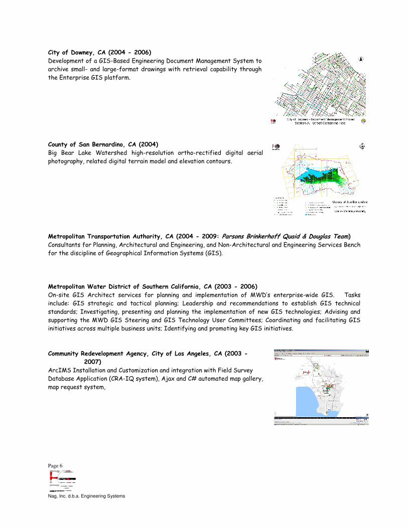
City of Downey, CA (2004 - 2006)
Development of a GIS-Based Engineering Document Management System to
archive small- and large-format drawings with retrieval capability through
the Enterprise GIS platform.
County of San Bernardino, CA (2004
Big Bear Lake Watershed high-resolution ortho
photography, related digital terrain model and elevation contours.
Metropolitan Transportation Authority
Consultants for Planning, Architectural and Engineering, and Non
for the discipline of Geographical Information Systems (GIS).
Metropolitan Water District of Southern California
On-site GIS Architect services for planning and implementation of MWD’s enterprise
include: GIS strategic and tactical planning; Leadership and recommendations to establish GIS technical
standards; Investigating, presenting and planning the implementation of new GIS technologies; Advising and
supporting the MWD GIS Steering and GIS Technology User Committees; Coordinating and facilitating GIS
initiatives across multiple business units; Identifying and
Community Redevelopment Agency, City of Los Angeles
2007)
ArcIMS Installation and Customization and integration with Field Survey
Database Application (CRA-IQ system), Ajax and C# automated map gallery,
map request system,
Based Engineering Document Management System to
format drawings with retrieval capability through
nty of San Bernardino, CA (2004)
resolution ortho-rectified digital aerial
photography, related digital terrain model and elevation contours.
Metropolitan Transportation Authority, CA (2004 - 2009: Parsons Brinkerhoff Quaid & Douglas TeamConsultants for Planning, Architectural and Engineering, and Non-Architectural and Engineering Services Bench
of Geographical Information Systems (GIS).
Southern California, CA (2003 - 2006)
site GIS Architect services for planning and implementation of MWD’s enterprise-
include: GIS strategic and tactical planning; Leadership and recommendations to establish GIS technical
nvestigating, presenting and planning the implementation of new GIS technologies; Advising and
supporting the MWD GIS Steering and GIS Technology User Committees; Coordinating and facilitating GIS
initiatives across multiple business units; Identifying and promoting key GIS initiatives.
Community Redevelopment Agency, City of Los Angeles, CA (2003 -
Installation and Customization and integration with Field Survey
IQ system), Ajax and C# automated map gallery,
Parsons Brinkerhoff Quaid & Douglas Team) Architectural and Engineering Services Bench
-wide GIS. Tasks
include: GIS strategic and tactical planning; Leadership and recommendations to establish GIS technical
nvestigating, presenting and planning the implementation of new GIS technologies; Advising and
supporting the MWD GIS Steering and GIS Technology User Committees; Coordinating and facilitating GIS

Page 7
Nag, Inc. d.b.a. Engineering Systems
Community Redevelopment Agency, City of Los Angeles
GIS Application Development, Redevelopment Project Area Mapping, and GIS Quality
Control.
Software Architecture & Development
ArcGIS Configuration and Installation
• Automated ArcGIS Map Generation Interface (VB)
• Automated ArcGIS tools labeling and spatial analysis for computation of
parcels within redevelopment zones (VBA)
• Design and Development of interface to establish data communications
between CRA-GIS and City o
• Design and Development of Access Database to manage extensive list of
projects, coverages, and macros
• Development of Automated QA/QC routines to validate currency of parcel
data against assessor lists
Community Redevelopment Agency, City of Los Angeles
Migration of CRA-GIS from Legacy AML
& ArcIMS) v9
• Creation of ArcGIS Personal Geodatabases
• Conversion of Unix ArcPlot AML scripts to automated
distributed PC environment
• Replication of Unix Arc/Info AML scripts to
VB/VBA, including GUI Migration and enhancing of Symbol Libraries from
Arc/Info Shade Sets to ArcGIS Symbols
County of Los Angeles, CA (2003 -
As-needed mapping services for traverse closure of tract and parcel maps
to accuracies better than 1:10000,
digital format, adjustment of data, and update of the GIS database.
Town of Vienna, VA Department of Planning & Zoning
Comprehensive On-Site GIS Support for Enterprise GIS Environment. M
ArcIMS, ArcSDE solution, with GPS technology overlays for most departments within
the town. GIS Database Design, ArcGIS Application Development, Migration from older
ESRI formats to new ESRI formats. A few of the integrated solutions include:
based Permit tracking database, automated the preparation of
maps, Flash GIS Map Gallery using FLEX, Automatic Map generation of
plan reports and maps. On-site GIS Development & Training
Community Redevelopment Agency, City of Los Angeles, CA (2002 - 2007)
GIS Application Development, Redevelopment Project Area Mapping, and GIS Quality
Software Architecture & Development:
ArcGIS Configuration and Installation
Automated ArcGIS Map Generation Interface (VB)
Automated ArcGIS tools labeling and spatial analysis for computation of
redevelopment zones (VBA)
Design and Development of interface to establish data communications
and City of Los Angeles GIS
Design and Development of Access Database to manage extensive list of
coverages, and macros
Development of Automated QA/QC routines to validate currency of parcel
Community Redevelopment Agency, City of Los Angeles, CA cont…
GIS from Legacy AML/ArcInfo v7.x to ArcGIS (ArcMap, ArcSDE
Creation of ArcGIS Personal Geodatabases
Conversion of Unix ArcPlot AML scripts to automated routines in the
Replication of Unix Arc/Info AML scripts to duplicate functionality in
Migration and enhancing of Symbol Libraries from
Arc/Info Shade Sets to ArcGIS Symbols
2006)
for traverse closure of tract and parcel maps
, COGO conversion of paper maps to
digital format, adjustment of data, and update of the GIS database.
Department of Planning & Zoning (1999 - present)
Site GIS Support for Enterprise GIS Environment. MS Sequel with
ArcIMS, ArcSDE solution, with GPS technology overlays for most departments within
the town. GIS Database Design, ArcGIS Application Development, Migration from older
ESRI formats to new ESRI formats. A few of the integrated solutions include: GIS
based Permit tracking database, automated the preparation of comprehensive plan
maps, Flash GIS Map Gallery using FLEX, Automatic Map generation of comprehensive
site GIS Development & Training

Page 8
Nag, Inc. d.b.a. Engineering Systems
Los Angeles Unified School District, CA
Technology Consulting Services Bench Contract
County of San Bernardino, CA (2003
On-Site Cadastral Data Conversion Support Services
County of Fairfax, VA (2000 - 2005
Information Technology Professional As
Parcel Update & Maintenance)
County of Los Angeles, CA (2003: Marmee Systems, Inc. TeamSolid Waste Information Management System Requirements Study and
Definition.
County of Fairfax, VA (2001 - 2003)
Police Incident Mapping and Crime Analysis
County of Fairfax, VA (2001 - 2003)
GIS database design for Stormwater Facility GIS; development
data entry interface to ArcGIS; data conversion of Stormwater
Network infrastructure.
, CA (2003 - 2007)
Technology Consulting Services Bench Contract
(2003 - 2004)
Site Cadastral Data Conversion Support Services
2005)
Information Technology Professional As-Needed Services (ITRA –
Marmee Systems, Inc. Team) Solid Waste Information Management System Requirements Study and
2003)
and Crime Analysis Tools.
2003)
GIS database design for Stormwater Facility GIS; development of
data entry interface to ArcGIS; data conversion of Stormwater

Page 9
Nag, Inc. d.b.a. Engineering Systems
City of Fairfax, VA (1999 - 2003)
Needs Analysis, GIS Implementation Plan, Database design, Cadastre
COGO, Water and Sewer Utility Management System Development
using ESRI Map Objects.
Department of Water & Power, City of Los Angeles
with Power System Engineering Inc.GIS analysis of wireless Supervisory Control and Data Acquisition (SCADA)
telecommunications infrastructure.
City of Big Bear Lake, CA (2001 -
Services: NPDES Storm Mapping System, COGO of Street Centerline
Network, Spatial Adjustment of Parcels, COGO entry of As
Built Storm Drain System
Town of Herndon, VA (2001 - 2002)
Services: Town-wide GIS Needs Analysis
Needs Analysis, GIS Implementation Plan, Database design, Cadastre
COGO, Water and Sewer Utility Management System Development
Department of Water & Power, City of Los Angeles, CA (2002: In partnership .)
GIS analysis of wireless Supervisory Control and Data Acquisition (SCADA)
2002)
NPDES Storm Mapping System, COGO of Street Centerline
k, Spatial Adjustment of Parcels, COGO entry of As-
2002)
wide GIS Needs Analysis
Page 10
Nag, Inc. d.b.a. Engineering Systems
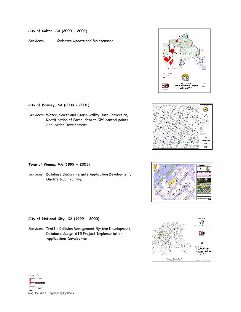
City of Colton, CA (2000 - 2002)
Services: Cadastre Update and Maintenance
City of Downey, CA (2000 - 2001)
Services: Water, Sewer and Storm Utility Data Conversion,
Rectification of Parcel data to GPS control points,
Application Development
Town of Vienna, VA (1999 - 2001)
Services: Database Design, Permits Applica
On-site GIS Training.
City of National City, CA (1999 - 2000)
Services: Traffic Collision Management System Development,
Database design, GIS Project Implementation,
Applications Development
Cadastre Update and Maintenance
Services: Water, Sewer and Storm Utility Data Conversion,
Rectification of Parcel data to GPS control points,
Database Design, Permits Application Development,
2000)
Services: Traffic Collision Management System Development,
Database design, GIS Project Implementation,

Page 11
Nag, Inc. d.b.a. Engineering Systems
City of Cerritos, CA (1999 - 2000:
Services: Needs Analysis, GIS Database design
City of Loma Linda, CA (1997 - 2000)
Services: Needs Analysis, Database design, GIS Project
Implementation, Applications Development (includ
and Sewer GIS Data Conversion)
County of Fairfax, VA (1994 - 200
Services: GIS Data Quality Control for Cadastral and Photo
Mapping.
City of Falls Church, VA (1994 - 2000)
Services: Needs Analysis, Database design,
Applications Development
2000: Applied Geodetics, Inc. Team)
Needs Analysis, GIS Database design
2000)
Needs Analysis, Database design, GIS Project
Implementation, Applications Development (including Water
and Sewer GIS Data Conversion)
2001)
GIS Data Quality Control for Cadastral and Photogrammetric
2000)
Needs Analysis, Database design, GIS Project Implementation,

Page 12
Nag, Inc. d.b.a. Engineering Systems
Southern California Gas Company, CA
Services: Utility Mapping system design and development, including data
conversion of gas distribution main data in support of their
Network Analysis Systems Automation (NASA) project.
area covered 20,000 square miles; 44,000 miles of gas mains;
5,000,000-customer service records.
, CA (1991 - 1995)
Services: Utility Mapping system design and development, including data
conversion of gas distribution main data in support of their
nalysis Systems Automation (NASA) project. Project
area covered 20,000 square miles; 44,000 miles of gas mains;
customer service records.

Page 13
Nag, Inc. d.b.a. Engineering Systems
Overview & Qualifications:
Legal Form of Company:
California Office:
Washington DC Office:
Contact Information:
Insurance Carrier Rating:
Statement of
Equal Employment Opportunity/
Affirmative Action:
MBE/SBE status:
Nag, Inc. d.b.a. Engineering Systems
Email: [email protected]
Wells Fargo Center, KPMG Tower
333 South Grand Avenue, Suite 2500
Los Angeles, CA 90071
Phone: (213) 625-7636
Fax: (213) 928-6522
Web: www.engineeringsys.com
1701 Pennsylvania Avenue, NW, Suite 300,
Washington, DC 20006
Phone: (202) 569-8722
Fax: (253) 830-1583
Swapan Nag
President
Phone: (213) 625-7636
Email: [email protected]
Engineering Systems’ insurance carrier has a Best’s Key
rating of A+ and a Financial Size Category of XV.
It is not Engineering Systems’ policy to discriminate in the
employment of persons in the workplace because of
religious creed, color, national origin, ancestry, disability,
medical condition, marital status, or sex of such persons.
ES currently maintains certifications as a Minority and Small
Business Enterprise.
rance carrier has a Best’s Key
rating of A+ and a Financial Size Category of XV.
It is not Engineering Systems’ policy to discriminate in the
employment of persons in the workplace because of race,
religious creed, color, national origin, ancestry, disability,
medical condition, marital status, or sex of such persons.
ES currently maintains certifications as a Minority and Small

Page 14
Nag, Inc. d.b.a. Engineering Systems
EXPERIENCE
Engineering Systems started in 1991 and is currently in its fift
Engineering Systems (ES) is a Geographic Information Systems (GIS) and Automated Mapping/Facilities Management
(AM/FM) consulting company with bi-coastal operations within the United States. Our clientele include utility companies and
local municipal governments who require support in:
• Geographic Information Systems
• Utility AM/FM systems
• Computer-aided Mapping, Design, and Drafting Systems
• Geodetic survey integration
• Photogrammetry, digital terrain modeling, digital orthophotography
• GIS application software development
• Database design and development
• Data translation and conversion
• Systems integration
• Quality Control & GIS produc
ES provides customized service through its Consulting, Software Development, and Data Conversion divisions, with a staff of
seasoned professionals having backgrounds in utility and municipal GIS and AM/FM. We are dedicated to prov
with quality products and services at competitive rates.
Consulting Team:
The focus of the ES consulting team is to provide professional GIS services to our clientele. Our team works closely with
your agency or organization, providing total GIS solutions that are tailored to meet and usually exceed your needs.
GIS Project Management
ES provides professional project management services. We work with a wide variety of clients, each with unique
requirements. In this way we are able to
implementation of GIS projects, installed on customer sites in the shortest possible implementation cycles and at significant
cost savings.
Additionally, your ES project management team will monitor your project and provide you with periodic status reports and
organize GIS steering committee meetings. In coordination with you, the PM team will recommend action items that will
allow you to produce a GIS that is stable, expan
GIS Data Specification Development
The ES consulting team will develop comprehensive data specifications in coordination with your department or agency. The
team will consider the unique requirements for your GIS system.
ensure that the GIS system will support your business processes. This procedure culminates in the definition of standard
map products, engineering graphics, applications and hardware/software solut
design to act as a guide for implementation.
GIS Database Design and Development
ES excels in providing GIS Database design and development for ArcGIS, MicroStation MGE, Oracle and SQL Server. The
ES consulting team will translate your project specifications into reality. Our team of database experts will create,
normalize and implement your relational database concentrating on linkage to and from the spatial component of the system.
Data centralization is the key to a successful system and ES’s takes a revolutionary approach to the development of a
centralized information-hub to service the integrated needs of various municipal government and utility departments.
Spatial data definitions are likewise created from your specifications. ES can provide your organization with a professional
GIS conversion and creation team onsite or off site (see Conversion Services below). Additionally, ES’s consulting team is
available to you to help review and verify the
91 and is currently in its fifteenth year of business in the field of GIS Consulting.
Engineering Systems (ES) is a Geographic Information Systems (GIS) and Automated Mapping/Facilities Management
astal operations within the United States. Our clientele include utility companies and
local municipal governments who require support in:
• Geographic Information Systems
• Utility AM/FM systems
aided Mapping, Design, and Drafting Systems
Geodetic survey integration
• Photogrammetry, digital terrain modeling, digital orthophotography
• GIS application software development
• Database design and development
• Data translation and conversion
• Quality Control & GIS product acceptance consulting
ES provides customized service through its Consulting, Software Development, and Data Conversion divisions, with a staff of
seasoned professionals having backgrounds in utility and municipal GIS and AM/FM. We are dedicated to prov
with quality products and services at competitive rates.
The focus of the ES consulting team is to provide professional GIS services to our clientele. Our team works closely with
tal GIS solutions that are tailored to meet and usually exceed your needs.
ES provides professional project management services. We work with a wide variety of clients, each with unique
requirements. In this way we are able to bring our experience and expertise to bear on your project. The results are the
implementation of GIS projects, installed on customer sites in the shortest possible implementation cycles and at significant
nagement team will monitor your project and provide you with periodic status reports and
organize GIS steering committee meetings. In coordination with you, the PM team will recommend action items that will
allow you to produce a GIS that is stable, expandable and above all, useful.
The ES consulting team will develop comprehensive data specifications in coordination with your department or agency. The
team will consider the unique requirements for your GIS system. We will help you define all feature and data elements to
ensure that the GIS system will support your business processes. This procedure culminates in the definition of standard
map products, engineering graphics, applications and hardware/software solutions. The team will thoroughly document your
design to act as a guide for implementation.
ES excels in providing GIS Database design and development for ArcGIS, MicroStation MGE, Oracle and SQL Server. The
ting team will translate your project specifications into reality. Our team of database experts will create,
normalize and implement your relational database concentrating on linkage to and from the spatial component of the system.
the key to a successful system and ES’s takes a revolutionary approach to the development of a
hub to service the integrated needs of various municipal government and utility departments.
eated from your specifications. ES can provide your organization with a professional
GIS conversion and creation team onsite or off site (see Conversion Services below). Additionally, ES’s consulting team is
available to you to help review and verify the spatial data creation efforts of outside sources (see Quality Control below).
eenth year of business in the field of GIS Consulting.
Engineering Systems (ES) is a Geographic Information Systems (GIS) and Automated Mapping/Facilities Management
astal operations within the United States. Our clientele include utility companies and
ES provides customized service through its Consulting, Software Development, and Data Conversion divisions, with a staff of
seasoned professionals having backgrounds in utility and municipal GIS and AM/FM. We are dedicated to providing clients
The focus of the ES consulting team is to provide professional GIS services to our clientele. Our team works closely with
tal GIS solutions that are tailored to meet and usually exceed your needs.
ES provides professional project management services. We work with a wide variety of clients, each with unique
bring our experience and expertise to bear on your project. The results are the
implementation of GIS projects, installed on customer sites in the shortest possible implementation cycles and at significant
nagement team will monitor your project and provide you with periodic status reports and
organize GIS steering committee meetings. In coordination with you, the PM team will recommend action items that will
The ES consulting team will develop comprehensive data specifications in coordination with your department or agency. The
We will help you define all feature and data elements to
ensure that the GIS system will support your business processes. This procedure culminates in the definition of standard
ions. The team will thoroughly document your
ES excels in providing GIS Database design and development for ArcGIS, MicroStation MGE, Oracle and SQL Server. The
ting team will translate your project specifications into reality. Our team of database experts will create,
normalize and implement your relational database concentrating on linkage to and from the spatial component of the system.
the key to a successful system and ES’s takes a revolutionary approach to the development of a
hub to service the integrated needs of various municipal government and utility departments.
eated from your specifications. ES can provide your organization with a professional
GIS conversion and creation team onsite or off site (see Conversion Services below). Additionally, ES’s consulting team is
spatial data creation efforts of outside sources (see Quality Control below).

Page 15
Nag, Inc. d.b.a. Engineering Systems
Quality Control and Vendor Delivery Acceptance
The ES consulting team can provide your organization with comprehensive Data Quality Control and Assurance services. The
ES team employs customized automated and visual data checking routines designed to ensure that data meets specifications.
These services are available for photogrammetry, cadastral mapping, topography and thematic GIS data. We will review
graphic and attribute data against source materials for completeness, positional accuracy, and appearance. Digital file
(attribute) review is automated for validation against pre
Software Development and Programming:
Development
Engineering Systems is a leader in the field of GIS application design and software development for Utilities and Municipal
Governments. Our experienced professionals study user needs, analyze application requirements, propose software options
and develop application designs in close collaboration with our clients. Our software development team produces complete,
easy to use and maintain applications on your GIS platform for an optimized solution.
Documentation
The ES software development team prepares comprehensive system level documentation to facilitate future maintenance
and update of the GIS and its applications. User level documentation is also prepared to provide a step
for the execution of each GIS application.
Training
Three levels of on-site training are provided: beginning, intermediate and advanced. Training sessions are scheduled at the
client’s request.
Data Conversion:
Spatial Data Conversion
The foundation of GIS is accurate and precise spatial d
conversion team of professionals combines more than 30 years of experience in the creation of spatial data. This experience
is available to you either on-site or in our conversion shop off
initial cost in developing a GIS is the creation of spatial data. Thus, we will implement your spatial data design based on
GIS specifications through the most cost effective means.
ES will work with your organization to review and assess all source material for existing data. In coordination with you, we
will design and implement a customized data conversion process. Resulting thematic data layers will support your projects
immediately and into the future.
Along with immediate usage, our team also considers data maintenance. Coordinating with our software development team,
ES can provide maintenance and update programs for your organization.
Database Integration
Most organizations have legacy databases that contain a plethora of historical information. The ES conversion team is
unsurpassed in linking GIS spatial data into these systems. In some cases the database design, executed in coordination
with your organization, requires that legacy data be captured into a new relational database. Under these circumstances,
data reconciliation and standardization will drive the process. In other cases, legacy systems must remain intact. The
conversion team will work with the software team
information for display and analysis.
Quality Control and Vendor Delivery Acceptance
The ES consulting team can provide your organization with comprehensive Data Quality Control and Assurance services. The
team employs customized automated and visual data checking routines designed to ensure that data meets specifications.
These services are available for photogrammetry, cadastral mapping, topography and thematic GIS data. We will review
ute data against source materials for completeness, positional accuracy, and appearance. Digital file
(attribute) review is automated for validation against pre-defined specifications and/or standardized formats.
:
Engineering Systems is a leader in the field of GIS application design and software development for Utilities and Municipal
Governments. Our experienced professionals study user needs, analyze application requirements, propose software options
and develop application designs in close collaboration with our clients. Our software development team produces complete,
easy to use and maintain applications on your GIS platform for an optimized solution.
team prepares comprehensive system level documentation to facilitate future maintenance
and update of the GIS and its applications. User level documentation is also prepared to provide a step
for the execution of each GIS application.
site training are provided: beginning, intermediate and advanced. Training sessions are scheduled at the
The foundation of GIS is accurate and precise spatial data designed to support your organization’s needs. The ES data
conversion team of professionals combines more than 30 years of experience in the creation of spatial data. This experience
site or in our conversion shop off-site. Whichever the choice, ES understands that most of the
initial cost in developing a GIS is the creation of spatial data. Thus, we will implement your spatial data design based on
GIS specifications through the most cost effective means.
work with your organization to review and assess all source material for existing data. In coordination with you, we
will design and implement a customized data conversion process. Resulting thematic data layers will support your projects
Along with immediate usage, our team also considers data maintenance. Coordinating with our software development team,
ES can provide maintenance and update programs for your organization.
have legacy databases that contain a plethora of historical information. The ES conversion team is
unsurpassed in linking GIS spatial data into these systems. In some cases the database design, executed in coordination
at legacy data be captured into a new relational database. Under these circumstances,
data reconciliation and standardization will drive the process. In other cases, legacy systems must remain intact. The
conversion team will work with the software team and your organization to link into these systems and extract required
The ES consulting team can provide your organization with comprehensive Data Quality Control and Assurance services. The
team employs customized automated and visual data checking routines designed to ensure that data meets specifications.
These services are available for photogrammetry, cadastral mapping, topography and thematic GIS data. We will review
ute data against source materials for completeness, positional accuracy, and appearance. Digital file
defined specifications and/or standardized formats.
Engineering Systems is a leader in the field of GIS application design and software development for Utilities and Municipal
Governments. Our experienced professionals study user needs, analyze application requirements, propose software options,
and develop application designs in close collaboration with our clients. Our software development team produces complete,
team prepares comprehensive system level documentation to facilitate future maintenance
and update of the GIS and its applications. User level documentation is also prepared to provide a step-by-step instruction
site training are provided: beginning, intermediate and advanced. Training sessions are scheduled at the
ata designed to support your organization’s needs. The ES data
conversion team of professionals combines more than 30 years of experience in the creation of spatial data. This experience
te. Whichever the choice, ES understands that most of the
initial cost in developing a GIS is the creation of spatial data. Thus, we will implement your spatial data design based on the
work with your organization to review and assess all source material for existing data. In coordination with you, we
will design and implement a customized data conversion process. Resulting thematic data layers will support your projects
Along with immediate usage, our team also considers data maintenance. Coordinating with our software development team,
have legacy databases that contain a plethora of historical information. The ES conversion team is
unsurpassed in linking GIS spatial data into these systems. In some cases the database design, executed in coordination
at legacy data be captured into a new relational database. Under these circumstances,
data reconciliation and standardization will drive the process. In other cases, legacy systems must remain intact. The
and your organization to link into these systems and extract required